Ontario King's Highway 16 Historical Route Maps
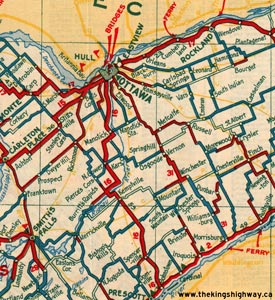
Route of King's Highway 16 in 1933, showing the original highway's route through Grenville and Carleton Counties. See an
Enlarged Map Here.
(Excerpt from the 1933-1934 Official Ontario Road Map - © King's Printer for Ontario, 1933)
|

Dual routes of King's Highway 16 through the City of Ottawa in 1942. See an
Enlarged Map Here.
(Excerpt from the 1942 Official Ontario Road Map - © King's Printer for Ontario, 1942)
|

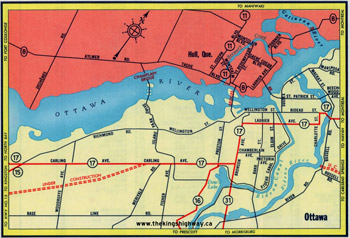
Single route of King's Highway 16 through the City of Ottawa via Rideau Canal Drive in 1955. See an
Enlarged Map Here.
(Excerpt from the 1955 Official Ontario Road Map - © King's Printer for Ontario, 1955)
|
Truncated route of King's Highway 16 through the City of Ottawa at Carling Avenue and Preston Street in 1960. See an
Enlarged Map Here.
(Excerpt from the 1960 Official Ontario Road Map - © King's Printer for Ontario, 1960)
|

Route of King's Highway 16 in 1978, showing the overlapped route of Highway 16 & Highway 31 through the City of Ottawa. See an
Enlarged Map Here.
(Excerpt from the 1978-1979 Official Ontario Road Map - © King's Printer for Ontario, 1978)
|
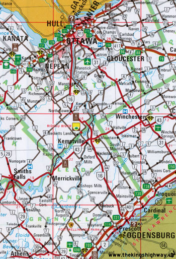
Route of King's Highway 16 in 1982, showing the relocated route of Highway 16 between Highway 401 and the Kemptville area. See an
Enlarged Map Here.
(Excerpt from the 1982-1983 Official Ontario Road Map - © King's Printer for Ontario, 1982)
|
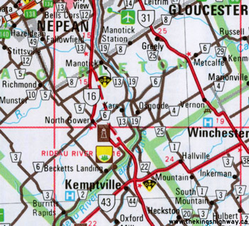
Route of King's Highway 16 in 1984, showing the North Gower Bypass under construction. See an
Enlarged Map Here.
(Excerpt from the 1984-1985 Official Ontario Road Map - © King's Printer for Ontario, 1984)
|
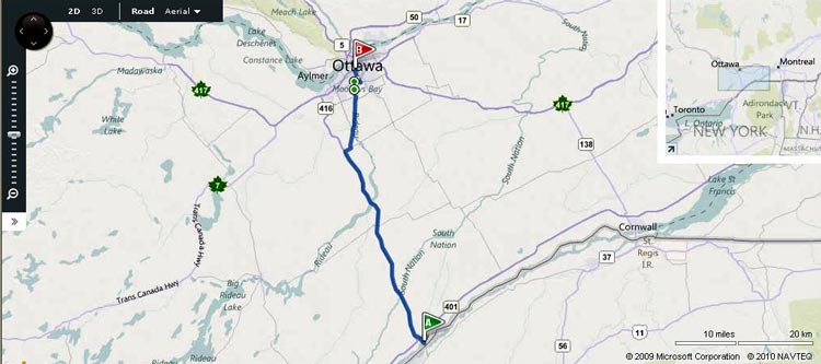
Route of King's Highway 16 as it existed prior to 1996. Since the former connection between Highway 416 and Ottawa Road 73 (Old Highway 16) near Roger Stevens Drive
no longer exists, it is not shown on this map.
Map Courtesy of Bing Maps (Retrieved August 16, 2010) - Link to this map at Bing Maps
|
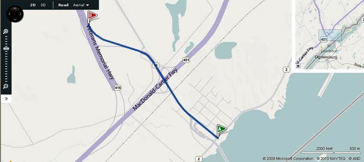
Route of King's Highway 16 as it appears today.
Map Courtesy of Bing Maps (Retrieved August 16, 2010) - Link to this map at Bing Maps
|
|
|---|
Links to Other King's Highway Website Pages:
Website contents, photos & text © 2002-2026, Cameron
Bevers (Webmaster) - All Rights Reserved / Contact Me
|
|---|


