Ontario King's Highway 28B Historical Route Maps

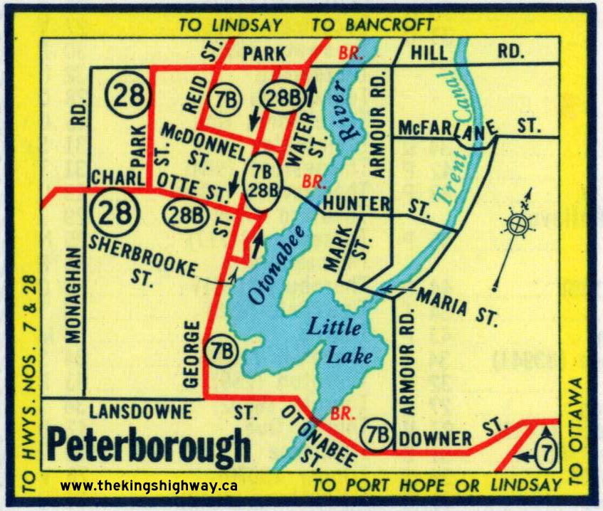
Route of King's Highway 28B in 1962, shortly before the Business Loop was decommissioned. See an Enlarged Map Here.
(Excerpt from the 1962 Official Ontario Road Map - © King's Printer for Ontario, 1962)
|
|
|---|
Links to Other King's Highway Website Pages:
Website contents, photos & text © 2002-2026, Cameron
Bevers (Webmaster) - All Rights Reserved / Contact Me
|
|---|