
| 
| |
|
|
This page contains present day photos (Year 2000 to date) of Ontario's King's Highway 101, arranged by location from Chapleau
easterly to the Highway 11 Junction west of Matheson. All photographs displayed on this page were taken by the Webmaster (Cameron Bevers), unless specifically noted
otherwise. Click on any thumbnail to see a larger image!
Please note that all photographs displayed on this
website are protected by copyright. These photographs must not be reproduced, published,
electronically stored or copied, distributed, or posted onto other websites without
my written permission. If you want to use photos from this website, please
email me first for permission. Thank-you!
|
|---|
|
Page 3: Present Day King's Highway 101 Photographs (Chapleau to Hwy 11)

Above - The worst King's Highway sign...ever!! This rusty relic was once a Hwy 101 sign just east of Hwy 655 in Timmins. It has since been replaced with a new
sign. See an
Enlarged Photo Here. (Photograph taken on August 18, 2003 - © Cameron Bevers) 

Left - Old Hwy 67 alignment buried below today's modern Hwy 101 near Porcupine. See an
Enlarged Photo Here. (Photograph taken on August 18, 2003 - © Cameron Bevers) Right - Looking east along Hwy 101 between Timmins and South Porcupine. See an Enlarged Photo Here. (Photograph taken on August 18, 2003 - © Cameron Bevers) 

Left - An old concrete culvert from the 1930s on a former Hwy 101 alignment near Hoyle. See an
Enlarged Photo Here. (Photograph taken on August 28, 2006 - © Cameron Bevers) Right - A recently abandoned alignment of Hwy 101 west of Hoyle. This section of highway was only closed off in 2006. The highway was relocated due to an expansion of the nearby Pamour Mine. See an Enlarged Photo Here. (Photograph taken on August 28, 2006 - © Cameron Bevers) 

Left - Eastern end of the Pamour Mine Diversion on Hwy 101. The truck in the background is driving along the relocated highway. See an
Enlarged Photo Here. (Photograph taken on August 28, 2006 - © Cameron Bevers) Right - Another view of the former Hwy 101 alignment near the Pamour Mine. The asphalt was removed from this old section of Hwy 101, which means that the surrounding forests will likely reclaim the old highway alignment fairly quickly. See an Enlarged Photo Here. (Photograph taken on August 28, 2006 - © Cameron Bevers) 

Left - The asphalt pavement was removed from the former Hwy 101 alignment only a short time before these photos were taken. See an
Enlarged Photo Here. (Photograph taken on August 28, 2006 - © Cameron Bevers) Right - Beginning of the Pamour Mine Diversion. The new highway joins the existing highway at this point. This view is facing east towards Matheson. See an Enlarged Photo Here. (Photograph taken on August 28, 2006 - © Cameron Bevers) 
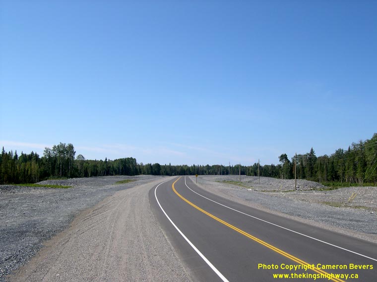
Left - Newly-completed Pamour Mine Diversion on Hwy 101, facing east towards Matheson. See an
Enlarged Photo Here. (Photograph taken on August 28, 2006 - © Cameron Bevers) Right - New Pamour Mine Diversion on Hwy 101, facing west towards Timmins. See an Enlarged Photo Here. (Photograph taken on August 28, 2006 - © Cameron Bevers) 

Left - One of the Pamour Mine Access Roads has its own grade separation across Hwy 101. See an
Enlarged Photo Here. (Photograph taken on August 28, 2006 - © Cameron Bevers) Right - Western end of the Pamour Mine Diversion on Hwy 101. The new highway curves off to the left towards Hoyle and Matheson. See an Enlarged Photo Here. (Photograph taken on August 28, 2006 - © Cameron Bevers) 

Left - Facing east along former Hwy 101 alignment near Pamour Mine. The old highway will soon be obliterated by an open pit
mining operation which is slowly being expanded southwards. See an
Enlarged Photo Here. (Photograph taken on August 28, 2006 - © Cameron Bevers) Right - A sharp horizontal curve on the old Hwy 101 alignment was bypassed by the Pamour Mine Diversion. See an Enlarged Photo Here. (Photograph taken on August 28, 2006 - © Cameron Bevers) 

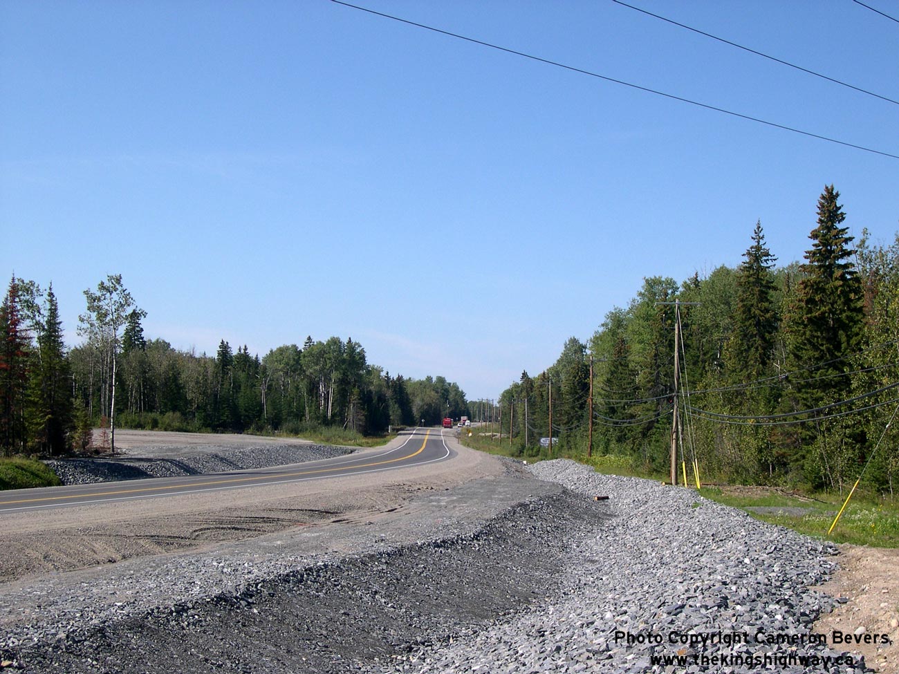
Left - Facing east along Pamour Mine Diversion from the western end of the diversion near Porcupine. See an
Enlarged Photo Here. (Photograph taken on August 28, 2006 - © Cameron Bevers) Right - End of the Pamour Mine Diversion. The new highway joins the existing highway at this point. This view is facing west towards Timmins. See an Enlarged Photo Here. (Photograph taken on August 28, 2006 - © Cameron Bevers) 

Left - Facing east along abandoned Hwy 101 alignment near Porcupine. See an
Enlarged Photo Here. (Photograph taken on August 28, 2006 - © Cameron Bevers) Right - Facing east along Hwy 101 towards start of Pamour Mine Diversion near Porcupine. See an Enlarged Photo Here. (Photograph taken on August 28, 2006 - © Cameron Bevers) 

Left - Looking east across Moose Creek Bridge on Hwy 101 near Hoyle. See an
Enlarged Photo Here. (Photograph taken on August 18, 2003 - © Cameron Bevers) Right - Abandoned Hwy 101 alignment west of Hoyle, facing east towards Matheson. See an Enlarged Photo Here. (Photograph taken on August 28, 2006 - © Cameron Bevers) 

Left - Moose Creek Bridge on Hwy 101 near Hoyle. Structure completed in 1939. See an
Enlarged Photo Here. (Photograph taken on August 18, 2003 - © Cameron Bevers) Right - The Frederickhouse River Bridge was replaced in 2004, after 65 years of service. There has been a precipitous decline in the number of steel through truss bridges on Ontario's highways in recent years. There are now less than 20 steel through truss bridges in the entire King's Highway system. Unfortunately, the demolition of the Frederickhouse River Bridge marks a continuation of this alarming trend. See an Enlarged Photo Here. (Photograph taken on August 18, 2003 - © Cameron Bevers) 

Left - Northern side of Frederickhouse River Bridge on Hwy 101. This new structure was constructed during 2004-2005. See an
Enlarged Photo Here. (Photograph taken on August 28, 2006 - © Cameron Bevers) Right - Date stamp on Frederickhouse River Bridge on Hwy 101. See an Enlarged Photo Here. (Photograph taken on August 28, 2006 - © Cameron Bevers) 

Left - Old Frederickhouse River Bridge on Hwy 101 near Hoyle. Structure was completed in 1939 and demolished in 2004. See an
Enlarged Photo Here. (Photograph taken on August 18, 2003 - © Cameron Bevers) Right - Southern side of Old Frederickhouse River Bridge on Hwy 101. See an Enlarged Photo Here. (Photograph taken on August 18, 2003 - © Cameron Bevers) 

Left - Western approach to Old Frederickhouse River Bridge, looking east towards Matheson. See an
Enlarged Photo Here. (Photograph taken on August 18, 2003 - © Cameron Bevers) Right - Eastern approach to Old Frederickhouse River Bridge, looking west towards Timmins. See an Enlarged Photo Here. (Photograph taken on August 18, 2003 - © Cameron Bevers) 

Left - Facing west along Hwy 101 towards Timmins at Frederickhouse River Bridge. See an
Enlarged Photo Here. (Photograph taken on August 28, 2006 - © Cameron Bevers) Right - Green directional sign on Hwy 101 for Former King's Highway 67. Many northern municipalities that received downloaded highways from the Ontario Government in 1997-1998 simply renamed the former highways as "Municipal Road", because they did not have a lower-tier road numbering system in place. In the instance of Former Hwy 67 between Timmins and Iroquois Falls, it would have been a better idea to name the former highway as "Highway 67", since most Timmins-area residents still call this road by its former highway number. See an Enlarged Photo Here. (Photograph taken on August 28, 2006 - © Cameron Bevers) 

Left - Approaching Hwy 101 and Former Hwy 67 Junction east of Hoyle. See an
Enlarged Photo Here. (Photograph taken on August 28, 2006 - © Cameron Bevers) Right - The MTO replaced the Driftwood River Bridge in 2004-2005. See an Enlarged Photo Here. (Photograph taken on August 18, 2003 - © Cameron Bevers) 

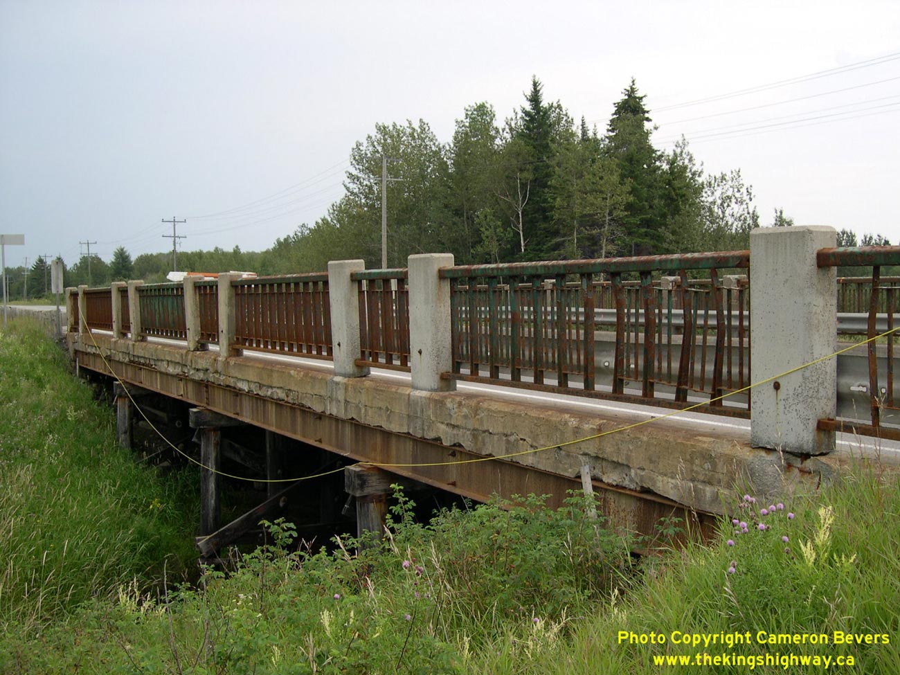
Left - The 240-foot Driftwood River Bridge was among Ontario's longest timber trestle bridges. See an
Enlarged Photo Here. (Photograph taken on August 18, 2003 - © Cameron Bevers) Right - North side of Driftwood River timber trestle bridge on Hwy 101 at Shillington. See an Enlarged Photo Here. (Photograph taken on August 18, 2003 - © Cameron Bevers) 

Left - Looking east along Hwy 101 across Driftwood River Bridge at Shillington. See an
Enlarged Photo Here. (Photograph taken on August 18, 2003 - © Cameron Bevers) Right - Driftwood River Bridge on Hwy 101 at Shillington. Structure completed in 1938. See an Enlarged Photo Here. (Photograph taken on August 18, 2003 - © Cameron Bevers)
Continue on to King's Highway 101 Photos: Hwy 11 to Ontario-Quebec Boundary
|
|---|
Links to Adjacent King's Highway Photograph Pages:
Back to Hwy 101 - Wawa to Chapleau
Hwy 101 Photo Index
On to Hwy 101 - Hwy 11 to Ontario-Quebec Boundary
Back to King's Highway 100 (#2) Photos /
King's Highway 101 History /
On to King's Highway 102 (#1) Photos
Ontario Highway History - Main Menu / Back to List of Highways Website contents, photos & text © 2002-2026, Cameron
Bevers (Webmaster) - All Rights Reserved / Contact Me
|
|---|