
| 
|  |
|
|
This page contains historical and present day photos of Ontario's King's Highway 102 (#2), which ran from Highway 11 &
Highway 17 at Thunder Bay westerly to Highway 11 & Highway 17 at Sistonen's Corners. All photographs displayed on this page were taken by the Webmaster (Cameron
Bevers), unless specifically noted otherwise. Historical photographs are arranged in approximate chronological order, while present day photographs (Year 2000 to date)
are arranged by location from east to west. Click on any thumbnail to see a larger image!
Please note that all photographs displayed on this
website are protected by copyright. These photographs must not be reproduced, published,
electronically stored or copied, distributed, or posted onto other websites without
my written permission. If you want to use photos from this website, please
email me first for permission. Thank-you!
|
|---|
|
Historical King's Highway 102 (#2) Photographs

Above - New Kaministiquia Diversion on Hwy 102 west of Thunder Bay in 1977. See an
Enlarged Photo Here. (Photo courtesy of Ontario Ministry of Transportation - © King's Printer for Ontario, 1977) |
|---|
|
Present Day King's Highway 102 (#2) Photographs
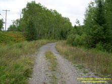

Left - Start of the bypassed Hwy 102 alignment at Kaministiquia. Over 2 km of Hwy 102 was bypassed in 1975 when a new diversion was constructed to eliminate
three at-grade railway crossings and a narrow bridge located on the original highway. See an
Enlarged Photo Here. (Photograph taken on September 1, 2004 - © Cameron Bevers) Right - Facing west along the abandoned Hwy 102 alignment west of Kaministiquia. See an Enlarged Photo Here. (Photograph taken on September 1, 2004 - © Cameron Bevers) 

Left - The old highway alignment begins its descent towards the first railway crossing at Kaministiquia. See an
Enlarged Photo Here. (Photograph taken on September 1, 2004 - © Cameron Bevers) Right - View of the steep grade and sharp curves west of the first Canadian National (CN) Railway crossing. See an Enlarged Photo Here. (Photograph taken on September 1, 2004 - © Cameron Bevers) 
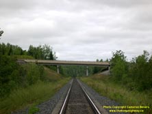
Left - Another sharp curve on the former route of Hwy 102 immediately west of the first CN Railway crossing. See an
Enlarged Photo Here. (Photograph taken on September 1, 2004 - © Cameron Bevers) Right - View of the Kaministiquia CN Railway Overhead on the new Hwy 102 alignment. Structure completed in 1975. See an Enlarged Photo Here. (Photograph taken on September 1, 2004 - © Cameron Bevers) 

Left - The abandoned Hwy 102 alignment descends from the first CN Railway crossing to the second CN Railway crossing. This second CN Railway line was abandoned
only recently, creating an unusual situation where an abandoned highway alignment crosses an abandoned railway alignment. See an
Enlarged Photo Here. (Photograph taken on September 1, 2004 - © Cameron Bevers) Right - Facing east towards the former CN Railway crossing on the abandoned Hwy 102 alignment. See an Enlarged Photo Here. (Photograph taken on September 1, 2004 - © Cameron Bevers) 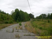
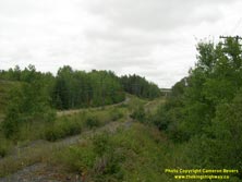
Left - Sharp curves on the abandoned Hwy 102 alignment leading up to the former CN Railway crossing. See an
Enlarged Photo Here. (Photograph taken on September 1, 2004 - © Cameron Bevers) Right - The tale of two abandoned transportation corridors: The former Hwy 102 alignment crosses the abandoned CN Railway line, while the present day Hwy 102 bridge can be seen in the distance. See an Enlarged Photo Here. (Photograph taken on September 1, 2004 - © Cameron Bevers) 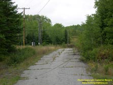

Left - Facing west along the abandoned Hwy 102 alignment west of the Kaministiquia River. See an
Enlarged Photo Here. (Photograph taken on September 1, 2004 - © Cameron Bevers) Right - Old Kaministiquia River bridge piers and abutments on the original Hwy 102 alignment, facing east. The third at-grade railway crossing was at the Canadian Pacific Railway line located on the other side of the river. See an Enlarged Photo Here. (Photograph taken on September 1, 2004 - © Cameron Bevers) 
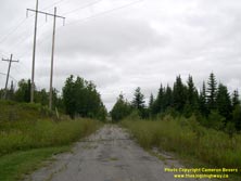
Left - Old Hwy 102 alignment facing west towards Kaministiquia. The old highway alignment lying east of the Kaministiquia River was kept open for local traffic
and is still in use today. See an Enlarged Photo Here. (Photograph taken on September 1, 2004 - © Cameron Bevers) Right - Abandoned Hwy 102 alignment west of Thunder Bay near Mokomon Lake, facing west. See an Enlarged Photo Here. (Photograph taken on September 1, 2004 - © Cameron Bevers) 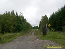

Left - Abandoned Hwy 102 alignment west of Thunder Bay near Mokomon Lake, facing east. See an
Enlarged Photo Here. (Photograph taken on September 1, 2004 - © Cameron Bevers) Right - Approaching Sistonen's Corners on Hwy 11 & Hwy 17, facing west. At this junction, Hwy 11 & Hwy 17 re-joins the alternate highway route through the Thunder Bay area (Hwy 102). These two highways meet again in Thunder Bay, about 40 km to the east. See an Enlarged Photo Here. (Photograph taken on September 2, 2011 - © Cameron Bevers) 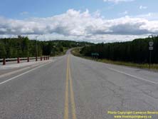

Left - Facing east along Hwy 102 from the Hwy 11 & Hwy 17 Junction at Sistonen's Corners. Motorists approaching Thunder Bay have the option of taking
either Hwy 11 & Hwy 17 or Hwy 102 between Sistonen's Corners and Thunder Bay. Overall, the route of Hwy 102 is more scenic and is actually about 16 km shorter than the
route offered by Hwy 11 & Hwy 17 via Kakabeka Falls. See an Enlarged Photo Here. (Photograph taken on September 2, 2011 - © Cameron Bevers) Right - Distance sign on Eastbound Hwy 102 at Sistonen's Corners, indicating the distance from the Hwy 11 & Hwy 17 Junction to Thunder Bay. See an Enlarged Photo Here. (Photograph taken on September 2, 2011 - © Cameron Bevers) 
Above - Junction sign assembly at Sistonen's Corners marking the western terminus of Hwy 102 at the Hwy 11 & Hwy 17 Junction. (Photograph taken on September 2, 2011 - © Cameron Bevers) 

Left - Approaching the western terminus of Hwy 102 at Sistonen's Corners, west of Thunder Bay. See an
Enlarged Photo Here. (Photograph taken on September 2, 2011 - © Cameron Bevers) Right - Guide sign for Atikokan, Fort Frances and Kenora at the end of Hwy 102 at Sistonen's Corners. Motorists who turn right at the Hwy 11 & Hwy 17 Junction can proceed west towards these destinations. Motorists who turn left here will return to Thunder Bay via Kakabeka Falls. (Photograph taken on September 2, 2011 - © Cameron Bevers) 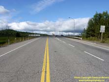
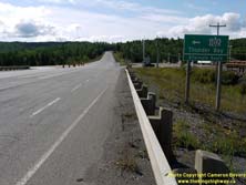
Left - Facing west along Hwy 102 at the Hwy 11 & Hwy 17 Junction. The heavier right-turn movement from Hwy 102 to Westbound Hwy 11 & Hwy 17 is
accommodated via a right-turn channelization. See an Enlarged Photo Here. (Photograph taken on September 2, 2011 - © Cameron Bevers) Right - Green guide sign on Hwy 11 & Hwy 17 marking the turn-off to Hwy 102 at Sistonen's Corners. Note the unusual "Alternate Route" tab under the primary sign. Historically, Hwy 102 was known as Hwy 17A (later Hwy 11A & Hwy 17A). In 1971, the route number was changed to Hwy 102. Although the change in route numbers undoubtedly simplified the signing along the highway corridor, the route number change also erased any trace of what was, up until then, an implied alternate route. See an Enlarged Photo Here. (Photograph taken on September 2, 2011 - © Cameron Bevers) 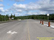

Left - Facing west along Hwy 11 & Hwy 17 from the Hwy 102 Junction at Sistonen's Corners. See an
Enlarged Photo Here. (Photograph taken on September 2, 2011 - © Cameron Bevers) Right - Junction assembly at the western terminus of Hwy 102 at the Hwy 11 & Hwy 17 Junction at Sistonen's Corners. (Photograph taken on September 2, 2011 - © Cameron Bevers) 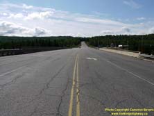
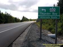
Left - Facing east along Hwy 11 & Hwy 17 towards the Hwy 102 Junction at the Sistonen's Corners Railway Overhead. (Photograph taken on September 2, 2011 - © Cameron Bevers) Right - Advance guide sign for the Hwy 102 Junction on Eastbound Hwy 11 & Hwy 17 approaching Sistonen's Corners. (Photograph taken on September 2, 2011 - © Cameron Bevers)
More King's Highway 102 (#2) Photographs Coming Soon!
|
|---|
Links to Adjacent King's Highway Photograph Pages:
Back to King's Highway 102 (#1) Photos /
King's Highway 102 (#2) History /
On to King's Highway 103 Photos
Ontario Highway History - Main Menu / Back to List of Highways Website contents, photos & text © 2002-2025, Cameron
Bevers (Webmaster) - All Rights Reserved / Contact Me |
|---|