
| 
|  |
|
|
This page contains present day photos (Year 2000 to date) of Ontario's King's Highway 115, arranged by location from the
Highway 35 Interchange at Enterprise Hill northerly to the Highway 28 Interchange at Springville. All photographs displayed on this page were taken by the Webmaster
(Cameron Bevers), unless specifically noted otherwise. Click on any thumbnail to see a larger image!
Please note that all photographs displayed on this
website are protected by copyright. These photographs must not be reproduced, published,
electronically stored or copied, distributed, or posted onto other websites without
my written permission. If you want to use photos from this website, please
email me first for permission. Thank-you!
|
|---|
|
Page 4: Present Day King's Highway 115 Photographs (Enterprise Hill to Hwy 28)


Left - An older green guide sign for Hwy 115 South to Toronto at the Boundary Road Interchange north of Enterprise Hill. See an
Enlarged Photo Here. (Photograph taken on August 25, 2012 - © Cameron Bevers) Right - Facing south along Hwy 115 towards Newcastle from the Boundary Road Overpass. This interchange is situated at the boundary line between the Regional Municipality of Durham and the City of Kawartha Lakes, which was previously known as the County of Victoria. The Hwy 35 & Hwy 115 Interchange at Enterprise Hill lies about 2 km southwest of the Boundary Road Interchange. When Hwy 115 was first opened to traffic in 1954, it was only a two-lane undivided highway. The highway was expanded to four lanes in the early 1990s, by "twinning" - a process by which a new two-lane pavement is constructed beside an existing two-lane pavement in order to create a four-lane divided highway. The section of Hwy 115 in the vicinity of the Boundary Road Interchange was actually the final stage of the four-lane expansion of Hwy 115 between Enterprise Hill and Peterborough. See an Enlarged Photo Here. (Photograph taken on August 25, 2012 - © Cameron Bevers) 

Left - Facing north along Hwy 115 towards Peterborough from the Boundary Road Overpass. The pavement structure along Hwy 115 consists of alternating
sections of concrete and asphalt surfaces. Generally speaking, the sections of Hwy 115 which are surfaced with asphalt form the portions of the original 1954 highway,
while the concrete sections are the new twin highway built in the 1990s. A temporary median crossover existed at Boundary Road during reconstruction in the 1990s, so
there is a short section where both the northbound and southbound lanes are surfaced with concrete. See an
Enlarged Photo Here. (Photograph taken on August 25, 2012 - © Cameron Bevers) Right - An older green guide sign for Hwy 115 North to Peterborough at the Boundary Road Interchange. See an Enlarged Photo Here. (Photograph taken on August 25, 2012 - © Cameron Bevers) 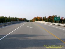

Left - Facing north across the Porter Road (Kawartha Lakes Road 32) Overpass on Hwy 115. The ramps at the Porter Road Interchange are in a simple diamond
configuration. This is actually one of several diamond interchanges located along Hwy 115. See an
Enlarged Photo Here. (Photograph taken on September 25, 2020 - © Cameron Bevers) Right - Western side of the Porter Road Overpass on Hwy 115. This two-span post-tensioned concrete structure was completed in 1991. See an Enlarged Photo Here. (Photograph taken on September 25, 2020 - © Cameron Bevers) 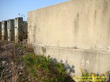

Left - Date stamp (1991) and structure identification number (Site #21-441) on the Porter Road Overpass on Hwy 115. See an
Enlarged Photo Here. (Photograph taken on September 25, 2020 - © Cameron Bevers) Right - View of Hwy 115 at the Porter Road Interchange, facing south towards Newcastle. This interchange is located about 7 km north of Enterprise Hill. See an Enlarged Photo Here. (Photograph taken on September 25, 2020 - © Cameron Bevers) 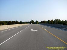
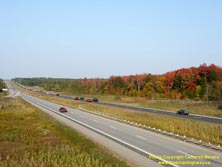
Left - Facing south across the Porter Road (Kawartha Lakes Road 32) Overpass on Hwy 115. See
an Enlarged Photo Here. (Photograph taken on September 25, 2020 - © Cameron Bevers) Right - Autumn colours along Hwy 115 at the Porter Road Interchange. See an Enlarged Photo Here. (Photograph taken on September 25, 2020 - © Cameron Bevers) 
Left - Eastern side of the Porter Road Overpass on Hwy 115. Up until the 1990s, Hwy 115 was a limited-access two-lane highway in this area. Prior to the
completion of this grade separation in the 1990s, Porter Road met Hwy 115 at an at-grade intersection. See an
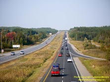
Enlarged Photo Here. (Photograph taken on September 25, 2020 - © Cameron Bevers) Right - Facing north along Hwy 115 towards Peterborough from the Porter Road Overpass. This highway carries a high percentage of recreational weekend traffic towards the cottage and resort areas located north and east of Peterborough. Accordingly, there is a significant directional imbalance of traffic volumes on this highway on Friday and Sunday evenings. In this photo (taken on a Friday), northbound traffic volumes exceed southbound traffic volumes by a considerable margin. See an Enlarged Photo Here. (Photograph taken on September 25, 2020 - © Cameron Bevers) 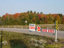

Left - Emergency ramp closure gate on Hwy 115 at the Porter Road Interchange. These ramp closure gates are now becoming quite common at freeway entrance ramps
in Ontario. See an Enlarged Photo Here. (Photograph taken on September 25, 2020 - © Cameron Bevers) Right - View of Hwy 115 facing north approaching the Peterborough County Boundary. An interesting engineering problem arose when the twinning of Hwy 115 was first being planned out in the 1970s and 1980s. While Hwy 115 was always intended to be a Controlled-Access Highway built on an entirely new alignment, the highway's original designers made a decision to centre the two-lane pavement within the highway's right-of-way. This suggests that the Department of Highways of Ontario (DHO) had envisioned that any future highway widening would take place about the existing centreline. In other words, the expansion would have resulted in an undivided four-lane pavement. As traffic volumes continued to increase, it was eventually decided that Hwy 115 should be built as a four-lane freeway with interchanges. However, that initial decision to centre the two-lane pavement within the right-of-way greatly complicated any staging plans for the construction of such a facility, as it would be very difficult and costly to keep the existing highway open to traffic while the new four-lane facility was being built. Ultimately, the problem was solved by purchasing additional property on one side of the highway only, in order to leave the existing Hwy 115 in place and in operation while the new "twin" highway was being constructed. See an Enlarged Photo Here. (Photograph taken on September 25, 2020 - © Cameron Bevers) 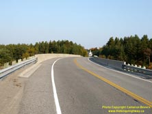

Left - Kawartha Lakes Road 12 Overpass on Hwy 115, facing east towards Millbrook. Although the structure itself is located fully within the City of Kawartha
Lakes, the Peterborough County Boundary lies almost immediately to the east. The small church seen in the background (the Marsh Trinity Church) is actually located in
neighbouring Peterborough County. Although it is barely perceptible in this photo, careful observers will note that there is a spiral built into the bridge's deck.
The superelevation seen on the road's circular curve in the foreground is not constant across the entire length of the structure and gradually runs out to a normal
crown as the road straightens towards the bridge's eastern abutment. Bridges with this type of geometric design are rather uncommon, as they are much more complicated
to design and construct than circular-curved bridges with a constant radius and superelevation rate. See an
Enlarged Photo Here. (Photograph taken on September 25, 2020 - © Cameron Bevers) Right - Southern side of the Kawartha Lakes Road 12 Overpass on Hwy 115. This two-span post-tensioned concrete structure was completed in 1990. Ontario was a rapid adopter of the post-tensioned bridge design, with dozens of them constructed on the provincial highway system by the mid-1960s. A key advantage of this type of design is that curved bridge decks such as this example can be accommodated much more easily than what can be achieved using a girder design. See an Enlarged Photo Here. (Photograph taken on September 25, 2020 - © Cameron Bevers) 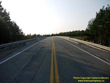

Left - Kawartha Lakes Road 12 Overpass at the Peterborough County Boundary, facing west. The superelevation development and spiral on the bridge deck are more
evident in this photo. All bridges take a considerable amount of engineering work to design, but this bridge is certainly among the more complicated structures that
I have seen built along the King's Highways in recent years. Prior to the conversion of Hwy 115 to a freeway in the 1990s, both Victoria Road 12 and Peterborough Road
28 (now known as Peterborough Road 21) connected with Hwy 115 at two closely-spaced intersections. As part of the Hwy 115 twinning, Victoria Road 12 was extended
easterly in 1990 so that it connected directly to Peterborough Road 28 via this flyover. See an
Enlarged Photo Here. (Photograph taken on September 25, 2020 - © Cameron Bevers) Right - Date stamp (1990) and structure identification number (Site #21-442) on the Kawartha Lakes Road 12 Overpass on Hwy 115. See an Enlarged Photo Here. (Photograph taken on September 25, 2020 - © Cameron Bevers) 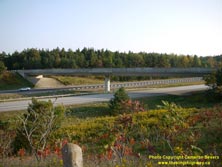

Left - Northern side of the Kawartha Lakes Road 12 Overpass on Hwy 115. See an
Enlarged Photo Here. (Photograph taken on September 25, 2020 - © Cameron Bevers) Right - Facing south along Hwy 115 towards Newcastle from the Kawartha Lakes Road 12 Overpass at the Peterborough County Boundary. See an Enlarged Photo Here. (Photograph taken on September 25, 2020 - © Cameron Bevers) 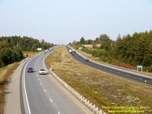

Left - View of Hwy 115 at the Peterborough County Boundary, facing north towards Peterborough. See an
Enlarged Photo Here. (Photograph taken on September 25, 2020 - © Cameron Bevers) Right - Older green guide sign for Hwy 115 North to Peterborough at the Tapley Quarter Line Interchange near Millbrook. See an Enlarged Photo Here. (Photograph taken on August 25, 2012 - © Cameron Bevers) 

Left - Facing north along Tapley Quarter Line approaching the dual underpasses at the Hwy 115 Interchange. The structure in the foreground carries the
northbound lanes of Hwy 115. This single-span concrete rigid frame structure was completed in 1992. Like the interchanges at Boundary Road and Porter Road located to
the south, the ramps at the Tapley Quarter Line Interchange are also in a simple diamond configuration. See an
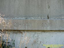
Enlarged Photo Here. (Photograph taken on August 25, 2012 - © Cameron Bevers) Right - Date stamp (1992) and structure identification number (Site #21-443) on the northbound Hwy 115 structure over Tapley Quarter Line. See an Enlarged Photo Here. (Photograph taken on August 25, 2012 - © Cameron Bevers) 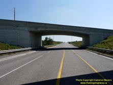
Left - Northern side of the northbound Hwy 115 structure over Tapley Quarter Line. See an
Enlarged Photo Here. (Photograph taken on August 25, 2012 - © Cameron Bevers) Right - Date stamp (1991) and structure identification number (Site #21-443) on the southbound Hwy 115 structure over Tapley Quarter Line. See an Enlarged Photo Here. (Photograph taken on August 25, 2012 - © Cameron Bevers) 

Left - Southern side of the southbound Hwy 115 structure over Tapley Quarter Line. This single-span concrete rigid frame structure was completed in 1991. Prior
to the completion of the dual underpasses at Tapley Quarter Line, this road crossed Hwy 115 at an at-grade intersection. See an
Enlarged Photo Here. (Photograph taken on August 25, 2012 - © Cameron Bevers) Right - Facing south along Tapley Quarter Line approaching the dual underpasses at the Hwy 115 Interchange. See an Enlarged Photo Here. (Photograph taken on August 25, 2012 - © Cameron Bevers) 
Left - Older green guide sign for Hwy 115 North to Peterborough at the Tapley Quarter Line Interchange near Millbrook. See an
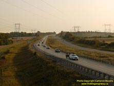
Enlarged Photo Here. (Photograph taken on August 25, 2012 - © Cameron Bevers) Right - Evening view of Hwy 115, facing south towards Newcastle from Larmer Line. Ontario's investments in highways has brought about phenomenal economic development since World War II. This photo juxtaposes one element of that investment (Hwy 115) with another major catalyst for the province's explosive growth - hydroelectricity. Although we take electricity for granted today, it is important to note that many parts of rural Ontario did not have electricity service until after World War II. Massive investments in electrification by Ontario's Hydroelectric Power Commission saw electrical services widely distributed to most areas of the province by the 1960s. Here, Hwy 115 passes below a major hydro transmission corridor which connects the Greater Toronto Area to the Chats Falls Hydroelectric Generating Station on the Ottawa River, which went into service in 1931. See an Enlarged Photo Here. (Photograph taken on September 25, 2020 - © Cameron Bevers) 

Left - Northern side of the Larmer Line Overpass on Hwy 115. This four-span post-tensioned concrete structure was completed in 1991. See an
Enlarged Photo Here. (Photograph taken on September 25, 2020 - © Cameron Bevers) Right - Facing east across the Larmer Line Overpass on Hwy 115 near Millbrook. See an Enlarged Photo Here. (Photograph taken on September 25, 2020 - © Cameron Bevers) 
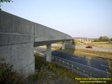
Left - Facing west across the Larmer Line Overpass on Hwy 115 near Millbrook. See an
Enlarged Photo Here. (Photograph taken on September 25, 2020 - © Cameron Bevers) Right - Southern side of the Larmer Line Overpass on Hwy 115. See an Enlarged Photo Here. (Photograph taken on September 25, 2020 - © Cameron Bevers) 

Left - Date stamp (1991) and structure identification number (Site #21-444) on the Larmer Line Overpass on Hwy 115. See an
Enlarged Photo Here. (Photograph taken on September 25, 2020 - © Cameron Bevers) Right - Facing north along Hwy 115 towards Peterborough from the Larmer Line Overpass. The median width along Hwy 115 was established in such a way to allow for an addition of one lane per direction in the future without too much difficulty. Even with the latest computer modelling, accurately forecasting future travel demand on new or expanded highway corridors is still quite difficult, since population, land use and economic conditions are rather fluid. Changes to any of these factors can dramatically affect travel demand along a particular corridor. See an Enlarged Photo Here. (Photograph taken on September 25, 2020 - © Cameron Bevers) 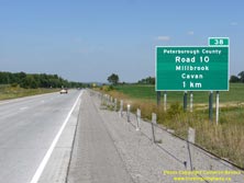

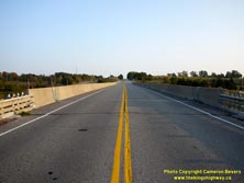
Left - Advance guide sign for Peterborough County Road 10 on northbound Hwy 115. The full county road name is spelled out on this sign, as this road does not
go by any other name. Normally, a "flowerpot" route marker is shown on these signs along with the road's proper name. See an
Enlarged Photo Here. (Photograph taken on August 25, 2012 - © Cameron Bevers) Right - Facing north along Hwy 115 at the Peterborough County Road 10 Interchange. The ramps at this interchange are in a "Parclo A-2" configuration. This is the first non-diamond interchange located along Hwy 115 north of Enterprise Hill. Prior to the completion of this interchange in the 1990s, Peterborough County Road 10 crossed Hwy 115 at an at-grade intersection. Click here to see a Historical 1972 Photo of the Peterborough County Road 10 intersection. See an Enlarged Photo Here. (Photograph taken on September 25, 2020 - © Cameron Bevers) 

Left - Facing south along Hwy 115 towards Newcastle from the Peterborough County Road 10 Overpass. See an
Enlarged Photo Here. (Photograph taken on September 25, 2020 - © Cameron Bevers) Right - Western side of the Peterborough County Road 10 Overpass on Hwy 115. This extraordinarily long four-span post-tensioned concrete structure was completed in 1990. This part of Ontario has relatively poor soil conditions from a foundations standpoint, so many of the structures along this section of Hwy 115 had to be built longer than would have otherwise been necessary. During reconstruction of Hwy 115, fill had to be placed more than a year in advance at this bridge and various other locations to allow time for settlement to occur. See an Enlarged Photo Here. (Photograph taken on September 25, 2020 - © Cameron Bevers) 
Left - Date stamp (1990) and structure identification number (Site #21-445) on the Peterborough County Road 10 Overpass on Hwy 115 near Cavan. See an
Enlarged Photo Here. (Photograph taken on September 25, 2020 - © Cameron Bevers) Right - Peterborough County Road 10 Overpass on Hwy 115, facing south towards Millbrook. This is the first long distance north-south road along the eastern side of the Ganaraska Forest. Beyond Millbrook, County Road 10 heads south towards Port Hope and connects to Hwy 2 at Welcome Corners. See an Enlarged Photo Here. (Photograph taken on September 25, 2020 - © Cameron Bevers) 

Left - View of the Peterborough County Road 10 Overpass on Hwy 115, facing north towards Cavan. This area of Peterborough County has many scenic rural vistas
such as this. The King's Highways and county roads around Peterborough make for some very pleasant driving itineraries. See an
Enlarged Photo Here. (Photograph taken on September 25, 2020 - © Cameron Bevers) Right - Eastern side of the Peterborough County Road 10 Overpass on Hwy 115 near Cavan. See an Enlarged Photo Here. (Photograph taken on September 25, 2020 - © Cameron Bevers) 
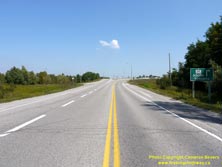
Left - Facing north along Hwy 115 from the Peterborough County Road 10 Overpass near Cavan. The two-lane route of Hwy 115 was widened to four lanes from just
south of Peterborough County Road 10 to the Hwy 28 Interchange in 1989-1990. In this photo, the "twin" concrete-surfaced northbound lanes can be seen beside the
original asphalt-surfaced highway, which now carries southbound traffic only. The Hwy 7A Interchange can be seen in the distance. See an
Enlarged Photo Here. (Photograph taken on September 25, 2020 - © Cameron Bevers) Right - Approaching the Hwy 115 Interchange on Hwy 7A near Cavan, facing east. See an Enlarged Photo Here. (Photograph taken on August 25, 2012 - © Cameron Bevers) 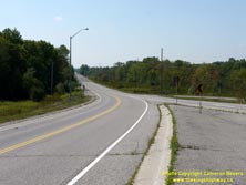

Left - Facing west along Hwy 7A towards Cavan from the Hwy 115 Interchange. From Hwy 115,
Hwy 7A continues westerly for almost 50 km to Hwy 7 & Hwy 12 via Cavan, Bethany and Port Perry. The highway was established as an alternate route to Hwy 7 just
prior to World War II. See an Enlarged Photo Here. (Photograph taken on August 25, 2012 - © Cameron Bevers) Right - This square route marker advises eastbound motorists that Hwy 7A ends at the Hwy 115 Interchange. The eastern terminus of Hwy 7A is rather well-signed, as the highway at one time continued easterly towards Peterborough beyond this interchange. Prior to 2003, Hwy 7A continued east from here along a concurrent route with Hwy 115. See an Enlarged Photo Here. (Photograph taken on August 25, 2012 - © Cameron Bevers) 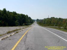
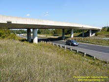
Left - The southbound Hwy 115 exit ramp to westbound Hwy 7A is almost tangential, due to the skewed crossing of Hwy 7A at Hwy 115. Although Hwy 115 is signed
with north and south cardinal directions, the highway actually trends along a northeast and southwest line between Enterprise Hill and Peterborough. See an
Enlarged Photo Here. (Photograph taken on August 25, 2012 - © Cameron Bevers) Right - Southern side of the Hwy 7A Overpass on Hwy 115 near Cavan. This four-span post-tensioned concrete structure was completed in 1990. Click here to see a Historical 1972 Photo of the Hwy 7A & Hwy 115 Junction, when the intersection was still at-grade. See an Enlarged Photo Here. (Photograph taken on August 25, 2012 - © Cameron Bevers) 

Left - An older green guide sign for Hwy 115 South to Toronto at the Hwy 7A Interchange. See an
Enlarged Photo Here. (Photograph taken on August 25, 2012 - © Cameron Bevers) Right - View of Hwy 115 at the Hwy 7A Interchange, facing north towards Peterborough. Note that both the northbound and southbound lanes of Hwy 115 are surfaced with concrete at this interchange. When this section of Hwy 115 was twinned in 1989-1990, a median crossover existed here. South of the Hwy 7A Interchange, the original two-lane route of Hwy 115 followed the present southbound lanes of the freeway. From this point northerly to the Hwy 28 Interchange, the original highway forms the northbound lanes of the freeway. See an Enlarged Photo Here. (Photograph taken on August 25, 2012 - © Cameron Bevers) 
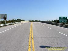
Left - Date stamp (1990) and structure identification number (Site #21-446) on the Hwy 7A Overpass on Hwy 115 near Cavan. See an
Enlarged Photo Here. (Photograph taken on August 25, 2012 - © Cameron Bevers) Right - Facing east across the Hwy 7A Overpass on Hwy 115 near Cavan. See an Enlarged Photo Here. (Photograph taken on August 25, 2012 - © Cameron Bevers) 

Left - Facing south along Hwy 115 towards Newcastle from the Hwy 7A Overpass near Cavan. See an
Enlarged Photo Here. (Photograph taken on August 25, 2012 - © Cameron Bevers) Right - Hwy 7A Overpass on Hwy 115, facing west towards Cavan. See an Enlarged Photo Here. (Photograph taken on August 25, 2012 - © Cameron Bevers) 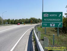
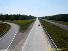
Left - Green guide sign marking the entrance ramp to northbound Hwy 115. A second sign below acts as a trailblazer to Hwy 7, since Hwy 7A no longer connects
directly to Hwy 7 at its eastern end. The overlapped route of Hwy 7A & Hwy 115 east of this interchange was discontinued in 2003, in an effort to simplify route
numbering in the Peterborough area. However, any motorist who enters the freeway at this point will automatically end up on Hwy 7 at the next interchange. See an
Enlarged Photo Here. (Photograph taken on August 25, 2012 - © Cameron Bevers) Right - The entrance ramp from Hwy 7A joins into the northbound lanes of Hwy 115 at left. At one time, the overlapped route of Hwy 7A & Hwy 115 extended easterly for one interchange where Hwy 7A exited the freeway and turned north to Springville. This former overlapped route made the highway signing in this area unnecessarily complicated and is far better in its current configuration, in my personal opinion. See an Enlarged Photo Here. (Photograph taken on August 25, 2012 - © Cameron Bevers) 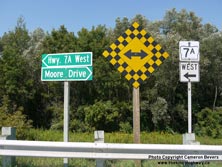
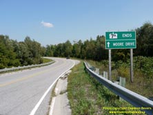
Left - Fingerboard guide signs and route marker at the northbound Hwy 115 exit ramp terminal at Hwy 7A. It is unusual to see a King's Highway marked with a
fingerboard guide sign like this. At one time, Moore Drive lying to the east of the Hwy 115 Interchange was also part of Hwy 7A. This eastern section of Hwy 7A via
Moore Drive was bypassed when Hwy 115 first opened to traffic in 1954. See an
Enlarged Photo Here. (Photograph taken on August 25, 2012 - © Cameron Bevers) Right - A second sign advises eastbound motorists that Hwy 7A ends. Between 1938 and 1954, Hwy 7A continued straight ahead towards Hwy 28 via today's Moore Drive. Jurisdiction over this bypassed section of Hwy 7A was transferred from the DHO to the Township of Cavan in November 1954. See an Enlarged Photo Here. (Photograph taken on August 25, 2012 - © Cameron Bevers)
Continue on to King's Highway 115 Photos: Hwy 28 to Peterborough
|
|---|
Links to Adjacent King's Highway Photograph Pages:
Back to Hwy 115 - Orono to Enterprise Hill
Hwy 115 Photo Index
On to Hwy 115 - Hwy 28 to Peterborough
Back to King's Highway 114 Photos /
King's Highway 115 History /
On to King's Highway 116 Photos
Ontario Highway History - Main Menu / Back to List of Highways Website contents, photos & text © 2002-2025, Cameron
Bevers (Webmaster) - All Rights Reserved / Contact Me |
|---|