
| 
| |
|
|
This page contains historical and present day photos of Ontario's King's Highway 118 from Glen Orchard easterly to Bracebridge.
All photographs displayed on this page were taken by the Webmaster (Cameron Bevers), unless specifically noted otherwise. Historical photographs are arranged in
approximate chronological order, while present day photographs (Year 2000 to date) are arranged by location from west to east. Click on any thumbnail to see a larger
image!
Please note that all photographs displayed on this
website are protected by copyright. These photographs must not be reproduced, published,
electronically stored or copied, distributed, or posted onto other websites without
my written permission. If you want to use photos from this website, please
email me first for permission. Thank-you!
|
|---|
|
Page 1: Historical King's Highway 118 Photographs

Left - Facing west along Joseph Street (Hwy 118) towards the Indian River Swing Bridge in Port Carling in 1950. The old one-lane swing bridge over the Indian
River and Port Carling Lock between Lake Muskoka and Lake Rosseau was constructed back in 1921. The swing bridge was replaced with a new two-lane lift bridge in 1974. See an
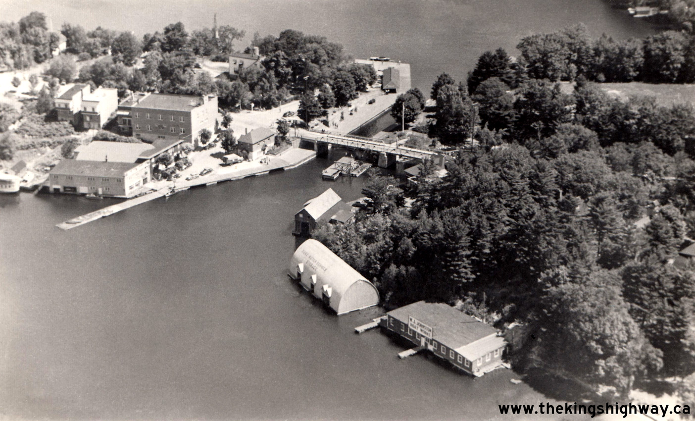
Enlarged Photo Here. Photo taken in 1950. (Photograph courtesy of Thatcher Studio) Right - Circa 1950 aerial view of the Indian River Swing Bridge on Hwy 118 in Port Carling. See an Enlarged Photo Here. (Photograph courtesy of Thatcher Studio) 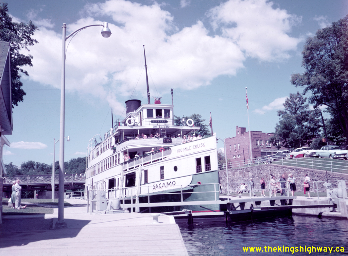
Above - Circa 1958 view of the Sagamo steamship passing through the Port Carling Lock, with the Hwy 118 swing bridge in the background. This photo shows the
Sagamo operating during one of her last seasons touring on the Muskoka Lakes. It was actually the waterways that served as Muskoka's "highways" in the early 20th
Century, with steamships such as this one providing critical transportation links between ports, railway terminals and the many fine summer resorts which dotted the
lakeshores. As the King's Highway system began to develop through Muskoka by the end of the 1930s, vacationers were suddenly able to travel reliably around Muskoka at
times of their own choosing by motorcar, rather than being tied to the steamships' service schedules. Passenger carriage on the steamships declined rapidly after
World War II as major highways such as Hwy 11 and Hwy 69 were improved and travel times by road were reduced. The Sagamo remained in service as the last operating
passenger steamship on the Muskoka Lakes for most of the 1950s, until it too was retired from service in September 1958. See an
Enlarged Photo Here. Photo taken circa 1958. (Photo © Archives of Ontario - Series RG-65-35, Photo #I-0014797) 
Above - Department of Highways' mulch motor-paver in operation on a Day Labour paving project on Hwy 118 (later known as Hwy 117) east of Bracebridge in 1959. See an
Enlarged Photo Here. (Photo courtesy of Ontario Ministry of Transportation - © King's Printer for Ontario, 1959) 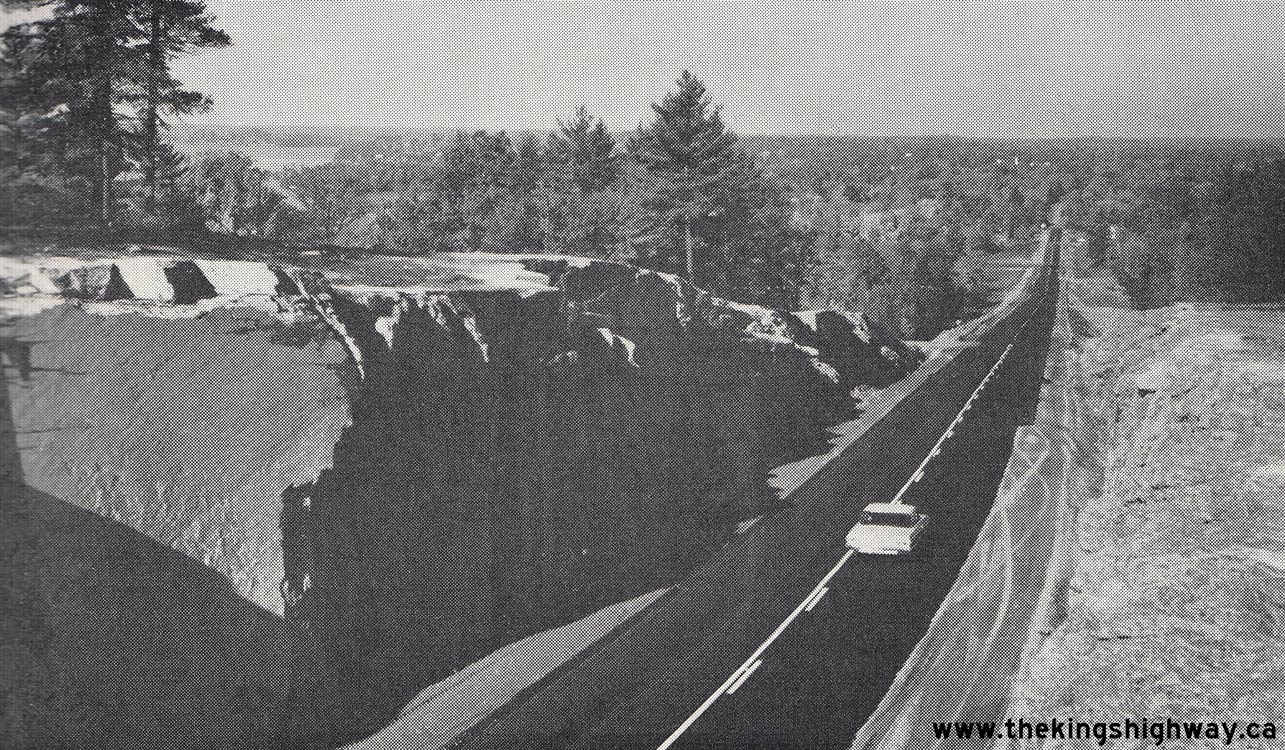
Above - Newly-completed Milford Bay Bypass (Hwy 118) facing west towards Port Carling from Huckleberry Rock, Contract #1962-200. See an
Enlarged Photo Here. Photo taken in 1963. (Photo courtesy of Ontario Ministry of Transportation - © King's Printer for Ontario, 1963) 
Left - Circa 1965 aerial view of the massive Huckleberry Rock Cut on Hwy 118 at Milford Bay, facing east towards Bracebridge. See an
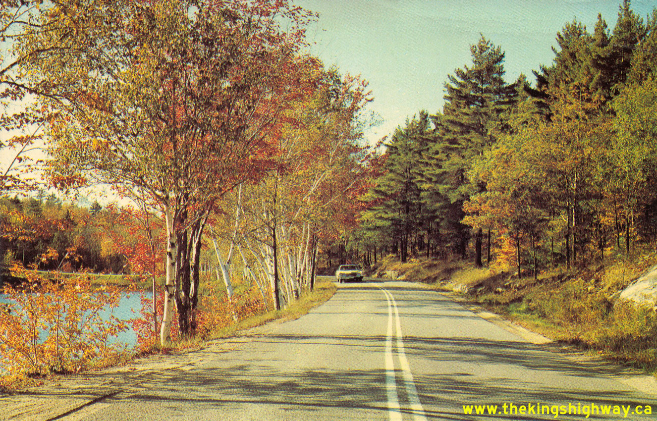
Enlarged Photo Here. (Photograph courtesy of Peterborough Post Card Company) Right - Circa 1965 postcard view of Hwy 118 at Henshaw Lake, located 1 mile west of Port Carling. See an Enlarged Photo Here. (Photo courtesy of Alex Wilson Publications Ltd.) 

Left - View of Hwy 118 (later known as Hwy 117), 3 miles west of Baysville. See an
Enlarged Photo Here. Photo taken in 1964. (Photo courtesy of Ontario Ministry of Transportation - © King's Printer for Ontario, 1964) Right - Preparation for rock blasting on Contract #1966-18 for a realignment and vertical grade correction on Hwy 118 west of Milford Bay. See an Enlarged Photo Here. Photo taken in 1966. (Photo courtesy of Ontario Ministry of Transportation - © King's Printer for Ontario, 1966) 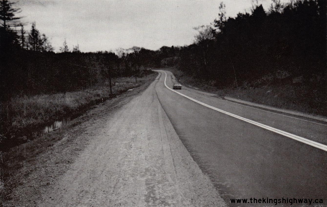
Above - New diversion of Hwy 118 on the eastern approach to Port Carling, Contract #1966-18. See an
Enlarged Photo Here. Photo taken in 1967. (Photo courtesy of Ontario Ministry of Transportation - © King's Printer for Ontario, 1967) 
Above - Construction underway for the replacement of the Indian River Swing Bridge on Joseph Street (Hwy 118) in Port Carling, Contract #1973-125. See an
Enlarged Photo Here. Photo taken in 1974. (Photo courtesy of Ontario Ministry of Transportation - © King's Printer for Ontario, 1974) |
|---|
|
Present Day King's Highway 118 Photographs (Glen Orchard to Bracebridge)


Left - Facing south along Hwy 169 towards Bala from the Hwy 118 Junction at Glen Orchard. All three approaches to the Hwy 169 & Hwy 118 Junction at Glen
Orchard were extensively realigned in the 1970s, as part of an improvement project to replace an inconspicuous junction where these two highways initially intersected.
This broad, sweeping curve beside Butterfly Lake bypassed a series of sharp curves on the original 1937 route of Hwy 69 (later Hwy 169). See an
Enlarged Photo Here. (Photograph taken on September 27, 2013 - © Cameron Bevers) Right - Approaching the Hwy 118 Junction on Hwy 169 at Glen Orchard, facing north towards MacTier. See an Enlarged Photo Here. (Photograph taken on September 27, 2013 - © Cameron Bevers) 

Left - Green guide sign for Muskoka Road 118 West (Former Hwy 118) on northbound Hwy 169 at Glen Orchard. Provincial ownership of Hwy 118 west of Bracebridge
ceased in 1998, when the Ministry of Transportation of Ontario (MTO) transferred jurisdiction over the western leg of Hwy 118 to the District Municipality of Muskoka.
Today, Former Hwy 118 from the Hwy 169 Junction at Glen Orchard to the Hwy 11 Interchange in Bracebridge is officially known as Muskoka Road 118 West. See an
Enlarged Photo Here. (Photograph taken on September 27, 2013 - © Cameron Bevers) Right - Scenic Butterfly Lake appears on the eastern side of the Hwy 118 & Hwy 169 Junction. This is one of many lakes in the popular Muskoka Lakes tourist area. See an Enlarged Photo Here. (Photograph taken on September 27, 2013 - © Cameron Bevers) 

Left - When the Hwy 169 & Hwy 118 Junction was reconstructed in 1974, new channelized right turn ramps were installed. Note the old "Ramp Speed 50" warning
sign on the left side of the ramp. In recent years, these Ramp Speed signs have been phased out and replaced with new plain yellow signs which just post the numerical
advisory speed only. See an Enlarged Photo Here. (Photograph taken on September 27, 2013 - © Cameron Bevers) Right - Western terminus of Hwy 118 at the Hwy 169 Junction at Glen Orchard. This interesting 1970s-vintage highway junction was constructed under Contract #1974-15. It even features white chevron pavement hatch markings approaching the raised traffic islands, which are not commonly used in Ontario anymore. See an Enlarged Photo Here. (Photograph taken on September 27, 2013 - © Cameron Bevers) 

Left - Green guide signs on westbound Hwy 118 approaching Muskoka Road 169 (Former Hwy 169) at Glen Orchard. See an
Enlarged Photo Here. (Photograph taken on September 27, 2013 - © Cameron Bevers) Right - Destination guide sign at the western terminus of Hwy 118 at the Hwy 169 Junction at Glen Orchard. The incorporated towns of Gravenhurst and Parry Sound were typically used as the destination control cities along Hwy 169 through Muskoka. Although the Town of Bala hasn't been an incorporated municipality in its own right in many decades, it is still a very popular Muskoka tourist destination and is still signed today at the Hwy 118 Junction. Bala was also the junction of two provincial highways (Hwy 169 & Hwy 660) up until 1982, which might further explain why Bala remained signed as a destination even though the town is no longer an incorporated municipal entity. See an Enlarged Photo Here. (Photograph taken on September 27, 2013 - © Cameron Bevers) 

Left - General view of the current Hwy 169 & Hwy 118 Junction, facing east towards Port Carling. This photo was taken from the approximate site of the
original highway junction, prior to the intersection's reconstruction in 1974. The vertical profile of Hwy 169 was lowered by several metres as a result of the
reconstruction, which allowed the two highways to intersect at a comparatively level grade. Previously, Hwy 118 would have ascended a steep uphill grade just before
reaching Hwy 169, which would have resulted in an inconspicuous intersection with poor sight lines. Given the magnitude of the reconstruction efforts displayed here,
it is quite probable that the old highway junction at Glen Orchard had a dubious safety record prior to the 1970s. See an
Enlarged Photo Here. (Photograph taken on September 27, 2013 - © Cameron Bevers) Right - Green guide sign for Muskoka Road 118 West (Former Hwy 118) on southbound Hwy 169 at Glen Orchard. See an Enlarged Photo Here. (Photograph taken on September 27, 2013 - © Cameron Bevers) 

Left - View of the channelized right turn ramp from westbound Hwy 118 to northbound Hwy 169. The Department of Highways of Ontario (DHO) and its successor, the
Ministry of Transportation and Communications (MTC), rebuilt many highway junctions with channelized right turn ramps such as this during the 1950s, 1960s and 1970s.
This right turn ramp allows vehicles approaching on Hwy 118 to bypass the stop sign at Hwy 169. This intersection feature is particularly advantageous for heavy
trucks. If they had to pass through the intersection and come to a full stop, it would take a considerable amount of time for the trucks to get back up to highway
speeds. See an Enlarged Photo Here. (Photograph taken on September 27, 2013 - © Cameron Bevers) Right - Facing east along Hwy 118 from the Hwy 169 Junction at Glen Orchard. When Hwy 118 was first established in the mid-1950s, the highway followed the aerial hydro lines onto West White's Road rather then continue straight ahead. This former alignment of Hwy 118 can be seen at right, departing from the current route of Hwy 118 and following the north shore of Butterfly Lake. A newer diversion of Hwy 118 can be seen straight ahead, which was built under Contract #1969-223 and completed in 1970. The diversion removed a sharp curve on the original 1955 route of Hwy 118 approaching Glen Orchard. See an Enlarged Photo Here. (Photograph taken on September 27, 2013 - © Cameron Bevers) 

Left - Facing north along Hwy 169 towards MacTier from the Hwy 118 Junction at Glen Orchard. A substantial relocation of the highway took place here in 1974.
Originally, the highway followed Carl's Road, located a short distance to the west. The relocation of Hwy 169 at Glen Orchard greatly improved the sight lines for
traffic approaching the Hwy 118 Junction. See an Enlarged Photo Here. (Photograph taken on September 27, 2013 - © Cameron Bevers) Right - Approaching the Hwy 118 Junction on Hwy 169 at Glen Orchard, facing south towards Bala. See an Enlarged Photo Here. (Photograph taken on September 27, 2013 - © Cameron Bevers) 

Left - Autumn colours on Butterfly Lake, as seen from Hwy 118 at Glen Orchard. See an
Enlarged Photo Here. (Photograph taken on September 27, 2013 - © Cameron Bevers) Right - Approaching the Hwy 169 Junction on Hwy 118 at Glen Orchard. A 1 km section of Hwy 118 was relocated east of the highway junction at Glen Orchard in the early 1970s. The original 1955 route of Hwy 118 followed the north shore of Butterfly Lake, via West White's Road. See an Enlarged Photo Here. (Photograph taken on September 27, 2013 - © Cameron Bevers) 

Left - Junction sign assembly at Hwy 118 & Hwy 169 at Glen Orchard. Although the old King's Highway crown signs have long since been removed at this
junction, it is still rather noteworthy to see two municipal roads with three-digit route numbers intersect at a common junction. When the District of Muskoka
acquired Hwy 118 & Hwy 169 from the province as a result of the municipal highway transfers in 1998, they made a wise decision to retain the Hwy 118 and Hwy 169
route numbers, rather than attempting to introduce new route numbers to these otherwise familiar highways. Old Hwy 118 (West White's Road) can be seen at left. See an
Enlarged Photo Here. (Photograph taken on September 27, 2013 - © Cameron Bevers) Right - Approaching the Hwy 169 Junction at Glen Orchard on Hwy 118, facing west. See an Enlarged Photo Here. (Photograph taken on September 27, 2013 - © Cameron Bevers) 

Left - Advance green guide signs on westbound Hwy 118 approaching Muskoka Road 169 (Former Hwy 169) at Glen Orchard. See an
Enlarged Photo Here. (Photograph taken on September 27, 2013 - © Cameron Bevers) Right - Facing east along Hwy 118 towards Port Carling, east of Butterfly Lake. See an Enlarged Photo Here. (Photograph taken on September 27, 2013 - © Cameron Bevers) 
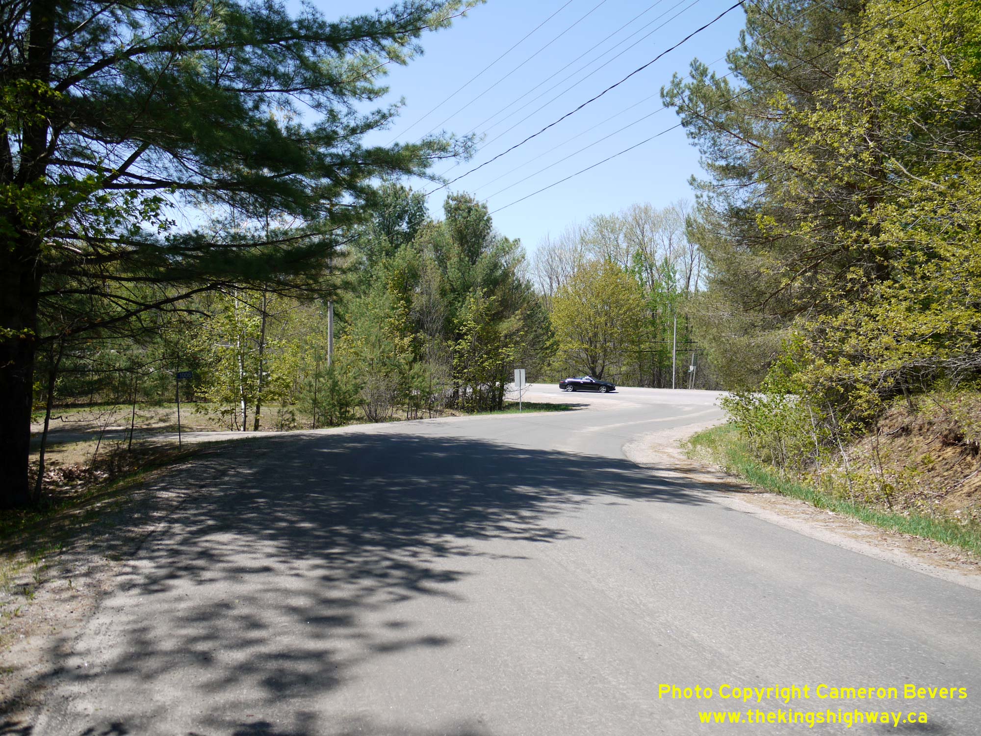
Left - View of Old Hwy 118 (West White's Road) at Glen Orchard, facing east from Hwy 118. This short loop of the original highway was bypassed in the early
1970s. See an Enlarged Photo Here. (Photograph taken on May 23, 2020 - © Cameron Bevers) Right - Old Hwy 118 (West White's Road) connects back to the relocated route of Hwy 118 immediately east of the Hwy 169 Junction at Glen Orchard. See an Enlarged Photo Here. (Photograph taken on May 23, 2020 - © Cameron Bevers) 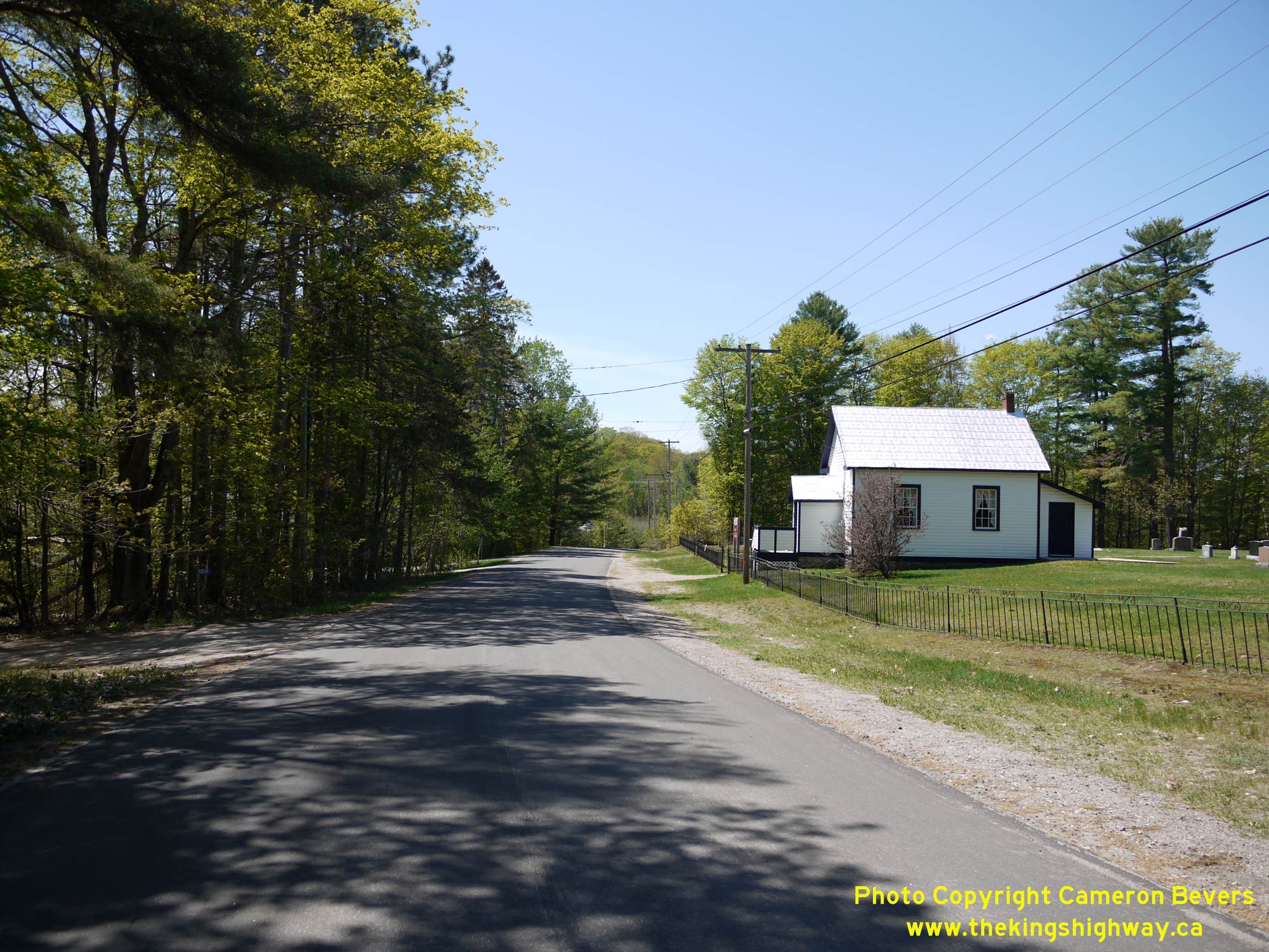

Left - Old Hwy 118 (West White's Road), facing west at Glen Orchard. The historical Glen Orchard Schoolhouse at right was constructed in 1890. Up until the
late 1960s, about 1,000 vehicles per day passed by the old schoolhouse on Hwy 118. Once the diversion was constructed around Glen Orchard in the early 1970s, the old
highway became a quiet residential street seeing only occasional local traffic. Jurisdiction over the old loop of Hwy 118 through Glen Orchard was transferred from
the province to the Township of Muskoka Lakes in November 1976. See an Enlarged Photo Here. (Photograph taken on May 23, 2020 - © Cameron Bevers) Right - This awkward intersection was among the many design deficiencies along Old Hwy 118 (West White's Road). Rather than continue straight ahead as one might expect, the original route of Hwy 118 actually curved sharply to the left onto White's Road. The apparent through road at this intersection comes to a dead-end at Butterfly Lake about 1 km ahead. Given the odd intersection layout here, it's quite probable that some historical motorists who intended to follow Hwy 118 easterly to Port Carling inadvertently missed this turn-off and continued straight ahead only to find out that the "highway" suddenly ended! See an Enlarged Photo Here. (Photograph taken on May 23, 2020 - © Cameron Bevers) 

Left - Old Hwy 118 (White's Road) curves sharply to the right as it enters the community of Glen Orchard. The route of Hwy 118 between Port Carling and Glen
Orchard was once plagued with numerous sharp curves. This was actually one of the better curves located along the historical route of Hwy 118, as it had a constant
and therefore predictable radius. Some of the other curves along the highway were laid out by 19th Century road builders who merely followed a path of least
resistance and constructed the road however the prevailing local topography allowed. This practice left behind a legacy of surprisingly sharp and unpredictable curves
which were not at all appropriate for high-speed travel. Driving this section of Hwy 118 prior to reconstruction would have been a very slow haul. The highway east of
Glen Orchard was reconstructed on a vastly-improved alignment under Contract #1969-223, which was completed in the Fall of 1970. See an
Enlarged Photo Here. (Photograph taken on May 23, 2020 - © Cameron Bevers) Right - Bypassed alignment of Hwy 118 (Pine Glen Drive) between Glen Orchard and Port Carling. This section of the old highway was closed off to through traffic once Hwy 118 was relocated onto an improved alignment nearby in 1970. This old section of Hwy 118 was transferred to the Township of Muskoka Lakes in November 1976. See an Enlarged Photo Here. (Photograph taken on May 23, 2020 - © Cameron Bevers) 
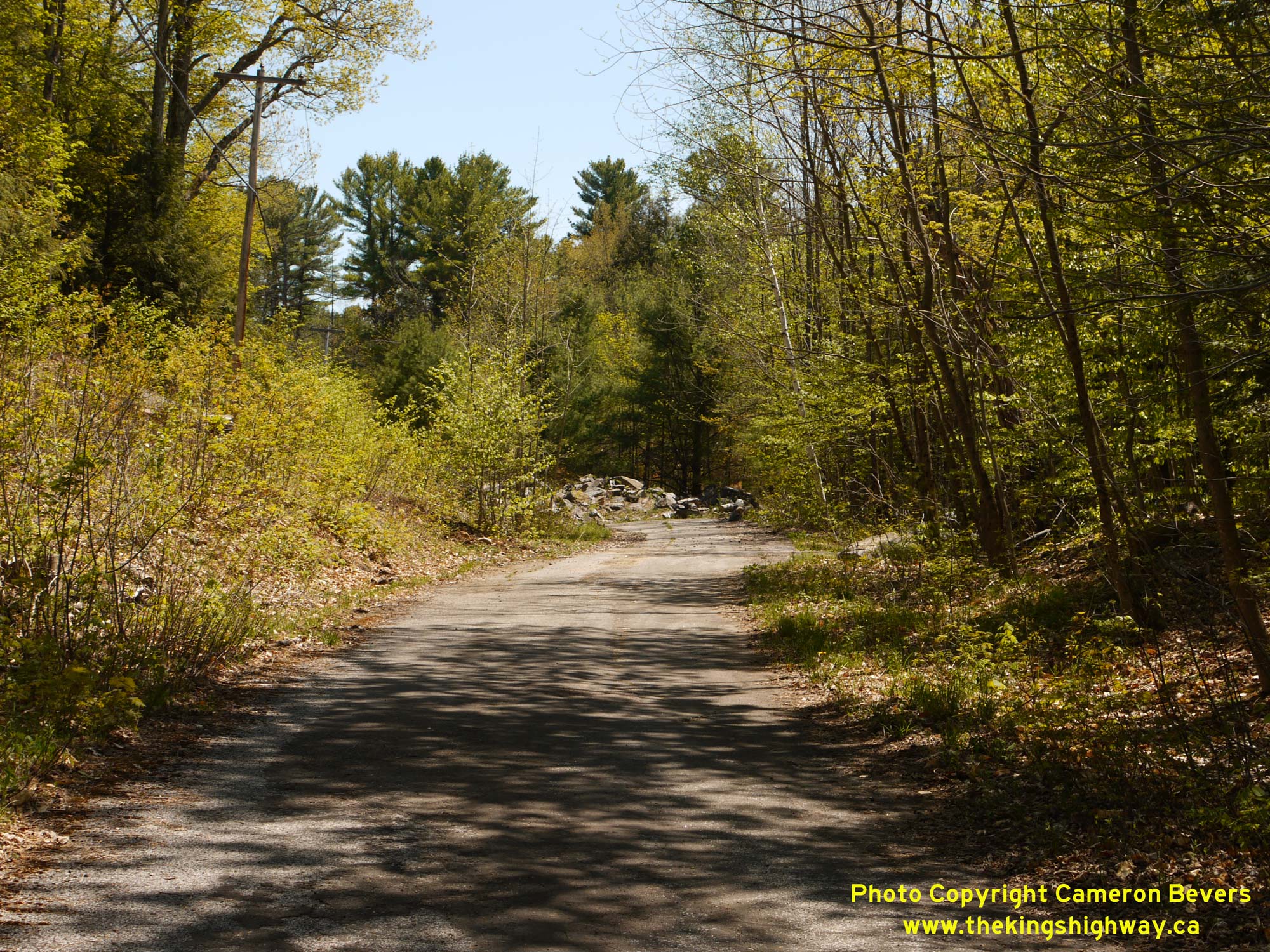
Left - Pine Grove Road (Old Hwy 118) is closed off to traffic at its eastern end. However, the former route of Hwy 118 is still quite apparent today, with its
original asphalt pavement still intact. Through traffic last used this section of Hwy 118 in the early 1970s. See an
Enlarged Photo Here. (Photograph taken on May 23, 2020 - © Cameron Bevers) Right - A sharp reverse curve exists along a closed section of Hwy 118 at the end of Pine Glen Drive west of Port Carling. The pavement on this former alignment of Hwy 118 has fared rather well, considering its age. The Port Carling-Glen Orchard Road was paved by the DHO in 1954, in preparation for the road's assumption as Hwy 118 during 1955. In the background, a pile of rubble was placed across the old highway's alignment, presumably to prevent people from using the road to reach Hwy 118. Pine Glen Drive does still connect to the relocated route of Hwy 118 at its western end. See an Enlarged Photo Here. (Photograph taken on May 23, 2020 - © Cameron Bevers) 

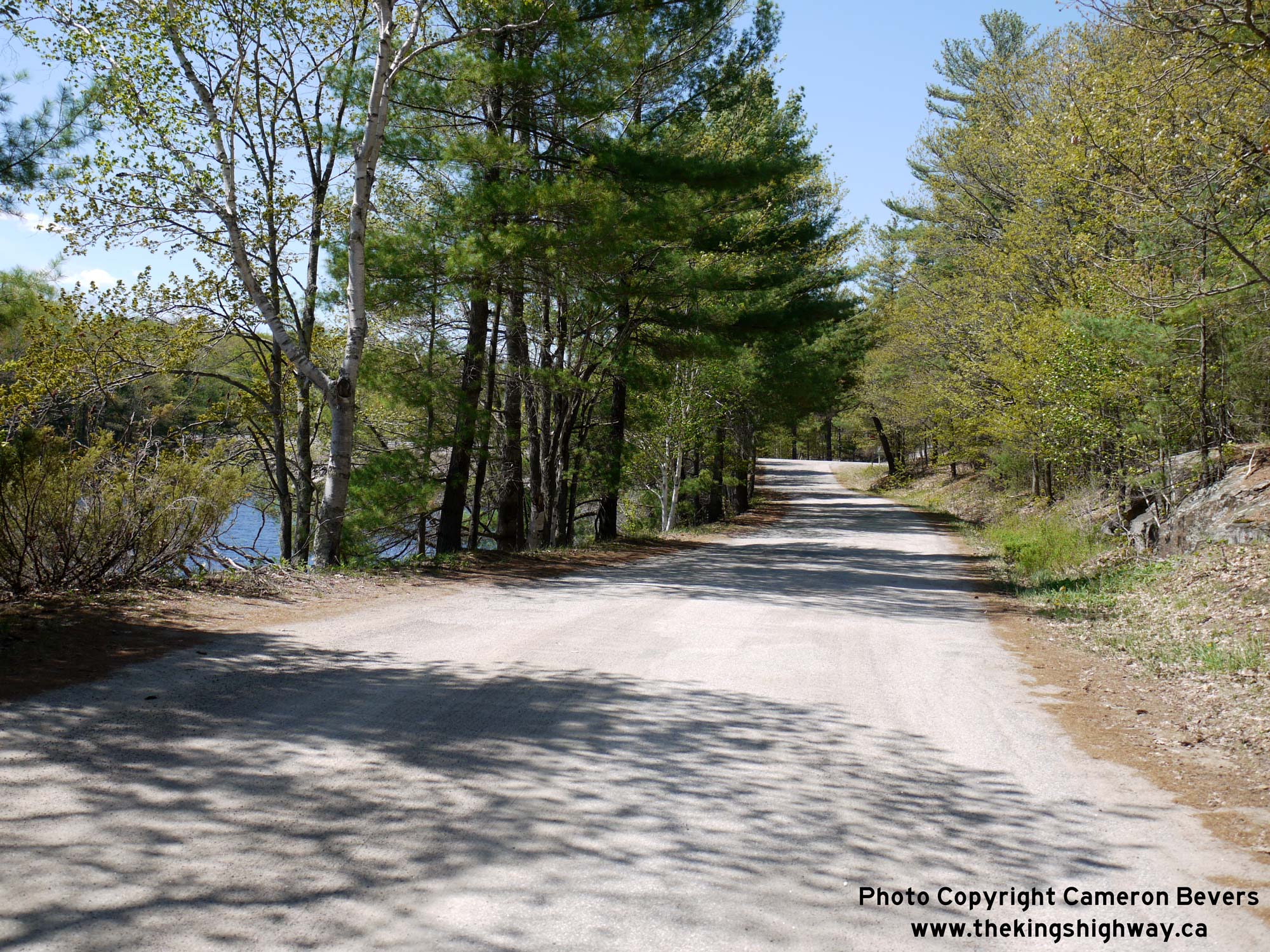
Left - Facing east along Hwy 118 at Henshaw Lake, approaching Port Carling. See an
Enlarged Photo Here. (Photograph taken on September 9, 2007 - © Cameron Bevers) Right - View of Henshaw Lake from Hwy 118 west of Port Carling. The highway passes about a dozen scenic lakes along its beautiful route through Muskoka. See an Enlarged Photo Here. (Photograph taken on September 9, 2007 - © Cameron Bevers) 
Left - This bypassed loop of Hwy 118 (Henshaw Lake Road) was left behind after a new highway diversion was completed through this area in 1967. The fact that
this narrow winding road was actually a King's Highway right up until the late 1960s is quite shocking. While heavy trucks are prohibited on this bypassed loop of
Hwy 118 today, there would have been a time when transport trucks would have had no choice but to use this road if they were driving between Port Carling and the
Hwy 69 Junction at Glen Orchard. Jurisdiction over the old loop of Hwy 118 at Henshaw Lake was transferred from the province to the Township of Medora & Wood in
August 1970. See an Enlarged Photo Here. (Photograph taken on May 23, 2020 - © Cameron Bevers) Right - Facing west along Henshaw Lake Road (Old Hwy 118) approaching the relocated route of Hwy 118 west of Port Carling. Prior to the highway's relocation in the late 1960s under Contract #1966-220, Hwy 118 actually continued straight ahead across to the northern side of Hwy 118 and then rounded a sharp curve. When the new relocated route of Hwy 118 was completed in 1967, it bisected both of these old loops of the highway in the vicinity of Henshaw Lake. The highway realignment also included an improved intersection at the adjacent Hwy 632 Junction. The section of the highway seen in this photo is roughly the same location as the one seen in the Circa 1965 Postcard view shown above. See an Enlarged Photo Here. (Photograph taken on May 23, 2020 - © Cameron Bevers) 

Left - Facing south along Peninsula Road (Former Hwy 632) towards the Hwy 118 Junction in Port Carling. This highway junction marks the original southern
terminus of Hwy 632 as it existed prior to the 1970s. Since 1972, provincial jurisdiction over Hwy 632 has ended at the Muskoka-Parry Sound District Boundary between
Port Sandfield and Rosseau. See an Enlarged Photo Here. (Photograph taken on June 24, 2017 - © Cameron Bevers) Right - Facing north along Former Hwy 632 (Peninsula Road) towards Port Sandfield from the Hwy 118 Junction in Port Carling. The former route of Hwy 632 within the District Municipality of Muskoka is now known as Muskoka District Road 7. The route of Hwy 632 is signed with a green-and-white trailblazer route marker via Peninsula Road. See an Enlarged Photo Here. (Photograph taken on June 24, 2017 - © Cameron Bevers) 

Left - Old green-and-white Hwy 169 trailblazer crown marker on Hwy 118 near Port Carling. See an
Enlarged Photo Here. (Photograph taken on September 9, 2007 - © Cameron Bevers) Right - Sorry, what direction am I going? Muskoka's insistence on referring to Former Hwy 118 as "Muskoka 118 West" is undoubtedly confusing for eastbound motorists. See an Enlarged Photo Here. (Photograph taken on September 9, 2007 - © Cameron Bevers) 

Left - Former alignment of Hwy 118 (Clearwater Shores Boulevard) near Henshaw Lake west of Port Carling. This section of Hwy 118 was bypassed in the 1960s by a
relocated route of Hwy 118 on a vastly-improved alignment. This former loop of Hwy 118 follows the northern shore of Henshaw Lake, before resuming its route into Port
Carling. See an Enlarged Photo Here. (Photograph taken on September 9, 2007 - © Cameron Bevers) Right - Former alignment of Hwy 118 (Lee Valley Drive) west of Port Carling. This short section of Hwy 118 between Henshaw Lake and Port Carling was relocated in 1980. See an Enlarged Photo Here. (Photograph taken on September 9, 2007 - © Cameron Bevers) 

Left - Northern side of the Joseph Street Bridge on Hwy 118 in Port Carling. This three-span structure was constructed under Contract #1973-125 and was
completed in 1974. The bridge consists of fixed spans over the Indian River and a walkway area and an opening span over the Port Carling Marine Lock. See an
Enlarged Photo Here. (Photograph taken on September 9, 2007 - © Cameron Bevers) Right - The Joseph Street Bridge on Hwy 118 spans the Port Carling Marine Lock. This lock allows marine traffic to pass between Lake Rosseau and Mirror Lake. See an Enlarged Photo Here. (Photograph taken on September 9, 2007 - © Cameron Bevers) 

Left - The Joseph Street Bridge on Hwy 118 opens to allow marine traffic to pass through the lock below. This busy lock forms part of a recreational waterway
system which connects Lake Muskoka with Lakes Joseph and Rosseau. See an Enlarged Photo Here. (Photograph taken on September 9, 2007 - © Cameron Bevers) Right - Approaching the Joseph Street Bridge on Hwy 118 in Port Carling, facing west. See an Enlarged Photo Here. (Photograph taken on September 9, 2007 - © Cameron Bevers) 

Left - Structure identification number and date stamp (1974) on the Joseph Street Bridge on Hwy 118. See an
Enlarged Photo Here. (Photograph taken on September 9, 2007 - © Cameron Bevers) Right - Facing west across the Joseph Street Bridge on Hwy 118 in Port Carling. This two-lane lift bridge replaced an old one-lane swing bridge that was built in 1921. See an Enlarged Photo Here. (Photograph taken on September 9, 2007 - © Cameron Bevers) 

Left - Facing east across the Joseph Street Bridge on Hwy 118 in Port Carling. See an
Enlarged Photo Here. (Photograph taken on September 9, 2007 - © Cameron Bevers) Right - Close-up of the Port Carling Marine Lock below the Joseph Street Bridge on Hwy 118. See an Enlarged Photo Here. (Photograph taken on September 9, 2007 - © Cameron Bevers) 

Left - Southern side of the Joseph Street Bridge on Hwy 118 in Port Carling. See an
Enlarged Photo Here. (Photograph taken on September 9, 2007 - © Cameron Bevers) Right - Sharp reverse curve on Hwy 118 on the eastern side of Port Carling. See an Enlarged Photo Here. (Photograph taken on September 9, 2007 - © Cameron Bevers) 

Left - Facing east along Hwy 118 towards Bracebridge, just east of Port Carling. See an
Enlarged Photo Here. (Photograph taken on September 9, 2007 - © Cameron Bevers) Right - Former alignment of Hwy 118 (Pennwood Road) about 1 km east of Port Carling. This old highway curve was bypassed as a result of a relocation of Hwy 118 onto an improved alignment between Port Carling and Milford Bay in 1966. See an Enlarged Photo Here. (Photograph taken on September 9, 2007 - © Cameron Bevers) 
Above - Commemorative sign on Hwy 118, indicating that this section of the highway is part of the Frank Miller Memorial Route. This was not a provincial
designation. It was applied to sections of Hwy 118 and Hwy 169 several years after jurisdiction over these highways was transferred from the province to the District
Municipality of Muskoka. The commemorative designation is a tribute to Frank Miller, who served as M.P.P. for Muskoka from 1971 until 1987 and who also briefly served
as Premier of Ontario in 1985. See an Enlarged Photo Here. (Photograph taken on September 9, 2007 - © Cameron Bevers) 

Left - Facing east along the Milford Bay Bypass (Hwy 118) from Milford Bay Road approaching the Huckleberry Rock Cut. This massive rock cut was completed as
part of a highway relocation project in the early 1960s, under Contract #1962-200. To this day, it remains one of the longest rock cuts ever constructed on the
provincial highway system. See an Enlarged Photo Here. (Photograph taken on September 9, 2007 - © Cameron Bevers) Right - Entering the Huckleberry Rock Cut on Hwy 118 at Milford Bay, facing east towards Bracebridge. See an Enlarged Photo Here. (Photograph taken on September 9, 2007 - © Cameron Bevers) 

Left - View of Hwy 118 from the top of the Huckleberry Rock Cut, facing west towards Port Carling. See an
Enlarged Photo Here. (Photograph taken on September 9, 2007 - © Cameron Bevers) Right - The Huckleberry Rock Cut is situated on a long horizontal curve on Hwy 118. This section of Hwy 118 is actually a diversion that bypassed the narrow and winding original 1955 route of Hwy 118 which passed through the community of Milford Bay. The new 3 km highway diversion around Milford Bay is slightly shorter than the original highway. See an Enlarged Photo Here. (Photograph taken on September 9, 2007 - © Cameron Bevers) 

Left - The Huckleberry Rock Cut on Hwy 118 is nearly half a kilometre in length. See an
Enlarged Photo Here. (Photograph taken on September 9, 2007 - © Cameron Bevers) Right - Eastern entrance to the Huckleberry Rock Cut on Hwy 118. See an Enlarged Photo Here. (Photograph taken on September 9, 2007 - © Cameron Bevers) 

Left - Facing east along Hwy 118 towards Bracebridge in the Huckleberry Rock Cut. See an
Enlarged Photo Here. (Photograph taken on September 9, 2007 - © Cameron Bevers) Right - View of Lake Muskoka along Hwy 118 near Willow Beach west of Bracebridge. See an Enlarged Photo Here. (Photograph taken on September 11, 2007 - © Cameron Bevers) 

Left - View of the Muskoka River in Bracebridge, facing east towards the Wellington Street Bridge on Hwy 118. See an
Enlarged Photo Here. (Photograph taken on June 6, 2009 - © Cameron Bevers) Right - Facing north along Wellington Street (Hwy 118) at the Muskoka River Bridge in Bracebridge. See an Enlarged Photo Here. (Photograph taken on June 6, 2009 - © Cameron Bevers) 

Left - Commemorative plaque marking the completion of the Wellington Street Bridge on Hwy 118 in Bracebridge in 1983. See an
Enlarged Photo Here. (Photograph taken on June 6, 2009 - © Cameron Bevers) Right - The ornamental stone pillars at the entrance and mid-span of the Wellington Street Bridge add to the bridge's aesthetic appeal. See an Enlarged Photo Here. (Photograph taken on June 6, 2009 - © Cameron Bevers) 

Left - Eastern side of the Wellington Street Bridge on Hwy 118 in Bracebridge. See an
Enlarged Photo Here. (Photograph taken on June 6, 2009 - © Cameron Bevers) Right - Western side of the Wellington Street Bridge over the Muskoka River on Hwy 118. See an Enlarged Photo Here. (Photograph taken on June 6, 2009 - © Cameron Bevers) 

Left - Aluminum tube handrails on the Wellington Street Bridge over the Muskoka River on Hwy 118. See an
Enlarged Photo Here. (Photograph taken on June 6, 2009 - © Cameron Bevers) Right - Structure identification number and date stamp (1983) on the Muskoka River Bridge on Wellington Street (Hwy 118) in Bracebridge. See an Enlarged Photo Here. (Photograph taken on June 6, 2009 - © Cameron Bevers) 

Left - Approaching the Muskoka River Bridge on Hwy 118 in Bracebridge. Until 1983, all traffic bound for Hwy 118 from Hwy 11 had to pass through Downtown
Bracebridge, via Ecclestone Drive (at right). The completion of the Wellington Street Bridge across the Muskoka River in 1983 provided a western bypass around
Downtown Bracebridge. See an Enlarged Photo Here. (Photograph taken on June 6, 2009 - © Cameron Bevers) Right - Facing east along Hwy 118 from the Muskoka River Bridge in Bracebridge. See an Enlarged Photo Here. (Photograph taken on June 6, 2009 - © Cameron Bevers) 

Left - Bracebridge Canadian National Railway (CNR) Subway on Ecclestone Drive (Old Hwy 11, later known as Hwy 118), facing south towards Gravenhurst. This
former section of Hwy 11 was bypassed by a new Hwy 11 route which was established east of Bracebridge in the early 1950s. Ecclestone Drive (Old Hwy 11) was
subsequently renumbered as part of Hwy 532, and more recently, as part of Hwy 118. See an
Enlarged Photo Here. (Photograph taken on September 12, 2007 - © Cameron Bevers) Right - Facing north along Ecclestone Drive (Hwy 118) at the Bracebridge CNR Subway. This single-span concrete slab structure was completed in 1930. See an Enlarged Photo Here. (Photograph taken on September 12, 2007 - © Cameron Bevers) 

Left - Considering when it was built, the Bracebridge CNR Subway on Ecclestone Drive (Hwy 118) has an extraordinarily high vertical clearance of 17 feet
(approximately 5.2 metres). Many railway subways built in the first half of the 20th Century had much lower vertical clearances, as vehicles on the roads at that time
had smaller dimensions and required less room to navigate through these structures. Railway subways with poor vertical clearances often created physical barriers for
transport trucks using the provincial highway system. As trucks became progressively larger, the low vertical clearances designed into some railway subways resulted
in the premature replacement of these structures. See an Enlarged Photo Here. (Photograph taken on September 12, 2007 - © Cameron Bevers) Right - Close-up of the date stamp (1930) on the Bracebridge CNR Subway on Ecclestone Drive (Hwy 118). Careful observers will notice faded paint on this historic structure, which reads "CANADIAN NATIONAL RAILWAYS" and CNR's corporate pledge of "COURTESY - SAFETY - SERVICE". See an Enlarged Photo Here. (Photograph taken on September 12, 2007 - © Cameron Bevers) 

Left - Facing south along Manitoba Street (Old Hwy 118) in Downtown Bracebridge. From 1955 until the mid-1970s, Hwy 118 followed Manitoba Street through
Downtown Bracebridge. Historically, the route of Hwy 118 turned left onto Taylor Road at the traffic signals at the bottom of the hill. See an
Enlarged Photo Here. (Photograph taken on July 11, 2015 - © Cameron Bevers) Right - Facing south along Manitoba Street (Old Hwy 118) in Downtown Bracebridge. Despite being bypassed by a new highway in the 1950s, the Bracebridge Town Centre has remained quite vibrant and active. Even in this late evening photograph, many of the parking spaces along the main street are still occupied. Unfortunately, Bracebridge was the exception rather than the rule. Many small and mid-sized towns in Ontario were not as successful, and experienced some degree of decline in their downtown areas after being bypassed by new highways. See an Enlarged Photo Here. (Photograph taken on July 11, 2015 - © Cameron Bevers) 
Above - Facing north along Manitoba Street (Old Hwy 118) departing Downtown Bracebridge. Historically, the route of Hwy 118 turned left onto Monck Road about
500 metres ahead, and continued west towards Port Carling. See an Enlarged Photo Here. (Photograph taken on July 11, 2015 - © Cameron Bevers)
Continue on to King's Highway 118 Photos: Bracebridge to Carnarvon
|
|---|
Links to Adjacent King's Highway Photograph Pages:
Back to King's Highway 117 (#2) Photos /
King's Highway 118 History /
On to King's Highway 119 Photos
Ontario Highway History - Main Menu / Back to List of Highways Website contents, photos & text © 2002-2026, Cameron
Bevers (Webmaster) - All Rights Reserved / Contact Me
|
|---|