
| 
| |
|
|
This page contains present day photos (Year 2000 to date) of Ontario's King's Highway 11, arranged by location from the King's
Highway 17 Junction near Nipigon westerly to the Secondary Highway 628 Junction at Red Rock Corners. All photographs displayed on this page were taken by the
Webmaster (Cameron Bevers), unless specifically noted otherwise. Click on any thumbnail to see a larger image!
Please note that all photographs displayed on this
website are protected by copyright. These photographs must not be reproduced, published,
electronically stored or copied, distributed, or posted onto other websites without
my written permission. If you want to use photos from this website, please
email me first for permission. Thank-you!
|
|---|
|
Page 31: Present Day King's Highway 11 Photographs (Nipigon to Red Rock Corners)


Left - Approaching the Hwy 11 Junction on Hwy 17 near Nipigon, facing west. See an
Enlarged Photo Here. (Photograph taken on August 30, 2011 - © Cameron Bevers) Right - This green guide sign on westbound Hwy 17 near Nipigon indicates that Hwy 11 and Hwy 17 are about to begin a concurrent, overlapped route just ahead. These two highways follow the same route for about 180 km between Nipigon and Shabaqua Corners. See an Enlarged Photo Here. (Photograph taken on August 30, 2011 - © Cameron Bevers) 

Left - Facing west along Hwy 17 near the Hwy 11 Junction. Motorists approaching the Hwy 11 Junction on westbound Hwy 17 at Nipigon can either continue
straight ahead towards Thunder Bay via Hwy 11 & Hwy 17 West or take Hwy 11 East back towards Cochrane. See an
Enlarged Photo Here. (Photograph taken on August 30, 2011 - © Cameron Bevers) Right - Green guide sign approaching the Hwy 11 Junction on westbound Hwy 17. From Nipigon, Hwy 11 East briefly heads north towards the Municipality of Greenstone (comprised of the former towns of Beardmore, Geraldton and Longlac), before resuming its route east towards Kapuskasing and Cochrane. See an Enlarged Photo Here. (Photograph taken on August 30, 2011 - © Cameron Bevers) 

Left - Junction sign assembly on westbound Hwy 17 approaching the Hwy 11 Junction. See an
Enlarged Photo Here. (Photograph taken on August 30, 2011 - © Cameron Bevers) Right - Approaching the Hwy 11 Junction on Hwy 17 near Nipigon, facing west. Historically, the Hwy 11 & Hwy 17 Junction was an extremely large directional "Y" intersection. As originally constructed in the late 1930s, there were two access points from Hwy 17 to the Nipigon-Geraldton Highway (now Hwy 11), separated by a gap of about 600 metres between the two legs of the "Y". This photo shows the historical tie-in point along Hwy 17 of the eastern leg of the "Y", which was ultimately abandoned and subsequently consumed by the advancing forests. Motorists on Hwy 17 approaching this highway junction from the east would have to keep to the right at this fork in order to access eastbound Hwy 11 to Beardmore and Geraldton. The western leg of the "Y" joined into Hwy 17 just before the Nipigon River Bridge. See an Enlarged Photo Here. (Photograph taken on August 30, 2011 - © Cameron Bevers) 

Left - Green guide signs marking the Hwy 11 & Hwy 17 Junction near Nipigon. This important highway junction was the product of an ambitious highway
construction program east of Port Arthur and Fort William (now Thunder Bay) in the 1930s, which saw the Trans-Canada Highway (Hwy 17) gradually extended from the
Lakehead Cities easterly to Nipigon and Schreiber, along with the construction of a new highway link (Hwy 11) from Nipigon to Geraldton. See an
Enlarged Photo Here. (Photograph taken on August 30, 2011 - © Cameron Bevers) Right - Junction sign assembly approaching the Hwy 11 & Hwy 17 Junction near Nipigon. One of Northwestern Ontario's most important route decision points, this junction also forms an interesting feature in the Ontario Highway System, and indeed Canada's overall road network as well. All traffic crossing through Ontario on the Trans-Canada Highway must pass through this intersection. It is actually the only road linking Eastern Canada to Western Canada. See an Enlarged Photo Here. (Photograph taken on August 30, 2011 - © Cameron Bevers) 

Left - Facing east along Hwy 17 towards Rossport from the Hwy 11 Junction near Nipigon. Note the white chevron pavement hatch markings approaching the raised
traffic islands at the junction. These types of pavement markings are not commonly used in Ontario anymore. See an
Enlarged Photo Here. (Photograph taken on August 30, 2011 - © Cameron Bevers) Right - Junction of Hwy 11 & Hwy 17, facing west towards Nipigon. When the old 1930s-era directional "Y" intersection was removed here, it was replaced by a much smaller conventional "T" intersection with right turn channelizations. See an Enlarged Photo Here. (Photograph taken on August 30, 2011 - © Cameron Bevers) 

Left - Approaching the Hwy 17 Junction on Hwy 11 near Nipigon. Up until 1960, Hwy 11 reached its western terminus at this highway junction. During 1960, a
major route renumbering took effect in Northwestern Ontario which saw Hwy 11 extended westerly from this highway junction near Nipigon to the Ontario-Minnesota
Boundary at Rainy River. The Hwy 11 designation was routed concurrently alongside an existing section of Hwy 17 through the Thunder Bay area, thus creating the
overlapped route of Hwy 11 & Hwy 17 that we see today. See an Enlarged Photo Here. (Photograph taken on August 30, 2011 - © Cameron Bevers) Right - The Hwy 11 & Hwy 17 Junction near Nipigon in a Stop-controlled intersection. A flashing beacon was installed over the Stop sign to increase its conspicuity to westbound Hwy 11 motorists approaching the highway junction. This is the first traffic control device requiring vehicles to stop and yield the right-of-way to cross traffic in almost 400 km. Although there is absolutely no issue with the visibility on the approach to this intersection, the sudden appearance of a Stop sign after such a long distance of rural driving may catch some inattentive motorists by surprise. See an Enlarged Photo Here. (Photograph taken on August 30, 2011 - © Cameron Bevers) 

Left - Fingerboard guide signs and oversized route markers at the Hwy 11 & Hwy 17 Junction near Nipigon. Although the decision was made by the Department
of Highways of Ontario (DHO) to extend Hwy 11 westerly from Nipigon in 1960, this highway junction made for a very logical western terminus for Hwy 11 in my personal
opinion. The 1960 highway renumbering scheme was by far the largest in Ontario's history, affecting nearly 575 km of Northwestern Ontario's King's Highways. The
Hwy 120 designation from Shabaqua Corners to Atikokan was retired, as was the Hwy 70 designation from Emo to Longbow Corners near Kenora. The Hwy 71 designation was
retained between Fort Frances and Emo, but was rerouted northerly up the former route of Hwy 70 towards Kenora instead of terminating in Rainy River as it had since
1937. This allowed the Hwy 11 designation to be carried westerly via the now-overlapped route of Hwy 11 & Hwy 17 from Nipigon to Shabaqua Corners, westerly along
the former route of Hwy 120 to Atikokan, across the then-incomplete highway link between Atikokan and Fort Frances and then westerly to Rainy River with a portion of
the route overlapped with Hwy 71. It just seemed like an extraordinarily large undertaking for no readily-apparent benefit to way-finding for the motorist. See an
Enlarged Photo Here. (Photograph taken on August 30, 2011 - © Cameron Bevers) Right - Facing east along Hwy 11 from the Hwy 17 Junction, showing the two current right-turn channelization ramps. The historical directional "Y" junction built in the 1930s was significantly larger than the current junction, and consisted of a trio of two-way roads connecting Hwy 11 and Hwy 17 together. See an Enlarged Photo Here. (Photograph taken on August 30, 2011 - © Cameron Bevers) 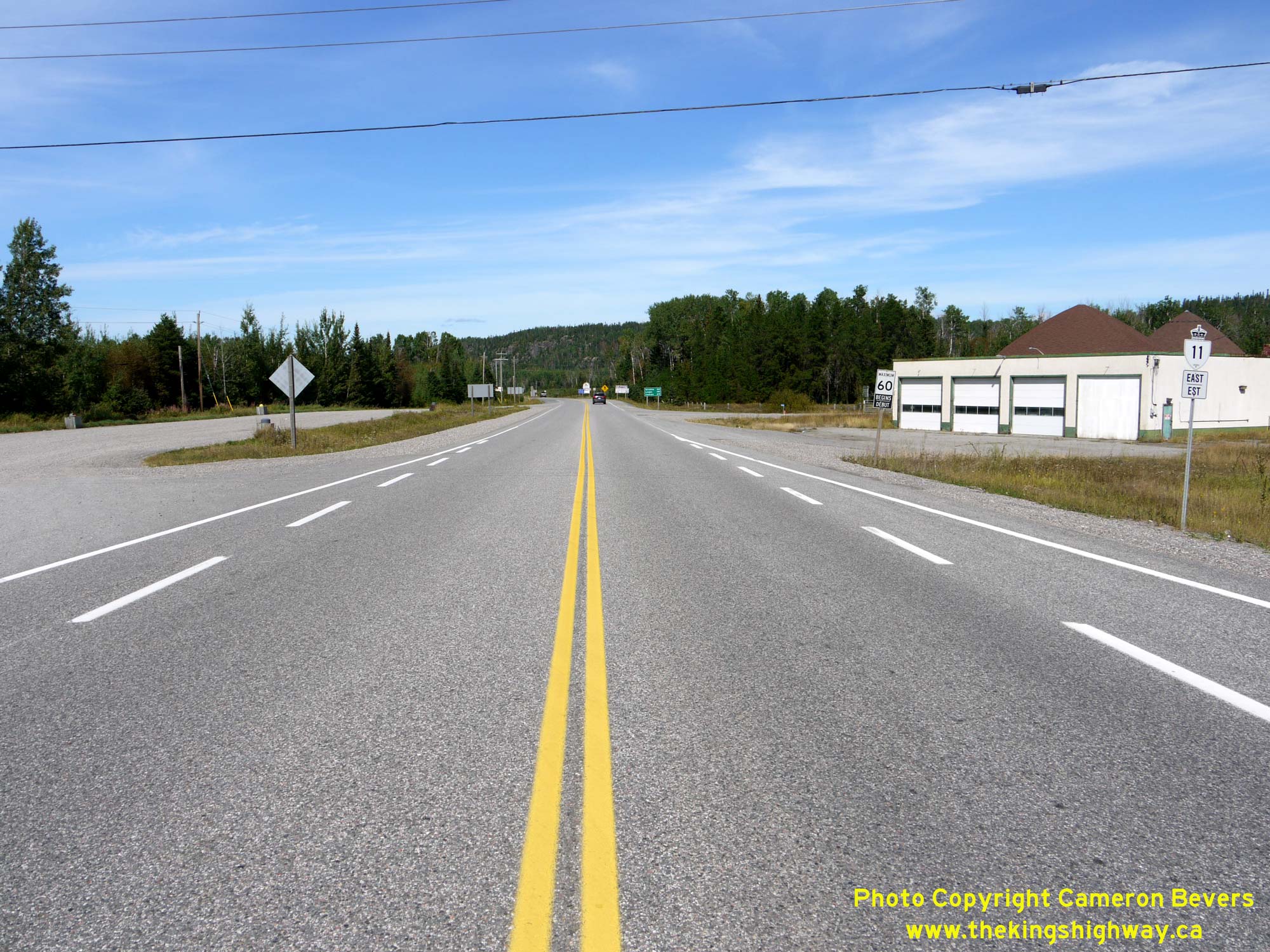

Left - The old roadways forming the directional "Y" junction converged together near this point on Hwy 11 about 300 metres north of the Hwy 17 Junction. The
Nipigon-Geraldton Highway was officially opened to traffic in September 1940, although the highway had actually been traversable for almost a year prior. The new
highway opened up the beautiful Lake Nipigon Region to motor tourism, in addition to creating the first leg of the Trans-Canada Highway's Northern Route across
Ontario. The last link in the highway between Hearst and Geraldton was completed and opened to traffic in 1943, despite the fact that World War II was still raging on
in Europe and the Pacific. The new highway link from Geraldton to Hearst was deemed to be a priority wartime highway project as it was a strategic route of national
importance. See an Enlarged Photo Here. (Photograph taken on August 30, 2011 - © Cameron Bevers) Right - Green guide sign for Hwy 17 East on westbound Hwy 11 near Nipigon. See an Enlarged Photo Here. (Photograph taken on August 30, 2011 - © Cameron Bevers) 

Left - Approaching the Hwy 17 Junction on Hwy 11 near Nipigon. This point marks the northern end of the historical directional "Y" junction, where motorists
would choose between the left fork for Hwy 17 East to Schreiber or the right fork for Hwy 17 West to Port Arthur and Fort William. The current Hwy 11 & Hwy 17
Junction can be seen in the distance. See an Enlarged Photo Here. (Photograph taken on August 30, 2011 - © Cameron Bevers) Right - Green guide sign marking the concurrent overlapped route of Hwy 11 & Hwy 17 to Thunder Bay. See an Enlarged Photo Here. (Photograph taken on August 30, 2011 - © Cameron Bevers) 
Above - Junction sign assembly on westbound Hwy 11 approaching the Hwy 17 Junction near Nipigon. Until recent years, Hwy 17 was signed with "North" and
"South" cardinal directions beyond Nipigon, in reflection of the fact that the highway does ultimately go south to Sault Ste. Marie. The section of Hwy 17 from
Nipigon to White River began to be signed with "East" and "West" cardinal directions a number of years ago. Although this change was more in keeping with the
actual compass directions of Hwy 17 along Lake Superior's North Shore, the highway intersected with so few roads between these two points that cardinal directions were
more or less irrelevant. See an Enlarged Photo Here. (Photograph taken on August 30, 2011 - © Cameron Bevers) 

Left - Facing east along Hwy 17 approaching the Hwy 11 Junction. At this intersection, Hwy 11
& Hwy 17 part ways after sharing a concurrent route for about 180 km through the Thunder Bay area. Up until 1960, all eastbound through traffic had to turn left
onto Hwy 11 in order to reach the rest of Ontario. For many years, Hwy 17 came to a dead-end along Lake Superior's North Shore. When the DHO assumed jurisdiction over
Hwy 17 in 1937, the highway ended just beyond Schreiber. A significant gap in Hwy 17 existed between Schreiber and Mamainse Harbour, located near Sault Ste. Marie.
This gap in Hwy 17 was progressively closed over a period of 23 years, with the final link completed and opened to traffic at Wawa in September 1960. See an
Enlarged Photo Here. (Photograph taken on August 30, 2011 - © Cameron Bevers) Right - Facing west along Hwy 11 & Hwy 17 approaching the Nipigon River Bridge. At right, the channelized right turn ramp from westbound Hwy 11 merges in. At the time this photo was taken in 2011, this lane dropped just before the Nipigon River Bridge. Due to the recent replacement of the Nipigon River Bridge, this lane now continues westerly across the bridge towards Thunder Bay. See an Enlarged Photo Here. (Photograph taken on August 30, 2011 - © Cameron Bevers) 

Left - Distance guide sign on westbound Hwy 11 & Hwy 17 at the Nipigon Highway Junction. See an
Enlarged Photo Here. (Photograph taken on August 30, 2011 - © Cameron Bevers) Right - Western approach to the Hwy 11 & Hwy 17 Junction near Nipigon. See an Enlarged Photo Here. (Photograph taken on August 30, 2011 - © Cameron Bevers) 

Left - Green guide signs facing eastbound traffic approaching the Hwy 11 & Hwy 17 Junction near Nipigon. See an
Enlarged Photo Here. (Photograph taken on August 30, 2011 - © Cameron Bevers) Right - Facing east along Hwy 11 & Hwy 17 from the Nipigon River Bridge. See an Enlarged Photo Here. (Photograph taken on August 30, 2011 - © Cameron Bevers) 

Left - Facing west along Hwy 11 & Hwy 17 approaching Nipigon and the Nipigon River Bridge. Note the green guide sign at right for Railway Street, which
marks the former route of Hwy 17 through the town centre prior to the construction of the Nipigon Bypass in the late 1950s. See an
Enlarged Photo Here. (Photograph taken on August 30, 2011 - © Cameron Bevers) Right - Although it has since been replaced, this interesting extruded aluminum diagrammatic highway guide sign used to stand on the western approach to the Hwy 11 & Hwy 17 Junction near Nipigon. The Nipigon Highway Junction is one of the key route decision points in Northwestern Ontario's highway network. See an Enlarged Photo Here. (Photograph taken on September 3, 2004 - © Cameron Bevers) 

Left - Facing west across the Nipigon River Bridge on Hwy 11 & Hwy 17 in 2011, showing the new sidewalk extension installed in 2005. See an
Enlarged Photo Here. (Photograph taken on August 30, 2011 - © Cameron Bevers) Right - View of the Nipigon River Bridge on Hwy 11 & Hwy 17 in 2004, before rehabilitation showing the original curb-faced sidewalk and concrete barrier walls. See an Enlarged Photo Here. (Photograph taken on September 3, 2004 - © Cameron Bevers) 

Left - Northern side of the Nipigon River Bridge on Hwy 11 & Hwy 17 in 2004. This four-span steel girder structure was completed in 1974. See an
Enlarged Photo Here. (Photograph taken on September 3, 2004 - © Cameron Bevers) Right - When the Nipigon River Bridge on Hwy 11 & Hwy 17 was replaced during the 1970s, only the steel deck truss portions of the original highway bridge were dismantled. The concrete piers for the old bridge were left in place. These concrete piers were constructed in 1936 as part of the Lake Superior North Shore Highway project, which ultimately became an extension of Hwy 17. The original Nipigon River Bridge on Hwy 17 was completed and officially opened to traffic to much fanfare on September 24, 1937, after almost two years of construction. See an Enlarged Photo Here. (Photograph taken on September 3, 2004 - © Cameron Bevers) 
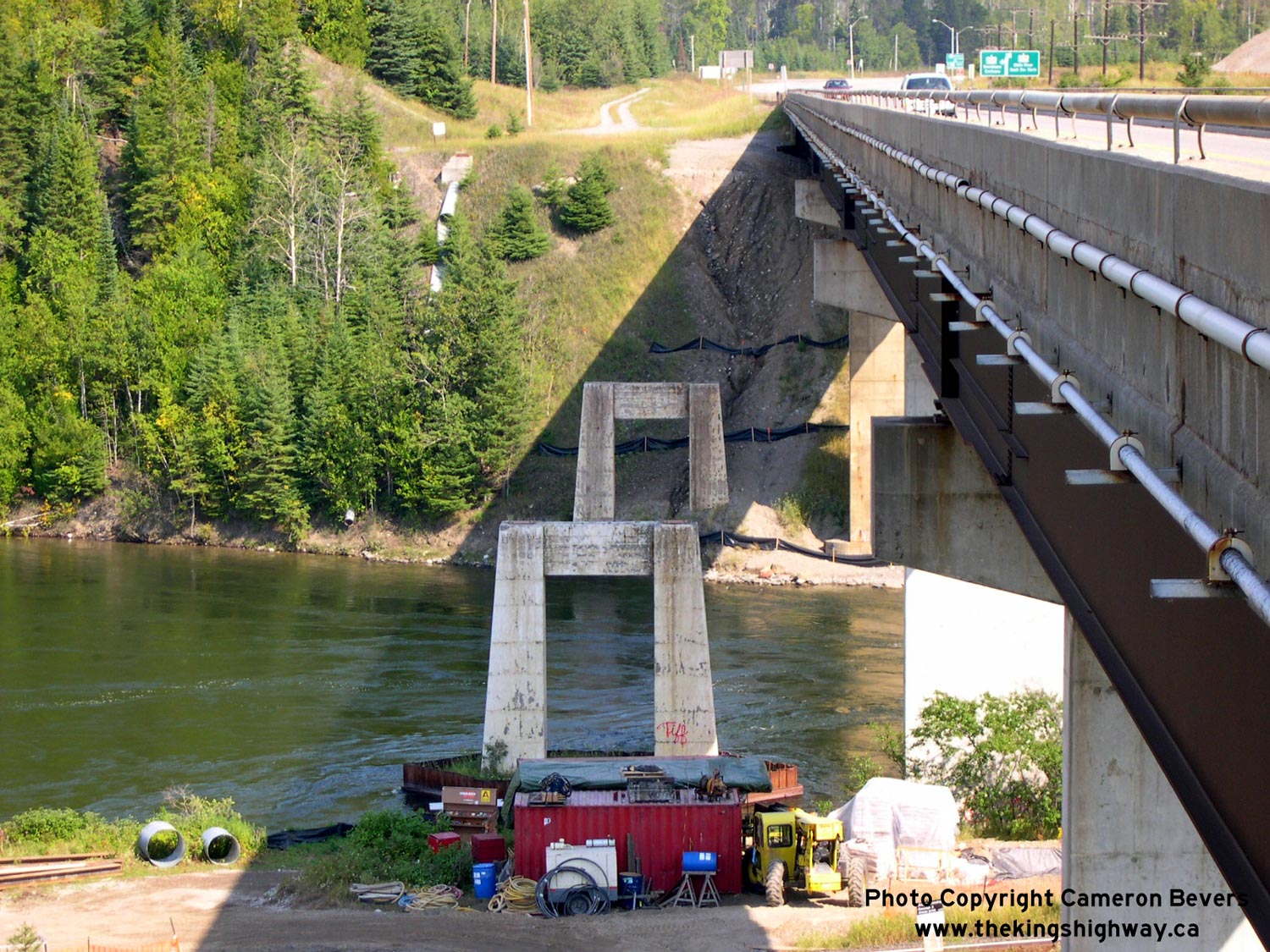
Left - The east abutment of the original 1937 Nipigon River Bridge is almost completely hidden by the fill for the newer replacement bridge. See an
Enlarged Photo Here. (Photograph taken on September 3, 2004 - © Cameron Bevers) Right - Looking east across the Nipigon River, showing the replacement (1974) Nipigon River Bridge at right and the ruins of the old 1930s highway bridge piers at left, just upstream of the replacement bridge. The original highway bridge consisted of several steel deck truss spans supported on concrete piers, footings and abutments. It may appear that the Trans-Canada Highway originally crossed the Nipigon River at a much lower elevation than it does today, but in reality, both the 1937 highway bridge and replacement 1974 highway bridge had comparable deck surface elevations. Due to its length, the main deck truss span across the Nipigon River had a significant depth, as can be seen in this Historical 1937 Photo. See an Enlarged Photo Here. (Photograph taken on September 3, 2004 - © Cameron Bevers) 
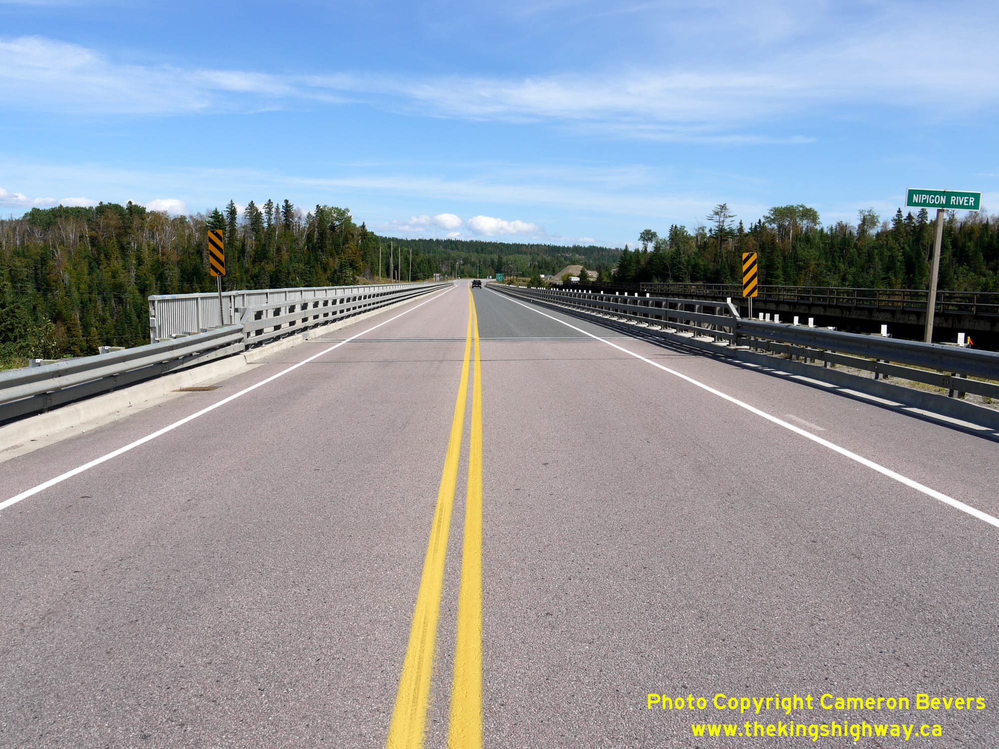
Left - Facing east along Hwy 11 & Hwy 17 across the Nipigon River Bridge in 2004, before rehabilitation. See an
Enlarged Photo Here. (Photograph taken on September 3, 2004 - © Cameron Bevers) Right - View of the Nipigon River Bridge on Hwy 11 & Hwy 17 in 2011, following rehabilitation. See an Enlarged Photo Here. (Photograph taken on August 30, 2011 - © Cameron Bevers) 

Left - View underneath the Nipigon River Bridge on Hwy 11 & Hwy 17. This interesting collection of bridge crossings illustrate the growing importance of
this key transportation corridor, from the construction of the Canadian Pacific Railway (CPR) in the 1880s, the construction of the original Trans-Canada Highway
Bridge at Nipigon River in the 1930s, along with the construction of the replacement highway structure in the 1970s. The highway bridge was replaced yet again in the
2010s with a new four-lane cable-stayed structure. See an Enlarged Photo Here. (Photograph taken on August 30, 2006 - © Cameron Bevers) Right - Scenic view of the Nipigon River from Hwy 11 & Hwy 17, facing north towards Lake Helen. See an Enlarged Photo Here. (Photograph taken on September 3, 2004 - © Cameron Bevers) 

Left - Southern side of the Nipigon River Bridge on Hwy 11 & Hwy 17. Construction began on the replacement Nipigon River Bridge in 1972 and was completed
in 1974. The replacement bridge was recently superseded by a new four-lane cable-stayed highway bridge. The CPR bridge over the Nipigon River can be seen at right.
See an Enlarged Photo Here. (Photograph taken on August 30, 2006 - © Cameron Bevers) Right - Northern side of the Nipigon River Bridge on Hwy 11 & Hwy 17 in 2011, following rehabilitation. See an Enlarged Photo Here. (Photograph taken on August 30, 2011 - © Cameron Bevers) 

Left - Construction of the new Nipigon River Bridge on Hwy 11 & Hwy 17 in 2015. This new bridge was built as part of a larger construction program to
ultimately widen Hwy 11 & Hwy 17 to four lanes between Nipigon and Thunder Bay. It is the first cable-stayed bridge ever built on an Ontario provincial highway.
See an Enlarged Photo Here. (Photograph taken on October 7, 2015 - © Cameron Bevers) Right - Facing west along Hwy 11 & Hwy 17 approaching the new Nipigon River Bridge. The new westbound structure can be seen under construction at right. Upon completion of the new cable-stayed bridge, the old 1974 structure was demolished and replaced with a new twin cable-stayed structure to carry the eastbound lanes of the four-lane highway. See an Enlarged Photo Here. (Photograph taken on October 7, 2015 - © Cameron Bevers) 

Left - Junction sign assembly on eastbound Hwy 11 & Hwy 17 departing from Nipigon. See an
Enlarged Photo Here. (Photograph taken on October 7, 2015 - © Cameron Bevers) Right - View of the new Nipigon River Bridge under construction on Hwy 11 & Hwy 17 in 2015, facing east. See an Enlarged Photo Here. (Photograph taken on October 7, 2015 - © Cameron Bevers) 

Left - Facing west along Hwy 11 & Hwy 17 from the Nipigon River Bridge in 2011, approaching Railway Street (Old Hwy 17) in Nipigon. Up until the late
1950s, Hwy 17 curved sharply to the left into Nipigon's town centre just ahead. The Nipigon Bypass (the current route of Hwy 11 & Hwy 17) curves off to the right
and can be seen climbing the hill in the background. The Nipigon Bypass was completed and opened to traffic in 1958, as part of a multi-year program in the 1950s to
reconstruct and modernize the Trans-Canada Highway between Nipigon and the Lakehead Cities of Port Arthur and Fort William (now Thunder Bay). See an
Enlarged Photo Here. (Photograph taken on August 30, 2011 - © Cameron Bevers) Right - Blue municipality sign for Nipigon on westbound Hwy 11 & Hwy 17. See an Enlarged Photo Here. (Photograph taken on August 30, 2006 - © Cameron Bevers) 

Left - Approaching the eastern end of the Nipigon Bypass (Hwy 11 & Hwy 17) in 2004, facing east towards the Nipigon River Bridge. The current route of
Hwy 11 & Hwy 17 joins back into the original route of the Trans-Canada Highway at Railway Street, which intersects the highway just west of the Nipigon River
Bridge. See an Enlarged Photo Here. (Photograph taken on September 3, 2004 - © Cameron Bevers) Right - Construction of the new cable-stayed Nipigon River Bridge on Hwy 11 & Hwy 17, facing east. The new highway at left was put into service after this photo was taken, to facilitate the removal of the existing (1974) Nipigon River Bridge. All four traffic lanes were put into service in 2018. See an Enlarged Photo Here. (Photograph taken on October 7, 2015 - © Cameron Bevers) 

Left - View of the Nipigon Bypass (Hwy 11 & Hwy 17) in 2011, facing east towards Railway Street (Old Hwy 17). The existing two-lane highway with an uphill
westbound passing lane was widened to an divided four-lane highway with a flush painted median in stages between 2015 and 2018. See an
Enlarged Photo Here. (Photograph taken on August 30, 2011 - © Cameron Bevers) Right - Facing west along Railway Street (Old Hwy 17) at 8th Street, approaching Downtown Nipigon. All traffic on Hwy 17 entered town via this street up until 1958. See an Enlarged Photo Here. (Photograph taken on August 30, 2011 - © Cameron Bevers) 

Left - Departing Nipigon on Railway Street (Old Hwy 17) at 8th Street. The former route of Hwy 17 through Nipigon is a flashback to much-earlier days of motor
tourism in Ontario, with vintage motels and diners geared towards the motorist lining the former route of the Trans-Canada Highway. Up until 1958, all traffic
travelling between Eastern and Western Canada rumbled along Nipigon's main street. Once the Nipigon Bypass was completed, services for the motorist predictably began
to migrate out to the new highway bypass from the town centre. See an Enlarged Photo Here. (Photograph taken on August 30, 2011 - © Cameron Bevers) Right - Concrete "Keep Right" traffic pylon on Railway Street (Old Hwy 17) at 5th Street in Nipigon. This interesting early traffic control device likely dates from the 1930s. Many Ontario municipalities installed pylons such as this at intersections with large footprints in the 1920s and 1930s, to discourage left-turning motorists from cutting the corner too widely and potentially posing a hazard to other road users. Typically, these pylons were constructed out of concrete or steel, but were sometimes constructed out of wood. See an Enlarged Photo Here. (Photograph taken on August 30, 2011 - © Cameron Bevers) 


Left - Another view of the concrete "Keep Right" traffic pylon at the intersection of Railway Street (Old Hwy 17) and 5th Street in Nipigon. Of all the
locations in Ontario where these early traffic control devices were placed, the example in Nipigon is the only one that I am aware of that still exists today on a
former provincial highway route. Note that the pylon has a small light fixture on top of it, for improved visibility at night. See an
Enlarged Photo Here. (Photograph taken on August 30, 2011 - © Cameron Bevers) Centre - Old trailblazer route marker assembly for Hwy 11 & Hwy 17 in Downtown Nipigon. See an Enlarged Photo Here. (Photograph taken on August 30, 2011 - © Cameron Bevers) Right - A very faded green guide sign on Railway Street (Old Hwy 17) in Nipigon directs traffic to "Hwy 11-17 West". See an Enlarged Photo Here. (Photograph taken on August 30, 2011 - © Cameron Bevers) 

Left - Intersection of 5th Street and Railway Street (Old Hwy 17) in Nipigon. facing east. This is actually a five-leg intersection, with 6th Street also
joining in at left alongside 5th Street. Apart from the former route of Hwy 17 through Nipigon, all of the other intersection legs are controlled by Stop signs. See
an Enlarged Photo Here. (Photograph taken on August 30, 2011 - © Cameron Bevers) Right - Facing west along Railway Street (Old Hwy 17) from 5th Street in Downtown Nipigon. See an Enlarged Photo Here. (Photograph taken on August 30, 2011 - © Cameron Bevers) 

Left - Facing east along Railway Street (Old Hwy 17) approaching Downtown Nipigon. This sharp curve in Old Hwy 17 was likely one of several reasons that
Nipigon was bypassed as early as it was. It is almost unthinkable that this street was once part of the Trans-Canada Highway! Following the completion of the Nipigon
Bypass, jurisdiction over the old route of Hwy 17 through Nipigon was transferred from the DHO to the municipality in April 1962. See an
Enlarged Photo Here. (Photograph taken on August 30, 2011 - © Cameron Bevers) Right - View of Railway Street (Old Hwy 17) in Nipigon, facing west. Railway Street merges with 1st Street about 300 metres ahead and returns back to the Nipigon Bypass (Hwy 11 & Hwy 17). The retro-looking Nipigon Cafe at right adds to the vintage feel of Old Hwy 17 through Nipigon. See an Enlarged Photo Here. (Photograph taken on August 30, 2011 - © Cameron Bevers) 

Left - Facing east along Railway Street (Old Hwy 17) in Nipigon. The old highway through town still looks like a 1930s or 1940s-era King's Highway, with a
narrow pavement and granular shoulders even within the built-up areas of the town. A pavement surface was first laid along Hwy 17 between the Nipigon River Bridge and
Red Rock Corners in 1940. Prior to that time, the highway was gravel-surfaced. See an
Enlarged Photo Here. (Photograph taken on August 30, 2011 - © Cameron Bevers) Right - View of Hwy 11 & Hwy 17 at the start of the Nipigon Bypass at 1st Street, facing east. Up until 1958, Hwy 17 curved to the right and followed 1st Street into Nipigon's town centre. The Nipigon Bypass (the current route of Hwy 11 & Hwy 17) continues straight ahead around the northern side of town. See an Enlarged Photo Here. (Photograph taken on August 30, 2006 - © Cameron Bevers) 

Left - View of Hwy 11 & Hwy 17 in Nipigon, facing west from 1st Street (Old Hwy 17). See an
Enlarged Photo Here. (Photograph taken on August 30, 2006 - © Cameron Bevers) Right - Facing east along Hwy 11 & Hwy 17 towards Nipigon from the Hwy 585 Junction. See an Enlarged Photo Here. (Photograph taken on August 30, 2006 - © Cameron Bevers) 

Left - Facing west along Hwy 11 & Hwy 17 towards Thunder Bay from the Hwy 585 Junction in Nipigon. See an
Enlarged Photo Here. (Photograph taken on August 30, 2006 - © Cameron Bevers) Right - Abandoned highway alignment located just west of the Hwy 585 Junction in Nipigon. This was one of several sections of Hwy 17 that were bypassed by a new, improved highway corridor between Nipigon and Red Rock Corners during the late 1950s. See an Enlarged Photo Here. (Photograph taken on September 3, 2004 - © Cameron Bevers) 

Left - Entering Nipigon on Hwy 11 & Hwy 17, facing east. See an
Enlarged Photo Here. (Photograph taken on August 30, 2006 - © Cameron Bevers) Right - Stillwater Creek Bridge on Hwy 11 & Hwy 17 west of Nipigon. This three-span steel girder structure was completed in 1958. See an Enlarged Photo Here. (Photograph taken on August 21, 2003 - © Cameron Bevers) 

Left - This abandoned Hwy 17 alignment near Nipigon still boasts a section of its original asphalt surface, before it disappears into the forest. This section
of Hwy 17 was bypassed by a new alignment on an improved grade in 1958. See an
Enlarged Photo Here. (Photograph taken on September 4, 2006 - © Cameron Bevers) Right - Facing east along Hwy 11 & Hwy 17 towards Nipigon. This section of Hwy 11 & Hwy 17 is actually a newer diversion, which bypassed a winding section of the original 1930s-era Trans-Canada Highway between Thunder Bay and Nipigon. A portion of the original highway can be seen where the truck is parked near the hydro pole off to the right. See an Enlarged Photo Here. (Photograph taken on September 4, 2006 - © Cameron Bevers) 

Left - A large rock cut was blasted through this rocky ridge near Nipigon in the late 1950s for a highway diversion in an effort to improve the road's
vertical profile. The original 1937 highway alignment looped up and over this rocky ridge, resulting in a steep grade and crooked alignment. The new highway through
the rock cut was completed and opened to traffic in 1958. The old 1930s highway alignment was subsequently closed off and abandoned. See an
Enlarged Photo Here. (Photograph taken on September 4, 2006 - © Cameron Bevers) Right - The former alignment of Hwy 17 crosses the current highway part-way up the ridge. The abandoned alignment emerges from the forest at the bottom left corner of this photo and continues on the other side of the current highway towards Nipigon. See an Enlarged Photo Here. (Photograph taken on September 4, 2006 - © Cameron Bevers) 

Left - The former highway alignment across the ridge is slowly being consumed by the surrounding forest. Eventually, there will be no evidence that a road ever
existed here. This section of Hwy 17 was bypassed by a new highway on an improved vertical grade in 1958. See an
Enlarged Photo Here. (Photograph taken on September 4, 2006 - © Cameron Bevers) Right - Facing east along Hwy 11 & Hwy 17 towards Nipigon from the Hwy 628 Junction at Red Rock Corners. See an Enlarged Photo Here. (Photograph taken on September 4, 2006 - © Cameron Bevers) 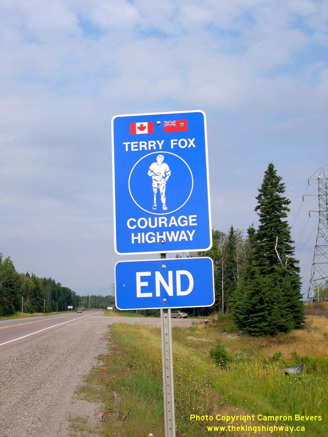

Left - Special route marker indicating the end of the Terry Fox Courage Highway on Hwy 11 & Hwy 17 near Nipigon. See an
Enlarged Photo Here. (Photograph taken on September 3, 2004 - © Cameron Bevers) Right - Dual King's Highway route markers for Hwy 11 & Hwy 17 between Red Rock and Nipigon. See an Enlarged Photo Here. (Photograph taken on September 4, 2006 - © Cameron Bevers)
Continue on to King's Highway 11 Photos: Red Rock Corners to Thunder Bay
|
|---|
Links to Adjacent King's Highway Photograph Pages:
Back to Hwy 11 - Geraldton to Nipigon
Hwy 11 Photo Index
On to Hwy 11 - Red Rock Corners to Thunder Bay
Back to King's Highway 10 Photos /
King's Highway 11 History /
On to King's Highway 12 Photos
Ontario Highway History - Main Menu / Back to List of Highways Website contents, photos & text © 2002-2026, Cameron
Bevers (Webmaster) - All Rights Reserved / Contact Me
|
|---|