
| 
| |
|
|
This page contains historical and present day photos of Ontario's King's Highway 122. All photographs displayed on this page
were taken by the Webmaster (Cameron Bevers), unless specifically noted otherwise. Historical photographs are arranged in approximate chronological order, while
present day photographs (Year 2000 to date) are arranged by location from west to north. Click on any thumbnail to see a larger image!
Please note that all photographs displayed on this
website are protected by copyright. These photographs must not be reproduced, published,
electronically stored or copied, distributed, or posted onto other websites without
my written permission. If you want to use photos from this website, please
email me first for permission. Thank-you!
|
|---|
|
Historical King's Highway 122 Photographs

Above - Resurfaced section of the Queen Elizabeth Way at Lower Middle Road (Royal Windsor Drive) east of Oakville . Photo taken on November 10, 1947. (Photo courtesy of Ontario Ministry of Transportation - © King's Printer for Ontario, 1947) 
Above - New Shook's Hill Interchange on the Queen Elizabeth Way at Southdown Road/Erin Mills Pkwy (June, 1961) (Photo © Archives of Ontario - Series RG-14-151-5-26, Photo #ES15-002) This British Motorway-style "rotary" interchange at Southdown Road & Erin Mills Parkway was built on the Queen Elizabeth Way west of Port Credit in 1958-1959. This unique interchange was the only one of its kind ever built in Ontario. Initially, the rotary interchange worked quite well under the comparatively low traffic volumes of the 1950s. However, the short weaving sections adjacent to the off-ramps within the rotary began to exhibit operational deficiencies as traffic volumes grew in the 1960s and early 1970s. In an effort to improve safety and increase traffic capacity at the interchange, the Ministry of Transportation and Communications took action by modifying the interchange in 1974. The two off-ramps from the Queen Elizabeth Way were realigned and removed from the rotary. As a result of the reconfiguration, traffic exiting from the freeway bypassed the rotary entirely, and joined directly to Southdown Road and Erin Mills Parkway at signalized intersections. Despite the retrofits in the 1970s, the prominent rotary configuration seen in this photo existed right up until 1999-2000, when this interchange was completely rebuilt. See an Enlarged Photo here. 

Left - Shooks Hill Rotary Underpass on the Queen Elizabeth Way in Mississauga (October 28, 1977) (Photo courtesy of Ontario Ministry of Transportation - © King's Printer for Ontario, 2011) Right - Facing east along the Queen Elizabeth Way at the Shooks Hill Rotary Interchange in 1977. Traffic travelling southbound from Erin Mills Parkway to Southdown Road passes below the QEW through the underpass in the foreground, while northbound traffic from Southdown Road to Erin Mills Parkway passes across the QEW on the overpass in the background. The British Motorway-inspired Shooks Hill Rotary Interchange was built in 1959. It was the only interchange of its kind ever built in Ontario. The Shooks Hill Rotary Interchange was removed during a multi-year construction project that began in 1998. The fact that the photographer was able to take this photo from the highway's median in the middle of Mississauga speaks to the comparatively low traffic volumes on the QEW at that time. See an Enlarged Photo here. Photo taken on October 28, 1977. (Photo courtesy of Ontario Ministry of Transportation - © King's Printer for Ontario, 2011) 

Left - Shooks Hill Rotary Overpass on the Queen Elizabeth Way in Mississauga. Although it isn't clear in this photo, an example of the Ministry of
Transportation's earliest series of traffic surveillance cameras can be seen mounted to a pole just to the right of the overpass. This experimental freeway
traffic management system was established along the QEW through Mississauga in 1975. This pilot project ultimately led to the development of the MTO's
present-day COMPASS freeway traffic management system. Photo taken in August, 1979. (Photo courtesy of Ontario Ministry of Transportation - © King's Printer for Ontario, 2011) Right - Facing north across the Shooks Hill Rotary Overpass in Mississauga in 1979. This overpass was completed in 1959 and was demolished in 2001, during the reconstruction of the Shooks Hill Interchange. Photo taken in August, 1979. (Photo courtesy of Ontario Ministry of Transportation - © King's Printer for Ontario, 2011) 
Left - View of the Shooks Hill Rotary on the Queen Elizabeth Way in Mississauga. This large rotary interchange was first built in 1958-1959. It provided
access to Southdown Road (Formerly Hwy 122) & Erin Mills Parkway. The Shooks Hill Rotary was plagued with operational problems, due to the high-speed entries and
exits on the rotary itself and short weaving areas. While some modifications were made to the interchange in 1974, the elliptical-shaped rotary remained in service
until it was removed during a multi-year interchange reconstruction project which began in the late 1990s. This view of the Shooks Hill Interchange shows the
northbound leg of the rotary roadway crossing over the Queen Elizabeth Way at left, and the Toronto-bound on-ramp leading down to the Queen Elizabeth Way at right.
See an Enlarged Photo here. Photo taken on July 11, 1991. (Photo courtesy of Ontario Ministry of Transportation - © King's Printer for Ontario, 2015) Right - Facing west along the Queen Elizabeth Way towards Hamilton from the Shooks Hill Rotary Interchange at Erin Mills Parkway & Southdown Road (Formerly Hwy 122) in Mississauga. See an Enlarged Photo here. Photo taken on July 11, 1991. (Photo courtesy of Ontario Ministry of Transportation - © King's Printer for Ontario, 2015) 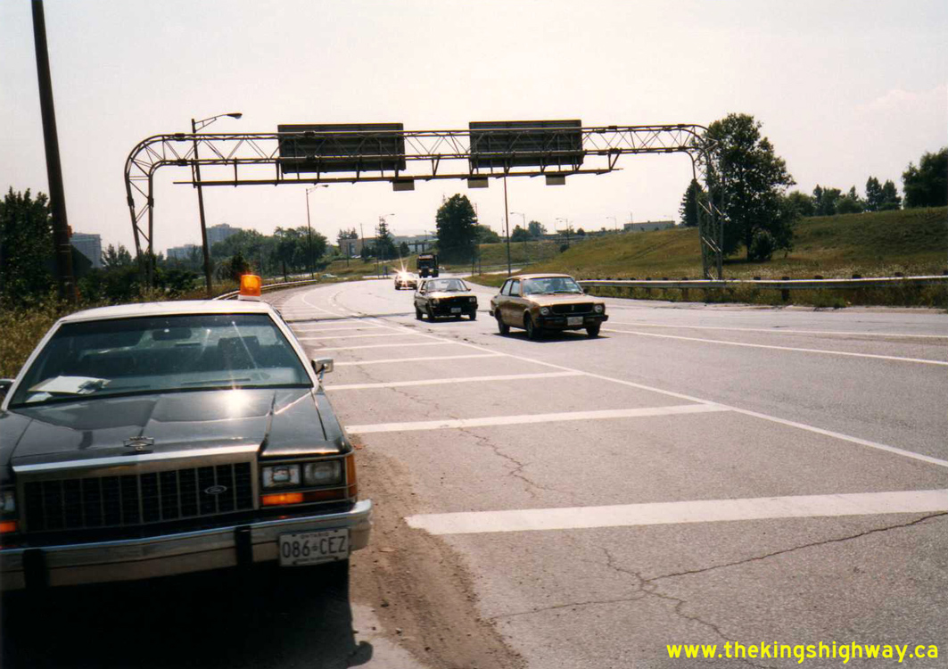
Left - Shooks Hill Rotary on the Queen Elizabeth Way at Southdown Road & Erin Mills Parkway in 1993, facing west from the Toronto-bound freeway on-ramp.
Southdown Road joins the rotary roughly where the dump truck is located in the background of this photo. See an
Enlarged Photo here. Photo taken on August 8, 1993. (Photo courtesy of Ontario Ministry of Transportation - © King's Printer for Ontario, 2015) Right - This superelevated curve forms the eastern side of the Shooks Hill Rotary. The overpass structure in the background carries the rotary roadway over the Queen Elizabeth Way. The elliptical rotary had a constantly changing radius, which caught many motorists off-guard. Looking at this interchange with the benefit of hindsight, it had many design problems. However, despite its shortcomings, it is important to note that the Shooks Hill Rotary Interchange was representative of a time when engineers with the Department of Highways of Ontario (DHO) were not afraid to experiment with new and innovative design concepts. Although it was very expensive to construct, the Shooks Hill Interchange was hardly a "White Elephant". It served its purpose for 40 years - likely longer than the designer had originally anticipated. See an Enlarged Photo here. Photo taken on August 8, 1993. (Photo courtesy of Ontario Ministry of Transportation - © King's Printer for Ontario, 2015) 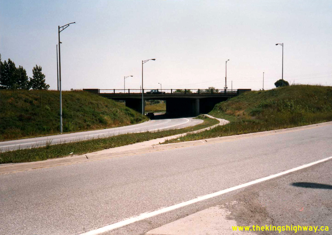

Left - Western side of the Shooks Hill Rotary on the Queen Elizabeth Way in Mississauga. This underpass carries the southbound leg of the rotary below the
Queen Elizabeth Way. The Hamilton-bound on-ramp to the Queen Elizabeth Way can be seen in the foreground. See an
Enlarged Photo here. Photo taken on August 8, 1993. (Photo courtesy of Ontario Ministry of Transportation - © King's Printer for Ontario, 2015) Right - Shooks Hill Rotary Overpass on the Queen Elizabeth Way Interchange in Mississauga. From this viewpoint, it is easy to understand why Ontario was such an early adopter of post-tensioned bridge structure technology in the early 1960s. Designing concrete or steel girder bridges for use on curvilinear ramps such as this one can be rather challenging! See an Enlarged Photo Here. Photo taken on June 22, 1995. (Photo courtesy of Ontario Ministry of Transportation - © King's Printer for Ontario, 2015) 

Left - Southern side of the Shooks Hill Rotary Underpass on the Queen Elizabeth Way Interchange in Mississauga. See an
Enlarged Photo Here. Photo taken on June 22, 1995. (Photo courtesy of Ontario Ministry of Transportation - © King's Printer for Ontario, 2015) Right - Northern side of the Shooks Hill Rotary Underpass on the Queen Elizabeth Way Interchange in Mississauga. See an Enlarged Photo Here. Photo taken on June 22, 1995. (Photo courtesy of Ontario Ministry of Transportation - © King's Printer for Ontario, 2015) 
Above - Shooks Hill Rotary Underpass on the Queen Elizabeth Way in Mississauga. See an
Enlarged Photo here. Photo taken on June 13, 1997. (Photo courtesy of Ontario Ministry of Transportation - © King's Printer for Ontario, 2015) |
|---|
|
Present Day King's Highway 122 Photographs


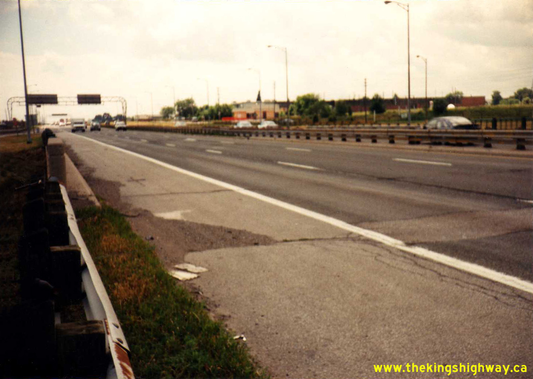
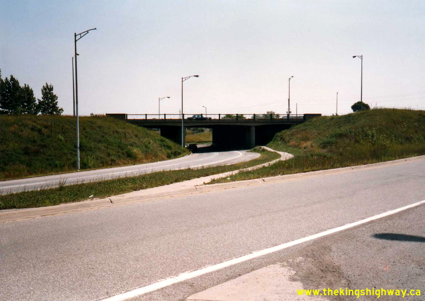
Left - Facing west along Royal Windsor Drive (Former Hwy 122) towards the Oakville Ford Plant Subway. See an
Enlarged Photo here. (Photograph taken on July 17, 2005 - © Cameron Bevers) Right - The Ford Plant Railway Subway on Royal Windsor Drive in Oakville. Structure completed in 1952. See an Enlarged Photo here. (Photograph taken on July 17, 2005 - © Cameron Bevers) 

Left - Date stamp (1952) on the Oakville Ford Plant Subway on Old Hwy 122. See an
Enlarged Photo here. (Photograph taken on July 17, 2005 - © Cameron Bevers) Right - Centre pier of the Ford Plant Subway on Old Hwy 122 in Oakville. See an Enlarged Photo here. (Photograph taken on July 17, 2005 - © Cameron Bevers) 

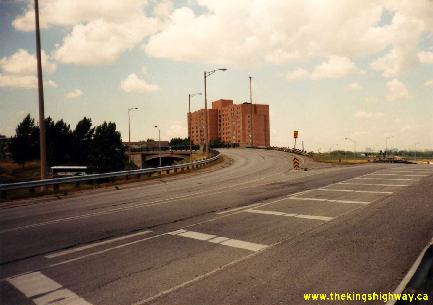
Left - Facing east towards Port Credit along Old Hwy 122 from the Ford Plant Railway Subway. See an
Enlarged Photo here. (Photograph taken on July 17, 2005 - © Cameron Bevers) Right - Facing west towards Oakville along Royal Windsor Drive from the Ford Plant Subway. See an Enlarged Photo here. (Photograph taken on July 17, 2005 - © Cameron Bevers) 

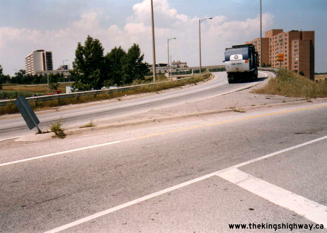
Left - Facing east towards Port Credit along Royal Windsor Drive from the Ford Plant Subway. See an
Enlarged Photo here. (Photograph taken on July 17, 2005 - © Cameron Bevers) Right - Royal Windsor Drive (Former Hwy 122) facing east towards the Ford Plant Subway. See an Enlarged Photo here. (Photograph taken on July 17, 2005 - © Cameron Bevers)
More King's Highway 122 Photographs Coming Soon!
|
|---|
Links to Adjacent King's Highway Photograph Pages:
Back to King's Highway 121 Photos /
King's Highway 122 History /
On to King's Highway 123 (#1) Photos
Ontario Highway History - Main Menu / Back to List of Highways Website contents, photos & text © 2002-2026, Cameron
Bevers (Webmaster) - All Rights Reserved / Contact Me
|
|---|