
| 
| |
|
|
This page contains historical and present day photos of Ontario's King's Highway 130. All photographs displayed on this page
were taken by the Webmaster (Cameron Bevers), unless specifically noted otherwise. Historical photographs are arranged in approximate chronological order, while
present day photographs (Year 2000 to date) are arranged by location from south to north. Click on any thumbnail to see a larger image!
Please note that all photographs displayed on this
website are protected by copyright. These photographs must not be reproduced, published,
electronically stored or copied, distributed, or posted onto other websites without
my written permission. If you want to use photos from this website, please
email me first for permission. Thank-you!
|
|---|
|
Historical King's Highway 130 Photographs

Above - Postcard view of the Rosslyn Road (now Hwy 130) approaching the Kaministiquia River Bridge, facing north (1926) (Photo Courtesy of Lovelady Brothers Studios) |
|---|
|
Present Day King's Highway 130 Photographs


Left - Facing north along Hwy 61 towards Thunder Bay from the Hwy 130 Junction. See an
Enlarged Photo Here. (Photograph taken on September 2, 2011 - © Cameron Bevers) Right - Approaching the Hwy 130 Junction on southbound Hwy 61, southwest of Thunder Bay. See an Enlarged Photo Here. (Photograph taken on September 2, 2011 - © Cameron Bevers) 

Left - Facing south along Hwy 61 towards Pigeon River at the Hwy 130 Junction. This is the last major highway junction on Hwy 61 before the highway crosses
into Minnesota at Pigeon River. Only two other minor Secondary Highways (Hwy 608 and Hwy 593) intersect with Hwy 61 south of the Hwy 130 Junction. See an
Enlarged Photo Here. (Photograph taken on September 2, 2011 - © Cameron Bevers) Right - Approaching the southern terminus of Hwy 130 at the Hwy 61 Junction southwest of Thunder Bay. See an Enlarged Photo Here. (Photograph taken on September 2, 2011 - © Cameron Bevers) 

Left - Facing north along Hwy 130 from the Hwy 61 Junction southwest of Thunder Bay. This short highway forms a cut-off route between Hwy 61 and Hwy 11 &
Hwy 17 near Thunder Bay, via Rosslyn. See an Enlarged Photo Here. (Photograph taken on August 30, 2006 - © Cameron Bevers) Right - Green guide sign marking the turn-off to Hwy 130 on northbound Hwy 61. See an Enlarged Photo Here. (Photograph taken on August 30, 2006 - © Cameron Bevers) 

Left - Facing south along Hwy 61 towards Pigeon River from the Hwy 130 Junction. See an
Enlarged Photo Here. (Photograph taken on August 30, 2006 - © Cameron Bevers) Right - Facing north along Hwy 61 towards the Hwy 130 Junction southwest of Thunder Bay. See an Enlarged Photo Here. (Photograph taken on August 30, 2006 - © Cameron Bevers) 


Left - Junction sign for Hwy 61 on Hwy 130 southwest of Thunder Bay. See an
Enlarged Photo Here. (Photograph taken on August 30, 2006 - © Cameron Bevers) Centre - Junction assembly approaching the Hwy 61 on southbound Hwy 130. See an Enlarged Photo Here. (Photograph taken on September 2, 2011 - © Cameron Bevers) Right - Junction signs at the end of Hwy 130 at Hwy 61. The control city on Hwy 61 south of Thunder Bay is Duluth, Minnesota. What this sign doesn't tell you is that it is a very lonely 280 km journey to Duluth from here. Duluth is the most distant out-of-province control city signed by the MTO. In fact, Duluth is the only sizeable town or city on either Ontario Hwy 61 or Minnesota Hwy 61, apart from Thunder Bay located at the highway's northern terminus. See an Enlarged Photo Here. (Photograph taken on August 30, 2006 - © Cameron Bevers) 

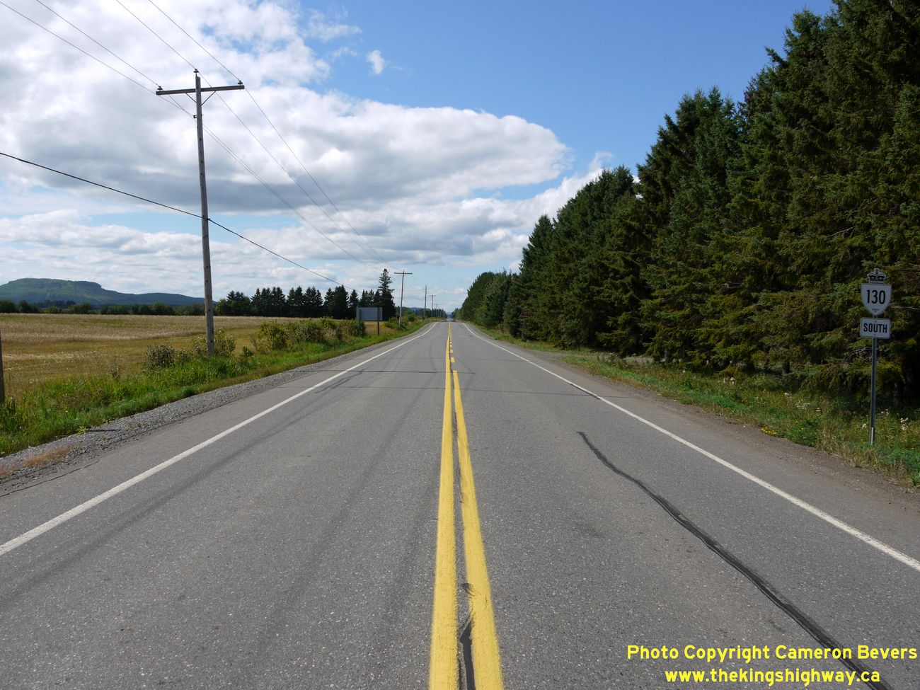
Left - Facing north along Hwy 130 approaching the first turn-off near Slate River Valley. At this junction, Hwy 130 briefly turns east for 2 km before resuming
its route north towards Rosslyn and the Hwy 11 & Hwy 17 Junction. This jog in the highway's alignment is due to the nearby Kaministiquia River, of which there are
only a limited number of crossings in the Thunder Bay area. (Photograph taken on September 2, 2011 - © Cameron Bevers) Right - Close-up of the green guide sign marking the upcoming Hwy 130 turn-off near Slate River Valley. (Photograph taken on September 2, 2011 - © Cameron Bevers) 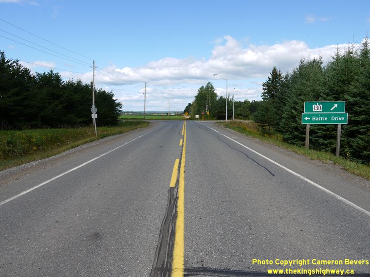

Left - The predominant Northbound Hwy 130 right-turn movement at this intersection is channelized. (Photograph taken on September 2, 2011 - © Cameron Bevers) Right - Facing west along Hwy 130 at the turn-off to Slate River Valley. Here, Hwy 130 turns left and heads south for about 5 km to join with Hwy 61. Continuing straight through on the township road leads to Hwy 588, an Ontario Secondary Highway that extends west from Kakabeka Falls to the small communities of Hymers and Nolalu. (Photograph taken on September 2, 2011 - © Cameron Bevers) 

Left - Facing east along Hwy 130 from the first turn-off near Slate River Valley. Although the route does briefly turn east for 2 km near Slate River Valley,
Hwy 130 is consistently signed with North and South cardinal direction tabs along the entire route. (Photograph taken on September 2, 2011 - © Cameron Bevers) Right - Scenic view of the Nor'Westers from Hwy 130 between Slate River Valley and Rosslyn. See an Enlarged Photo Here. (Photograph taken on September 2, 2011 - © Cameron Bevers) 

Left - Motorists can enjoy the atypical Northern Ontario scenery along Hwy 130 west of Thunder Bay, which is unique to this part of the province. Farmland
extends for many miles, only to end abruptly in places where steep-sided rugged mesas jut out into the landscape. See an
Enlarged Photo Here. (Photograph taken on September 2, 2011 - © Cameron Bevers) Right - Facing south along Hwy 130 from the turn-off south of Rosslyn. Candy Mountain, one of the Thunder Bay area's many mesas, can be seen at left. See an Enlarged Photo Here. (Photograph taken on September 2, 2011 - © Cameron Bevers) 

Left - Approaching the Hwy 130 turn-off south of Rosslyn. After traveling east for 2 km, Northbound Hwy 130 turns left and continues north towards Rosslyn. (Photograph taken on September 2, 2011 - © Cameron Bevers) Right - Hwy 130 resumes its route north towards the Kaministiquia River Bridge and Rosslyn after the second turn-off. (Photograph taken on September 2, 2011 - © Cameron Bevers) 

Left - Facing south along Hwy 130 approaching the turn-off south of Rosslyn. From here, Hwy 130 turns west for about 2 km before resuming its route south
towards Hwy 61. (Photograph taken on September 2, 2011 - © Cameron Bevers) Right - Kaministiquia River Bridge on Hwy 130 near Rosslyn. Structure completed in 1985. (Photograph taken on September 2, 2011 - © Cameron Bevers) 

Left - Structure identification number and date stamp (1985) on the Kaministiquia River Bridge on Hwy 130. (Photograph taken on September 2, 2011 - © Cameron Bevers) Right - Facing north across the Kaministiquia River Bridge towards Rosslyn on Hwy 130. (Photograph taken on September 2, 2011 - © Cameron Bevers) 

Left - Kaministiquia River Bridge on Hwy 130 near Rosslyn, facing south. This is one of only six major bridges crossing the river in the Thunder Bay area. (Photograph taken on September 2, 2011 - © Cameron Bevers) Right - Facing north along Hwy 130 at Rosslyn. The small communities of Rosslyn and Twin City are situated along Hwy 130 and the banks of the Kaministiquia River. (Photograph taken on September 2, 2011 - © Cameron Bevers) 

Left - Facing south along Hwy 130 from the intersection of Arthur Street and Twin City Crossroad. Note the distance guide sign at right, indicating that it is
more than 300 km (185 miles) to Duluth, Minnesota. Although Hwy 130 does not go all the way to Duluth (most of the route is encompassed by Hwy 61), there are no
other qualified control cities along this route. (Photograph taken on September 2, 2011 - © Cameron Bevers) Right - Approaching the intersection of Arthur Street and Twin City Crossroad on Northbound Hwy 130. Until the New Shabaqua Highway opened to traffic, Hwy 130 ended at this intersection at the Hwy 11 & Hwy 17 Junction. When the New Shabaqua Highway opened to traffic and bypassed this area, Hwy 11 & Hwy 17 were rerouted onto the new highway. A section of Former Hwy 11 & Hwy 17 was renumbered as Hwy 130, while the rest of the old highway alignment was renamed Arthur Street. Today, Hwy 130 turns left at this intersection and follows the former route of Hwy 11 & Hwy 17 out to the New Shabaqua Highway, located about 2 km to the west. (Photograph taken on September 2, 2011 - © Cameron Bevers) 

Left - Sunset over Arthur Street (Formerly Hwy 11 & Hwy 17) at the Hwy 130 Junction at Twin City Crossroad, west of Thunder Bay. See an
Enlarged Photo Here. (Photograph taken on September 1, 2011 - © Cameron Bevers) Right - Green guide sign at the Hwy 130 Junction on Arthur Street (Formerly Hwy 11 & Hwy 17), west of Thunder Bay. (Photograph taken on September 1, 2011 - © Cameron Bevers) 

Left - Facing east along Arthur Street (Formerly Hwy 11 & Hwy 17) towards Thunder Bay from the Hwy 130 Junction at Twin City Crossroad. (Photograph taken on September 2, 2011 - © Cameron Bevers) Right - Facing north along Hwy 130 (Formerly Hwy 11 & Hwy 17) from the intersection of Twin City Crossroad and Arthur Street, west of Thunder Bay. (Photograph taken on September 2, 2011 - © Cameron Bevers)
More King's Highway 130 Photographs Coming Soon!
|
|---|
Links to Adjacent King's Highway Photograph Pages:
Back to King's Highway 129 Photos /
King's Highway 130 History /
On to King's Highway 131 (#1) Photos
Ontario Highway History - Main Menu / Back to List of Highways Website contents, photos & text © 2002-2026, Cameron
Bevers (Webmaster) - All Rights Reserved / Contact Me
|
|---|