
| 
| |
|
|
This page contains historical and present day photos of Ontario's King's Highway 129. All photographs displayed on this page
were taken by the Webmaster (Cameron Bevers), unless specifically noted otherwise. Historical photographs are arranged in approximate chronological order, while
present day photographs (Year 2005 to date) are arranged by location from south to north. Click on any thumbnail to see a larger image!
Please note that all photographs displayed on this
website are protected by copyright. These photographs must not be reproduced, published,
electronically stored or copied, distributed, or posted onto other websites without
my written permission. If you want to use photos from this website, please
email me first for permission. Thank-you!
|
|---|
|
Historical King's Highway 129 Photographs
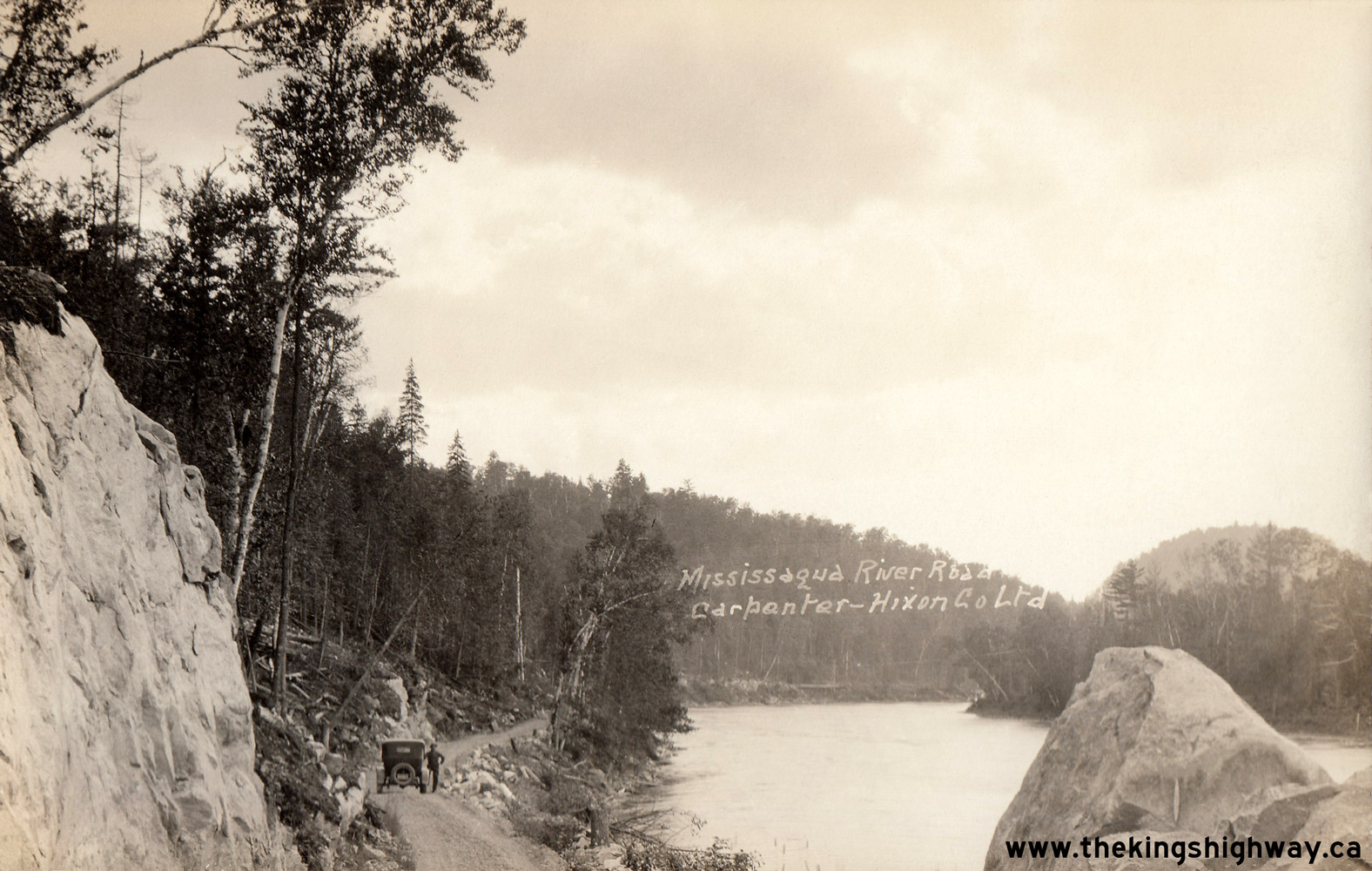
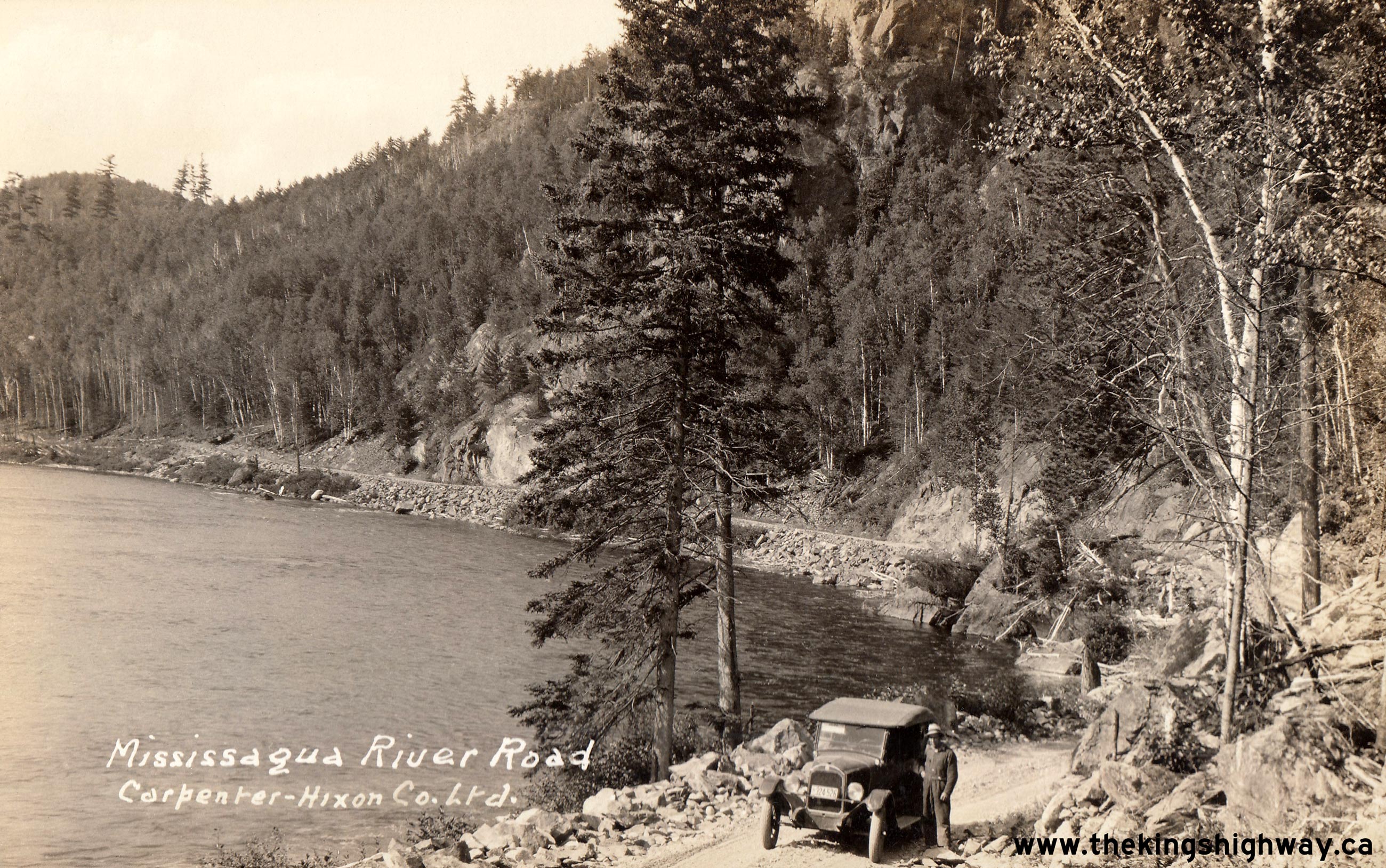
Left - Postcard view of the Mississagua River Road (sic) in 1926, facing south towards Thessalon. This crude forestry road was owned originally by the
Carpenter-Hixon Company Ltd, who operated a sawmill in Blind River. This forestry road was constructed in order to harvest timber at the northern reaches of the
Mississagi River's watershed. The road was made available to public travel, and was later upgraded and ultimately assumed by the province as King's Highway 129 during
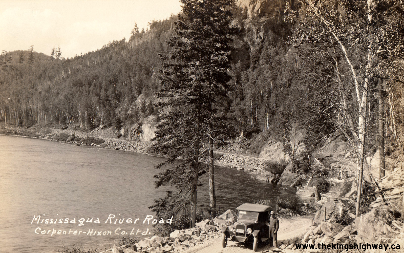
the 1950s. See an Enlarged Photo Here. Photo taken in 1926. (Photo from Cameron Bevers' historical photograph collection - Original photographer unknown) Right - Postcard view of an early motorist on the Mississagua River Road (sic) between Thessalon and Aubrey Falls. See an Enlarged Photo Here. Photo taken in 1926. (Photo from Cameron Bevers' historical photograph collection - Original photographer unknown) 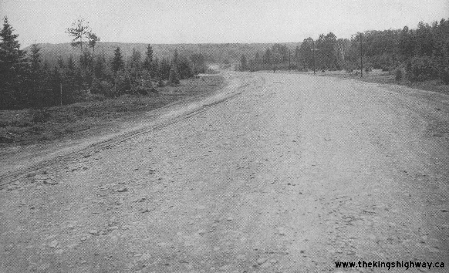
Above - View of the new Thessalon-Chapleau Highway (Hwy 129) in 1948 north of Thessalon. This new section of the highway was built under Contract #1947-86 by
the Storms Construction Company, and was primarily necessitated by the Hydro-Electric Power Commission's Tunnel Lake development located north of Thessalon near
Wharncliffe. In addition to serving the needs of the hydro-electric development, construction of a new highway was also needed to bypass those parts of the old
Mississagi River Road situated below the flood line of the proposed reservoir. As a result of the Rayner Generating Station's proposed hydro dam, several miles of the
old Mississagi River Road were scheduled to be flooded below Tunnel Lake and had to be relocated by the Department of Highways of Ontario (DHO) to higher ground. See
an Enlarged Photo Here. Photo taken on August 16, 1948. (Photo courtesy of Ontario Ministry of Transportation - © King's Printer for Ontario, 1948) 

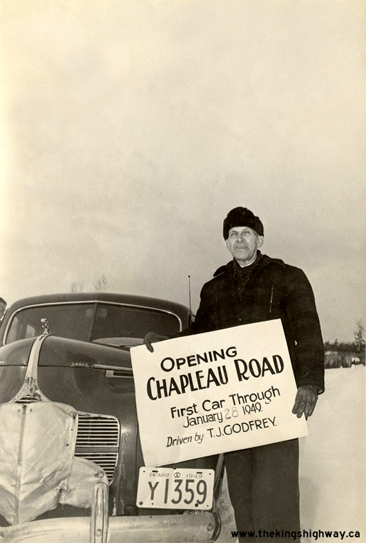
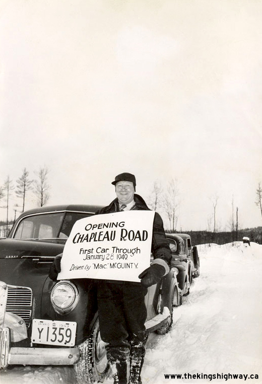
Above Photos - First car to use the new Thessalon-Chapleau Highway on January 28, 1949. The first vehicle through was driven by T.J. Godfrey (left photo) and
Mac McGuinty (right photo). See an Enlarged Photo Here (Left) and
Enlarged Photo Here (Right). Photos taken on January 28, 1949. (Photos courtesy of the Woods & Randle Families) 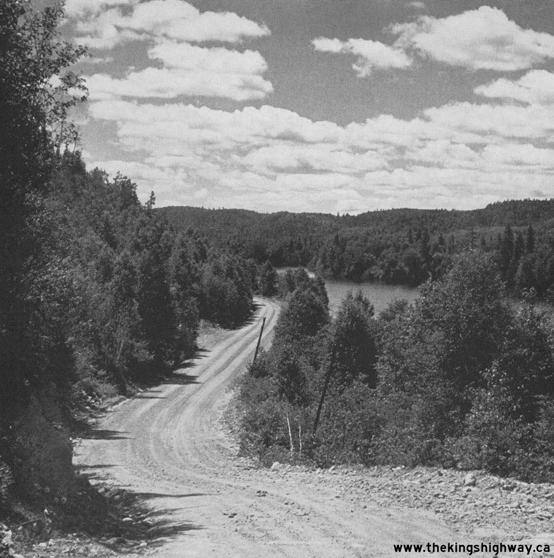
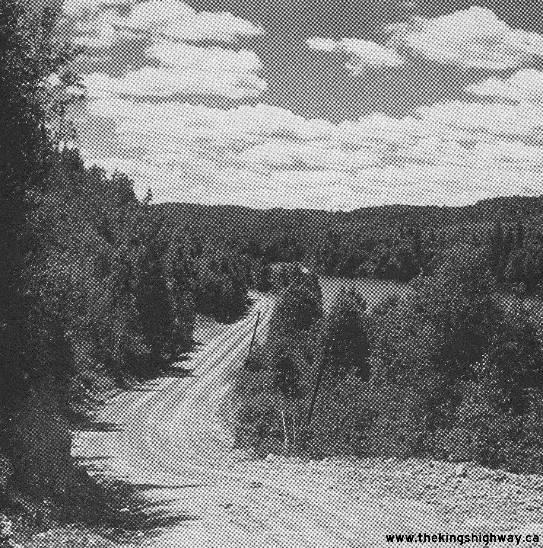
Above - View of the Mississagi River and the Thessalon-Chapleau Highway (Hwy 129) south of Aubrey Falls. See an
Enlarged Photo Here. Photo taken on August 29, 1951. (Photo courtesy of Ontario Ministry of Transportation - © King's Printer for Ontario, 1951) 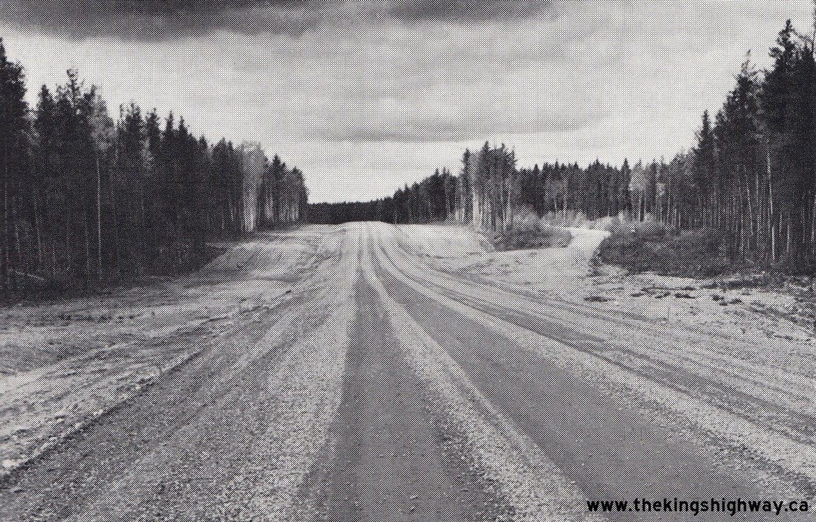
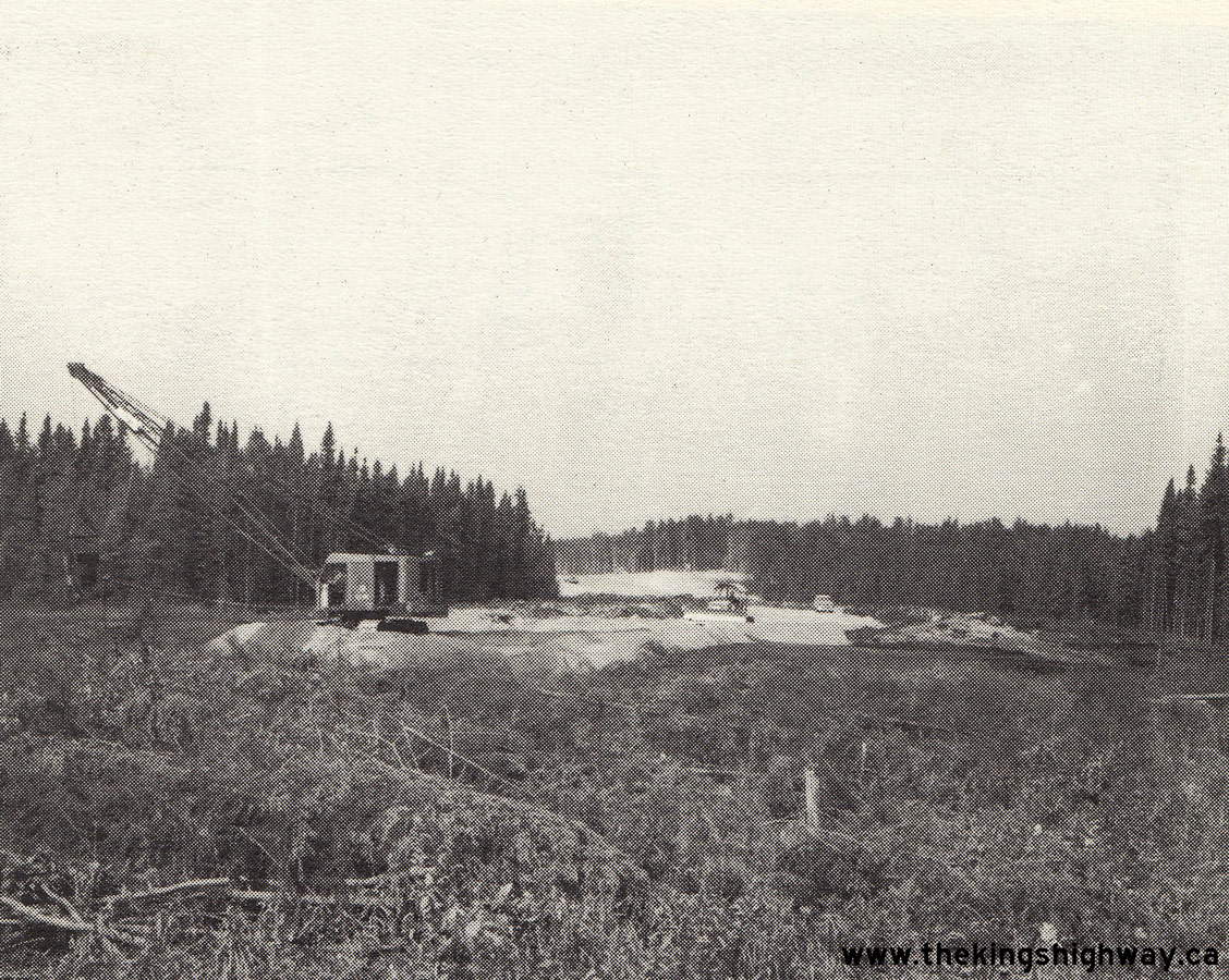
  Left - Completed grading on a revision to Hwy 129 near Chapleau. See an
Enlarged Photo Here. Photo taken in 1958. Left - Completed grading on a revision to Hwy 129 near Chapleau. See an
Enlarged Photo Here. Photo taken in 1958.(Photo courtesy of Ontario Ministry of Transportation - © King's Printer for Ontario, 1958) Right - Construction of a new bridge on Hwy 129 at Sideburned Lake southwest of Chapleau, Contract #1957-137 (structural steel) and Contract #1958-41
(structure and approaches). Although this bridge was originally built as part of a proposed extension of Hwy 129, the highway was ultimately renumbered as Hwy 101
during the 1960s. See an Enlarged Photo Here. Photo taken in 1958.(Photo courtesy of Ontario Ministry of Transportation - © King's Printer for Ontario, 1958) 
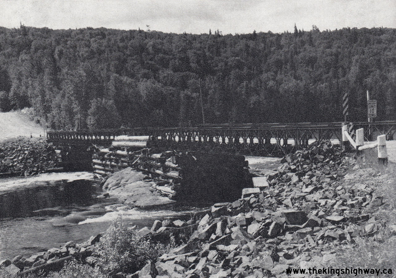
Left - Junction of Hwy 17, Hwy 17B and Hwy 129 at the eastern entrance to Thessalon, facing west towards Sault Ste. Marie. See an
Enlarged Photo Here. Photo taken in 1959. (Photo courtesy of Ontario Ministry of Transportation - © King's Printer for Ontario, 1959) Right - Aubrey Falls Bailey Bridge over the Mississagi River on Hwy 129, located about 68 miles north of Thessalon. A new highway bridge was completed across
the Mississagi River on a diversion of Hwy 129 in 1967, about 1/2 mile downstream of the old bridge site. See an
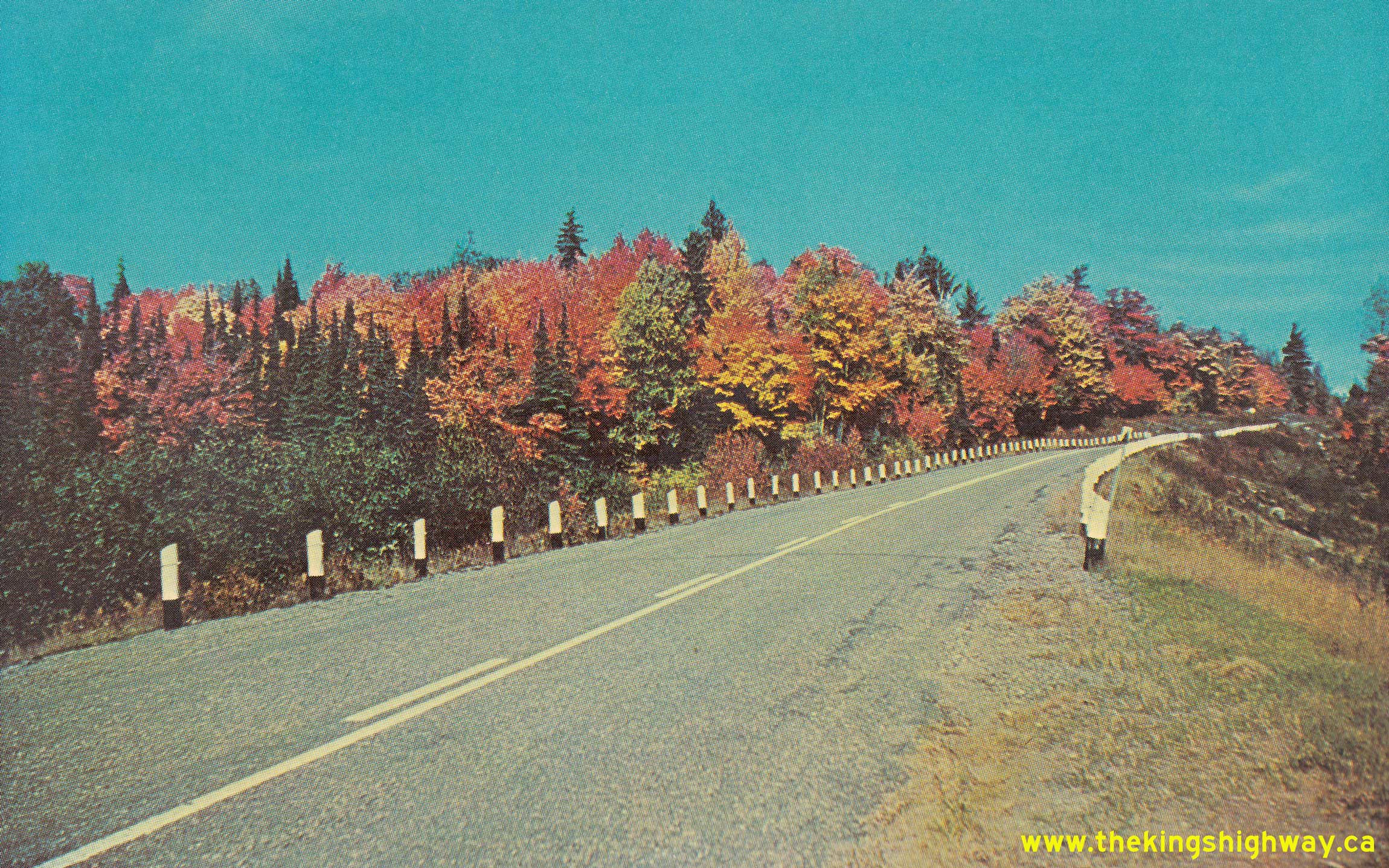
Enlarged Photo Here. Photo taken on July 15, 1960.(Photo courtesy of Ontario Ministry of Transportation - © King's Printer for Ontario, 1960) 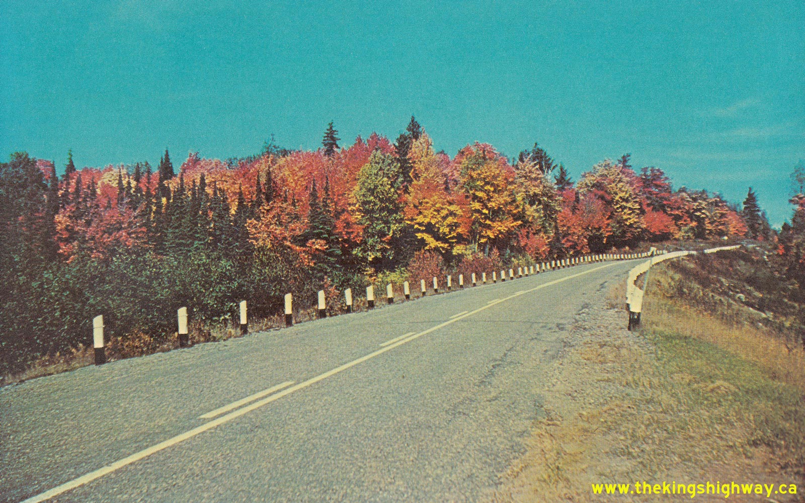 Above - Circa 1960 postcard view of the fall colours along Hwy 129 north of Thessalon. See an
Enlarged Photo Here. Above - Circa 1960 postcard view of the fall colours along Hwy 129 north of Thessalon. See an
Enlarged Photo Here.(Photo courtesy of Perepelytz Advertising, Sault Ste. Marie) 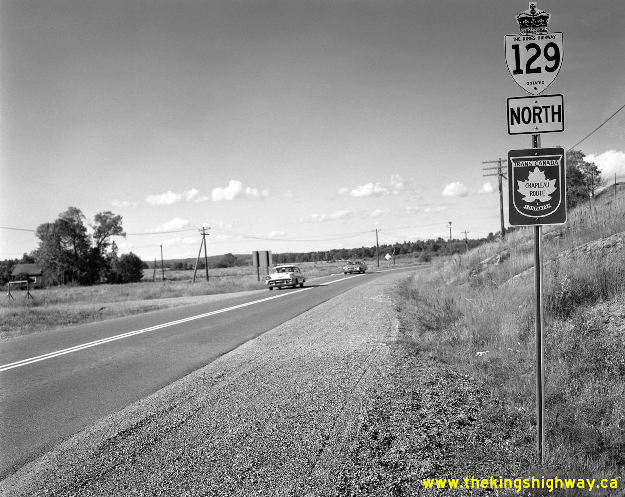
 Left - King's Highway 129 route marker and "Chapleau Route" Trans-Canada Highway route marker just north of the Hwy 17 Junction in Thessalon in 1960. The
enigmatic Chapleau Route of the Trans-Canada Highway was established during 1960 between Thessalon and Chapleau. This unusual route actually came to a dead-end in
Chapleau for many years, as there were no other highway outlets leading away from Chapleau until Hwy 101 was completed years later. Originally, it was envisioned that
the Chapleau Route would become a branch Trans-Canada Highway Route, which would eventually swing westerly from Chapleau and tie back into the Trans-Canada Highway's
main route via Hwy 17 in Wawa. However, signing of the Chapleau Route was apparently never continued westerly once the final link in Hwy 101 was completed and opened
to traffic between Chapleau and Wawa in late 1966. Thus, the Trans-Canada Highway's Chapleau Route mysteriously came to an end in the town bearing the route's name.
References to the Chapleau Route were deleted from the Official Ontario Road Maps in the early 1970s, which suggests that signing of the Chapleau Route via Hwy 129
was discontinued around that time. See an Enlarged Photo Here. Photo taken on August 29,
1960. Left - King's Highway 129 route marker and "Chapleau Route" Trans-Canada Highway route marker just north of the Hwy 17 Junction in Thessalon in 1960. The
enigmatic Chapleau Route of the Trans-Canada Highway was established during 1960 between Thessalon and Chapleau. This unusual route actually came to a dead-end in
Chapleau for many years, as there were no other highway outlets leading away from Chapleau until Hwy 101 was completed years later. Originally, it was envisioned that
the Chapleau Route would become a branch Trans-Canada Highway Route, which would eventually swing westerly from Chapleau and tie back into the Trans-Canada Highway's
main route via Hwy 17 in Wawa. However, signing of the Chapleau Route was apparently never continued westerly once the final link in Hwy 101 was completed and opened
to traffic between Chapleau and Wawa in late 1966. Thus, the Trans-Canada Highway's Chapleau Route mysteriously came to an end in the town bearing the route's name.
References to the Chapleau Route were deleted from the Official Ontario Road Maps in the early 1970s, which suggests that signing of the Chapleau Route via Hwy 129
was discontinued around that time. See an Enlarged Photo Here. Photo taken on August 29,
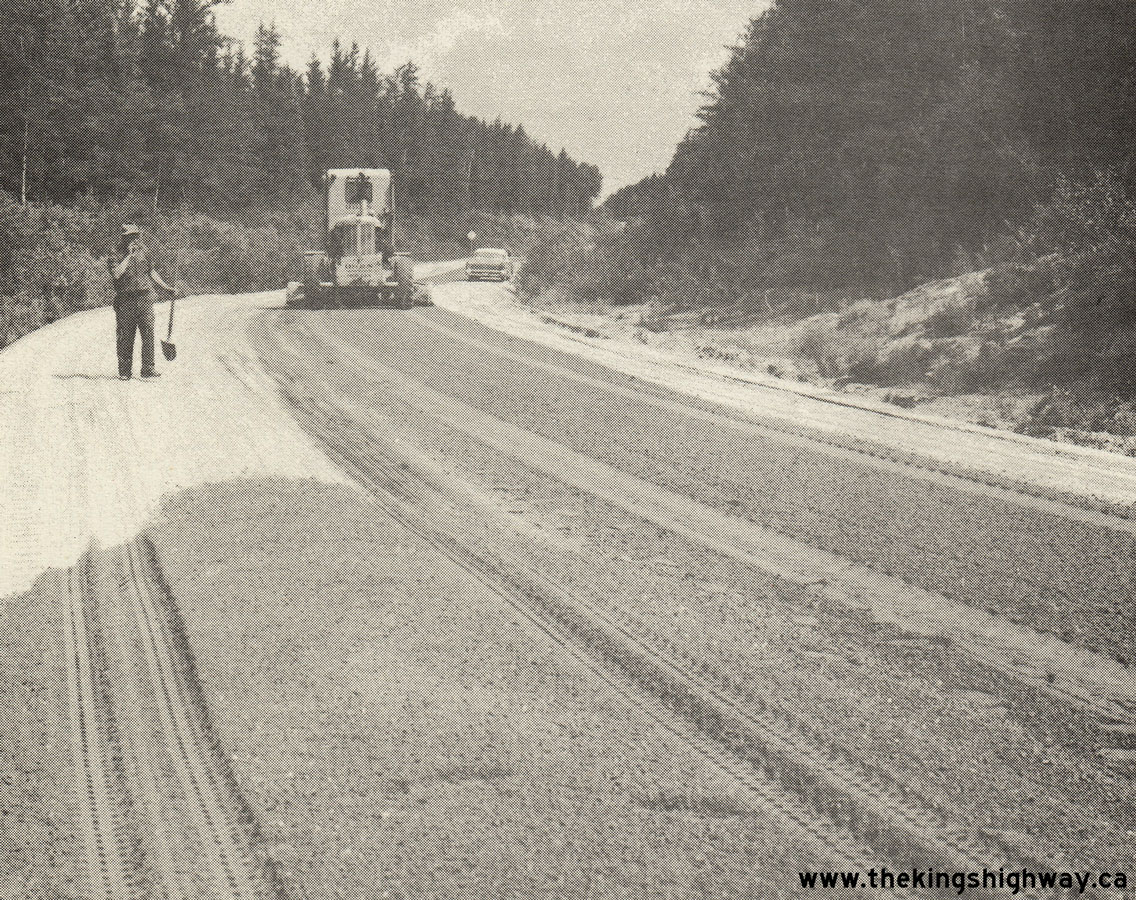
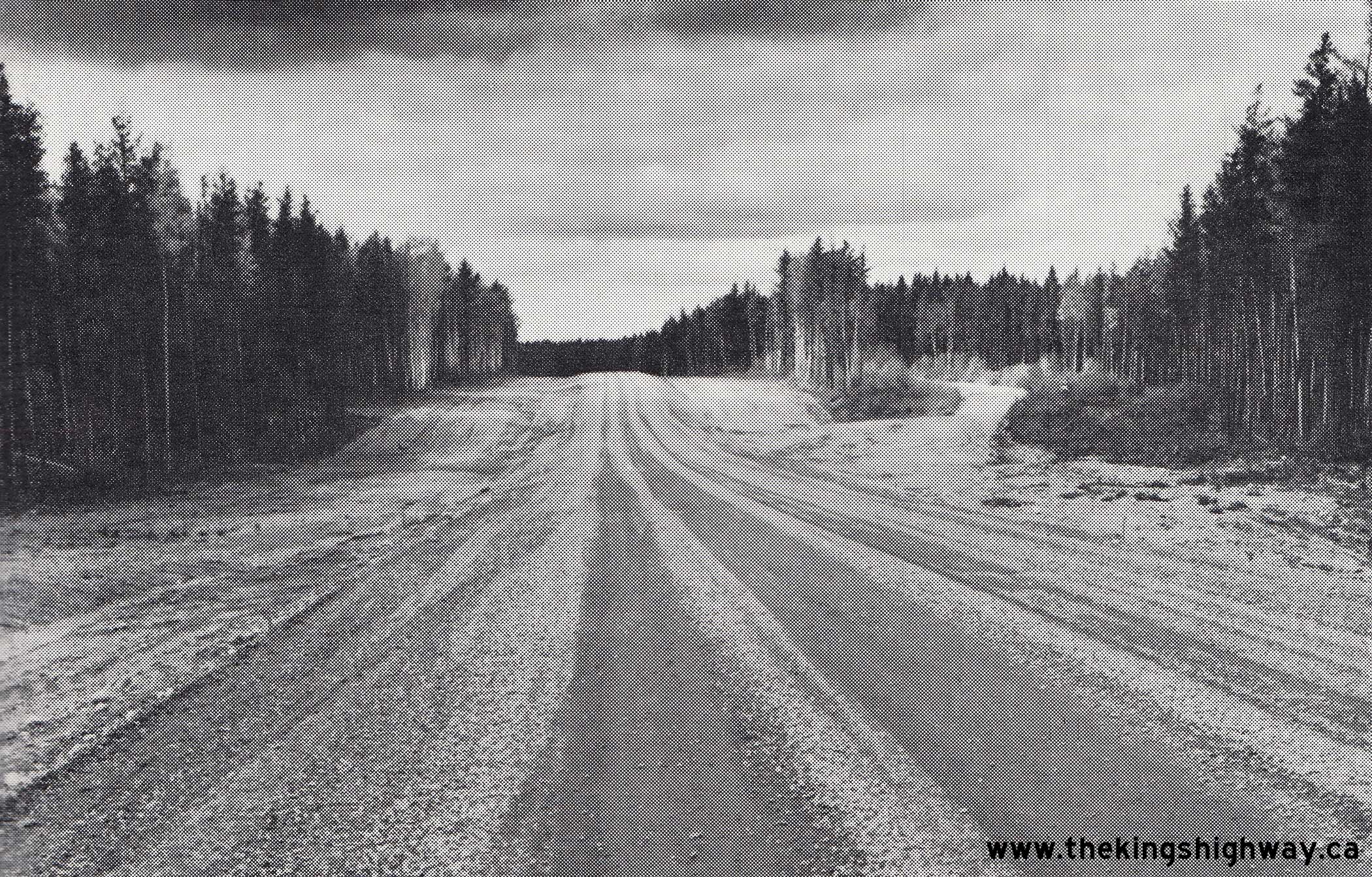
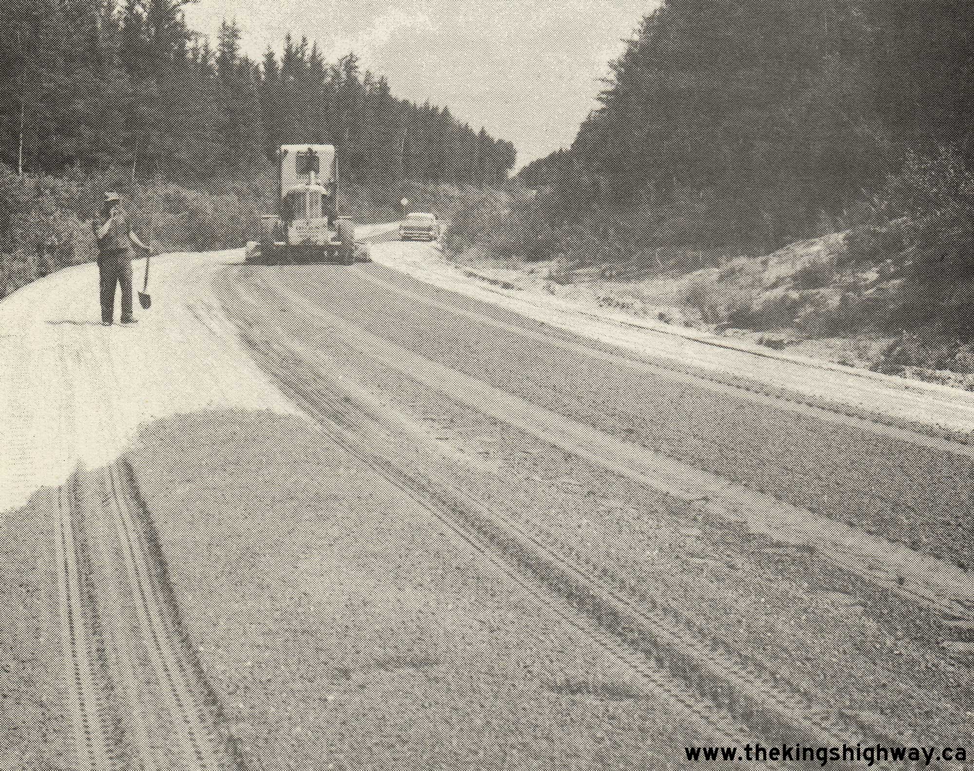
1960.(Photo © Archives of Ontario - Series RG-14-151-1, Container A-1682, Photo #599: Jct. 17 Thessalon - T.C.H. Sign Chapleau Route, [photograph], [August 29, 1960], Ministry of Transportation Chronological Numbered Photos, RG-14-151-1, Archives of Ontario, B116134, Copyright Crown) Right - Grader spreading granular base along Hwy 129, about 113 miles north of the Hwy 17 Junction, Contract #1961-235. See an
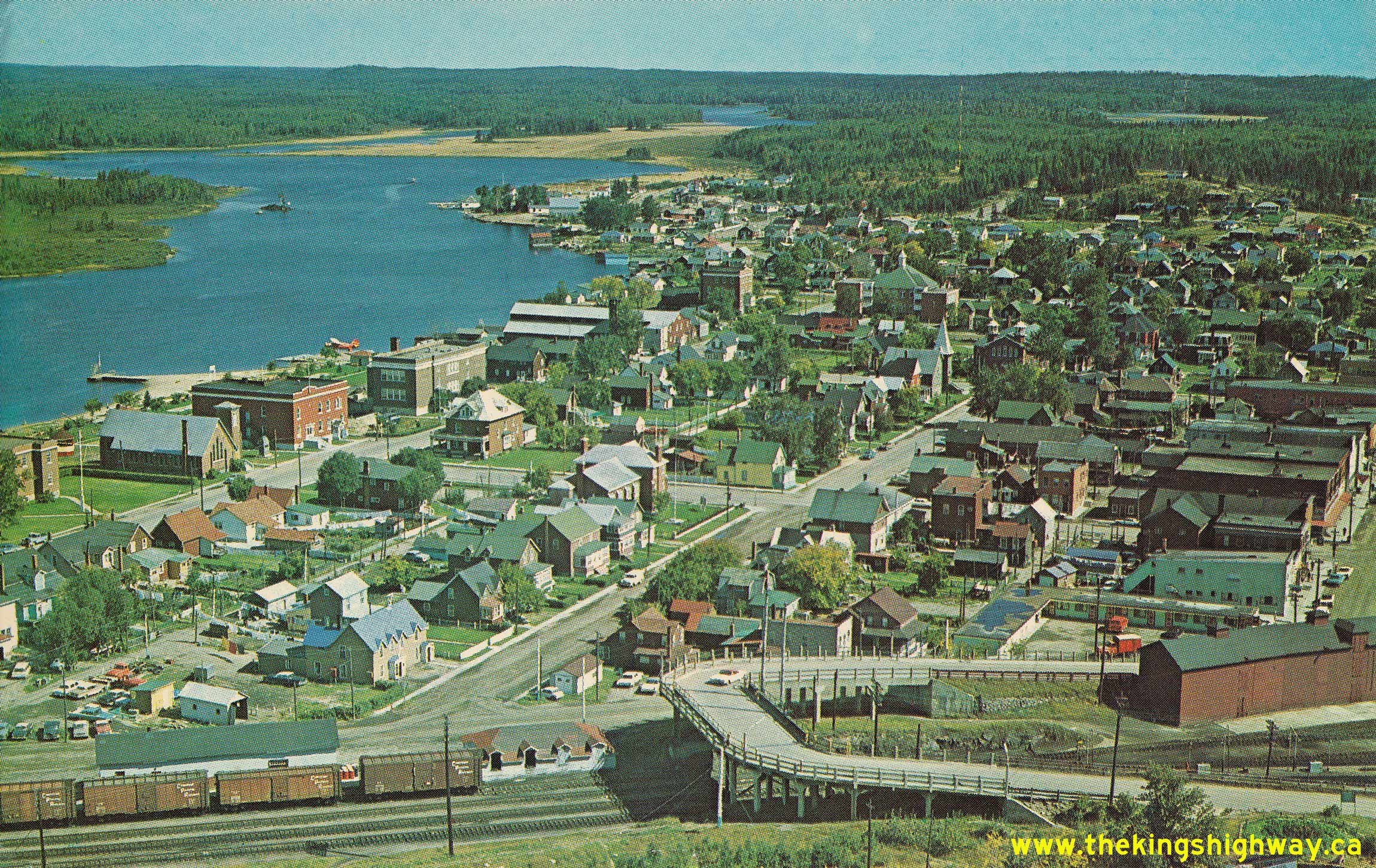
Enlarged Photo Here. Photo taken in 1962.(Photo courtesy of Ontario Ministry of Transportation - © King's Printer for Ontario, 1962) 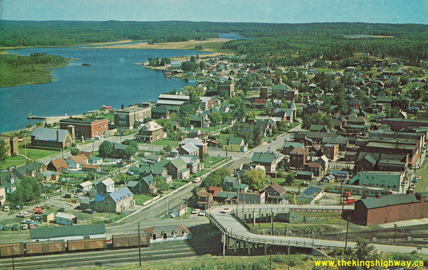 Above - Circa 1965 aerial postcard view of Chapleau at the northern terminus of Hwy 129, facing northeast. Note the now-removed "Horseshoe Bridge", which once
connected the town centre to Monk Street and Hwy 129. The Horseshoe Bridge was demolished and replaced with a new highway structure with improved approach curves in
the years after this photo was taken in the 1960s. The new overhead bridge crosses the railway further to the north, away from the town centre. See an
Enlarged Photo Here. Above - Circa 1965 aerial postcard view of Chapleau at the northern terminus of Hwy 129, facing northeast. Note the now-removed "Horseshoe Bridge", which once
connected the town centre to Monk Street and Hwy 129. The Horseshoe Bridge was demolished and replaced with a new highway structure with improved approach curves in
the years after this photo was taken in the 1960s. The new overhead bridge crosses the railway further to the north, away from the town centre. See an
Enlarged Photo Here.(Photo courtesy of H.R. Oakman) 
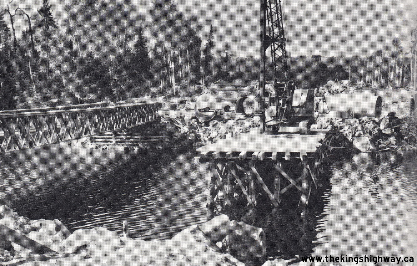
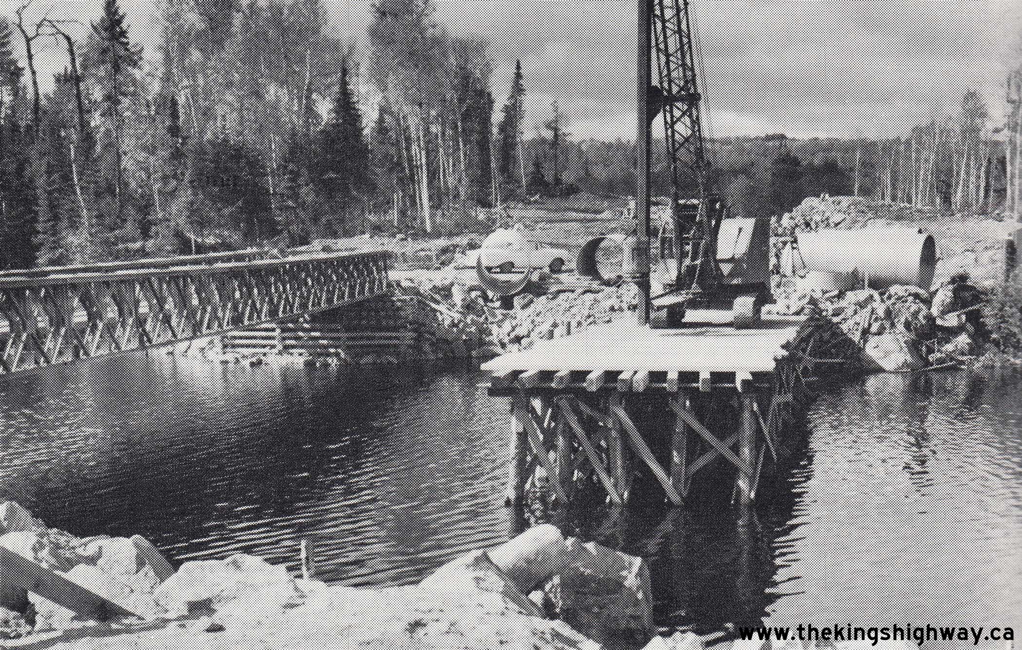
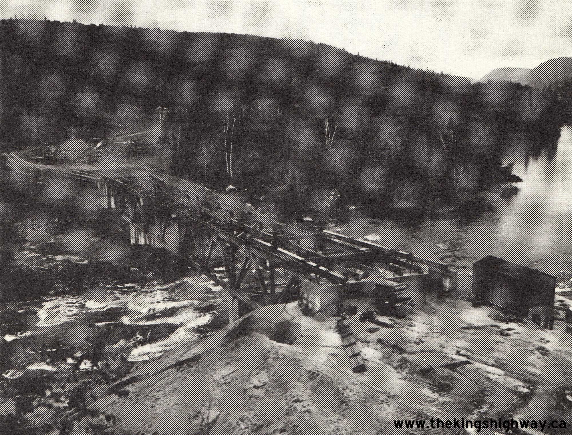
 Left - Mississagi River Bridge under construction on a diversion of Hwy 129 near Aubrey Falls, Contract #1965-197 (structural steel) and Contract #1965-07
(concrete substructure and approaches). This latter contract also included the construction of a diversion of Hwy 129 for a distance of just over 1 1/4 miles. See an
Enlarged Photo Here. Photo taken in 1966. Left - Mississagi River Bridge under construction on a diversion of Hwy 129 near Aubrey Falls, Contract #1965-197 (structural steel) and Contract #1965-07
(concrete substructure and approaches). This latter contract also included the construction of a diversion of Hwy 129 for a distance of just over 1 1/4 miles. See an
Enlarged Photo Here. Photo taken in 1966.(Photo courtesy of Ontario Ministry of Transportation - © King's Printer for Ontario, 1966) Right - Construction of a diversion of Hwy 129 south of the Hwy 101 West Junction near Chapleau, Contract #1967-80. A 9-mile section of Hwy 129's route was
reconstructed as a modern highway facility under this contract, from about 2 miles south of the Hwy 101 West Junction southerly. See an
Enlarged Photo Here. Photo taken in 1967.(Photo courtesy of Ontario Ministry of Transportation - © King's Printer for Ontario, 1967) 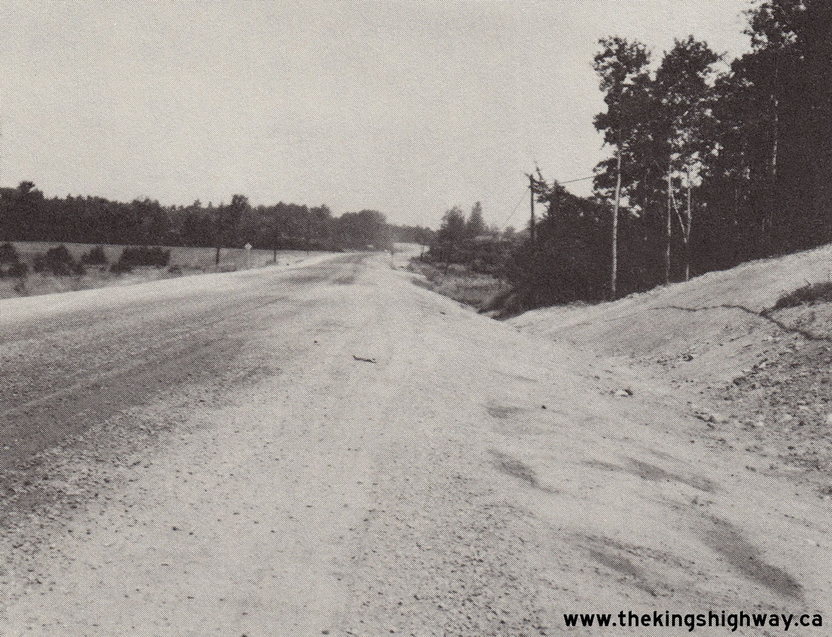
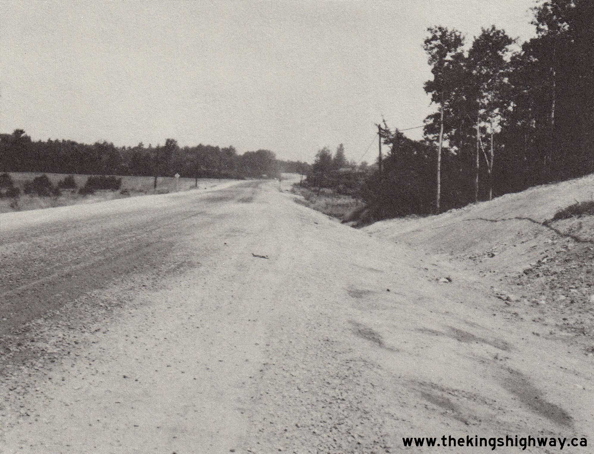
 Left - Completed grading on a reconstructed section of Hwy 129 north of the Hwy 17 Junction at Thessalon. Under Contract #1973-45, about 10 miles of Hwy 129's
route was reconstructed from the Hwy 17 Junction northerly towards Wharncliffe. See an
Enlarged Photo Here. Photo taken in 1974. Left - Completed grading on a reconstructed section of Hwy 129 north of the Hwy 17 Junction at Thessalon. Under Contract #1973-45, about 10 miles of Hwy 129's
route was reconstructed from the Hwy 17 Junction northerly towards Wharncliffe. See an
Enlarged Photo Here. Photo taken in 1974.(Photo courtesy of Ontario Ministry of Transportation - © King's Printer for Ontario, 1974) Right - Reconstruction of Hwy 129 north of the Hwy 554 Junction, about 25 miles north of Thessalon, Contract #1975-59. See an
Enlarged Photo Here. Photo taken in 1975.(Photo courtesy of Ontario Ministry of Transportation - © King's Printer for Ontario, 1975) 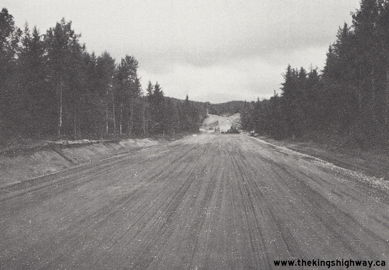
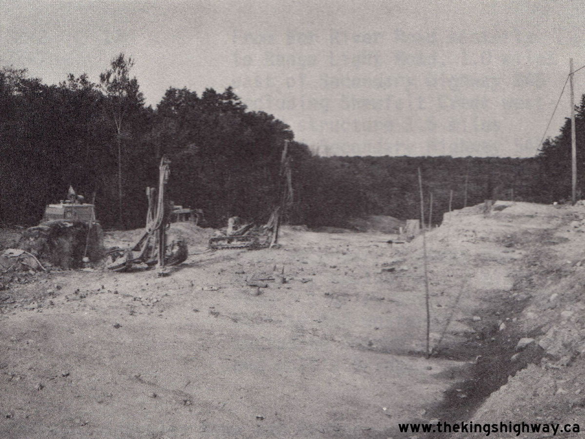
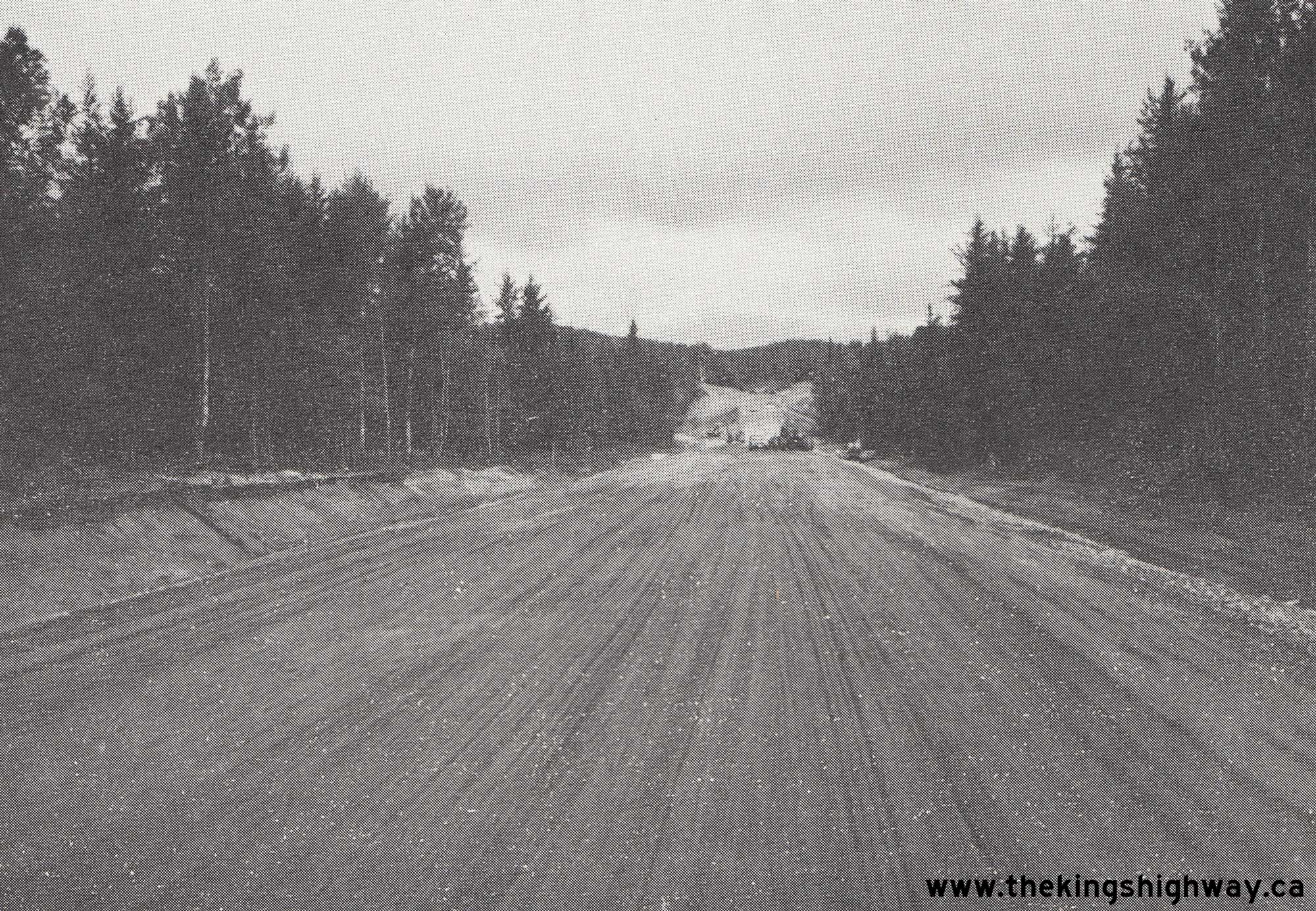
 Left - Construction of the Snowshoe Creek Diversion on Hwy 129, about 12 miles north of the Hwy 554 Junction, Contract #1976-83. See an
Enlarged Photo Here. Photo taken in 1977. Left - Construction of the Snowshoe Creek Diversion on Hwy 129, about 12 miles north of the Hwy 554 Junction, Contract #1976-83. See an
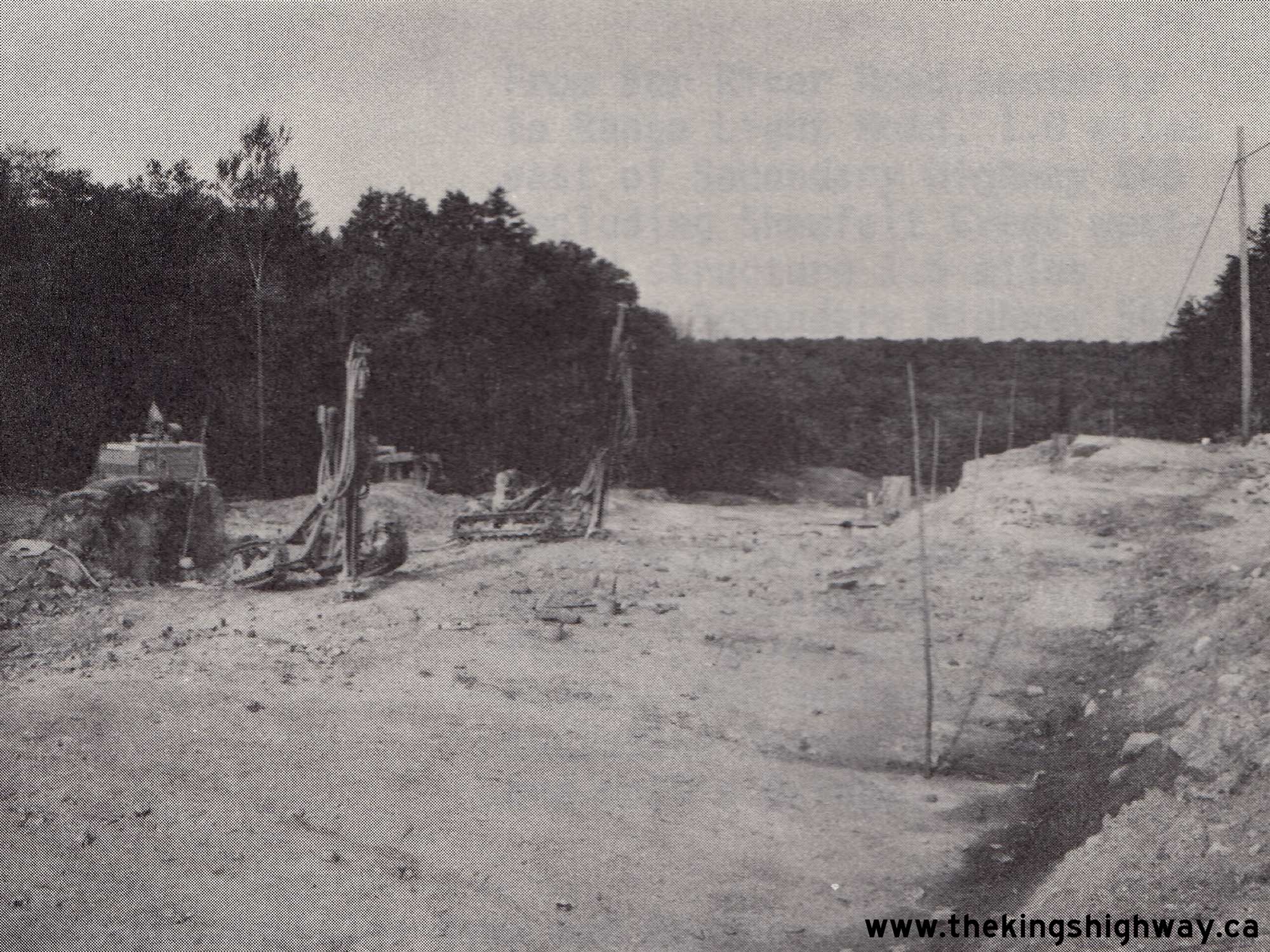
Enlarged Photo Here. Photo taken in 1977.(Photo courtesy of Ontario Ministry of Transportation - © King's Printer for Ontario, 1977) Right - Rock cut excavation on a reconstructed section of Hwy 129, about 35 miles north of the Hwy 554 Junction, Contract #1981-210. See an
Enlarged Photo Here. Photo taken in 1982.(Photo courtesy of Ontario Ministry of Transportation - © King's Printer for Ontario, 1982) 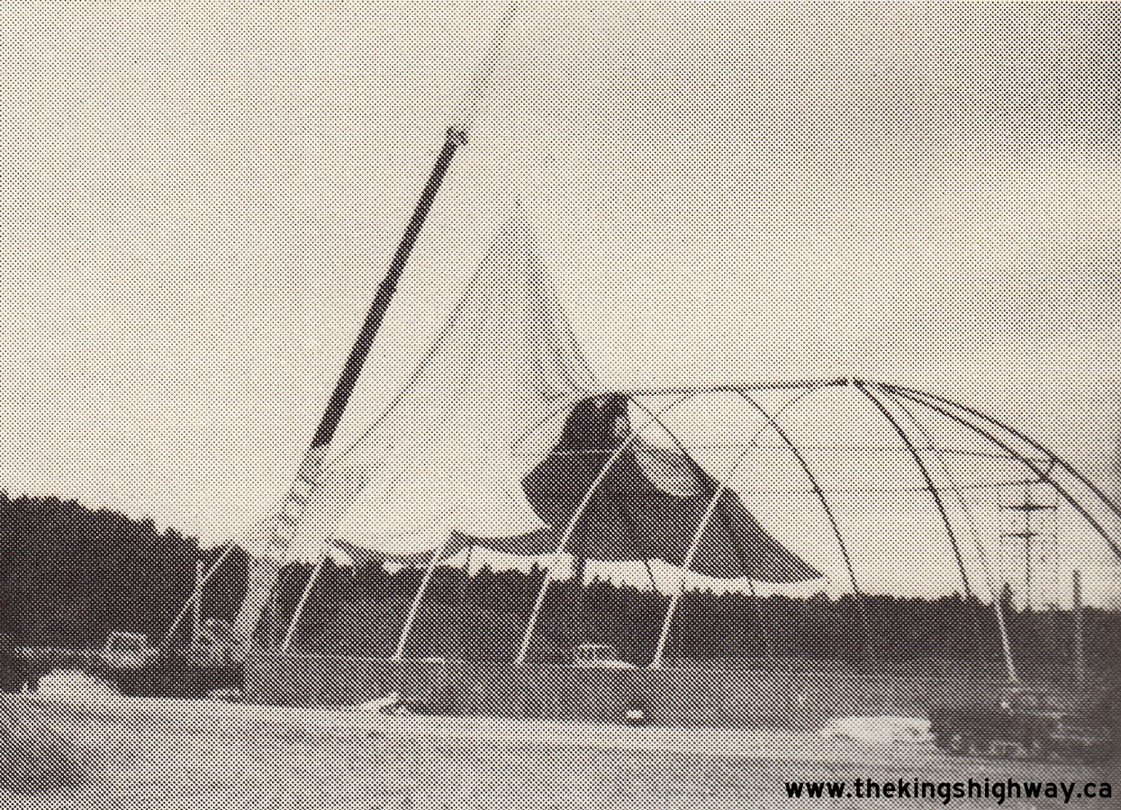
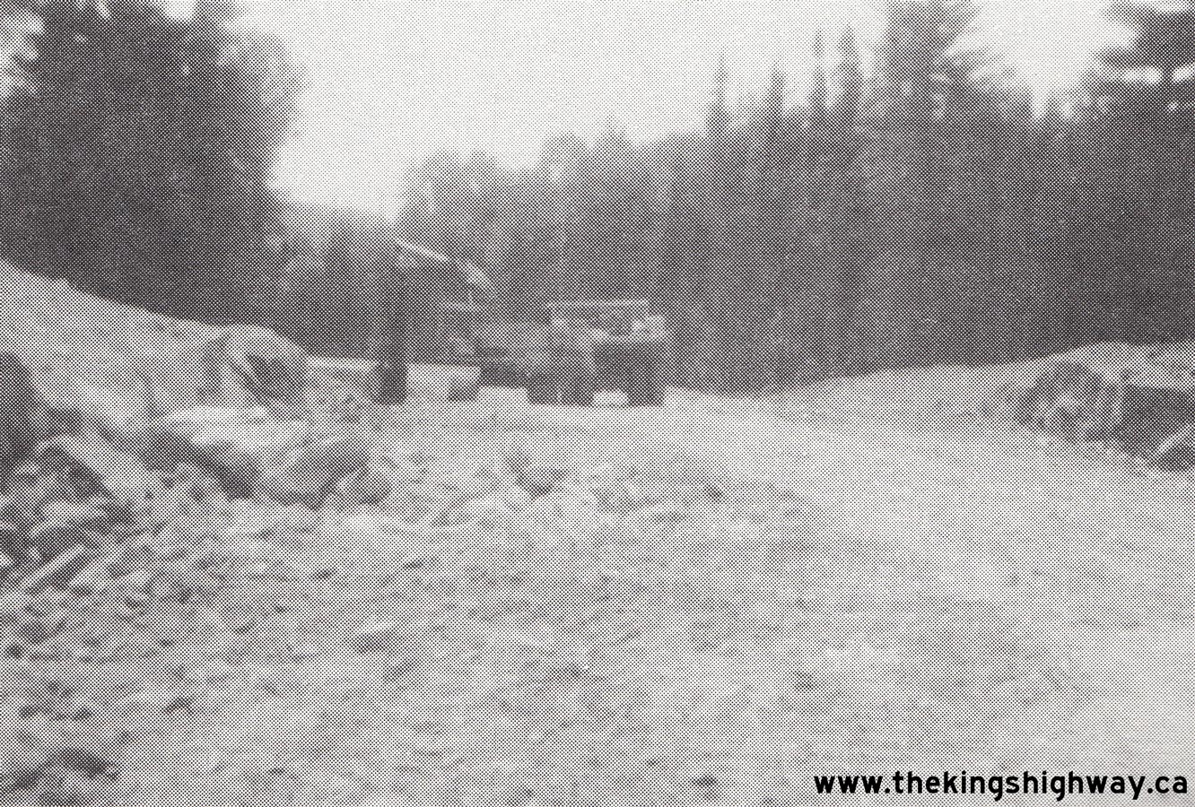
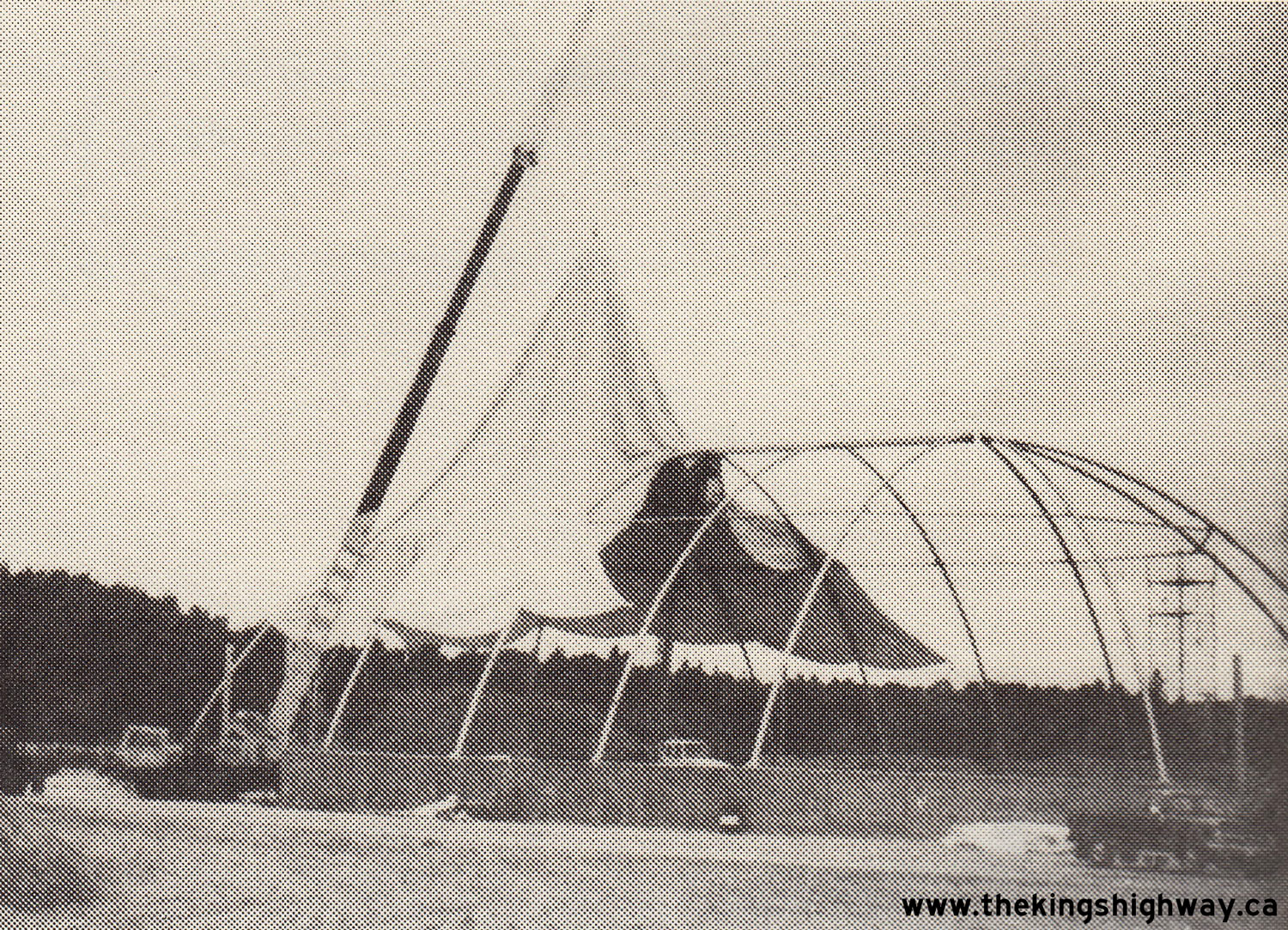
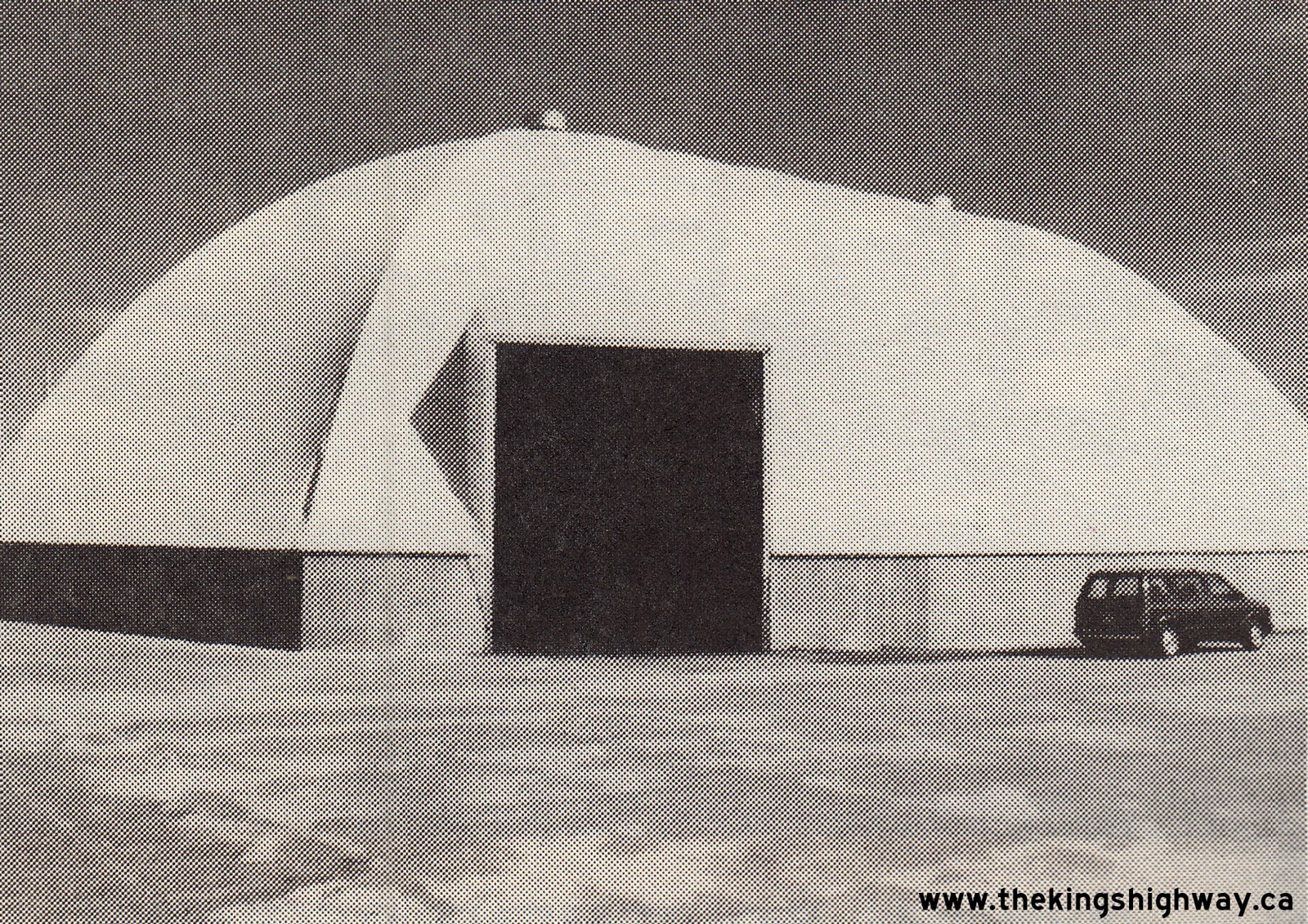
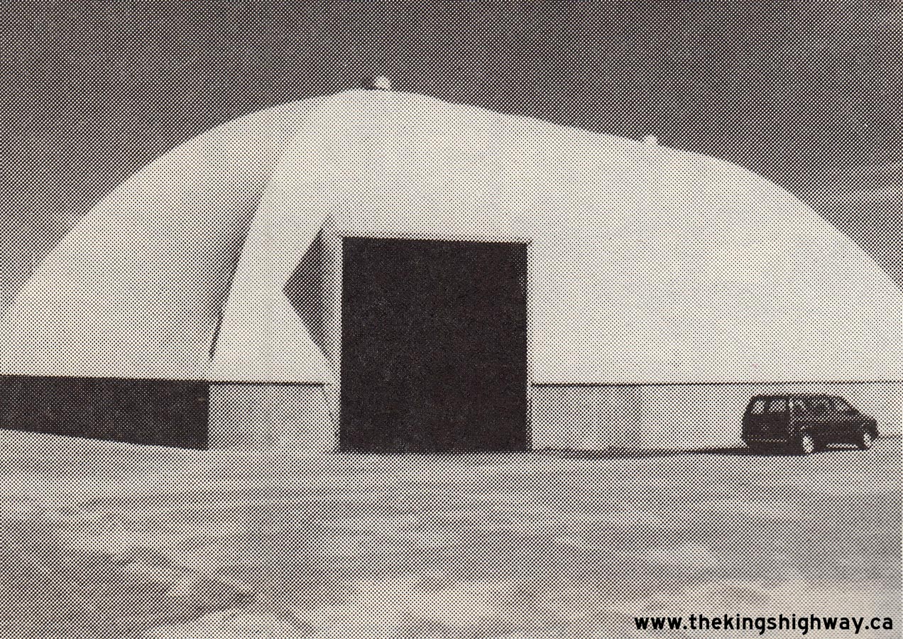 Left - Salt shed under construction at the Chapleau MTO Patrol Yard on Hwy 129. See an
Enlarged Photo Here. Photo taken in 1989. Left - Salt shed under construction at the Chapleau MTO Patrol Yard on Hwy 129. See an
Enlarged Photo Here. Photo taken in 1989.(Photo courtesy of Ontario Ministry of Transportation - © King's Printer for Ontario, 1989) Right - Completed salt shed at the Chapleau MTO Patrol Yard on Hwy 129. See an
Enlarged Photo Here. Photo taken in 1989.(Photo courtesy of Ontario Ministry of Transportation - © King's Printer for Ontario, 1989) |
|---|
|
Present Day King's Highway 129 Photographs


Left - Approaching the Hwy 129 & Hwy 17B Junction in Thessalon, facing west. Until the Thessalon Bypass was completed in 1958, Hwy 17 passed through
Downtown Thessalon. The former alignment of Hwy 17 leading into Thessalon was converted into a long right-turn channelization from northbound Hwy 17B to eastbound
Hwy 17. See an Enlarged Photo Here. (Photograph taken on August 28, 2011 - © Cameron Bevers) Right - Facing west along Hwy 17 (Thessalon Bypass) at the Hwy 129 & Hwy 17B Junction. Compare this present day photo to this 1959 Photo, taken shortly after the Thessalon Bypass was completed and opened to traffic. Not much has changed here since the 1950s. See an Enlarged Photo Here. (Photograph taken on August 28, 2011 - © Cameron Bevers) 

Left - Northern terminus of Hwy 17B at the Hwy 17 & Hwy 129 Junction in Thessalon. Note the right-turn channelization, which leads to eastbound Hwy 17. See
an Enlarged Photo Here. (Photograph taken on August 28, 2011 - © Cameron Bevers) Right - Facing east along Hwy 17 towards Blind River from the Hwy 129 & Hwy 17B Junction in Thessalon. See an Enlarged Photo Here. (Photograph taken on August 28, 2011 - © Cameron Bevers) 

Left - Green guide sign marking the Hwy 129 Junction on westbound Hwy 17 in Thessalon. What this sign doesn't tell you is that it is a very lonely 220 km
journey to Chapleau along Hwy 129. While Hwy 129 is a spectacular route in terms of scenery, it is also extremely isolated. There are no communities along the entire
highway of any significant size other than Chapleau, which lies at Hwy 129's northern terminus. See an
Enlarged Photo Here. (Photograph taken on August 28, 2011 - © Cameron Bevers) Right - Facing east along Hwy 17 towards the Hwy 129 & Hwy 17B Junction in Thessalon. See an Enlarged Photo Here. (Photograph taken on August 28, 2011 - © Cameron Bevers) 

Left - Facing east along Hwy 17 towards the Thessalon River Bridge at the Hwy 129 & Hwy 17B Junction. See an
Enlarged Photo Here. (Photograph taken on August 28, 2011 - © Cameron Bevers) Right - Green guide sign approaching the Hwy 129 Junction in Thessalon. At Chapleau, Hwy 129 connects to Hwy 101, an important east-west highway link across Northeastern Ontario. It is also possible to reconnect with Hwy 17 at Wawa, via Hwy 129 and Hwy 101. This creates a useful alternate route to Hwy 17, in the event that Hwy 17 is closed due to collisions or poor weather conditions. See an Enlarged Photo Here. (Photograph taken on August 28, 2011 - © Cameron Bevers) 

Left - Facing west along Hwy 17 towards the Thessalon River Bridge from the Hwy 17B & Hwy 129 Junction. See an
Enlarged Photo Here. (Photograph taken on August 28, 2011 - © Cameron Bevers) Right - Junction sign assembly at the southern terminus of Hwy 129 at the Hwy 17 & Hwy 17B Junction in Thessalon. See an Enlarged Photo Here. (Photograph taken on August 28, 2011 - © Cameron Bevers) 


Left - Advance junction sign assembly on northbound Hwy 17B departing from Thessalon. See an
Enlarged Photo Here. (Photograph taken on August 28, 2011 - © Cameron Bevers) Centre - Junction sign assembly at the northern terminus of Hwy 17B at the Hwy 17 & Hwy 129 Junction in Thessalon. See an Enlarged Photo Here. (Photograph taken on August 28, 2011 - © Cameron Bevers) Right - Advance junction sign assembly on southbound Hwy 129 approaching the Hwy 17 & Hwy 129 Junction in Thessalon. See an
Enlarged Photo Here.(Photograph taken on July 1, 2006 - © Cameron Bevers) 
 Left - Facing south along Hwy 129 approaching the Hwy 17 & Hwy 17B Junction. See an
Enlarged Photo Here. Left - Facing south along Hwy 129 approaching the Hwy 17 & Hwy 17B Junction. See an
Enlarged Photo Here.(Photograph taken on August 21, 2022 - © Cameron Bevers) Right - Blue-and-white municipal boundary sign at the northern limits to Thessalon on Hwy 129. See an
Enlarged Photo Here.(Photograph taken on August 21, 2022 - © Cameron Bevers) 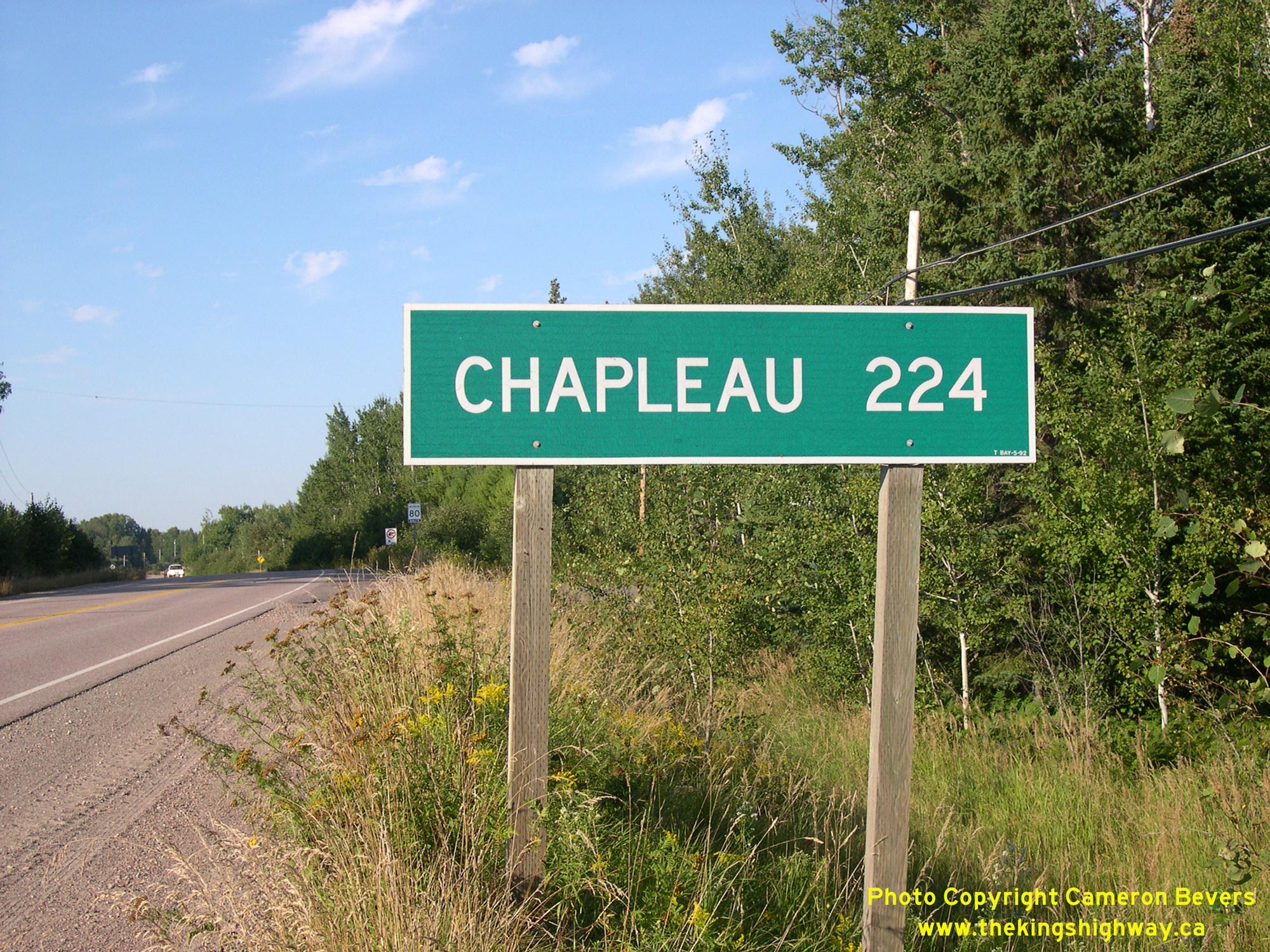
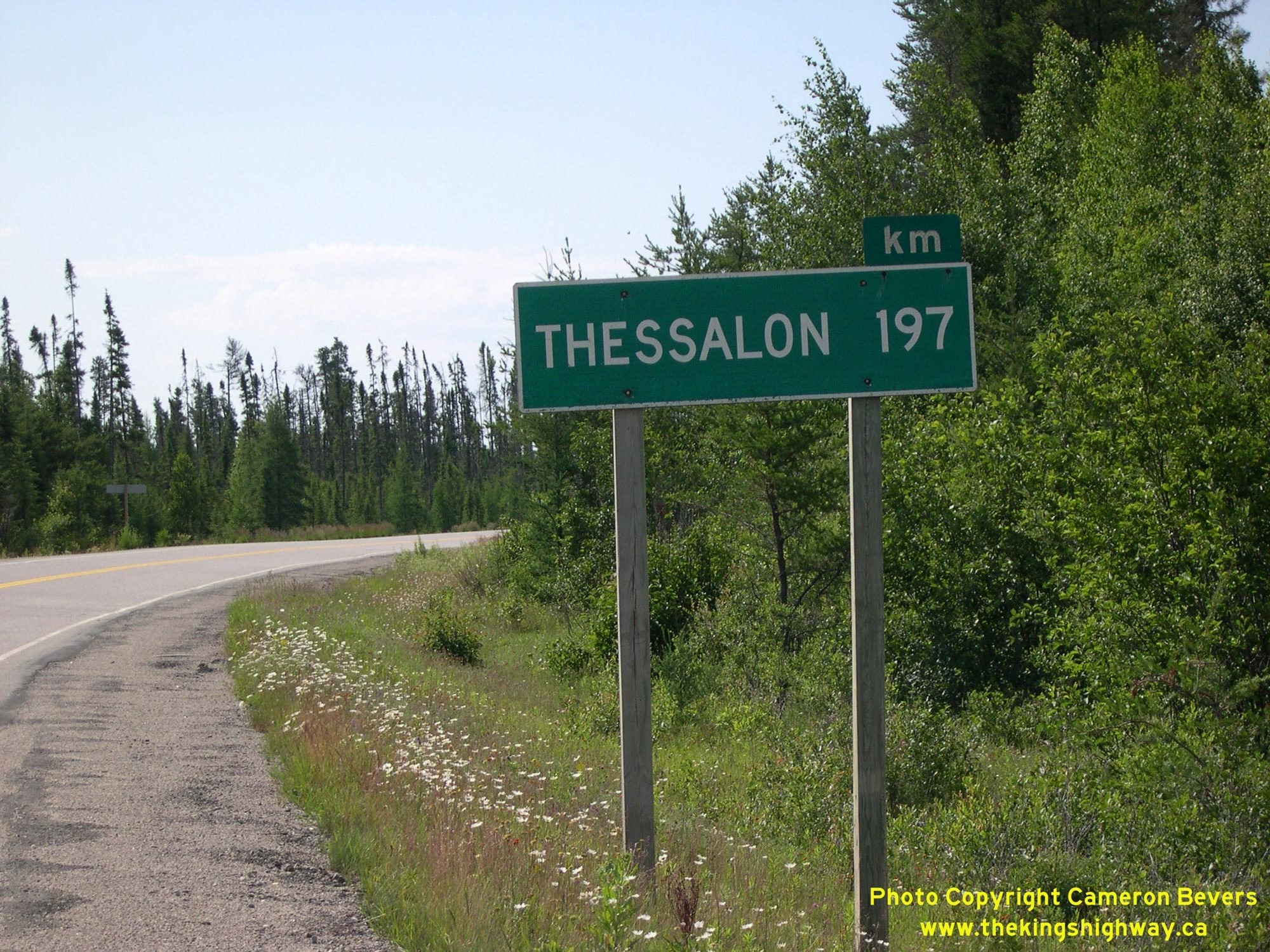
 Left - Distance guide sign on northbound Hwy 129 departing from Thessalon. The route of Hwy 129 passes through a virtually unpopulated part of Ontario. There
are no settlements of any significant size along Hwy 129 between Thessalon and Chapleau. Only three minor Secondary Highways (Hwy 554, Hwy 556 and Hwy 667) intersect
with Hwy 129 between Hwy 17 and the Hwy 101 Junction, which lies over 200 km to the north. See an
Enlarged Photo Here. Left - Distance guide sign on northbound Hwy 129 departing from Thessalon. The route of Hwy 129 passes through a virtually unpopulated part of Ontario. There
are no settlements of any significant size along Hwy 129 between Thessalon and Chapleau. Only three minor Secondary Highways (Hwy 554, Hwy 556 and Hwy 667) intersect
with Hwy 129 between Hwy 17 and the Hwy 101 Junction, which lies over 200 km to the north. See an
Enlarged Photo Here.(Photograph taken on September 1, 2008 - © Cameron Bevers) Right - Facing north along Hwy 129 towards the small rural community of Little Rapids, located about 3 km north of Thessalon. See an
Enlarged Photo Here.(Photograph taken on September 1, 2008 - © Cameron Bevers) 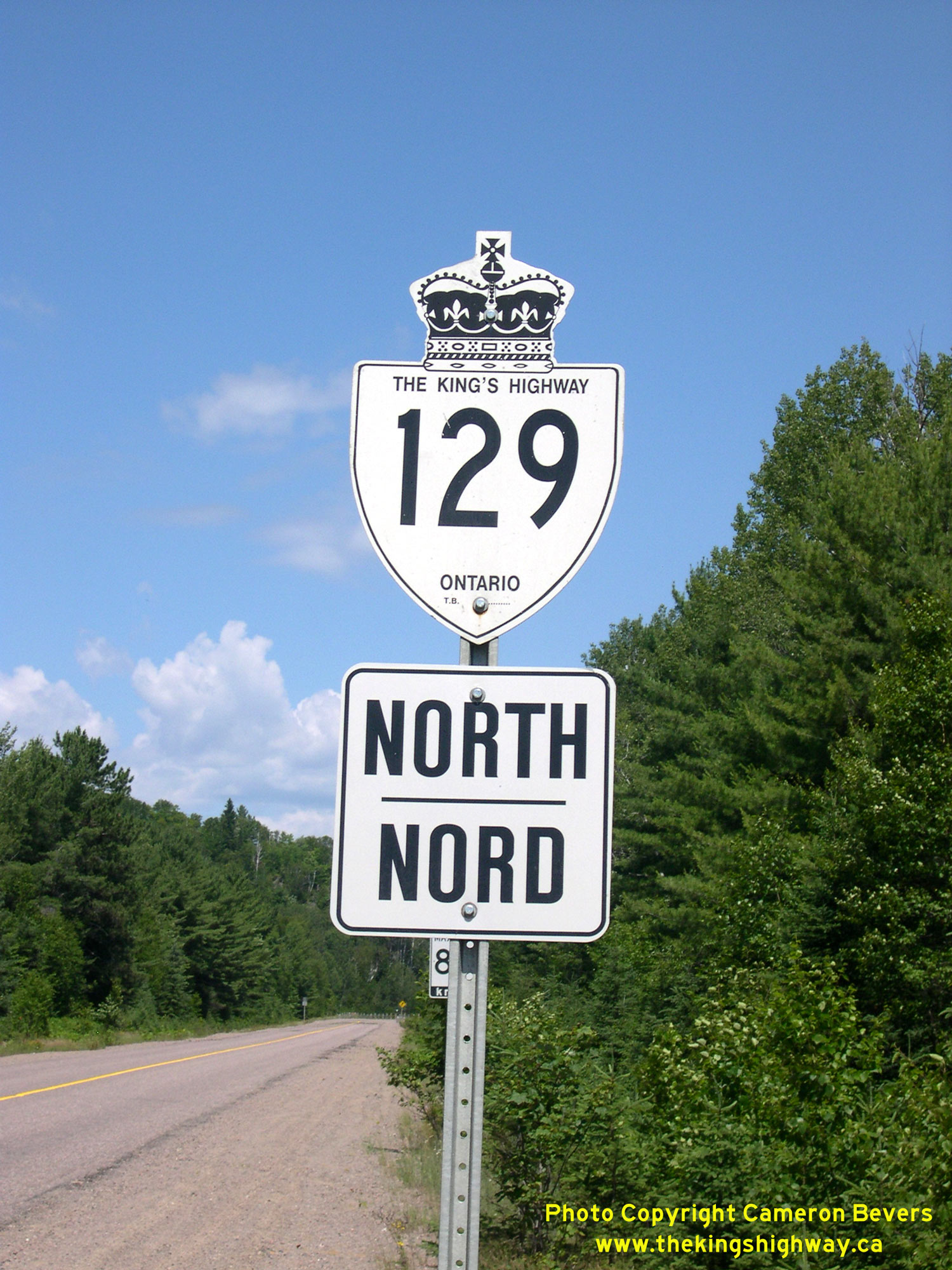 Above - An older King's Highway 129 route marker located near the Hwy 554 Junction north of Wharncliffe. See an
Enlarged Photo Here. Above - An older King's Highway 129 route marker located near the Hwy 554 Junction north of Wharncliffe. See an
Enlarged Photo Here.(Photograph taken on July 17, 2007 - © Cameron Bevers) 

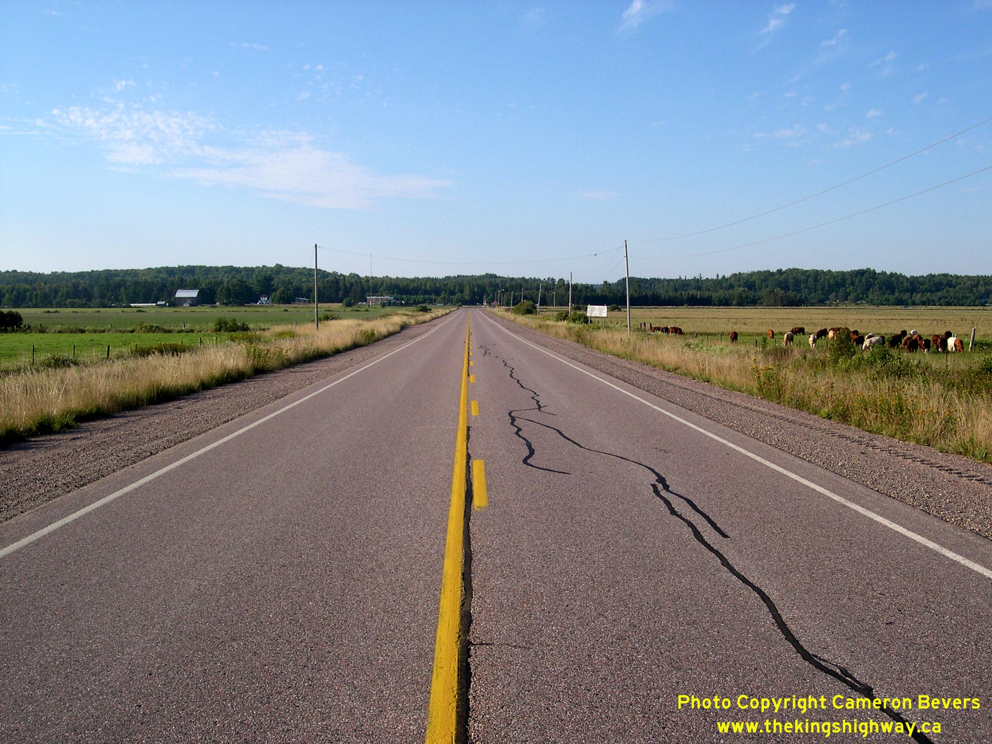
Left - Facing north along Hwy 129 from the Hwy 554 Junction north of Thessalon. The mileage sign at right indicates that it is nearly 200 km to Chapleau. This
highway passes through a vast unpopulated region of forests and lakes. It is also one of the loneliest King's Highways in Ontario, with a daily traffic volume of
approximately 200 vehicles per day on the central section near Aubrey Falls. See an
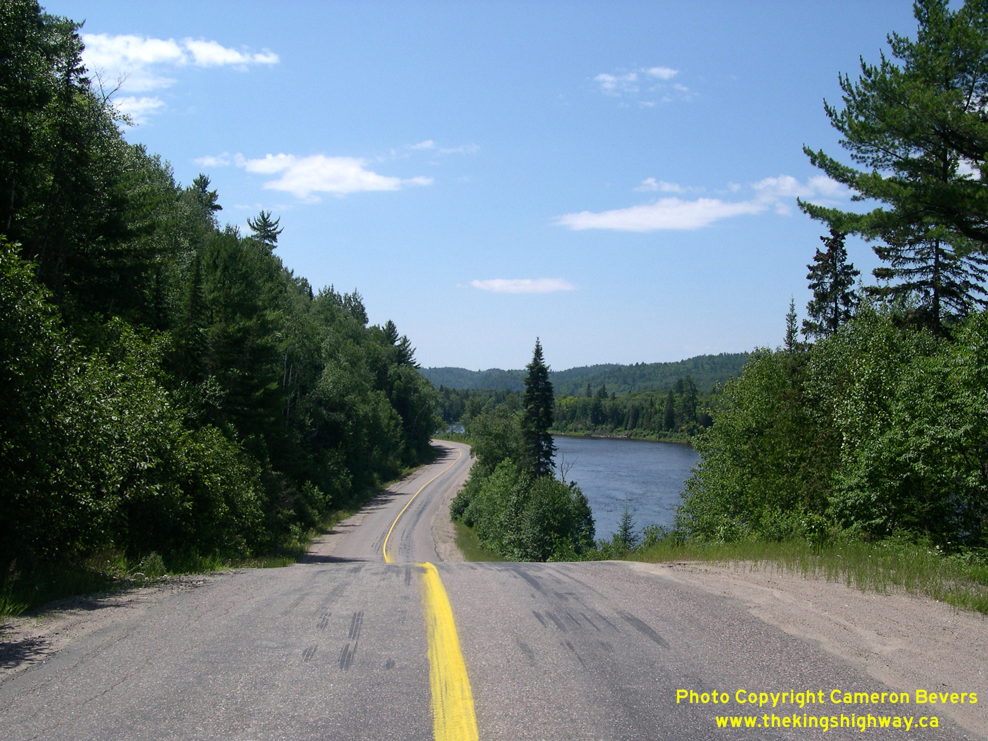
Enlarged Photo Here. (Photograph taken on July 17, 2007 - © Cameron Bevers) Right - Motorists who are not intimidated by long and desolate highways will be rewarded with spectacular scenery along Hwy 129. Here, the highway hugs the beautiful Mississagi River on its long journey north to Chapleau. Road enthusiasts will find Hwy 129 very interesting, due to its unique design features and rugged northern setting. See an Enlarged Photo Here. (Photograph taken on July 17, 2007 - © Cameron Bevers) 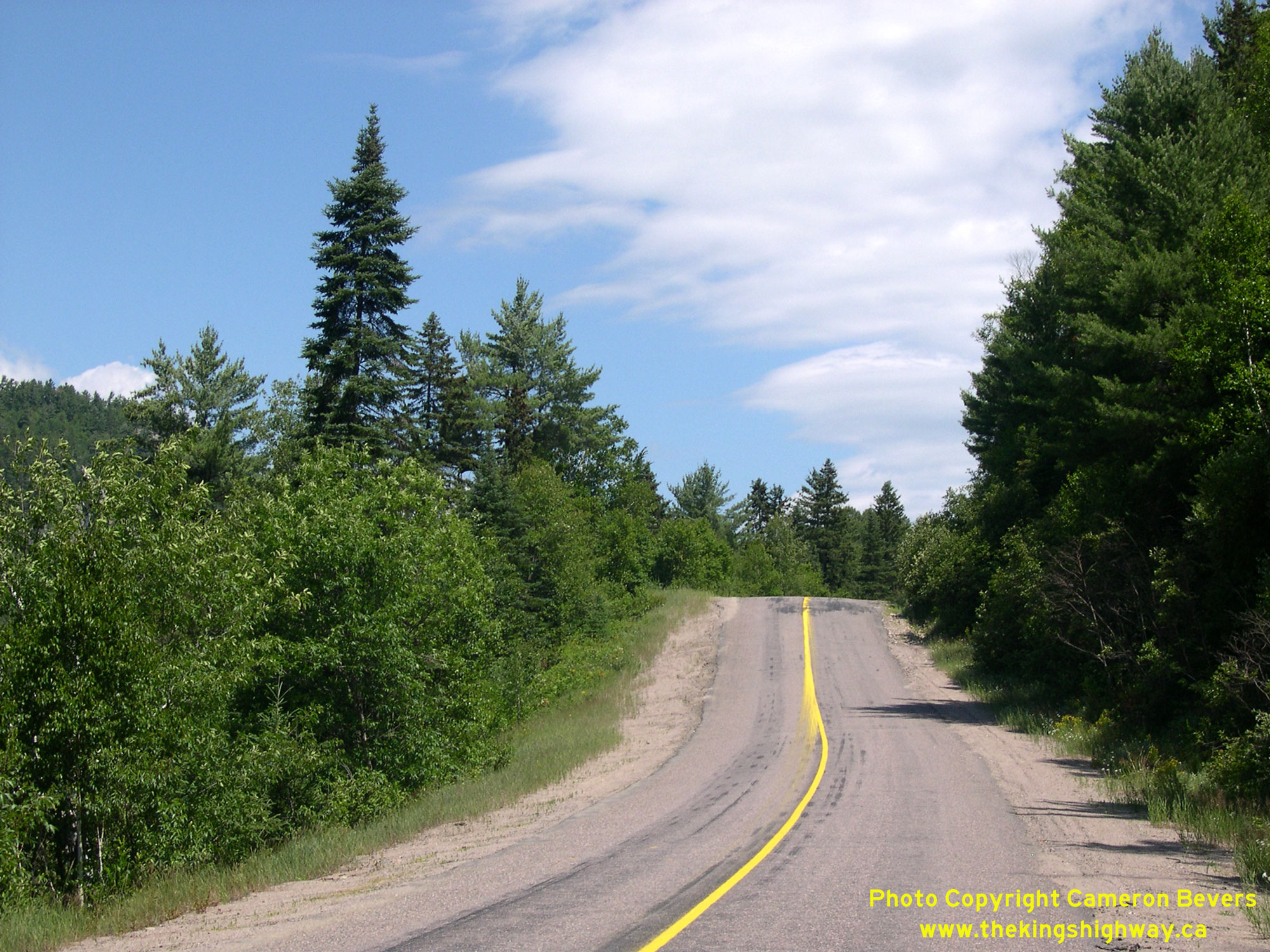
Left - The constrained highway right-of-way along the Mississagi River has dictated some less-than-ideal highway geometry in places. This very steep vertical
grade might surprise an inattentive motorist. Given the topography of this area, this section of Hwy 129 was never really upgraded after its initial construction. It
still resembles a low-volume Secondary Highway, as opposed to a King's Highway. See an
Enlarged Photo Here. (Photograph taken on July 17, 2007 - © Cameron Bevers) Right - Looking down the vertical grade on Hwy 129. This vertical grade more or less follows the original ground line and therefore does not have a parabolic profile. Parabolic shaped vertical curves are used on all reconstructed highways to avoid situations like this one, where the highway ahead suddenly disappears from the motorist's view as the vehicle reaches the crest of the hill. While this steep grade is certainly not ideal, the traffic volumes on Hwy 129 are so low that it probably doesn't pose much of a problem. Compare this photo to this Historical 1951 Photo, which was taken from the top of the same hill over 55 years earlier. See an Enlarged Photo Here. (Photograph taken on July 17, 2007 - © Cameron Bevers) 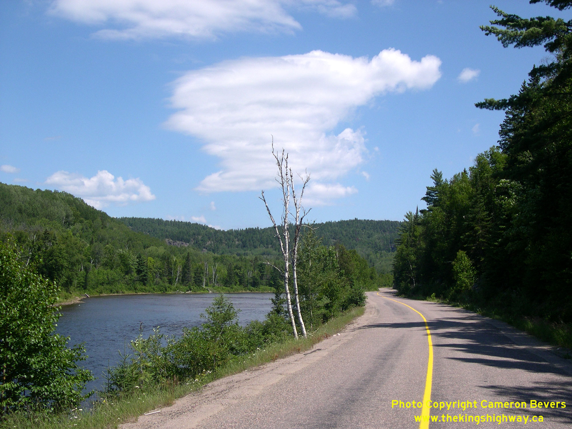
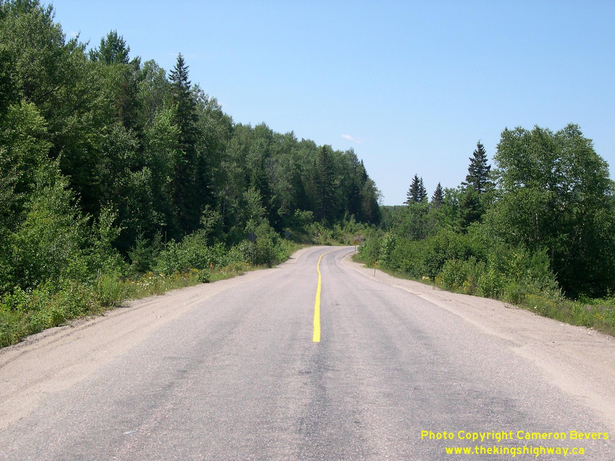
Left - Facing north along Hwy 129 towards Chapleau along the Mississagi River. The winding narrow lanes and coarse asphalt resulting from surface treatment seen
along this section of Hwy 129 are more commonly found on Ontario's Secondary Highways and are rarely seen on King's Highways. This highway's design is a function of
its incredibly low traffic volumes and difficult surrounding topography. Any major upgrades to this highway would be very costly to construct. See an
Enlarged Photo Here. (Photograph taken on July 17, 2007 - © Cameron Bevers) Right - Facing south towards Thessalon from the Rapid River Bridge on Hwy 129. The centreline of the highway stops just before the one-lane structure. See an Enlarged Photo Here. (Photograph taken on July 17, 2007 - © Cameron Bevers) 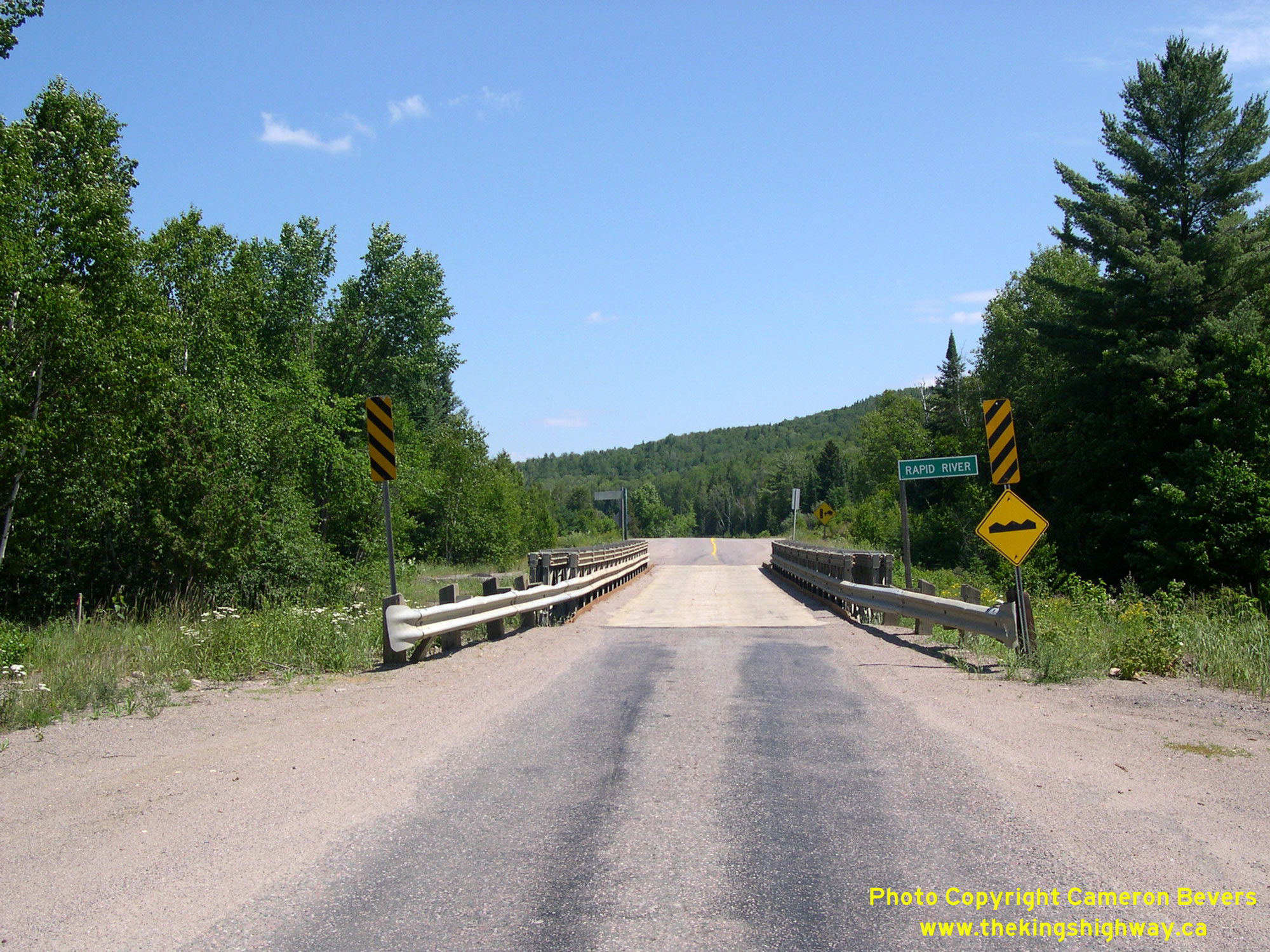
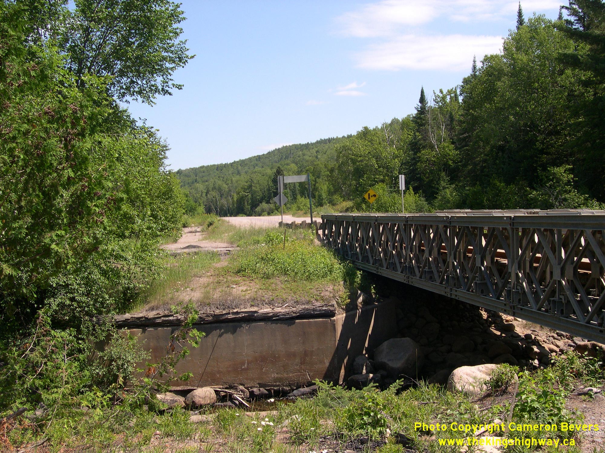
Left - Rapid River Bridge on Hwy 129 located about 79 km north of Thessalon, facing north towards Chapleau. See an
Enlarged Photo Here. (Photograph taken on July 17, 2007 - © Cameron Bevers) Right - Former bridge abutments at the Rapid River. The abandoned concrete abutments of a much earlier timber beam structure are visible to the left of a newer Bailey Bridge at right. See an Enlarged Photo Here. (Photograph taken on July 17, 2007 - © Cameron Bevers) 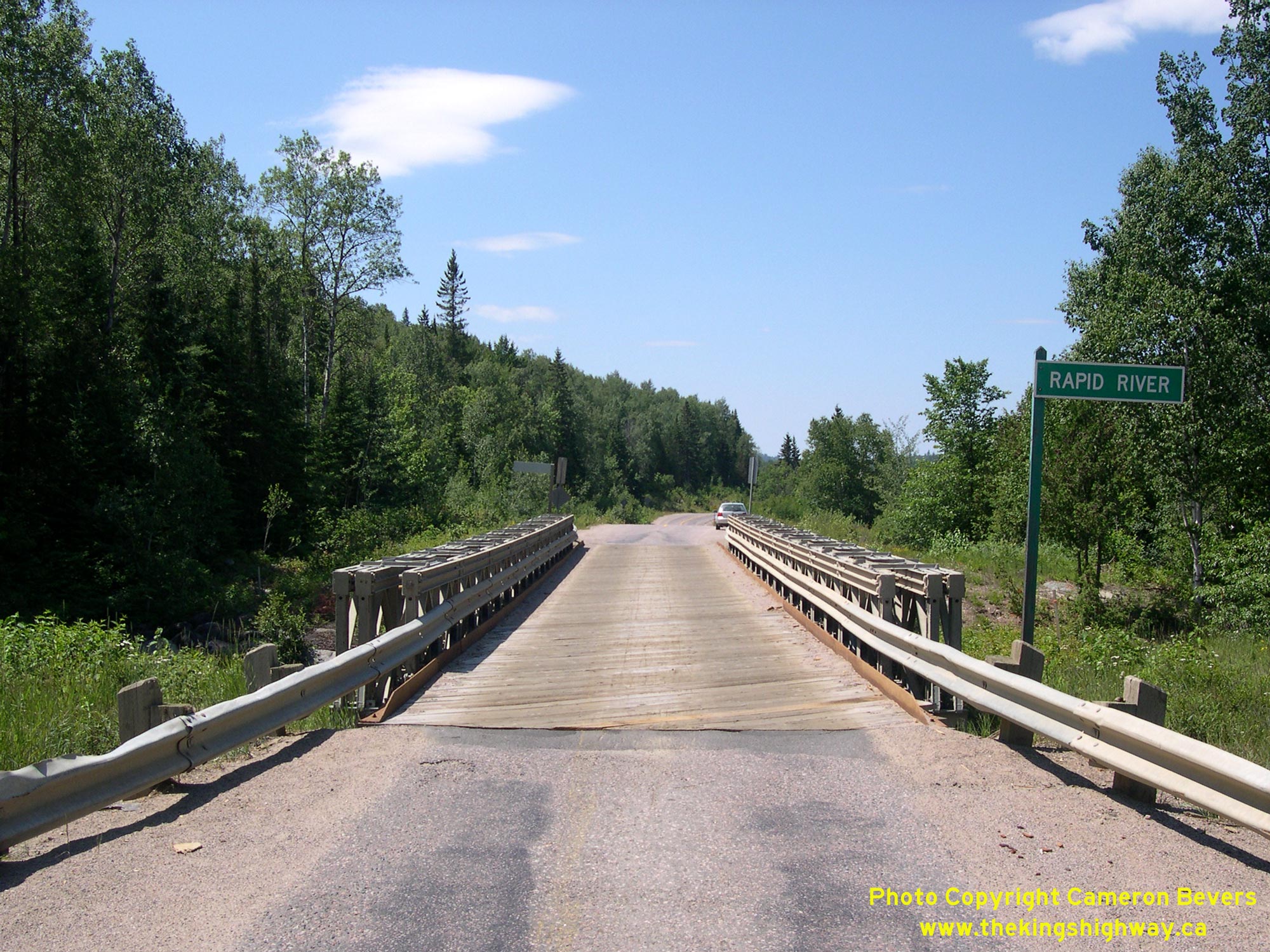
Left - Facing south towards Thessalon at the Rapid River Bridge on Hwy 129. One-lane bridges on the King's Highways are very rare and are normally controlled
by traffic signals to alternate traffic flow. However, traffic volumes on Hwy 129 are so low that the uncontrolled one-lane bridge operation does not pose any
significant issues. There is also no available local power supply to install traffic signals here. See an
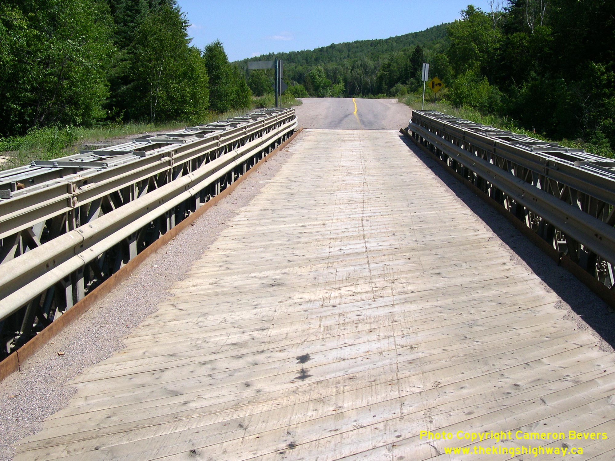
Enlarged Photo Here. (Photograph taken on July 17, 2007 - © Cameron Bevers) Right - Close-up of the timber decking on the Rapid River Bridge on Hwy 129 north of Thessalon. See an Enlarged Photo Here. (Photograph taken on July 17, 2007 - © Cameron Bevers) 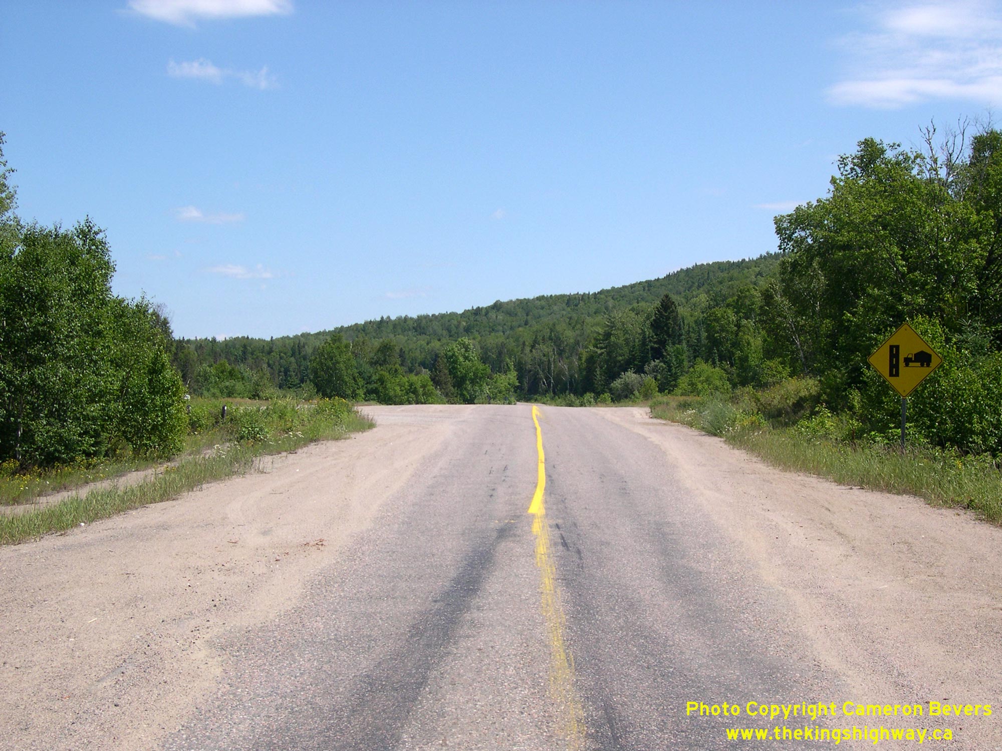
Left - Facing north towards Chapleau from the Rapid River Bridge on Hwy 129. See an
Enlarged Photo Here. (Photograph taken on July 17, 2007 - © Cameron Bevers) Right - Facing north along Hwy 129 towards Chapleau at the Mississagi River Bridge at Aubrey Falls. This structure was built on a greatly-improved alignment of
Hwy 129. A 2 km diversion was built in the 1960s to bypass an older one-lane Bailey bridge across the Mississagi River with a crooked alignment on both approaches to
the bridge. See an Enlarged Photo Here.(Photograph taken on July 17, 2007 - © Cameron Bevers) 
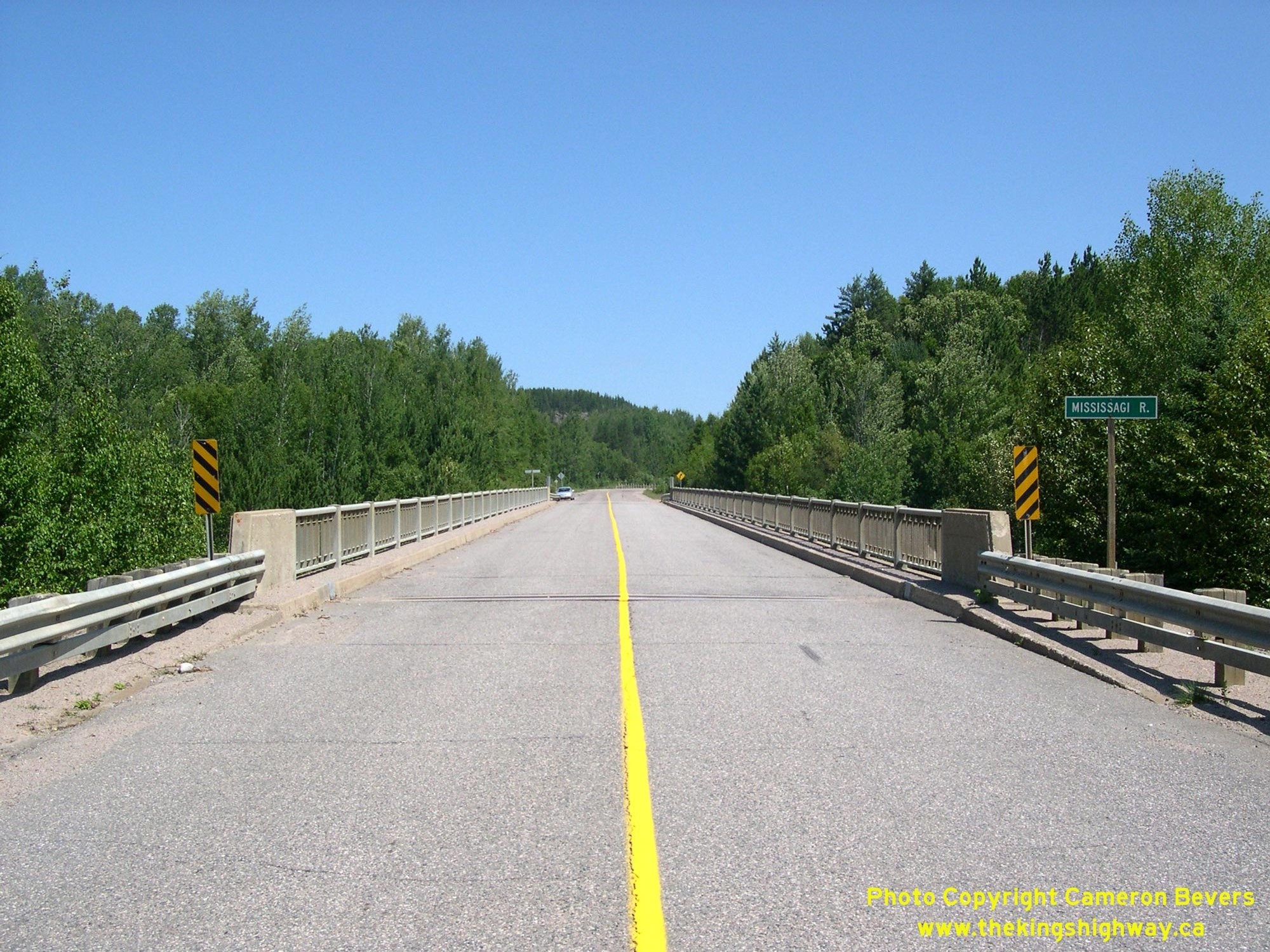
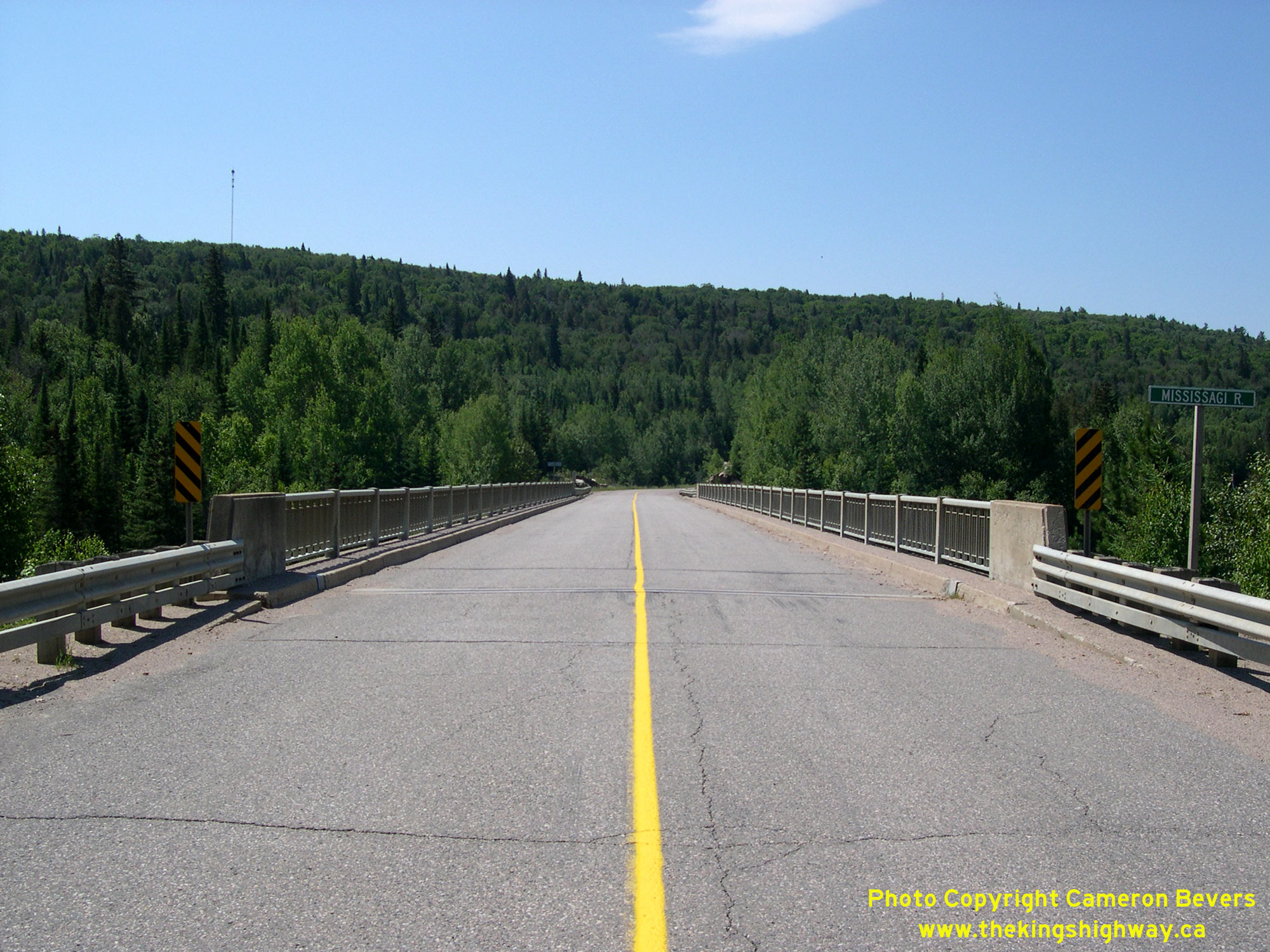
 Left - Mississagi River Bridge on Hwy 129 at Aubrey Falls, located about 100 km north of Thessalon. This three-span steel deck truss structure was built
under Contract #1965-07 and was completed in 1967. It marked the last time a steel deck truss highway bridge was completed by the Department of Highways of Ontario
(DHO). Until recent decades, the steel truss design was the only practical way for engineers to construct long-span highway bridges. Advances in concrete bridge
construction technology during the 1960s provided engineers with alternatives to truss bridge designs, using either precast girders or post-tensioned bridge
construction techniques. See an Enlarged Photo Here. Left - Mississagi River Bridge on Hwy 129 at Aubrey Falls, located about 100 km north of Thessalon. This three-span steel deck truss structure was built
under Contract #1965-07 and was completed in 1967. It marked the last time a steel deck truss highway bridge was completed by the Department of Highways of Ontario
(DHO). Until recent decades, the steel truss design was the only practical way for engineers to construct long-span highway bridges. Advances in concrete bridge
construction technology during the 1960s provided engineers with alternatives to truss bridge designs, using either precast girders or post-tensioned bridge
construction techniques. See an Enlarged Photo Here.(Photograph taken on July 17, 2007 - © Cameron Bevers) Right - Below-deck view of the steel truss superstructure of the Mississagi River Bridge on Hwy 129 at Aubrey Falls. This bridge consists of a continuous
Warren-type deck truss superstructure, supported on two concrete piers situated on the riverbanks. See an
Enlarged Photo Here.(Photograph taken on July 17, 2007 - © Cameron Bevers) 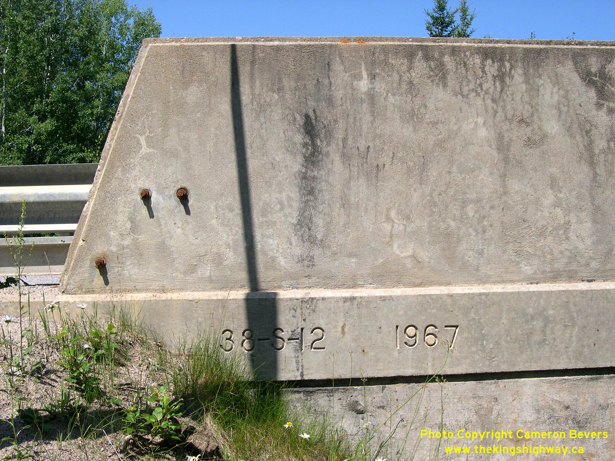
 Left - Date stamp (1967) and structure identification number (Site #38S-12) on the Mississagi River Bridge on Hwy 129. See an
Enlarged Photo Here. Left - Date stamp (1967) and structure identification number (Site #38S-12) on the Mississagi River Bridge on Hwy 129. See an
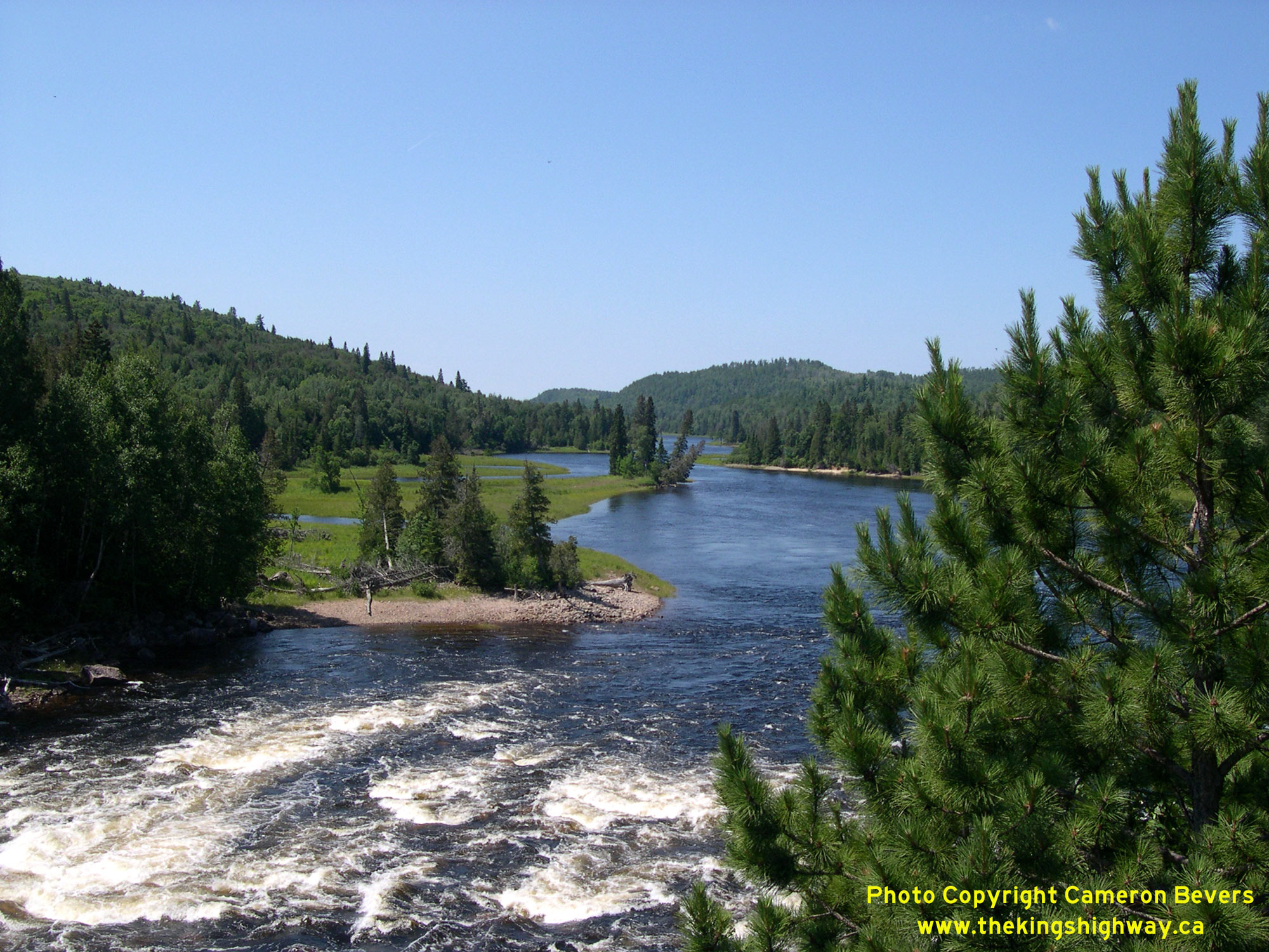
Enlarged Photo Here.(Photograph taken on July 17, 2007 - © Cameron Bevers) Right - Scenic view of the Mississagi River from the Aubrey Falls Bridge on Hwy 129, located about 100 km north of Thessalon. See an
Enlarged Photo Here.(Photograph taken on July 17, 2007 - © Cameron Bevers) 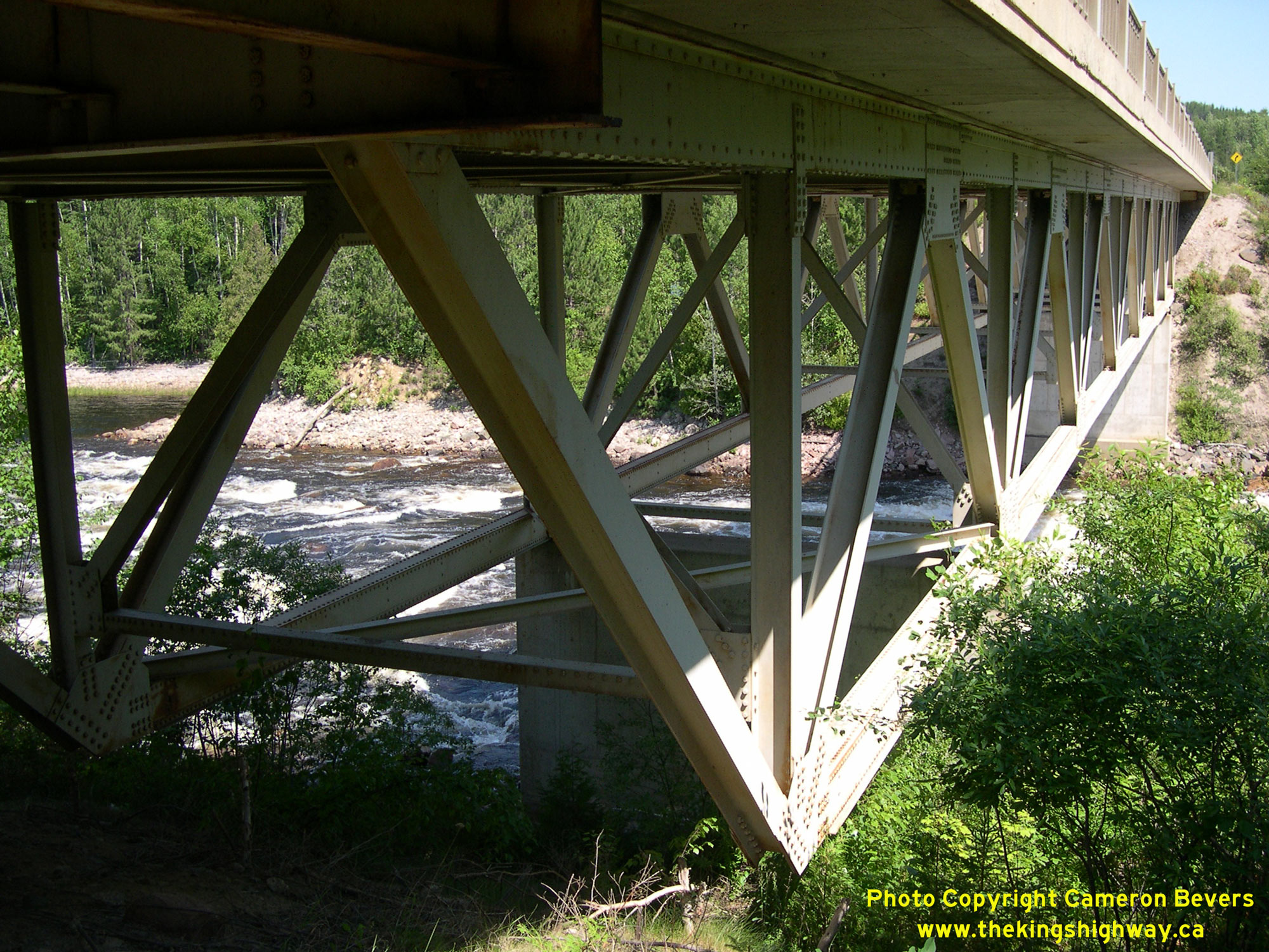
 Left - Eastern side of the Mississagi River Bridge on Hwy 129, showing the cantilevered end of the steel deck truss superstructure. See an
Enlarged Photo Here. Left - Eastern side of the Mississagi River Bridge on Hwy 129, showing the cantilevered end of the steel deck truss superstructure. See an
Enlarged Photo Here.(Photograph taken on July 17, 2007 - © Cameron Bevers) Right - Facing south along Hwy 129 towards Thessalon at the Mississagi River Bridge at Aubrey Falls. See an
Enlarged Photo Here.(Photograph taken on July 17, 2007 - © Cameron Bevers) 
 Left - Close-up view of the steel handrail design on the Mississagi River Bridge. After being used on countless highway bridges in Ontario since the mid-1930s,
this handrail design was phased out by the late 1960s and replaced by other designs. See an
Enlarged Photo Here. Left - Close-up view of the steel handrail design on the Mississagi River Bridge. After being used on countless highway bridges in Ontario since the mid-1930s,
this handrail design was phased out by the late 1960s and replaced by other designs. See an
Enlarged Photo Here.(Photograph taken on July 17, 2007 - © Cameron Bevers) Right - Facing north along Hwy 129 towards Chapleau from Peshu Lake Road, located about 5 km north of Aubrey Falls. Although one would never guess by looking
at this forested area today, this region was the site of the worst forest wildfire in Ontario's history. For several months in the Spring and Summer of 1948, the
Great Mississagi Fire consumed over 200,000 hectares (or over 2,000 square-km) of forest by the time the flames finally subsided. The unprecedented inferno was
reportedly the end result of a single trapper's campfire which accidentally spread out-of-control and ignited the surrounding forest ablaze on May 25, 1948. See an
Enlarged Photo Here.(Photograph taken on July 17, 2007 - © Cameron Bevers) 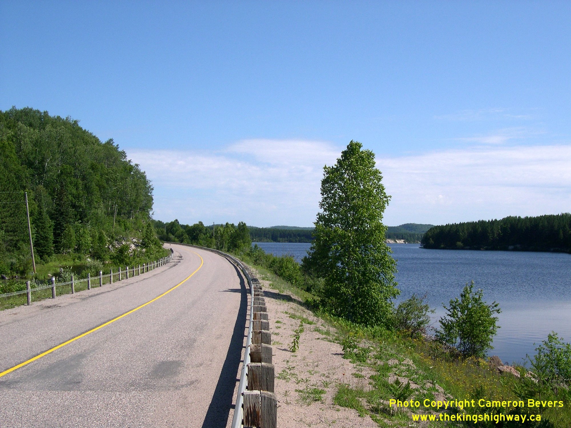
 Left - View of the Wenebegon River from Hwy 129, about 10 km north of Aubrey Falls. See an
Enlarged Photo Here. Left - View of the Wenebegon River from Hwy 129, about 10 km north of Aubrey Falls. See an
Enlarged Photo Here.(Photograph taken on July 17, 2007 - © Cameron Bevers) Right - Facing south along Hwy 129 towards Aubrey Falls at an unnamed lake, located about 54 km south of the Hwy 667 Junction. See an
Enlarged Photo Here.(Photograph taken on July 17, 2007 - © Cameron Bevers) 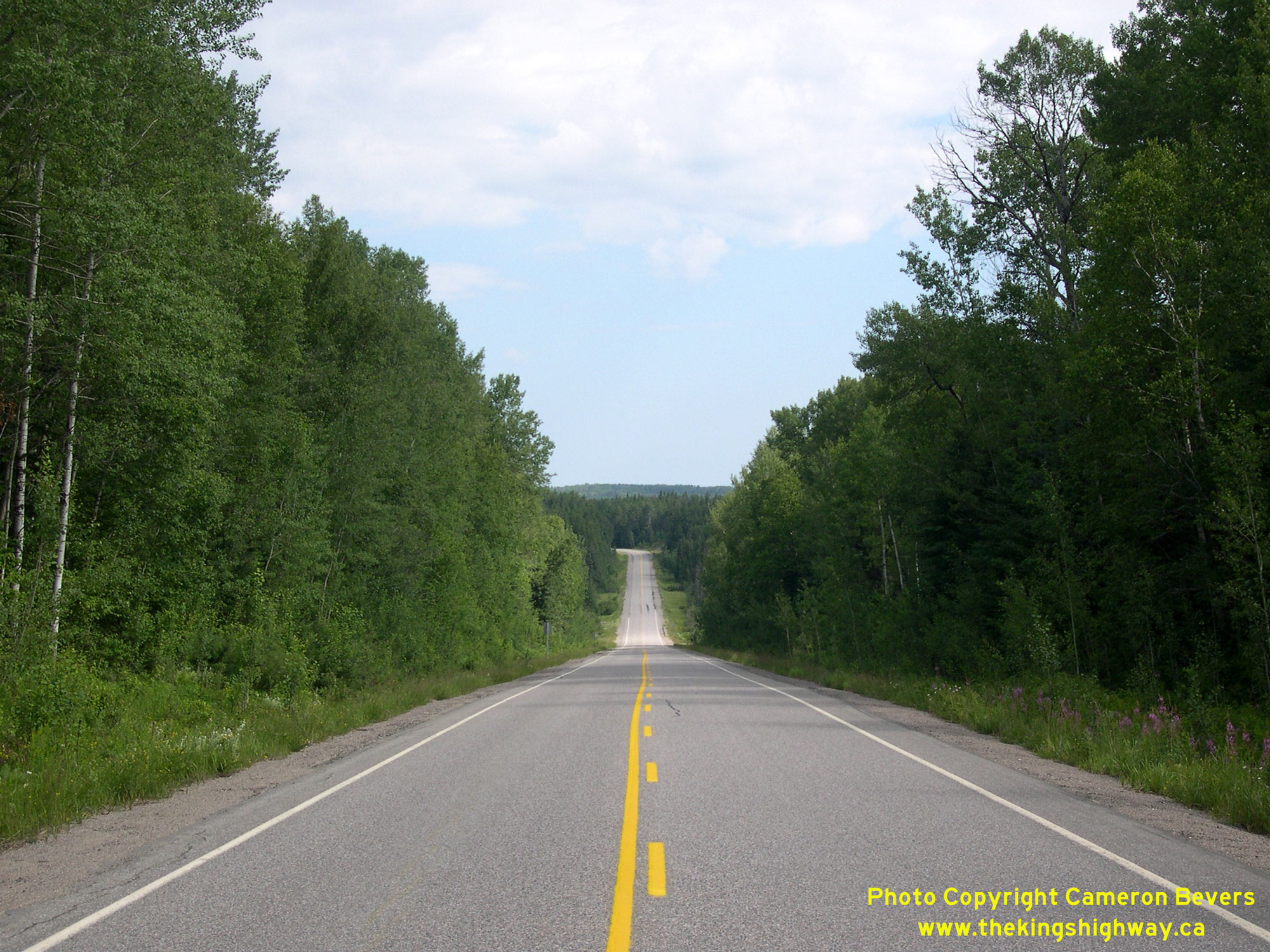
 Left - Facing north towards Chapleau along Hwy 129 near Chene Lake, located about 21 km south of the Hwy 667 Junction. See an
Enlarged Photo Here. Left - Facing north towards Chapleau along Hwy 129 near Chene Lake, located about 21 km south of the Hwy 667 Junction. See an
Enlarged Photo Here.(Photograph taken on July 17, 2007 - © Cameron Bevers) Right - Distance guide sign on southbound Hwy 129 at the Hwy 667 Junction south of Chapleau. This older distance sign still has an educational "km" tab affixed
to it. After Ontario's highways converted to Metric measurements in 1977, these tabs were placed on all distance guide signs to advise motorists that the distances
shown were in kilometres, not miles. Although once plentiful, these educational "km" tabs have been gradually removed over the decades and are now very rarely seen.
See an Enlarged Photo Here.(Photograph taken on July 17, 2007 - © Cameron Bevers) 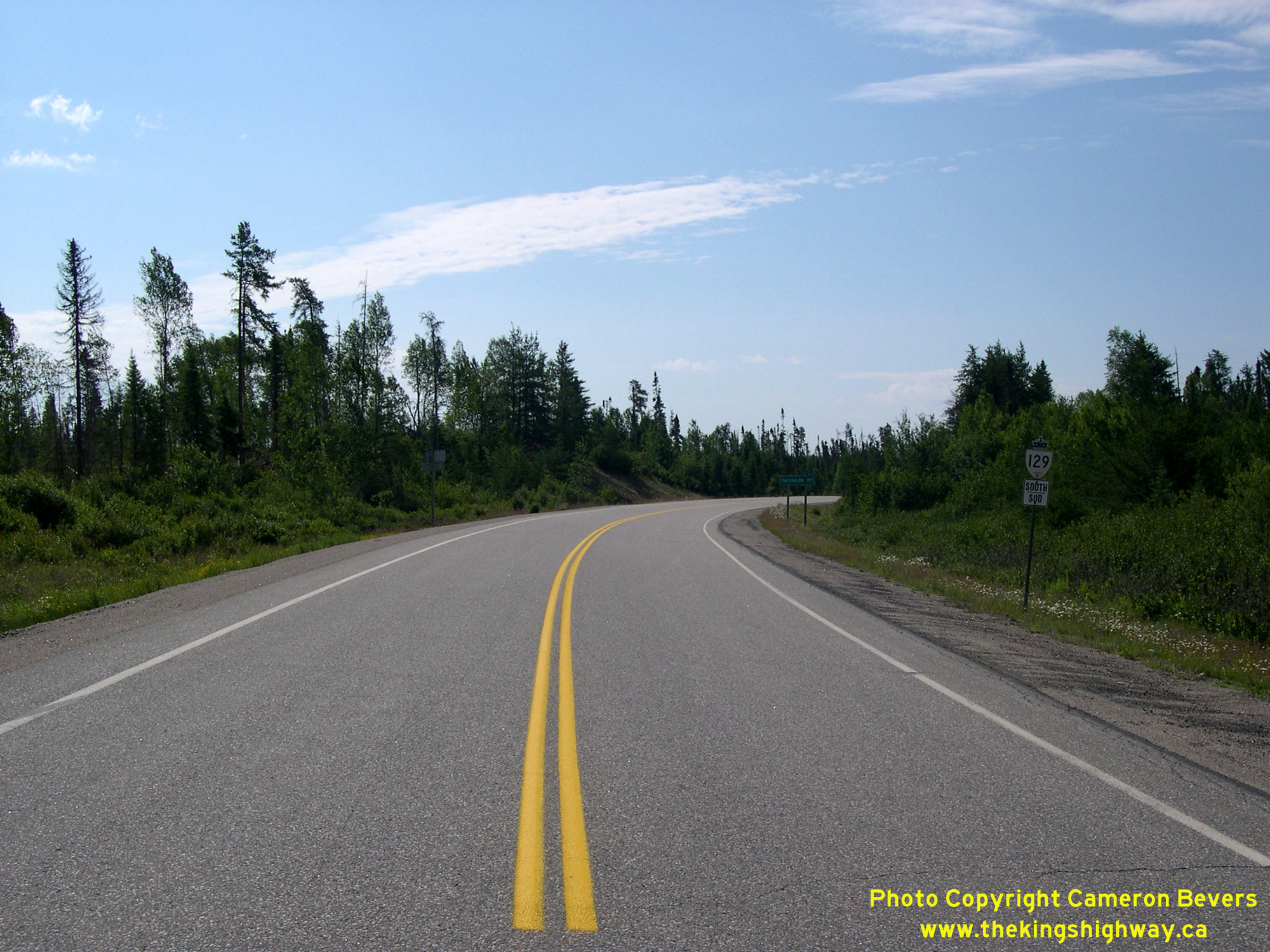
 Left - View of Hwy 129 facing south towards Thessalon from the Hwy 667 Junction. See an
Enlarged Photo Here. Left - View of Hwy 129 facing south towards Thessalon from the Hwy 667 Junction. See an
Enlarged Photo Here.(Photograph taken on July 17, 2007 - © Cameron Bevers) Right - Facing north along Hwy 129 towards Chapleau from the Hwy 667 Junction. See an
Enlarged Photo Here.(Photograph taken on July 17, 2007 - © Cameron Bevers) 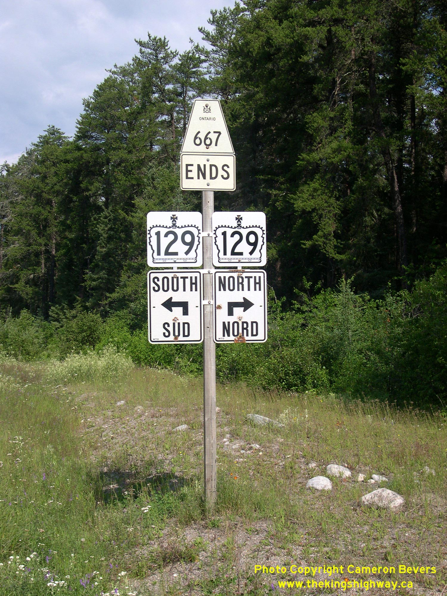 Above - Junction sign assembly approaching the western terminus of Hwy 667 at the Hwy 129 Junction south of Chapleau. See an
Enlarged Photo Here. Above - Junction sign assembly approaching the western terminus of Hwy 667 at the Hwy 129 Junction south of Chapleau. See an
Enlarged Photo Here.(Photograph taken on July 17, 2007 - © Cameron Bevers) 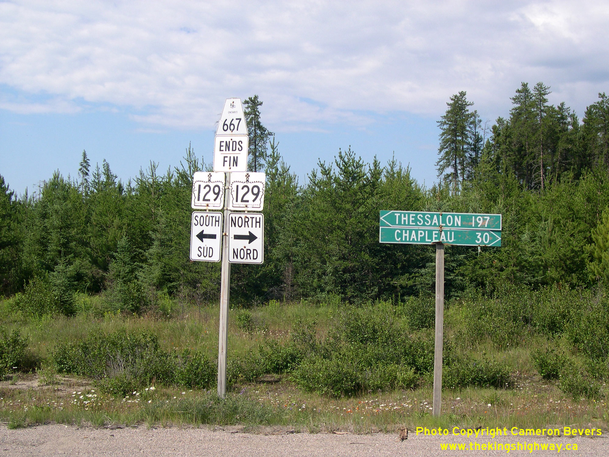
 Left - Junction sign assembly at the Hwy 129 & Hwy 667 Junction, located about 30 km south of Chapleau. The narrow fingerboard guide signs for Chapleau and
Thessalon likely date from the late 1970s, when Hwy 667 was first established as a provincial highway between Hwy 129 and Sultan. See an
Enlarged Photo Here. Left - Junction sign assembly at the Hwy 129 & Hwy 667 Junction, located about 30 km south of Chapleau. The narrow fingerboard guide signs for Chapleau and
Thessalon likely date from the late 1970s, when Hwy 667 was first established as a provincial highway between Hwy 129 and Sultan. See an
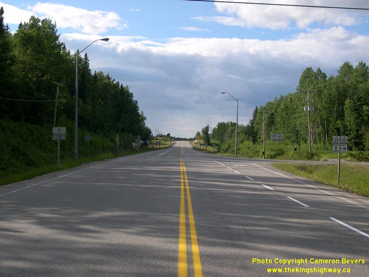
Enlarged Photo Here.(Photograph taken on July 16, 2007 - © Cameron Bevers) Right - Facing south along Hwy 101 & Hwy 129, about 5 km south of Chapleau. See an Enlarged Photo Here. (Photograph taken on July 16, 2007 - © Cameron Bevers) 

Left - Dual Hwy 101 & Hwy 129 route markers south of Chapleau. These two highways share a short concurrent route for approximately 8 km. See an
Enlarged Photo Here. (Photograph taken on July 16, 2007 - © Cameron Bevers) Right - Highway route marker assembly at the Hwy 101 East Junction on southbound Hwy 129 near Chapleau. Hwy 101 and Hwy 129 share a brief overlapped route before parting ways again about 11 km south of Chapleau. See an Enlarged Photo Here. (Photograph taken on July 16, 2007 - © Cameron Bevers) 
Left - Facing south along Hwy 101 & Hwy 129 from the Hwy 101 East Junction near Chapleau. Two destinations are provided on the mileage sign. Wawa lies at
the western terminus of Hwy 101, while Thessalon is located at the southern terminus of Hwy 129. See an
Enlarged Photo Here. (Photograph taken on July 16, 2007 - © Cameron Bevers) Right - Just south of Chapleau, Hwy 101 turns and resumes its route east towards Timmins. At the junction, Hwy 129 continues north for 3 km into Chapleau. See an Enlarged Photo Here. (Photograph taken on July 16, 2007 - © Cameron Bevers) 

Left - Facing east along Hwy 101 towards Timmins from the Hwy 129 Junction near Chapleau. See an
Enlarged Photo Here. (Photograph taken on July 16, 2007 - © Cameron Bevers) Right - Directional signs and highway route marker assembly at the Hwy 129 and Hwy 101 East Junction, 3 km south of Chapleau. See an Enlarged Photo Here. (Photograph taken on July 16, 2007 - © Cameron Bevers) 

Left - Facing south along Hwy 129 towards the Hwy 101 Junction near Chapleau. See an
Enlarged Photo Here. (Photograph taken on July 16, 2007 - © Cameron Bevers) Right - View of Hwy 129, facing north from the Hwy 101 East Junction. The route of Hwy 129 ends 3 km ahead in Chapleau. See an Enlarged Photo Here. (Photograph taken on July 16, 2007 - © Cameron Bevers) 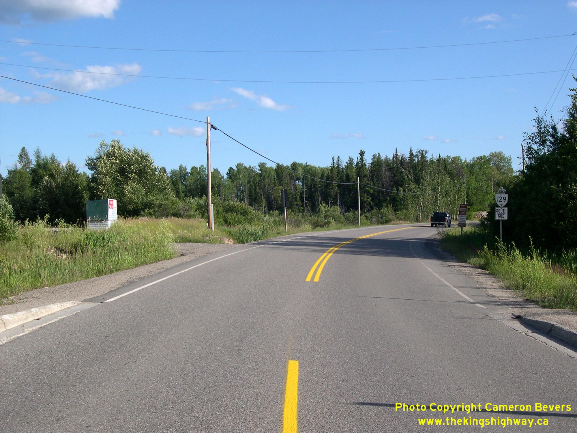
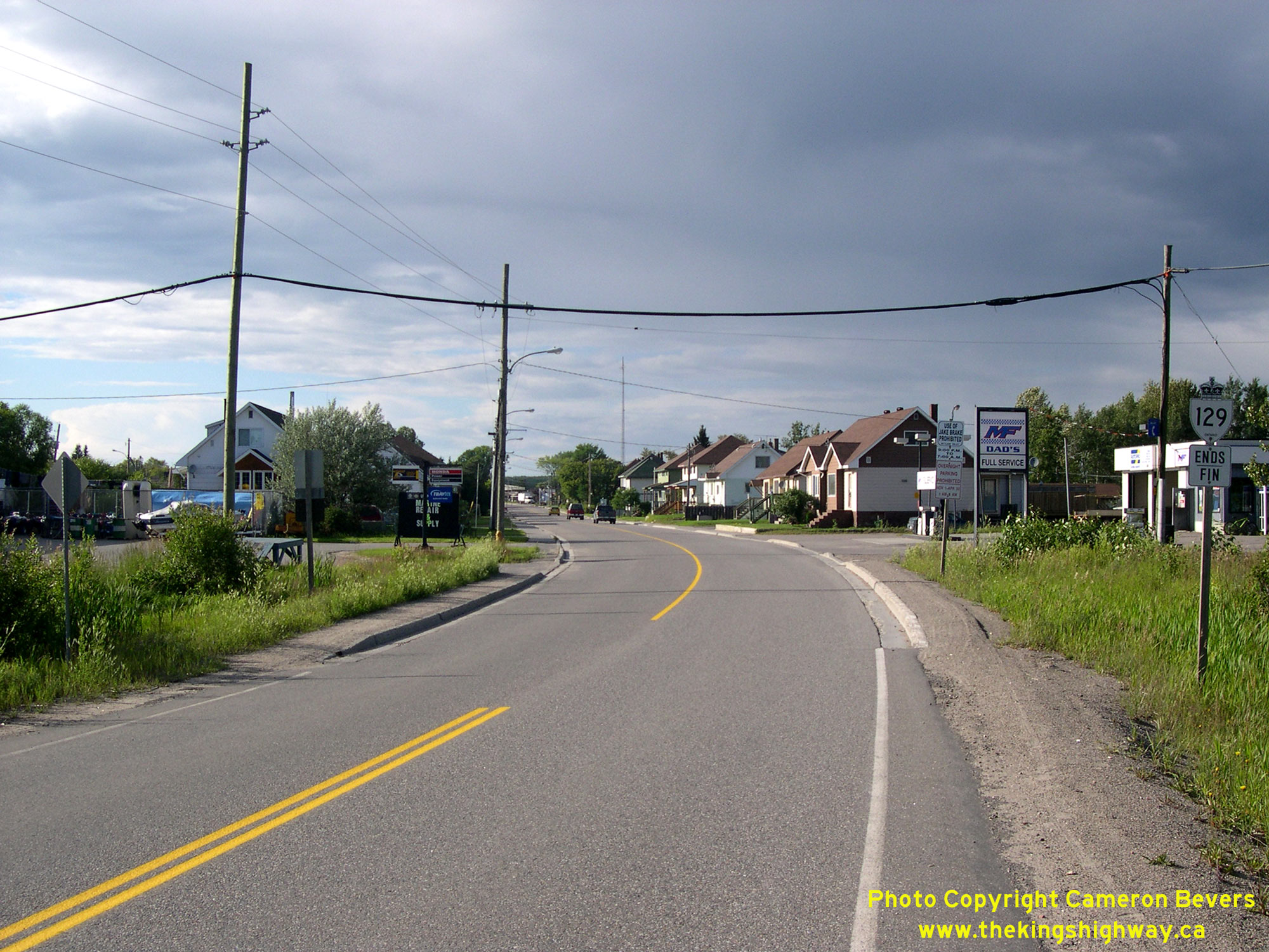 Left - Facing south along Hwy 129 towards Thessalon from the southern entrance to Chapleau. During the 1930s, construction began on a Northern Development
Trunk Road from Chapleau southerly, with the goal of connecting this road up to the existing Mississagi River Forestry Road near Aubrey Falls. After several years of
construction, 43 miles of the new road had been completed and gravelled. However, the project was put on hold in 1936. Work quickly resumed on the road after World
War II. By late 1948, the new road link between Thessalon and Chapleau was practically complete, and the first public vehicles passed through the new road link on
January 28, 1949. The Thessalon-Chapleau Road was ultimately assumed as a new King's Highway in various sections beginning in 1950, and was assigned the Hwy 129
designation in 1956. See an Enlarged Photo Here. Left - Facing south along Hwy 129 towards Thessalon from the southern entrance to Chapleau. During the 1930s, construction began on a Northern Development
Trunk Road from Chapleau southerly, with the goal of connecting this road up to the existing Mississagi River Forestry Road near Aubrey Falls. After several years of
construction, 43 miles of the new road had been completed and gravelled. However, the project was put on hold in 1936. Work quickly resumed on the road after World
War II. By late 1948, the new road link between Thessalon and Chapleau was practically complete, and the first public vehicles passed through the new road link on
January 28, 1949. The Thessalon-Chapleau Road was ultimately assumed as a new King's Highway in various sections beginning in 1950, and was assigned the Hwy 129
designation in 1956. See an Enlarged Photo Here.(Photograph taken on July 17, 2007 - © Cameron Bevers) Right - Northern terminus of Hwy 129 at the southern entrance to Chapleau. See an
Enlarged Photo Here.(Photograph taken on July 17, 2007 - © Cameron Bevers)  Above - Hwy 129 Ends sign at the southern entrance to Chapleau. See an
Enlarged Photo Here. Above - Hwy 129 Ends sign at the southern entrance to Chapleau. See an
Enlarged Photo Here.(Photograph taken on July 17, 2007 - © Cameron Bevers)
More King's Highway 129 Photographs Coming Soon!
|
|---|
Links to Adjacent King's Highway Photograph Pages:
Back to King's Highway 128 Photos /
King's Highway 129 History /
On to King's Highway 130 Photos
Ontario Highway History - Main Menu / Back to List of Highways Website contents, photos & text © 2002-2026, Cameron
Bevers (Webmaster) - All Rights Reserved / Contact Me
|
|---|