
| 
| |
|
|
This page contains historical and present day photos of Ontario's King's Highway 16. All photographs displayed on this page
were taken by the Webmaster (Cameron Bevers), unless specifically noted otherwise. Historical photographs are arranged in approximate chronological order, while
present day photographs (Year 2000 to date) are arranged by location from south to north. Click on any thumbnail to see a larger image!
Please note that all photographs displayed on this
website are protected by copyright. These photographs must not be reproduced, published,
electronically stored or copied, distributed, or posted onto other websites without
my written permission. If you want to use photos from this website, please
email me first for permission. Thank-you!
|
|---|
|
Historical King's Highway 16 Photographs


Left - A scenic view of the Rideau Canal in Ottawa in 1950, approaching the Wellington Street Bridge near Parliament Hill. Although they are not particularly
obvious in this photo, note the four King's Highway route markers mounted onto a single post on Rideau Canal Drive at left. For many years, the routes of Hwy 15,
Hwy 16, Hwy 17 and Hwy 31 all followed Rideau Canal Drive along a city-signed scenic loop through Downtown Ottawa. See an
Enlarged Photo Here. Photo taken in 1950. (Photo courtesy of Ontario Ministry of Transportation - © King's Printer for Ontario, 1950) Right - Facing south along Rideau Canal Drive (Hwy 15, Hwy 16, Hwy 17 & Hwy 31) in Ottawa in 1951. See an Enlarged Photo Here. Photo taken in 1951. (Photo courtesy of Ontario Ministry of Transportation - © King's Printer for Ontario, 1951) |
|---|
|
Present Day King's Highway 16 Photographs


Left - Guide sign marking the exit to Hwy 16 South from Hwy 401 at Prescott. The erroneous King's Highway 37 crown at left was intended to be a
trailblazer marker referring to New York's State Route 37, which lies just across the Prescott-Ogdensburg International Bridge. (Photograph taken on July 31, 2005 - © Cameron Bevers) Right - Facing south along Hwy 16 at the Hwy 401 Interchange near Prescott. The towers of the Prescott-Ogdensburg International Bridge can be seen on the horizon. (Photograph taken on July 31, 2005 - © Cameron Bevers) 
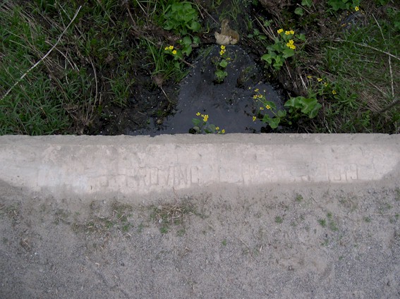
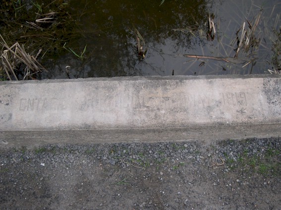
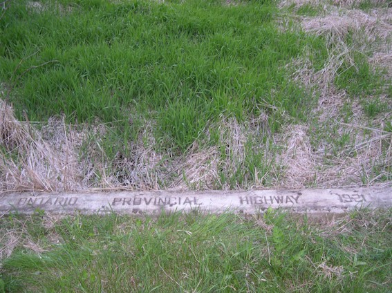
Left - 1919 date stamp on old DHO culvert on Old Hwy 16 north of Johnstown (Photograph taken on May 21, 2005 - © Cameron Bevers) Right - Although weak, this culvert date stamp reads "ONTARIO PROVINCIAL HIGHWAY 1919" (Photograph taken on May 21, 2005 - © Cameron Bevers) 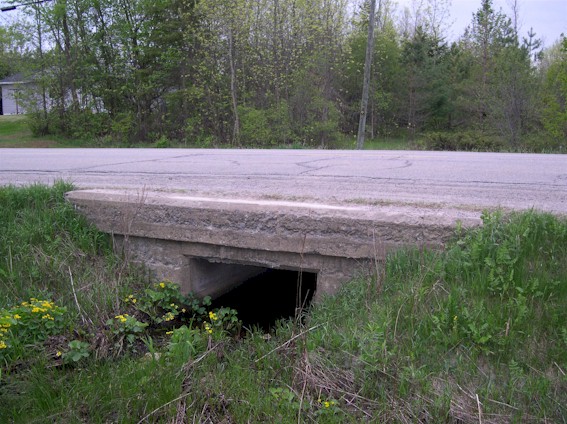
Left - Side view of old DHO culvert on Old Hwy 16 between Johnstown and Spencerville (Photograph taken on May 21, 2005 - © Cameron Bevers) Right - Ontario's oldest dated provincial highway culverts can be found along Old Hwy 16 (today's Leeds and Grenville County Road 44) between Johnstown and Spencerville. This section of Hwy 16 was reconstructed extensively between 1919 and 1921. (Photograph taken on May 21, 2005 - © Cameron Bevers) 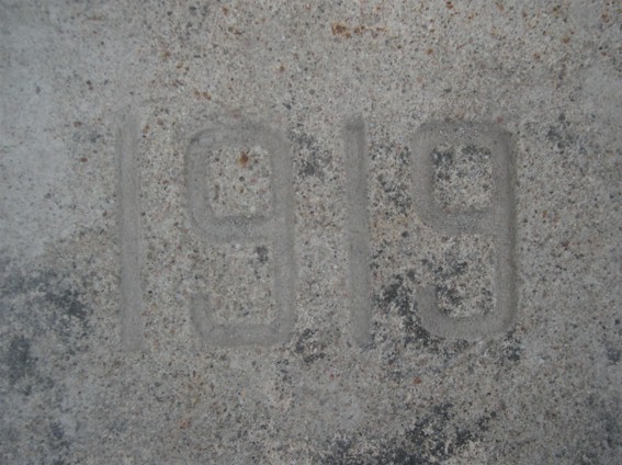
Left - This 1919 culvert date stamp is almost as clear as the day the structure was completed (Photograph taken on May 21, 2005 - © Cameron Bevers) Right - Western side of South Nation River Bridge on Old Hwy 16 in Spencerville (Photograph taken on May 21, 2005 - © Cameron Bevers) 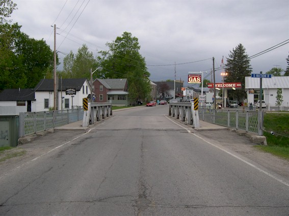
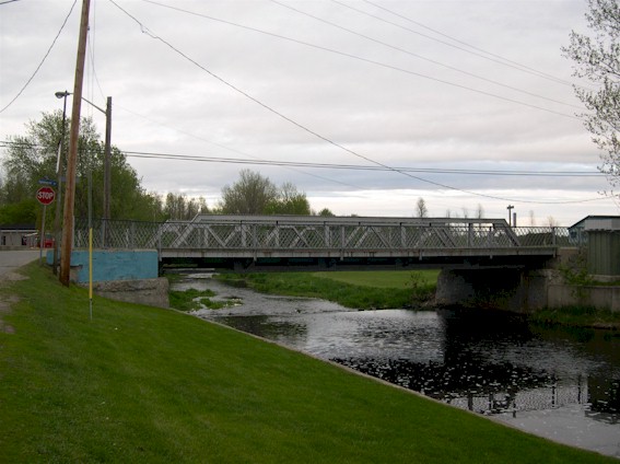
Left - Facing north along Old Hwy 16 towards Spencerville and South Nation River Bridge (Photograph taken on May 21, 2005 - © Cameron Bevers) Right - The small pony truss bridge at Spencerville is one of the oldest surviving bridges built by the Department of Highways. The Spencerville Bridge was completed in 1920, only four years after the Department of Highways was established. (Photograph taken on May 21, 2005 - © Cameron Bevers) 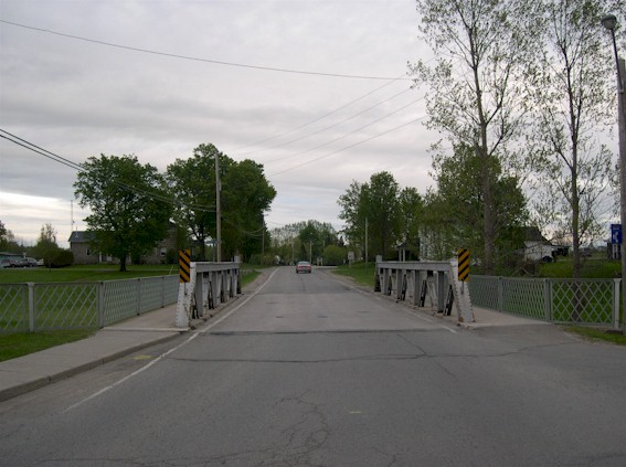
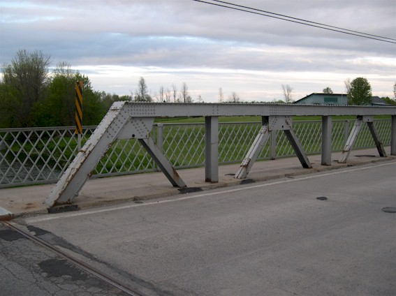
Left - Facing south along Old Hwy 16 towards Johnstown and South Nation River Bridge (Photograph taken on May 21, 2005 - © Cameron Bevers) Right - The Warren Truss design was used extensively on steel bridges built by the Department of Highways in the early 1920s. By 1924, the Department adopted concrete as its preferred bridge construction material for small bridges. Very few small steel bridges were constructed after 1924. (Photograph taken on May 21, 2005 - © Cameron Bevers) 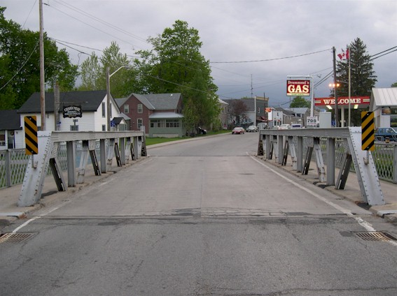
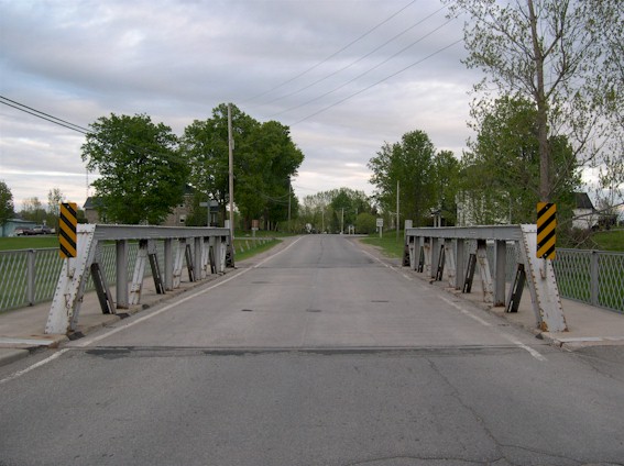
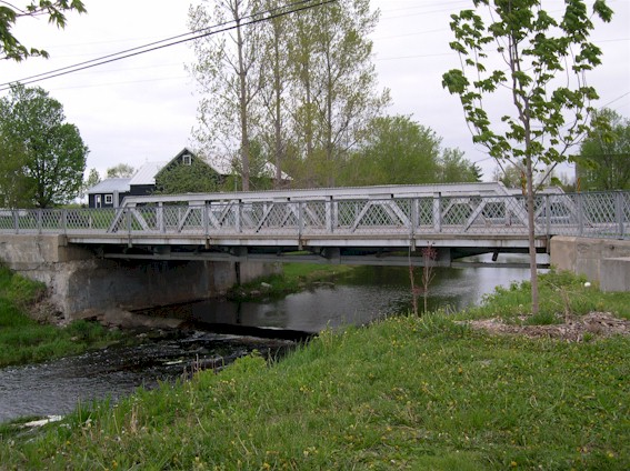
Left - Short steel pony truss bridges like the one at Spencerville used to be plentiful on our Provincial Highway System. Dozens of them were
constructed on our highways between 1920 and 1924. Today, only three of these bridges survive and all of them are located on bypassed highway alignments. (Photograph taken on May 21, 2005 - © Cameron Bevers) Right - The Spencerville Bridge is also unique in that is has sidewalks on both sides of the roadway. Very few structures built by the Department of Highways in the 1920s had two sidewalks. In fact, most rural structures at that time had no sidewalk at all. (Photograph taken on May 21, 2005 - © Cameron Bevers) 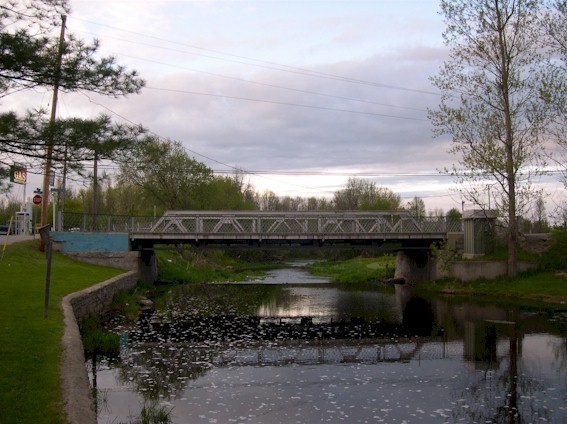
Left - This tranquil setting seems rather fitting for the historically significant bridge at Spencerville. (Photograph taken on May 21, 2005 - © Cameron Bevers) Right - Old culvert on abandoned Hwy 16 alignment north of Spencerville (Photograph taken on May 21, 2005 - © Cameron Bevers)
More King's Highway 16 Photographs Coming Soon!
|
|---|
Links to Adjacent King's Highway Photograph Pages:
Back to King's Highway 15 Photos /
King's Highway 16 History /
On to King's Highway 17 Photos
Ontario Highway History - Main Menu / Back to List of Highways Website contents, photos & text © 2002-2026, Cameron
Bevers (Webmaster) - All Rights Reserved / Contact Me
|
|---|