
| 
| |
|
|
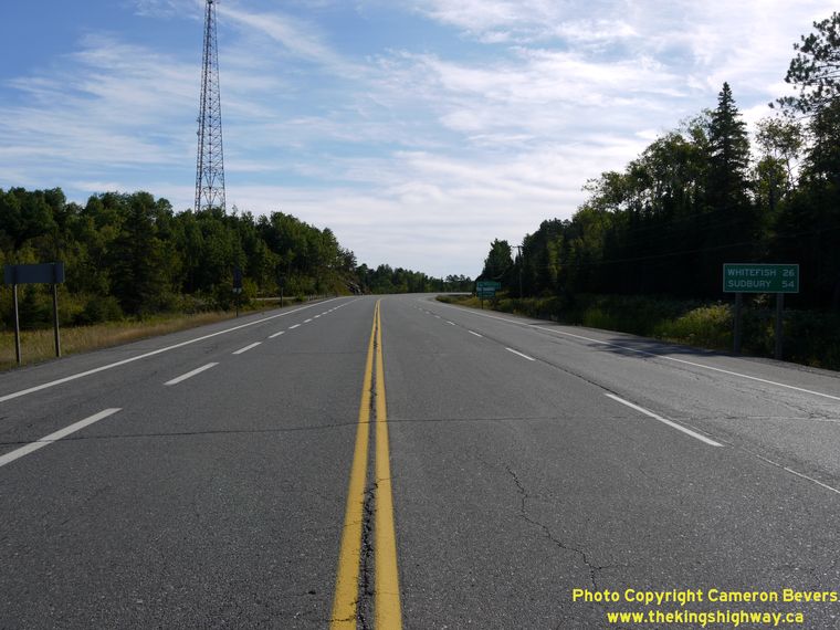
This page contains present day photos (Year 2000 to date) of Ontario's King's Highway 17, arranged by location from Whitefish
westerly to Espanola. All photographs displayed on this page were taken by the Webmaster (Cameron Bevers), unless specifically noted otherwise. Click on any
thumbnail to see a larger image!
Please note that all photographs displayed on this
website are protected by copyright. These photographs must not be reproduced, published,
electronically stored or copied, distributed, or posted onto other websites without
my written permission. If you want to use photos from this website, please
email me first for permission. Thank-you!
|
|---|
|
Page 19: Present Day King's Highway 17 Photographs (Whitefish to Espanola)

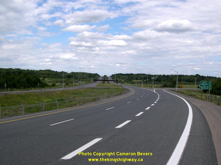
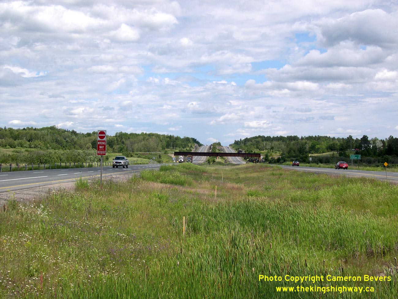
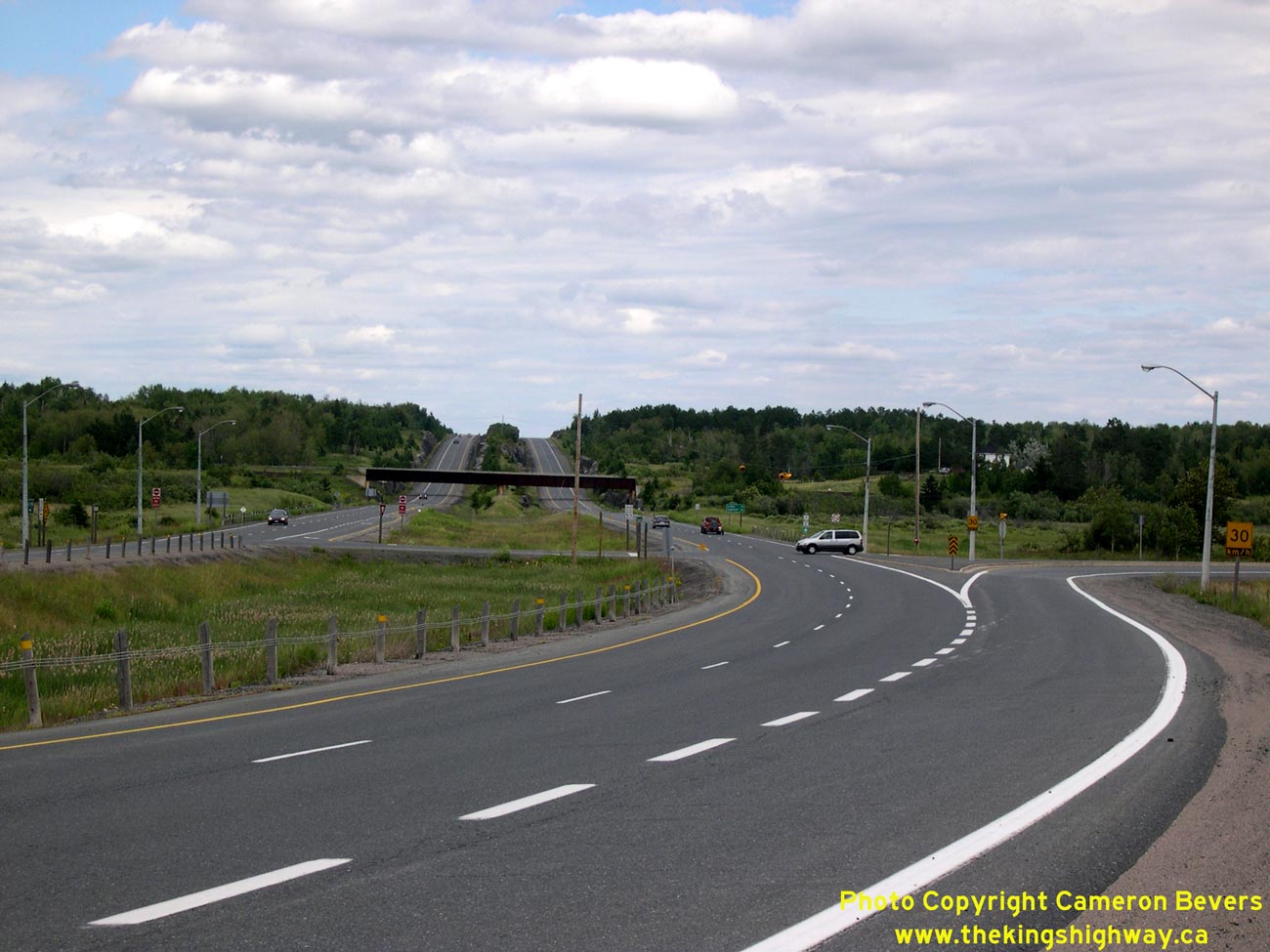
Left - Facing east along Hwy 17 towards Sudbury from the Whitefish Turn-off (Sudbury Road 55). This four-lane bypass was completed in the early
1980s, diverting through traffic off of the old two-lane highway through Naughton and Whitefish. While the junction with Sudbury Road 55 was left
as an at-grade intersection, the rest of the divided highway from the Whitefish Turn-off to Sudbury was built as a controlled-access freeway. See an
Enlarged Photo Here. (Photograph taken on July 3, 2007 - © Cameron Bevers) Right - Facing west along Hwy 17 towards Espanola from the Whitefish Turn-off (Sudbury Road 55). The divided highway ends about 1 km past this curve. (Photograph taken on July 3, 2007 - © Cameron Bevers) 
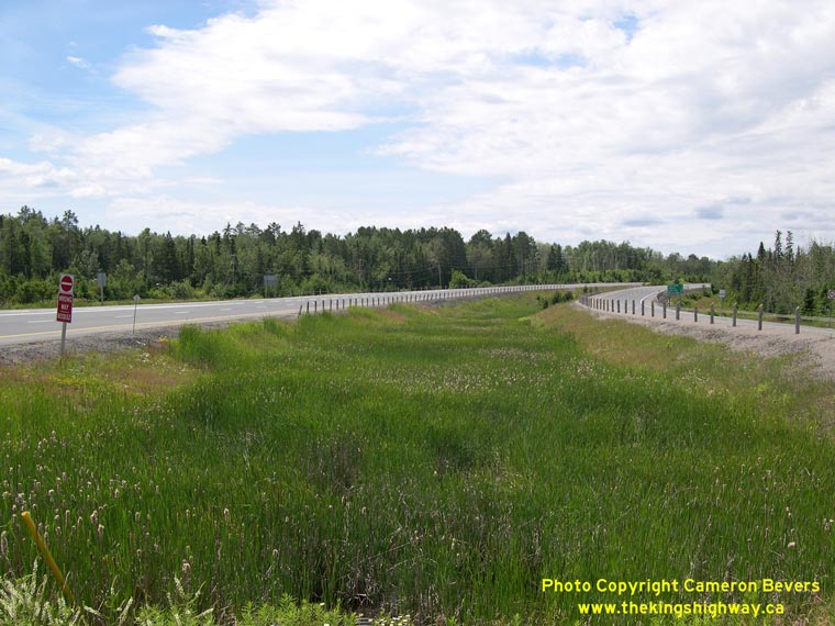
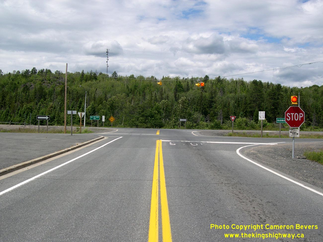
Left - The at-grade intersection of Sudbury Road 55 and Hwy 17 near Whitefish. See an
Enlarged Photo Here. (Photograph taken on July 3, 2007 - © Cameron Bevers) Right - Facing east along Hwy 17 towards the Sudbury Road 55 Junction near Whitefish. Before the construction of the Naughton and Whitefish Bypass, the route of Hwy 17 continued off to the right into Whitefish as a conventional rural two-lane highway. See an Enlarged Photo Here. (Photograph taken on July 3, 2007 - © Cameron Bevers) 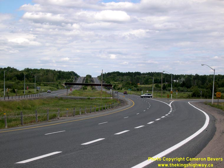
Left - Close-up of the at-grade Sudbury Road 55 Junction on Hwy 17 near Whitefish. Sufficient right-of-way exists at this junction to construct a grade
separation and interchange when traffic volumes warrant such improvements. See an
Enlarged Photo Here. (Photograph taken on July 3, 2007 - © Cameron Bevers) Right - Facing east along Hwy 17 towards Sudbury from Nairn Centre. (Photograph taken on August 28, 2011 - © Cameron Bevers) 
Left - Approaching Nairn Centre on Westbound Hwy 17, facing west. (Photograph taken on August 28, 2011 - © Cameron Bevers) Right - The community of Nairn Centre is at the bottom of this hill. This is the first community situated along Hwy 17 west of Sudbury. Other villages along the original highway route between Sudbury and Nairn Centre were bypassed by the various highway relocation projects which have taken place since the 1950s. See an Enlarged Photo Here. (Photograph taken on August 28, 2011 - © Cameron Bevers) 

Left - Facing west along Hwy 17 at Smith Street (Former Hwy 662) in Nairn Centre. See an
Enlarged Photo Here. (Photograph taken on August 28, 2011 - © Cameron Bevers) Right - Approaching Smith Street (Former Hwy 662) on Hwy 17 in Nairn Centre, facing east towards Sudbury. (Photograph taken on August 28, 2011 - © Cameron Bevers) 

Left - Facing north along Former Hwy 662 (Smith Street) in Nairn Centre. The Ministry of Transportation (MTO) maintains this road,
although it hasn't been signed as Hwy 662 in many years (if ever). In all likelihood, the Hwy 662 designation was not actually a posted route number, since the
highway is not marked on any Ontario Official Road Maps. (Photograph taken on August 28, 2011 - © Cameron Bevers) Right - Distance sign on Westbound Hwy 17 leaving Nairn Centre. (Photograph taken on August 28, 2011 - © Cameron Bevers) 
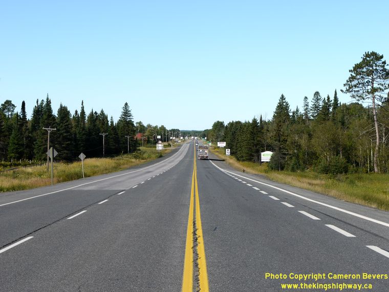
Left - Facing west along Hwy 17 towards McKerrow from Nairn Centre. (Photograph taken on August 28, 2011 - © Cameron Bevers) Right - Hwy 17 at the Nairn Centre Railway Overhead, facing east. (Photograph taken on August 28, 2011 - © Cameron Bevers) 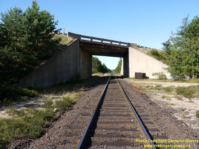

Left - Nairn Centre Railway Overhead on Hwy 17. Structure completed in 1956. (Photograph taken on August 28, 2011 - © Cameron Bevers) Right - Facing west across the Nairn Centre Railway Overhead on Hwy 17. (Photograph taken on August 28, 2011 - © Cameron Bevers) 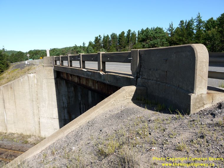
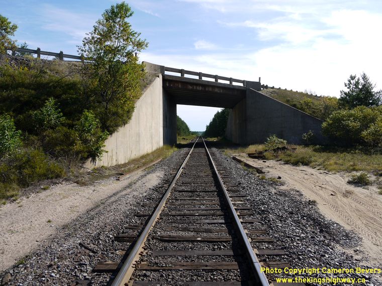
Left - Close-up of the concrete beam and post handrail on the Nairn Centre Railway Overhead. (Photograph taken on August 28, 2011 - © Cameron Bevers) Right - Southern side of the Nairn Centre Railway Overhead on Hwy 17. (Photograph taken on August 28, 2011 - © Cameron Bevers) 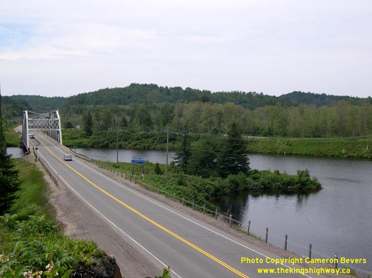

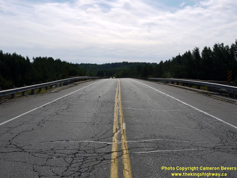
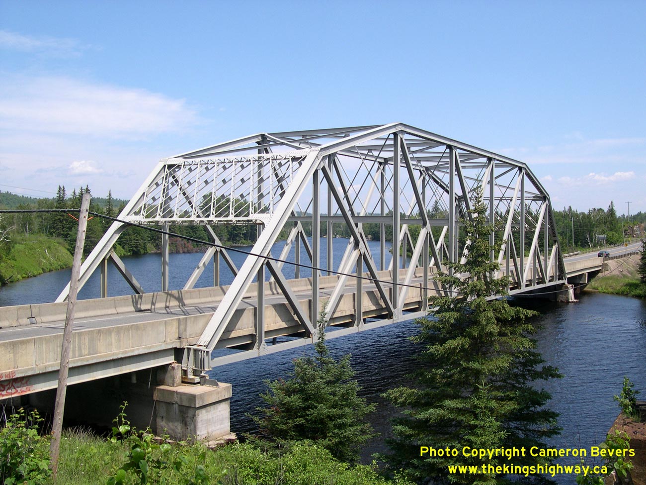
Left - Hwy 17 at the Spanish River between Nairn Centre and McKerrow. See an
Enlarged Photo Here. (Photograph taken on July 3, 2006 - © Cameron Bevers) Right - Facing west along Hwy 17 towards Espanola at the Spanish River Bridge. (Photograph taken on July 3, 2006 - © Cameron Bevers) 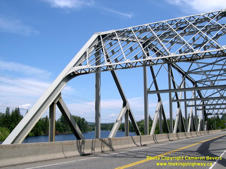

Left - The Spanish River Bridge is a Pratt type steel through truss structure. (Photograph taken on July 3, 2006 - © Cameron Bevers) Right - Southern side of the Spanish River Bridge. Structure completed in 1956. See an Enlarged Photo Here. (Photograph taken on July 3, 2006 - © Cameron Bevers) 

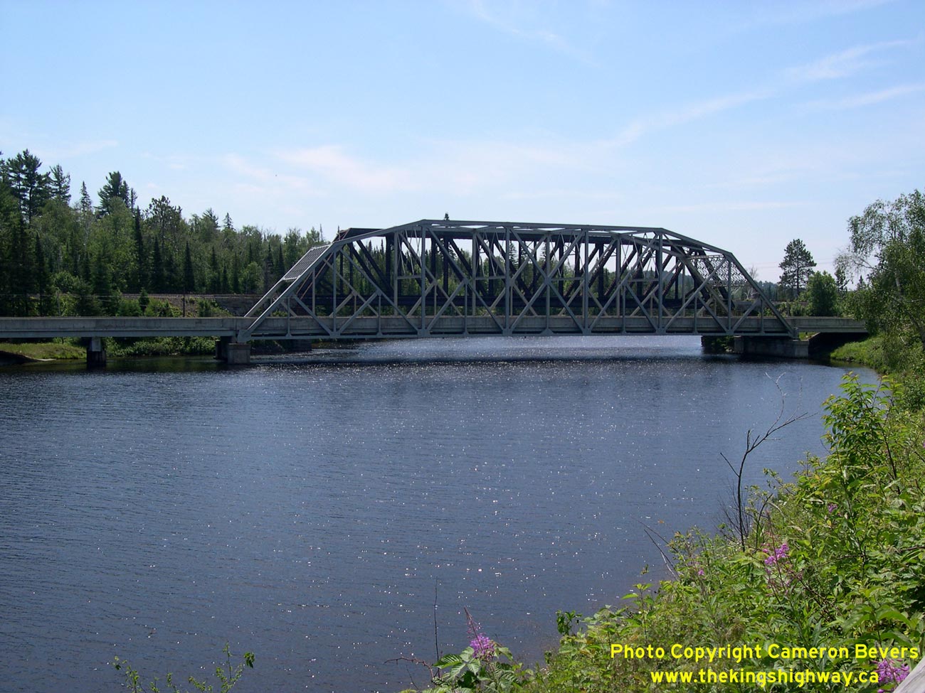
Left - View of the Spanish River, facing south towards the Hwy 17 Bridge near McKerrow. See an
Enlarged Photo Here. (Photograph taken on July 3, 2006 - © Cameron Bevers) Right - Facing east along Hwy 17 towards Sudbury at the Spanish River Bridge east of McKerrow. (Photograph taken on July 3, 2006 - © Cameron Bevers) 

Left - Approaching McKerrow on Westbound Hwy 17, facing west. (Photograph taken on August 28, 2011 - © Cameron Bevers) Right - Facing east along Hwy 17 towards Nairn Centre, departing McKerrow. (Photograph taken on August 28, 2011 - © Cameron Bevers) 

Left - Facing west along Hwy 17 at McKerrow. See an
Enlarged Photo Here. (Photograph taken on August 28, 2011 - © Cameron Bevers) Right - Like so many towns along Lake Huron's North Shore, McKerrow fronts onto Hwy 17 and the adjacent railway line. (Photograph taken on August 28, 2011 - © Cameron Bevers) 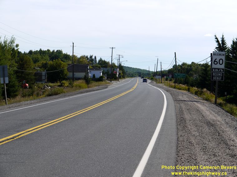

Left - Approaching McKerrow on Eastbound Hwy 17, facing east. See an
Enlarged Photo Here. (Photograph taken on August 28, 2011 - © Cameron Bevers) Right - Facing west along Hwy 17 towards the Hwy 6 Junction, departing McKerrow. (Photograph taken on August 28, 2011 - © Cameron Bevers) 
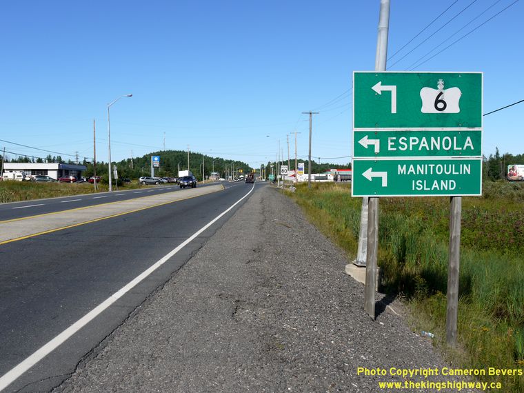
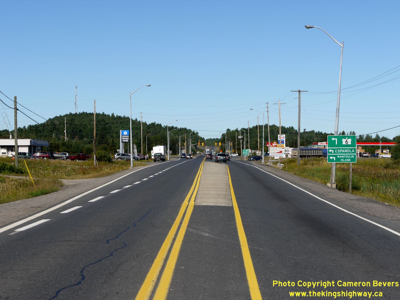
Left - Facing west along Hwy 17 approaching the Hwy 6 Junction north of Espanola. See an
Enlarged Photo Here. (Photograph taken on August 28, 2011 - © Cameron Bevers) Right - Guide sign marking the upcoming Hwy 6 Junction on Hwy 17 north of Espanola. This important highway connection provides the only road access to Manitoulin Island. (Photograph taken on August 28, 2011 - © Cameron Bevers) 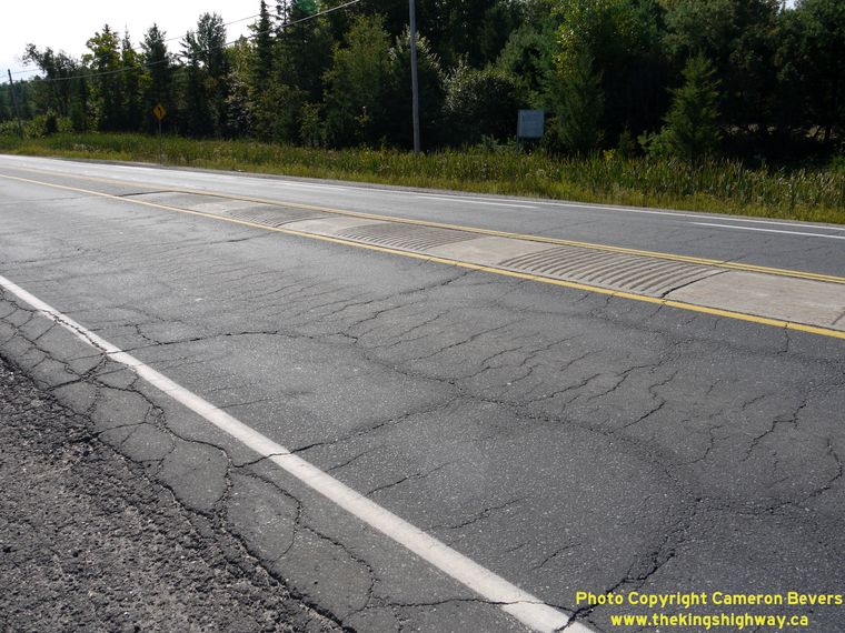
Left - "Singing median" on Hwy 17 approaching the Hwy 6 Junction near Espanola. The concrete centre strip has a series of intermittent alternating recessed
grooves and raised humps, which provides drivers with an audible warning that their vehicle's tires have encroached over the centreline of the highway. Although many highways were constructed with this type of median treatment
before the 1980s, it is no longer popular with the Ontario Ministry of Transportation. The singing median is slowly disappearing from the Ontario landscape as older
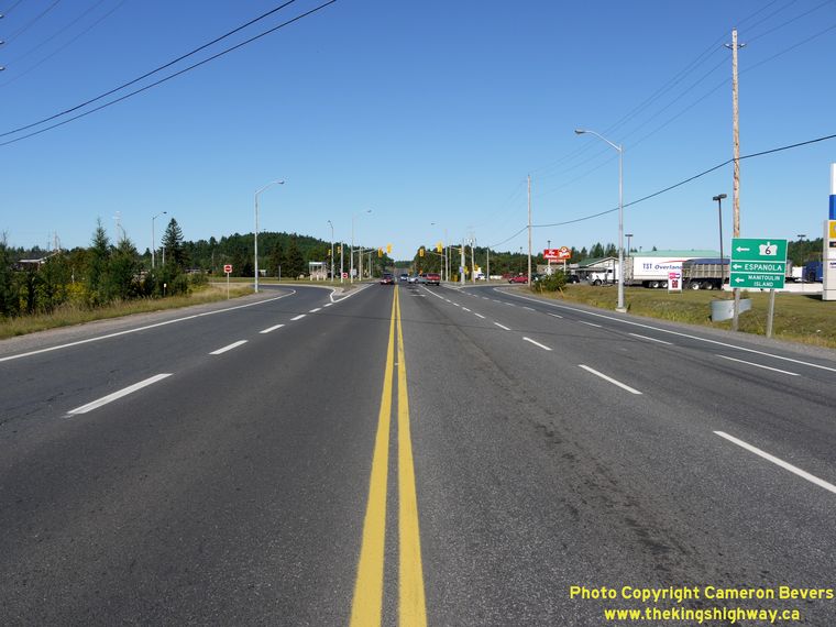
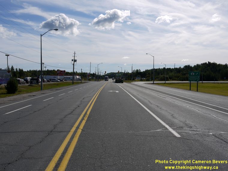
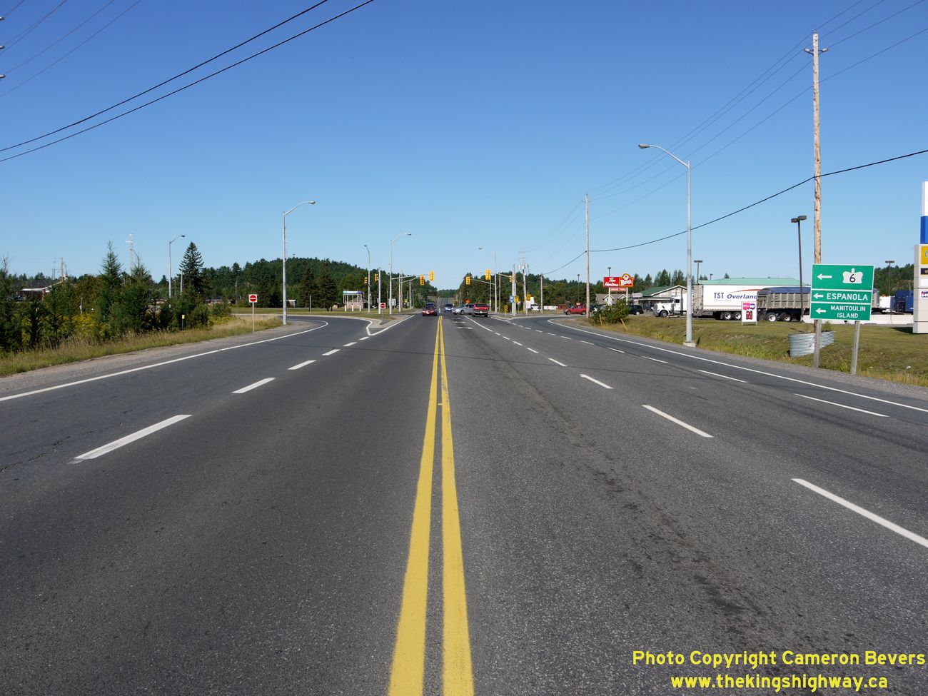
highways are reconstructed. (Photograph taken on August 28, 2011 - © Cameron Bevers) Right - Facing west along Hwy 17 at the Hwy 6 Junction near Espanola. See an Enlarged Photo Here. (Photograph taken on August 28, 2011 - © Cameron Bevers) 
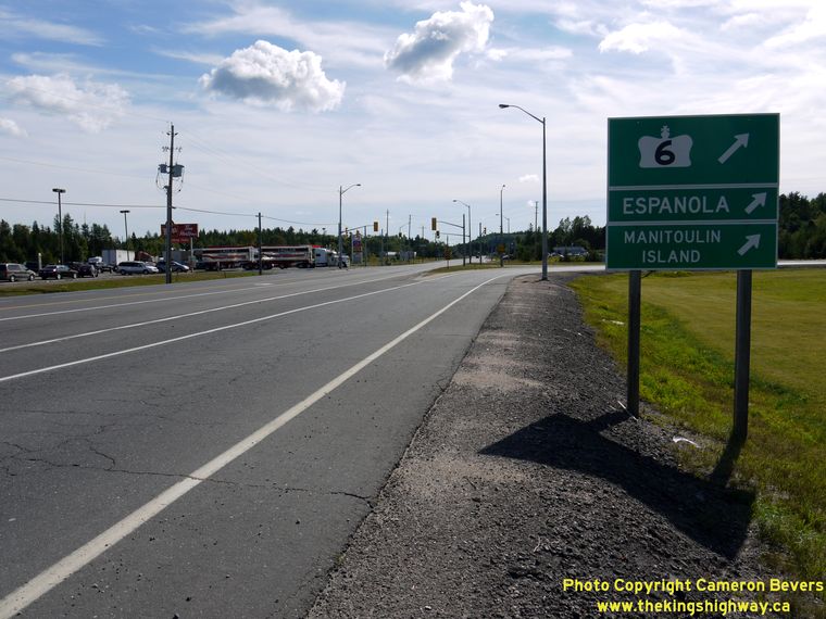
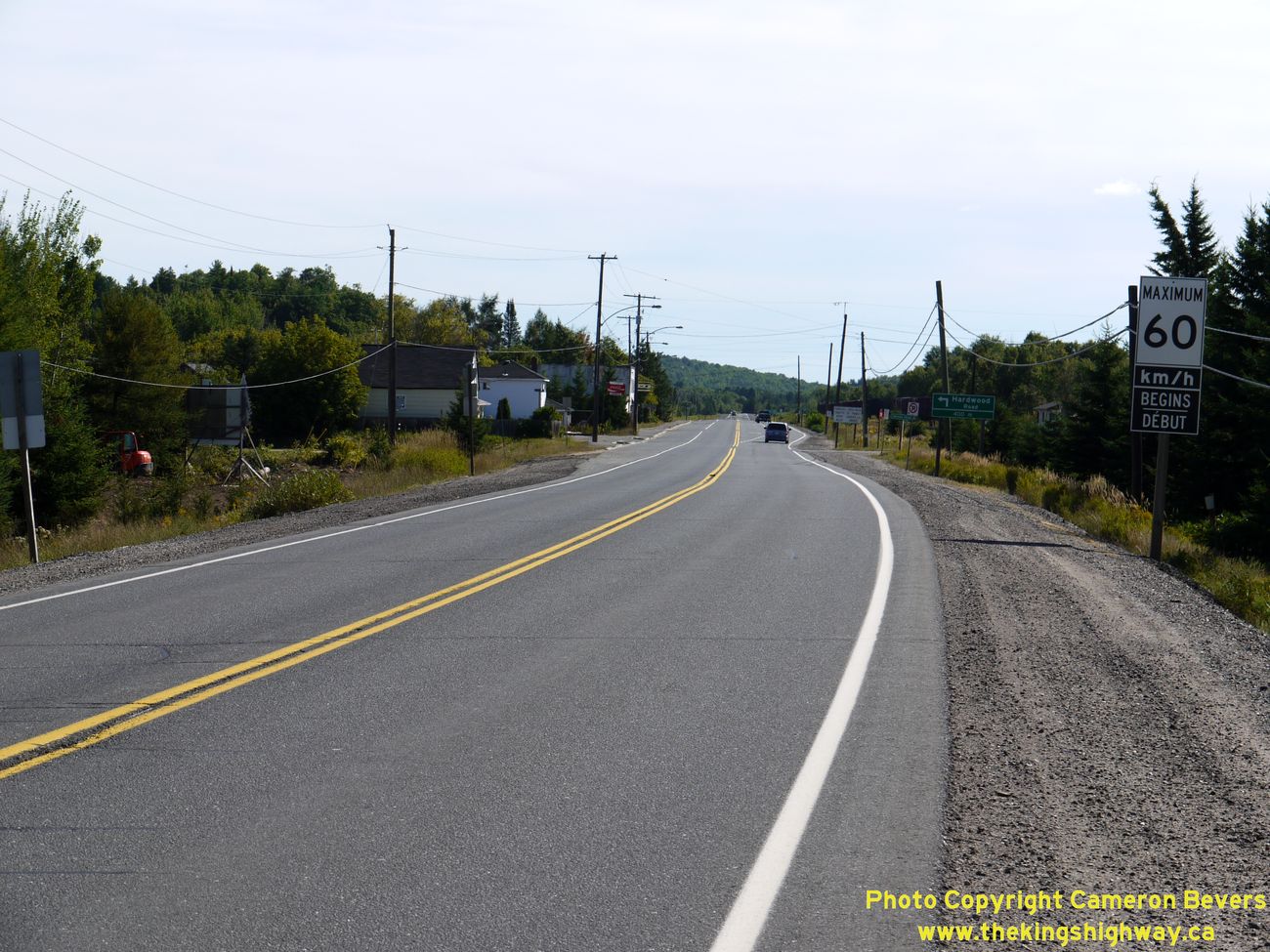
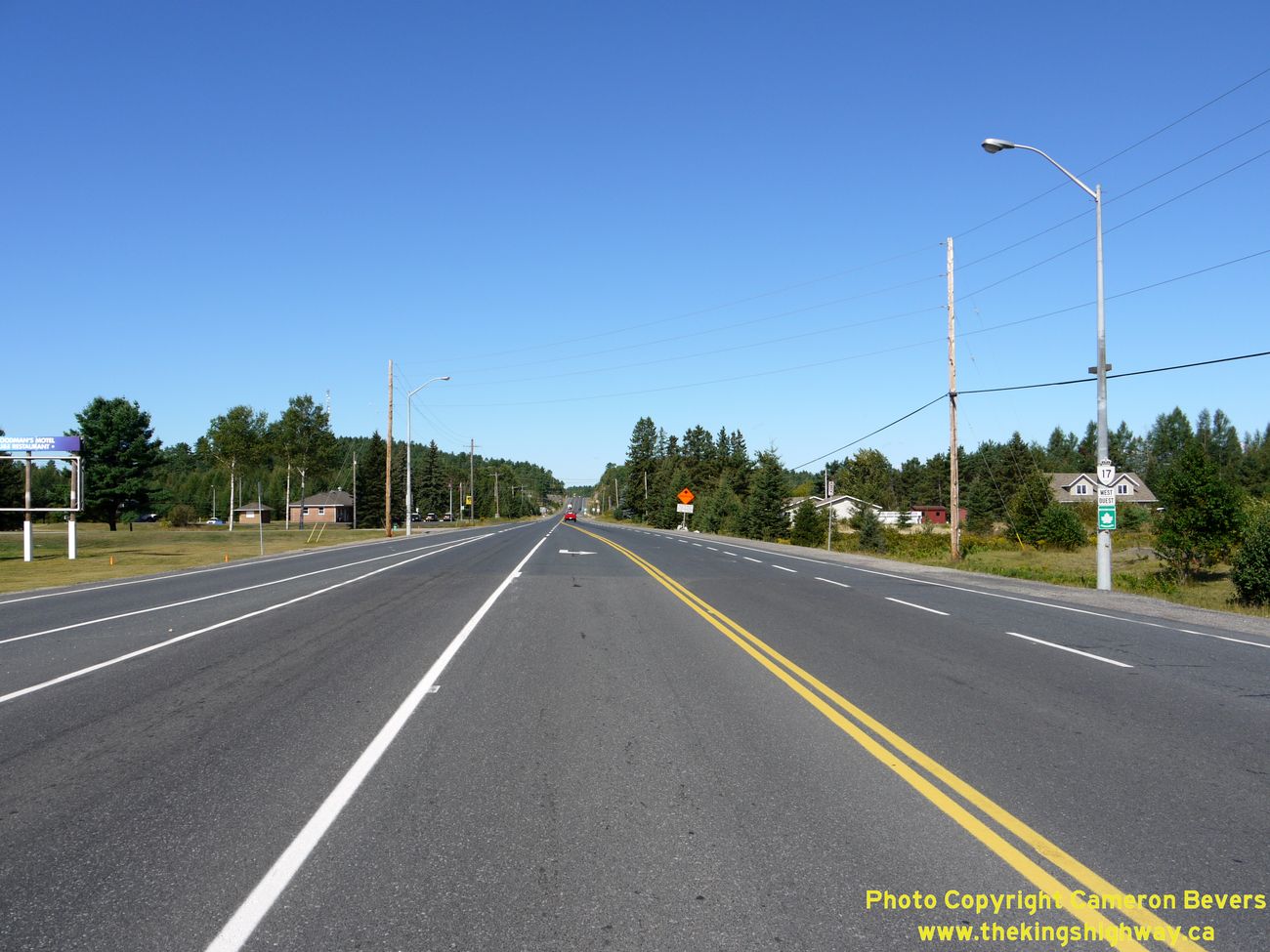
Left - Facing west along Hwy 17 towards Massey from the Hwy 6 Junction north of Espanola. See an
Enlarged Photo Here. (Photograph taken on August 28, 2011 - © Cameron Bevers) Right - Hwy 6 turn-off guide sign on Eastbound Hwy 17 near Espanola. (Photograph taken on August 28, 2011 - © Cameron Bevers) 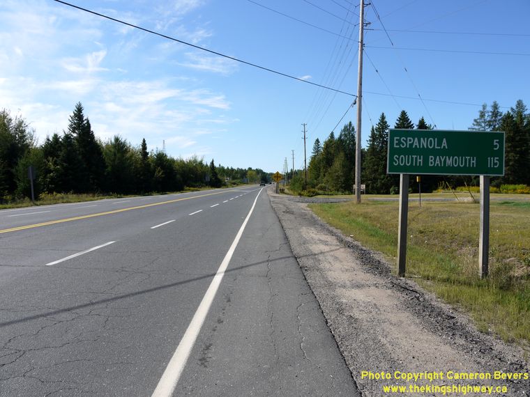
Left - Distance sign on Southbound Hwy 6 at the Hwy 17 Junction near Espanola. The community of South Baymouth is the southernmost road-accessible point on
Manitoulin Island. It is also the location where Hwy 6 continues south to Tobermory and Southern Ontario via a ferry service that runs during the peak travel seasons only. During the off-peak season from
October to May, Hwy 6 is discontinuous between Manitoulin Island and the Bruce Peninsula. (Photograph taken on August 28, 2011 - © Cameron Bevers) Right - Facing north along Hwy 6 towards the Hwy 17 Junction north of Espanola. The route of Hwy 6 finally comes to an end at this intersection, after traveling nearly 500 km north from Port Dover, located on the shores of Lake Erie. Hwy 6 is one of Ontario's longest King's Highways. (Photograph taken on July 3, 2006 - © Cameron Bevers) 
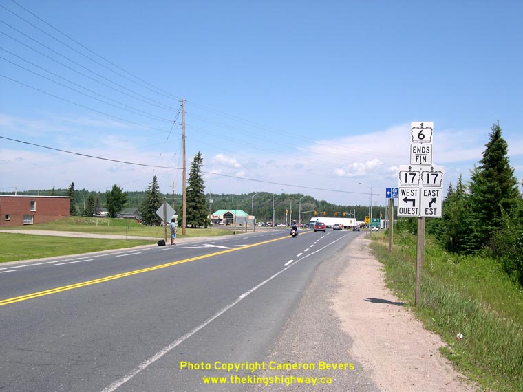
Left - Northern terminus of Hwy 6 at the Hwy 17 Junction near Espanola. See an
Enlarged Photo Here. (Photograph taken on August 28, 2011 - © Cameron Bevers) Right - Facing east along Hwy 17 at the Hwy 6 Junction, north of Espanola. (Photograph taken on August 28, 2011 - © Cameron Bevers) 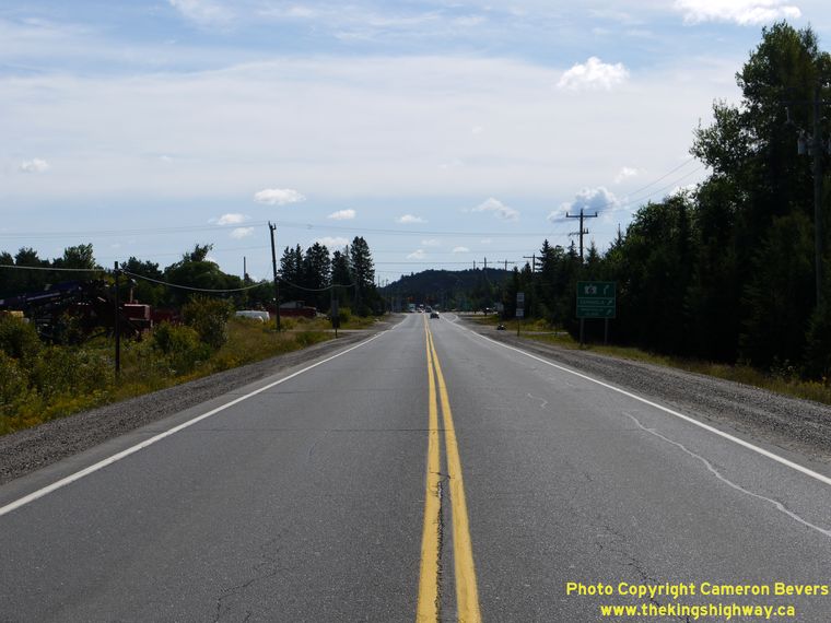
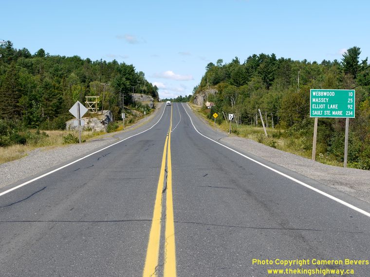
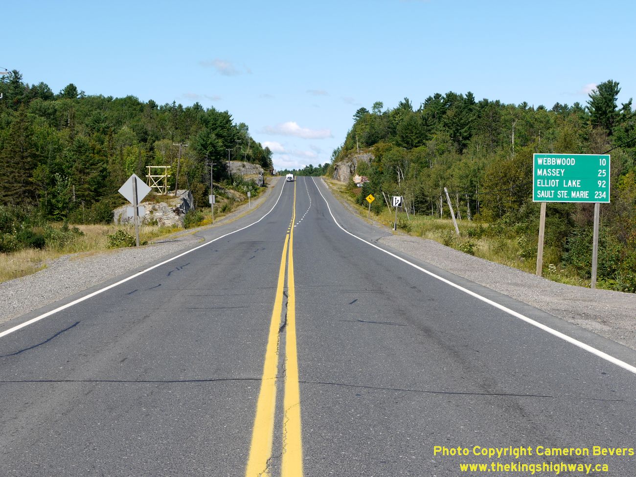
Left - Approaching the Hwy 6 Junction on Hwy 17, facing east towards Sudbury. (Photograph taken on August 28, 2011 - © Cameron Bevers) Right - Distance sign on Westbound Hwy 17, west of the Hwy 6 Junction near Espanola. See an Enlarged Photo Here. (Photograph taken on August 28, 2011 - © Cameron Bevers)
Continue on to King's Highway 17 Photos: Espanola to Spanish
|
|---|
Links to Adjacent King's Highway Photograph Pages:
Back to King's Highway 16 Photos /
King's Highway 17 History /
On to King's Highway 18 Photos
Ontario Highway History - Main Menu / Back to List of Highways Website contents, photos & text © 2002-2026, Cameron
Bevers (Webmaster) - All Rights Reserved / Contact Me
|
|---|