
| 
|  |
|
|
This page contains present day photos (Year 2000 to date) of Ontario's King's Highway 17, arranged by location from the
Secondary Highway 527 Junction in Shuniah to the King's Highway 61 Junction in Thunder Bay. All photographs displayed on this page were taken by the Webmaster
(Cameron Bevers), unless specifically noted otherwise. Click on any thumbnail to see a larger image!
Please note that all photographs displayed on this
website are protected by copyright. These photographs must not be reproduced, published,
electronically stored or copied, distributed, or posted onto other websites without
my written permission. If you want to use photos from this website, please
email me first for permission. Thank-you!
|
|---|
|
Page 33: Present Day King's Highway 17 Photographs (Hwy 527 Junction to Thunder Bay)
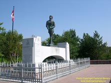

Left - Terry Fox Monument, located in a memorial park beside Hwy 11 & Hwy 17 just east of Thunder Bay. See an
Enlarged Photo here. (Photograph taken on September 3, 2004 - © Cameron Bevers) Right - Another view of the Terry Fox Monument. The commemorative monument was unveiled by the government in 1982, shortly after Terry Fox lost his battle with cancer. See an Enlarged Photo here. (Photograph taken on September 3, 2004 - © Cameron Bevers) 

Left - When the Terry Fox Monument was originally dedicated in 1982, it was located on the south side of Hwy 11 & Hwy 17 in the flat grassy area seen in
this photo. The tiny rest area and scenic lookout was inadequate for the large number of visitors who stop at the monument every year. In 1993, the MTO relocated the
monument to a new rest area directly across the road. An old concrete base marks the original monument's location, and it is still visible in the tall grass from the
new Terry Fox scenic lookout. The new Terry Fox Memorial Park has considerably more visitor parking than its predecessor, and it has much better facilities for
tourists. See an Enlarged Photo here. (Photograph taken on September 3, 2004 - © Cameron Bevers) Right - The old Terry Fox Rest Area is located just off to the left in this photo. See an Enlarged Photo here. (Photograph taken on September 3, 2004 - © Cameron Bevers) 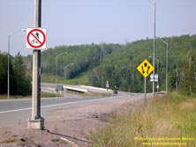
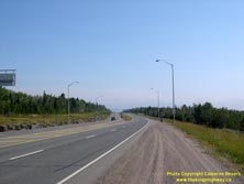
Left - The start of the Thunder Bay Expressway facing south, as seen from Hodder Avenue. See an
Enlarged Photo here. (Photograph taken on September 3, 2004 - © Cameron Bevers) Right - Only the northernmost portion of the Thunder Bay Expressway is divided. Between Balsam Avenue and the Thunder Bay Airport, Hwy 11 & Hwy 17 is an undivided four-lane highway. See an Enlarged Photo here. (Photograph taken on September 3, 2004 - © Cameron Bevers) 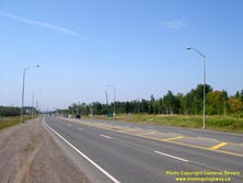
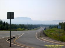
Left - Approach to the Balsam Avenue intersection on Hwy 11 & Hwy 17. See an
Enlarged Photo here. (Photograph taken on September 3, 2004 - © Cameron Bevers) Right - View of Mount MacKay and the Thunder Bay Expressway from Oliver Road. See an Enlarged Photo here. (Photograph taken on September 3, 2004 - © Cameron Bevers) 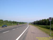

Left - Facing north on the Thunder Bay Expressway (Hwy 11 & Hwy 17) from the Harbour Expressway. See an
Enlarged Photo here. (Photograph taken on September 3, 2004 - © Cameron Bevers) Right - Approach to the Harbour Expressway intersection on Hwy 11 & Hwy 17. See an Enlarged Photo here. (Photograph taken on September 3, 2004 - © Cameron Bevers) 
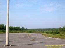
Left - Western terminus of the Harbour Expressway at the Thunder Bay Expressway (Hwy 11 & Hwy 17). See an
Enlarged Photo here. (Photograph taken on September 3, 2004 - © Cameron Bevers) Right - Cleared right-of-way for the new Shabaqua Highway, facing west from the Thunder Bay Expressway. The new Shabaqua Highway is essentially a western extension of the existing Harbour Expressway. This new road was completed recently. It now carries all Hwy 11 & Hwy 17 traffic and bypasses a congested portion of Arthur Street. See an Enlarged Photo here. (Photograph taken on September 3, 2004 - © Cameron Bevers) 

Left - Facing west along the Harbour Expressway from the Thunder Bay Expressway. See an
Enlarged Photo here. (Photograph taken on September 3, 2004 - © Cameron Bevers) Right - Facing north on the Thunder Bay Expressway towards the Harbour Expressway intersection. See an Enlarged Photo here. (Photograph taken on September 3, 2004 - © Cameron Bevers) 
Above - Facing south on the Thunder Bay Expressway towards the Arthur Street intersection. Up until 2007, Hwy 11 & Hwy 17 turned west towards Kakabeka
Falls and Kenora at this intersection, while Hwy 61 continued south along the Thunder Bay Expressway towards the airport and the Ontario-Minnesota Border. See an
Enlarged Photo here. (Photograph taken on September 3, 2004 - © Cameron Bevers) |
|---|