
| 
| |
|
|
This page contains present day photos (Year 2000 to date) of Ontario's King's Highway 17, arranged by location from the
Secondary Highway 527 Junction in Shuniah to the King's Highway 61 Junction in Thunder Bay. All photographs displayed on this page were taken by the Webmaster
(Cameron Bevers), unless specifically noted otherwise. Click on any thumbnail to see a larger image!
Please note that all photographs displayed on this
website are protected by copyright. These photographs must not be reproduced, published,
electronically stored or copied, distributed, or posted onto other websites without
my written permission. If you want to use photos from this website, please
email me first for permission. Thank-you!
|
|---|
|
Page 39: Present Day King's Highway 17 Photographs (Hwy 527 Junction to Thunder Bay)
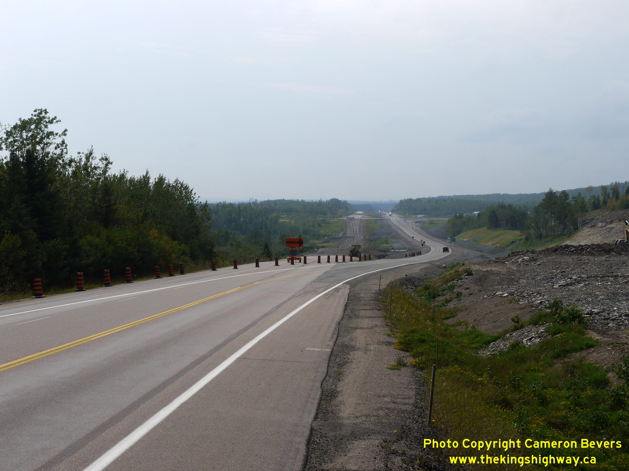
  Left - View of the highway twinning underway along Hwy 11 & Hwy 17 in 2011, facing west towards the Hwy 527 Junction in Shuniah. At the time this photo was
taken in 2011, the previous two-lane route of Hwy 11 & Hwy 17 was closed for reconstruction. All traffic was diverted onto the newly-built westbound carriageway
at right. Once reconstruction was completed, the previous two-lane route of Hwy 11 & Hwy 17 at left was reopened to carry eastbound traffic only, while the new
carriageway at right was converted to carry westbound traffic only. See an
Enlarged Photo Here. Left - View of the highway twinning underway along Hwy 11 & Hwy 17 in 2011, facing west towards the Hwy 527 Junction in Shuniah. At the time this photo was
taken in 2011, the previous two-lane route of Hwy 11 & Hwy 17 was closed for reconstruction. All traffic was diverted onto the newly-built westbound carriageway
at right. Once reconstruction was completed, the previous two-lane route of Hwy 11 & Hwy 17 at left was reopened to carry eastbound traffic only, while the new
carriageway at right was converted to carry westbound traffic only. See an
Enlarged Photo Here.(Photograph taken on September 1, 2011 - © Cameron Bevers) Right - Facing west towards the Hwy 527 Junction along the completed four-lane Hwy 11 & Hwy 17 in Shuniah in 2015. See an
Enlarged Photo Here.(Photograph taken on October 7, 2015 - © Cameron Bevers) 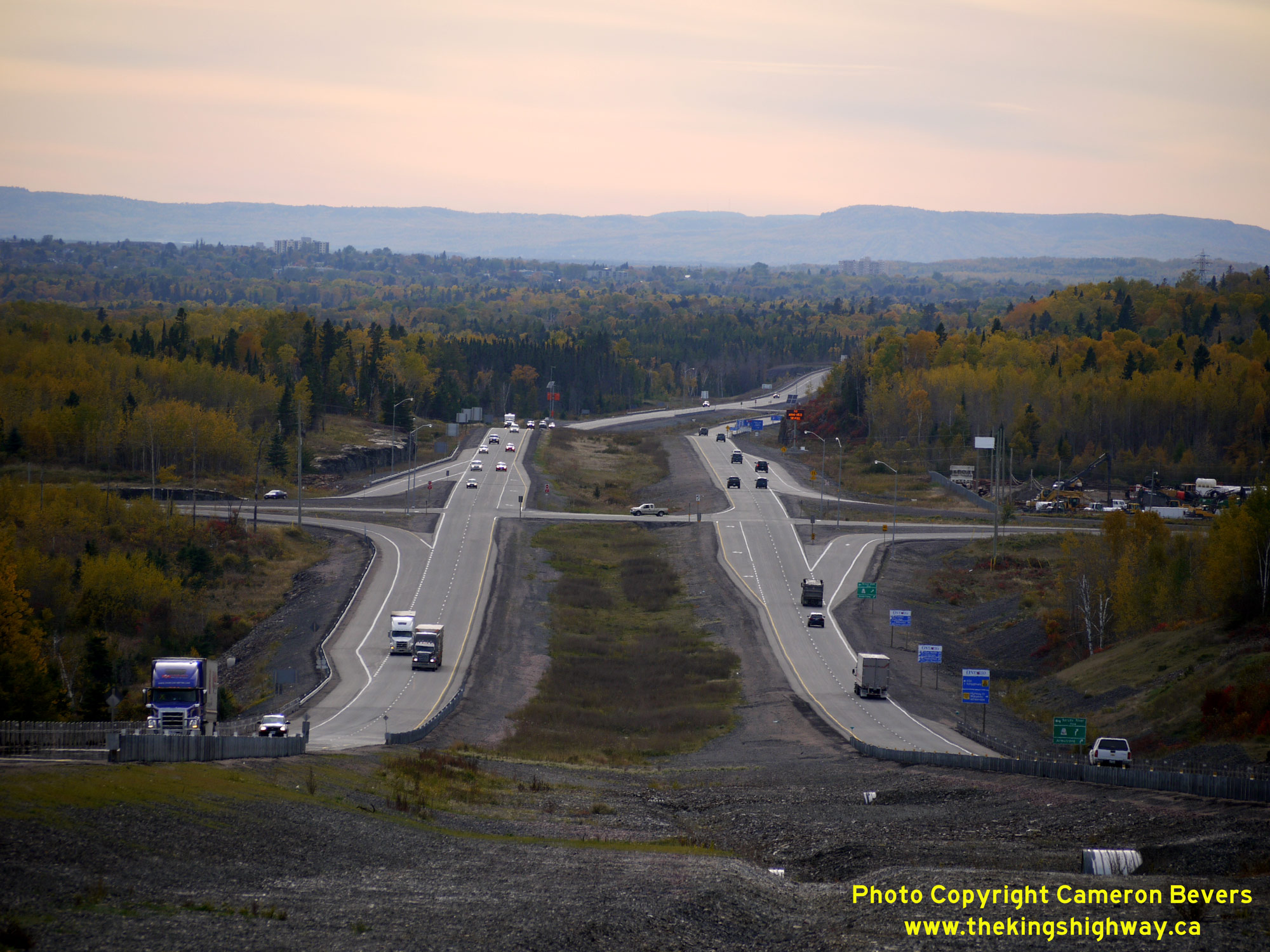
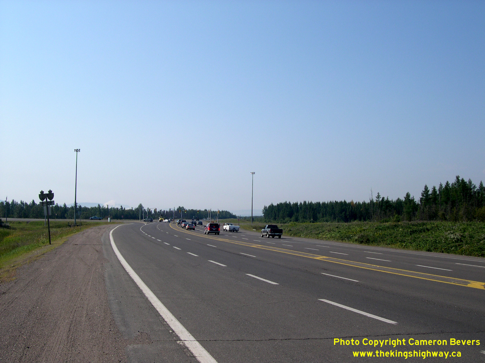
 Left - This great view of the reconstructed Hwy 527 Junction on Hwy 11 & Hwy 17 was taken at dusk in 2015, facing west towards Thunder Bay. The new highway
junction features fully channelized right-turn lanes on all approaches. The previous highway junction with the two-lane Hwy 11 & Hwy 17 featured a channelized
right-turn lane in the northwest quadrant only, from southbound Hwy 527 to westbound Hwy 11 & Hwy 17. The prominent mountain range in the background are the
Nor'Westers, which stretch from Thunder Bay down towards Minnesota. See an
Enlarged Photo Here. Left - This great view of the reconstructed Hwy 527 Junction on Hwy 11 & Hwy 17 was taken at dusk in 2015, facing west towards Thunder Bay. The new highway
junction features fully channelized right-turn lanes on all approaches. The previous highway junction with the two-lane Hwy 11 & Hwy 17 featured a channelized
right-turn lane in the northwest quadrant only, from southbound Hwy 527 to westbound Hwy 11 & Hwy 17. The prominent mountain range in the background are the
Nor'Westers, which stretch from Thunder Bay down towards Minnesota. See an
Enlarged Photo Here.(Photograph taken on October 7, 2015 - © Cameron Bevers) Right - Facing east along the two-lane Hwy 11 & Hwy 17 from the Hwy 527 Junction in 2006, prior to the highway's reconstruction and twinning. This road now
forms the eastbound carriageway of the new four-lane divided highway. This section of Hwy 11 & Hwy 17 is actually a relocation of the original highway, built in
conjunction with the Thunder Bay (Lakehead) Expressway during the late 1960s. The original route of Hwy 11 & Hwy 17 closely followed along the shores of Lake
Superior, but a new highway was built further inland on an improved alignment. A 4 1/4-mile section of Hwy 11 & Hwy 17 New was constructed east of the Hwy 527
Junction under Contract #1968-114, with the balance of the highway from that point easterly for 5 miles to existing Hwy 11 & Hwy 17 near Mackenzie River
constructed under Contract #1968-02. Final paving of the Lakehead Expressway east of the Hwy 527 Junction was completed under Contract #1969-131. The relocated
highway opened to traffic between Hwy 527 and the Mackenzie River in 1970. See an
Enlarged Photo Here.(Photograph taken on August 30, 2006 - © Cameron Bevers) 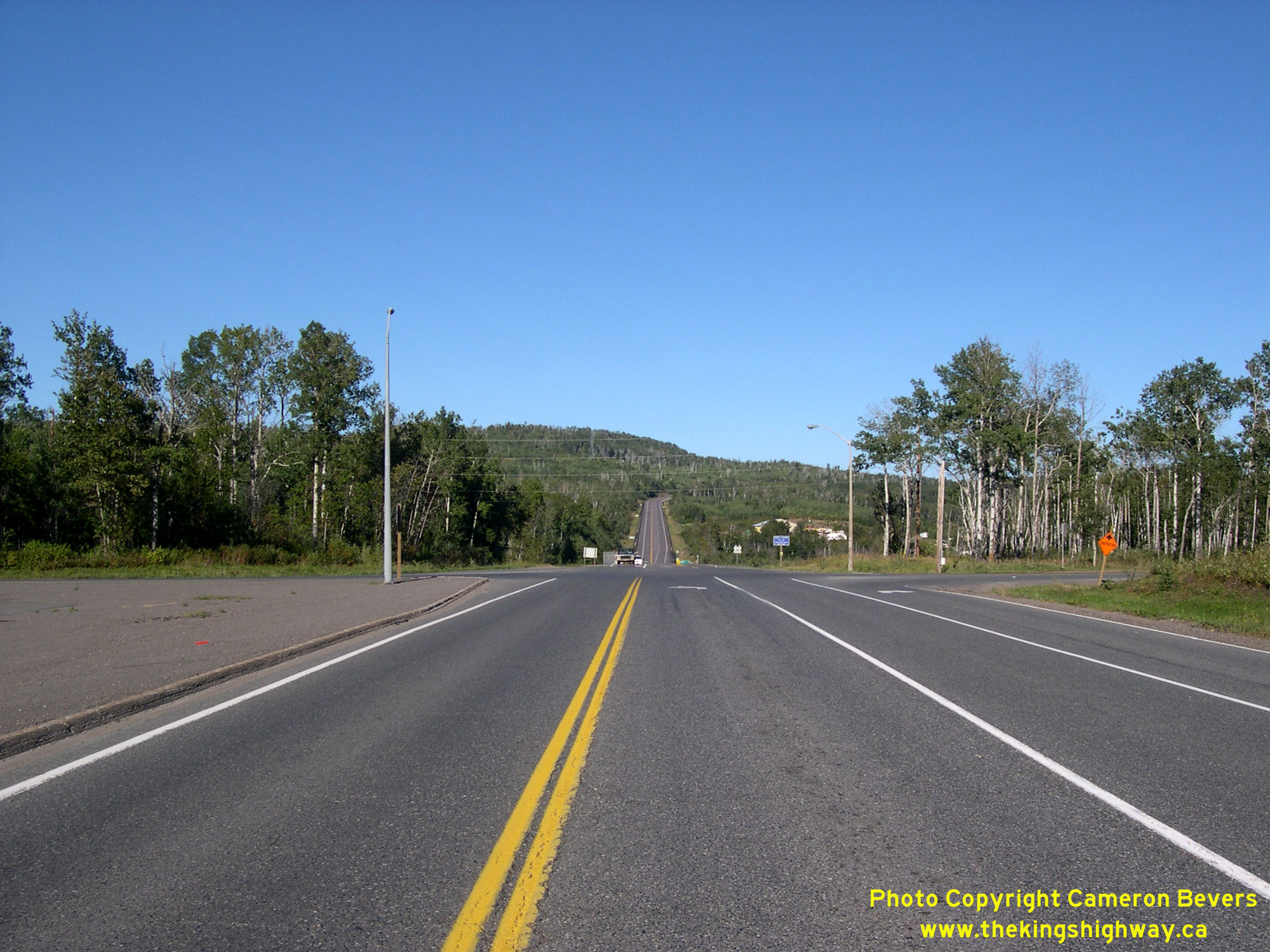
 Left - Facing east along the two-lane Hwy 11 & Hwy 17 at the Hwy 527 Junction in 2006, prior to the highway's reconstruction and twinning. See an
Enlarged Photo Here. Left - Facing east along the two-lane Hwy 11 & Hwy 17 at the Hwy 527 Junction in 2006, prior to the highway's reconstruction and twinning. See an
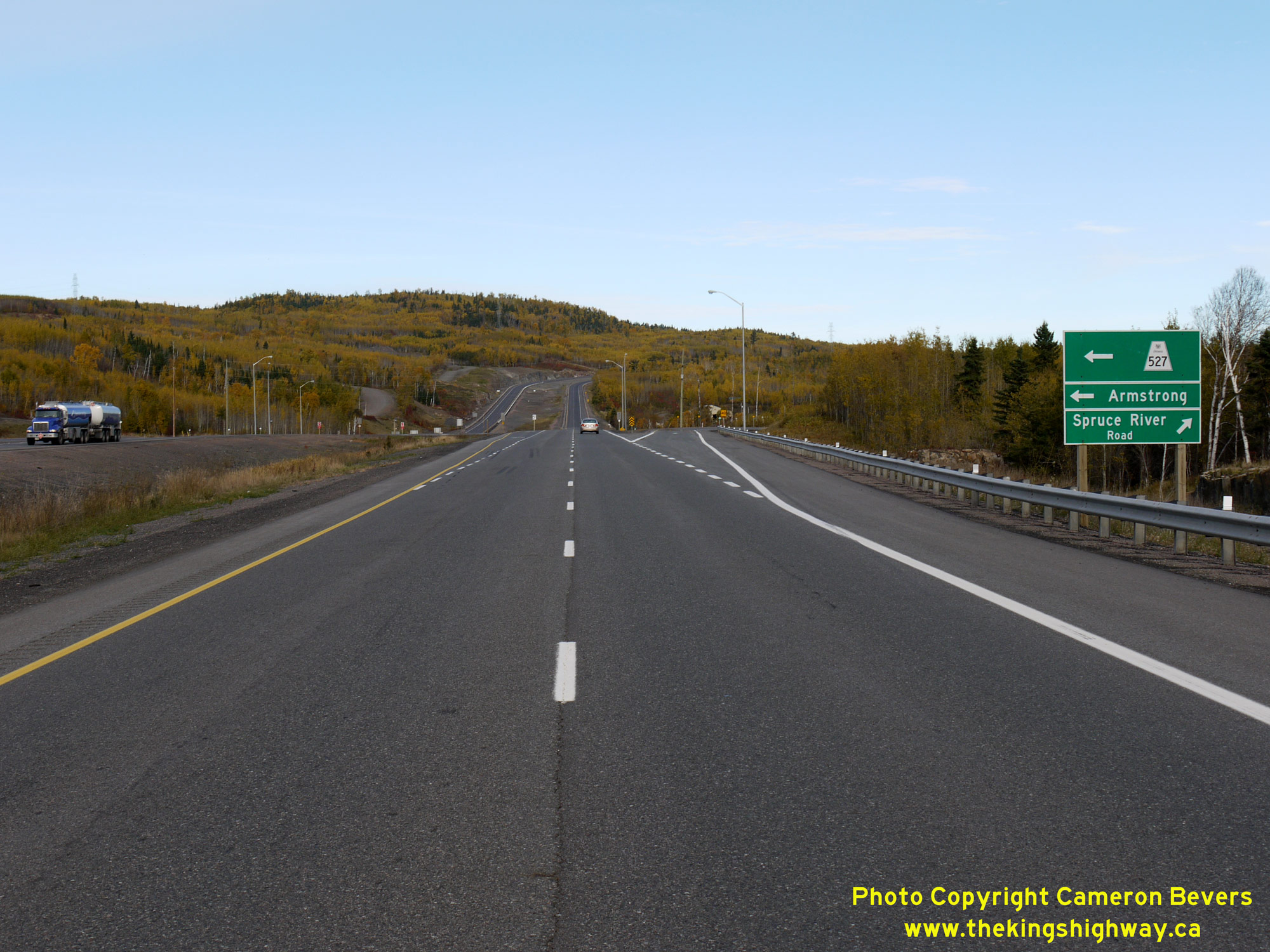
Enlarged Photo Here.(Photograph taken on August 30, 2006 - © Cameron Bevers) Right - View of the completed four-lane Hwy 11 & Hwy 17 approaching the Hwy 527 Junction in 2015, following reconstruction and twinning. The long route of
Hwy 527 begins at this highway junction and heads north to the northern community of Armstong, which lies almost 240 km to the north of Thunder Bay. See an
Enlarged Photo Here.(Photograph taken on October 7, 2015 - © Cameron Bevers) 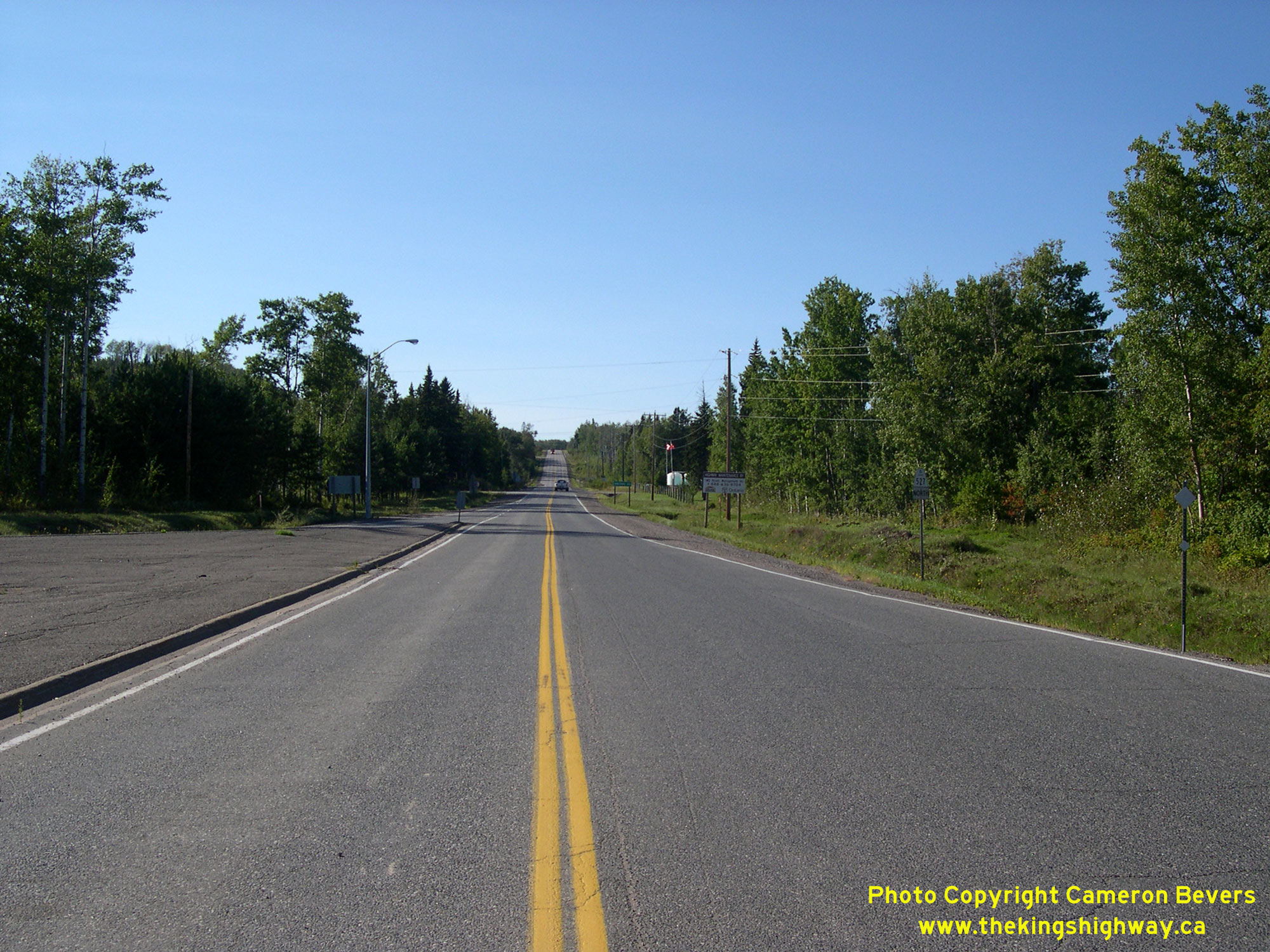
 Left - Facing north along Hwy 527 from the Hwy 11 & Hwy 17 Junction near Thunder Bay in 2006, prior to reconstruction. As a result of the four-lane
expansion of Hwy 11 & Hwy 17, this intersection was fully rebuilt and was shifted northerly in order to accommodate the new westbound carriageway of the divided
highway. See an Enlarged Photo Here. Left - Facing north along Hwy 527 from the Hwy 11 & Hwy 17 Junction near Thunder Bay in 2006, prior to reconstruction. As a result of the four-lane
expansion of Hwy 11 & Hwy 17, this intersection was fully rebuilt and was shifted northerly in order to accommodate the new westbound carriageway of the divided
highway. See an Enlarged Photo Here.(Photograph taken on August 30, 2006 - © Cameron Bevers) Right - View of Hwy 527 in 2011 following reconstruction of the junction, facing north from the new westbound lanes of Hwy 11 & Hwy 17. See an
Enlarged Photo Here.(Photograph taken on September 1, 2011 - © Cameron Bevers) 
 Left - Facing south along Hwy 527 approaching the highway's southern terminus at the Hwy 11 & Hwy 17 Junction east of Thunder Bay. See an
Enlarged Photo Here. Left - Facing south along Hwy 527 approaching the highway's southern terminus at the Hwy 11 & Hwy 17 Junction east of Thunder Bay. See an
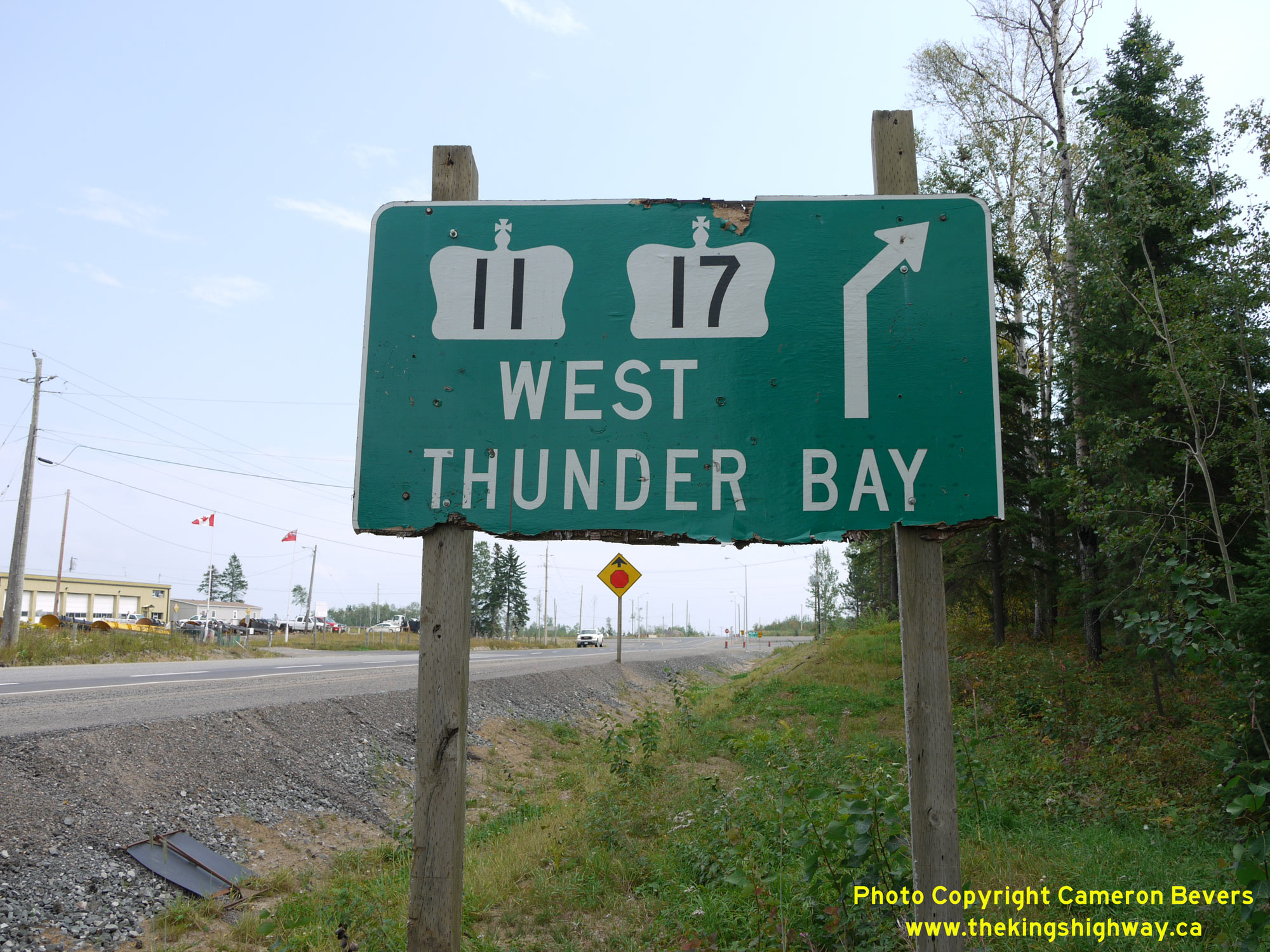
Enlarged Photo Here.(Photograph taken on September 1, 2011 - © Cameron Bevers) Right - This ancient Hwy 11 & Hwy 17 green guide sign likely dates back to the early 1980s, when a new right-turn channel was constructed at this junction.
See an Enlarged Photo Here.(Photograph taken on September 1, 2011 - © Cameron Bevers)  Above - Junction sign assembly at the southern terminus of Hwy 527 at the Hwy 11 & Hwy 17 Junction in Shuniah. See an
Enlarged Photo Here. Above - Junction sign assembly at the southern terminus of Hwy 527 at the Hwy 11 & Hwy 17 Junction in Shuniah. See an
Enlarged Photo Here.(Photograph taken on September 1, 2011 - © Cameron Bevers) 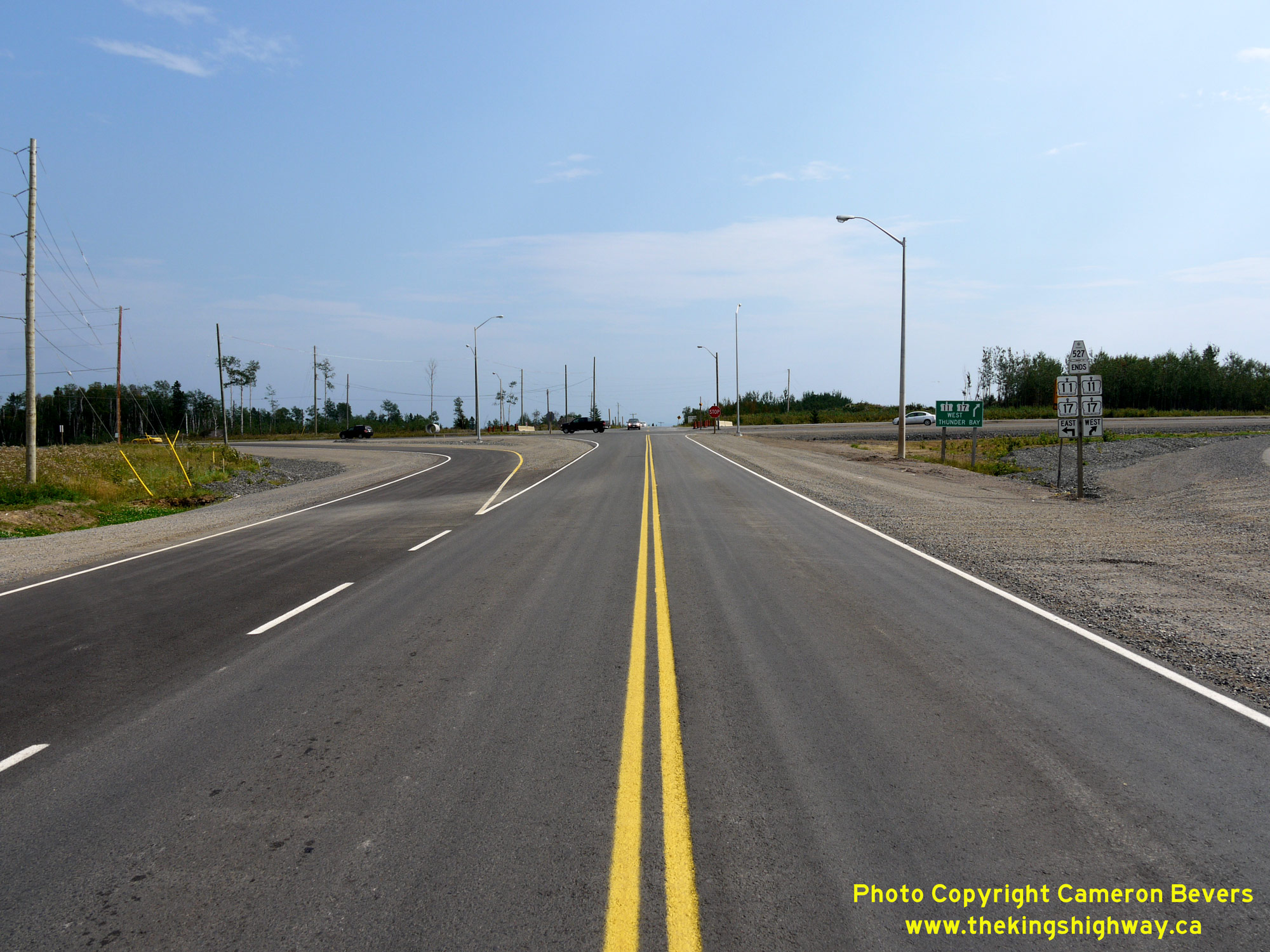
 Left - View of the Hwy 527 Junction during reconstruction in 2011, approaching the new westbound lanes of Hwy 11 & Hwy 17. Note that in this photo, the
previous two-lane highway (the future eastbound lanes) were closed for reconstruction with both directions of traffic temporarily using the westbound carriageway. See
an Enlarged Photo Here. Left - View of the Hwy 527 Junction during reconstruction in 2011, approaching the new westbound lanes of Hwy 11 & Hwy 17. Note that in this photo, the
previous two-lane highway (the future eastbound lanes) were closed for reconstruction with both directions of traffic temporarily using the westbound carriageway. See
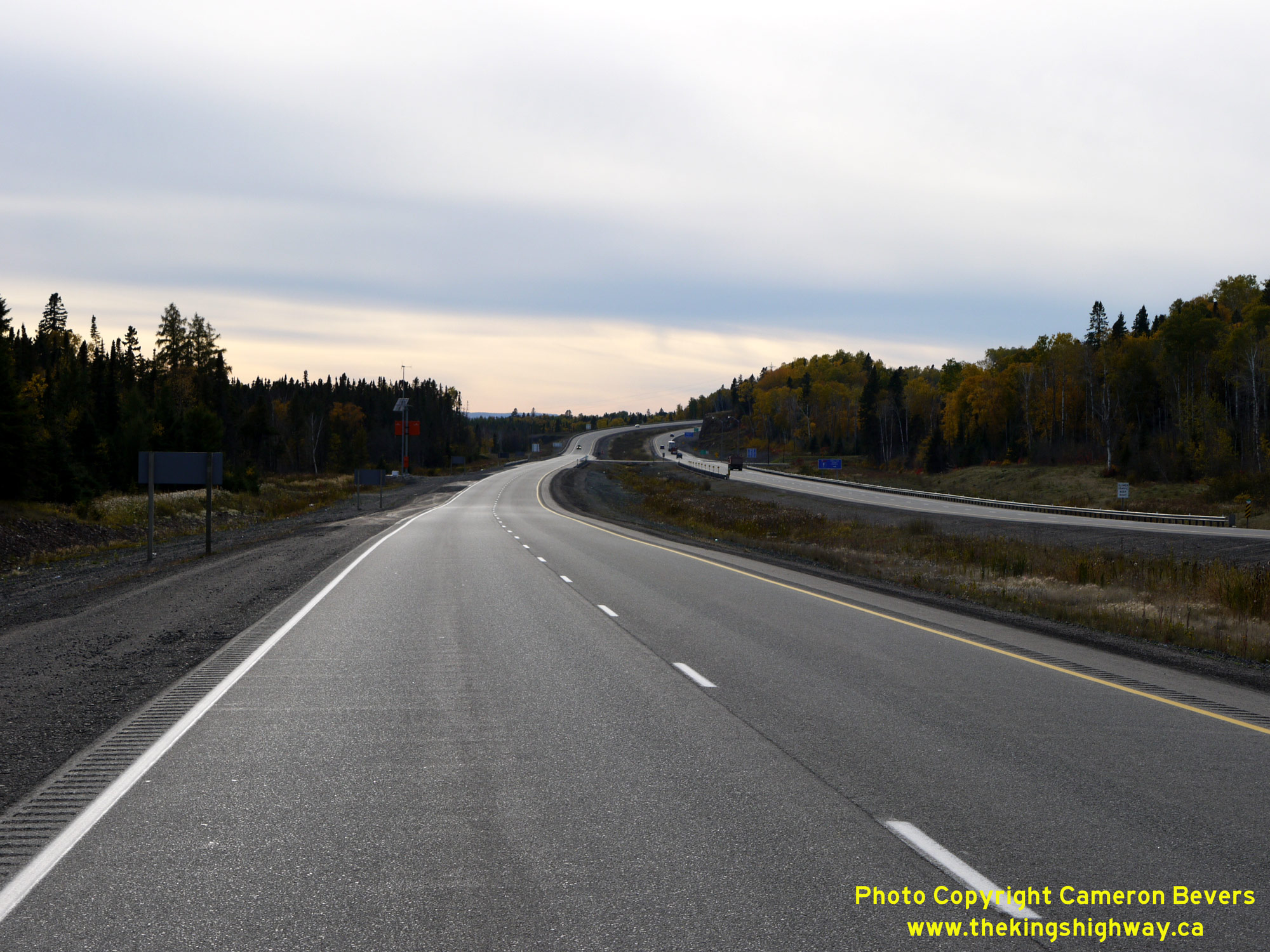
an Enlarged Photo Here.(Photograph taken on September 1, 2011 - © Cameron Bevers) Right - Completed four-lane section of Hwy 11 & Hwy 17 in 2015, facing east between the Terry Fox Scenic Lookout and the Hwy 527 Junction. See an
Enlarged Photo Here.(Photograph taken on October 7, 2015 - © Cameron Bevers) 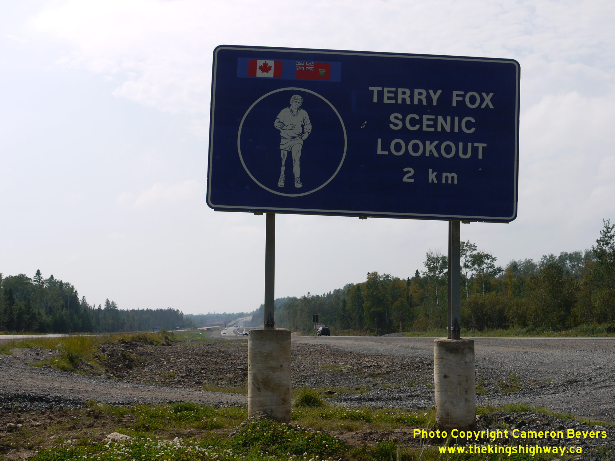
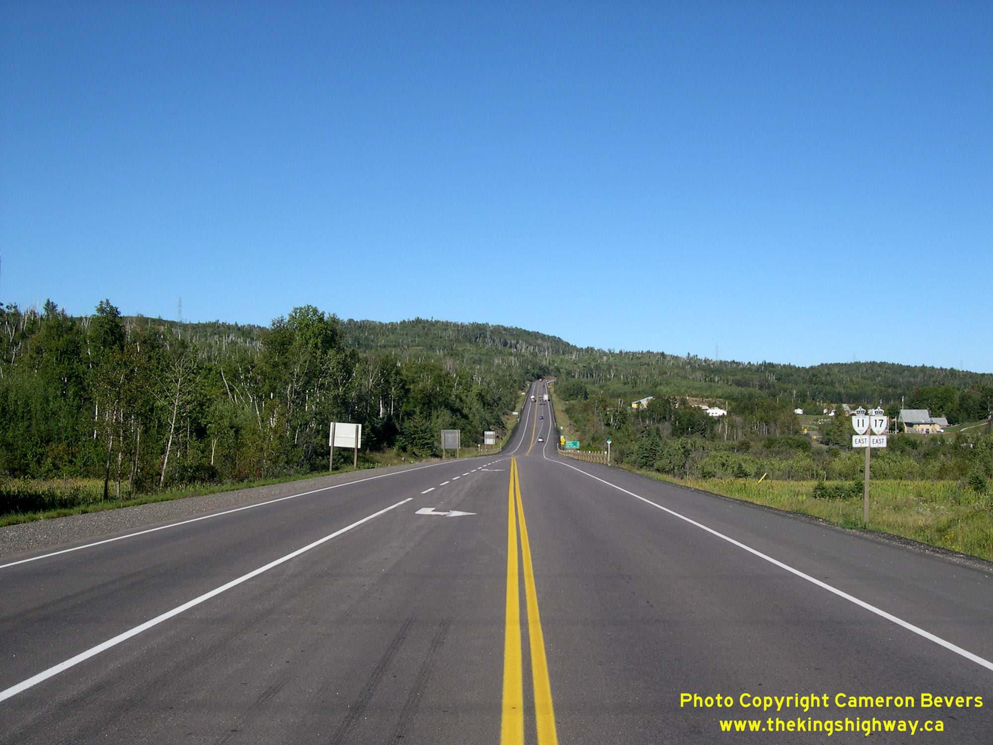
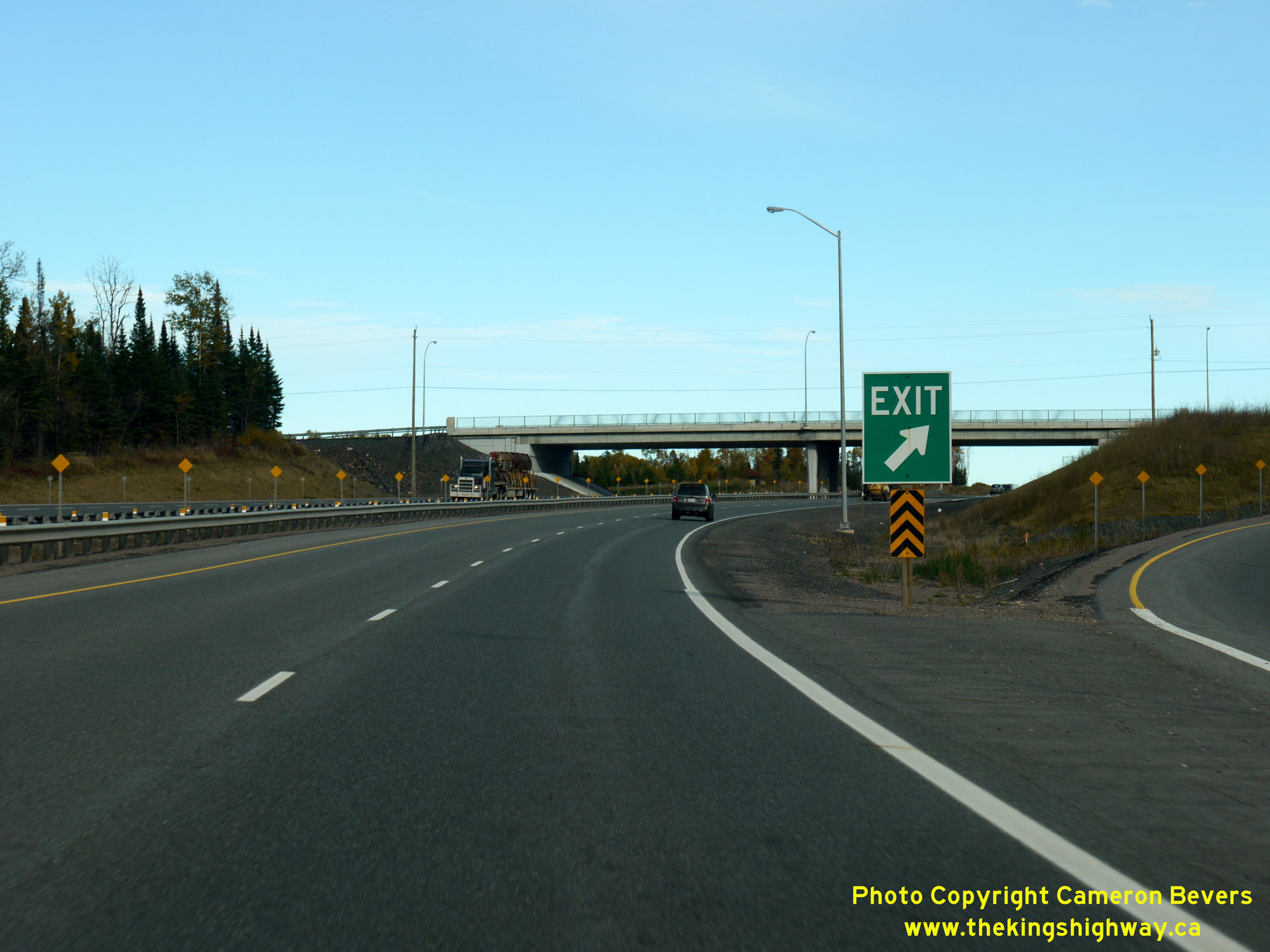
 Left - Guide sign marking the Terry Fox Scenic Lookout along the old two-lane route of Hwy 11 & Hwy 17 in 2011. At the time this photo was taken, the old
two-lane highway at left was closed for reconstruction, while the new westbound carriageway can be seen at right carrying both directions of traffic temporarily. See
an Enlarged Photo Here. Left - Guide sign marking the Terry Fox Scenic Lookout along the old two-lane route of Hwy 11 & Hwy 17 in 2011. At the time this photo was taken, the old
two-lane highway at left was closed for reconstruction, while the new westbound carriageway can be seen at right carrying both directions of traffic temporarily. See
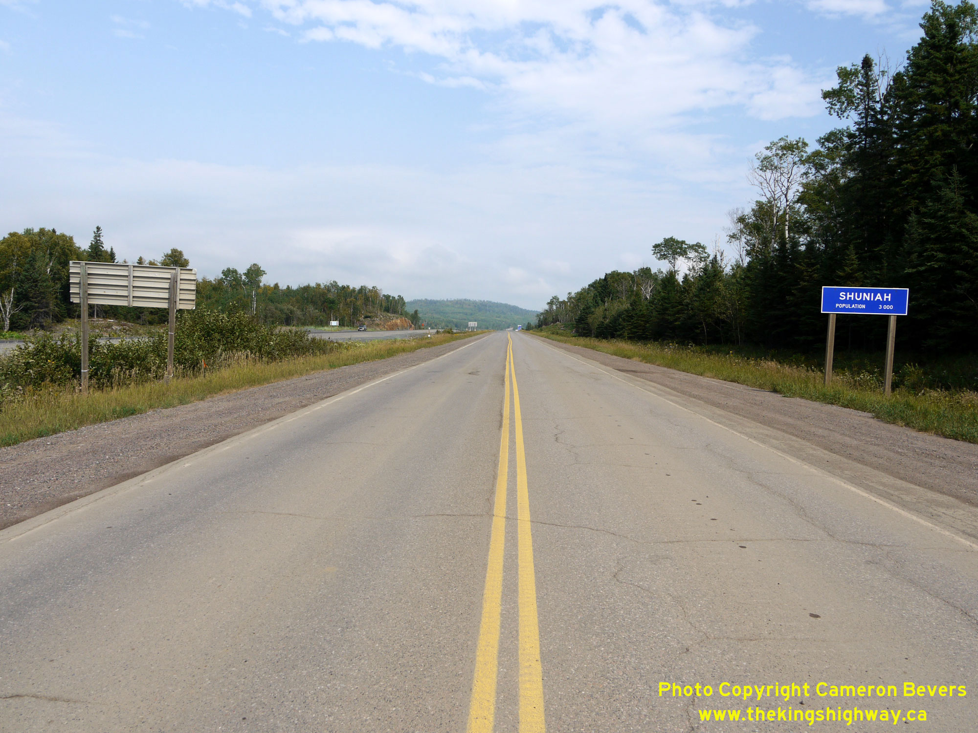
an Enlarged Photo Here.(Photograph taken on September 1, 2011 - © Cameron Bevers) Right - Blue-and-white municipal boundary sign for Shuniah along the old route of Hwy 11 & Hwy 17 in 2011. The Municipality of Shuniah extends easterly
along Hwy 11 & Hwy 17 and the shores of Lake Superior from Thunder Bay's City Limits. See an
Enlarged Photo Here.(Photograph taken on September 1, 2011 - © Cameron Bevers) 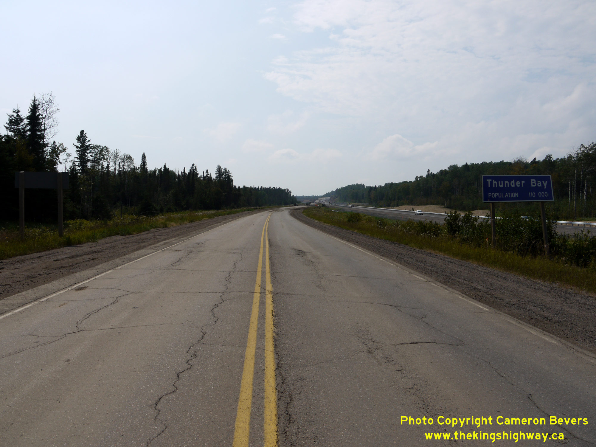
 Left - Facing west towards Thunder Bay along the old route of Hwy 11 & Hwy 17 at the city's eastern limits. The old route of Hwy 11 & Hwy 17 was closed
for reconstruction at the time this photo was taken in 2011, with all traffic using the new westbound carriageway at right. The reconstruction and widening of Hwy 11
& Hwy 17 from two to four lanes from Thunder Bay to east of the Hwy 527 Junction took place under Contract #2010-6001. See an
Enlarged Photo Here. Left - Facing west towards Thunder Bay along the old route of Hwy 11 & Hwy 17 at the city's eastern limits. The old route of Hwy 11 & Hwy 17 was closed
for reconstruction at the time this photo was taken in 2011, with all traffic using the new westbound carriageway at right. The reconstruction and widening of Hwy 11
& Hwy 17 from two to four lanes from Thunder Bay to east of the Hwy 527 Junction took place under Contract #2010-6001. See an
Enlarged Photo Here.(Photograph taken on September 1, 2011 - © Cameron Bevers) Right - Old extruded aluminum blue-and-white municipal boundary sign for Thunder Bay along the old route of Hwy 11 & Hwy 17 in 2011. With a population of
approximately 110,000, Thunder Bay is by far the largest urban centre in Northwestern Ontario. See an
Enlarged Photo Here.(Photograph taken on September 1, 2011 - © Cameron Bevers) 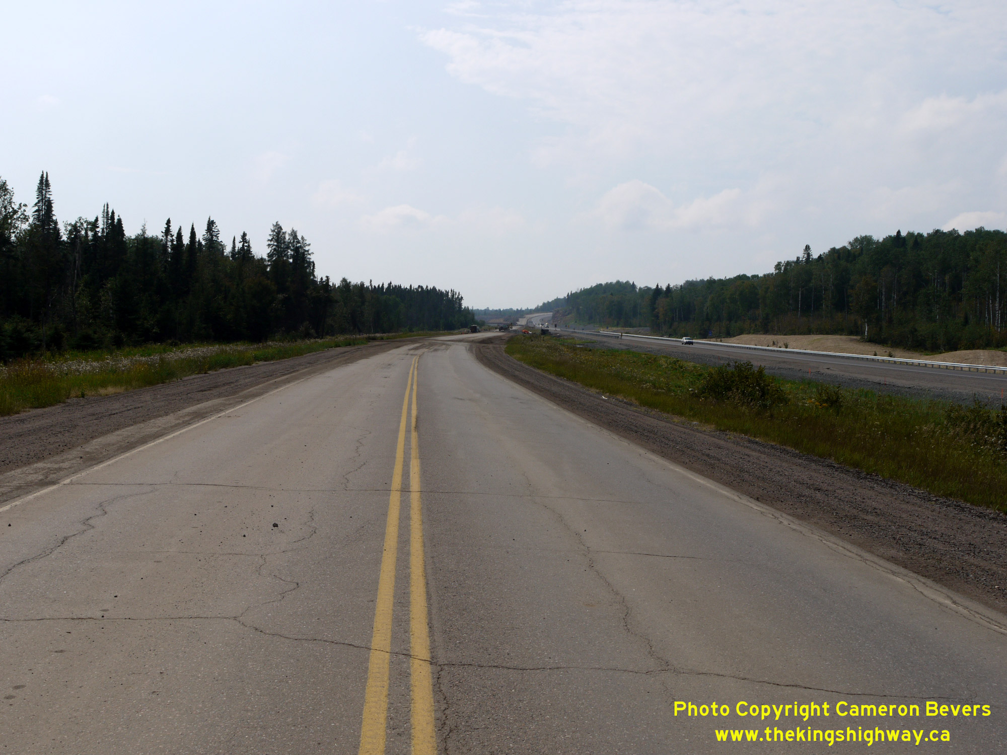
 Left - Old route of Hwy 11 & Hwy 17, facing west from Thunder Bay's City Limits in 2011. In this photo, all traffic was using the newly-constructed
westbound carriageway. The old highway seen here was closed for reconstruction. This roadway now forms the eastbound lanes of Hwy 11 & Hwy 17. This section of the
Lakehead (Thunder Bay) Expressway from the Hwy 527 Junction westerly to the Hwy 102 Junction (Red River Road) in Thunder Bay was constructed under Contract #1967-56
(grading), with final paving completed under Contract #1968-42. The new bypass highway temporarily opened to traffic between Red River Road and the Hwy 527 Junction
in the Fall of 1968, although it wasn't fully completed at that time. After operating on an interim basis throughout the Winter of 1968-1969, the Lakehead Expressway
was then fully closed again to traffic east of Red River Road in May 1969 to complete all remaining works. The Lakehead Expressway was then reopened to traffic on a
permanent basis in August 1969. See an Enlarged Photo Here. Left - Old route of Hwy 11 & Hwy 17, facing west from Thunder Bay's City Limits in 2011. In this photo, all traffic was using the newly-constructed
westbound carriageway. The old highway seen here was closed for reconstruction. This roadway now forms the eastbound lanes of Hwy 11 & Hwy 17. This section of the
Lakehead (Thunder Bay) Expressway from the Hwy 527 Junction westerly to the Hwy 102 Junction (Red River Road) in Thunder Bay was constructed under Contract #1967-56
(grading), with final paving completed under Contract #1968-42. The new bypass highway temporarily opened to traffic between Red River Road and the Hwy 527 Junction
in the Fall of 1968, although it wasn't fully completed at that time. After operating on an interim basis throughout the Winter of 1968-1969, the Lakehead Expressway
was then fully closed again to traffic east of Red River Road in May 1969 to complete all remaining works. The Lakehead Expressway was then reopened to traffic on a
permanent basis in August 1969. See an Enlarged Photo Here.(Photograph taken on September 1, 2011 - © Cameron Bevers) Right - Completed four-lane route of Hwy 11 & Hwy 17 in 2015, facing west towards Thunder Bay from the city limits. See an
Enlarged Photo Here.(Photograph taken on October 7, 2015 - © Cameron Bevers) 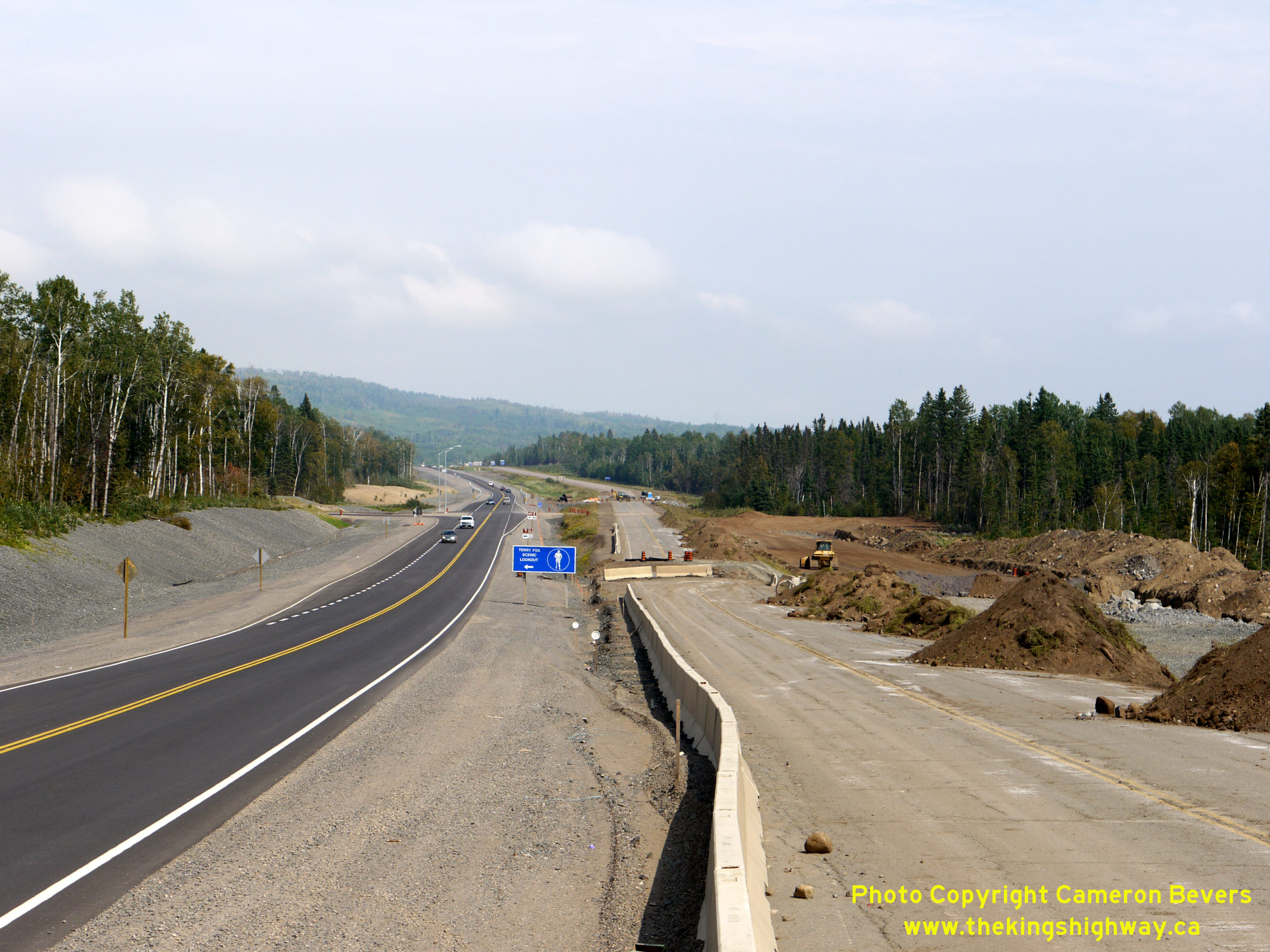
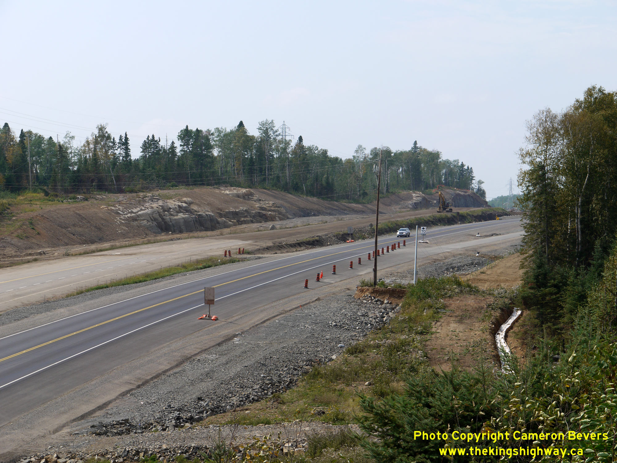
 Left - Reconstruction and twinning of Hwy 11 & Hwy 17 underway in 2011, facing east towards the Terry Fox Scenic Lookout. The old two-lane highway at right
was abandoned altogether. The future eastbound carriageway can be seen under construction at far right, while the newly-completed westbound carriageway can be seen at
left, carrying both directions of traffic temporarily. See an Enlarged Photo Here. Left - Reconstruction and twinning of Hwy 11 & Hwy 17 underway in 2011, facing east towards the Terry Fox Scenic Lookout. The old two-lane highway at right
was abandoned altogether. The future eastbound carriageway can be seen under construction at far right, while the newly-completed westbound carriageway can be seen at
left, carrying both directions of traffic temporarily. See an Enlarged Photo Here.(Photograph taken on September 1, 2011 - © Cameron Bevers) Right - Completed four-lane route of Hwy 11 & Hwy 17 in 2015, facing east towards the Terry Fox Scenic Lookout. See an
Enlarged Photo Here.(Photograph taken on October 7, 2015 - © Cameron Bevers) 
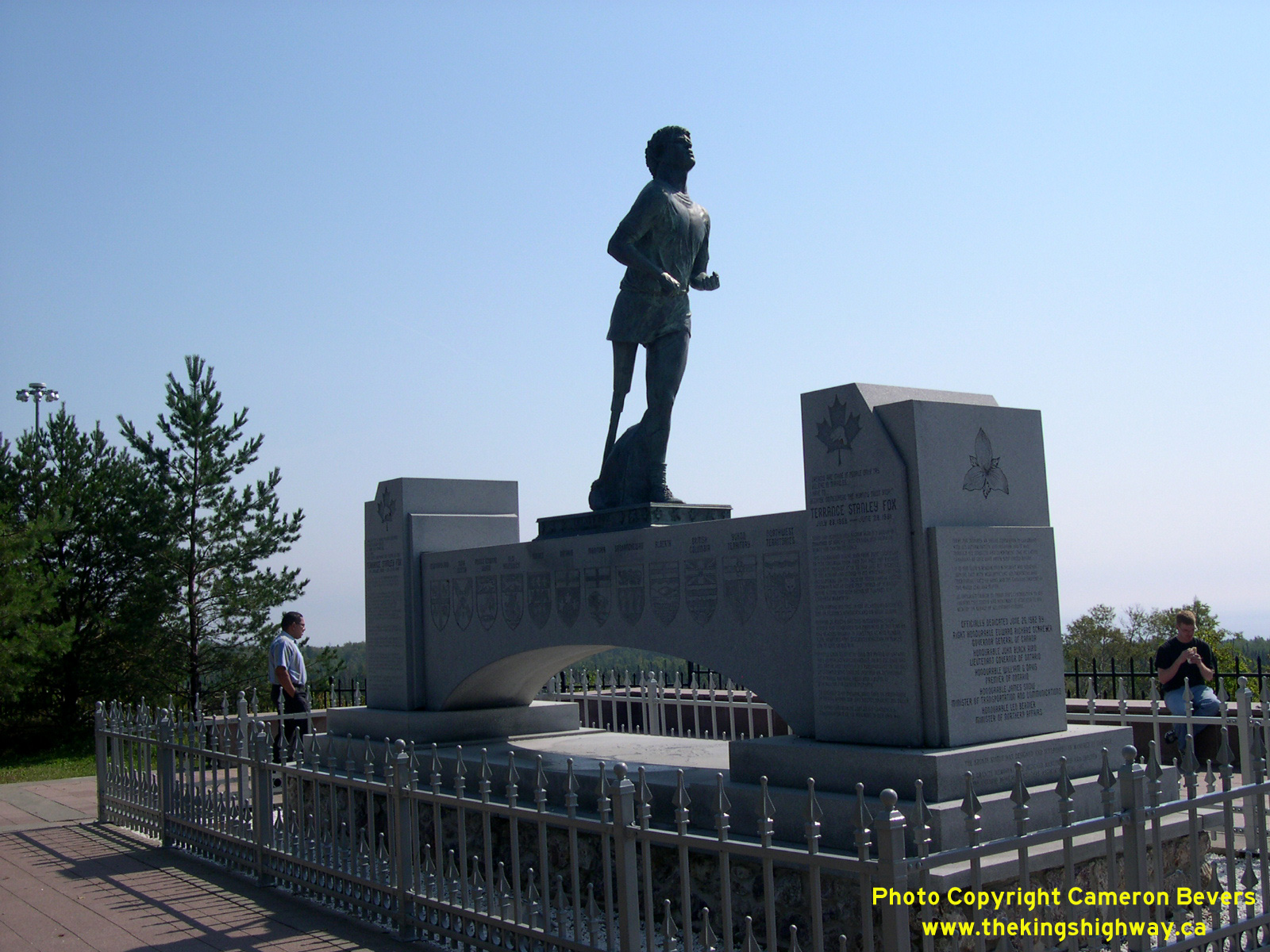
Left - Terry Fox Monument, located in a memorial park beside Hwy 11 & Hwy 17 just east of Thunder Bay. See an
Enlarged Photo Here. (Photograph taken on September 3, 2004 - © Cameron Bevers) Right - Another view of the Terry Fox Monument. This commemorative monument was unveiled by the Government of Ontario in 1982, shortly after Terry Fox lost his battle with cancer. This site was chosen because it marks the approximate point where Terry Fox's courageous "Marathon of Hope" run across Canada came to an end in the Fall of 1980. See an Enlarged Photo Here. (Photograph taken on September 3, 2004 - © Cameron Bevers)  Above - Inscription on the Terry Fox Monument, commemorating its unveiling on June 26, 1982. See an
Enlarged Photo Here. Above - Inscription on the Terry Fox Monument, commemorating its unveiling on June 26, 1982. See an
Enlarged Photo Here.(Photograph taken on September 1, 2011 - © Cameron Bevers) 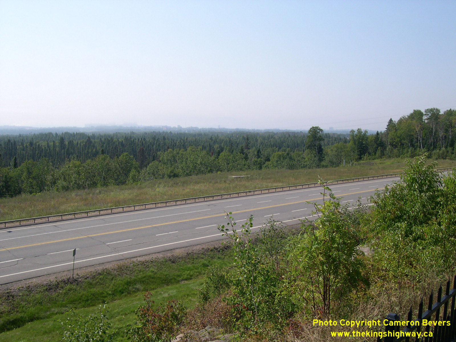

Left - When the Terry Fox Monument was originally dedicated in 1982, it was located on the south side of Hwy 11 & Hwy 17 in a small roadside scenic lookout
point. This scenic lookout point was built in 1968 as part of the initial construction of the Lakehead Expressway. It was situated in the flat grassy area on the
opposite side of the highway in this 2004 photo. After the Terry Fox Monument was installed there in 1982, the tiny parking area at the scenic lookout quickly became
inadequate for the large number of visitors who stopped at the monument. In 1993, the MTO relocated the Terry Fox Monument into a new expanded rest area directly
across the road. An old concrete base marks the original monument's location, which is still visible in the tall grass across the road from the relocated monument.
The new Terry Fox Scenic Lookout has considerably more parking than its predecessor, and it offers much better facilities for tourists. See an
Enlarged Photo Here. (Photograph taken on September 3, 2004 - © Cameron Bevers) Right - View of the former Terry Fox Scenic Lookout site along the southern side of Hwy 11 & Hwy 17 in 2011, just before the old park site was removed
altogether in order to construct the future eastbound carriageway of the twinned Hwy 11 & Hwy 17. See an
Enlarged Photo Here.(Photograph taken on September 1, 2011 - © Cameron Bevers) 
Left - The old Terry Fox Scenic Lookout was located just off to the left of the highway in this 2004 photo. Following the relocation of the Terry Fox Monument
in the early 1990s, the old scenic lookout point was permanently closed and barricaded off by a steel box-beam barrier. See an
Enlarged Photo Here. (Photograph taken on September 3, 2004 - © Cameron Bevers) Right - Facing west along Hwy 11 & Hwy 17 towards the Hodder Avenue Interchange in 2011, while under construction under Contract #2010-6001. See an
Enlarged Photo Here.(Photograph taken on September 1, 2011 - © Cameron Bevers) 
 Left - Relocation of the Terry Fox Scenic Lookout access road on Hwy 11 & Hwy 17 under Contract #2010-6001. As a result of the construction of the nearby
Hodder Avenue Interchange in 2010-2011, the access road to the Terry Fox Scenic Lookout had to be relocated further east so that it did not conflict with the exit
ramp's operations. See an Enlarged Photo Here. Left - Relocation of the Terry Fox Scenic Lookout access road on Hwy 11 & Hwy 17 under Contract #2010-6001. As a result of the construction of the nearby
Hodder Avenue Interchange in 2010-2011, the access road to the Terry Fox Scenic Lookout had to be relocated further east so that it did not conflict with the exit
ramp's operations. See an Enlarged Photo Here.(Photograph taken on September 1, 2011 - © Cameron Bevers) Right - View of the former Terry Fox Scenic Lookout access road on Hwy 11 & Hwy 17. The entrance to the park was relocated about 700 metres to the east as
part of the expansion and twinning of Hwy 11 & Hwy 17 under Contract #2010-6001. See an
Enlarged Photo Here.(Photograph taken on September 1, 2011 - © Cameron Bevers) 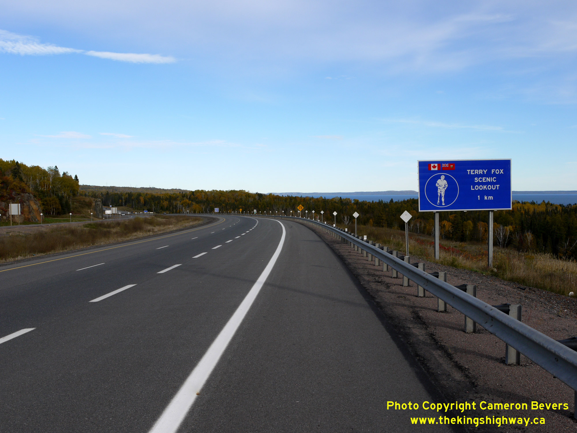
 Left - Guide sign marking the Terry Fox Scenic Lookout along the completed four-lane route of Hwy 11 & Hwy 17 in 2015. See an
Enlarged Photo Here. Left - Guide sign marking the Terry Fox Scenic Lookout along the completed four-lane route of Hwy 11 & Hwy 17 in 2015. See an
Enlarged Photo Here.(Photograph taken on October 7, 2015 - © Cameron Bevers) Right - Facing south along Hodder Avenue (Former Hwy 11B & Hwy 17B) from the Thunder Bay Expressway (Hwy 11 & Hwy 17). Originally, Hwy 11 & Hwy 17
passed right through the city centre. A new bypass road was constructed during the second half of the 1960s which carried Hwy 11 & Hwy 17 along a relocated route
which orbited the lakehead cities of Port Arthur and Fort William. Known originally as the Lakehead Expressway, the bypass road was eventually renamed the Thunder Bay
Expressway, following the amalgamation of Port Arthur and Fort William as the City of Thunder Bay in 1970. See an
Enlarged Photo Here.(Photograph taken on September 1, 2011 - © Cameron Bevers) 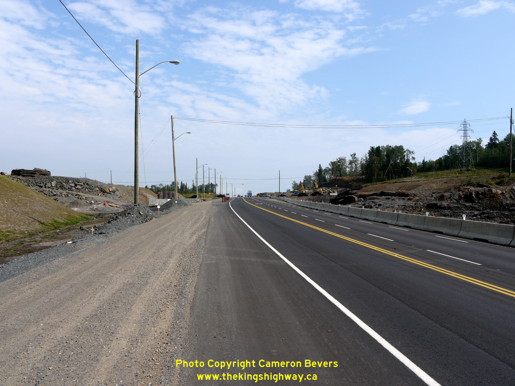
 Left - Construction of the new grade separation at Hodder Avenue on Hwy 11 & Hwy 17 in 2011 at the northeast entrance to Thunder Bay, Contract #2010-6001.
See an Enlarged Photo Here. Left - Construction of the new grade separation at Hodder Avenue on Hwy 11 & Hwy 17 in 2011 at the northeast entrance to Thunder Bay, Contract #2010-6001.
See an Enlarged Photo Here.(Photograph taken on September 1, 2011 - © Cameron Bevers) Right - Completed Hodder Avenue Interchange on the Thunder Bay Expressway (Hwy 11 & Hwy 17) in 2015. This was the first grade-separated interchange built
along Hwy 11 & Hwy 17 in the Thunder Bay area. Previously, Hodder Avenue crossed Hwy 11 & Hwy 17 at an at-grade stop-controlled intersection. See an
Enlarged Photo Here.(Photograph taken on October 7, 2015 - © Cameron Bevers) 
 Left - View of the completed four-lane Hwy 11 & Hwy 17 in 2015, facing east from the new Hodder Avenue Overpass in Thunder Bay. See an
Enlarged Photo Here. Left - View of the completed four-lane Hwy 11 & Hwy 17 in 2015, facing east from the new Hodder Avenue Overpass in Thunder Bay. See an
Enlarged Photo Here.(Photograph taken on October 7, 2015 - © Cameron Bevers) Right - Facing south along Hodder Avenue at the new grade-separated interchange on Hwy 11 & Hwy 17 in 2015. See an
Enlarged Photo Here.(Photograph taken on October 7, 2015 - © Cameron Bevers) 

Left - Facing west along Hwy 11 & Hwy 17 (Thunder Bay Expressway) towards the dual bridges over the Current River, as seen from Hodder Avenue in 2004.
Until the completion of the Hodder Avenue Interchange on Hwy 11 & Hwy 17 in 2012, the divided highway came to an end at this point. From this point easterly to
Nipigon, Hwy 11 & Hwy 17 was a two-lane undivided highway until fairly recently. Over the last several years, a number of sections of Hwy 11 & Hwy 17 have
been expanded from two to four lanes between Thunder Bay and Nipigon. See an
Enlarged Photo Here. (Photograph taken on September 3, 2004 - © Cameron Bevers) Right - View of the completed four-lane Hwy 11 & Hwy 17 approaching the dual bridges over the Current River in 2015, facing west from the new Hodder Avenue
Overpass. Note that the two dual roadways no longer converge east of the Current River structures as they did previously. The original two-lane Hwy 11 & Hwy 17
structure over the Current River was constructed under Contract #1967-56 and was completed in 1968. This structure presently carries the eastbound lanes of Hwy 11
& Hwy 17 at left. A twin structure carrying the westbound lanes was constructed over the Current River under Contract #1992-230. This newer twin structure, seen
here at right, was completed in 1993. See an Enlarged Photo Here.(Photograph taken on October 7, 2015 - © Cameron Bevers) 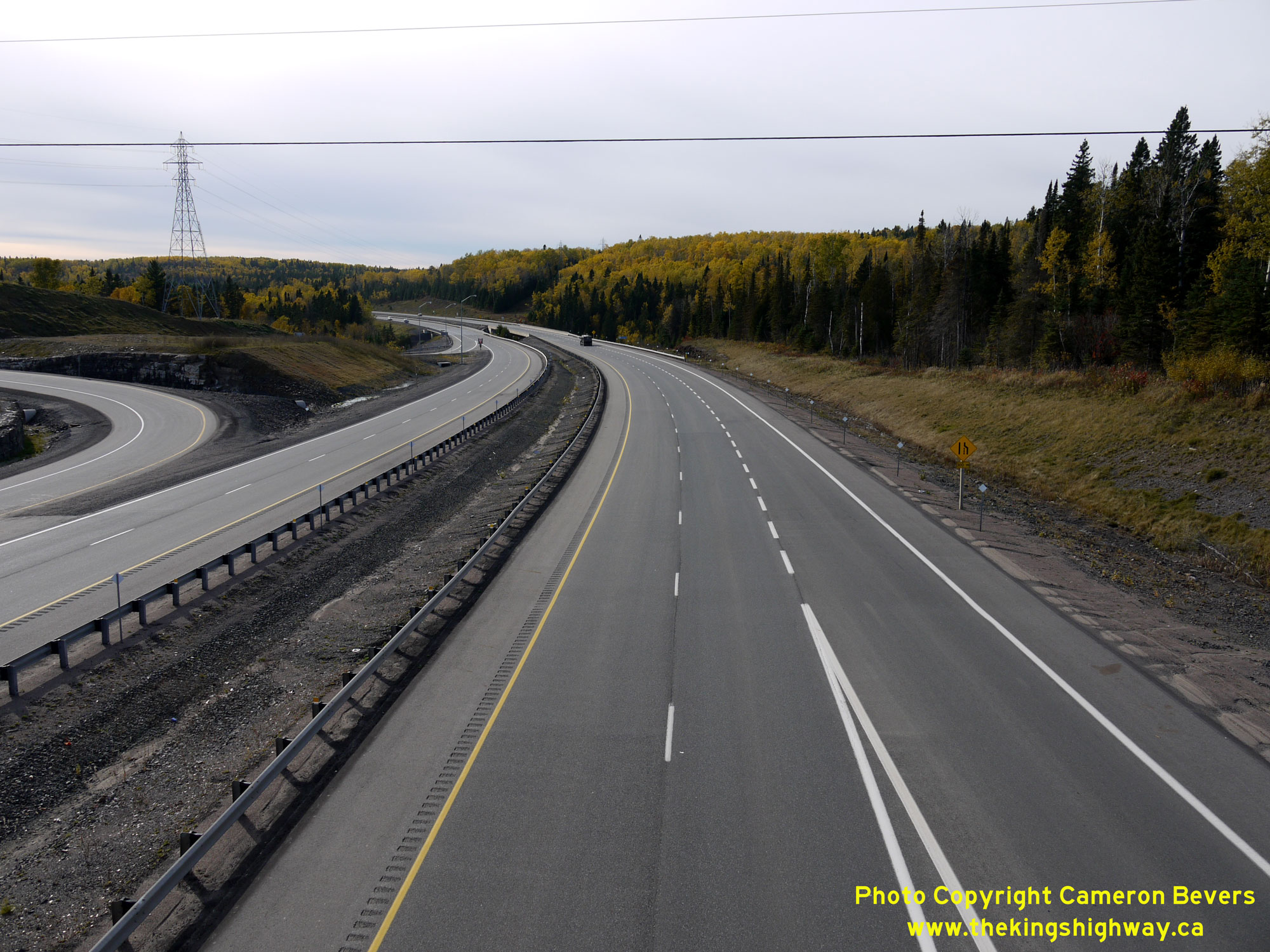
 Left - Western side of the completed Hodder Avenue Interchange on the new four-lane Hwy 11 & Hwy 17 in 2015, facing west towards Thunder Bay. See an
Enlarged Photo Here. Left - Western side of the completed Hodder Avenue Interchange on the new four-lane Hwy 11 & Hwy 17 in 2015, facing west towards Thunder Bay. See an
Enlarged Photo Here.(Photograph taken on October 7, 2015 - © Cameron Bevers) Right - Plywood interchange guide signs on eastbound Hwy 11 & Hwy 17 for the upcoming Hodder Avenue Interchange. Copenhagen Road is also accessible from
the Hodder Avenue Interchange and is thus also signed as an exit along the Thunder Bay Expressway. See an
Enlarged Photo Here.(Photograph taken on October 7, 2015 - © Cameron Bevers) 
 Left - Facing east along Hwy 11 & Hwy 17 between Balsam Street and the Current River Bridge. Just over 3 km of the Thunder Bay Expressway was "twinned" in
the 1990s between Balsam Street and Hodder Avenue (Hwy 11B & Hwy 17B), when a new two-lane carriageway was built beside the existing two-lane highway. The newer
carriageway at left accommodates westbound traffic only and was constructed under Contract #1994-234. For almost 2 decades, this was Northwestern Ontario's only
section of high-speed divided highway. See an Enlarged Photo Here. Left - Facing east along Hwy 11 & Hwy 17 between Balsam Street and the Current River Bridge. Just over 3 km of the Thunder Bay Expressway was "twinned" in
the 1990s between Balsam Street and Hodder Avenue (Hwy 11B & Hwy 17B), when a new two-lane carriageway was built beside the existing two-lane highway. The newer
carriageway at left accommodates westbound traffic only and was constructed under Contract #1994-234. For almost 2 decades, this was Northwestern Ontario's only
section of high-speed divided highway. See an Enlarged Photo Here.(Photograph taken on October 7, 2015 - © Cameron Bevers) Right - Warning signs on eastbound Hwy 11 & Hwy 17 in 2011, indicating the upcoming end of the divided highway at the dual bridges over the Current River.
These signs have since been removed, as the four-lane divided highway now extends to a point well east of Thunder Bay due to recent highway expansion projects. See an
Enlarged Photo Here.(Photograph taken on September 2, 2011 - © Cameron Bevers) 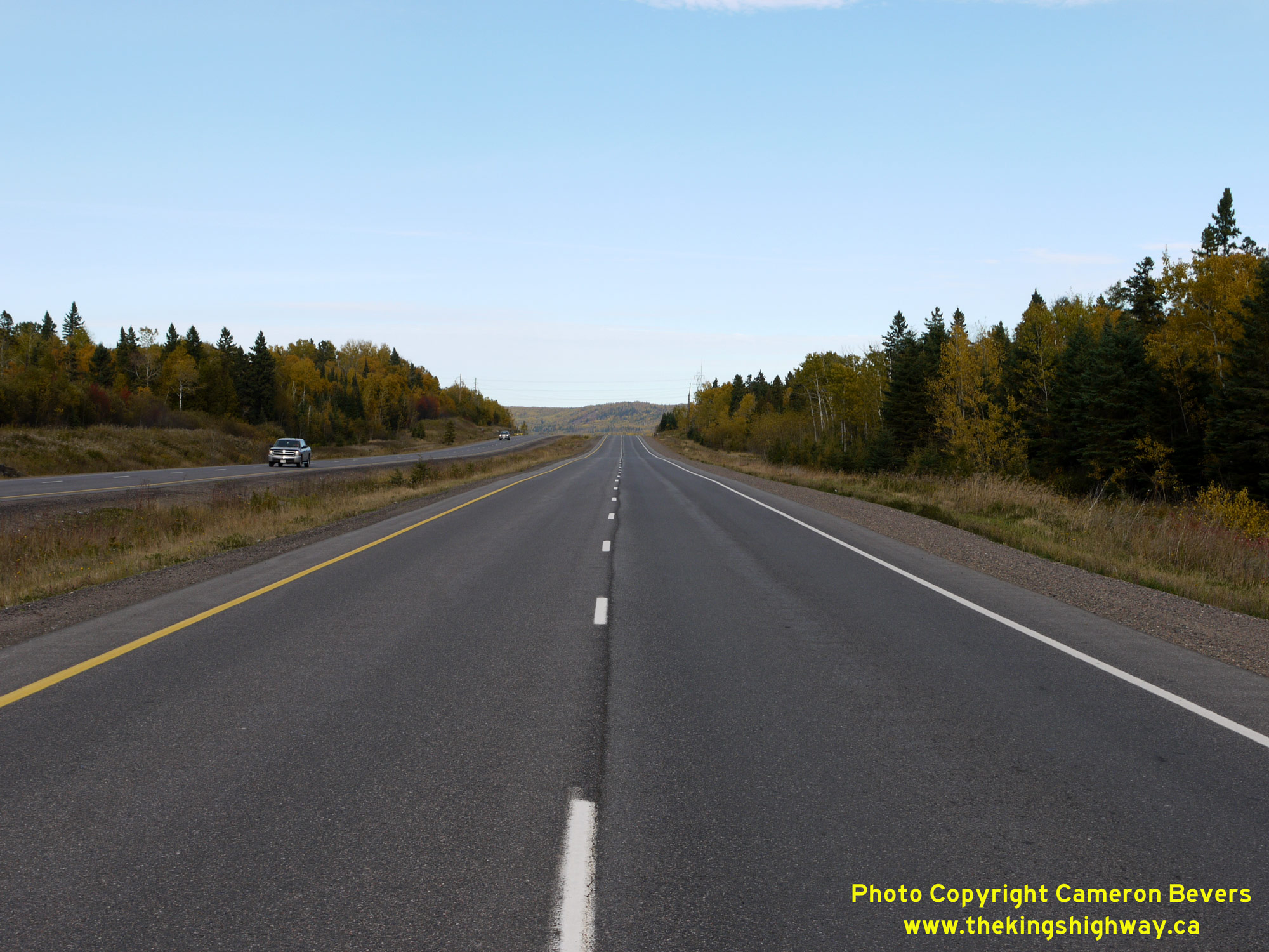
 Left - View of the Thunder Bay Expressway (Hwy 11 & Hwy 17) in 2015, facing east between Balsam Street and Hodder Avenue. This photo shows a typical view
of the Thunder Bay Expressway's design in the northeastern end of the city, with separate eastbound and westbound carriageways with a depressed grass centre median
lying between them. This section of the Thunder Bay Expressway was initially built in the 1960s as a two-lane undivided highway, which was later expanded to four
lanes in the 1990s by constructing a new twin carriageway. See an Enlarged Photo Here. Left - View of the Thunder Bay Expressway (Hwy 11 & Hwy 17) in 2015, facing east between Balsam Street and Hodder Avenue. This photo shows a typical view
of the Thunder Bay Expressway's design in the northeastern end of the city, with separate eastbound and westbound carriageways with a depressed grass centre median
lying between them. This section of the Thunder Bay Expressway was initially built in the 1960s as a two-lane undivided highway, which was later expanded to four
lanes in the 1990s by constructing a new twin carriageway. See an Enlarged Photo Here.(Photograph taken on October 7, 2015 - © Cameron Bevers) Right - Thunder Bay Expressway (Hwy 11 & Hwy 17) facing east from Balsam Street in 2004, showing the start of the four-lane divided highway with the depressed grass centre median. The Thunder Bay Expressway from Balsam Street to the Thunder Bay Airport is a divided four-lane highway with a flush painted median, but without a physical barrier or divider between the eastbound and westbound lanes. See an Enlarged Photo Here. (Photograph taken on September 3, 2004 - © Cameron Bevers) 

Left - Approach to the Balsam Street intersection on Hwy 11 & Hwy 17, facing west. For westbound Hwy 17 motorists, this is the first set of traffic signals
encountered since leaving Sault Ste Marie, which is located nearly 700 km to the east. See an
Enlarged Photo Here. (Photograph taken on September 3, 2004 - © Cameron Bevers) Right - Facing east along Hwy 11 & Hwy 17 approaching Balsam Street in Thunder Bay. See an
Enlarged Photo Here.(Photograph taken on August 30, 2006 - © Cameron Bevers) 
 Left - Warning sign facing eastbound traffic on Hwy 11 & Hwy 17 in advance of Balsam Street, advising motorists of the divided highway with a physical
centre median ahead. The balance of the Thunder Bay Expressway from Balsam Street easterly is also technically a divided highway, as it has a 4-foot (1.25 m) flush
painted median. Highways with this design do not have a centre barrier or divider. See an
Enlarged Photo Here. Left - Warning sign facing eastbound traffic on Hwy 11 & Hwy 17 in advance of Balsam Street, advising motorists of the divided highway with a physical
centre median ahead. The balance of the Thunder Bay Expressway from Balsam Street easterly is also technically a divided highway, as it has a 4-foot (1.25 m) flush
painted median. Highways with this design do not have a centre barrier or divider. See an
Enlarged Photo Here.(Photograph taken on September 1, 2011 - © Cameron Bevers) Right - Advance green guide sign for the upcoming Hwy 102 Junction on westbound Hwy 11 & Hwy 17 at Red River Road. The route of Hwy 102 between Thunder Bay
and Sistonen's Corners provides an alternate route to the Trans-Canada Highway in the Thunder Bay area. Long-distance through traffic can also use the Hwy 102 cut-off
to reach Kenora and Dryden instead of staying on Hwy 17. See an Enlarged Photo Here.(Photograph taken on September 1, 2011 - © Cameron Bevers) 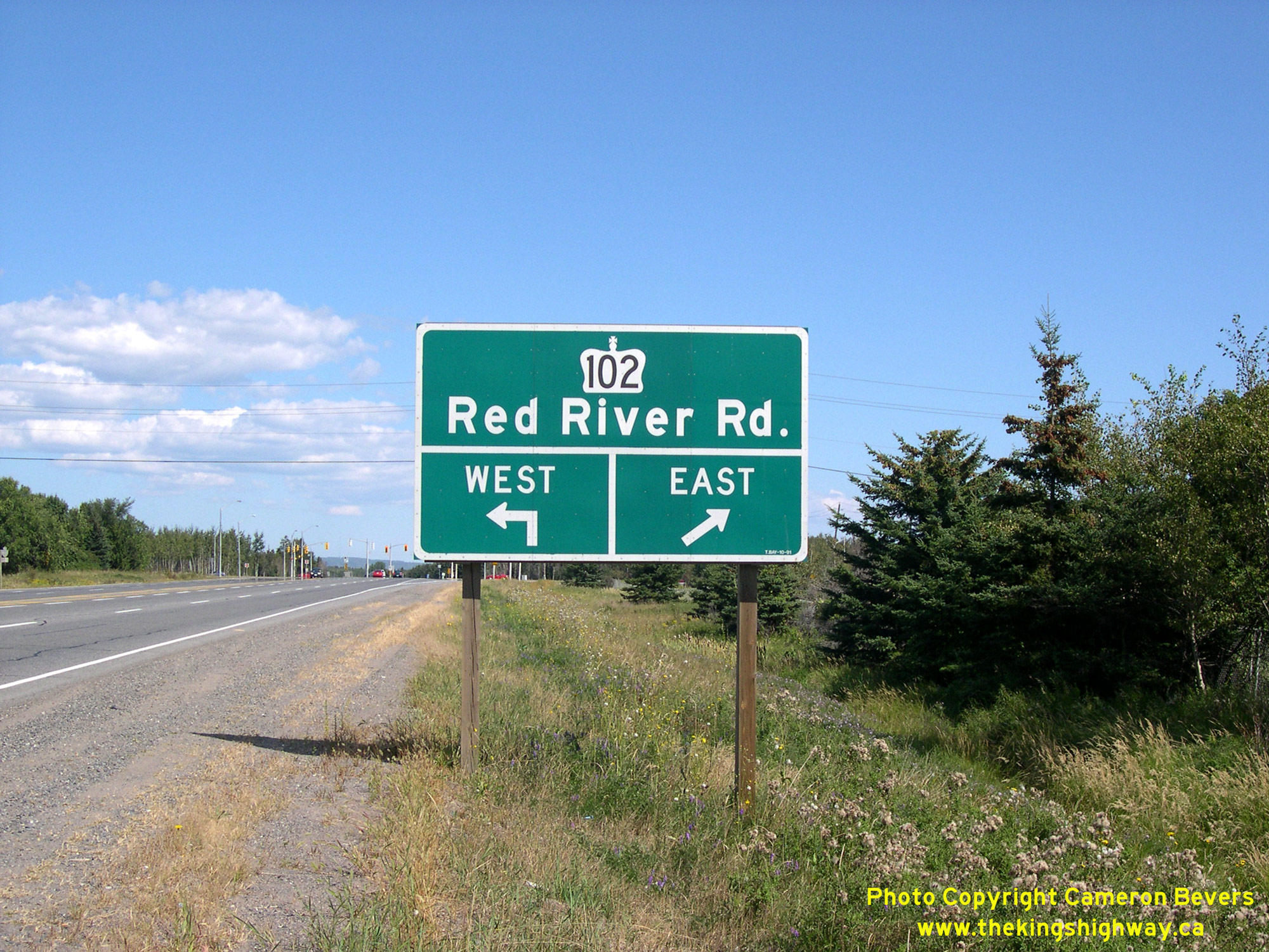
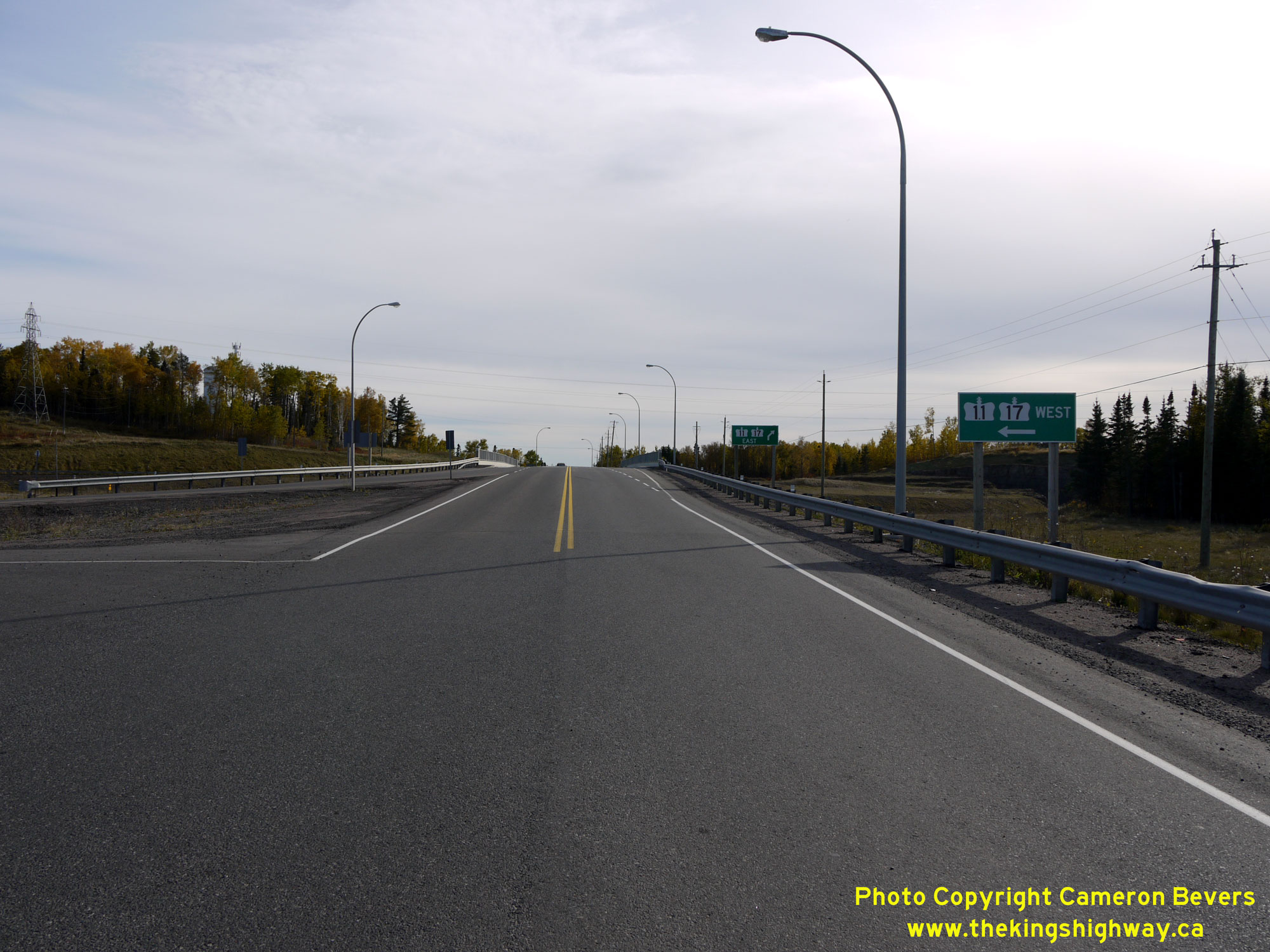
 Left - Green guide sign approaching the Hwy 102 Junction (Red River Road) on eastbound Hwy 11 & Hwy 17. See an
Enlarged Photo Here. Left - Green guide sign approaching the Hwy 102 Junction (Red River Road) on eastbound Hwy 11 & Hwy 17. See an
Enlarged Photo Here.(Photograph taken on August 30, 2006 - © Cameron Bevers) Right - Facing west along Hwy 11 & Hwy 17 from the Hwy 102 Junction at Red River Road. This section of the Thunder Bay Expressway was the first part of
the new bypass highway to be completed in the 1960s. Under Contract #1966-79, a 2 1/3-mile section of the bypass was constructed from Red River Road southerly to the
intersection of Oliver Road (Hwy 130) and Golf Links Road. The Thunder Bay Expressway was initially built as a two-lane highway, which was subsequently widened to
four lanes. The expansion of Hwy 11 & Hwy 17 from Red River Road to John Street took place in the late 1970s under Contract #1977-41, making this the first
continuous four-lane section of the Thunder Bay Expressway. Previously, only localized sections of four-lane highway were in place approaching signalized
intersections along the bypass. See an Enlarged Photo Here.(Photograph taken on August 30, 2006 - © Cameron Bevers) 
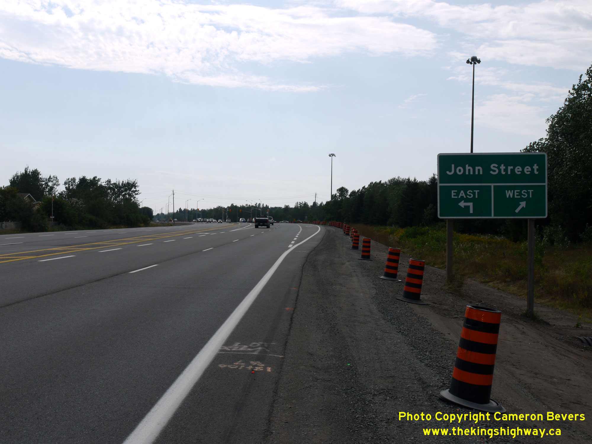 Left - Advance green guide sign for the upcoming John Street intersection on westbound Hwy 11 & Hwy 17 in Thunder Bay. See an
Enlarged Photo Here. Left - Advance green guide sign for the upcoming John Street intersection on westbound Hwy 11 & Hwy 17 in Thunder Bay. See an
Enlarged Photo Here.(Photograph taken on September 1, 2011 - © Cameron Bevers) Right - Green guide sign marking the turn-off for John Street on westbound Hwy 11 & Hwy 17. This is one of several at-grade signalized intersections along
the Thunder Bay Expressway. Longer-term plans for the Thunder Bay Expressway include grade-separation and interchanges at crossing roads, once traffic conditions
warrant these types of improvements. The intersection of John Street is proposed to be grade-separated at Hwy 11 & Hwy 17 in the future, with no interchange
provided. See an Enlarged Photo Here.(Photograph taken on September 1, 2011 - © Cameron Bevers) 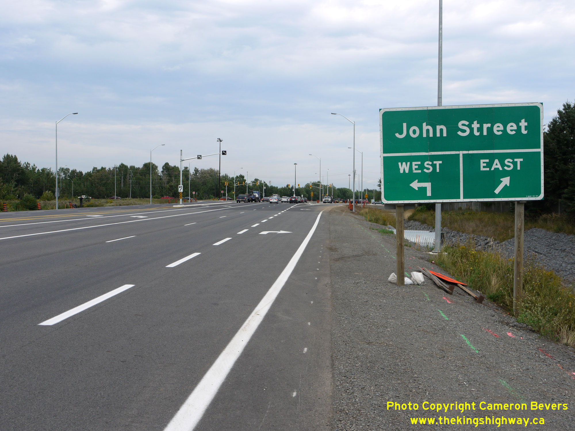
 Left - Green guide sign marking the turn-off for John Street on eastbound Hwy 11 & Hwy 17. A dual eastbound left-turn lane was built at Hwy 11 &
Hwy 17 and John Street in 2010. A proposed city street known as the Northwest Arterial Road is proposed in this area, which would cross the Thunder Bay Expressway
between John Street and Oliver Road. The Northwest Arterial Road is proposed to have an interchange at Hwy 11 & Hwy 17, which would allow access between John
Street and the Thunder Bay Expressway. See an Enlarged Photo Here. Left - Green guide sign marking the turn-off for John Street on eastbound Hwy 11 & Hwy 17. A dual eastbound left-turn lane was built at Hwy 11 &
Hwy 17 and John Street in 2010. A proposed city street known as the Northwest Arterial Road is proposed in this area, which would cross the Thunder Bay Expressway
between John Street and Oliver Road. The Northwest Arterial Road is proposed to have an interchange at Hwy 11 & Hwy 17, which would allow access between John
Street and the Thunder Bay Expressway. See an Enlarged Photo Here.(Photograph taken on September 1, 2011 - © Cameron Bevers) Right - Green guide sign for the upcoming John Street intersection on westbound Hwy 11 & Hwy 17. See an
Enlarged Photo Here.(Photograph taken on September 1, 2011 - © Cameron Bevers) 
 Left - Northern side of the McIntyre River Bridge on the Thunder Bay Expressway (Hwy 11 & Hwy 17). This single-span concrete rigid frame structure was
originally built under Contract #1966-79 to carry a two-lane highway. The bridge was originally completed in 1967. As part of the widening of the Thunder Bay
Expressway in the early 1980s, this bridge was expanded to accommodate a four-lane highway under Contract #1982-207. See an
Enlarged Photo Here. Left - Northern side of the McIntyre River Bridge on the Thunder Bay Expressway (Hwy 11 & Hwy 17). This single-span concrete rigid frame structure was
originally built under Contract #1966-79 to carry a two-lane highway. The bridge was originally completed in 1967. As part of the widening of the Thunder Bay
Expressway in the early 1980s, this bridge was expanded to accommodate a four-lane highway under Contract #1982-207. See an
Enlarged Photo Here.(Photograph taken on September 1, 2011 - © Cameron Bevers) Right - Date stamp (1983) and structure identification number (Site #48C-105) on the McIntyre River Bridge. The northern side of this bridge is considerably
newer than the southern end of the structure, which was constructed during the 1960s. See an
Enlarged Photo Here.(Photograph taken on September 1, 2011 - © Cameron Bevers) 
 Left - Facing west along Hwy 11 & Hwy 17 approaching the Oliver Road Intersection. This section of the Thunder Bay Expressway was actually built several
years after the initial completion of a bypass highway around Thunder Bay. Initially, Hwy 11 & Hwy 17 followed Golf Links Road from west of the McIntyre River
Bridge down to the present day location of the Harbour Expressway. In the early 1970s, a realignment took place which relocated the bypass even further away from the
city. A 3-mile section of new two-lane highway was constructed between the McIntyre River and the Harbour Expressway under Contract #1972-202. The relocated highway
was completed in 1974. Historically, Oliver Road was also a King's Highway (Hwy 130). See an
Enlarged Photo Here. Left - Facing west along Hwy 11 & Hwy 17 approaching the Oliver Road Intersection. This section of the Thunder Bay Expressway was actually built several
years after the initial completion of a bypass highway around Thunder Bay. Initially, Hwy 11 & Hwy 17 followed Golf Links Road from west of the McIntyre River
Bridge down to the present day location of the Harbour Expressway. In the early 1970s, a realignment took place which relocated the bypass even further away from the
city. A 3-mile section of new two-lane highway was constructed between the McIntyre River and the Harbour Expressway under Contract #1972-202. The relocated highway
was completed in 1974. Historically, Oliver Road was also a King's Highway (Hwy 130). See an
Enlarged Photo Here.(Photograph taken on August 30, 2006 - © Cameron Bevers) Right - A hazy distant view of Mount McKay and the Thunder Bay Expressway (Hwy 11 & Hwy 17), facing west from the intersection of Oliver Road. The next intersection along Hwy 11 & Hwy 17 in the distant background is the Harbour Expressway. This section of the Thunder Bay Expressway was a relocation of the original bypass highway around Thunder Bay via Golf Links Road. Even today, this section of the highway seems far-removed from the busy city lying just to the east. Like John Street, Oliver Road is proposed to be grade-separated at the Thunder Bay Expressway in the future, but without an interchange provided. See an Enlarged Photo Here. (Photograph taken on September 3, 2004 - © Cameron Bevers) 
 Left - Green guide sign marking the Harbour Expressway on westbound Hwy 11 & Hwy 17. This arterial road links Thunder Bay's port area directly with the
Thunder Bay Expressway. The highway was originally constructed by the province under a cost-sharing agreement with the City of Thunder Bay. Provincial jurisdiction
over the Harbour Expressway ended in 1981, when ownership of the highway was transferred to the city. See an
Enlarged Photo Here. Left - Green guide sign marking the Harbour Expressway on westbound Hwy 11 & Hwy 17. This arterial road links Thunder Bay's port area directly with the
Thunder Bay Expressway. The highway was originally constructed by the province under a cost-sharing agreement with the City of Thunder Bay. Provincial jurisdiction
over the Harbour Expressway ended in 1981, when ownership of the highway was transferred to the city. See an
Enlarged Photo Here.(Photograph taken on September 1, 2011 - © Cameron Bevers) Right - View of the northern approach to the Harbour Expressway Junction on Hwy 11 & Hwy 17 in 2004, prior to the construction of the Shabaqua Highway (Hwy 11 & Hwy 17 New). This highway junction was effectively a T-intersection at the time this photo was taken, but it was later converted to a four-leg crossroads once the Shabaqua Highway opened to traffic in 2007. The Shabaqua Highway bypassed a 13 km section of the original Hwy 11 & Hwy 17 route via Arthur Street. See an Enlarged Photo Here. (Photograph taken on September 3, 2004 - © Cameron Bevers) 
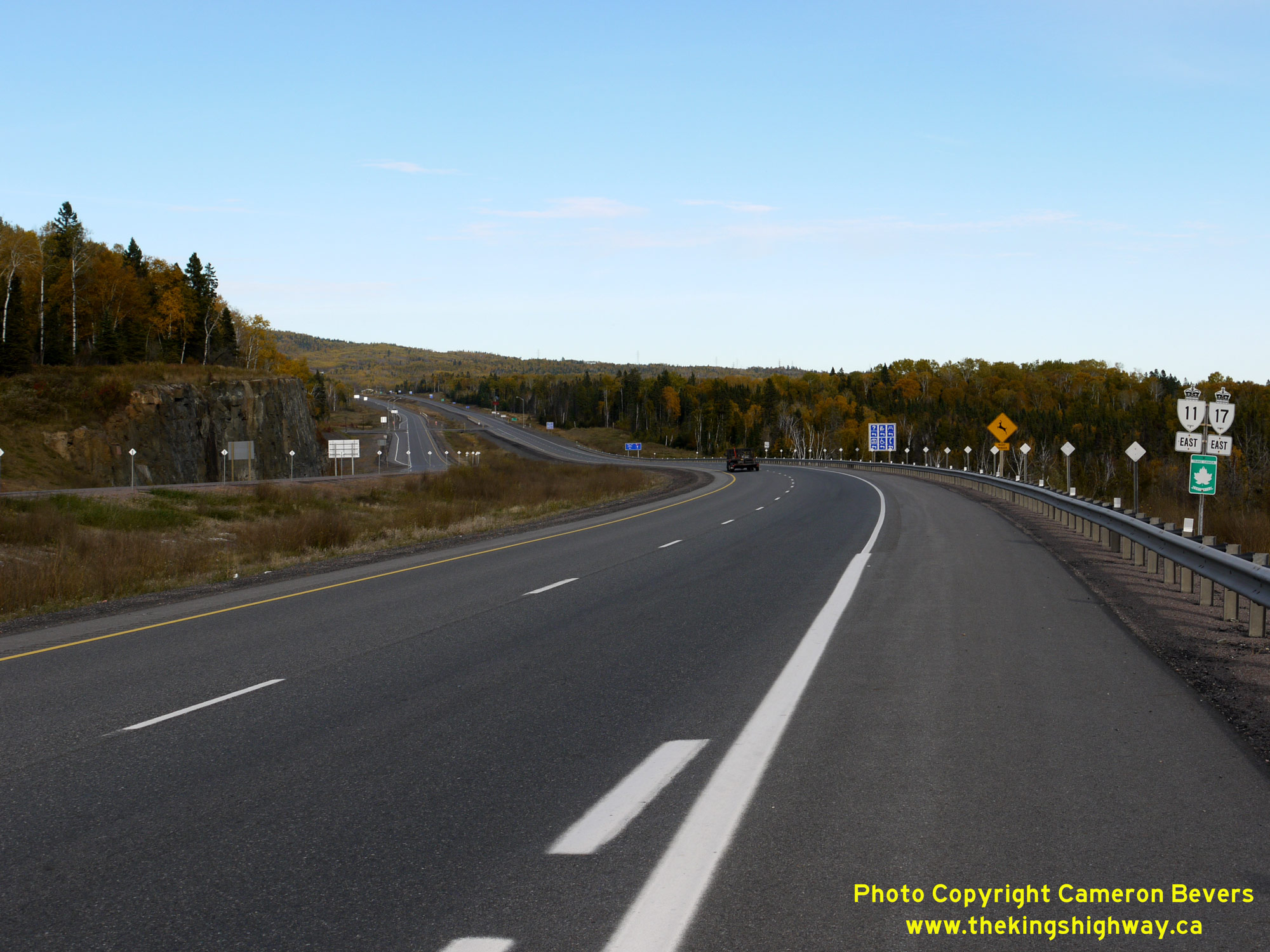
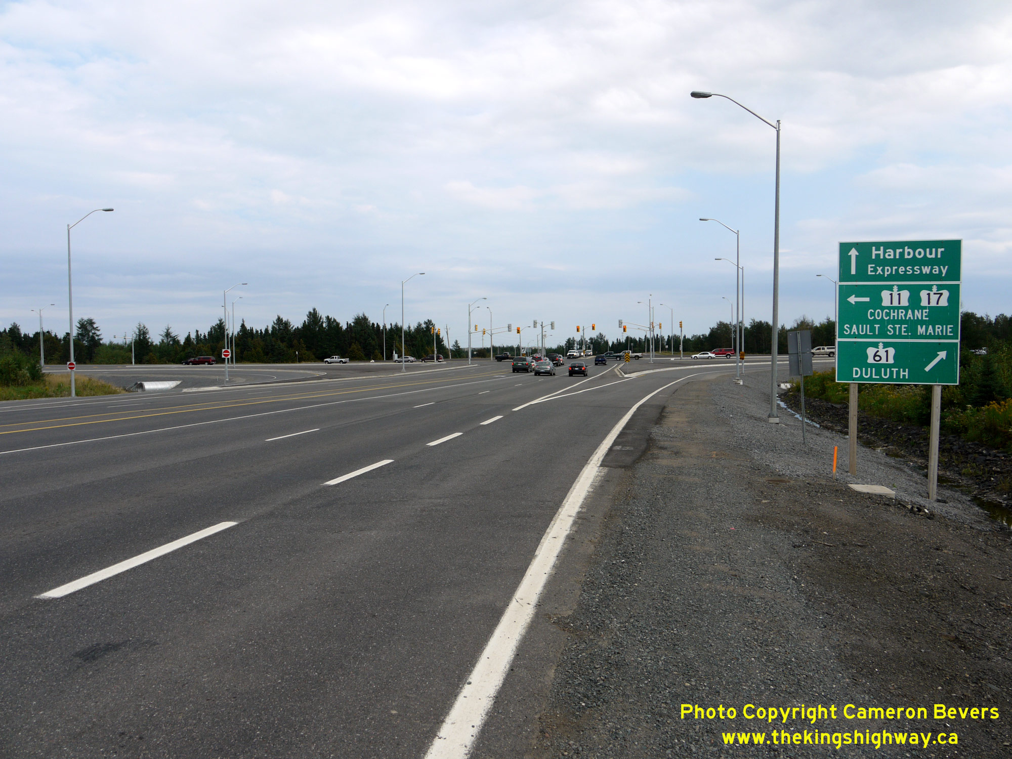
 Left - Advance green guide signs for the upcoming Hwy 61 Junction on Hwy 11 & Hwy 17 in 2011, following the completion of the Shabaqua Highway. The Harbour
Expressway forms the eastern leg of this highway junction, while Hwy 11 & Hwy 17 turn right onto the Shabaqua Highway and continue west. See an
Enlarged Photo Here. Left - Advance green guide signs for the upcoming Hwy 61 Junction on Hwy 11 & Hwy 17 in 2011, following the completion of the Shabaqua Highway. The Harbour
Expressway forms the eastern leg of this highway junction, while Hwy 11 & Hwy 17 turn right onto the Shabaqua Highway and continue west. See an
Enlarged Photo Here.(Photograph taken on September 1, 2011 - © Cameron Bevers) Right - Approaching the turn-off of Hwy 11 & Hwy 17 at the Hwy 61 & Harbour Expressway Junction in 2011. Westbound motorists who wish to continue west
towards Dryden, Kenora and Western Canada must turn right in order to stay on the Trans-Canada Highway. The through highway at this junction is Hwy 61, which heads
south from Thunder Bay towards the United States Border - and ultimately to Duluth, Minnesota. See an
Enlarged Photo Here.(Photograph taken on September 1, 2011 - © Cameron Bevers) 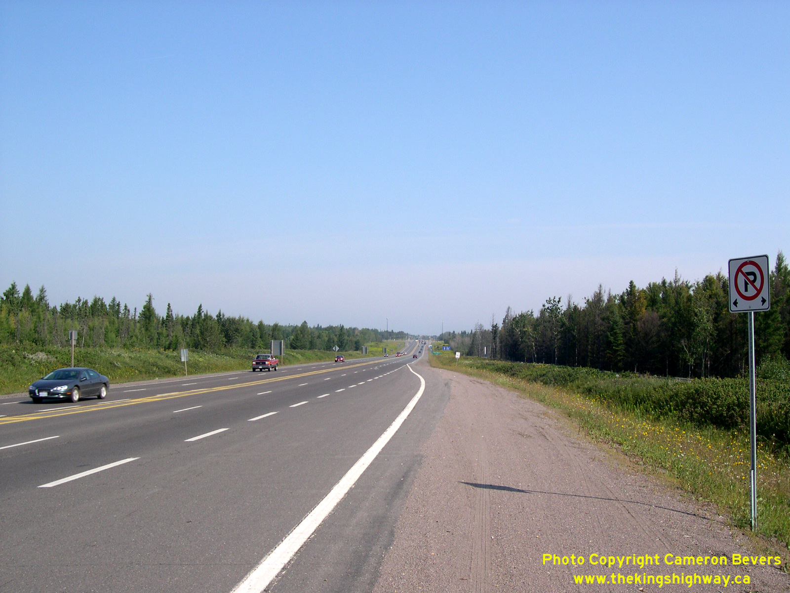

Left - Facing north along the Thunder Bay Expressway (Hwy 11 & Hwy 17) from the Harbour Expressway in 2004. See an
Enlarged Photo Here. (Photograph taken on September 3, 2004 - © Cameron Bevers) Right - Western terminus of the Harbour Expressway at the Thunder Bay Expressway (Hwy 11 & Hwy 17) in 2004. The future site of the Shabaqua Highway (Hwy 11 & Hwy 17 New) can be seen in the background. The Shabaqua Highway opened to traffic in 2007. See an Enlarged Photo Here. (Photograph taken on September 3, 2004 - © Cameron Bevers) 

Left - Facing east along the Harbour Expressway from the Thunder Bay Expressway in 2004. The first section of the Harbour Expressway up to Golf Links Road seen
here was initially constructed as part of the bypass highway around the lakehead cities of Port Arthur and Fort William in the late 1960s. The bypass highway extended
westerly from Golf Links Road and then curved to the south to connect with Arthur Street (Hwy 11 & Hwy 17) at the western entrance to the city. Construction of
the 2 1/2-mile bypass highway between Golf Links Road and Arthur Street was constructed under Contract #1968-165 and was opened to traffic in 1970. See an
Enlarged Photo Here. (Photograph taken on September 3, 2004 - © Cameron Bevers) Right - Cleared right-of-way for the proposed Shabaqua Highway, facing west from the Thunder Bay Expressway. The new Shabaqua Highway is essentially a western extension of the existing Harbour Expressway. Preparatory work for the Shabaqua Highway began in the early 1990s, with the tendering of intersection modifications and advance right-of-way clearing under Contract #1992-207 and Contract #1993-220, respectively. The highway was completed in 2007. It now carries all Hwy 11 & Hwy 17 traffic and bypasses a congested portion of Arthur Street. See an Enlarged Photo Here. (Photograph taken on September 3, 2004 - © Cameron Bevers) 
 Left - New hot-mix asphalt paving on the Shabaqua Highway in 2006 under Contract #2004-6000, facing west towards the Thunder Bay Expressway. See an
Enlarged Photo Here. Left - New hot-mix asphalt paving on the Shabaqua Highway in 2006 under Contract #2004-6000, facing west towards the Thunder Bay Expressway. See an
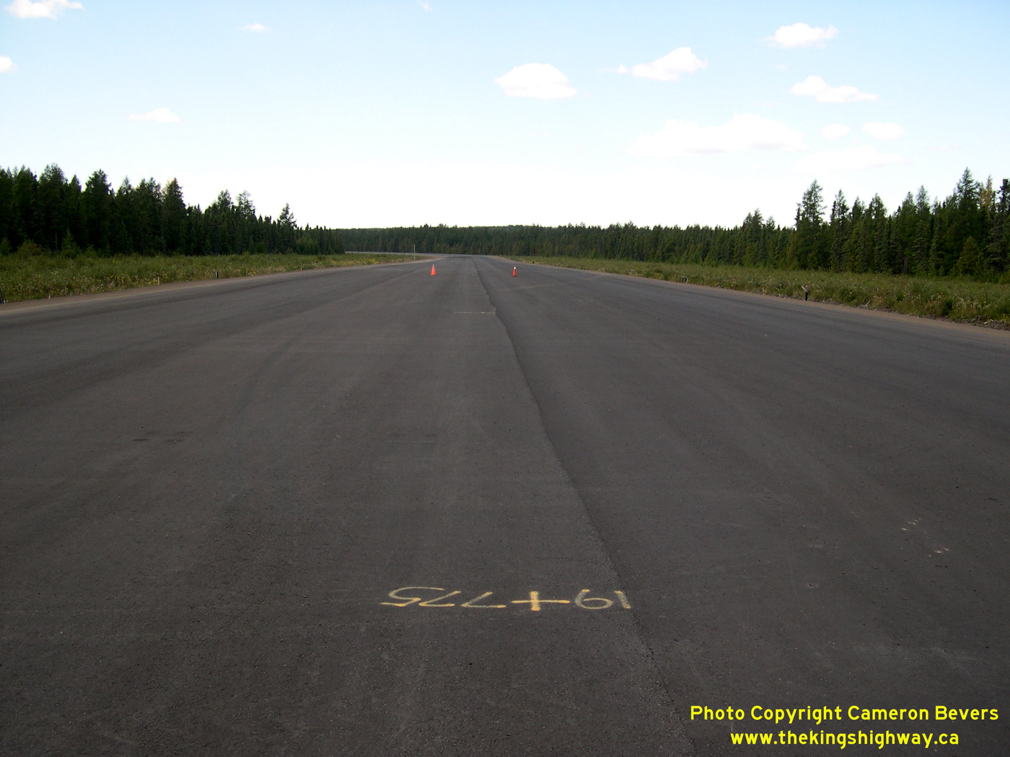
Enlarged Photo Here.(Photograph taken on August 30, 2006 - © Cameron Bevers) Right - Facing west along the new Shabaqua Highway from Sta. 19+775 during construction in 2006. The entire 13 km highway route was constructed under Contract
#2004-6000 and was officially completed and opened to traffic in 2007. See an
Enlarged Photo Here.(Photograph taken on August 30, 2006 - © Cameron Bevers) 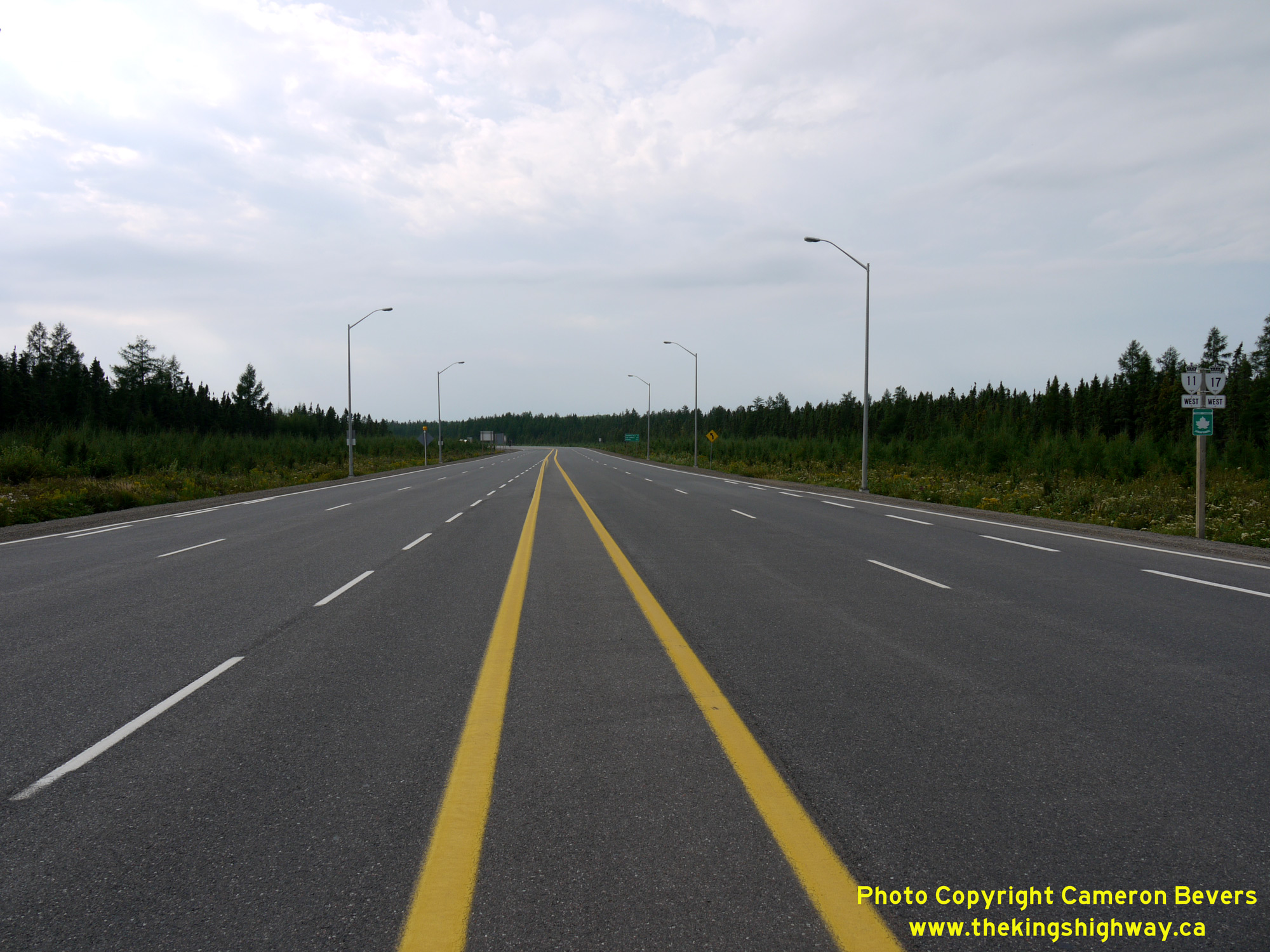
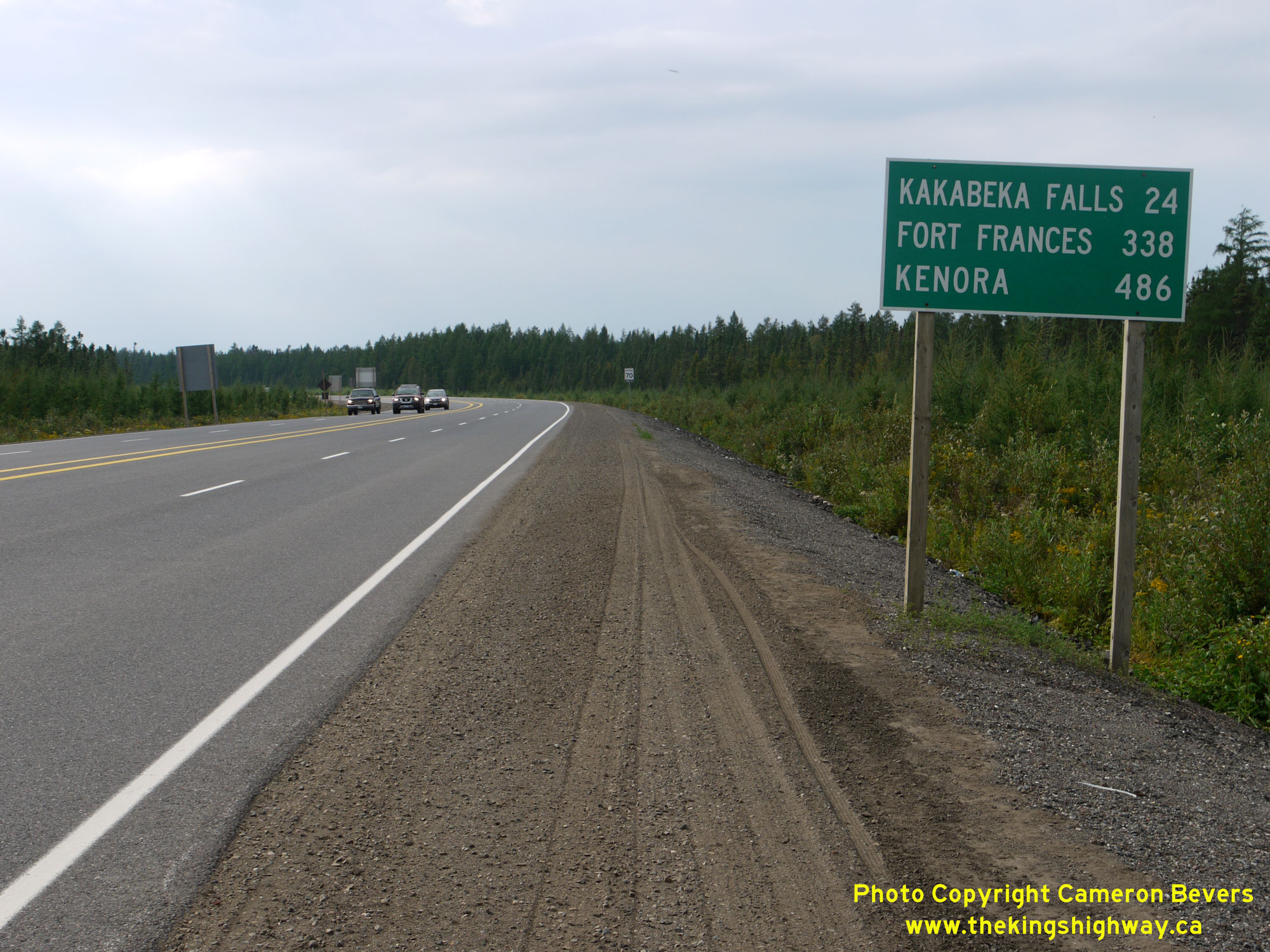 Left - Facing west along the completed Shabaqua Highway (Hwy 11 & Hwy 17 New) towards Kakabeka Falls from the Thunder Bay Expressway Junction in 2011. See an
Enlarged Photo Here. Left - Facing west along the completed Shabaqua Highway (Hwy 11 & Hwy 17 New) towards Kakabeka Falls from the Thunder Bay Expressway Junction in 2011. See an
Enlarged Photo Here.(Photograph taken on September 1, 2011 - © Cameron Bevers) Right - Distance guide sign on westbound Hwy 11 & Hwy 17 departing from Thunder Bay on the Shabaqua Highway. It is 486 km to Kenora from Thunder Bay, and
a further 50 km beyond that before Hwy 17 ends at the Ontario-Manitoba Boundary. Ontario is a very big province! See an
Enlarged Photo Here.(Photograph taken on September 1, 2011 - © Cameron Bevers) 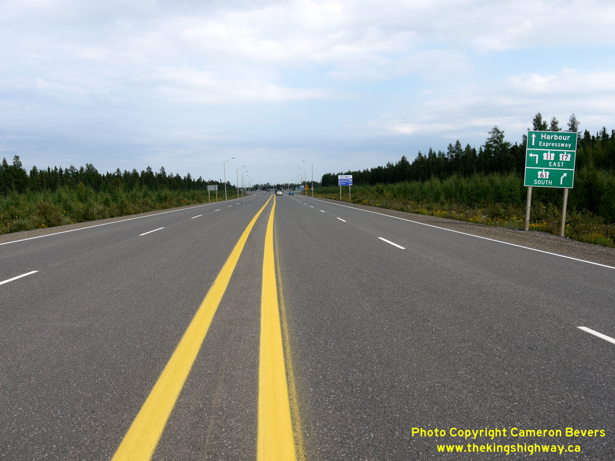
 Left - Facing east along the Shabaqua Highway (Hwy 11 & Hwy 17 New) approaching Thunder Bay. About 1 km ahead, Hwy 11 & Hwy 17 turn left and follow the
Thunder Bay Expressway around the city. Only the first section of the Shabaqua Highway is four lanes. Just west of this point, Hwy 11 & Hwy 17 narrows back to a
two-lane highway. See an Enlarged Photo Here. Left - Facing east along the Shabaqua Highway (Hwy 11 & Hwy 17 New) approaching Thunder Bay. About 1 km ahead, Hwy 11 & Hwy 17 turn left and follow the
Thunder Bay Expressway around the city. Only the first section of the Shabaqua Highway is four lanes. Just west of this point, Hwy 11 & Hwy 17 narrows back to a
two-lane highway. See an Enlarged Photo Here.(Photograph taken on September 1, 2011 - © Cameron Bevers) Right - Green guide signs along the eastbound Shabaqua Highway (Hwy 11 & Hwy 17 New) for the upcoming highway junction at the Harbour Expressway and
Hwy 61. See an Enlarged Photo Here.(Photograph taken on September 1, 2011 - © Cameron Bevers) 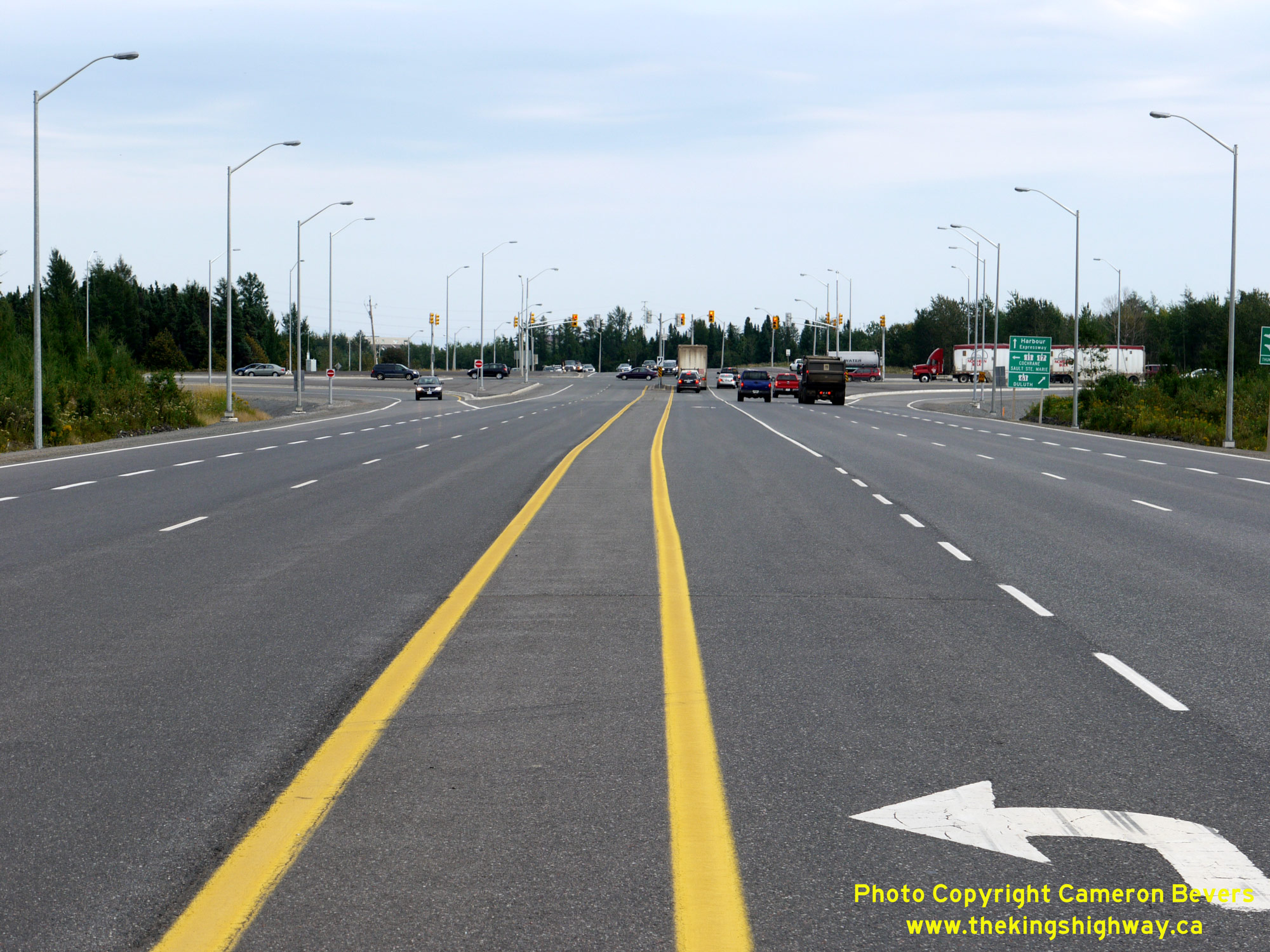
 Left - Approaching the Thunder Bay Expressway on the completed Shabaqua Highway (Hwy 11 & Hwy 17 New) in 2011. See an
Enlarged Photo Here. Left - Approaching the Thunder Bay Expressway on the completed Shabaqua Highway (Hwy 11 & Hwy 17 New) in 2011. See an
Enlarged Photo Here.(Photograph taken on September 1, 2011 - © Cameron Bevers) Right - Green guide signs at the Thunder Bay Expressway Junction along the eastbound Shabaqua Highway (Hwy 11 & Hwy 17 New) in 2011. The turn-off signs mark
destination control cities rather than cardinal directions, as Hwy 61 only goes south from this junction while Hwy 11 & Hwy 17 continue east. Duluth, Minnesota
is listed as the control city for southbound Hwy 61 traffic, as there are no communities of any significant size to sign to on the Canadian side of the border. This
is one of the rare instances where an out-of-province destination control city is used for an Ontario highway. At 305 km, Duluth is actually the closest control city
signed at this highway junction heading eastbound, even though it is an international destination and situated within a different time zone than Thunder Bay. Sault
Ste Marie (697 km) and Cochrane (731 km) are each more than twice that distance away by highway, even though both destinations are located within Ontario - a
reflection of just how big Ontario is geographically. See an Enlarged Photo Here.(Photograph taken on September 1, 2011 - © Cameron Bevers) 
 Left - Facing south along Hwy 61 (Formerly Hwy 11 & Hwy 17) from the Harbour Expressway and Shabaqua Highway Junction in Thunder Bay. This section of the
Thunder Bay Expressway was known as Hwy 11 & Hwy 17 up until the opening of the Shabaqua Highway in 2007. Upon completion of the new highway, Hwy 61 was extended
north along the Thunder Bay Expressway for about 3 km to connect with the relocated route of Hwy 11 & Hwy 17. See an
Enlarged Photo Here. Left - Facing south along Hwy 61 (Formerly Hwy 11 & Hwy 17) from the Harbour Expressway and Shabaqua Highway Junction in Thunder Bay. This section of the
Thunder Bay Expressway was known as Hwy 11 & Hwy 17 up until the opening of the Shabaqua Highway in 2007. Upon completion of the new highway, Hwy 61 was extended
north along the Thunder Bay Expressway for about 3 km to connect with the relocated route of Hwy 11 & Hwy 17. See an
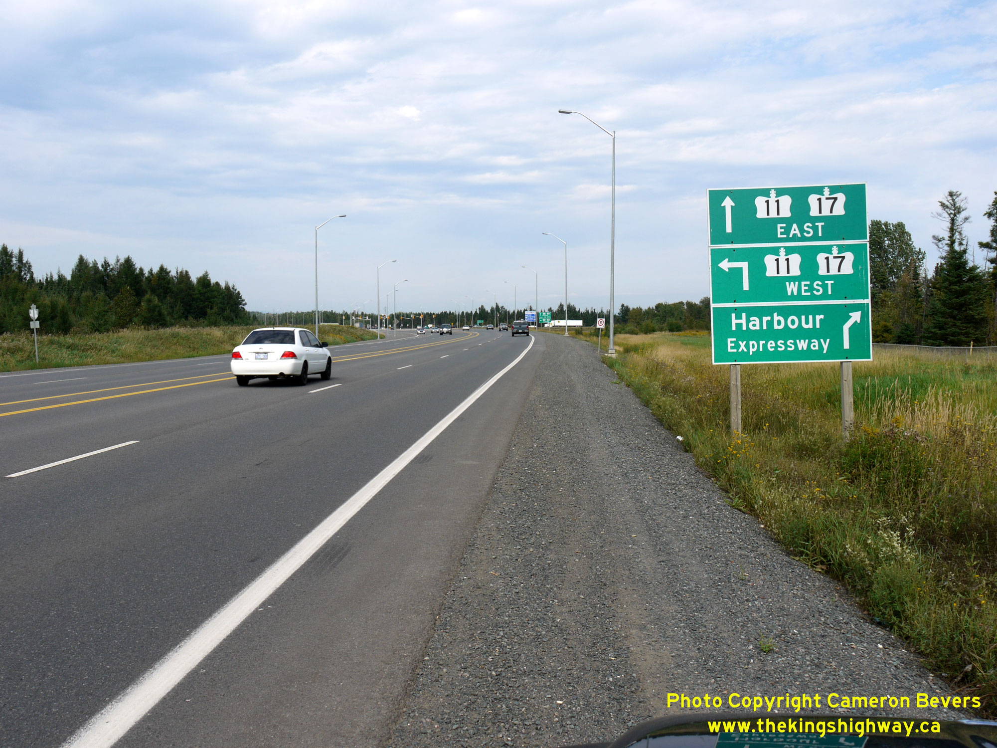
Enlarged Photo Here.(Photograph taken on September 1, 2011 - © Cameron Bevers) Right - Facing north along the Thunder Bay Expressway towards the Harbour Expressway Junction in 2011. Since 2007, the route Hwy 61 has come to an end just
ahead at the traffic signals. The Thunder Bay Expressway continues straight ahead as Hwy 11 & Hwy 17 East, while the Harbour Expressway and Hwy 11 & Hwy 17
West (Shabaqua Highway) form the eastern (right) and western (left) legs of this intersection, respectively. See an
Enlarged Photo Here.(Photograph taken on September 1, 2011 - © Cameron Bevers) 
Left - Facing north along the Thunder Bay Expressway towards the Harbour Expressway Junction in 2004. At the time this photo was taken, motorists could only
continue straight through or turn right onto the Harbour Expressway, since the western leg of the intersection (Hwy 11 & Hwy 17 New) had not yet been completed.
See an Enlarged Photo Here. (Photograph taken on September 3, 2004 - © Cameron Bevers) Right - Advance green guide signs on the Thunder Bay Expressway (Hwy 61) approaching the Shabaqua Highway (Hwy 11 & Hwy 17 New) and Harbour Expressway
Junction in 2011. Since Hwy 11 & Hwy 17 continue both easterly and westerly from this highway junction, it was necessary to employ cardinal directions on these
signs. See an Enlarged Photo Here.(Photograph taken on September 1, 2011 - © Cameron Bevers) 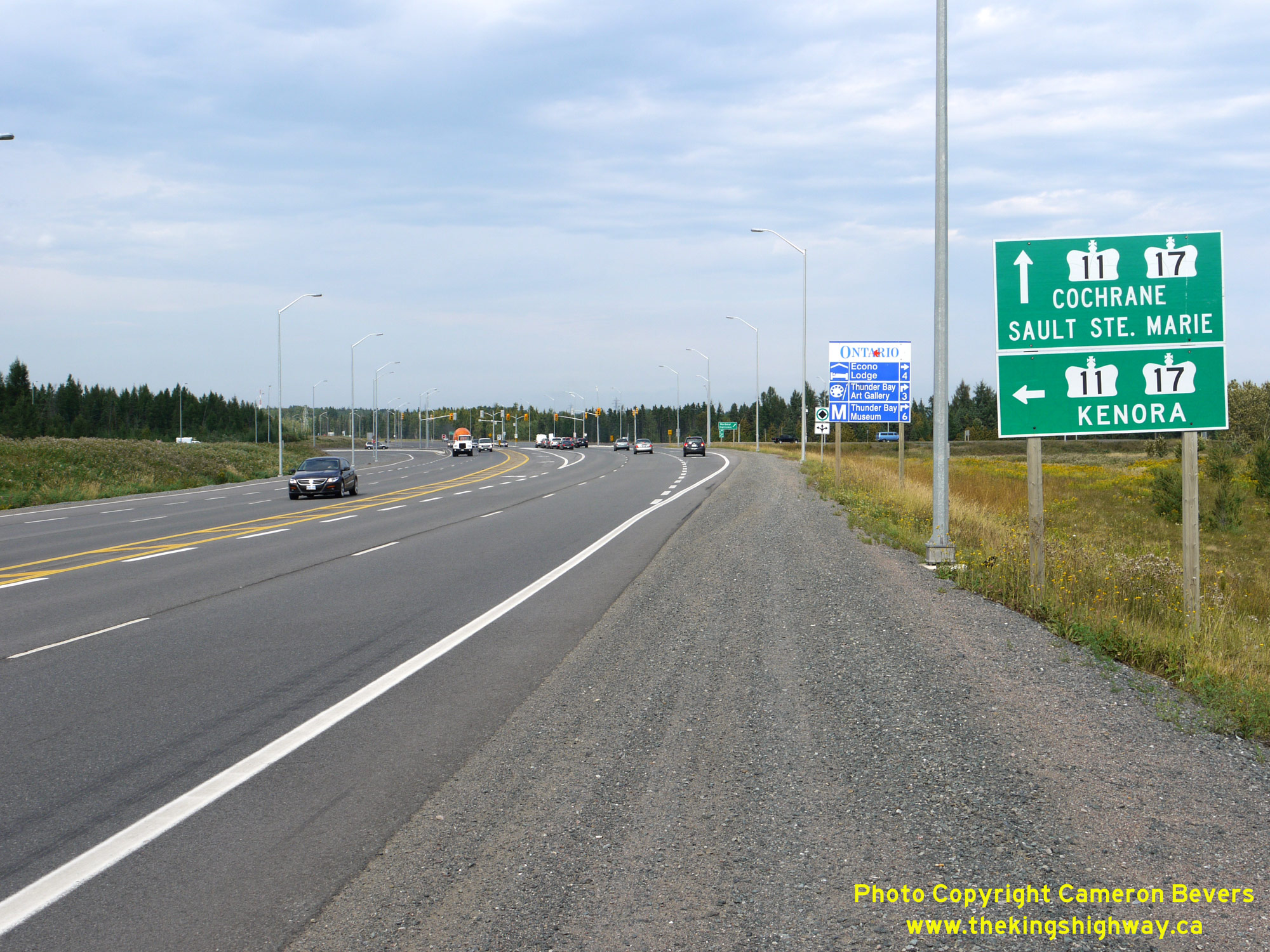
 Left - Green guide signs along the Thunder Bay Expressway at the Shabaqua Highway (Hwy 11 & Hwy 17 New) and Harbour Expressway Junction. The turn-off signs
mark destination control cities rather than cardinal directions, with Kenora being signed as the western control city and Cochrane and Sault Ste. Marie signed as the
eastbound control cities. See an Enlarged Photo Here. Left - Green guide signs along the Thunder Bay Expressway at the Shabaqua Highway (Hwy 11 & Hwy 17 New) and Harbour Expressway Junction. The turn-off signs
mark destination control cities rather than cardinal directions, with Kenora being signed as the western control city and Cochrane and Sault Ste. Marie signed as the
eastbound control cities. See an Enlarged Photo Here.(Photograph taken on September 1, 2011 - © Cameron Bevers) Right - Facing south along the Thunder Bay Expressway towards the Arthur Street intersection in 2004. Up until 2007, Hwy 11 & Hwy 17 turned right at the traffic signals just ahead and continued west towards Kakabeka Falls and Kenora, while Hwy 61 continued south along the Thunder Bay Expressway towards the airport and the Ontario-Minnesota Border at Pigeon River. See an Enlarged Photo Here. (Photograph taken on September 3, 2004 - © Cameron Bevers)
Continue on to King's Highway 17 Photos: Thunder Bay to Shabaqua Corners
|
|---|
Links to Adjacent King's Highway Photograph Pages:
Back to Hwy 17 - Pass Lake to Hwy 527 Junction
Hwy 17 Photo Index
On to Hwy 17 - Thunder Bay to Shabaqua Corners
Back to King's Highway 16 Photos /
King's Highway 17 History /
On to King's Highway 18 Photos
Ontario Highway History - Main Menu / Back to List of Highways Website contents, photos & text © 2002-2026, Cameron
Bevers (Webmaster) - All Rights Reserved / Contact Me
|
|---|