
| 
| |
|
|
This page contains present day photos (Year 2000 to date) of Ontario's King's Highway 17, arranged by location from Shabaqua
Corners westerly to English River. All photographs displayed on this page were taken by the Webmaster (Cameron Bevers), unless specifically noted otherwise. Click on
any thumbnail to see a larger image!
Please note that all photographs displayed on this
website are protected by copyright. These photographs must not be reproduced, published,
electronically stored or copied, distributed, or posted onto other websites without
my written permission. If you want to use photos from this website, please
email me first for permission. Thank-you!
|
|---|
|
Page 41: Present Day King's Highway 17 Photographs (Shabaqua Corners to English River)

Left - Facing west along Hwy 17 towards English River and Ignace, about 4 km west of the Hwy 11 Junction at Shabaqua Corners. See an
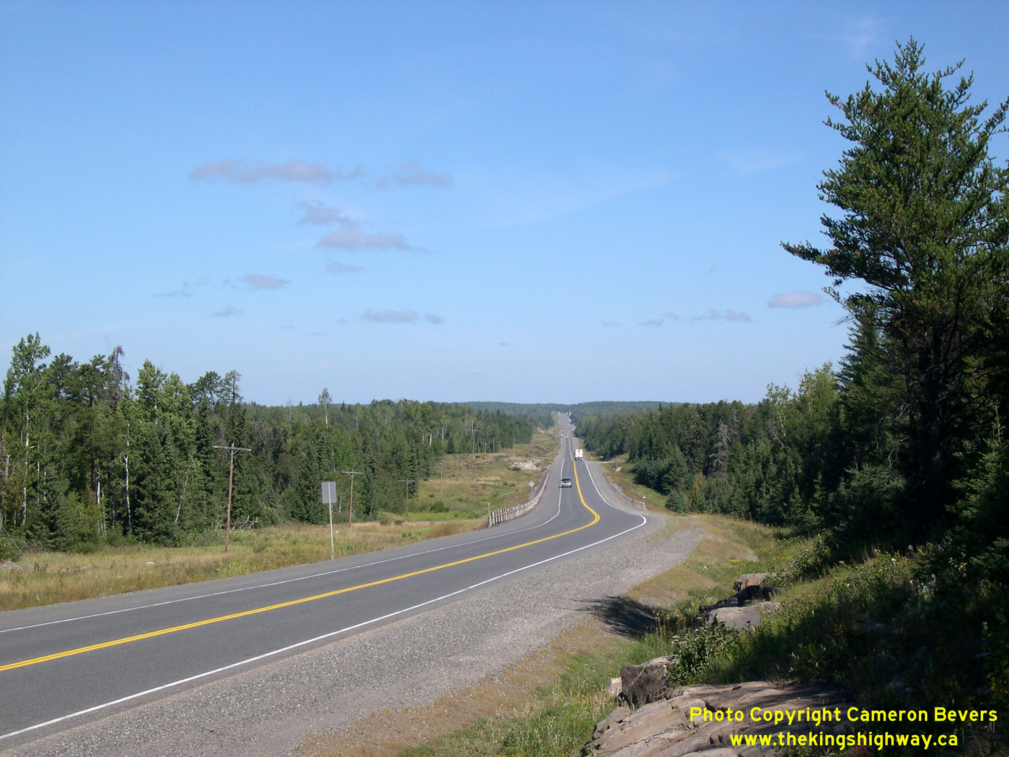
Enlarged Photo Here. (Photograph taken on August 31, 2006 - © Cameron Bevers) Right - This spectacular vista can be found about 10 km west of Shabaqua Corners, where Hwy 17 climbs quickly up to the Arctic Watershed near the small community of Raith. On this side of the watershed, all streams and rivers flow south into Lake Superior and out to the Atlantic Ocean. West of the watershed boundary at Raith, all streams and rivers flow north into the Arctic Ocean. The Trans-Canada Highway was originally built through Northwestern Ontario by the Department of Northern Development during the first half of the 1930s. The highway was officially opened to traffic between the lakehead port cities of Port Arthur and Fort William (now Thunder Bay) and Kenora by the Minister of Lands and Forests, Peter Heenan, on July 1, 1935. The Trans-Canada Highway was subsequently assumed by the Department of Highways of Ontario (DHO) as part of King's Highway 17, effective June 30, 1937. See an Enlarged Photo Here. (Photograph taken on August 31, 2006 - © Cameron Bevers) 

Left - Facing east along Hwy 17 towards Thunder Bay, about 10 km west of Shabaqua Corners. This large rock cut was constructed in order to remove a steep
grade along this section of Hwy 17. The rock excavated from this cut was used to build up the road elevation on the approach to this hill, thus flattening out the
highway's vertical profile. When the Trans-Canada Highway was first built across Northwestern Ontario during the 1930s, road builders generally made an effort to
avoid large rock cuts such as this one, often at the expense of the road's geometry. Subsequent reconstruction of Hwy 17 during the 1950s and 1960s greatly improved
the highway's alignment, which made the once-challenging drive across Northwestern Ontario of yesteryear into a fairly straightforward exercise today. See an
Enlarged Photo Here. (Photograph taken on August 31, 2006 - © Cameron Bevers) Right - View of Hwy 17 facing west towards English River. The westbound passing lane continues, but an eastbound passing lane ends at the curve. Numerous passing lanes and truck climbing lanes were constructed along the provincial highway system during the 1970s and 1980s in order to allow safe and assured passing opportunities for motorists. See an Enlarged Photo Here. (Photograph taken on August 31, 2006 - © Cameron Bevers) 

Left - View of the former route of Hwy 17 through Raith. The new highway at right bypasses the small community of Raith entirely. Although it is more commonly
known as the "Raith Loop", the former route of Hwy 17 through Raith is still a provincial highway with a 7000-Series designation (Hwy 7171). See an
Enlarged Photo Here. (Photograph taken on September 1, 2004 - © Cameron Bevers) Right - Sign at the roadside park and rest area on Hwy 17 near Raith indicating the changeover from the Eastern Standard Time Zone to the Central Standard Time Zone. Geographically, Ontario is a very large province. The northwestern portion of Ontario lies in a different time zone than the rest of the province. Accordingly, motorists need to be mindful that local time in Thunder Bay is one hour ahead of local time in other Northwestern Ontario towns and cities along Hwy 17, such as Ignace, Dryden and Kenora. See an Enlarged Photo Here. (Photograph taken on September 1, 2004 - © Cameron Bevers) 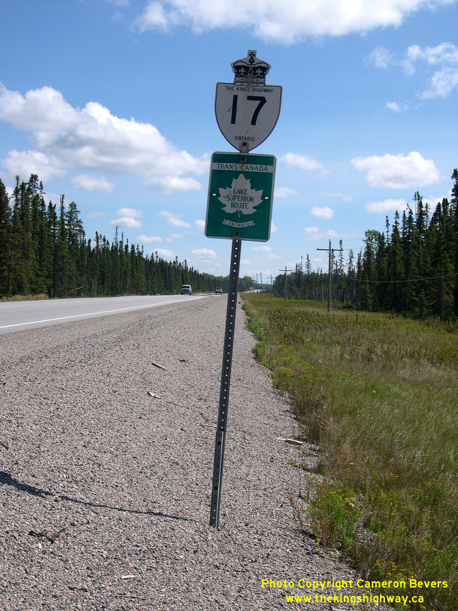
Above - Hwy 17 route marker with a Trans-Canada Highway "Lake Superior Route" sign between Raith and Savanne. Although they were used extensively in years
past, the Lake Superior Route Trans-Canada Highway signs are now very rare out on the highway today. See an
Enlarged Photo Here. (Photograph taken on August 31, 2006 - © Cameron Bevers) 

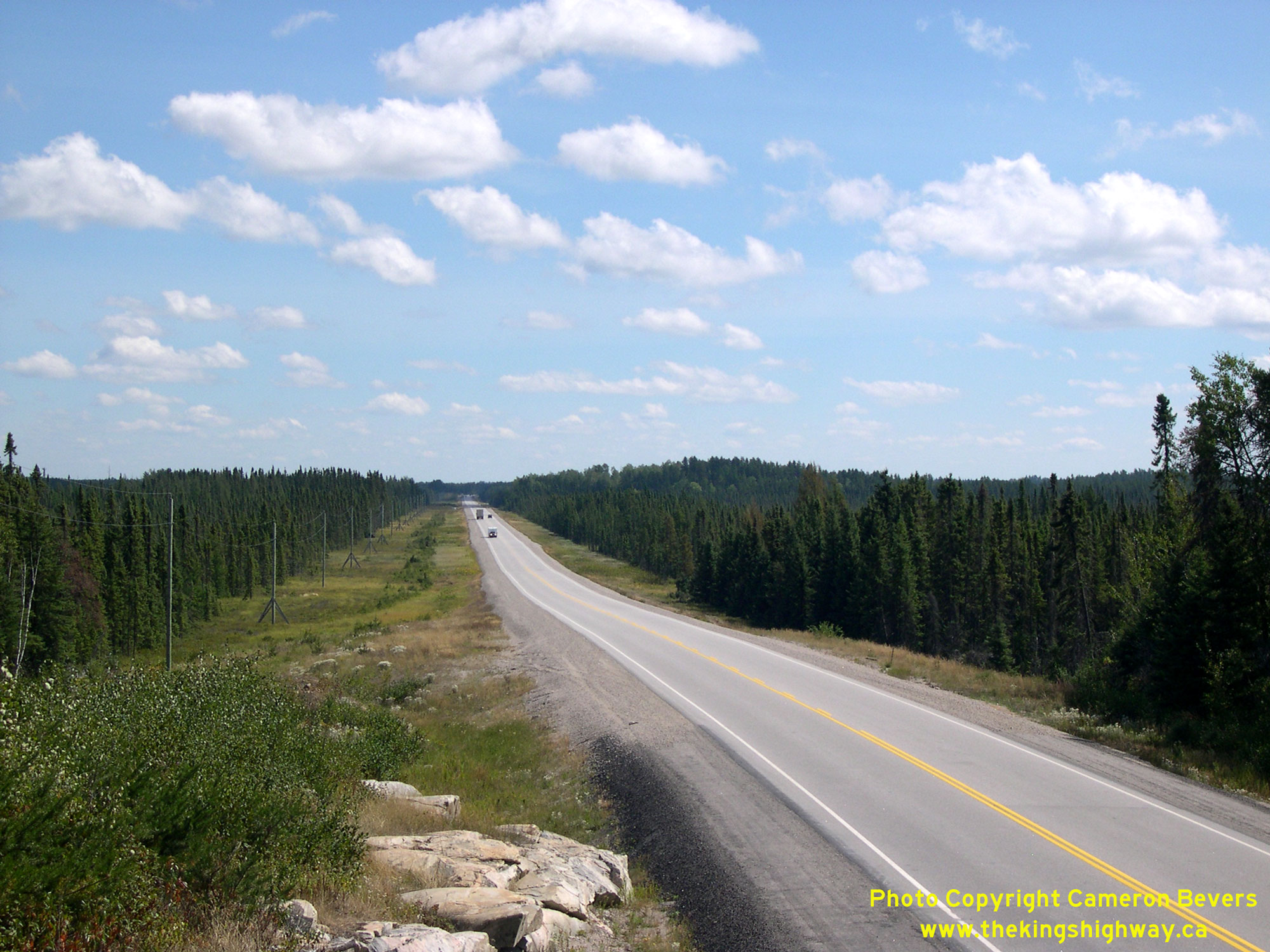
Left - View of Hwy 17 about 27 km west of Raith, facing west towards English River. The scenery on the far side of the Arctic Watershed is far more subdued,
with many long tangent sections and few reference points. The drive can be rather tedious along this stretch of Hwy 17. See an
Enlarged Photo Here. (Photograph taken on August 31, 2006 - © Cameron Bevers) Right - Little Savanne River Bridge (Site #48W-16) on Hwy 17, located about 20 km east of Upsala. This seven-span steel beam and creosoted timber trestle structure was built under Contract #1947-94 and was completed in 1948. See an Enlarged Photo Here. (Photograph taken on September 1, 2004 - © Cameron Bevers) 
Left - The Little Savanne River Bridge has a creosoted timber trestle below the steel beam and concrete slab deck. It was one of several new bridges built
along Hwy 17 in the Upsala area during the 1940s in order to replace older narrow wooden bridges built along the Trans-Canada Highway back in the 1930s. Previously,
a timber trestle structure with a timber deck carried Hwy 17 across the Little Savanne River. See an
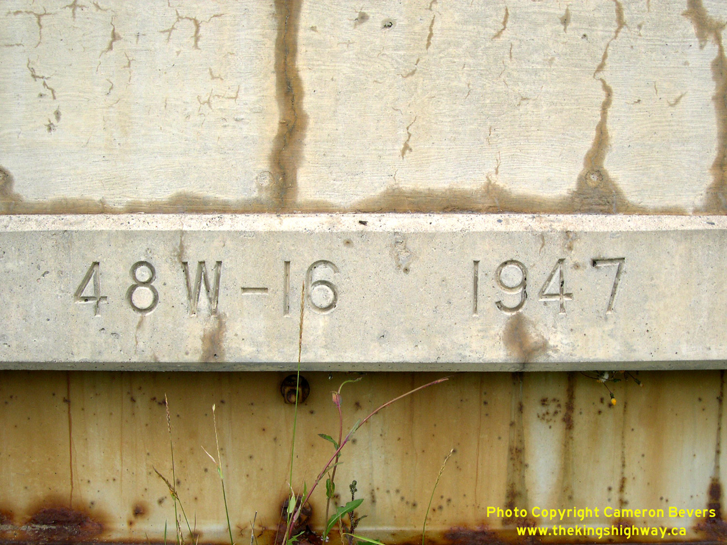
Enlarged Photo Here. (Photograph taken on September 1, 2004 - © Cameron Bevers) Right - A date stamp was added to this bridge during a recent rehabilitation project. Typically, bridges of this era do not have the year of construction marked. See an Enlarged Photo Here. (Photograph taken on September 1, 2004 - © Cameron Bevers) 

Left - Facing east along Hwy 17 towards Raith at the Little Savanne River Bridge. See an
Enlarged Photo Here. (Photograph taken on September 1, 2004 - © Cameron Bevers) Right - Southern side of the Little Savanne River Bridge on Hwy 17 between Raith and Upsala. This aging bridge was replaced by a new structure in 2005. See an Enlarged Photo Here. (Photograph taken on September 1, 2004 - © Cameron Bevers) 

Left - Facing west along Hwy 17 towards Upsala at the Little Savanne River Bridge. See an
Enlarged Photo Here. (Photograph taken on September 1, 2004 - © Cameron Bevers) Right - Northern side of the Little Firesteel River Bridge on Hwy 17. This single-span concrete rigid frame structure was constructed under Contract #1944-08 and was completed in 1945. It was one of only two concrete bridges constructed in the entire province during 1945, owing to the crippling shortages of construction materials brought about by World War II. See an Enlarged Photo Here. (Photograph taken on September 1, 2004 - © Cameron Bevers) 

Left - Southern side of the Little Firesteel River Bridge (Site #48W-15) on Hwy 17, located about 12 km west of Upsala. See an
Enlarged Photo Here. (Photograph taken on September 1, 2004 - © Cameron Bevers) Right - Northern side of the Firesteel River Bridge (Site #48W-14) on Hwy 17. This single-span concrete rigid frame structure was completed in 1939. See an Enlarged Photo Here. (Photograph taken on September 1, 2004 - © Cameron Bevers) 

Left - Southern side of the Firesteel River Bridge on Hwy 17, located about 15 km west of Upsala. See an
Enlarged Photo Here. (Photograph taken on September 1, 2004 - © Cameron Bevers) Right - Facing west along Hwy 17 towards English River at the Firesteel River Bridge west of Upsala. See an Enlarged Photo Here. (Photograph taken on September 1, 2004 - © Cameron Bevers) 

Left - Entrance to the abandoned Firesteel River Roadside Park on Hwy 17, located about 15 km west of Upsala. The DHO established a small roadside park at this
location in 1937 for the convenience of motorists using the Trans-Canada Highway. The Firesteel River Roadside Park was only 4 acres in size, but camping was
permitted in the park up until the late 1950s. The park continued to operate after that time as a day-use picnic area until it was closed in the late 1990s. See an
Enlarged Photo Here. (Photograph taken on September 1, 2004 - © Cameron Bevers) Right - This former roadside park on Hwy 17 at Firesteel River closed in the late 1990s, after serving the motoring public for over 60 years. See an Enlarged Photo Here. (Photograph taken on September 1, 2004 - © Cameron Bevers) 

Left - Facing west along Hwy 17 towards English River at the Beaver Creek Bridge. See an
Enlarged Photo Here. (Photograph taken on September 1, 2004 - © Cameron Bevers) Right - Southern side of the Beaver Creek Bridge (Site #48W-13) on Hwy 17 west of Upsala. Along with another similar nearby structure over the Little Firesteel River, this single-span concrete rigid frame structure over Beaver Creek was constructed under Contract #1944-08. See an Enlarged Photo Here. (Photograph taken on September 1, 2004 - © Cameron Bevers) 
Left - Northern side of the Beaver Creek Bridge on Hwy 17. This small Wartime-era structure was completed in 1944. It is located about 20 km west of Upsala.
See an Enlarged Photo Here. (Photograph taken on September 1, 2004 - © Cameron Bevers) Right - View of Hwy 17 about 18 km east of English River, facing east towards Upsala. See an Enlarged Photo Here. (Photograph taken on August 31, 2006 - © Cameron Bevers) 

Left - Facing west along Hwy 17, about 18 km east of English River. See an
Enlarged Photo Here. (Photograph taken on August 31, 2006 - © Cameron Bevers) Right - Canadian Pacific Railway (CPR) Overhead (Site #48W-111) on Hwy 17 at Sheba, located about 13 km east of English River. This three-span steel girder structure was built under Contracts #1962-55 (structural steel) and #1962-10 (concrete substructure and approaches) and was completed in 1964. See an Enlarged Photo Here. (Photograph taken on September 1, 2004 - © Cameron Bevers) 

Left - Abandoned Hwy 17 alignment at Sheba. Until the Sheba CPR Overhead was completed in 1964, there was a dangerous railway crossing on Hwy 17 at this
location. Several railway grade separations were built during the 1960s along Hwy 17 in Northwestern Ontario in order to eliminate at-grade railway crossings. See an
Enlarged Photo Here. (Photograph taken on September 1, 2004 - © Cameron Bevers) Right - Creosoted timber box culvert passing below Hwy 17 at English River. Numerous creosoted timber box culverts were constructed along Northern Ontario's highways, particularly during and after World War II when reinforcing steel needed for concrete culvert construction was in very short supply. See an Enlarged Photo Here. (Photograph taken on September 1, 2004 - © Cameron Bevers)
Continue on to King's Highway 17 Photos: English River to Ignace
|
|---|
Links to Adjacent King's Highway Photograph Pages:
Back to Hwy 17 - Thunder Bay to Shabaqua Corners
Hwy 17 Photo Index
On to Hwy 17 - English River to Ignace
Back to King's Highway 16 Photos /
King's Highway 17 History /
On to King's Highway 18 Photos
Ontario Highway History - Main Menu / Back to List of Highways Website contents, photos & text © 2002-2026, Cameron
Bevers (Webmaster) - All Rights Reserved / Contact Me
|
|---|