
| 
|  |
|
|
This page contains present day photos (Year 2000 to date) of Ontario's King's Highway 19, arranged by location from Stratford
northerly to the King's Highway 86 Junction at Tralee. All photographs displayed on this page were taken by the Webmaster (Cameron Bevers), unless specifically noted
otherwise. Click on any thumbnail to see a larger image!
Please note that all photographs displayed on this
website are protected by copyright. These photographs must not be reproduced, published,
electronically stored or copied, distributed, or posted onto other websites without
my written permission. If you want to use photos from this website, please
email me first for permission. Thank-you!
|
|---|
|
Page 4: Present Day King's Highway 19 Photographs (Stratford to Tralee)
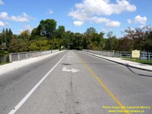

Left - Facing north across the William Hutt Bridge on Waterloo Street (Hwy 19) from Veterans Drive in Stratford. See an
Enlarged Photo Here. (Photograph taken on September 18, 2011 - © Cameron Bevers) Right - Eastern side of the William Hutt Bridge on Waterloo Street (Hwy 19) in Stratford. This single-span concrete rigid frame structure was completed in 1960, as part of a highway diversion through Stratford. As originally established in 1934, the route of Hwy 19 followed Ontario Street, Huron Street and Mornington Street through Stratford. See an Enlarged Photo Here. (Photograph taken on September 18, 2011 - © Cameron Bevers) 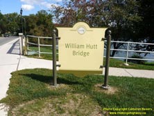

Left - Sign marking the William Hutt Bridge on Waterloo Street (Hwy 19). See an
Enlarged Photo Here. (Photograph taken on September 18, 2011 - © Cameron Bevers) Right - Western side of the William Hutt Bridge on Waterloo Street (Hwy 19) in Stratford. This bridge spans a narrow section of Lake Victoria along the Avon River. See an Enlarged Photo Here. (Photograph taken on September 18, 2011 - © Cameron Bevers) 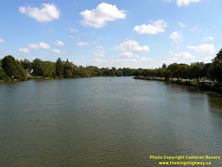
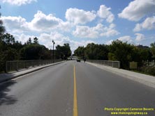
Left - View of Stratford's Lake Victoria from the William Hutt Bridge on Waterloo Street (Hwy 19). See an
Enlarged Photo Here. (Photograph taken on September 18, 2011 - © Cameron Bevers) Right - Facing south along Waterloo Street (Hwy 19) towards Downtown Stratford at the William Hutt Bridge. See an Enlarged Photo Here. (Photograph taken on September 18, 2011 - © Cameron Bevers) 
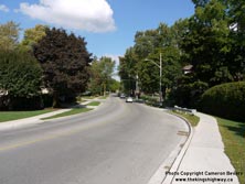
Left - Approaching the William Hutt Bridge and Downtown Stratford on Waterloo Street (Hwy 19), facing south from William Street. See an
Enlarged Photo Here. (Photograph taken on September 18, 2011 - © Cameron Bevers) Right - Facing north along Waterloo Street (Hwy 19) towards William Street in Stratford. Two blocks ahead, Hwy 19 curves to the right onto Mornington Street. Prior to the completion of the William Hutt Bridge in the early 1960s, Hwy 19 followed Mornington Street southerly to Huron Street (Hwy 8). See an Enlarged Photo Here. (Photograph taken on September 18, 2011 - © Cameron Bevers) 

Left - Blue municipality sign marking the entrance to the City of Stratford on southbound Hwy 19. See an
Enlarged Photo Here. (Photograph taken on September 23, 2018 - © Cameron Bevers) Right - Truck Bypass sign for Hwy 7 & Hwy 8 approaching Stratford on southbound Hwy 19. Stratford has several designated truck routes around the perimeter of the city to encourage long-distance truck traffic to bypass the city centre. Downtown Stratford has some closely-spaced signalized intersections which are impractical for long trucks to negotiate. See an Enlarged Photo Here. (Photograph taken on September 23, 2018 - © Cameron Bevers) 
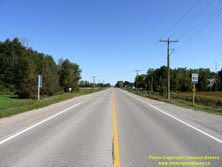
Left - Facing north along Hwy 19 from Vivian Line 37 in Stratford. Although the city limits lie about 600 metres to the north, Vivian Line 37 marks the end
of Stratford's urbanized area. From Stratford, Hwy 19 continues in a general northerly direction towards Milverton and the Hwy 86 Junction at Tralee. The Department
of Highways of Ontario (DHO) assumed jurisdiction over the Stratford-Milverton-Tralee Road on July 4, 1934. The highway was provincially-maintained up until the late
1990s. Jurisdiction over Hwy 19 was transferred from the province to the County of Perth, effective January 1, 1998. Note the sign at right for "119 North", a
reference to Hwy 19's new official name as Perth Line 119. See an
Enlarged Photo Here. (Photograph taken on September 23, 2018 - © Cameron Bevers) Right - Departing from Stratford on Hwy 19, facing north towards Milverton. Note the old yellow "CL" sign at right, marking the northern limits of the old Municipal Connecting Link through Stratford. The province seldom assumes ownership of highways passing through built-up urbanized areas. These small yellow signs are often placed to mark the boundary between provincial and municipal jurisdiction at the entrances to towns and cities. See an Enlarged Photo Here. (Photograph taken on September 23, 2018 - © Cameron Bevers) 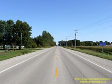

Left - Approaching Gadshill on Hwy 19, facing north towards Milverton. This small rural community is located about 7 km north of Stratford on Hwy 19. See an
Enlarged Photo Here. (Photograph taken on September 23, 2018 - © Cameron Bevers) Right - Facing south along Hwy 19 towards Stratford at Perth Line 45 at Gadshill. See an Enlarged Photo Here. (Photograph taken on September 23, 2018 - © Cameron Bevers) 
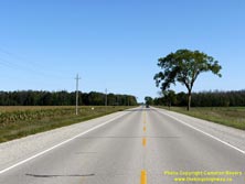
Left - Approaching Gadshill on Hwy 19, facing south towards Stratford. See an
Enlarged Photo Here. (Photograph taken on September 23, 2018 - © Cameron Bevers) Right - Facing north along Hwy 19 towards Milverton about 9 km north of Stratford. This part of Perth County is incredibly flat, with very little change in the vertical profile of Hwy 19 for many miles. See an Enlarged Photo Here. (Photograph taken on September 23, 2018 - © Cameron Bevers) 

Left - Inscription on an old concrete culvert on Hwy 19 about 10 km north of Stratford - "THE KING'S HIGHWAY 1937". See an
Enlarged Photo Here. (Photograph taken on April 9, 2005 - © Cameron Bevers) Right - Facing north along Hwy 19 about 11 km north of Stratford. The route of Hwy 19 between Stratford and Milverton was the location of one of the longest examples of Ontario's infamous "Hepburn Sidewalks" - a single-lane concrete highway pavement of 1930s vintage. Nearly the entire 25 km route of Hwy 19 from Stratford to Milverton was paved as a 10-foot strip (the northbound lane only) during 1937 and 1938, but the opposing lane was left with a gravel surface. This unusual type of pavement construction became surprisingly common on rural Ontario highways in the 1930s, at a time when politicians would often campaign on promises to construct a "paved highway" between various towns. Embittered motorists and electors alike became frustrated when campaign promises to build a paved highway were, quite literally, only half-filled. Motorists had to endure the gravel surface on the southbound lane until 1950, when Hwy 19 was finally paved to its full width. The term "Hepburn Sidewalk" was a reference to former Ontario Premier Mitch Hepburn, whose government oversaw the construction of many miles of these single-lane concrete highway pavements during the 1930s. See an Enlarged Photo Here. (Photograph taken on September 23, 2018 - © Cameron Bevers) 

Left - Facing north along the Topping Diversion (Hwy 19) towards Milverton. This long highway curve was built in 1959-1960 as part of a highway improvement
project carried out along Hwy 19. This new diversion bypassed a much tighter corner diversion, which had been built at Topping in the late 1930s. See an
Enlarged Photo Here. (Photograph taken on September 23, 2018 - © Cameron Bevers) Right - View of Old Hwy 19 (now Perth Line 56A) approaching Topping. This section of Hwy 19 was bypassed by the Topping Diversion in 1960. The DHO relinquished jurisdiction over the old route of Hwy 19 through Topping in January 1961. A shorter section of Hwy 19 through the old corners at Topping had been bypassed previously during an earlier highway improvement project carried out in the late 1930s. See an Enlarged Photo Here. (Photograph taken on September 23, 2018 - © Cameron Bevers) 
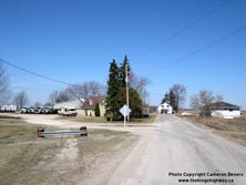
Left - Facing south along Old Hwy 19 (now Perth Line 56A) towards Stratford from Topping. The Topping Diversion can be seen joining in from the right, which
allowed through traffic on Hwy 19 travelling between Stratford and Milverton to bypass the small community of Topping altogether. See an
Enlarged Photo Here. (Photograph taken on September 23, 2018 - © Cameron Bevers) Right - This old superelevated curve on the former alignment of Hwy 19 at Topping has been barricaded off for decades and now serves as a private driveway. The old highway curve seen here was closed to traffic once the Topping Diversion was completed in 1960. The original 1934 route of Hwy 19 continued straight ahead to the T-intersection, where traffic could either turn left and continue up Hwy 19 to Milverton or turn right and follow a county road to Wellesley. The curve diversion was built during a highway improvement project carried out in 1937-1938. See an Enlarged Photo Here. (Photograph taken on April 9, 2005 - © Cameron Bevers) 
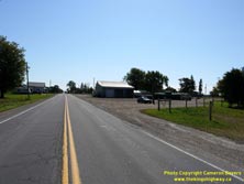
Left - Close-up view of the abandoned highway curve on Old Hwy 19 at Topping. This short corner diversion was built in the late 1930s and was surfaced with a
twin-slab concrete pavement. This was one of the few locations between Stratford and Milverton where the highway was actually paved in concrete to full-width,
presumably for safety reasons. The highway curve was resurfaced with an asphalt top course in 1950, which coincided with the completion of the rest of the paving work
along Hwy 19 between Stratford and Milverton. See an Enlarged Photo Here. (Photograph taken on September 23, 2018 - © Cameron Bevers) Right - The old corner diversion on the former route of Hwy 19 at Topping is much less evident when approaching from the west, as an adjacent property owner has grassed over the old concrete highway curve. Up until 1938, Hwy 19 traffic had to continue straight ahead and turn right just beyond the house in order to continue south towards Stratford. Jurisdiction over the old bypassed route of Hwy 19 through the corners at Topping was transferred from the DHO to the Townships of Mornington and Ellice in August 1944. See an Enlarged Photo Here. (Photograph taken on September 23, 2018 - © Cameron Bevers) 

Left - View of Old Hwy 19 (now Perth Line 55) in Topping, facing east. Note the slight crest in the pavement in the foreground. I suspect that the old
superelevated twin-slab concrete highway curve was simply left in place and paved over, rather than removed. Concrete highways constructed by the DHO in the 1920s and
1930s had a tendency to be very well-built and are still occasionally found under asphalt-surfaced provincial highways even today, some 80-100 years after being laid.
See an Enlarged Photo Here. (Photograph taken on September 23, 2018 - © Cameron Bevers) Right - Entering Topping on Old Hwy 19 (now Perth Line 55), facing east. Topping was one of two small communities bypassed along Hwy 19 south of Milverton. See an Enlarged Photo Here. (Photograph taken on September 23, 2018 - © Cameron Bevers) 
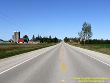
Left - Facing south along Hwy 19 towards Stratford at the Topping Diversion. See an
Enlarged Photo Here. (Photograph taken on September 23, 2018 - © Cameron Bevers) Right - This bucolic scene greets motorists driving Hwy 19 between Topping and Brunner. See an Enlarged Photo Here. (Photograph taken on September 23, 2018 - © Cameron Bevers) 

Left - Facing south along Hwy 19 towards Stratford from Brunner. This is the only significant grade along the entire route of Hwy 19 between Stratford and
Milverton. See an Enlarged Photo Here. (Photograph taken on September 23, 2018 - © Cameron Bevers) Right - Approaching Brunner on Hwy 19, facing north towards Milverton. This small rural community is located about 18 km north of Stratford on Hwy 19. See an Enlarged Photo Here. (Photograph taken on September 23, 2018 - © Cameron Bevers) 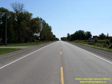
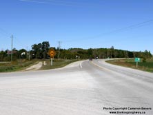
Left - Approaching Brunner on Hwy 19, facing south towards Stratford. See an
Enlarged Photo Here. (Photograph taken on September 23, 2018 - © Cameron Bevers) Right - Start of the Brunner Diversion (Hwy 19) facing north towards Milverton. Note the abandoned section of twin-slab concrete highway at left behind the checkerboard sign. The Brunner Diversion was completed in 1959-1960 as part of a highway improvement project carried out along Hwy 19. Like a similar diversion at nearby Topping, this long curve on Hwy 19 near Brunner bypassed a tight corner diversion built in the late 1930s. A portion of the old Hwy 19 alignment follows today's Perth Line 55. The new official name of Hwy 19 changes from Perth Line 119 to Perth Line 131 beginning at this intersection. See an Enlarged Photo Here. (Photograph taken on September 23, 2018 - © Cameron Bevers) 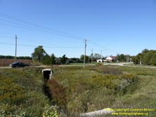

Left - View of the abandoned Hwy 19 alignment and culvert near Brunner. At right, Perth Line 55 can be seen joining the former route of Hwy 19. See an
Enlarged Photo Here. (Photograph taken on September 23, 2018 - © Cameron Bevers) Right - Abandoned Hwy 19 alignment and culvert near Brunner. Traffic can be seen using the current route of Hwy 19 (the Brunner Diversion) at left. See an Enlarged Photo Here. (Photograph taken on April 9, 2005 - © Cameron Bevers) 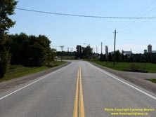
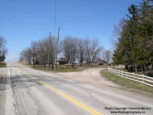
Left - Facing east along Perth Line 55 (Old Hwy 19) near Brunner. Just ahead, Perth Line 55 curves to the left and connects to the current route of Hwy 19 (the
Brunner Diversion). As originally established in 1934, the route of Hwy 19 continued straight ahead towards Stratford. See an
Enlarged Photo Here. (Photograph taken on September 23, 2018 - © Cameron Bevers) Right - Curved twin-slab concrete pavement on a former Hwy 19 alignment south of Milverton near Brunner. This superelevated curve was constructed in the late 1930s in an effort to improve the route of Hwy 19 in this area. Originally, Hwy 19 continued ahead to the corners beside the brick house and then turned right towards Milverton. See an Enlarged Photo Here. (Photograph taken on April 9, 2005 - © Cameron Bevers) 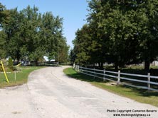

Left - The old concrete highway curve near Brunner has been out of service for decades. This former alignment of Hwy 19 now serves as a private driveway. See
an Enlarged Photo Here. (Photograph taken on September 23, 2018 - © Cameron Bevers) Right - The former alignment of Hwy 19 south of Milverton was closed to traffic and now serves as a residential driveway. See an Enlarged Photo Here. (Photograph taken on April 9, 2005 - © Cameron Bevers) 
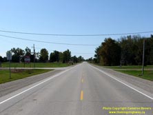
Left - View of the Brunner Diversion on Hwy 19, facing south towards Stratford. Slight traces of the historical Hwy 19 alignment can be seen gliding off into
the forest at right. See an Enlarged Photo Here. (Photograph taken on September 23, 2018 - © Cameron Bevers) Right - Facing south along Hwy 19 towards Stratford from the southern entrance to Milverton. See an Enlarged Photo Here. (Photograph taken on September 23, 2018 - © Cameron Bevers) 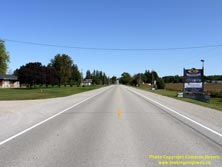

Left - Approaching Milverton on Hwy 19, facing north. Milverton is the northernmost town located along the pre-1998 route of Hwy 19, as there are no services located
at the Hwy 86 Junction at Tralee. As a result of the highway downloading spree of 1997-1998, the provincially-maintained section of Hwy 19 now ends at the Hwy 401
Interchange in Ingersoll. See an Enlarged Photo Here. (Photograph taken on September 23, 2018 - © Cameron Bevers) Right - Facing south along Main Street (Hwy 19) from Pugh Street in Milverton. See an Enlarged Photo Here. (Photograph taken on September 23, 2018 - © Cameron Bevers) 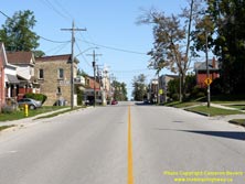

Left - Facing north along Main Street (Hwy 19) from Pugh Street in Downtown Milverton. See an
Enlarged Photo Here. (Photograph taken on September 23, 2018 - © Cameron Bevers) Right - Facing south along Main Street (Hwy 19) approaching Mill Street in Downtown Milverton. This is the only traffic signal located along Hwy 19 north of Stratford. The Hwy 19 & Hwy 86 Junction lying to the north of Milverton at Tralee is merely under Stop-control. See an Enlarged Photo Here. (Photograph taken on September 23, 2018 - © Cameron Bevers) 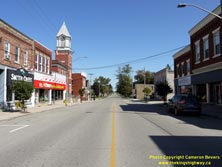

Left - View of Main Street (Hwy 19) in Downtown Milverton, facing north from Mill Street. See an
Enlarged Photo Here. (Photograph taken on September 23, 2018 - © Cameron Bevers) Right - Facing north along Hwy 19 from Spencer Street in Milverton. After departing from Milverton, Hwy 19 crosses another rural area of northern Perth County, before reaching its northern terminus at the Hwy 86 Junction at Tralee, located about 10 km southeast of Listowel. See an Enlarged Photo Here. (Photograph taken on September 23, 2018 - © Cameron Bevers) 

Left - Approaching Milverton on Hwy 19, facing south. See an
Enlarged Photo Here. (Photograph taken on September 23, 2018 - © Cameron Bevers) Right - Eastern side of Smith Creek Bridge #1 on Hwy 19 north of Milverton. This recently-rehabilitated single-span concrete rigid frame structure was completed in 1936. See an Enlarged Photo Here. (Photograph taken on September 23, 2018 - © Cameron Bevers) 
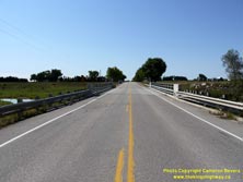
Left - Facing north along Hwy 19 towards Tralee at Smith Creek Bridge #1. This is the first of four crossings of Smith Creek on Hwy 19 north of Milverton. See an
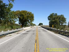
Enlarged Photo Here. (Photograph taken on September 23, 2018 - © Cameron Bevers) Right - Facing south along Hwy 19 towards Milverton at Smith Creek Bridge #1. See an Enlarged Photo Here. (Photograph taken on September 23, 2018 - © Cameron Bevers) 
Left - Western side of Smith Creek Bridge #1 on Hwy 19. The abutments of this bridge were extended slightly, presumably to leave provisions for a future
sidewalk, which was never built. Three other bridges of 1930s vintage between Milverton and Tralee have identical treatments on their western-facing sides. See an
Enlarged Photo Here. (Photograph taken on September 23, 2018 - © Cameron Bevers) Right - Facing north along Hwy 19 towards Tralee at Smith Creek Bridge #2. This is the second of four crossings of Smith Creek on Hwy 19 north of Milverton. See an Enlarged Photo Here. (Photograph taken on September 23, 2018 - © Cameron Bevers) 

Left - Eastern side of Smith Creek Bridge #2 on Hwy 19. This single-span concrete rigid frame structure was completed in 1935, at an original construction
cost of $9,000 in 1935 Dollars (equivalent to about $175,000 today). See an Enlarged Photo Here. (Photograph taken on September 23, 2018 - © Cameron Bevers) Right - Facing south along Hwy 19 towards Milverton at Smith Creek Bridge #2. See an Enlarged Photo Here. (Photograph taken on September 23, 2018 - © Cameron Bevers) 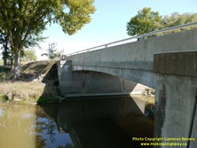
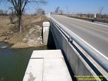
Left - Western side of Smith Creek Bridge #2 on Hwy 19. Like other bridges along Hwy 19 in this area, the western abutments of this bridge were extended
slightly. See an Enlarged Photo Here. (Photograph taken on September 23, 2018 - © Cameron Bevers) Right - Another view of the extended abutments of Smith Creek Bridge #2 on Hwy 19 north of Milverton. This single-span concrete rigid frame structure was completed in 1935. It was one of four nearly-identical bridges built across Smith Creek along Hwy 19 between Milverton and Tralee during the mid-1930s. See an Enlarged Photo Here. (Photograph taken on April 9, 2005 - © Cameron Bevers) 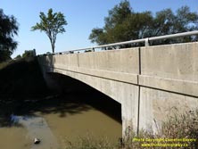
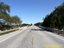
Left - Eastern side of Smith Creek Bridge #3 on Hwy 19 north of Milverton. See an
Enlarged Photo Here. (Photograph taken on September 23, 2018 - © Cameron Bevers) Right - Facing north along Hwy 19 towards Tralee at Smith Creek Bridge #3. See an Enlarged Photo Here. (Photograph taken on September 23, 2018 - © Cameron Bevers) 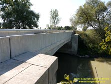
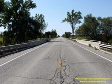
Left - Western side of Smith Creek Bridge #3 on Hwy 19. This single-span concrete rigid frame structure was completed in 1934. See an
Enlarged Photo Here. (Photograph taken on September 23, 2018 - © Cameron Bevers) Right - Facing south along Hwy 19 towards Milverton at Smith Creek Bridge #3. See an Enlarged Photo Here. (Photograph taken on September 23, 2018 - © Cameron Bevers) 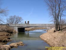

Left - Another view of Smith Creek Bridge #3 on Hwy 19 north of Milverton. The DHO first adopted the concrete rigid frame design for highway bridges in 1931.
The design proved to be quite practical and saw widespread use almost immediately. By the mid-1930s, dozens of bridges of this design had been built along the King's
Highway system. See an Enlarged Photo Here. (Photograph taken on April 9, 2005 - © Cameron Bevers) Right - Approaching Carthage on Hwy 19, facing north towards Tralee. See an Enlarged Photo Here. (Photograph taken on September 23, 2018 - © Cameron Bevers) 
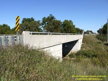
Left - Facing north along Hwy 19 towards Tralee at Smith Creek Bridge #4 at Carthage. See an
Enlarged Photo Here. (Photograph taken on September 23, 2018 - © Cameron Bevers) Right - Eastern side of the Carthage Bridge (Smith Creek Bridge #4) on Hwy 19. See an Enlarged Photo Here. (Photograph taken on September 23, 2018 - © Cameron Bevers) 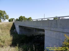

Left - The 1930s-era concrete rigid frame structure on Hwy 19 over Smith Creek at Carthage was replaced in recent years with this new steel beam structure.
See an Enlarged Photo Here. (Photograph taken on September 23, 2018 - © Cameron Bevers) Right - Facing south along Hwy 19 towards Milverton at Smith Creek Bridge #4 at Carthage. See an Enlarged Photo Here. (Photograph taken on September 23, 2018 - © Cameron Bevers) 
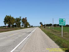
Left - Approaching Carthage on Hwy 19, facing south towards Milverton. See an
Enlarged Photo Here. (Photograph taken on September 23, 2018 - © Cameron Bevers) Right - Green guide sign for Perth Line 86 (Formerly King's Highway 86) approaching the northern terminus of Hwy 19 at Tralee. Like Hwy 19, jurisdiction over Hwy 86 was transferred or "downloaded" from the province to Perth County during the late 1990s. The reorganization of provincial and municipal government services during the 1990s resulted in the loss of many provincial highways, particularly in Southern Ontario. These two former King's Highways are now both county roads maintained by municipalities. See an Enlarged Photo Here. (Photograph taken on September 23, 2018 - © Cameron Bevers) 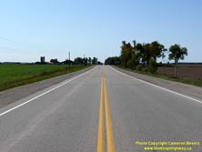

Left - Facing south along Hwy 19 towards Milverton from the Hwy 86 Junction at Tralee. Note the Perth County Road 131 marker at right, which reflects former
King's Highway 19's new name in this part of Perth County. See an
Enlarged Photo Here. (Photograph taken on September 23, 2018 - © Cameron Bevers) Right - Northern terminus of Hwy 19 at the Hwy 86 Junction at Tralee. When Hwy 19 was first assumed as a King's Highway in July 1934, a strange anomaly was created in the provincial highway system at this location, albeit temporarily. The route of Hwy 19 simply came to an end at this intersection and did not continue north or connect to any other provincial highways. It merely ended at the Listowel-Elmira Road, which at the time was maintained by local municipalities. It wasn't until 1937 that motorists reaching the end of Hwy 19 could travel any further on a provincially-maintained King's Highway. This strange discontinuity in the highway network ceased when the DHO assumed responsibility for the Listowel-Elmira Road as King's Highway 86 in August 1937. See an Enlarged Photo Here. (Photograph taken on September 23, 2018 - © Cameron Bevers) 

Left - Guide signs at the Hwy 19 & Hwy 86 Junction at Tralee. The route of Hwy 86 straddles the boundary between the Counties of Wellington and Perth. See
an Enlarged Photo Here. (Photograph taken on September 23, 2018 - © Cameron Bevers) Right - Facing east along Hwy 86 towards Elmira from the Hwy 19 Junction at Tralee. See an Enlarged Photo Here. (Photograph taken on September 23, 2018 - © Cameron Bevers) 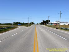
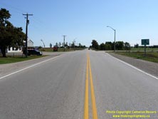
Left - View of the Hwy 19 Junction on Hwy 86, facing west towards Listowel. Two channelized right-turn ramps were built at Tralee during an intersection
reconstruction project which took place here in 1953. This was one of several King's Highway junctions in Southwestern Ontario that was rebuilt in the early 1950s
with right-turn channelization ramps to expedite traffic flow. See an
Enlarged Photo Here. (Photograph taken on September 23, 2018 - © Cameron Bevers) Right - Approaching the Hwy 19 Junction on Hwy 86, facing east towards Elmira. Since being downloaded by the province in 1998, former King's Highway 19 from Tralee southerly to the Milverton area has been known officially as Perth Line 131. The Counties of Wellington and Perth retained the route number for Former King's Highway 86 after the highway was downloaded to them. See an Enlarged Photo Here. (Photograph taken on September 23, 2018 - © Cameron Bevers) 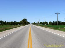
Above - Facing west along Hwy 86 towards Listowel from the Hwy 19 Junction at Tralee. See an
Enlarged Photo Here. (Photograph taken on September 23, 2018 - © Cameron Bevers)
More King's Highway 19 Photographs Coming Soon!
|
|---|
Links to Adjacent King's Highway Photograph Pages:
Back to King's Highway 18 Photos /
King's Highway 19 History /
Back to King's Highway 20 Photos
Ontario Highway History - Main Menu / Back to List of Highways Website contents, photos & text © 2002-2025, Cameron
Bevers (Webmaster) - All Rights Reserved / Contact Me |
|---|