
| 
| |
|
|
This page contains present day photos (Year 2000 to date) of Ontario's King's Highway 19, arranged by location from Ingersoll
northerly to Stratford. All photographs displayed on this page were taken by the Webmaster (Cameron Bevers), unless specifically noted otherwise. Click on any
thumbnail to see a larger image!
Please note that all photographs displayed on this
website are protected by copyright. These photographs must not be reproduced, published,
electronically stored or copied, distributed, or posted onto other websites without
my written permission. If you want to use photos from this website, please
email me first for permission. Thank-you!
|
|---|
|
Page 3: Present Day King's Highway 19 Photographs (Ingersoll to Stratford)


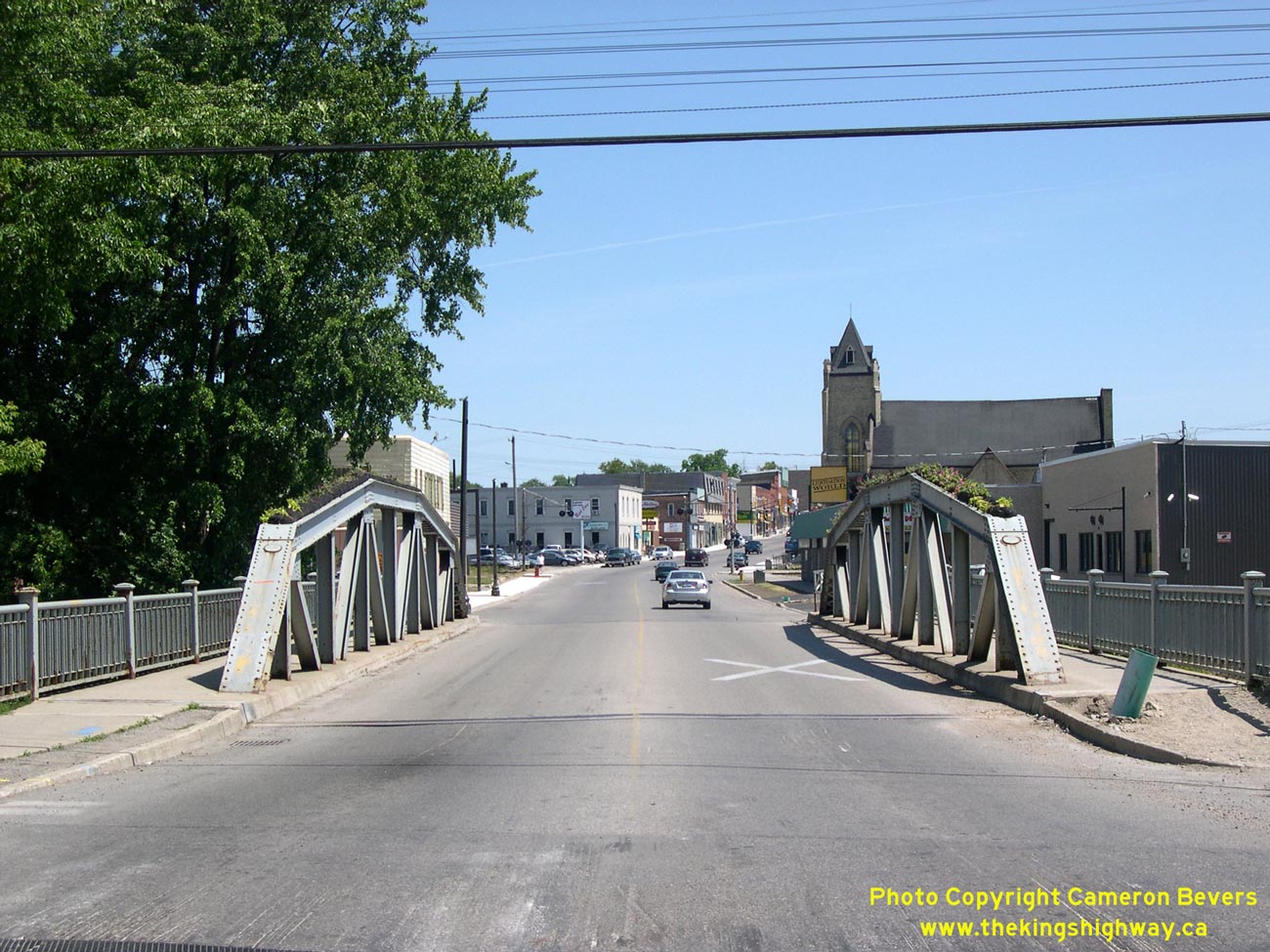
Left - Facing north along Hwy 19 at the Thames River Bridge in Ingersoll. See an
Enlarged Photo here. (Photograph taken on June 24, 2007 - © Cameron Bevers) Right - Thames River Bridge on Hwy 19 in Ingersoll. Structure completed in 1937. See an Enlarged Photo here. (Photograph taken on June 24, 2007 - © Cameron Bevers) 

Left - Facing south along Hwy 19 at the Thames River Bridge in Ingersoll. See an
Enlarged Photo here. (Photograph taken on June 24, 2007 - © Cameron Bevers) Right - The Thames River Bridge was the only surviving steel truss bridge on Hwy 19, but it was recently replaced. See an Enlarged Photo here. (Photograph taken on June 24, 2007 - © Cameron Bevers) 

Left - Bridge manufacturer's plaque on the Thames River Bridge in Ingersoll. See an
Enlarged Photo here. (Photograph taken on June 24, 2007 - © Cameron Bevers) Right - The Thames River Bridge is a Warren Type Truss. See an Enlarged Photo here. (Photograph taken on June 24, 2007 - © Cameron Bevers) 

Left - Facing north along Erie Street (Hwy 7) approaching the Ontario Street (Hwy 8) Junction in Downtown Stratford. These two highways join together in the
centre of the city. Overhead sign structures were installed on the approaches to this junction a number of years ago. Traffic bound for Goderich can turn left onto
Hwy 8 West. Traffic bound for Kitchener can turn right onto Hwy 7 & Hwy 8 East. Traffic bound for the Stratford Shakespeare Festival Theatre is directed to
follow Erie Street North. Historically, Hwy 19 also entered this intersection from the south along Erie Street, where it turned right concurrently with Hwy 7 &
Hwy 8 East. See an Enlarged Photo here. (Photograph taken on October 7, 2006 - © Cameron Bevers) Right - Many years ago, the median island separating the opposing directions of traffic at the Hwy 7 & Hwy 8 Junction in Downtown Stratford were painted with yellow-and-black diagonal hazard stripes. The once-common practice of marking roadside hazards with paint such as this example has been virtually supplanted in recent decades by the installation of yellow-and-black warning signs. Shortly after this photo was taken, the painted hazard stripes were removed at this highway junction. See an Enlarged Photo here. (Photograph taken on October 7, 2006 - © Cameron Bevers) 

Left - This unusual warning sign facing traffic turning left from Hwy 7 to Hwy 8 West alerts motorists to watch for pedestrians at the crosswalk. See an
Enlarged Photo here. (Photograph taken on October 7, 2006 - © Cameron Bevers) Right - Both ends of the Erie Street (Hwy 7) median island have been painted with yellow-and-black diagonal hazard stripes. See an Enlarged Photo here. (Photograph taken on October 7, 2006 - © Cameron Bevers) 

Left - Facing west along Ontario Street (Hwy 8) from Erie Street (Hwy 7). The route of Hwy 8 West follows Ontario Street for one block west of Erie Street,
where it turns northwest towards Goderich via Huron Street. It is rather interesting to note that Stratford's three main streets bear the names of the Great Lakes
which those streets generally point towards. See an Enlarged Photo here. (Photograph taken on October 7, 2006 - © Cameron Bevers) Right - Facing east along Ontario Street (Hwy 7 & Hwy 8) from Erie Street (Hwy 7). These two highways share an overlapped route between Stratford and Kitchener. Until the northern section of Hwy 19 was lost to downloading in 1997-1998, Hwy 19 also followed Ontario Street for one block between Erie Street and Waterloo Street. This resulted in three different highways being routed concurrently (Hwy 7, Hwy 8 & Hwy 19) along this short section of Ontario Street. The former route of Hwy 19 turned left at the next traffic signal in the background. See an Enlarged Photo here. (Photograph taken on October 7, 2006 - © Cameron Bevers) 

Left - Facing west along Ontario Street (Hwy 7 & Hwy 8) towards Erie Street in Downtown Stratford. Westbound motorists intending to turn onto Hwy 7 West must take care
here. It is very easy to inadvertently mistake Downie Street for Erie Street, since both streets intersect Ontario Street within 20 metres of each other. Until 1998,
Hwy 19 also turned left at Erie Street, concurrently with Hwy 7 towards St. Marys. See an
Enlarged Photo here. (Photograph taken on October 7, 2006 - © Cameron Bevers) Right - Overhead guide signs on Ontario Street (Hwy 7 & Hwy 8), directing traffic to London and Goderich. See an Enlarged Photo here. (Photograph taken on October 7, 2006 - © Cameron Bevers) 

Left - Facing south along Erie Street (Hwy 7) from Ontario Street in Downtown Stratford. Until recently, Hwy 7 & Hwy 19 shared a concurrent route for
approximately 16 km between Stratford and St. Marys. The overlapped routing between Hwy 7 & Hwy 19 was technically discontinued in 1998, when the northernmost
legs of Hwy 19 were transferred to Perth and Oxford Counties. However, some dual Hwy 7 & Hwy 19 route markers remained posted along the highway in the St. Marys
area until about 10 years ago. See an Enlarged Photo here. (Photograph taken on October 7, 2006 - © Cameron Bevers) Right - Facing south along Waterloo Street (Formerly Hwy 19) towards Ontario Street (Hwy 7 & Hwy 8) in Downtown Stratford. Until 1998, Hwy 19 turned right at this intersection and followed Hwy 7 & Hwy 8 West for one block to Erie Street. At Erie Street, Hwy 19 turned south towards St. Marys, concurrently with Hwy 7. See an Enlarged Photo here. (Photograph taken on September 18, 2011 - © Cameron Bevers) 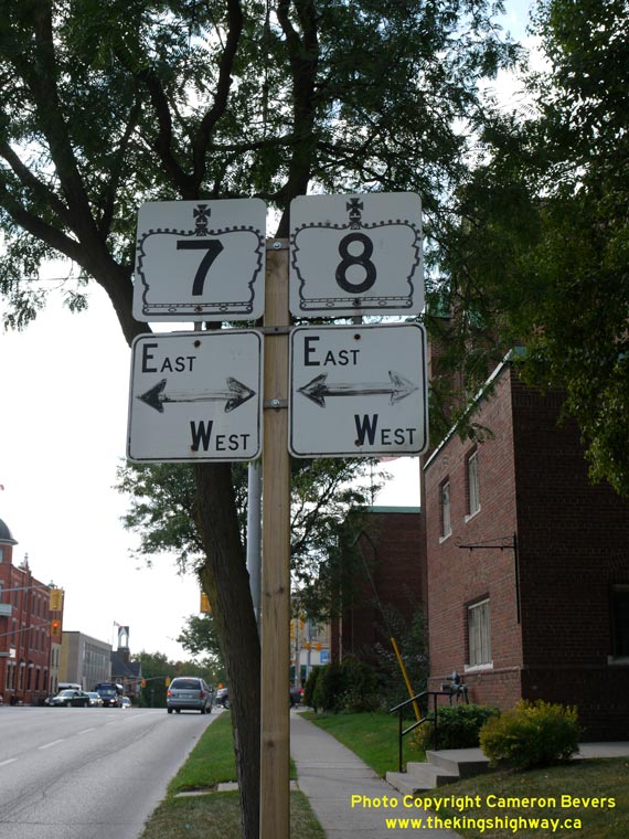
Above - Junction assembly for Hwy 7 & Hwy 8 on Waterloo Street (Formerly Hwy 19) in Downtown Stratford. See an
Enlarged Photo here. (Photograph taken on September 18, 2011 - © Cameron Bevers) 
Above - Facing north along Waterloo Street (Formerly Hwy 19) from Ontario Street (Hwy 7 & Hwy 8) in Downtown Stratford. Until the north leg of Hwy 19 was
transferred to Perth County in 1998, Hwy 19 continued north through Milverton. The highway came to an end at the Hwy 86 Junction at Tralee, between Listowel and
Elmira. See an Enlarged Photo here. (Photograph taken on September 18, 2011 - © Cameron Bevers)
Continue on to King's Highway 19 Photos: Stratford to Tralee
|
|---|
Links to Adjacent King's Highway Photograph Pages:
Back to King's Highway 18 Photos /
King's Highway 19 History /
On to King's Highway 20 Photos
Ontario Highway History - Main Menu / Back to List of Highways Website contents, photos & text © 2002-2026, Cameron
Bevers (Webmaster) - All Rights Reserved / Contact Me
|
|---|