
| 
| |
|
|
This page contains historical and present day photos of Ontario's King's Highway 28A. All photographs displayed on this page
were taken by the Webmaster (Cameron Bevers), unless specifically noted otherwise. Historical photographs are arranged in approximate chronological order, while
present day photographs (Year 2000 to date) are arranged by location from south to north. Click on any thumbnail to see a larger image!
Please note that all photographs displayed on this
website are protected by copyright. These photographs must not be reproduced, published,
electronically stored or copied, distributed, or posted onto other websites without
my written permission. If you want to use photos from this website, please
email me first for permission. Thank-you!
|
|---|
|
Present Day King's Highway 28A Photographs


Left - Facing north towards the Old Youngs Point Bridge along the former Hwy 28A alignment. The Old Youngs Point Bridge was constructed by the Dominion Bridge
Company in 1884-1885. It is one of the oldest surviving truss bridges in the province. This one-lane bridge carried Hwy 28 traffic across the Otonabee River for two
decades, from the time Hwy 28 was first designated through this area in 1934 up until the completion of the high-level bridge in 1954. See an
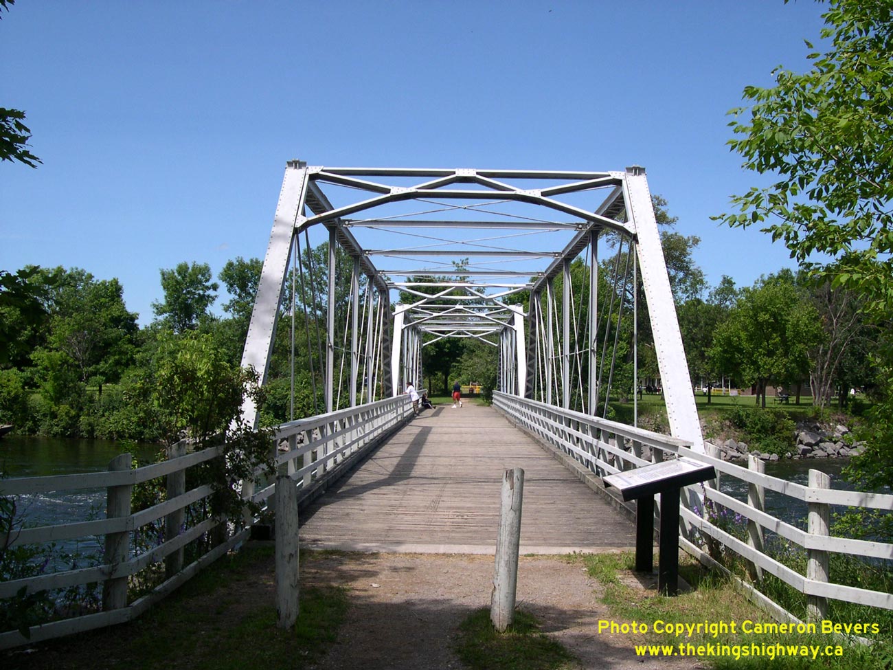
Enlarged Photo Here. (Photograph taken on July 25, 2004 - © Cameron Bevers) Right - The historic pin-connected wrought iron and steel truss bridge at Youngs Point is believed to be the only surviving example of its kind in Ontario. This structure represents an interesting transition in bridge construction techniques, since it was built using both wrought iron (commonly used in bridges built in the 1870s and 1880s) and steel, which has been used as a construction material in nearly all bridges built since the 1880s. In addition, the method of connecting the truss members together using pins fell out of favour by the 1890s, when rivets became the predominant method of assembling truss members. Thankfully, this attractive Pratt truss structure was thoughtfully preserved after the completion of the current Hwy 28 bridge at Youngs Point. The old bridge now serves as a pedestrian trail between Old Hwy 28 at the south end of the community of Youngs Point and the Trent-Severn Waterway Lock. (Photograph taken on July 25, 2004 - © Cameron Bevers) 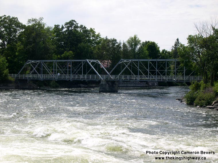
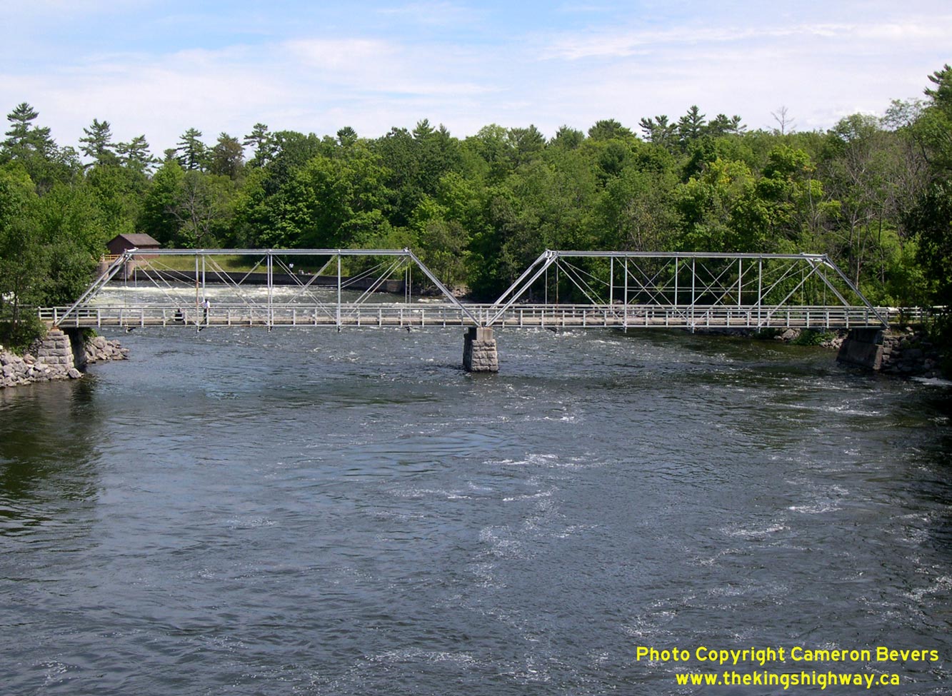
Left - Eastern side of the Old Hwy 28 Bridge at Youngs Point, as seen from the Trent-Severn Waterway Lock. The Youngs Point Lock (Lock #27) allows marine
traffic on the Trent-Severn Waterway to travel between Clear Lake and Katchewanooka Lake, bypassing these dramatic rapids on the Otonabee River. It is one of 44
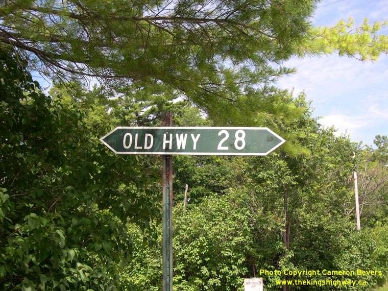
locks on the Trent-Severn Waterway system. (Photograph taken on July 25, 2004 - © Cameron Bevers) Right - The old alignment of Hwy 28A at Youngs Point is still signed as a former highway. Sadly, this ancient fingerboard sign was replaced during a construction project a few years ago. (Photograph taken on July 25, 2004 - © Cameron Bevers) 
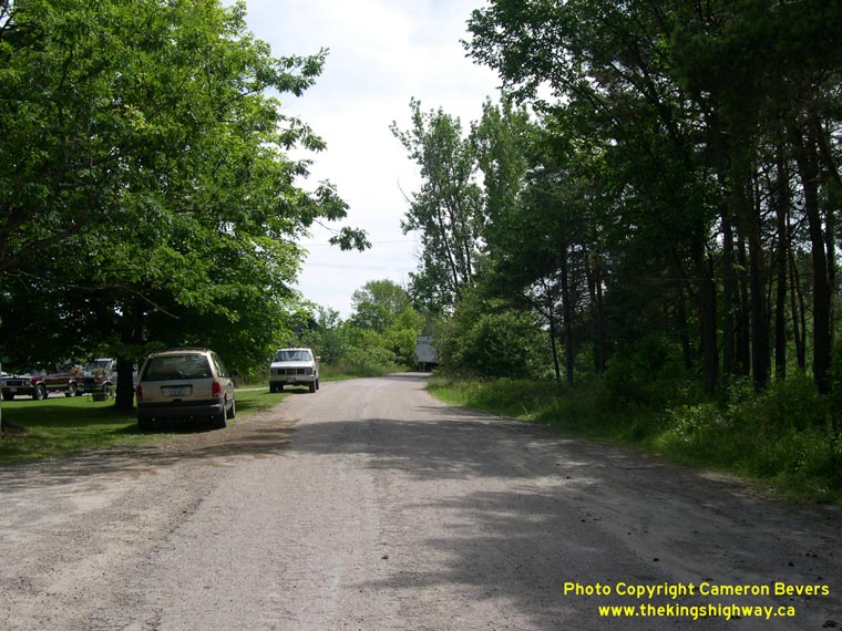
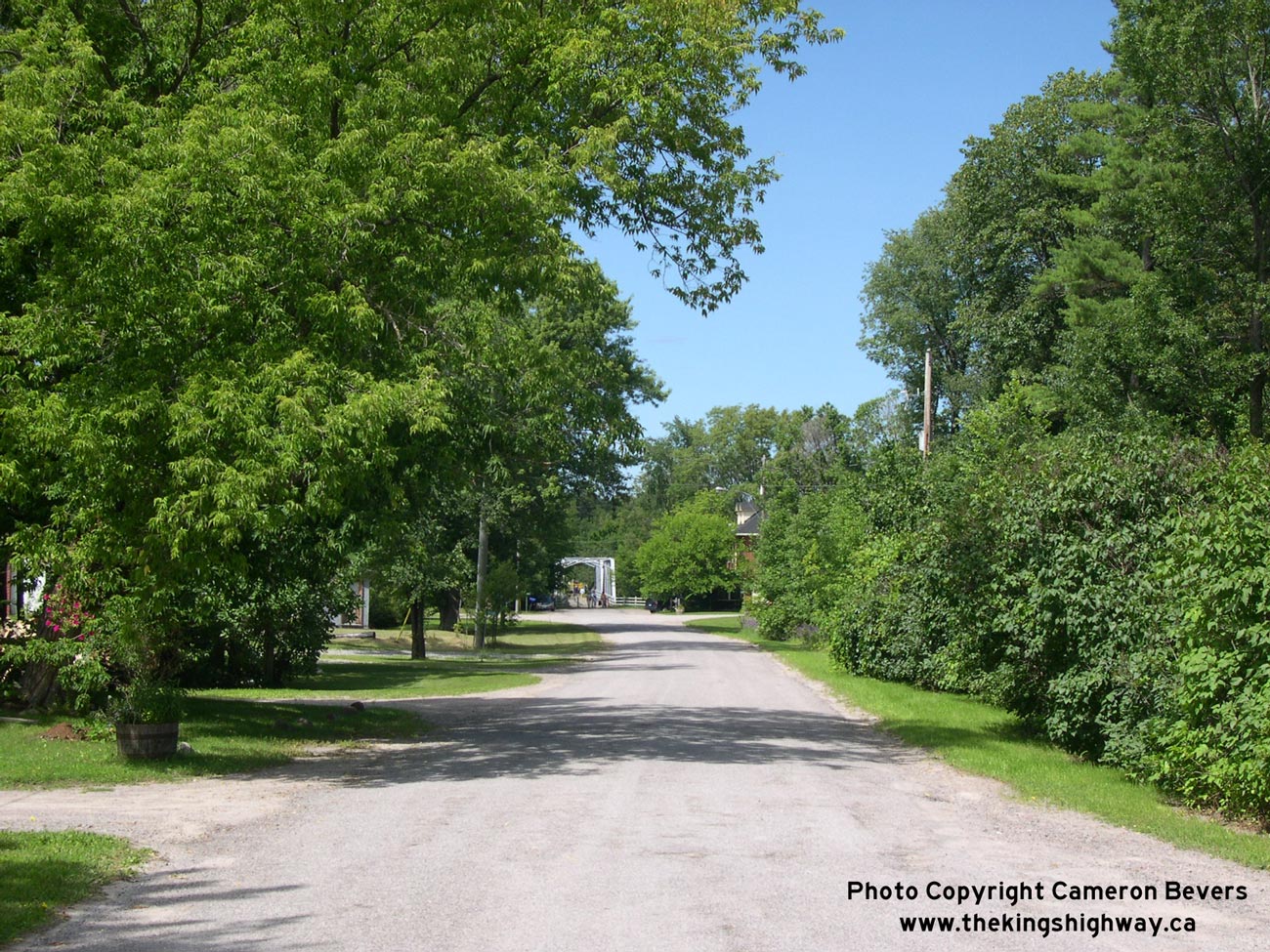
Left - Former Hwy 28A alignment at Youngs Point, facing north towards the old bridge. The original highway alignment is now a quiet side street. See an
Enlarged Photo Here. (Photograph taken on July 25, 2004 - © Cameron Bevers) Right - Former Hwy 28A alignment at Youngs Point, facing south towards Lakefield. A substantial diversion was built on Hwy 28 during the 1950s in order to construct a new high-level fixed-span bridge over the Trent-Severn Waterway at Youngs Point. As a result, bypassed portions of the original highway can be found both to the north and south of the Old Youngs Point Bridge. (Photograph taken on July 25, 2004 - © Cameron Bevers) 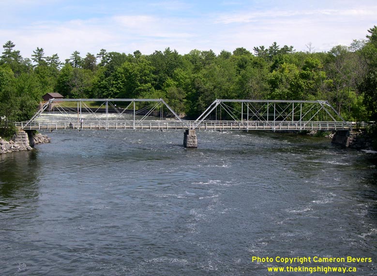
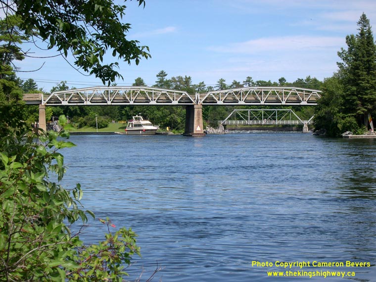
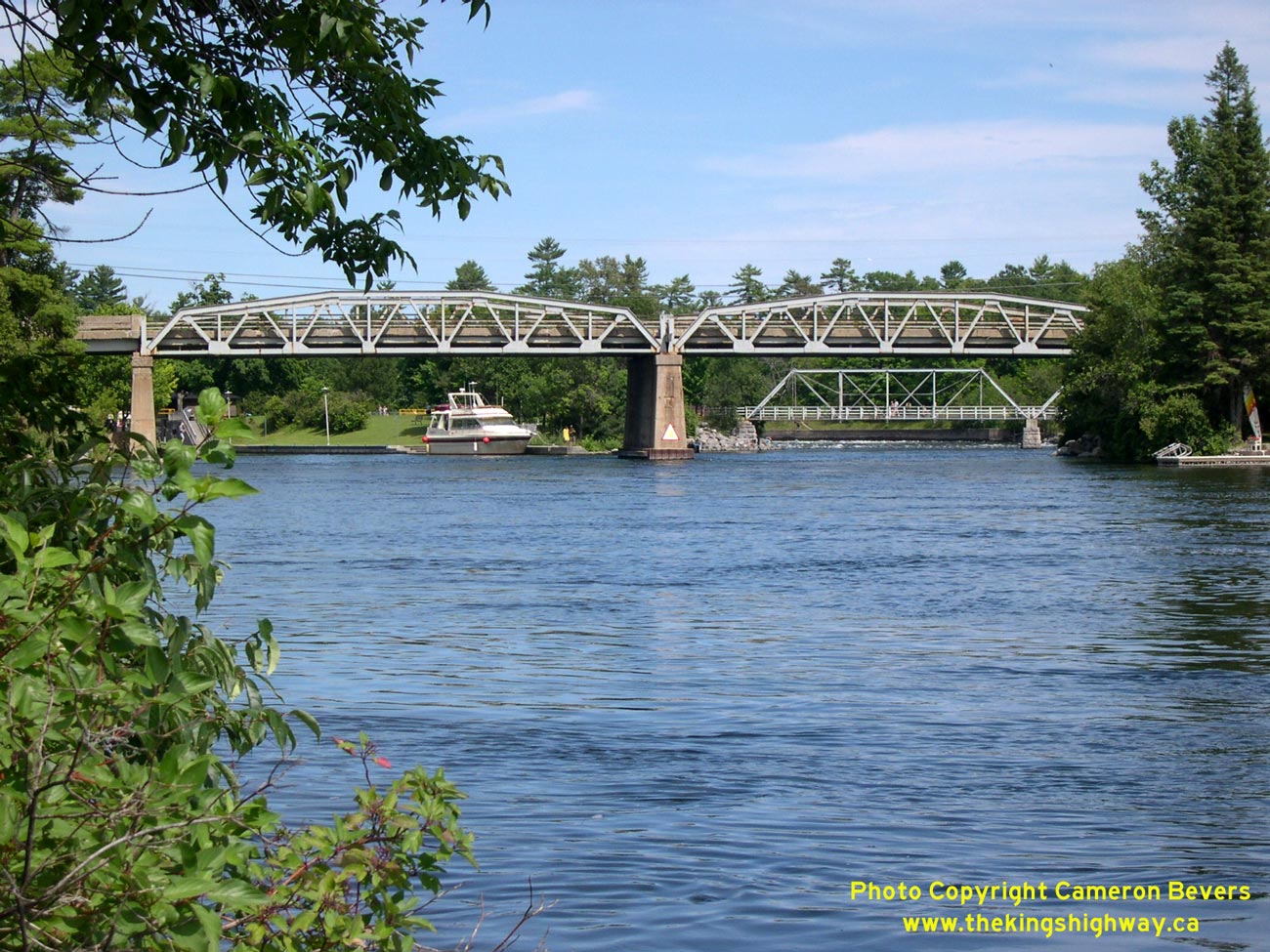
Left - An old 19th Century truss bridge can be seen from the current Hwy 28 bridge at Youngs Point, north of Peterborough. This truss bridge was built in
1884-1885. It carried Hwy 28 traffic across the Otonabee River until the current high-level bridge at Youngs Point was built in the mid-1950s. See an
Enlarged Photo Here. (Photograph taken on July 25, 2004 - © Cameron Bevers) Right - Both the old and new bridges at Youngs Point can be seen from this photogenic vantage point just west of Hwy 28. See an Enlarged Photo Here. (Photograph taken on July 25, 2004 - © Cameron Bevers)
More King's Highway 28A Photographs Coming Soon!
|
|---|
Links to Adjacent King's Highway Photograph Pages:
Back to King's Highway 28 Photos /
King's Highway 28A History /
On to King's Highway 29 Photos
Ontario Highway History - Main Menu / Back to List of Highways Website contents, photos & text © 2002-2026, Cameron
Bevers (Webmaster) - All Rights Reserved / Contact Me
|
|---|