
| 
| |
|
|
This page contains historical and present day photos of Ontario's King's Highway 38. All photographs displayed on this page
were taken by the Webmaster (Cameron Bevers), unless specifically noted otherwise. Historical photographs are arranged in approximate chronological order, while
present day photographs (Year 2000 to date) are arranged by location from south to north. Click on any thumbnail to see a larger image!
Please note that all photographs displayed on this
website are protected by copyright. These photographs must not be reproduced, published,
electronically stored or copied, distributed, or posted onto other websites without
my written permission. If you want to use photos from this website, please
email me first for permission. Thank-you!
|
|---|
|
Historical King's Highway 38 Photographs
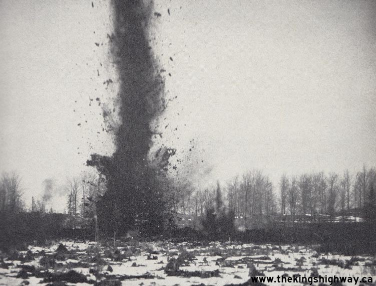
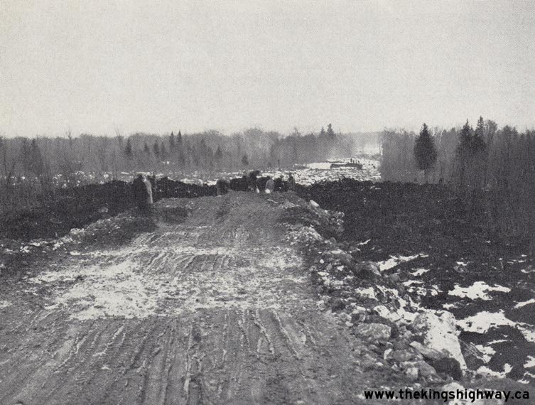
Left - Blasting muskeg on the Hartington-Verona Diversion on Hwy 38 in 1936. Photo taken on December 9, 1936. (Photo courtesy of Ontario Ministry of Transportation - © King's Printer for Ontario, 1936) Right - Fill over swamp and muskeg on the Hwy 38 Hartington-Verona Diversion. Photo taken on December 10, 1936. (Photo courtesy of Ontario Ministry of Transportation - © King's Printer for Ontario, 1936) 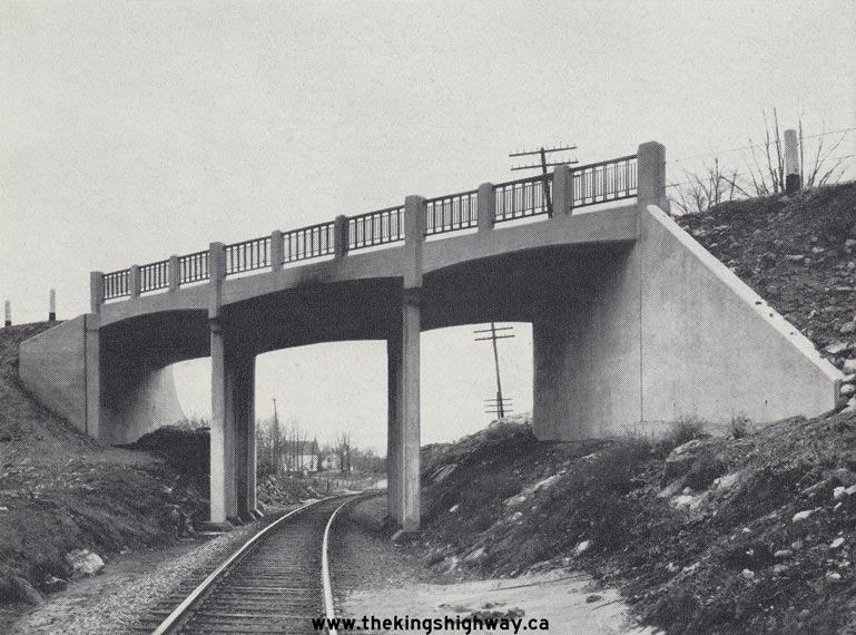
Above - New Sharbot Lake Railway Overhead on Hwy 38, shown shortly after the structure was completed in 1935. Photo taken on April 9, 1937. (Photo courtesy of Ontario Ministry of Transportation - © King's Printer for Ontario, 1937) 
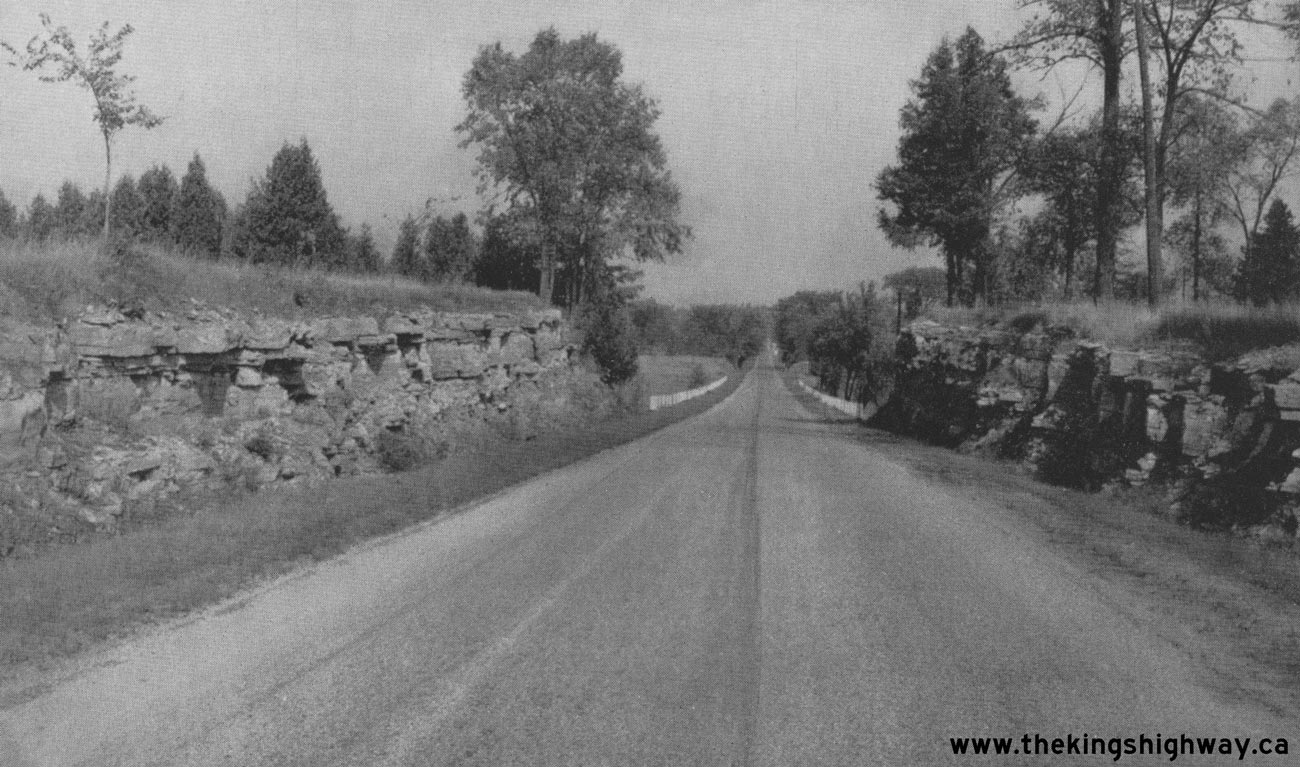
Above - View of Hwy 38 one mile south of Harrowsmith. Photo taken on September 27, 1946. See an
Enlarged Photo here. (Photo courtesy of Ontario Ministry of Transportation - © King's Printer for Ontario, 1946) |
|---|
|
Present Day King's Highway 38 Photographs

Above - Green guide sign at the junction of Hwy 2 and Hwy 38 in Kingston. See an
Enlarged Photo Here. (Photograph taken on May 18, 2006 - © Cameron Bevers) 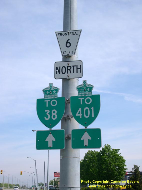
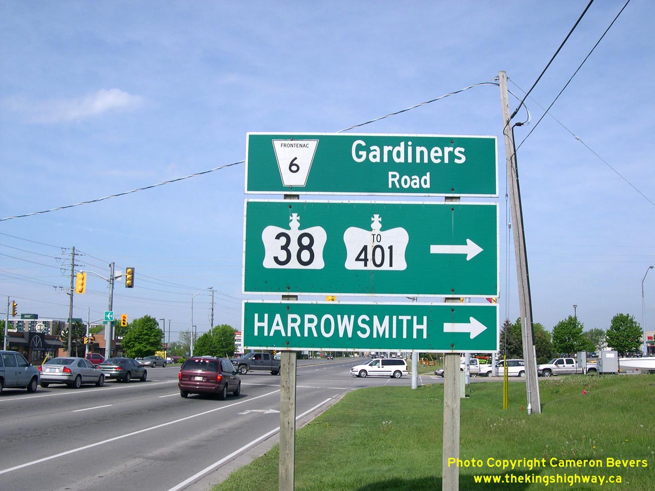
Above - Green trailblazer signs for Hwy 38 and Hwy 401 in Kingston. See an
Enlarged Photo Here. (Photograph taken on May 18, 2006 - © Cameron Bevers) 

Left - Facing west along Hwy 401 towards Belleville from the Hwy 38 Overpass near Kingston. See an
Enlarged Photo here. (Photograph taken on April 9, 2004 - © Cameron Bevers) Right - Facing east along Hwy 401 towards Kingston from the Hwy 38 Overpass. This section of Hwy 401 was widened to six lanes in 2005 and 2006. The project included the removal of an old railway overhead, located at the crest of the hill just east of Hwy 38. The decommissioned railway overhead spanned the former K & P (Kingston and Pembroke) Railway right-of-way. See an Enlarged Photo here. (Photograph taken on April 9, 2004 - © Cameron Bevers) 

Left - Old Hwy 38 (Sydenham Road) overpass at Hwy 401 in Kingston. Structure completed in 1957. Sydenham Road was the
original route of Hwy 38 from the 1930s until the 1950s, when the highway was relocated further west. (Photograph taken on April 9, 2004 - © Cameron Bevers) Right - Close-up view of unusual concrete railing design of Sydenham Road (Old Hwy 38) overpass at Hwy 401 (Photograph taken on April 9, 2004 - © Cameron Bevers) 

Left - Facing west along Hwy 401 from Old Hwy 38 (Sydenham Road) Overpass in Kingston (Photograph taken on April 9, 2004 - © Cameron Bevers) Right - Facing east along Hwy 401 from Old Hwy 38 (Sydenham Road) Overpass in Kingston. The Kingston section of Hwy 401 is one of the oldest portions of this freeway in Eastern Ontario. Note the narrow grass median, with a temporary Jersey barrier added beside the westbound lanes for safety. (Photograph taken on April 9, 2004 - © Cameron Bevers) 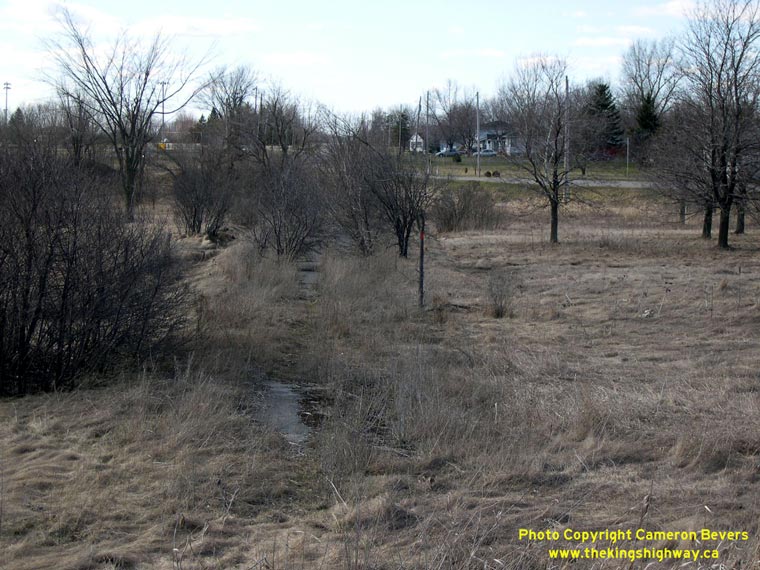
Left - Long-abandoned alignment of Hwy 38 north of Hwy 401 in Kingston. See an
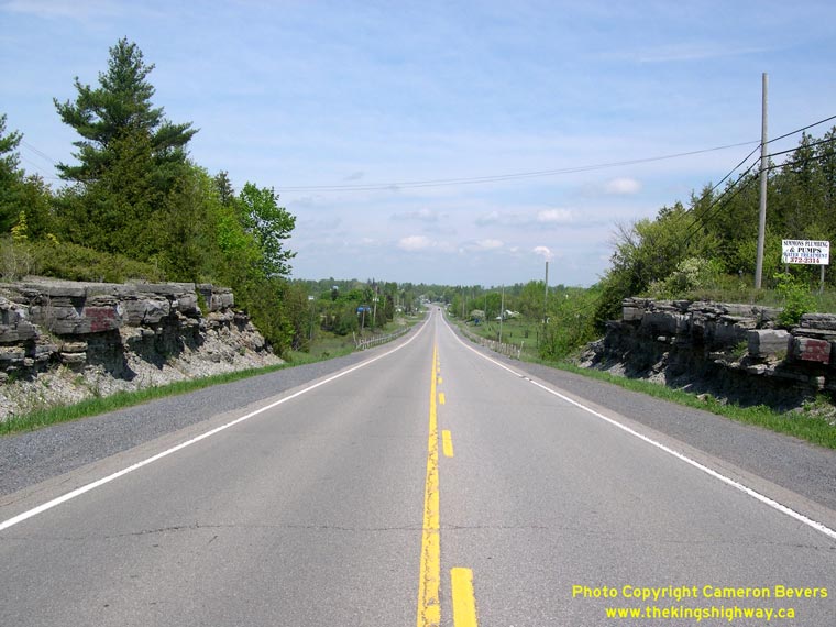
Enlarged Photo Here. (Photograph taken on April 9, 2004 - © Cameron Bevers) Right - Facing north along Hwy 38 towards Harrowsmith. Compare this photo to the 1948 image seen above in the Historical Photos section, which was taken from this same location about 60 years ago. See an Enlarged Photo Here. (Photograph taken on May 18, 2006 - © Cameron Bevers) 
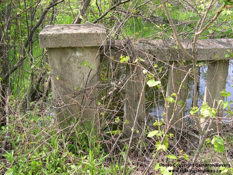
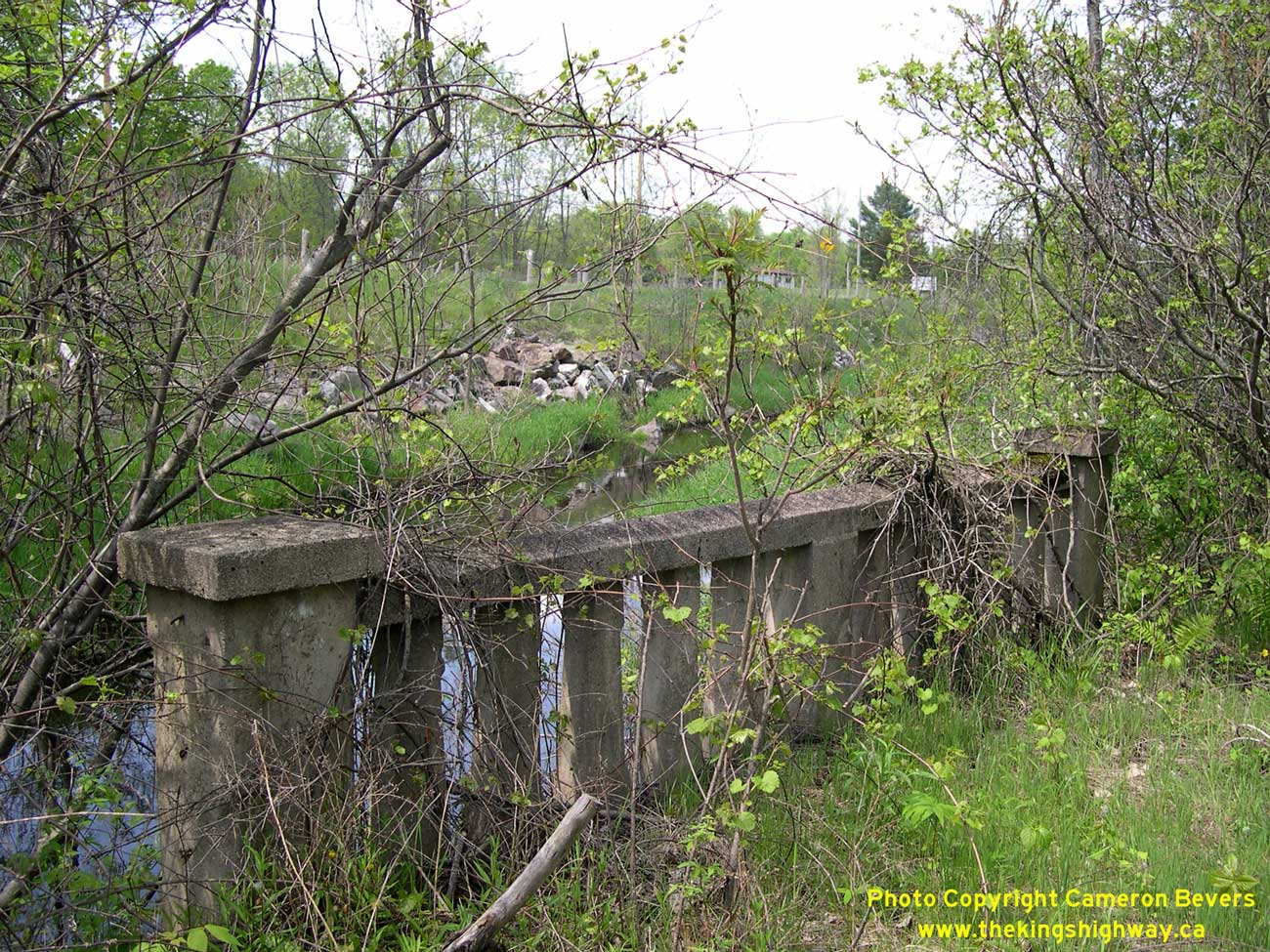
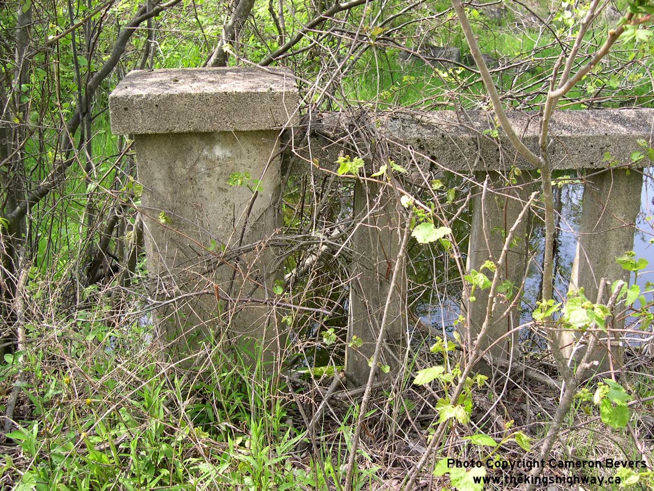
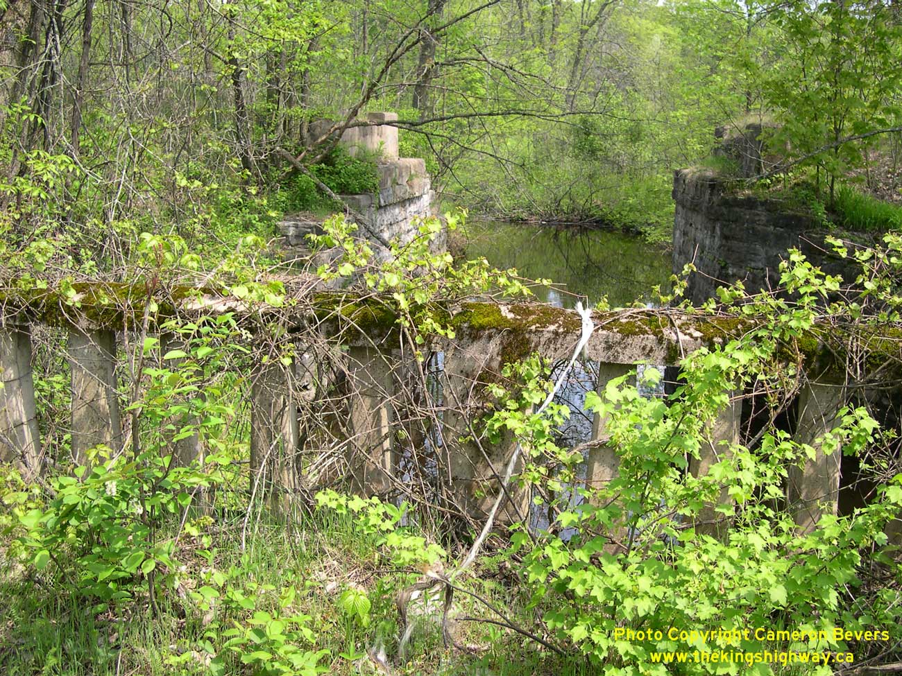
Left - Abandoned bridge on Hwy 38 north of Verona. This old concrete structure was built by Frontenac County long before the Department of Highways
assumed ownership of Hwy 38 in the 1930s. See an
Enlarged Photo Here. (Photograph taken on May 18, 2006 - © Cameron Bevers) Right - The bridge parapets are almost completely engulfed in vegetation and undergrowth. See an Enlarged Photo Here. (Photograph taken on May 18, 2006 - © Cameron Bevers) 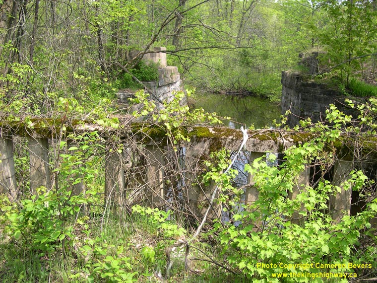
Left - The ruins of a former K & P (Kingston and Pembroke) Railway bridge can be seen beside the abandoned Hwy 38 Bridge near Verona. See an
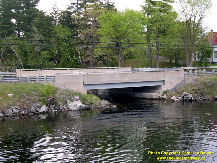
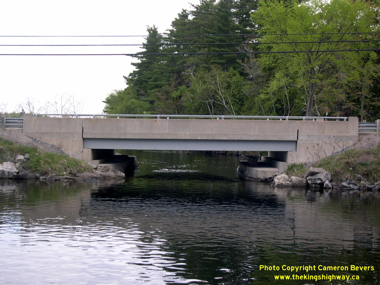
Enlarged Photo Here. (Photograph taken on May 18, 2006 - © Cameron Bevers) Right - Sharbot Lake Bridge on Hwy 38. Structure completed in 1947. See an Enlarged Photo Here. (Photograph taken on May 21, 2005 - © Cameron Bevers) 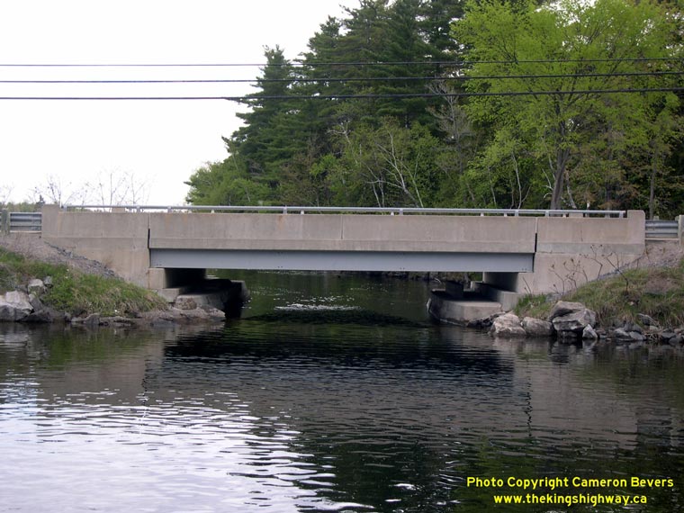
Left - Sharbot Lake is almost cut in half by two causeways. One causeway carries a pair of abandoned railway lines, while the other carries Hwy 38. This latter
causeway was built long before the Department of Highways assumed Hwy 38 in the 1930s. The first bridge connecting the causeway to the south shore of Sharbot Lake
was too narrow, so it was torn out and replaced by the current bridge in 1947. However, the original bridge abutments were incorporated into the new structure. See an
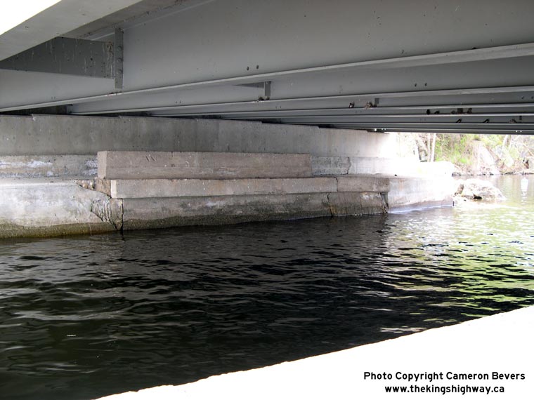
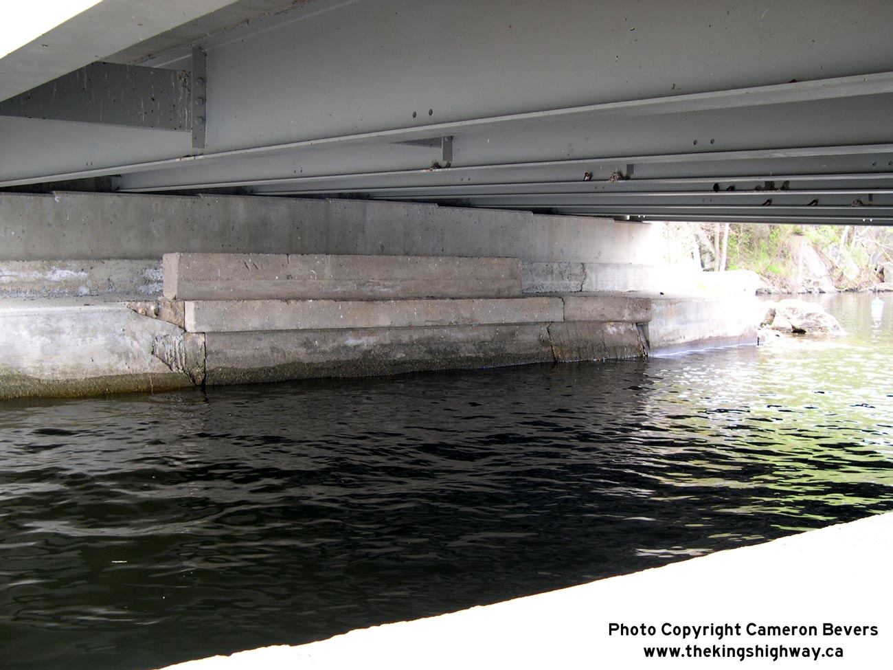
Enlarged Photo Here. (Photograph taken on May 21, 2005 - © Cameron Bevers) Right - Close-up of old bridge abutments underneath the Sharbot Lake Bridge on Hwy 38. See an Enlarged Photo Here. (Photograph taken on May 21, 2005 - © Cameron Bevers) 
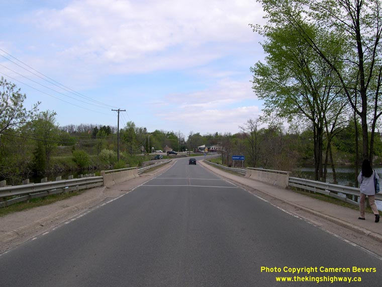
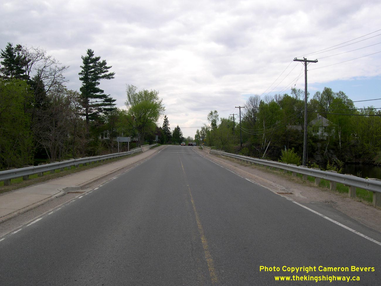
Left - Facing south towards Kingston across Sharbot Lake Causeway on Hwy 38. See an
Enlarged Photo Here. (Photograph taken on May 21, 2005 - © Cameron Bevers) Right - Facing north across the Sharbot Lake Causeway on Hwy 38. The old double track railway causeway across Sharbot Lake can be seen just off to the left of the highway bridge. One of these former railway lines passes under Hwy 38 at a railway overhead just north of Sharbot Lake. See an Enlarged Photo Here. (Photograph taken on May 21, 2005 - © Cameron Bevers)
More King's Highway 38 Photographs Coming Soon!
|
|---|
Links to Adjacent King's Highway Photograph Pages:
Back to King's Highway 37 Photos /
King's Highway 38 History /
Back to King's Highway 39 Photos
Ontario Highway History - Main Menu / Back to List of Highways Website contents, photos & text © 2002-2026, Cameron
Bevers (Webmaster) - All Rights Reserved / Contact Me
|
|---|