| 
| |
|
|
This page contains historical and present day photos of Ontario's King's Highway 39. All photographs displayed on this page
were taken by the Webmaster (Cameron Bevers), unless specifically noted otherwise. Historical photographs are arranged in approximate chronological order, while
present day photographs (Year 2000 to date) are arranged by location from west to east. Click on any thumbnail to see a larger image!
Please note that all photographs displayed on this
website are protected by copyright. These photographs must not be reproduced, published,
electronically stored or copied, distributed, or posted onto other websites without
my written permission. If you want to use photos from this website, please
email me first for permission. Thank-you!
|
|---|
|
Historical King's Highway 39 Photographs

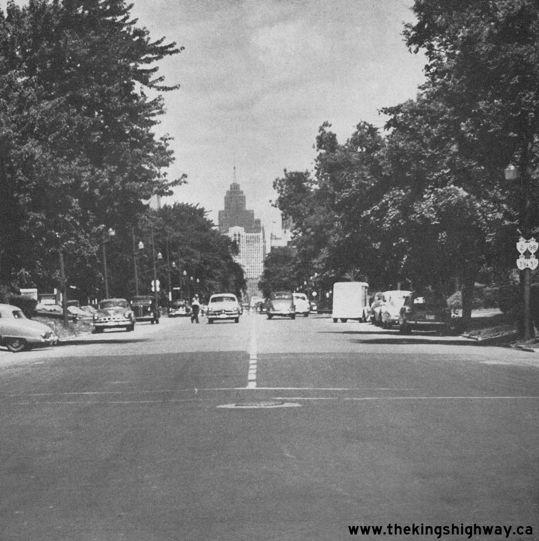
Above - Facing north along Ouellette Avenue towards Downtown Windsor in 1951. Note the signpost at right, which bears no fewer than four King's Highway shields.
Although the route numbers are difficult to discern in this photo, the four marked routes are Hwy 2, Hwy 3B, Hwy 39 and Hwy 98. For a number of years, all four of
these King's Highways were signed concurrently along Ouellette Avenue into Downtown Windsor. However, due to the construction of the E.C. Row Expressway and the
decommissioning of Hwy 39 and Hwy 98, three of these highway routes were eventually removed from Ouellette Avenue. Only the Hwy 3B route designation survived until
the 1990s. See an Enlarged Photo Here. Photo taken on July 10, 1951. (Photo courtesy of Ontario Ministry of Transportation - © King's Printer for Ontario, 1951) 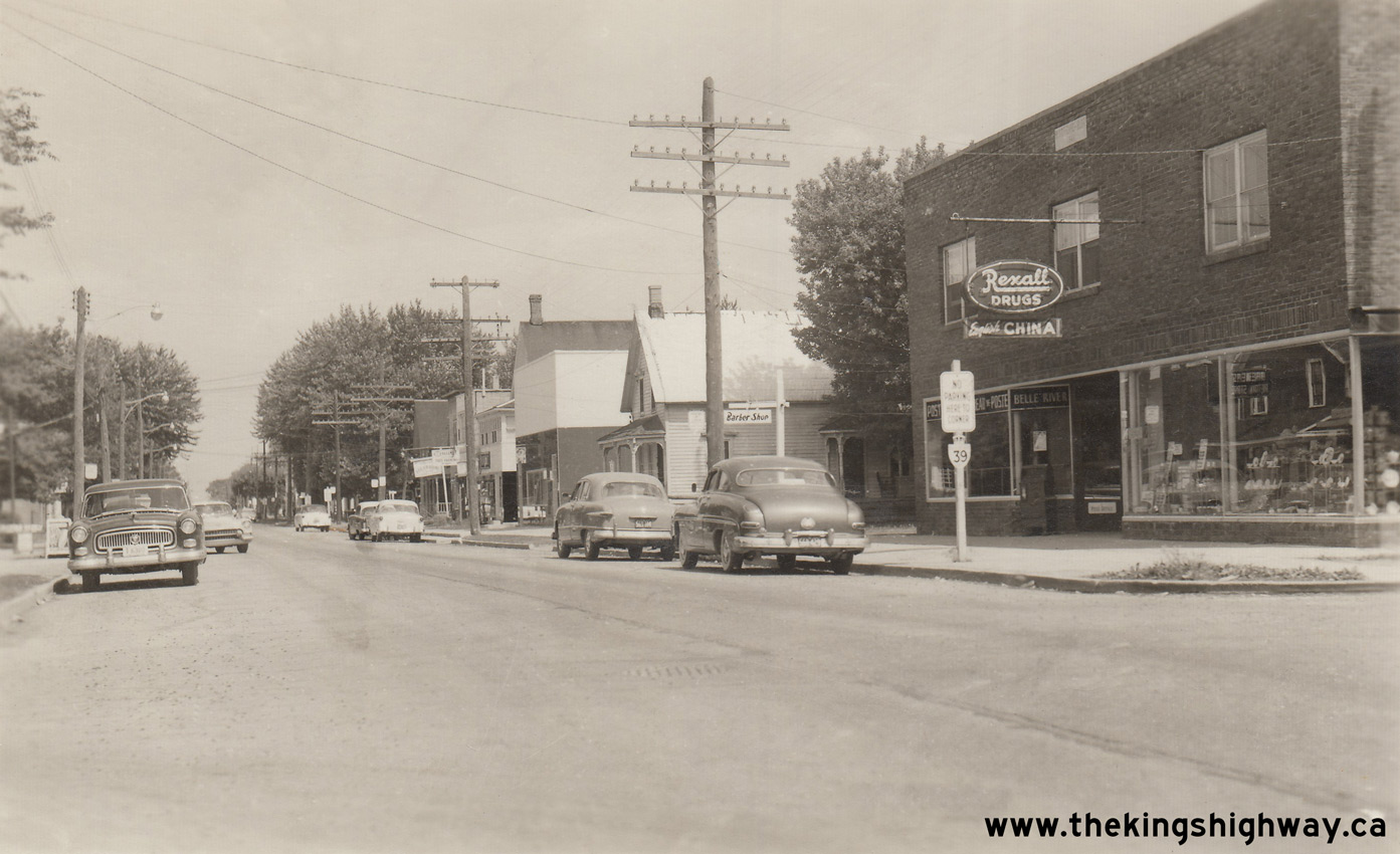
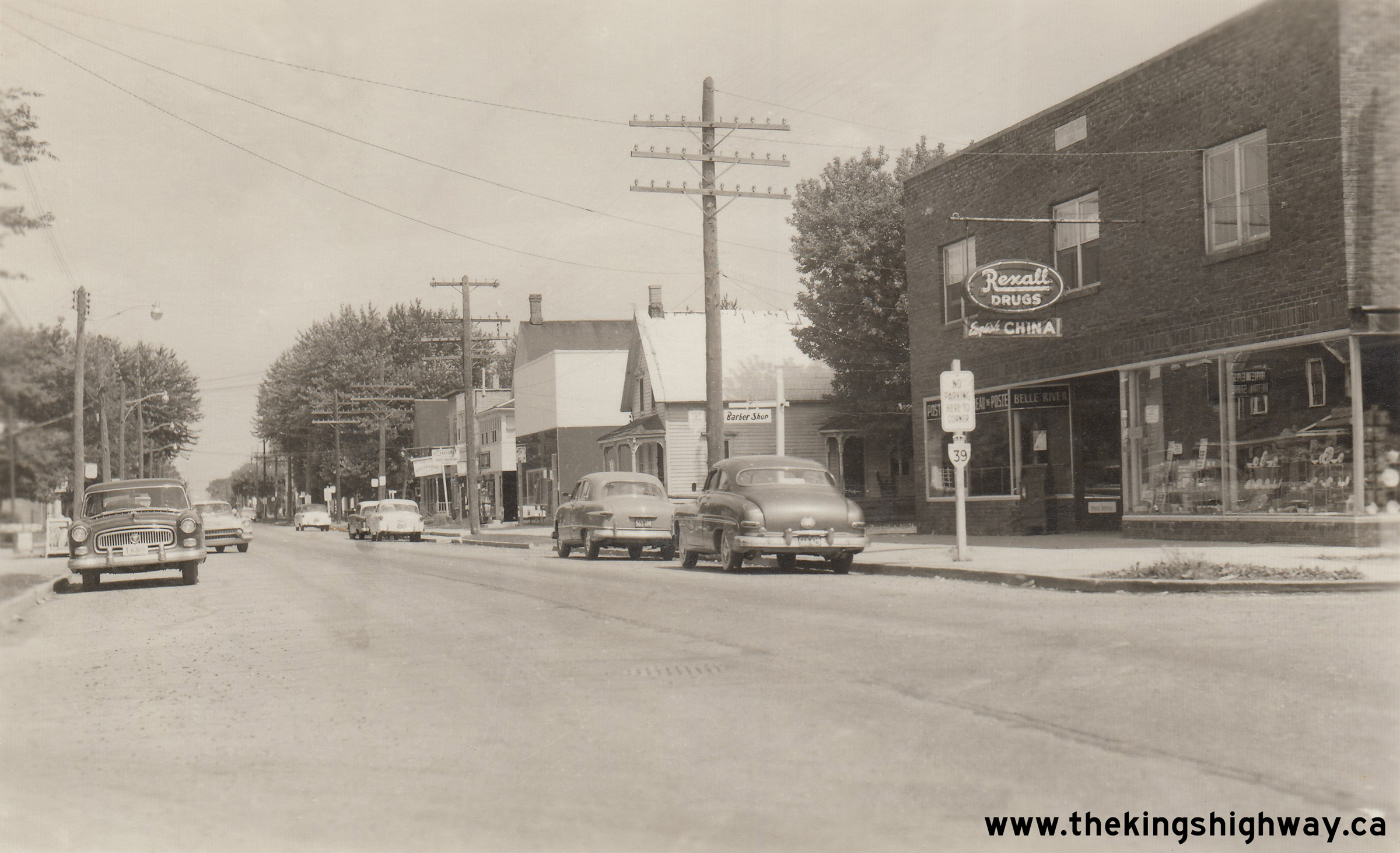
Above - Circa 1955 postcard view of Hwy 39 (Notre Dame Street) in Belle River, facing east from Chisholm Street. See an
Enlarged Photo Here. (Photo from Cameron Bevers' Historical Photograph Collection - Original Photographer Unknown) 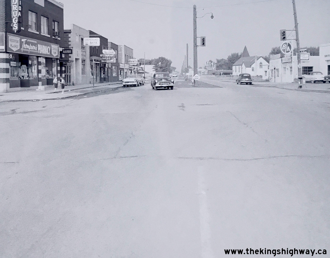
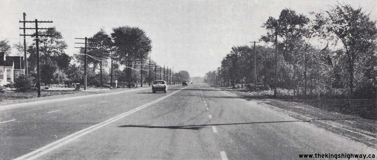
Left - Facing west along Hwy 39 (Tecumseh Road) towards Windsor from Pillette Road in 1956. This interesting suburban section of Hwy 39 was constructed as a
dual highway on the eastern approach to Windsor. Despite being rather urbanized, this divided section of Hwy 39 remained under the jurisdiction and control of the
Department of Highways of Ontario (DHO) up until 1966, when it was transferred to the newly-amalgamated City of Windsor. See an
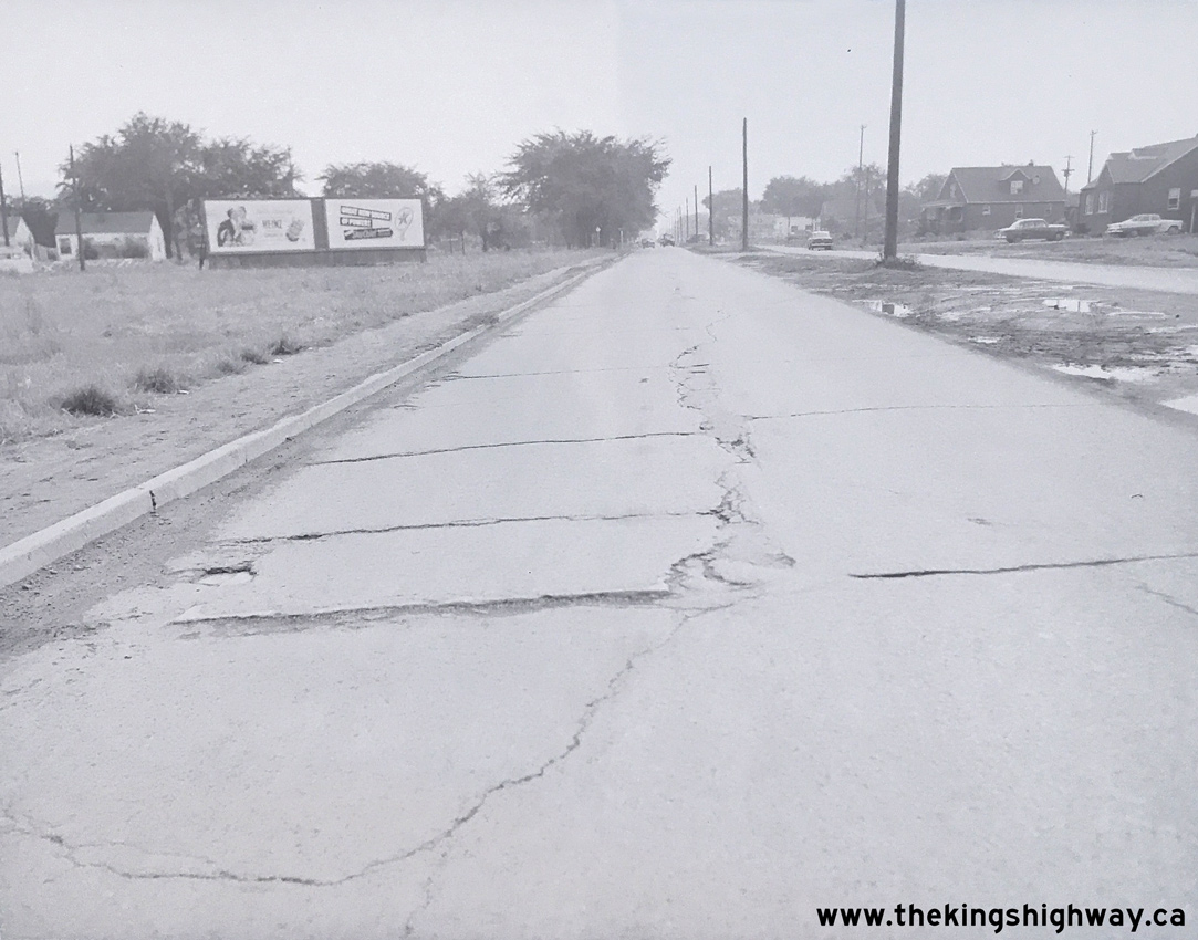
Enlarged Photo Here. Photo taken on July 26, 1956. (Photo courtesy of Ontario Ministry of Transportation - © King's Printer for Ontario, 1956) Right - Deteriorated pavement on a divided section of Hwy 39 at the eastern approach to Windsor, facing west from Larkin Road. See an Enlarged Photo Here. Photo taken on July 26, 1956. (Photo courtesy of Ontario Ministry of Transportation - © King's Printer for Ontario, 1956) 
Above - Facing east towards Windsor along Hwy 39 in Riverside, showing the newly resurfaced highway completed under Contract #1957-298. See an
Enlarged Photo Here. Photo taken in 1958. (Photo courtesy of Ontario Ministry of Transportation - © King's Printer for Ontario, 1958) 
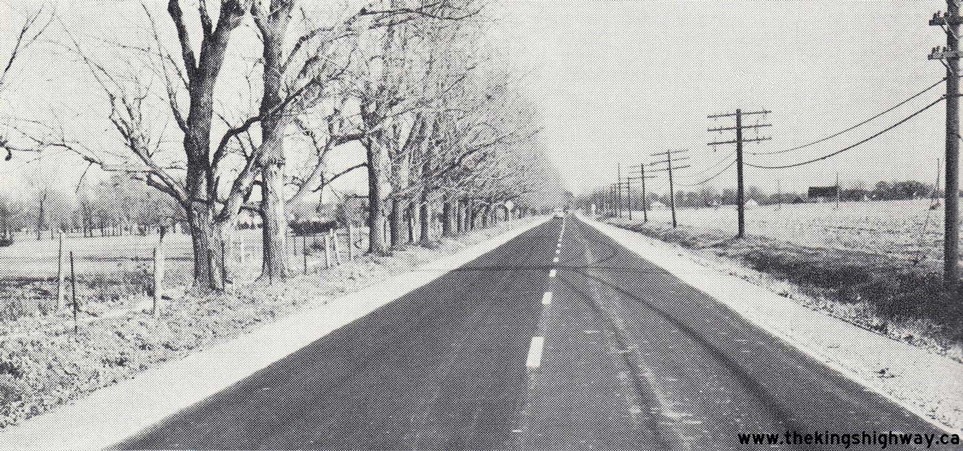
Above - Resurfaced section of Hwy 39 about 1/2 mile east of Tecumseh, Contract #1959-162. See an
Enlarged Photo Here. Photo taken on November 10, 1959. (Photo courtesy of Ontario Ministry of Transportation - © King's Printer for Ontario, 1959) |
|---|
|
Present Day King's Highway 39 Photographs


Left - Bypassed section of the Tecumseh-Pike Creek Bypass (Hwy 2, Formerly Hwy 39) near Banwell Road. See an
Enlarged Photo Here. (Photograph taken on November 8, 2003 - © Cameron Bevers) Right - Looking east along a former Hwy 2 (Hwy 39) alignment east of Banwell Road. See an Enlarged Photo Here. (Photograph taken on November 8, 2003 - © Cameron Bevers) 

Left - Pike Creek Bridge on an old Hwy 39 alignment east of Tecumseh. This bridge is not dated, but was likely constructed around 1932. See an
Enlarged Photo Here. (Photograph taken on November 8, 2003 - © Cameron Bevers) Right - Very old road alignment leading to the original (pre-1930s) Pike Creek Bridge. See an Enlarged Photo Here. (Photograph taken on November 8, 2003 - © Cameron Bevers) 

Left - Pike Creek Bridge on the old Hwy 39 alignment east of Tecumseh, looking west. See an
Enlarged Photo Here. (Photograph taken on November 8, 2003 - © Cameron Bevers) Right - North side of the Pike Creek Bridge on the old Hwy 39 alignment east of Tecumseh. See an Enlarged Photo Here. (Photograph taken on November 8, 2003 - © Cameron Bevers) 
Above - Original Hwy 39 alignment through Pike Creek, looking east. See an
Enlarged Photo Here. (Photograph taken on November 8, 2003 - © Cameron Bevers)
More King's Highway 39 Photographs Coming Soon!
|
|---|
Links to Adjacent King's Highway Photograph Pages:
Back to King's Highway 38 Photos /
King's Highway 39 History /
On to King's Highway 40 Photos
Ontario Highway History - Main Menu / Back to List of Highways Website contents, photos & text © 2002-2026, Cameron
Bevers (Webmaster) - All Rights Reserved / Contact Me
|
|---|