
| 
|  |
|
|
This page contains historical photos of Ontario's King's Highway 404 dating from 1980 to 1989. All photographs displayed on
this page were taken by the Ontario Ministry of Transportation, unless specifically noted otherwise. Historical photographs are arranged in approximate chronological
order. Click on any thumbnail to see a larger image!
Please note that all photographs displayed on this
website are protected by copyright. These photographs must not be reproduced, published,
electronically stored or copied, distributed, or posted onto other websites without
my written permission. If you want to use photos from this website, please
email me first for permission. Thank-you!
|
|---|
|
Page 2: Historical King's Highway 404 Photographs (1980-1989)

Above - Hwy 404 Extension nearing completion approaching the Major Mackenzie Drive Interchange near Richmond Hill in 1980. The final grading and paving
contract for the Hwy 404 Extension from the Hwy 7 Interchange northerly to the Gormley Road Interchange (now known as Stouffville Road) was constructed under Contract
#1979-74. This 10 km extension of Hwy 404 was opened to traffic in late 1980, although some residual carryover construction and top-course paving was not completed
along the highway until the Spring of 1981. See an Enlarged Photo Here. Photo taken in
1980. (Photo courtesy of Ontario Ministry of Transportation - © King's Printer for Ontario, 1980) 

Left - View of Hwy 404 facing north towards the Markham Canadian National Railway (CNR) Subway in 1981. This fantastic centreline shot of the CNR Subway
shows a then-sleepy Hwy 404 between the Steeles Avenue Interchange and the Hwy 7 Interchange, before the population of York Region really began to explode in the
1980s. Today, there are 10 freeway lanes which squeeze through this railway structure - 4 General Purpose Lanes and 1 High-Occupancy Vehicle (HOV) Lane per direction.
At the time this photo was taken, Hwy 404 was only four lanes in total (two lanes per direction) and was completed as far north as Gormley Road (now known as
Stouffville Road) only. The Markham CNR Subway was constructed in 1962, well in advance of the completion of Hwy 404 through this area during the late 1970s. Although
Hwy 404 is a comparatively new 400-Series Highway, planning for the new freeway actually began many decades ago. Thanks to the foresight of early transportation
planners, the new freeway's alignment north of Metropolitan Toronto had already been established by the Spring of 1960. See an
Enlarged Photo Here. Photo taken on September 28, 1981. (Photo courtesy of Ontario Ministry of Transportation - © King's Printer for Ontario, 2023) Right - Facing west across the Markham CNR Subway on Hwy 404 towards the Leslie Street CNR Overhead in 1981. Note how rural the area was at that time! Today, this entire area is quite urbanized, with industrial and business parks located along the eastern side of Hwy 404, while suburban residential developments lie to the west of the freeway. See an Enlarged Photo Here. Photo taken on September 28, 1981. (Photo courtesy of Ontario Ministry of Transportation - © King's Printer for Ontario, 2023) 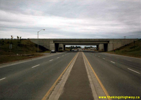

Left - View of the Hwy 7 Interchange on Hwy 404, facing east towards Markham in 1981. This interchange was constructed under Contract #1976-107, which included
the extension of Hwy 404 from Woodbine Avenue & Steeles Avenue northerly to the Hwy 7 Interchange. The Hwy 404 Extension from Woodbine Avenue & Steeles Avenue
to Hwy 7 was completed and opened to traffic in the Fall of 1978. See an Enlarged Photo Here.
Photo taken on September 28, 1981. (Photo courtesy of Ontario Ministry of Transportation - © King's Printer for Ontario, 2023) Right - Facing south along the southbound lanes of Hwy 404 towards Toronto from the Hwy 7 Interchange in 1981. The southbound Hwy 404 structure over Hwy 7 began to carry traffic in 1978, when Hwy 404 was opened from Woodbine Avenue northerly to Hwy 7. Due to construction sequencing, Hwy 404 ended at the Hwy 7 Interchange for nearly 2 years between late 1978 and late 1980. Noticeably absent in this historical 1981 photo is the adjacent Hwy 404 & Hwy 407 ETR Interchange, which wasn't constructed until the mid-1990s. See an Enlarged Photo Here. Photo taken on September 28, 1981. (Photo courtesy of Ontario Ministry of Transportation - © King's Printer for Ontario, 2023) 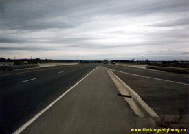

Left - Facing north towards Newmarket along the northbound lanes of Hwy 404 at the Hwy 7 Interchange between Markham and Richmond Hill in 1981. Although this
structure was built in 1976-1977, the northbound bridge sat unopened for several years before it was finally opened to traffic along with the northbound highway lanes
in late 1980. At the time this photo was taken, the section of Hwy 404 lying north of Hwy 7 had only been open to traffic for about 10 months. See an
Enlarged Photo Here. Photo taken on September 28, 1981. (Photo courtesy of Ontario Ministry of Transportation - © King's Printer for Ontario, 2023) Right - Facing west towards Richmond Hill at the Hwy 404 & Hwy 7 Interchange in 1981. In the early 1980s, Hwy 7 had a four-lane cross section through this interchange, as it was still very much a rural King's Highway. With increased urbanization and the completion of Hwy 407 ETR a short distance to the south, the province decided to transfer jurisdiction over Hwy 7 between the Hwy 50 Junction at Sunset Corners and the Hwy 404 Interchange in Markham to the Regional Municipality of York, effective June 7, 1997. See an Enlarged Photo Here. Photo taken on September 28, 1981. (Photo courtesy of Ontario Ministry of Transportation - © King's Printer for Ontario, 2023) 

Left - Facing north along the southbound lanes of Hwy 404 at the Beaver Creek Bridge in 1981, located just north of the Hwy 7 Interchange. This view of Hwy 404
was taken about 10 months after this section of the freeway was completed in late 1980. Advance grading and structural work began along the Hwy 404 Extension between
Hwy 7 and Gormley Road in early 1978, under Contract #1978-45. This contract work included construction of the twin structures over Beaver Creek, one of which is seen
here. Buttonville Airport can be seen beside the highway at right. See an Enlarged Photo Here. Photo taken on October 1, 1981. (Photo courtesy of Ontario Ministry of Transportation - © King's Printer for Ontario, 2023) Right - View of Hwy 404 at the Beaver Creek Bridge, facing south along the northbound lanes towards the Hwy 7 Interchange. See an Enlarged Photo Here. Photo taken on October 1, 1981. (Photo courtesy of Ontario Ministry of Transportation - © King's Printer for Ontario, 2023) 

Left - Western side of the Beaver Creek Bridge. located just north of the Hwy 7 Interchange. The structure in the foreground carries the southbound lanes of
Hwy 404, while the structure in the background carries the northbound lanes. See an
Enlarged Photo Here. Photo taken on October 1, 1981. (Photo courtesy of Ontario Ministry of Transportation - © King's Printer for Ontario, 2023) Right - Eastern side of the Beaver Creek Bridge, which shows the structure carrying the northbound lanes of Hwy 404. See an Enlarged Photo Here. Photo taken on October 1, 1981. (Photo courtesy of Ontario Ministry of Transportation - © King's Printer for Ontario, 2023) 
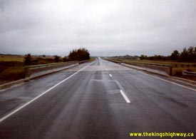
Left - 16th Avenue in Richmond Hill, facing east towards Hwy 404 in 1981. There was no interchange at 16th Avenue when Hwy 404 was first constructed, since
this was a predominantly rural area when the highway was built in 1979-1980. Development pressures by the late 1980s triggered the widening of 16th Avenue to a
four-lane cross section. New interchange ramps were constructed along Hwy 404 at 16th Avenue in the early 1990s, under Contract #1990-64. See an
Enlarged Photo Here. Photo taken on October 1, 1981. (Photo courtesy of Ontario Ministry of Transportation - © King's Printer for Ontario, 2014) Right - Facing south along the northbound lanes of Hwy 404 at the 16th Avenue Underpass in Richmond Hill. See an Enlarged Photo Here. Photo taken on October 1, 1981. (Photo courtesy of Ontario Ministry of Transportation - © King's Printer for Ontario, 2014) 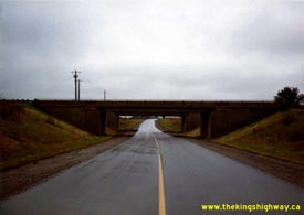

Left - Facing west along 16th Avenue at Hwy 404 in Richmond Hill. The twin structures carrying the northbound and southbound lanes of Hwy 404 over 16th Avenue
were built under Contract #1978-45. See an Enlarged Photo Here. Photo taken on October 1,
1981. (Photo courtesy of Ontario Ministry of Transportation - © King's Printer for Ontario, 2014) Right - Facing north along Hwy 404 towards Newmarket at the Major Mackenzie Drive Interchange. See an Enlarged Photo Here. Photo taken on October 1, 1981. (Photo courtesy of Ontario Ministry of Transportation - © King's Printer for Ontario, 2023) 
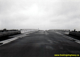
Left - Facing west across the Major Mackenzie Drive Overpass on Hwy 404, constructed under Contract #1978-45. See an
Enlarged Photo Here. Photo taken on October 1, 1981. (Photo courtesy of Ontario Ministry of Transportation - © King's Printer for Ontario, 2023) Right - Facing east across the 19th Avenue Overpass on Hwy 404. See an Enlarged Photo Here. Photo taken on October 1, 1981. (Photo courtesy of Ontario Ministry of Transportation - © King's Printer for Ontario, 2023) 

Left - Facing south towards the 19th Avenue Overpass on Hwy 404, constructed under Contract #1978-45. See an
Enlarged Photo Here. Photo taken on October 1, 1981. (Photo courtesy of Ontario Ministry of Transportation - © King's Printer for Ontario, 2023) Right - Facing east across the 18th Avenue (Elgin Mills Road) Overpass on Hwy 404. Photo taken on October 2, 1981. (Photo courtesy of Ontario Ministry of Transportation - © King's Printer for Ontario, 2014) 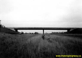

Left - Northern side of the 18th Avenue (Elgin Mills Road) Overpass on Hwy 404 in Richmond Hill in 1981. This two-lane structure was constructed under Contract
#1978-45. It stood until 2003, when it was demolished and replaced by a larger four-lane structure with a new interchange at Hwy 404. Photo taken on October 2, 1981. (Photo courtesy of Ontario Ministry of Transportation - © King's Printer for Ontario, 2014) Right - Facing south along Hwy 404 towards the Steeles Avenue Interchange in Toronto. See an Enlarged Photo Here. Photo taken on October 14, 1981. (Photo courtesy of Ontario Ministry of Transportation - © King's Printer for Ontario, 2014) 

Left - Facing south along Hwy 404 towards the Finch Avenue Interchange in Toronto, constructed under Contract #1975-137. See an
Enlarged Photo Here. Photo taken on October 14, 1981. (Photo courtesy of Ontario Ministry of Transportation - © King's Printer for Ontario, 2014) Right - Facing north along Hwy 404 towards the Finch Avenue Interchange in Toronto. See an Enlarged Photo Here. Photo taken on October 14, 1981. (Photo courtesy of Ontario Ministry of Transportation - © King's Printer for Ontario, 2014) 
Above - Facing east along Finch Avenue at the Hwy 404 Interchange in Toronto. See an
Enlarged Photo Here. Photo taken on October 14, 1981. (Photo courtesy of Ontario Ministry of Transportation - © King's Printer for Ontario, 2014) 

Left - Facing north along Hwy 404 at the Woodbine Avenue & Steeles Avenue Interchange in Toronto in 1981. This photo shows the unbelievably low traffic
volumes on Hwy 404 in the early 1980s, before the highway was extended north to Newmarket. At the time this photo was taken, Richmond Hill and Markham were
just small towns on the northern fringe of Toronto, with a total population of just over 90,000 residents. As of the 2021 Census, these two sprawling suburban cities
have a combined population of more than 540,000 residents. Traffic volumes on Hwy 404 have also increased dramatically as a result. During the highway's first full
year of operation between Steeles Avenue and Hwy 7, Hwy 404 carried about 13,000 vehicles on a typical day during 1979. By comparison, the highway carries about 200,000
vehicles per day today. See an Enlarged Photo Here. Photo taken on October 14, 1981. (Photo courtesy of Ontario Ministry of Transportation - © King's Printer for Ontario, 2010) Right - Facing north along Hwy 404 towards the Van Horne Avenue Overpass in Toronto in 1983. This great centreline view of Hwy 404 shows the depressed grass strip in the highway's median prior to the reconstruction and widening in the late 1990s. Hwy 404 was widened from six lanes to eight lanes as an interim widening measure under Contract #1998-66. HOV Lanes were added as part of a final widening of Hwy 404 during a multi-year reconstruction contract which began in 2001, under Contract #2001-0009. See an Enlarged Photo Here. Photo taken on June 22, 1983. (Photo courtesy of Ontario Ministry of Transportation - © King's Printer for Ontario, 2023) 
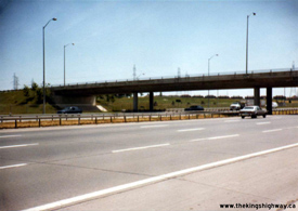
Left - Facing west across the Van Horne Avenue Overpass on Hwy 404 in Toronto, constructed under Contract #1975-137. See an
Enlarged Photo Here. Photo taken on June 22, 1983. (Photo courtesy of Ontario Ministry of Transportation - © King's Printer for Ontario, 2023) Right - Northern side of the McNicoll Avenue Overpass on Hwy 404 in Toronto. See an Enlarged Photo Here. Photo taken on June 22, 1983. (Photo courtesy of Ontario Ministry of Transportation - © King's Printer for Ontario, 2023) 
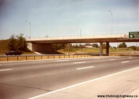
Left - Bridge-mounted overhead guide sign on the McNicoll Avenue Overpass indicating the upcoming Finch Avenue Interchange on southbound Hwy 404 in Toronto in
1983. This overhead guide sign shows the abbreviated message "2 Lanes" rather than the previous message "Keep Right 2 Lanes", which was used on many early
Toronto-area overhead freeway guide signs to indicate a multilane exit ramp. Eventually, even the message "2 Lanes" was dropped. During the early 1990s, signs for
multilane exit ramps were changed to show lane arrangements diagrammatically with upward-pointing arrows rather than using text to convey the message to motorists.
See an Enlarged Photo Here. Photo taken on June 22, 1983. (Photo courtesy of Ontario Ministry of Transportation - © King's Printer for Ontario, 2023) Right - Box-beam median barrier along Hwy 404 at McNicoll Avenue in Toronto. The earliest phase of Hwy 404 was built in the mid-1970s under Contract #1975-137, at a time where the use of this median barrier system reached its zenith in Ontario. The box-beam median barrier was removed and replaced with a concrete tall-wall barrier system during reconstruction and widening of various sections of Hwy 404 through Toronto between 1998 and 2000. See an Enlarged Photo Here. Photo taken on June 22, 1983. (Photo courtesy of Ontario Ministry of Transportation - © King's Printer for Ontario, 2014) 

Left - Facing east across the McNicoll Avenue Overpass on Hwy 404 in Toronto, constructed under Contract #1975-137. See an
Enlarged Photo Here. Photo taken on June 22, 1983. (Photo courtesy of Ontario Ministry of Transportation - © King's Printer for Ontario, 2014) Right - Bridge-mounted overhead guide sign on the McNicoll Avenue Overpass for the upcoming Steeles Avenue and Woodbine Avenue Interchange in Toronto. When the first 3-mile section of Hwy 404 was completed and opened to traffic from Sheppard Avenue northerly in 1977, all northbound traffic was forced off of the freeway via the Woodbine Avenue exit ramp. Hwy 404 temporarily ended at Woodbine Avenue until the highway was extended further north to Hwy 7 during 1978. See an Enlarged Photo Here. Photo taken on June 22, 1983. (Photo courtesy of Ontario Ministry of Transportation - © King's Printer for Ontario, 2014) 

Left - Eastern side of the Woodbine Avenue Flyover to southbound Hwy 404 in Toronto, constructed under Contract #1975-137. When the first 3-mile section of
Hwy 404 opened to traffic in the Fall of 1977, all southbound traffic entered the freeway via this ramp. The adjacent Steeles Avenue Interchange was built under a
subsequent construction contract. See an Enlarged Photo Here. Photo taken on June 22, 1983. (Photo courtesy of Ontario Ministry of Transportation - © King's Printer for Ontario, 2023) Right - Flyover from Woodbine Avenue to southbound Hwy 404, facing south. See an Enlarged Photo Here. Photo taken on June 22, 1983. (Photo courtesy of Ontario Ministry of Transportation - © King's Printer for Ontario, 2023) 
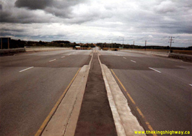
Left - Facing south along the southbound lanes of Hwy 404 at the 16th Avenue Underpass in Richmond Hill in 1983. Note that office towers are starting to appear
on the horizon near the Hwy 7 Interchange and that the highway is noticeably busier than in the earlier
1981 Photo seen above. Increased development in Richmond Hill and Markham prompted the
construction of a new interchange on Hwy 404 at 16th Avenue in the early 1990s. See an
Enlarged Photo Here.
Photo taken on September 21, 1983. (Photo courtesy of Ontario Ministry of Transportation - © King's Printer for Ontario, 2014) Right - Facing east across the Major Mackenzie Drive Overpass on Hwy 404. See an Enlarged Photo Here. Photo taken on September 21, 1983. (Photo courtesy of Ontario Ministry of Transportation - © King's Printer for Ontario, 2023) 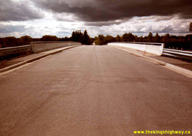
Above - Facing west across the 19th Avenue Overpass on Hwy 404. See an
Enlarged Photo Here. Photo taken on September 21, 1983. (Photo courtesy of Ontario Ministry of Transportation - © King's Printer for Ontario, 2023) 
Above - Facing south along Hwy 404 towards Toronto at the Stouffville Road Interchange. Hwy 404 temporarily ended at the Stouffville Road Interchange at
Gormley for about 2 years from late 1980 until the highway was completed northerly for 4 km to Bloomington Road in the Summer of 1982. Under Contract #1981-65,
grading was completed along the future route of Hwy 404 from Stouffville Road northerly to the Holland River, with granular base and final paving completed between
Stouffville Road and Bloomington Road. See an Enlarged Photo Here. Photo taken on September
21, 1983. (Photo courtesy of Ontario Ministry of Transportation - © King's Printer for Ontario, 2023) 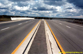
Above - Facing east across the Stouffville Road Overpass on Hwy 404, constructed under Contract #1979-74. See an
Enlarged Photo Here. Photo taken on September 21, 1983. (Photo courtesy of Ontario Ministry of Transportation - © King's Printer for Ontario, 2023) 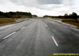

Left - Northern terminus of Hwy 404 at the Bloomington Road Interchange in 1983. This interesting photo shows traffic entering the start of the southbound
lanes of Hwy 404 from the loop ramp at Bloomington Road. Note the completed grading to the north for the future highway extension to Newmarket. The highway ended
here temporarily for three years between 1982 and 1985, before being extended north during a subsequent construction phase. However, grading work carried out under
Contract #1981-65 was completed to the Holland River north of Vandorf Sideroad. This was done to allow the placement and stockpiling of fill in preparation for the
construction of the new CNR Overhead on Hwy 404 at Vandorf. See an Enlarged Photo Here. Photo
taken on September 23, 1983. (Photo courtesy of Ontario Ministry of Transportation - © King's Printer for Ontario, 2014) Right - Future northbound lanes of Hwy 404 at the Bloomington Road Interchange in 1983. Due to construction staging, the northbound structure at Bloomington Road did not carry any traffic for three years following its construction in 1982. It wasn't until the completion of the next phase of Hwy 404 in 1985 that this structure was opened to traffic. Although it isn't particularly clear in this photo, all northbound traffic is forced to exit the highway at the Bloomington Road off-ramp in the background. See an Enlarged Photo Here. Photo taken on September 23, 1983. (Photo courtesy of Ontario Ministry of Transportation - © King's Printer for Ontario, 2014) 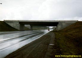

Left - Bloomington Road Interchange on Hwy 404, facing west. See an
Enlarged Photo Here. Photo taken on September 23, 1983. (Photo courtesy of Ontario Ministry of Transportation - © King's Printer for Ontario, 2014) Right - Facing east along Bloomington Road at the new Hwy 404 Interchange, constructed under Contract #1981-65. See an Enlarged Photo Here. Photo taken on September 23, 1983. (Photo courtesy of Ontario Ministry of Transportation - © King's Printer for Ontario, 2014) 
Above - Eastern side of the southbound Hwy 404 structure over Hwy 7 between Markham and Richmond Hill. See an
Enlarged Photo Here. Photo taken on May 22, 1985. (Photo courtesy of Ontario Ministry of Transportation - © King's Printer for Ontario, 2023) 
Above - Facing west across the Vandorf Sideroad Overpass on Hwy 404, completed under Contract #1982-74. See
an Enlarged Photo Here. Photo taken on July 31, 1985. (Photo courtesy of Ontario Ministry of Transportation - © King's Printer for Ontario, 2014) 
Above - Hwy 404 at Vandorf Sideroad, facing south towards Toronto in 1985. This photo shows the partially-completed highway with a base-course asphalt surface
constructed under Contract #1984-10, just a few months before this section of Hwy 404 was opened to traffic. See an
Enlarged Photo Here. Photo taken on July 31, 1985. (Photo courtesy of Ontario Ministry of Transportation - © King's Printer for Ontario, 2014) 
Above - Facing west across the Aurora Road Overpass on Hwy 404. See
an Enlarged Photo Here. Photo taken on July 31, 1985. (Photo courtesy of Ontario Ministry of Transportation - © King's Printer for Ontario, 2014) 
Above - Facing north along the future northbound lanes of Hwy 404 at Aurora Road, showing the end of the grading just north of the interchange. The Aurora Road
Overpass seen here was built as part of an advance contract, under Contract #1982-74. Grading and granular base for the Hwy 404 Extension from the Holland River to
north of Aurora Road and final paving from Bloomington Road to Aurora Road took place under Contract #1984-10. The highway was completed and opened to traffic from
Bloomington Road to Aurora Road in the Fall of 1985. See an Enlarged Photo Here. Photo taken
on July 31, 1985. (Photo courtesy of Ontario Ministry of Transportation - © King's Printer for Ontario, 2014) 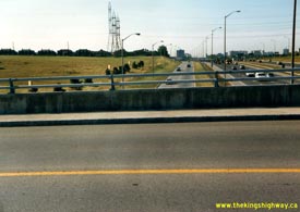

Left - View of Gordon Baker Road and Hwy 404 from the McNicoll Avenue Overpass in Toronto in 1985, facing south. Note that the prestige office towers which now
line Gordon Baker Road had not been built yet. See an Enlarged Photo Here. Photo taken in August 1985. (Photo courtesy of Ontario Ministry of Transportation - © King's Printer for Ontario, 2014) Right - McNicoll Avenue Overpass on Hwy 404 in Toronto, facing west. See an Enlarged Photo Here. Photo taken in August 1985. (Photo courtesy of Ontario Ministry of Transportation - © King's Printer for Ontario, 2014) 
Above - New hot mix paving on the future northbound lanes of Hwy 404 at the Bloomington Road Interchange in 1985, constructed under Contract #1984-10. The
highway extension north of Bloomington Road up to Aurora Road was opened to traffic a few months after this photo was taken. See an
Enlarged Photo Here. Photo taken on August 7, 1985. (Photo courtesy of Ontario Ministry of Transportation - © King's Printer for Ontario, 2014) 
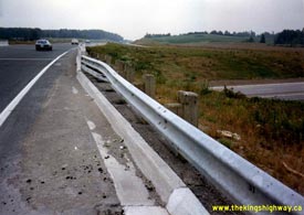
Left - Facing south along the southbound lanes of Hwy 404 from Bloomington Road. At the time this photo was taken in the Summer of 1985, this structure
actually marked the beginning of Hwy 404. The freeway wasn't completed north of the Bloomington Road Interchange until the Fall of 1985. See an
Enlarged Photo Here. Photo taken on August 7, 1985. (Photo courtesy of Ontario Ministry of Transportation - © King's Printer for Ontario, 2014) Right - View of the Bloomington Road Interchange on Hwy 404, facing south towards Toronto. See an Enlarged Photo Here. Photo taken on August 7, 1985. (Photo courtesy of Ontario Ministry of Transportation - © King's Printer for Ontario, 2014) 
Above - Slope paving of the 19th Avenue Overpass on Hwy 404, facing south. See an
Enlarged Photo Here. Photo taken on August 7, 1985. (Photo courtesy of Ontario Ministry of Transportation - © King's Printer for Ontario, 2023) 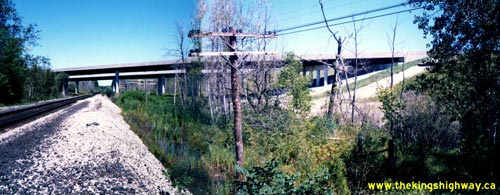
Above - Western side of the Vandorf CNR Overhead on Hwy 404, completed under Contract #1982-74. See an
Enlarged Photo Here. Photo taken on August 11, 1987. (Photo courtesy of Ontario Ministry of Transportation - © King's Printer for Ontario, 2014) 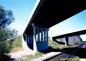

Left - View of the Vandorf CNR Overhead on Hwy 404 in 1987. This view is underneath the southbound structure, facing north. The northbound structure can be
seen in the background. Both structures were completed under an advance contract (Contract #1982-74), prior to the award of the final highway extension contract
between Bloomington Road and Aurora Road (Contract #1984-10). See an Enlarged Photo Here.
Photo taken on August 11, 1987. (Photo courtesy of Ontario Ministry of Transportation - © King's Printer for Ontario, 2014) Right - Facing north along Hwy 404 at the Vandorf CNR Overhead in 1987. The Vandorf Sideroad Overpass can be seen in the distance. See an Enlarged Photo Here. Photo taken on August 11, 1987. (Photo courtesy of Ontario Ministry of Transportation - © King's Printer for Ontario, 2014) 
Above - Completed St. John's Sideroad Overpass across the future Hwy 404 south of Newmarket facing south. See an
Enlarged Photo Here. Photo taken on December 1, 1987. (Photo courtesy of Ontario Ministry of Transportation - © King's Printer for Ontario, 2023) 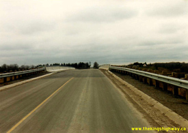

Left - St. John's Sideroad Overpass across the future Hwy 404 facing west, built under Contract #1985-56. See an
Enlarged Photo Here. Photo taken on December 1, 1987. (Photo courtesy of Ontario Ministry of Transportation - © King's Printer for Ontario, 2023) Right - Facing west across the Sutton Road (now Mulock Drive) Overpass across the future Hwy 404 in Newmarket. See an Enlarged Photo Here. Photo taken on December 1, 1987. (Photo courtesy of Ontario Ministry of Transportation - © King's Printer for Ontario, 2014) 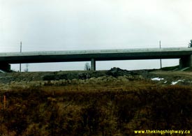

Left - Heavy grading on the future route of Hwy 404 near Sutton Road (now Mulock Drive) in Newmarket. The Sutton Road structure was completed in advance of the
construction of Hwy 404 under Contract #1985-56. Grading, granular base and paving of the Hwy 404 Extension from Aurora Road northerly to Davis Drive was completed
under Contract #1987-76. The 6 km extension of Hwy 404 from Aurora Road to Newmarket (Davis Drive) was completed and opened to traffic in the Fall of 1989. See an
Enlarged Photo Here. Photo taken on December 1, 1987. (Photo courtesy of Ontario Ministry of Transportation - © King's Printer for Ontario, 2014) Right - Facing west across the Davis Drive Overpass on Hwy 404 in Newmarket. See an Enlarged Photo Here. Photo taken on December 1, 1987. (Photo courtesy of Ontario Ministry of Transportation - © King's Printer for Ontario, 2014) 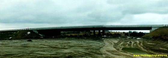
Above - Completed Davis Drive Overpass across the future Hwy 404 in Newmarket, constructed under Contract #1985-56. See an
Enlarged Photo Here. Photo taken on December 1, 1987. (Photo courtesy of Ontario Ministry of Transportation - © King's Printer for Ontario, 2014) 
Above - Aerial view of the Hwy 404 & Hwy 7 Interchange near Richmond Hill in 1988. See an
Enlarged Photo Here. (Photo courtesy of Ontario Ministry of Transportation - © King's Printer for Ontario, 1991) 
Above - View of Hwy 404 facing north towards Markham from the Sheppard Avenue Interchange in Toronto. See an
Enlarged Photo Here. Photo taken in October 1988. (Photo courtesy of Ontario Ministry of Transportation - © King's Printer for Ontario, 2023) 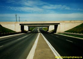
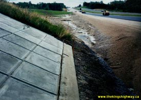
Left - Widened 16th Avenue and newly-completed interchange at Hwy 404 in Richmond Hill, facing west. See an
Enlarged Photo Here. Photo taken on August 22, 1989. (Photo courtesy of Ontario Ministry of Transportation - © King's Printer for Ontario, 2014) Right - Hot mix paving on Hwy 404, facing south from Sutton Road (Mulock Drive), built under Contract #1987-76. See an Enlarged Photo Here. Photo taken on September 9, 1989. (Photo courtesy of Ontario Ministry of Transportation - © King's Printer for Ontario, 2014) 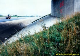
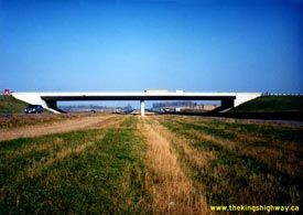
Left - Newly-laid asphalt surface on Hwy 404 at Sutton Road (Mulock Drive), facing north. See an
Enlarged Photo Here. Photo taken on September 9, 1989. (Photo courtesy of Ontario Ministry of Transportation - © King's Printer for Ontario, 2014) Right - Newly-completed Hwy 404 at the Aurora Road Interchange, facing north towards Newmarket. See an Enlarged Photo Here. Photo taken on October 25, 1989. (Photo courtesy of Ontario Ministry of Transportation - © King's Printer for Ontario, 2014) 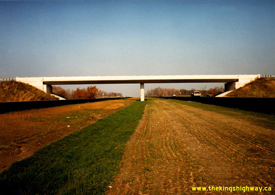

Left - Completed Hwy 404 at St. John's Sideroad in Newmarket, facing north. See an
Enlarged Photo Here. Photo taken on October 25, 1989. (Photo courtesy of Ontario Ministry of Transportation - © King's Printer for Ontario, 2023) Right - Northern terminus of Hwy 404 at Davis Drive in Newmarket in 1989. This great autumn photograph shows the completed highway extension to Newmarket, shortly after being opened to traffic. The opening of the final phase of Hwy 404 to Newmarket in 1989 concluded a multi-year construction program which had begun in 1975 to build Hwy 404 between Toronto and Newmarket. The freeway ended at the Davis Drive Interchange for 13 years until the highway was extended north by another 2 km to Green Lane, a project which was completed in early 2002. See an Enlarged Photo Here. Photo taken on October 25, 1989. (Photo courtesy of Ontario Ministry of Transportation - © King's Printer for Ontario, 2014)
Continue on to King's Highway 404 Historical Photos: 1990-1999
|
|---|
Links to Adjacent King's Highway Photograph Pages:
Back to Hwy 404 Historical Photos (1975-1979)
Hwy 404 Photo Index
On to Hwy 404 Historical Photos (1990-1999)
Back to King's Highway 403 Photos /
King's Highway 404 History /
On to King's Highway 405 Photos
Ontario Highway History - Main Menu / Back to List of Highways Website contents, photos & text © 2002-2025, Cameron
Bevers (Webmaster) - All Rights Reserved / Contact Me
|
|---|