
| 
| |
|
|
This page contains historical photos of Ontario's King's Highway 406 dating from 1962 to 1979. All photographs displayed on
this page were taken by the Ontario Ministry of Transportation, unless specifically noted otherwise. Historical photographs are arranged in approximate chronological
order. Click on any thumbnail to see a larger image!
Please note that all photographs displayed on this
website are protected by copyright. These photographs must not be reproduced, published,
electronically stored or copied, distributed, or posted onto other websites without
my written permission. If you want to use photos from this website, please
email me first for permission. Thank-you!
|
|---|
|
Page 1: Historical King's Highway 406 Photographs (1962-1979)

Above - Original 1962 route plan for Hwy 406 between St. Catharines and Welland. The northern section of the route through St. Catharines was constructed more
or less as proposed, although the connection to the Queen Elizabeth Way was built further to the west. Major changes were made to the highway's route at the Welland
end, where Hwy 406 ended up being built a considerable distance to the east. Originally, the proposed southern terminus of Hwy 406 was at the intersection of the
Welland Bypass (Prince Charles Drive) and Thorold Road (Hwy 58). It is believed that this plan was unveiled at the official announcement for Hwy 406 by Premier John
Robarts and Highways Minister C.S. MacNaughton on November 12, 1962. See an
Enlarged Photo Here. (Photo courtesy of Ontario Ministry of Transportation - © King's Printer for Ontario, 1962) 
Above - Completed Westchester Avenue Overpass across the future route of Hwy 406 in St. Catharines. See an
Enlarged Photo Here.
Photo taken in 1963. (Photo courtesy of Ontario Ministry of Transportation - © King's Printer for Ontario, 1963) 
Above - Plan showing the construction status of Hwy 406 through St. Catharines in February, 1964. See
an Enlarged Photo Here. (Photo courtesy of Ontario Ministry of Transportation - © King's Printer for Ontario, 1964) 
Above - Plan showing the newly-completed route of Hwy 406 from Geneva Street in St. Catharines to Townline Road (St. David's Road) in Thorold in 1965. This new
section of Hwy 406 was just over 3 miles in length and was officially opened to traffic on December 7, 1965. See an
Enlarged Photo Here. (Photo courtesy of Ontario Ministry of Transportation - © King's Printer for Ontario, 1965) 

Left - Facing west along Glendale Avenue at the Hwy 406 Interchange in 1967. At the time this photo was taken, Hwy 406 had only been open to traffic for about
18 months. Note that neither of the two Hwy 406 ramp terminals were signalized yet - both were still under stop-control. See an
Enlarged Photo Here. Photo taken in May, 1967. (Photo courtesy of Ontario Ministry of Transportation - © King's Printer for Ontario, 2020) Right - Facing north along the southbound lanes of Hwy 406 at the Glendale Avenue Interchange in St. Catharines. See an Enlarged Photo Here. Photo taken in May, 1967. (Photo courtesy of Ontario Ministry of Transportation - © King's Printer for Ontario, 2020) 

Left - Facing east along Glendale Avenue at the Hwy 406 Interchange in St. Catharines in 1968. Note the newly-installed traffic signals at the Hwy 406 ramp
terminals, due to the anticipated extension of Hwy 406 to Welland and the upcoming opening of the Thorold Tunnel Approach (Hwy 58 New). See an
Enlarged Photo Here. Photo taken in May, 1968. (Photo courtesy of Ontario Ministry of Transportation - © King's Printer for Ontario, 2020) Right - View of Hwy 406 at the Glendale Avenue Interchange in St. Catharines, facing north. See an Enlarged Photo Here. Photo taken in May, 1968. (Photo courtesy of Ontario Ministry of Transportation - © King's Printer for Ontario, 2020) 
Above - Twin underpass structures on Hwy 406 at the Glendale Avenue Interchange in St. Catharines. See
an Enlarged Photo Here. Photo taken in May, 1968. (Photo courtesy of Ontario Ministry of Transportation - © King's Printer for Ontario, 2020) 

Left - Formwork for new concrete pavement at the Hwy 406 and St. David's Road Interchange in Thorold, Contract #1968-03 (1969) (Photo courtesy of Ontario Ministry of Transportation - © King's Printer for Ontario, 1969) Right - Grading underway on an extension of Hwy 406 south of Beaverdams Road in Thorold, Contract #1969-137 (1970) (Photo courtesy of Ontario Ministry of Transportation - © King's Printer for Ontario, 1970) 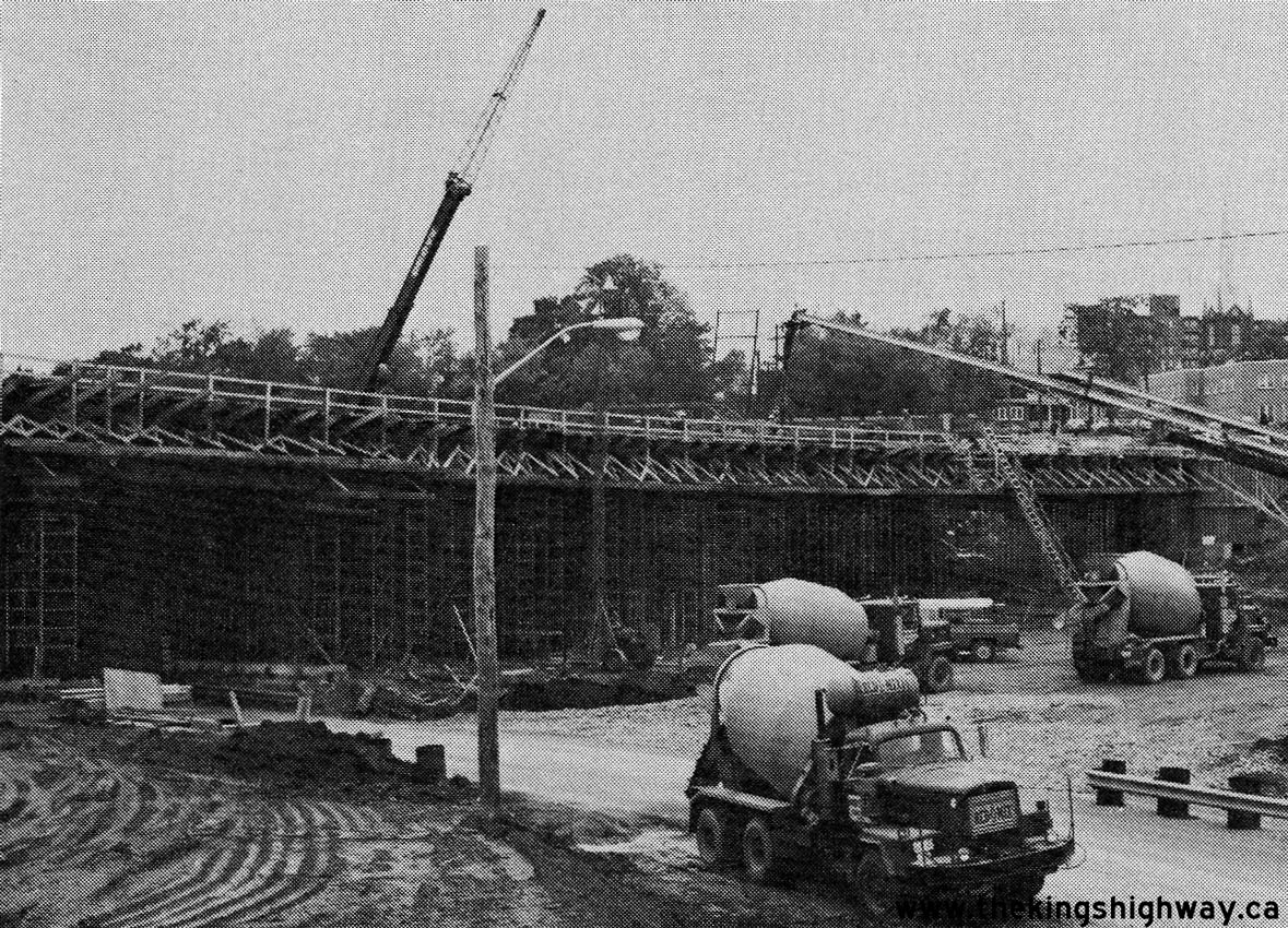
Above - New Geneva Street Overpass under construction on Hwy 406 in St. Catharines (1978) (Photo courtesy of Ontario Ministry of Transportation - © King's Printer for Ontario, 1978)
Continue on to King's Highway 406 Historical Photos: 1980 to 1999
|
|---|
Links to Adjacent King's Highway Photograph Pages:
Back to King's Highway 405 Photos /
King's Highway 406 History /
On to Highway 407 (ETR) Photos
Ontario Highway History - Main Menu / Back to List of Highways Website contents, photos & text © 2002-2026, Cameron
Bevers (Webmaster) - All Rights Reserved / Contact Me
|
|---|