| 
| |
|
|
This page contains historical and present day photos of Ontario's Highway 407 Express Toll Route (ETR). All photographs
displayed on this page were taken by the Webmaster (Cameron Bevers), unless specifically noted otherwise. Historical photographs are arranged in approximate
chronological order, while present day photographs (Year 2000 to date) are arranged by location from west to east. Click on any thumbnail to see a larger image!
Please note that all photographs displayed on this
website are protected by copyright. These photographs must not be reproduced, published,
electronically stored or copied, distributed, or posted onto other websites without
my written permission. If you want to use photos from this website, please
email me first for permission. Thank-you!
|
|---|
|
Historical Highway 407 (ETR) Photographs


Left - Nearly completed southbound lanes of Hwy 427 near the Claireville CN Railway Overhead in Toronto, facing north towards the Hwy 407 ETR Interchange.
Apart from the occasional construction vehicle, the southbound lanes were not open to traffic. Top-course asphalt was still being laid on the
southbound lanes between Hwy 7 and the new Hwy 407 Interchange at the time this photo was taken. Due to construction staging, the northbound lanes of Hwy 427 opened
to traffic earlier than the southbound lanes. See an Enlarged Photo Here. Photo taken on
August 27, 1991. (Photo courtesy of Ontario Ministry of Transportation - © King's Printer for Ontario, 2014) Right - Unopened southbound lanes of Hwy 427 at the Steeles Avenue Underpass in Toronto in 1991, facing north towards the Hwy 407 Interchange. The completed Hwy 407 West to Hwy 427 South Flyover can be seen in the background. Noticeably absent is the opposing Hwy 427 North to Hwy 407 West Flyover, which had not yet been built at the time this photo was taken. The flyover from Hwy 427 North to Hwy 407 West wasn't built until 1994. The Hwy 407 & Hwy 427 Interchange sat completed but unopened for several years. The interchange was finally put into service when Hwy 407 ETR was opened to traffic in June, 1997. See an Enlarged Photo Here. Photo taken on August 27, 1991. (Photo courtesy of Ontario Ministry of Transportation - © King's Printer for Ontario, 2014) 

Left - Completed northbound lanes of Hwy 427 at the Steeles Avenue Underpass in Toronto, shortly after being opened to traffic in 1991. Due to the
construction staging at the adjacent Hwy 427 and Hwy 407 Interchange, the northbound lanes of Hwy 427 opened to traffic before the southbound lanes were completed.
See an Enlarged Photo Here. Photo taken on August 27, 1991. (Photo courtesy of Ontario Ministry of Transportation - © King's Printer for Ontario, 2014) Right - Unopened southbound lanes of Hwy 427 at the Hwy 50 (Albion Road) Underpass in Toronto in 1991, facing north towards the Hwy 407 Interchange. The graded but unpaved ramp leading from the completed Hwy 407 West to Hwy 427 South Flyover can be seen at left. See an Enlarged Photo Here. Photo taken on August 27, 1991. (Photo courtesy of Ontario Ministry of Transportation - © King's Printer for Ontario, 2014) 

Left - Facing north along Hwy 427 at the newly-opened Hwy 407 ETR Interchange in Toronto. Hwy 407 ETR had only opened to traffic about one week before
this photo was taken. See an Enlarged Photo Here. Photo taken on June 16, 1997. (Photo courtesy of Ontario Ministry of Transportation - © King's Printer for Ontario, 2014) Right - Northbound lanes of Hwy 427 at the Claireville CN Railway Overhead in Toronto, facing north towards the Hwy 407 ETR Interchange. See an Enlarged Photo Here. Photo taken on June 16, 1997. (Photo courtesy of Ontario Ministry of Transportation - © King's Printer for Ontario, 2014) 

Left - Western side of the Hwy 427 North to Hwy 407 ETR East Ramp over Steeles Avenue in Toronto. See an
Enlarged Photo Here. Photo taken on October 8, 1997. (Photo courtesy of Ontario Ministry of Transportation - © King's Printer for Ontario, 2014) Right - Hwy 427 North to Hwy 407 ETR East Ramp, facing north across Steeles Avenue in Toronto. See an Enlarged Photo Here. Photo taken on October 8, 1997. (Photo courtesy of Ontario Ministry of Transportation - © King's Printer for Ontario, 2014) 

Left - Hwy 407 ETR West Ramp to Hwy 427 South, facing north across Steeles Avenue in Toronto. See an
Enlarged Photo Here. Photo taken on October 8, 1997. (Photo courtesy of Ontario Ministry of Transportation - © King's Printer for Ontario, 2014) Right - Eastern side of the Hwy 407 ETR West Ramp to Hwy 427 South over Steeles Avenue in Toronto. See an Enlarged Photo Here. Photo taken on October 8, 1997. (Photo courtesy of Ontario Ministry of Transportation - © King's Printer for Ontario, 2014) 

Left - Western side of the Hwy 427 North to Hwy 407 ETR East Ramp over Steeles Avenue in Toronto. See an
Enlarged Photo Here. Photo taken on October 8, 1997. (Photo courtesy of Ontario Ministry of Transportation - © King's Printer for Ontario, 2014) Right - Facing north along the Hwy 427 North to Hwy 407 ETR East Ramp in Toronto. See an Enlarged Photo Here. Photo taken on October 8, 1997. (Photo courtesy of Ontario Ministry of Transportation - © King's Printer for Ontario, 2014) 
Above - Eastern side of the Hwy 427 North to Hwy 407 ETR East Ramp over Steeles Avenue in Toronto. See an
Enlarged Photo Here. Photo taken on October 15, 1997. (Photo courtesy of Ontario Ministry of Transportation - © King's Printer for Ontario, 2014) 
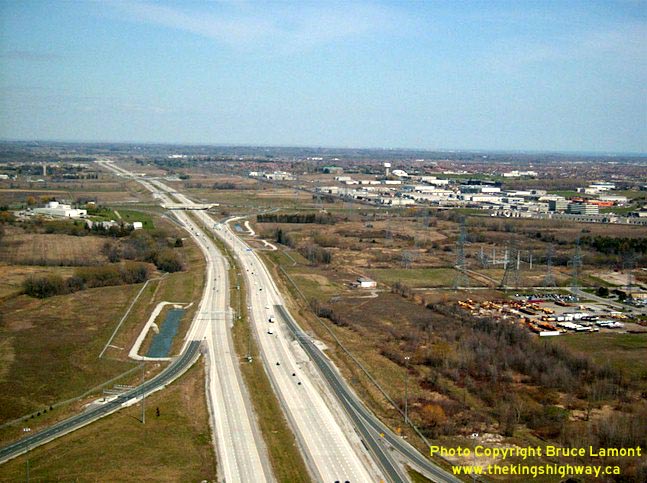
Left - Aerial view of the Freeman Interchange (Hwy 403 & Queen Elizabeth Way) in Burlington, looking west in 1999. Note the new Hwy 407 ETR
under construction at right and the Brant Street Interchange in the foreground. (Photo courtesy of Bruce Lamont - © 1999) Right - Aerial view of Hwy 407 ETR, looking east from Warden Avenue in 1999. (Photo courtesy of Bruce Lamont - © 1999) |
|---|
|
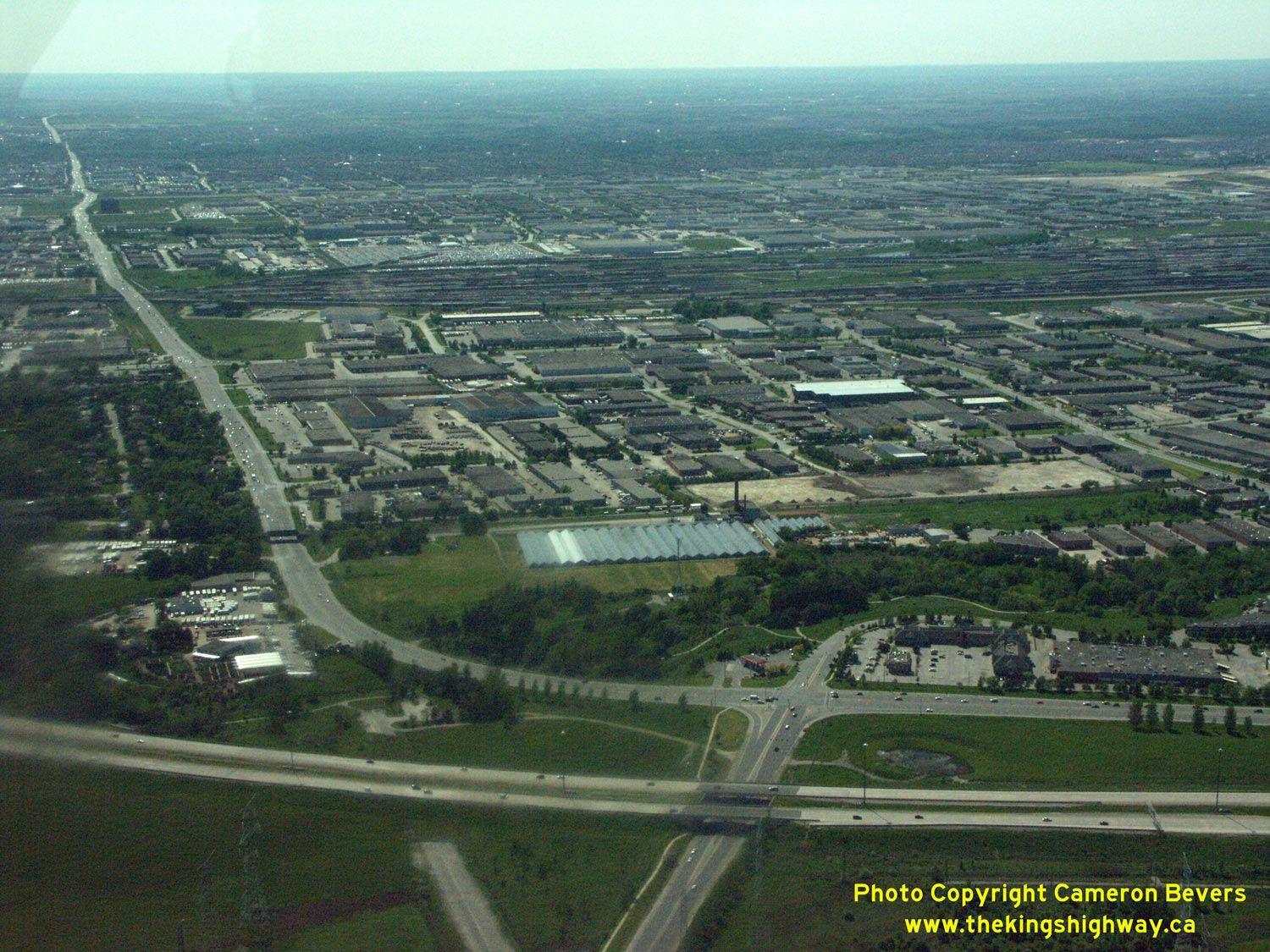
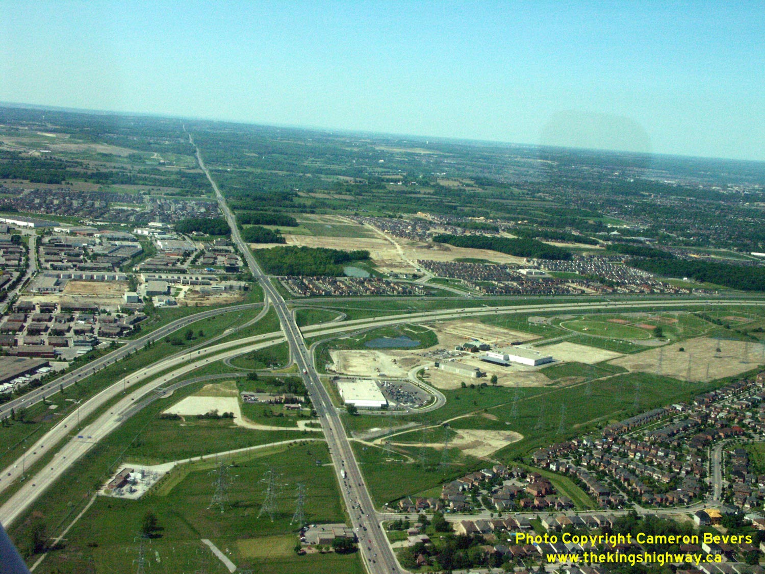
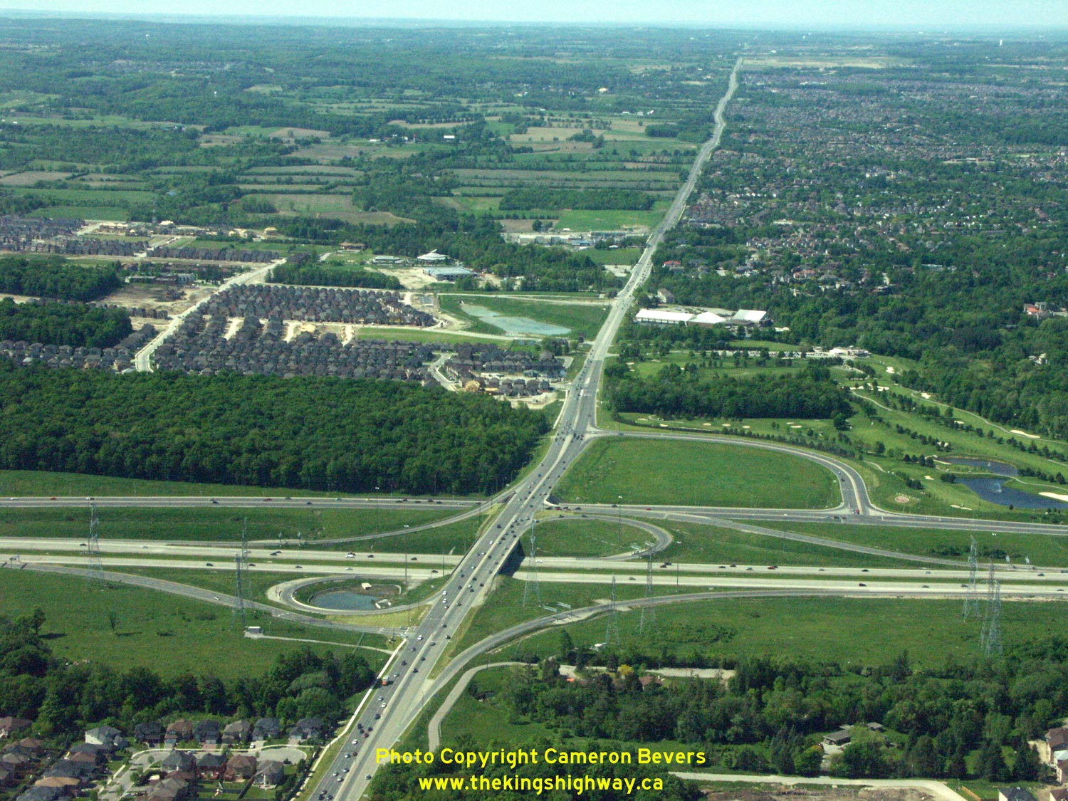
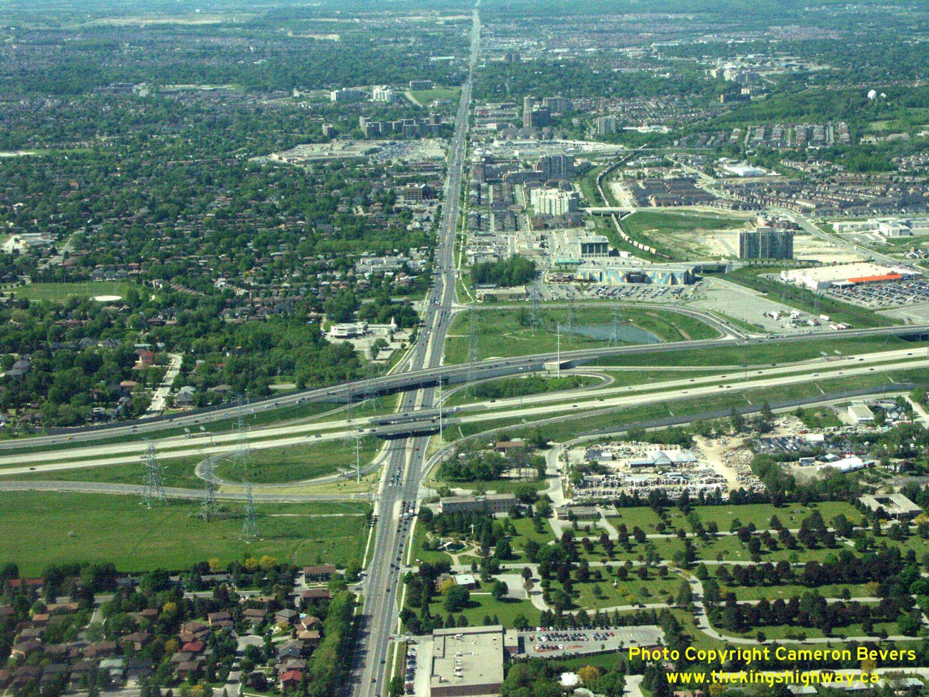
Present Day Highway 407 (ETR) Photographs

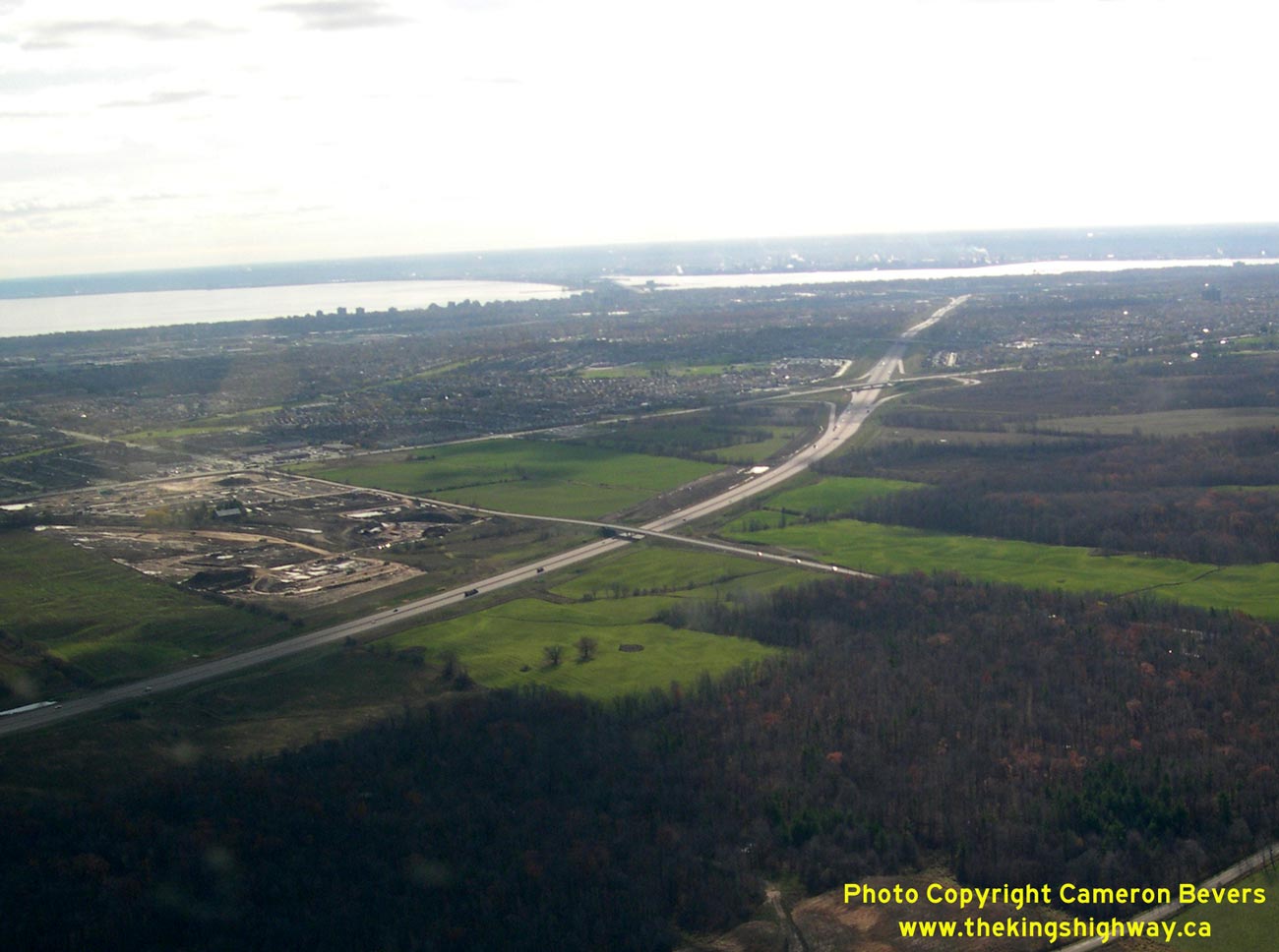
Above - Aerial view of Hwy 407 and Hwy 5 Interchange in Burlington, facing west. See an
Enlarged Photo Here. (Photograph taken on November 3, 2006 - © Cameron Bevers) 

Left - Aerial view of Hwy 407 and Hwy 5 Interchange in Burlington, facing northwest. See an
Enlarged Photo Here. (Photograph taken on November 3, 2006 - © Cameron Bevers) Right - Aerial view of Hwy 407 and Hwy 5 Interchange in Burlington, facing south. See an Enlarged Photo Here. (Photograph taken on November 3, 2006 - © Cameron Bevers) 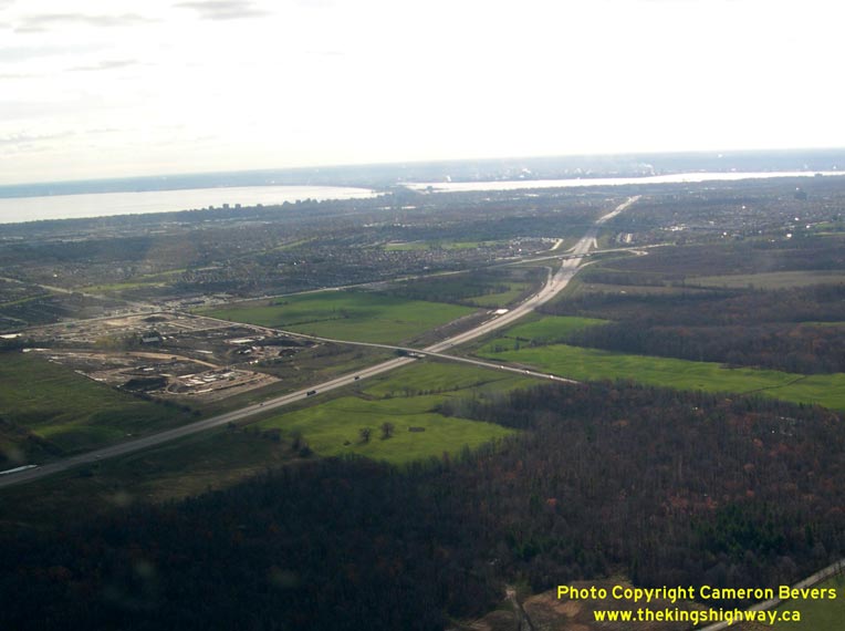
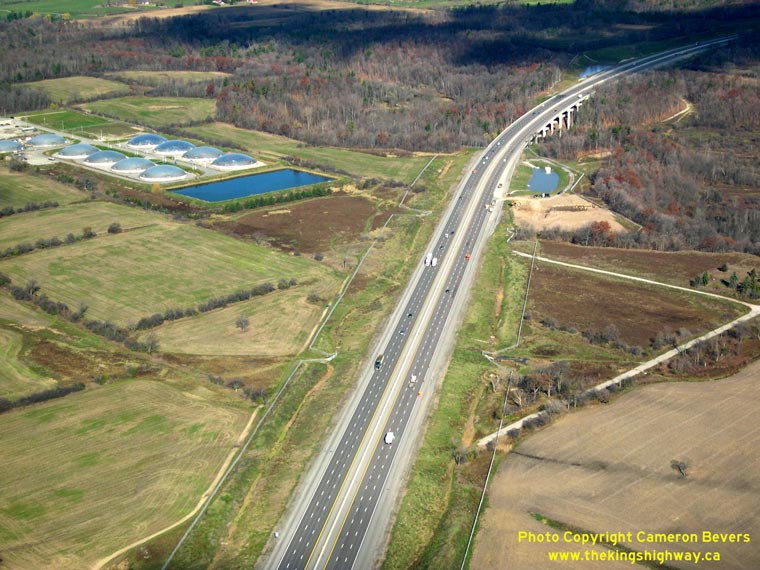
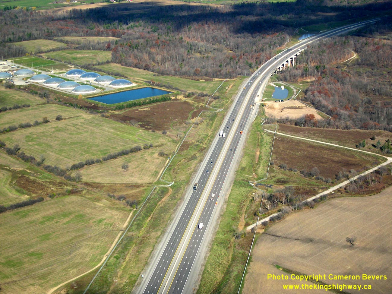
Left - Aerial view of Hwy 407 approaching Hwy 5 Interchange in Burlington. See an
Enlarged Photo Here. (Photograph taken on November 14, 2005 - © Cameron Bevers) Right - Aerial view of Hwy 407 approaching Sixteen Mile Creek Bridge in Oakville. See an Enlarged Photo Here. (Photograph taken on November 14, 2005 - © Cameron Bevers) 
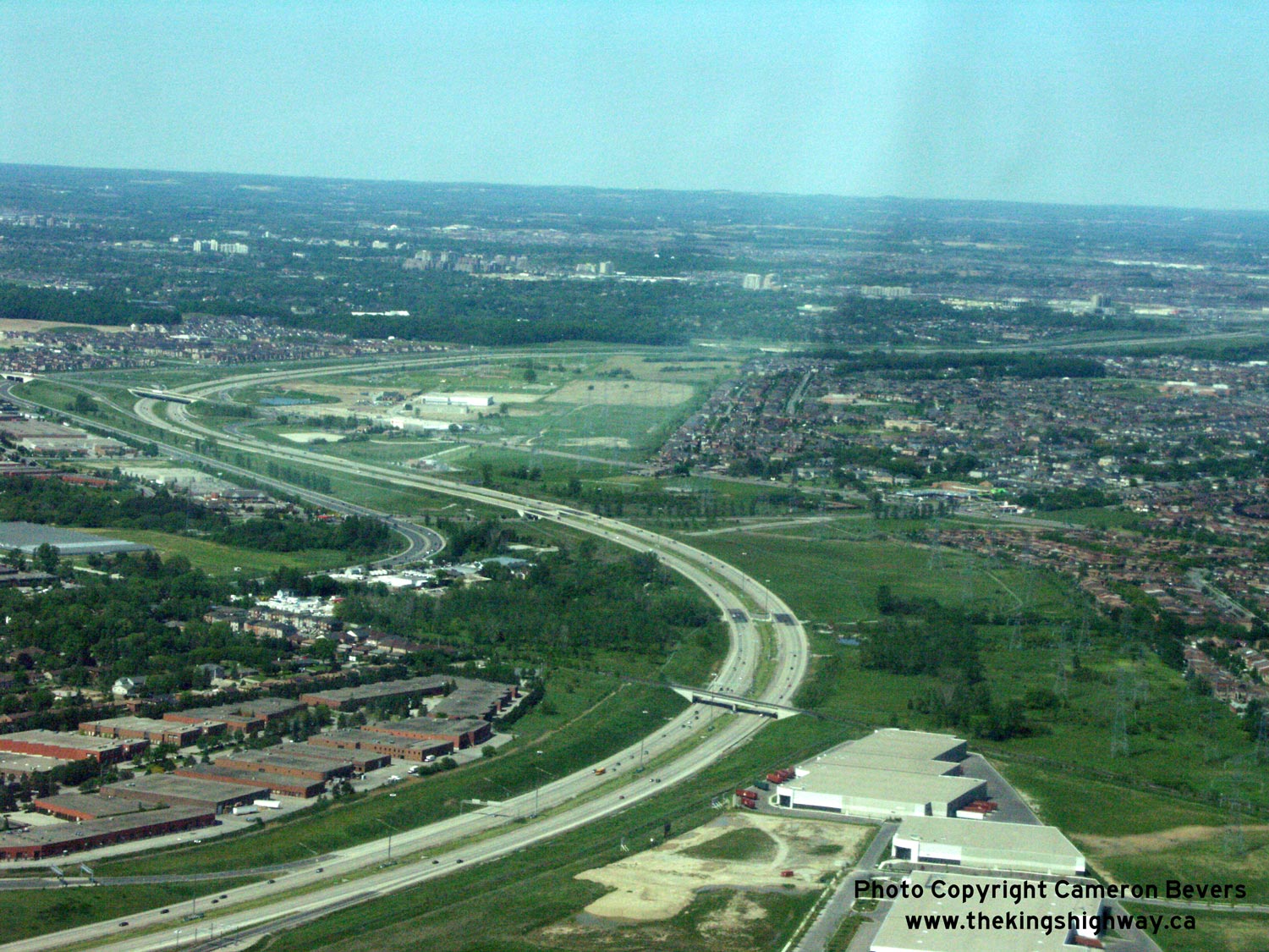
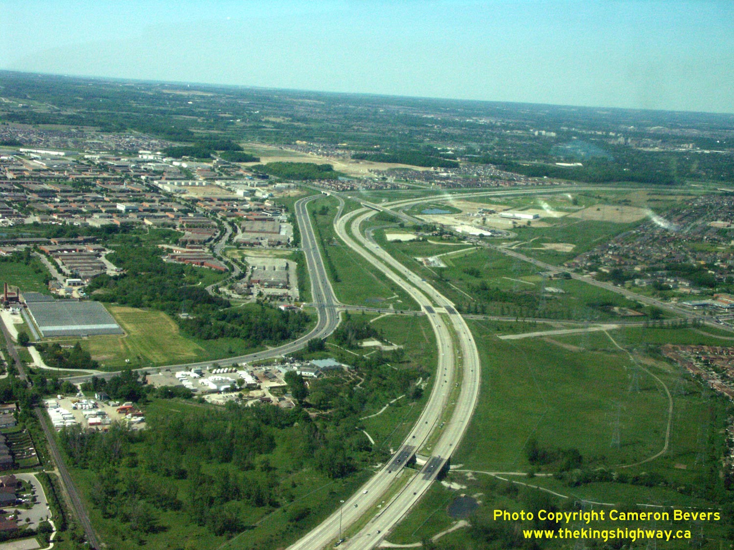
Above - Aerial view of the Hwy 400 & Hwy 407 ETR Interchange in Vaughan, facing north along Hwy 400. This impressive four-level fully
directional freeway interchange took several years to complete due to the complex construction staging that was required. See an
Enlarged Photo Here. (Photograph taken on May 30, 2004 - © Cameron Bevers) 
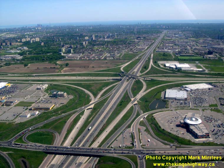
Left - Aerial view of Hwy 407 ETR, facing east towards the Hwy 400 Interchange from Weston Road in Vaughan. See an
Enlarged Photo Here. (Photograph taken on May 30, 2004 - © Mark Mirrlees) Right - Aerial view of Hwy 400, facing south from the Hwy 7 Interchange towards the Hwy 407 ETR Interchange in Vaughan. See an Enlarged Photo Here. (Photograph taken on May 30, 2004 - © Mark Mirrlees) 

Left - Aerial view of the Hwy 400 & Hwy 407 ETR Interchange in Vaughan, facing northeast. (Photograph taken on May 30, 2004 - © Mark Mirrlees) Right - Aerial view of Hwy 407 ETR, facing west towards the Hwy 400 Interchange from Jane Street in Vaughan. See an Enlarged Photo Here. (Photograph taken on May 30, 2004 - © Cameron Bevers) 
Above - Aerial view of the Hwy 400 & Hwy 407 Interchange in Vaughan, facing northwest. (Photograph taken on May 25, 2002 - © Lance Dutchak) 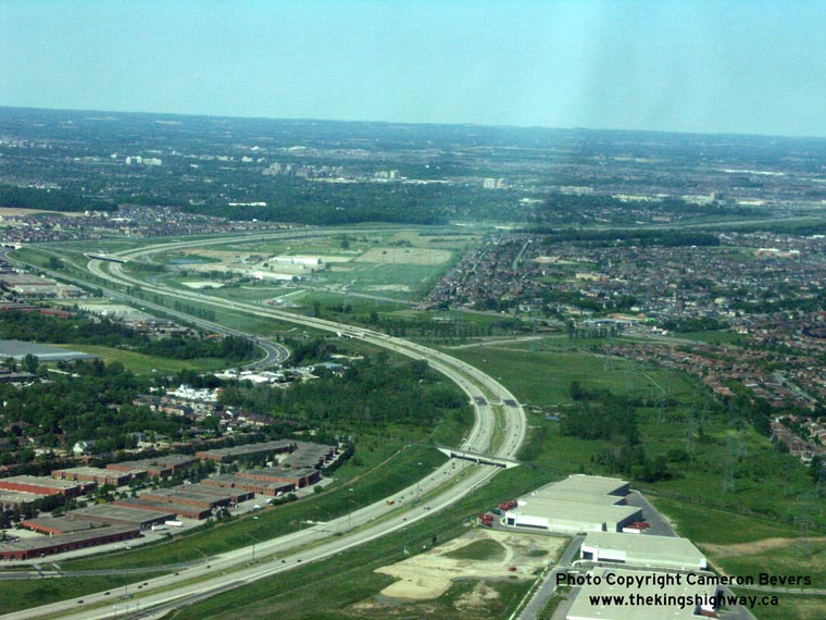
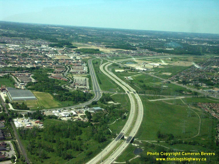
Left - Aerial view of Hwy 407 facing east from Keele Street Interchange. See an
Enlarged Photo Here. (Photograph taken on May 30, 2004 - © Cameron Bevers) Right - Aerial view of Hwy 407 (right) & Hwy 7 (left) at Concord, facing northeast. See an Enlarged Photo Here. (Photograph taken on May 30, 2004 - © Cameron Bevers) 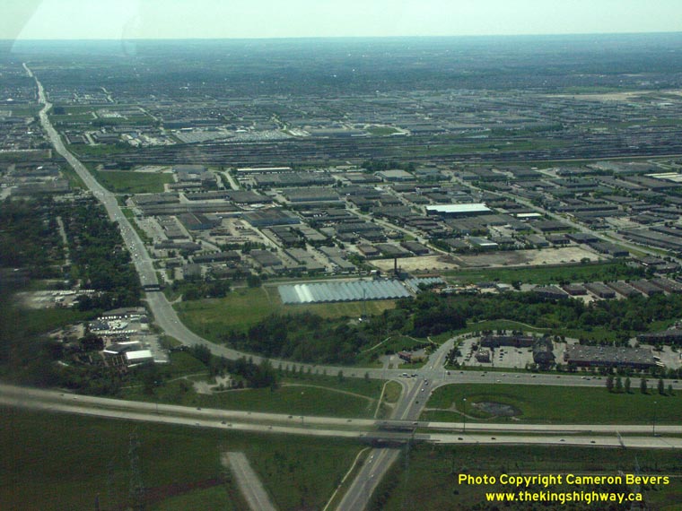
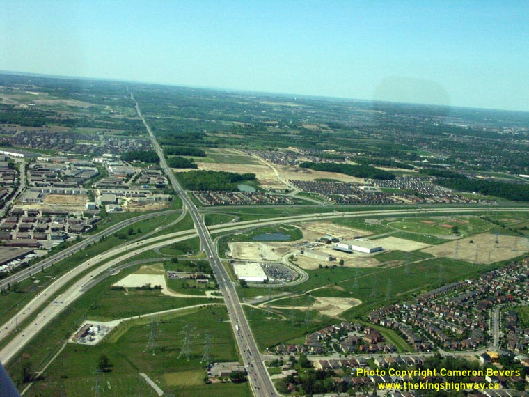
Left - Aerial view of Hwy 407 at Centre Street facing west. Note the abandoned Hwy 7 alignment off of Centre Street in foreground, which was severed during
construction of Hwy 407 in the 1990s. See an Enlarged Photo Here. (Photograph taken on May 30, 2004 - © Cameron Bevers) Right - Aerial view of Hwy 407 Interchange at Dufferin Street, facing north. See an Enlarged Photo Here. (Photograph taken on May 30, 2004 - © Cameron Bevers) 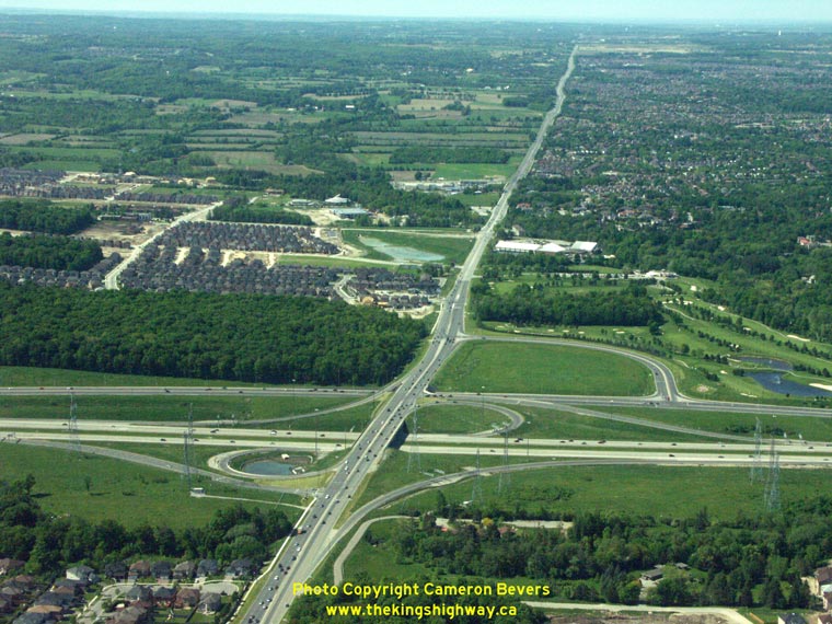
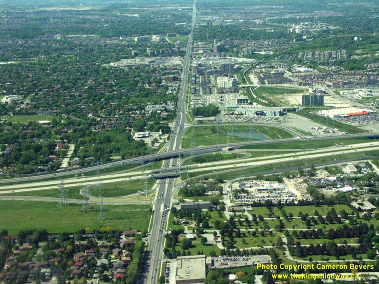
Left - Aerial view of Hwy 407 Interchange at Bathurst Street, facing north. See an
Enlarged Photo Here. (Photograph taken on May 30, 2004 - © Cameron Bevers) Right - Aerial view of the Hwy 407 and Hwy 7 Interchanges at Yonge Street (Hwy 11) in Richmond Hill, facing north. See an Enlarged Photo Here. (Photograph taken on May 30, 2004 - © Cameron Bevers) 
Above - Close-up of the Hwy 407 and Hwy 7 Interchanges at Yonge Street (Hwy 11) in Richmond Hill, facing north. See an
Enlarged Photo Here. (Photograph taken on May 30, 2004 - © Mark Mirrlees) 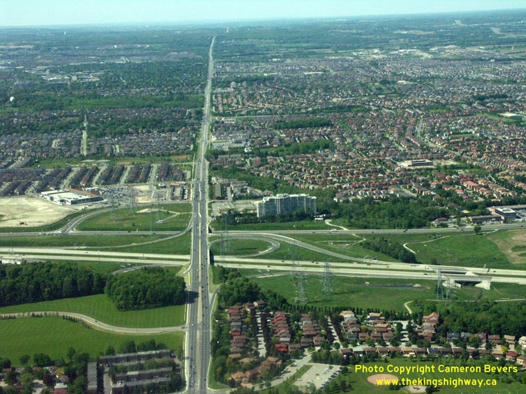

Left - Aerial view of Hwy 407 Interchange at Bayview Avenue, facing north. See an
Enlarged Photo Here. (Photograph taken on May 30, 2004 - © Cameron Bevers) Right - Aerial view of the Hwy 404 & Hwy 407 Interchange, facing west along Hwy 407 towards Richmond Hill. See an Enlarged Photo Here. (Photograph taken on May 30, 2004 - © Mark Mirrlees) 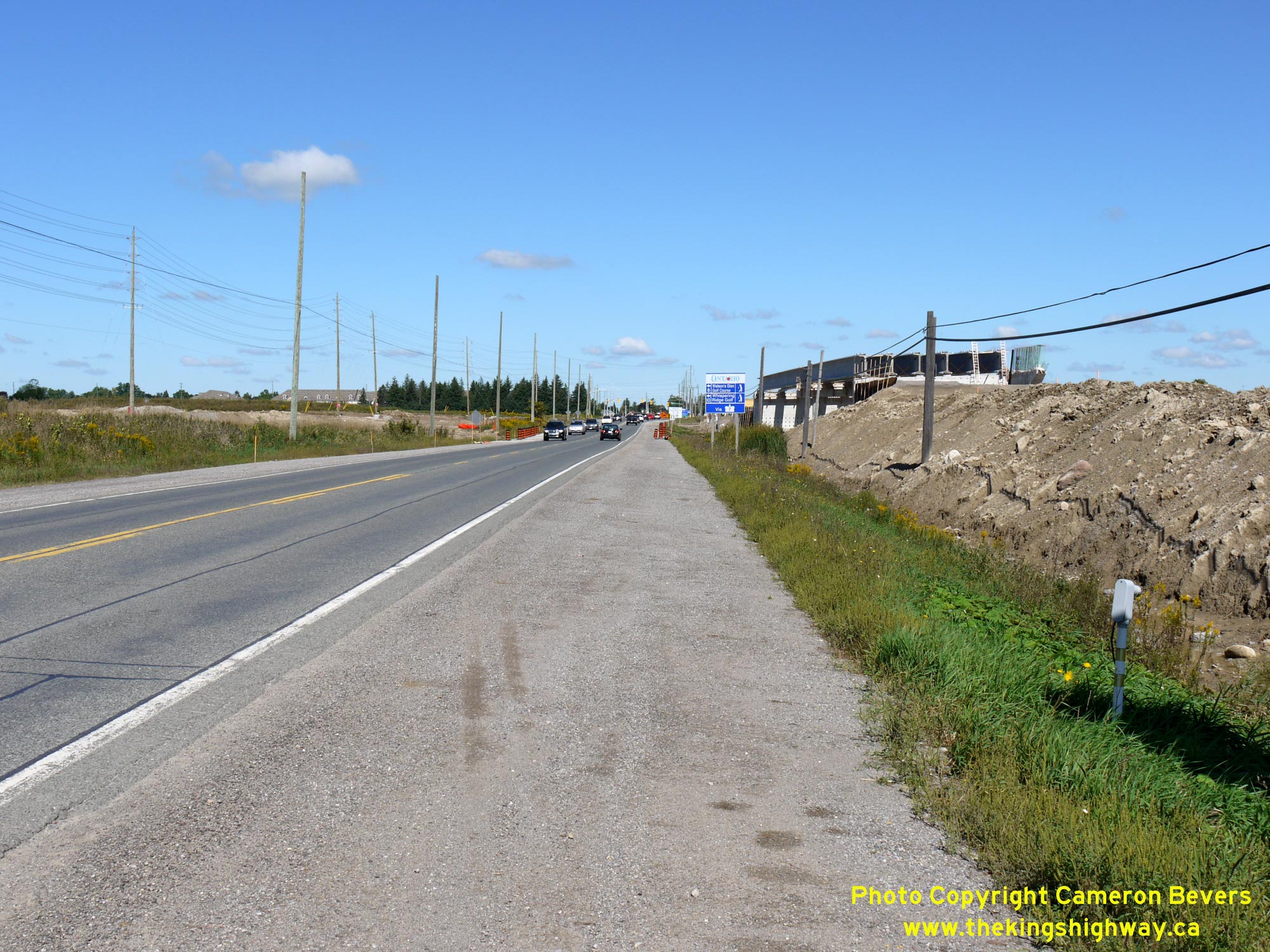
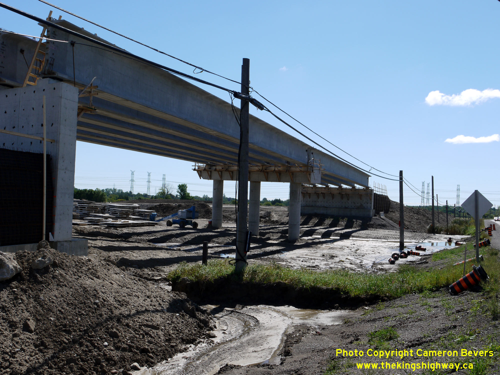
Left - Facing north along Hwy 12 towards Brooklin during the construction of Hwy 407 in 2014, showing the new overpass under construction at right. In order to
stage traffic during the interchange's construction, the eastern half of the Hwy 12 Overpass was built first, just off the existing highway's centreline. That way,
all Hwy 12 traffic could continue to use the existing highway for a good portion of the construction project. Upon completion of the eastern half of the structure,
Hwy 12 traffic was shifted onto the new bridge. The existing highway was then removed to allow the construction of the western half of the bridge. See an
Enlarged Photo Here. (Photograph taken on September 7, 2014 - © Cameron Bevers) Right - Western side of the new Hwy 12 Overpass on Hwy 407 near Brooklin in 2014. See an Enlarged Photo Here. (Photograph taken on September 7, 2014 - © Cameron Bevers) 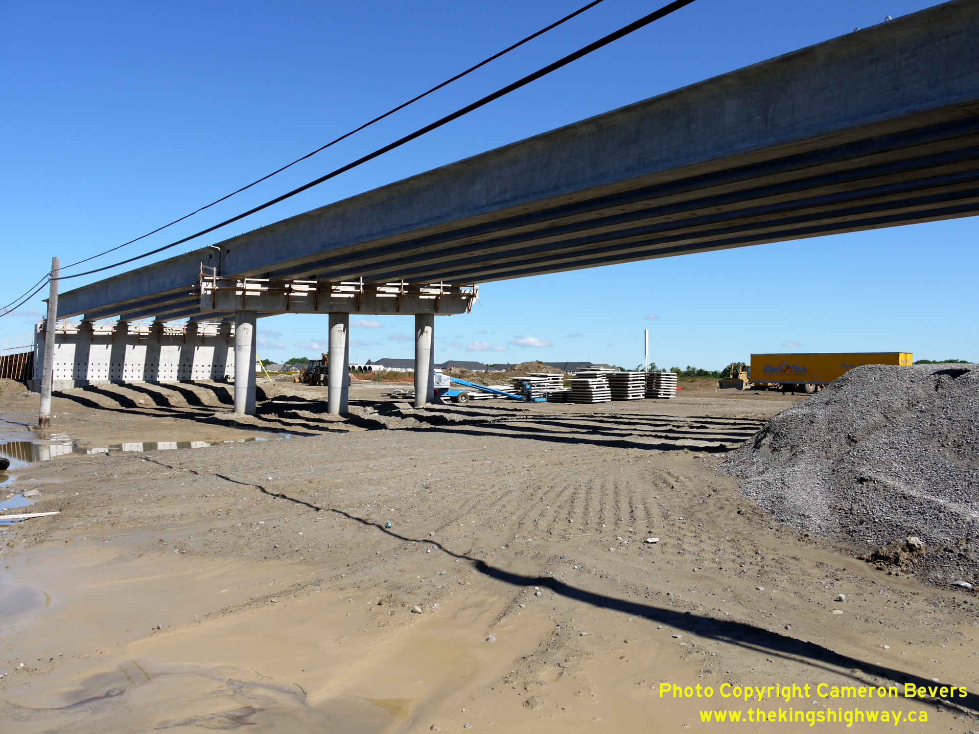

Left - New Hwy 12 Overpass under construction on Hwy 407 south of Brooklin in 2014. See an
Enlarged Photo Here. (Photograph taken on September 7, 2014 - © Cameron Bevers) Right - Grading equipment positioned at the Hwy 12 Interchange, during construction of Hwy 407 in 2014. The dual bridges over Lynde Creek can be seen under construction on Hwy 407 in the distance, along with the proposed overpass for Anderson Street which lies just beyond Lynde Creek. See an Enlarged Photo Here. (Photograph taken on September 7, 2014 - © Cameron Bevers) 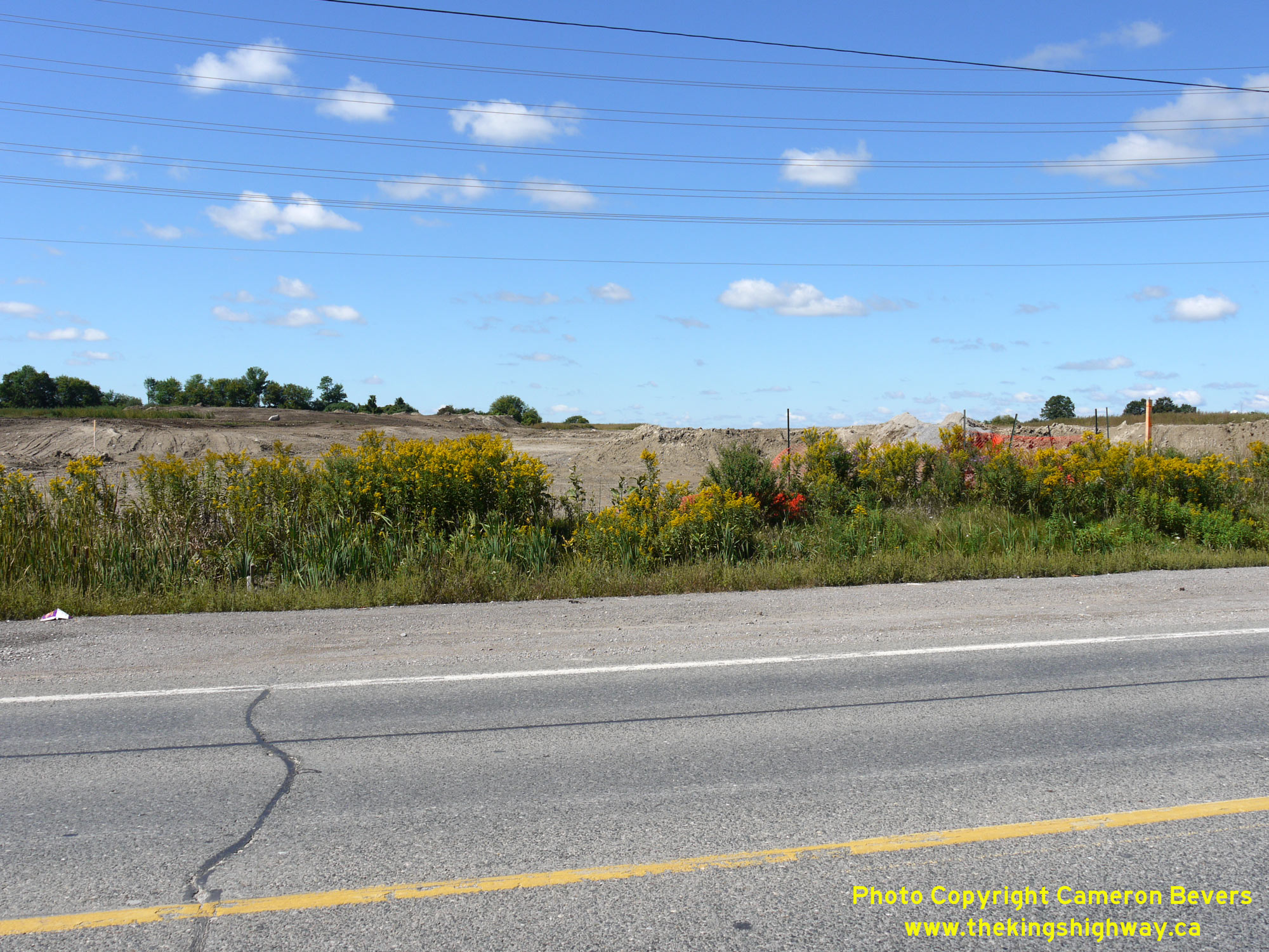
Left - Facing west towards Markham along the proposed route of Hwy 407 at the Hwy 12 Interchange near Brooklin in 2014. See an
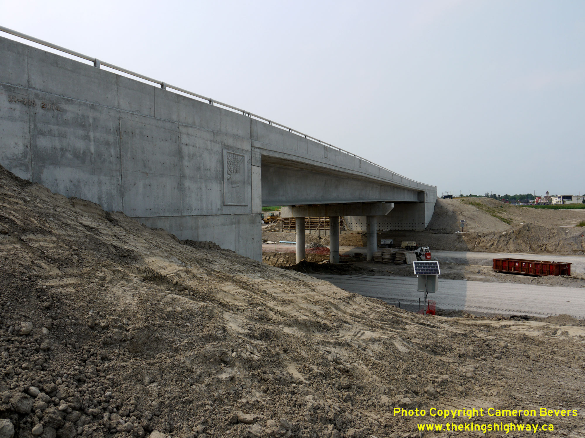
Enlarged Photo Here. (Photograph taken on September 7, 2014 - © Cameron Bevers) Right - View of the partially-completed Hwy 12 Overpass on Hwy 407 near Brooklin, facing north. At the time this photo was taken in 2015, traffic was using the eastern half of the new overpass. The western half of the structure was still being built. Upon completion of the western half of the bridge, all southbound Hwy 12 traffic was shifted onto the western structure, while the eastern structure was converted to carry northbound Hwy 12 traffic only. See an Enlarged Photo Here. (Photograph taken on July 7, 2015 - © Cameron Bevers) 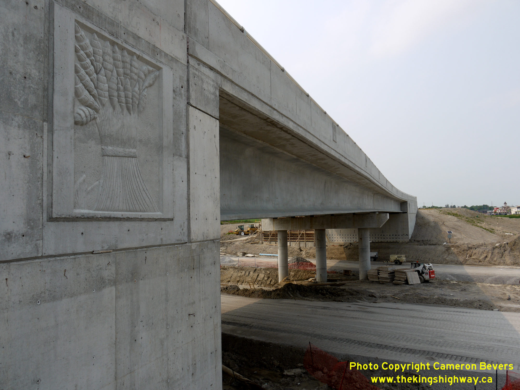
Left - Close-up of the decorative emblem on the Hwy 12 Overpass on Hwy 407. Several provincial highway bridges built in recent decades have decorative emblems
on them, often highlighting environmental or wildlife themes - or in this case, agricultural produce. See an
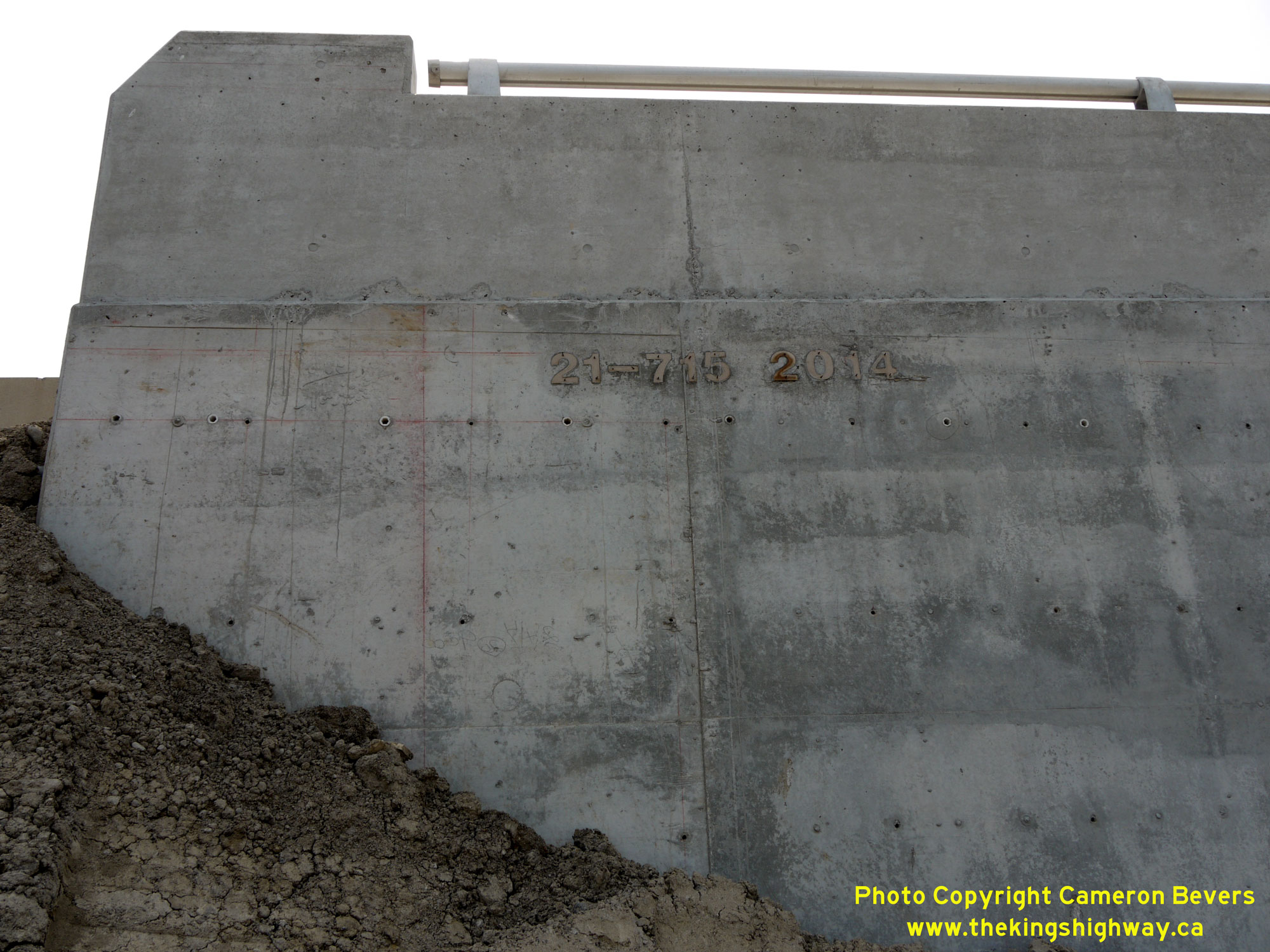
Enlarged Photo Here. (Photograph taken on July 7, 2015 - © Cameron Bevers) Right - Date stamp (2014) and structure identification number (Site #21-715) on the Hwy 12 Overpass on Hwy 407 near Brooklin. See an Enlarged Photo Here. (Photograph taken on July 7, 2015 - © Cameron Bevers) 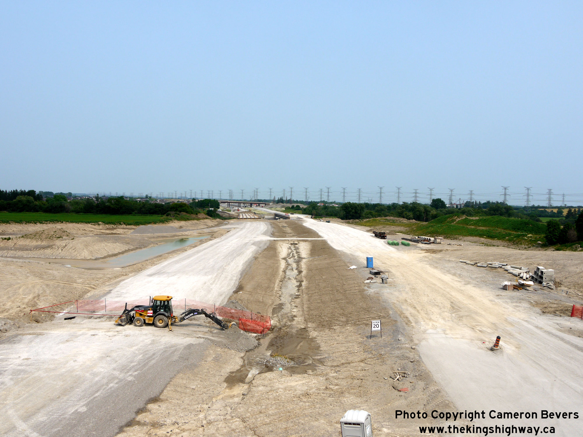

Left - Facing east along Hwy 407 from the Hwy 12 Overpass in 2015, showing the completed grading works and placement of granular base. See an
Enlarged Photo Here. (Photograph taken on July 7, 2015 - © Cameron Bevers) Right - View of Hwy 407 facing east from the Hwy 12 Overpass in 2016, one day prior to the highway's official opening. See an Enlarged Photo Here. (Photograph taken on June 19, 2016 - © Cameron Bevers) 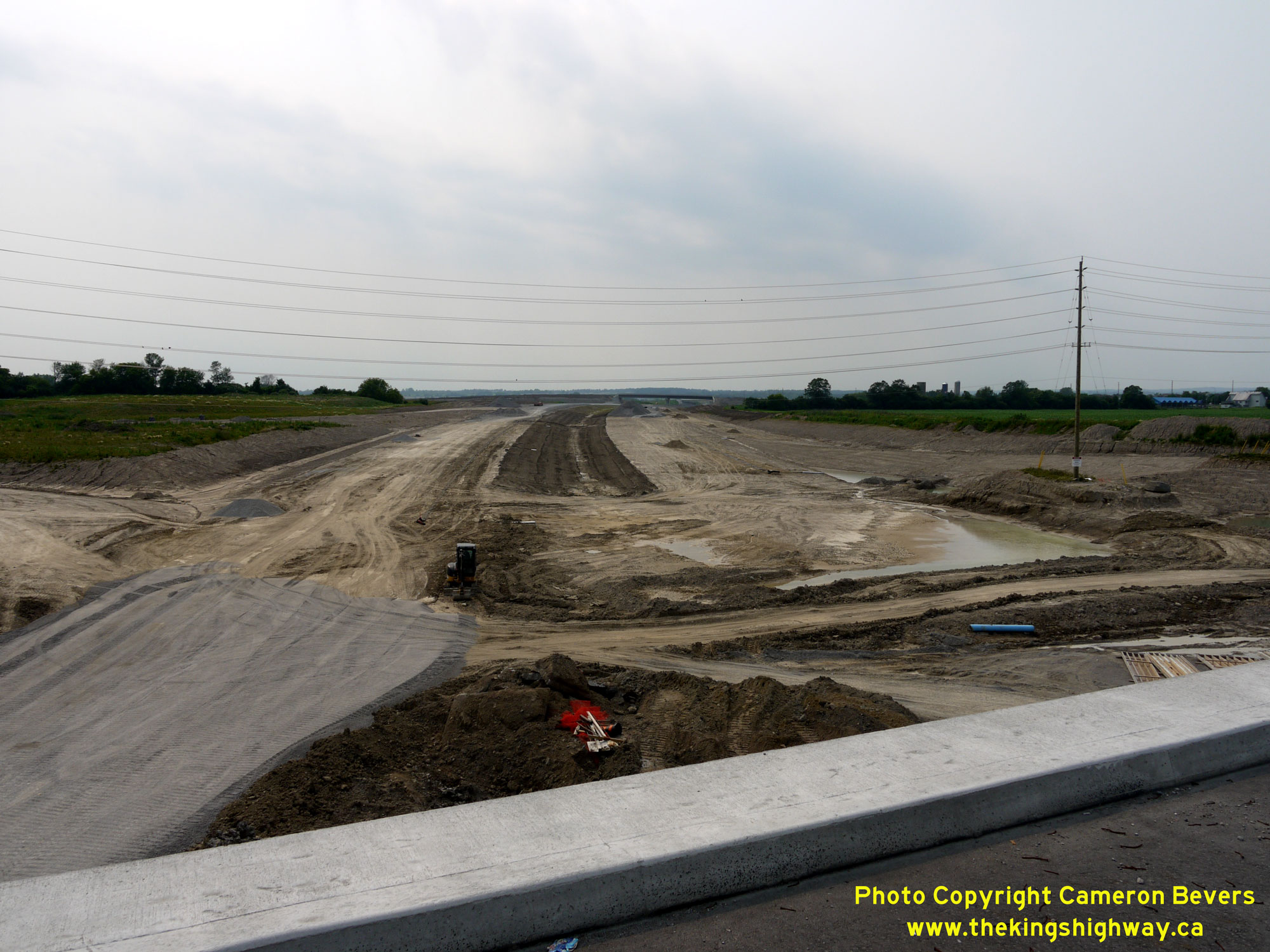
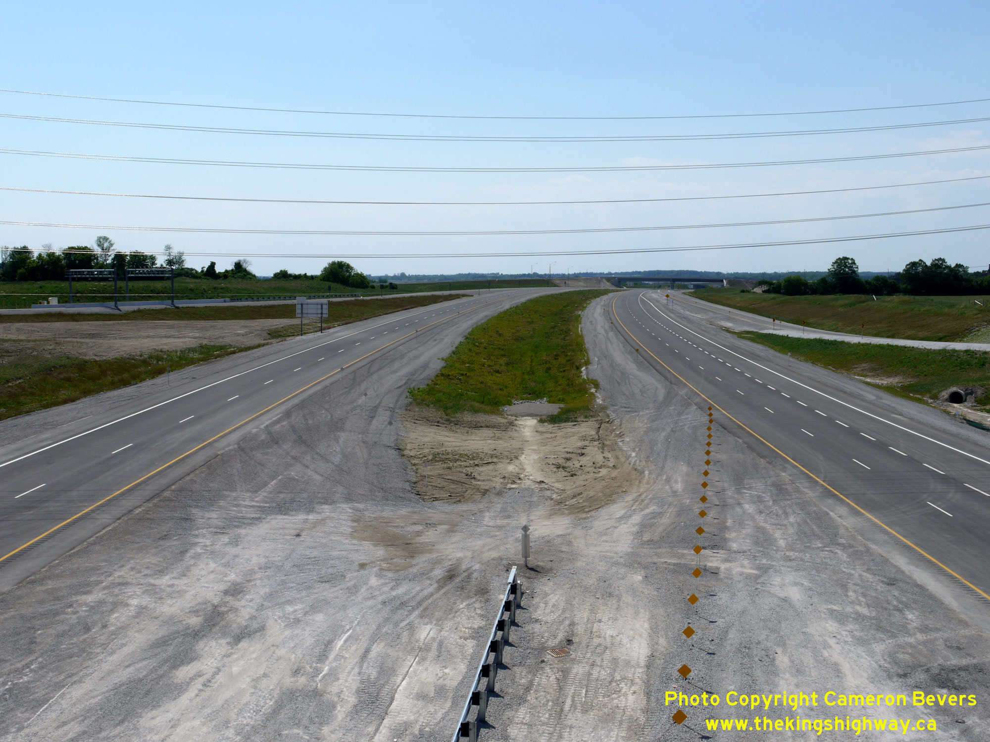
Left - Facing west along Hwy 407 towards Markham from the Hwy 12 Overpass in 2015, showing the mainline freeway grading works nearing completion. Granular base
had been placed on the eastbound carriageway to a point just west of the Hwy 12 Overpass at the time this photo was taken. See an
Enlarged Photo Here. (Photograph taken on July 7, 2015 - © Cameron Bevers) Right - View of Hwy 407 facing west towards Markham from the Hwy 12 Overpass in 2016, one day prior to the highway's official opening. See an Enlarged Photo Here. (Photograph taken on June 19, 2016 - © Cameron Bevers) 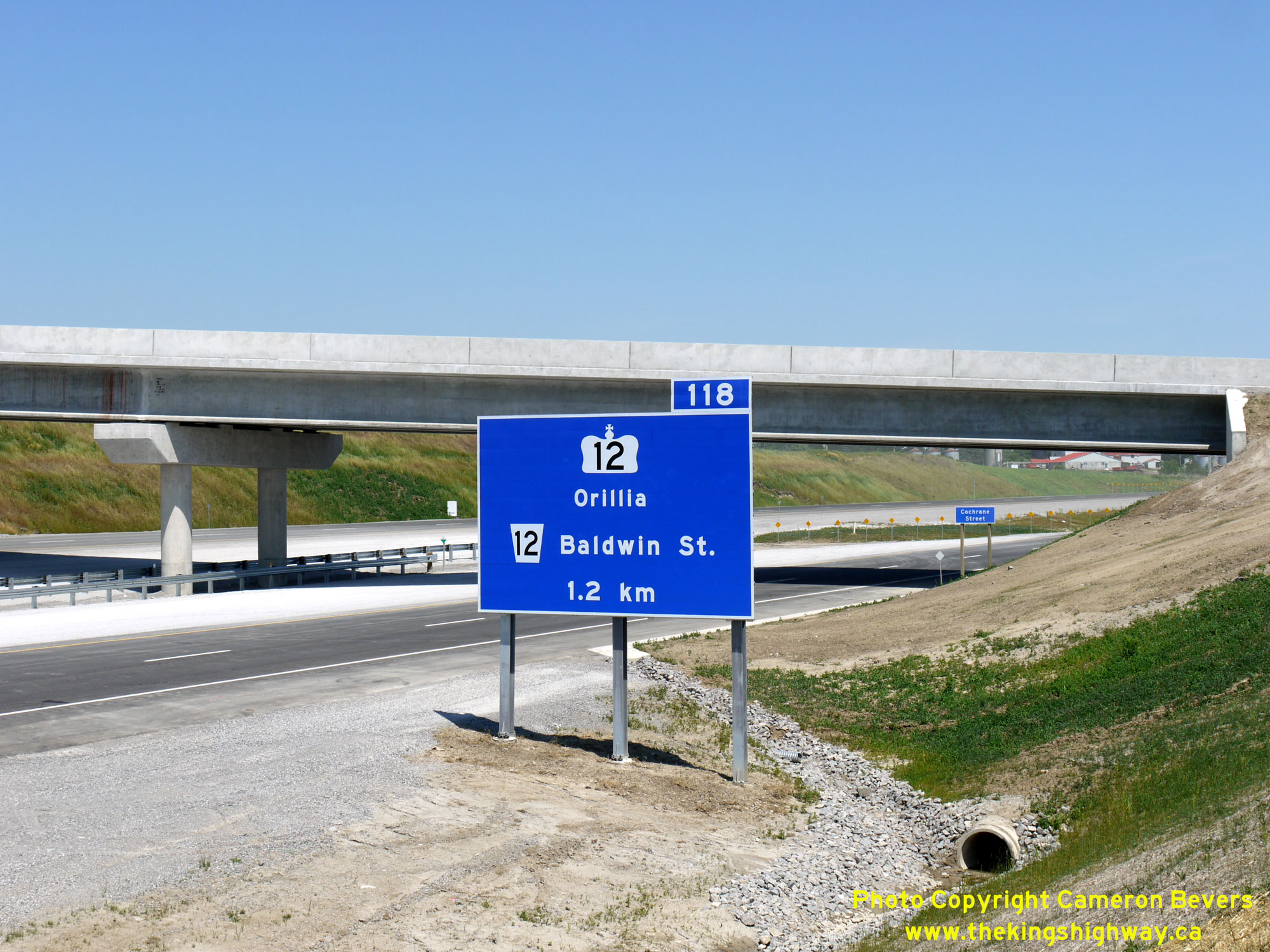
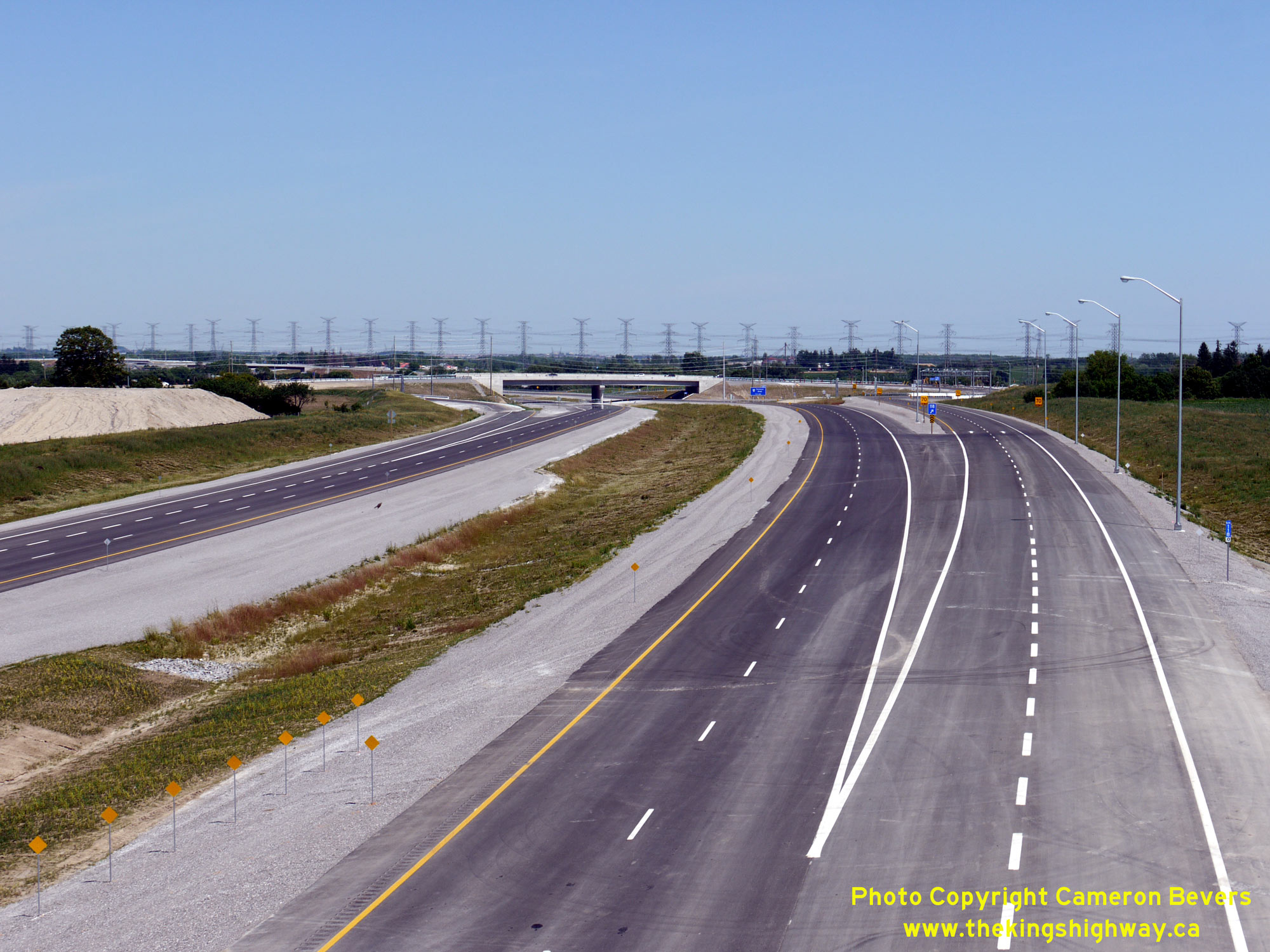
Left - Advance freeway exit guide sign on eastbound Hwy 407 approaching the Hwy 12 Interchange. See an
Enlarged Photo Here. (Photograph taken on June 19, 2016 - © Cameron Bevers) Right - View of the completed Hwy 12 Interchange on Hwy 407, facing east from the Ashburn Road Overpass near Brooklin. See an Enlarged Photo Here. (Photograph taken on June 19, 2016 - © Cameron Bevers) 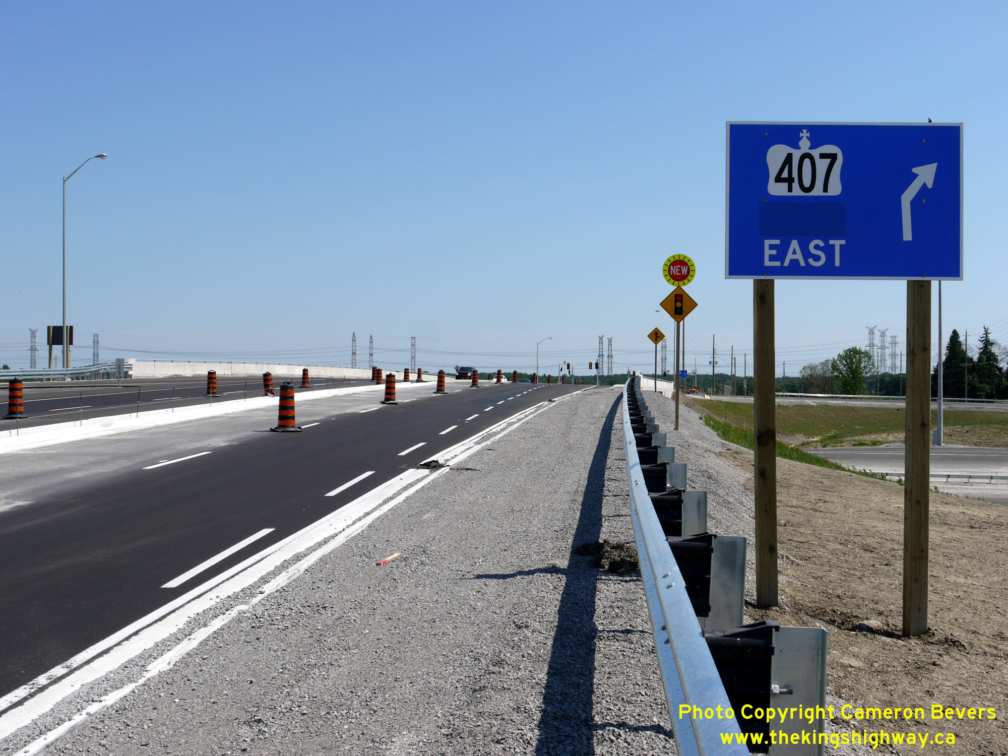
Left - Guide sign on southbound Hwy 12 marking the on-ramp to eastbound Hwy 407. A temporary sticker covers up the word "Toll" on this sign. Tolls were not
collected along Hwy 407 for several months after the highway's official opening between Brock Road and Harmony Road on June 20, 2016. See an
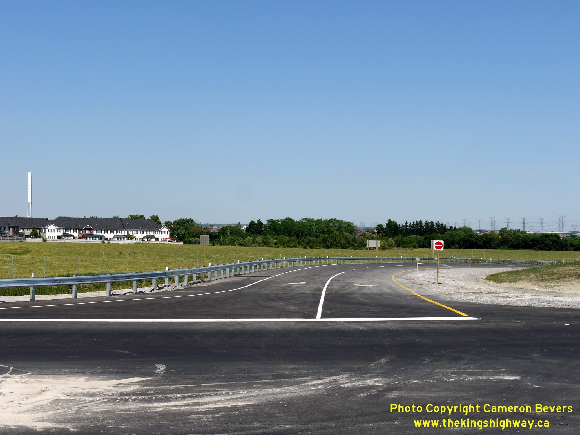
Enlarged Photo Here. (Photograph taken on June 19, 2016 - © Cameron Bevers) Right - Stop-controlled exit ramp from westbound Hwy 407 to Hwy 12. Due to prevailing traffic patterns, it was not necessary to signalize many of the westbound ramp terminals at interchanges along Hwy 407 at the time of the highway's opening. See an Enlarged Photo Here. (Photograph taken on June 19, 2016 - © Cameron Bevers) 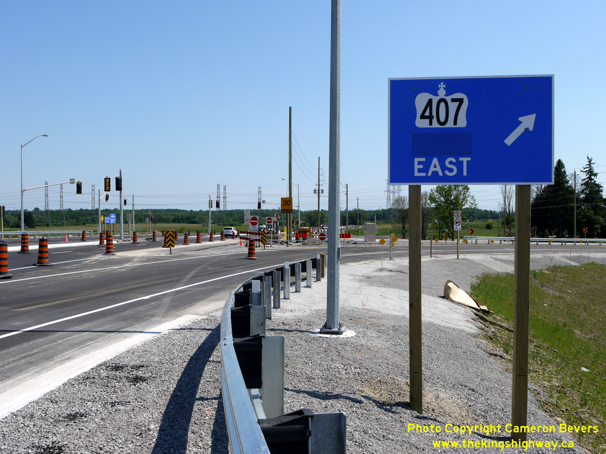

Left - Facing south along Hwy 12 at the entrance ramp to eastbound Hwy 407. The eastbound Hwy 407 exit ramp to Hwy 12 intersects just ahead at the new traffic
signals. See an Enlarged Photo Here. (Photograph taken on June 19, 2016 - © Cameron Bevers) Right - Traffic signals awaiting activation at the south ramp terminal at the Hwy 407 & Hwy 12 Interchange, one day prior to Hwy 407's official opening. See an Enlarged Photo Here. (Photograph taken on June 19, 2016 - © Cameron Bevers) 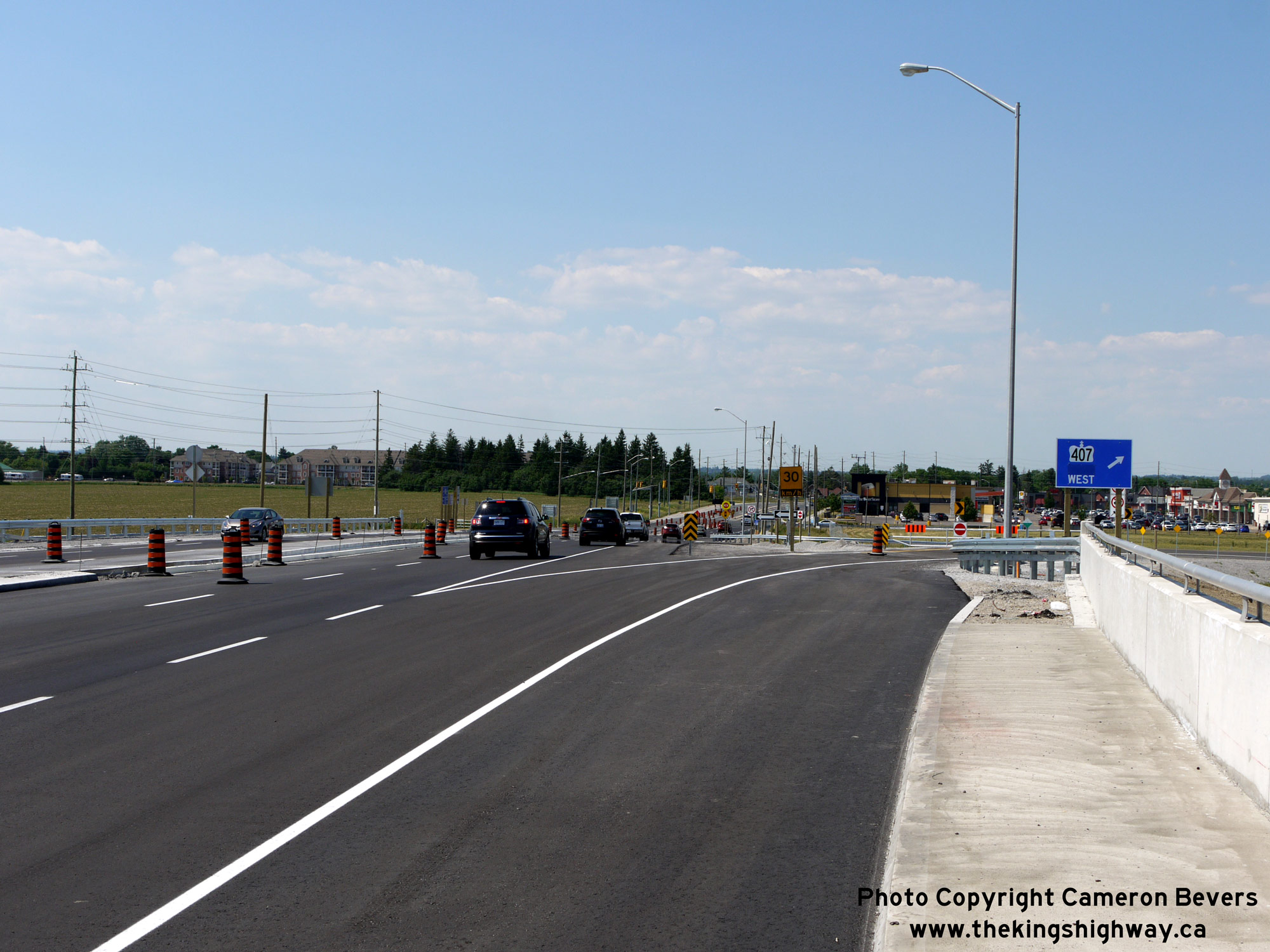
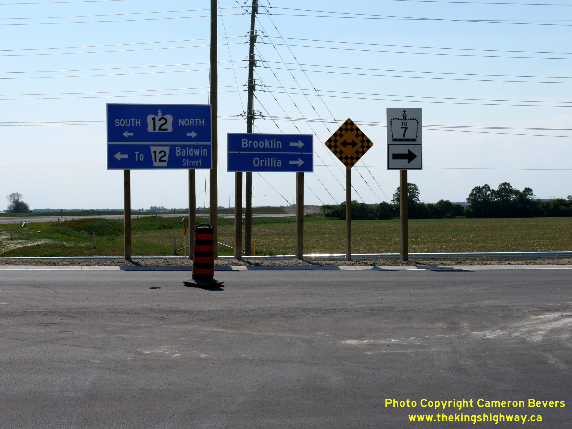
Left - Facing north along Hwy 12 towards Brooklin approaching the entrance ramp to westbound Hwy 407. See an
Enlarged Photo Here. (Photograph taken on June 19, 2016 - © Cameron Bevers) Right - Guide signs at the eastbound Hwy 407 exit ramp to Hwy 12. See an Enlarged Photo Here. (Photograph taken on June 19, 2016 - © Cameron Bevers) 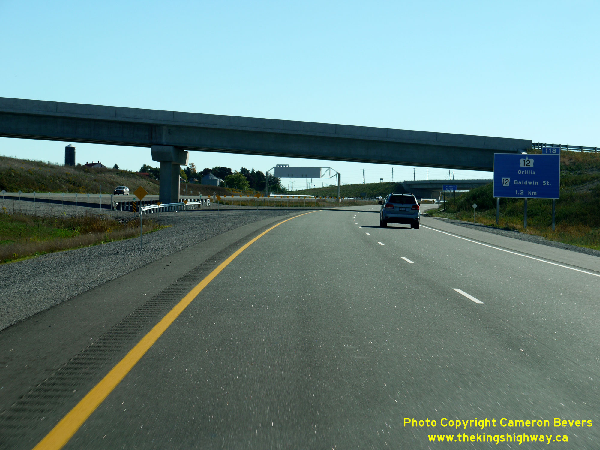
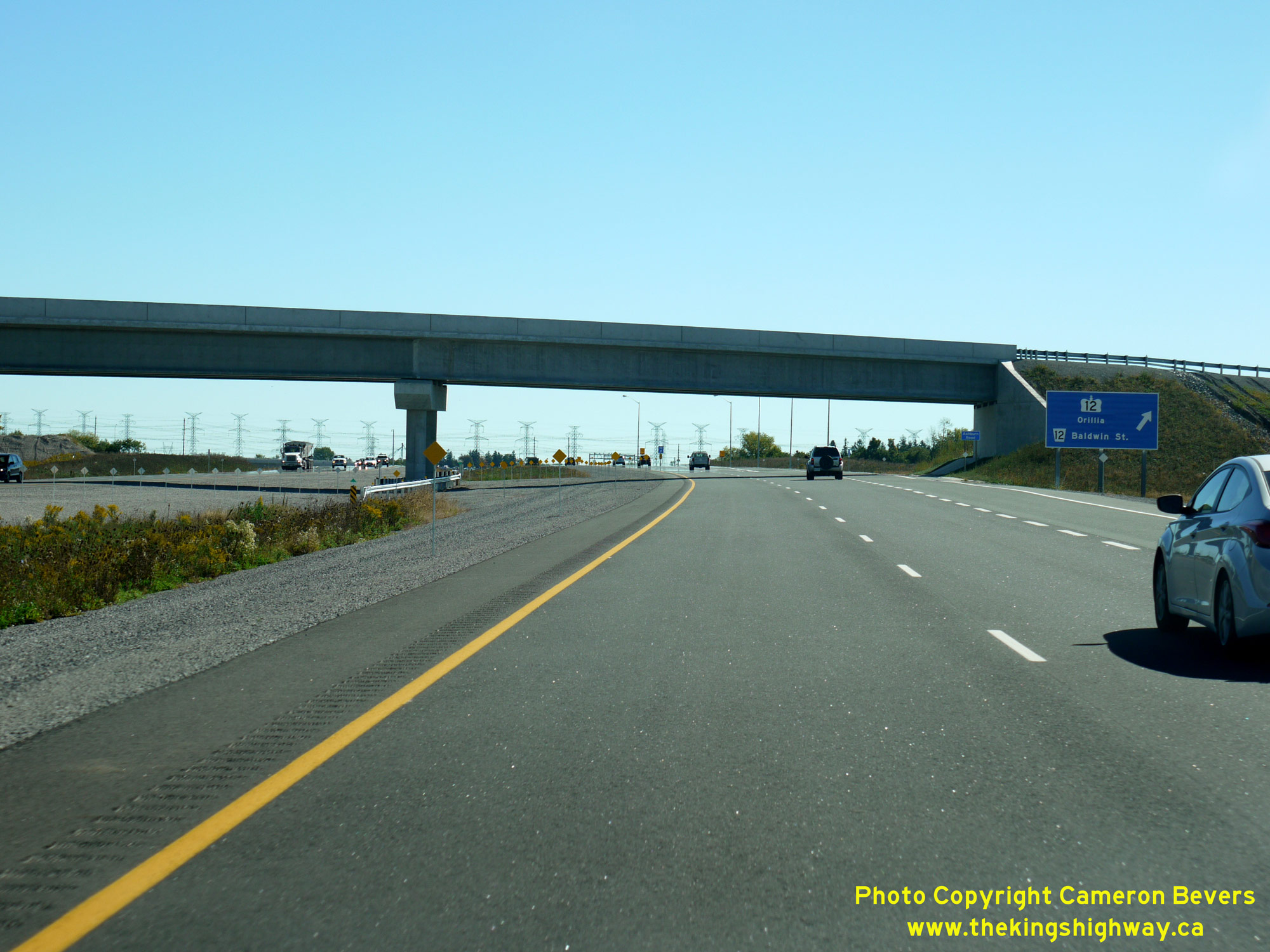
Left - Advance freeway exit guide sign for the upcoming Hwy 12 Interchange on eastbound Hwy 407 near Brooklin. See an
Enlarged Photo Here. (Photograph taken on September 24, 2016 - © Cameron Bevers) Right - Facing east along Hwy 407 after the freeway's opening in 2016, approaching the Hwy 12 Interchange near Brooklin. See an Enlarged Photo Here. (Photograph taken on September 24, 2016 - © Cameron Bevers) 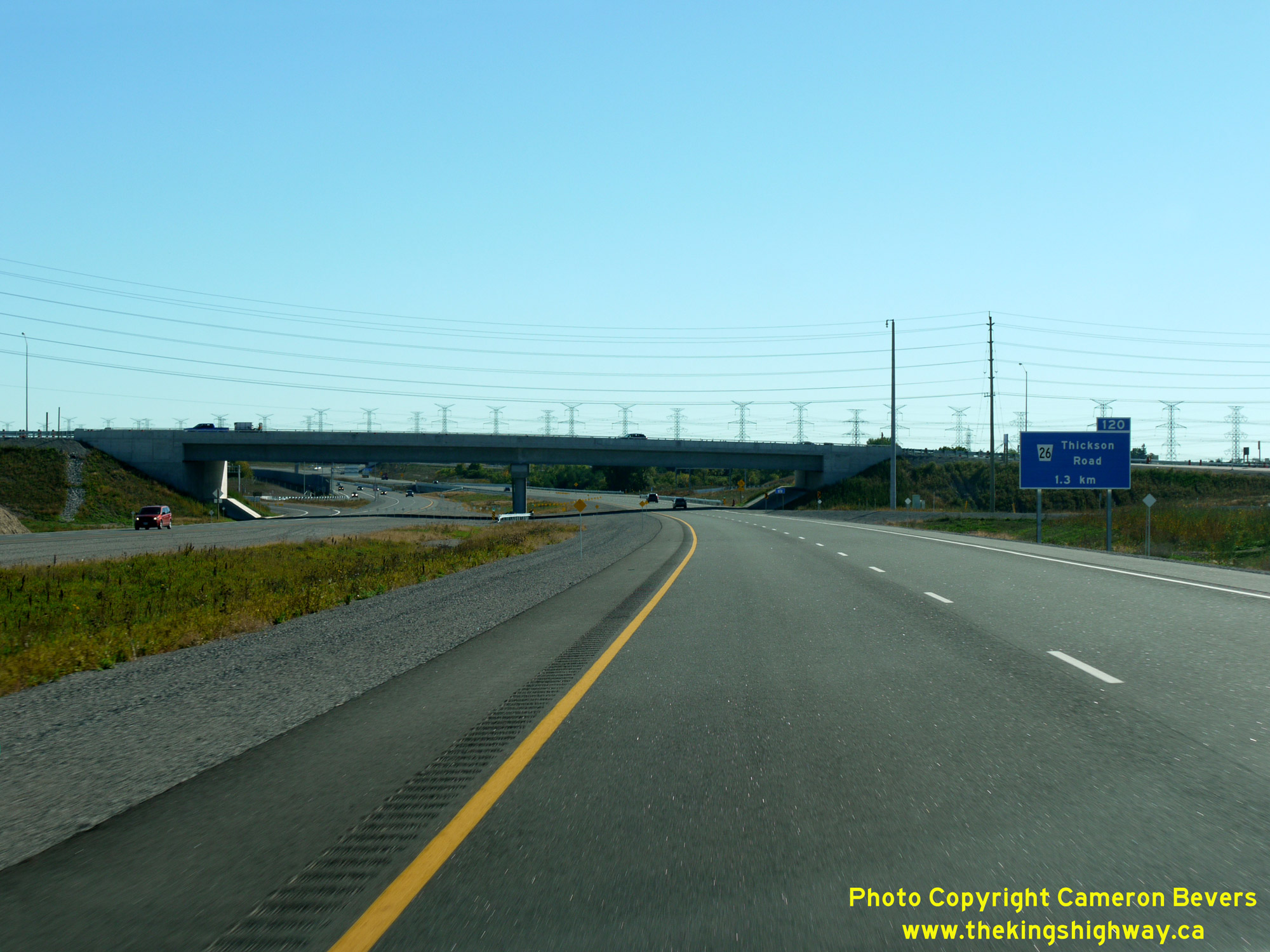
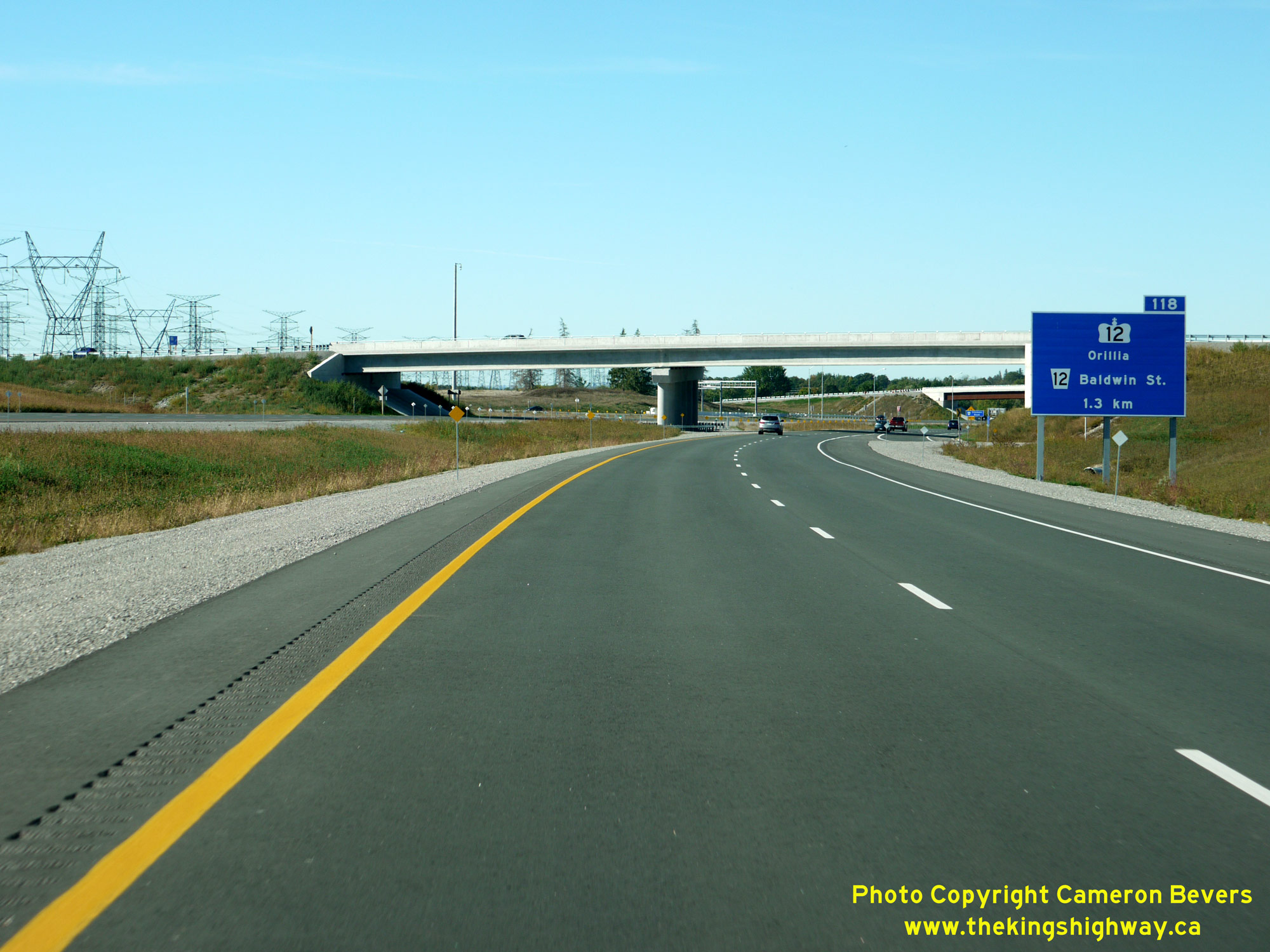
Left - Western side of the Hwy 12 Overpass on Hwy 407 near Brooklin, as seen from the completed freeway after it was opened to traffic in 2016. See an
Enlarged Photo Here. (Photograph taken on September 24, 2016 - © Cameron Bevers) Right - Advance freeway exit guide sign for the upcoming Hwy 12 Interchange on westbound Hwy 407 near Brooklin. See an Enlarged Photo Here. (Photograph taken on September 24, 2016 - © Cameron Bevers) 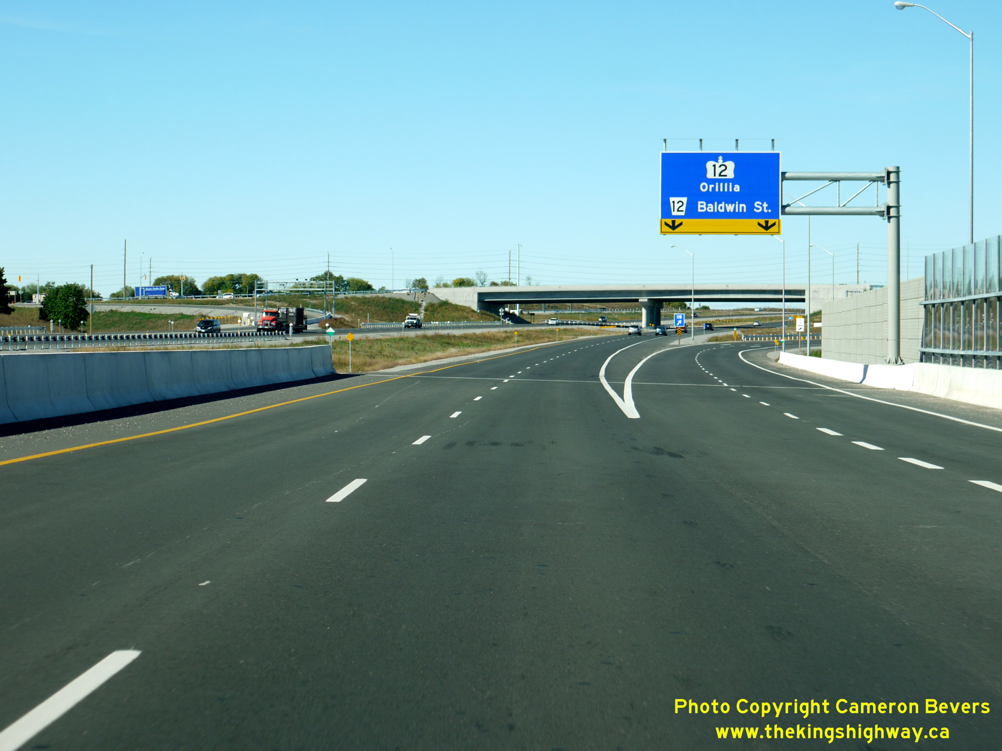
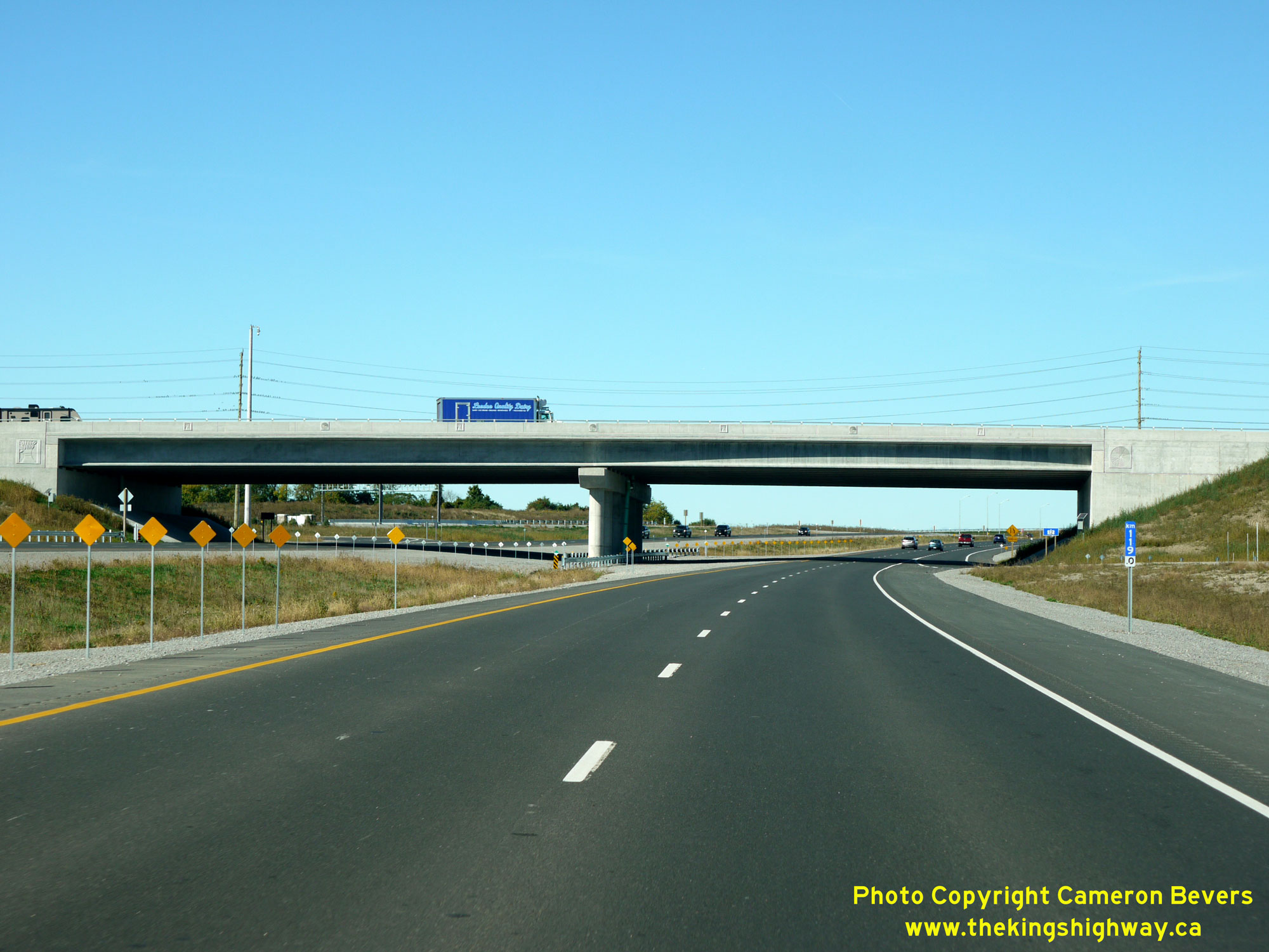
Left - Overhead freeway exit guide sign for the Hwy 12 Interchange on westbound Hwy 407 near Brooklin. This sign was installed on a cantilevered overhead sign
structure, as there was insufficient space beside the freeway to install a standard ground-mounted freeway exit guide sign. See an
Enlarged Photo Here. (Photograph taken on September 24, 2016 - © Cameron Bevers) Right - Eastern side of the Hwy 12 Overpass on Hwy 407 near Brooklin, as seen from the completed freeway after it was opened to traffic in 2016. See an Enlarged Photo Here. (Photograph taken on September 24, 2016 - © Cameron Bevers)
More Highway 407 (ETR) Photos Coming Soon!
|
|---|
Links to Adjacent King's Highway Photograph Pages:
Back to King's Highway 406 Photos /
Highway 407 (ETR) History /
On to King's Highway 409 Photos
Ontario Highway History - Main Menu / Back to List of Highways Website contents, photos & text © 2002-2026, Cameron
Bevers (Webmaster) - All Rights Reserved / Contact Me
|
|---|