| 
|  |
|
|
This page contains historical and present day photos of Ontario's King's Highway 51 (#2), which ran from Rondeau Provincial
Park northerly to Highway 3 in the Chatham area. All photographs displayed on this page were taken by the Webmaster (Cameron Bevers), unless specifically noted
otherwise. Historical photographs are arranged in approximate chronological order, while present day photographs (Year 2000 to date) are arranged by location from
south to north. Click on any thumbnail to see a larger image!
Please note that all photographs displayed on this
website are protected by copyright. These photographs must not be reproduced, published,
electronically stored or copied, distributed, or posted onto other websites without
my written permission. If you want to use photos from this website, please
email me first for permission. Thank-you!
|
|---|
|
Present Day King's Highway 51 (#2) Photographs


Left - Looking north along Hwy 51 from the Rondeau Creek Bridge. Note the lack of shoulders along the highway! See an
Enlarged Photo here. (Photograph taken on August 14, 2004 - © Cameron Bevers) Right - Eastern side of the Rondeau Creek Bridge. Structure completed circa 1935. See an Enlarged Photo here. (Photograph taken on August 14, 2004 - © Cameron Bevers) 

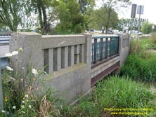
Left - Close-up of the unusual concrete and steel handrail design of the Rondeau Creek Bridge. This structure was built by Kent County in the 1930s when the
highway to Rondeau was just a county road. The highway to Rondeau Provincial Park was not designated as King's Highway 51 until 1970. See an
Enlarged Photo here. (Photograph taken on August 14, 2004 - © Cameron Bevers) Right - Western side of the Rondeau Creek Bridge on Hwy 51. See an Enlarged Photo here. (Photograph taken on August 14, 2004 - © Cameron Bevers) 

Left - Looking south along Hwy 51 towards Rondeau Provincial Park from the Rondeau Creek Bridge. See an
Enlarged Photo here. (Photograph taken on August 14, 2004 - © Cameron Bevers) Right - Green guide sign for Chatham-Kent Road 15 (Former Hwy 51) on eastbound Hwy 3. Up until the 1990s, Hwy 51 was a short King's Highway which connected Rondeau Provincial Park to Hwy 3 at Eatonville. Jurisdiction over Hwy 51 was transferred from the province to the Municipality of Chatham-Kent in 1997. On the top sign, traces of the old Hwy 51 crown route marker can still be seen underneath the newer flowerpot route marker. See an Enlarged Photo Here. (Photograph taken on September 14, 2010 - © Cameron Bevers) 

Left - Facing east along Hwy 3 towards St. Thomas at the Hwy 51 Junction at Eatonville. The turn-off to southbound Hwy 51 from eastbound Hwy 3 has been
channelized. See an Enlarged Photo Here. (Photograph taken on September 14, 2010 - © Cameron Bevers) Right - Facing west along Hwy 3 towards Blenheim from the Hwy 51 Junction at Eatonville. These two highways intersect about 11 km east of Blenheim. See an Enlarged Photo Here. (Photograph taken on September 14, 2010 - © Cameron Bevers) 

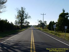
Left - Facing south along Hwy 51 towards Rondeau Provincial Park from the Hwy 3 Junction at Eatonville. See an
Enlarged Photo Here. (Photograph taken on September 14, 2010 - © Cameron Bevers) Right - Approaching the historical northern terminus of Hwy 51 at the Hwy 3 Junction at Eatonville. Kent Bridge Road continues north from Hwy 3 towards Hwy 401 and Kent Bridge as Chatham-Kent Road 15. After the province downloaded Hwy 51, the Municipality of Chatham-Kent extended the route of County Road 15 south via the former route of Hwy 51. See an Enlarged Photo Here. (Photograph taken on September 14, 2010 - © Cameron Bevers) 

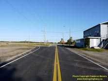
Left - Facing south along Former Hwy 51 (now Chatham-Kent Road 15) from Eatonville. The entrance to Rondeau Provincial Park lies about 6 km south of the Hwy 3
Junction. Rondeau is one of Southern Ontario's most popular provincial parks, with old growth Carolinian forests that are very uncommon in Ontario. It is also one of
the oldest provincial parks in Ontario, having been established well over a century ago, in 1894. See an
Enlarged Photo Here. (Photograph taken on September 14, 2010 - © Cameron Bevers) Right - Junction of Hwy 3 & Hwy 51, facing west towards Blenheim. The turn-off to eastbound Hwy 3 from northbound Hwy 51 is also channelized. The westbound left turn lane at this junction was offset to the right of the highway's centreline, presumably to avoid property and building displacements on the south side of Hwy 3. See an Enlarged Photo Here. (Photograph taken on September 14, 2010 - © Cameron Bevers) 

Left - Approaching the Hwy 51 Junction on Hwy 3 at Eatonville, facing west towards Blenheim. See an
Enlarged Photo Here. (Photograph taken on September 14, 2010 - © Cameron Bevers) Right - Green guide sign for Chatham-Kent Road 15 (Former Hwy 51) on westbound Hwy 3 at Eatonville. The See an Enlarged Photo Here. (Photograph taken on September 14, 2010 - © Cameron Bevers) 
Above - Facing east along Hwy 3 towards St. Thomas from the Hwy 51 Junction at Eatonville. See an
Enlarged Photo Here. (Photograph taken on September 14, 2010 - © Cameron Bevers)
More King's Highway 51 (#2) Photographs Coming Soon!
|
|---|
Links to Adjacent King's Highway Photograph Pages:
Back to King's Highway 51 (#1) Photos /
King's Highway 51 (#2) History /
Back to King's Highway 52 Photos
Ontario Highway History - Main Menu / Back to List of Highways Website contents, photos & text © 2002-2025, Cameron
Bevers (Webmaster) - All Rights Reserved / Contact Me |
|---|