
| 
| |
|
|
All photographs displayed on this page were taken by the
Webmaster (Cameron Bevers), unless specifically noted otherwise. Historical photographs are
arranged in approximate chronological order, while present day photographs (Year 2000 to date)
are arranged by location from east to west. Click on any thumbnail to see a larger image!
Please note that all photographs displayed on this
website are protected by copyright. These photographs must not be reproduced, published,
electronically stored or copied, distributed, or posted onto other websites without
my written permission. If you want to use photos from this website, please
email me first for permission. Thank-you!
|
|---|
|
Historical Secondary Highway 540 Photographs

Above - Facing east along the Gore Bay-Meldrum Bay Secondary Road (Hwy 540) at the Indian Point Bridge in 1940. This small one lane truss bridge was built in
1899, and remained in service up until 1960, when it was replaced with a Bailey Bridge. Photo taken on September 13, 1940. (Photo courtesy of Ontario Ministry of Transportation - © King's Printer for Ontario, 1940) 
Above - Bridal Veil Falls beside the Little Current-Gore Bay Secondary Road (Hwy 540) at Kagawong. Photo taken on September 13, 1940. (Photo courtesy of Ontario Ministry of Transportation - © King's Printer for Ontario, 1940) 

Left - New zone striping on the Little Current-Gore Bay Secondary Road (Hwy 540) east of Gore Bay. Photo taken on September 23, 1955. (Photo courtesy of Ontario Ministry of Transportation - © King's Printer for Ontario, 1955) Right - Widening an earth cut on Hwy 540 in 1975, near M'Chigeeng (West Bay) (Photo courtesy of Ontario Ministry of Transportation - © King's Printer for Ontario, 1975) 
Above - Circa 1980 view of Hwy 540 approaching Lake Wolsey and the Indian Point Bridge, about 17 km west of Gore Bay. This photo was featured on the front
cover of the 1980-81 Edition of the Ontario Official Road Map. See an Enlarged Photo here. (Photo courtesy of Ontario Ministry of Transportation - © King's Printer for Ontario, 1980) |
|---|
|
Present Day Secondary Highway 540 Photographs


Left - Facing north along Hwy 6 towards Espanola from the Hwy 540 Junction in Little Current. See an
Enlarged Photo here. (Photograph taken on August 15, 2016 - © Cameron Bevers) Right - Approaching the Hwy 540 Junction in Little Current, facing south along Hwy 6. The route of Hwy 6 turns left at this intersection and continues south towards South Baymouth. Hwy 540 begins at this intersection and continues straight ahead into Little Current. See an Enlarged Photo here. (Photograph taken on August 15, 2016 - © Cameron Bevers) 

Left - Facing north along Hwy 6 towards the Hwy 540 Junction in Little Current. Hwy 6 turns right at the intersection and continues north off of Manitoulin
Island towards Espanola. At left, Hwy 540 heads into Little Current before heading west towards M'Chigeeng (West Bay), Gore Bay and Meldrum Bay. See an
Enlarged Photo here. (Photograph taken on August 15, 2016 - © Cameron Bevers) Right - Facing south along Hwy 6 towards South Baymouth from the Hwy 540 Junction in Little Current. See an Enlarged Photo here. (Photograph taken on August 15, 2016 - © Cameron Bevers) 

Left - Eastern terminus of Hwy 540 at the Hwy 6 Junction in Little Current. From here, traffic can either continue straight ahead off of Manitoulin Island
towards Espanola via Hwy 6 North, or turn right and follow Hwy 6 South towards Manitowaning and South Baymouth. See an
Enlarged Photo here. (Photograph taken on August 15, 2016 - © Cameron Bevers) Right - Facing west along Hwy 540 from the Hwy 6 Junction in Little Current. The Little Current Town Centre lies a short distance north of Hwy 540. See an Enlarged Photo here. (Photograph taken on August 15, 2016 - © Cameron Bevers) 


Left - Hwy 6 & Hwy 540 Junction assembly on northbound Hwy 6 in Little Current. See an
Enlarged Photo here. (Photograph taken on July 2, 2005 - © Cameron Bevers) Centre - Junction assembly on eastbound Hwy 540 approaching the Hwy 6 Junction in Little Current. See an Enlarged Photo here. (Photograph taken on August 15, 2016 - © Cameron Bevers) Right - Fingerboard guide signs and Hwy 540 route marker at Meredith Street and Worthington Street in Little Current. Meldrum Bay is one of the smallest communities signed as a control city by the MTO, with an estimated population of about 50. The community is located at the western terminus of Hwy 540 near the western tip of Manitoulin Island. See an Enlarged Photo here. (Photograph taken on August 15, 2016 - © Cameron Bevers) 
Left - Facing east along Meredith Street (Hwy 540) in Little Current, approaching the Hwy 6 Junction. See an
Enlarged Photo here. (Photograph taken on August 15, 2016 - © Cameron Bevers) Right - Facing west along Meredith Street (Hwy 540) in Little Current. Hwy 540 turns left onto Worthington Street at the stop sign. See an Enlarged Photo here. (Photograph taken on August 15, 2016 - © Cameron Bevers) 

Left - Approaching Meredith Street on Hwy 540 (Worthington Street), facing north. Hwy 540 turns right onto Meredith Street at the intersection and heads across
to Hwy 6, while the Little Current Town Centre lies directly ahead via Worthington Street. See an
Enlarged Photo here. (Photograph taken on August 15, 2016 - © Cameron Bevers) Right - Facing south along Worthington Street (Hwy 540) from Meredith Street. Historically, Hwy 540 followed Vankoughnet Street at left, but the route was changed in 1966 to the present-day route through Little Current via Meredith Street. See an Enlarged Photo here. (Photograph taken on August 15, 2016 - © Cameron Bevers) 

Left - Hwy 540 enters Little Current along Worthington Street. Provincial jurisdiction over Hwy 540 ends at this point, and the remainder of the route
over to the Hwy 6 Junction is considered a "Municipal Connecting Link" in the provincial highway system. The Public Transportation and Highway Improvement Act (PTHIA)
allows the Minister of Transportation to enter into agreements with municipalities for provincial highways which pass through urbanized areas. Typically, routine
day-to-day road maintenance and development/access permits are administered through the municipality, but major road infrastructure upgrades are sometimes eligible
for cost-sharing between the municipality and the province. See an
Enlarged Photo here. (Photograph taken on August 15, 2016 - © Cameron Bevers) Right - Distance guide sign on westbound Hwy 540 departing Little Current. See an Enlarged Photo here. (Photograph taken on August 15, 2016 - © Cameron Bevers) 

Left - Facing west along Hwy 540 from the western entrance to Little Current. See an
Enlarged Photo here. (Photograph taken on August 15, 2016 - © Cameron Bevers) Right - View of Hwy 540 from the Columbus Mountain Lookout west of Little Current. See an Enlarged Photo here. (Photograph taken on August 15, 2016 - © Cameron Bevers) 

Left - Facing east along Hwy 540 towards Little Current from Columbus Mountain Road. See an
Enlarged Photo here. (Photograph taken on August 15, 2016 - © Cameron Bevers) Right - This expansive view of the North Channel appears along Hwy 540 about 10 km west of Little Current. See an Enlarged Photo here. (Photograph taken on July 2, 2005 - © Cameron Bevers) 

Left - Facing east along Hwy 540, about 18 km west of Little Current. The section of Hwy 540 between M'Chigeeng and Little Current is one of the few
highways on Manitoulin Island which carries an appreciable amount of traffic. See an
Enlarged Photo here. (Photograph taken on August 15, 2016 - © Cameron Bevers) Right - Facing east along Hwy 540, about 20 km west of Little Current. The highways on Manitoulin Island offer motorists with many pleasant rural vistas. See an Enlarged Photo here. (Photograph taken on August 15, 2016 - © Cameron Bevers) 

Left - Facing east along Hwy 540 at the Town of Northeast Manitoulin and the Islands (NEMI) boundary, about 5 km east of M'Chigeeng. The Town of NEMI was one
of several amalgamated municipalities created as a result of municipal restructuring in Ontario during the late 1990s. In 1998, the Town of Little Current was
amalgamated with the surrounding townships and several unincorporated rural areas to create this new and much larger municipality. See an
Enlarged Photo here. (Photograph taken on August 15, 2016 - © Cameron Bevers) Right - Facing west along Hwy 540 towards M'Chigeeng from the Town of NEMI boundary. See an Enlarged Photo here. (Photograph taken on August 15, 2016 - © Cameron Bevers) 

Left - Reverse curve along Hwy 540 east of M'Chigeeng. Between Little Current and Gore Bay, Hwy 540 is surfaced with a hot-mix asphalt pavement structure. The
Little Current-Gore Bay Road was paved in its entirety in the 1950s, just prior to being designated as a provincial highway in May, 1956. Many of Manitoulin Island's
Secondary Highways have been paved through a surface treatment, whereby a bituminous layer is applied to the old gravel surface. For all intents and purposes, the
treated surface is essentially "paved", but highways such as this are subject to periodic truck load restrictions and are far more susceptible to frost heaving in
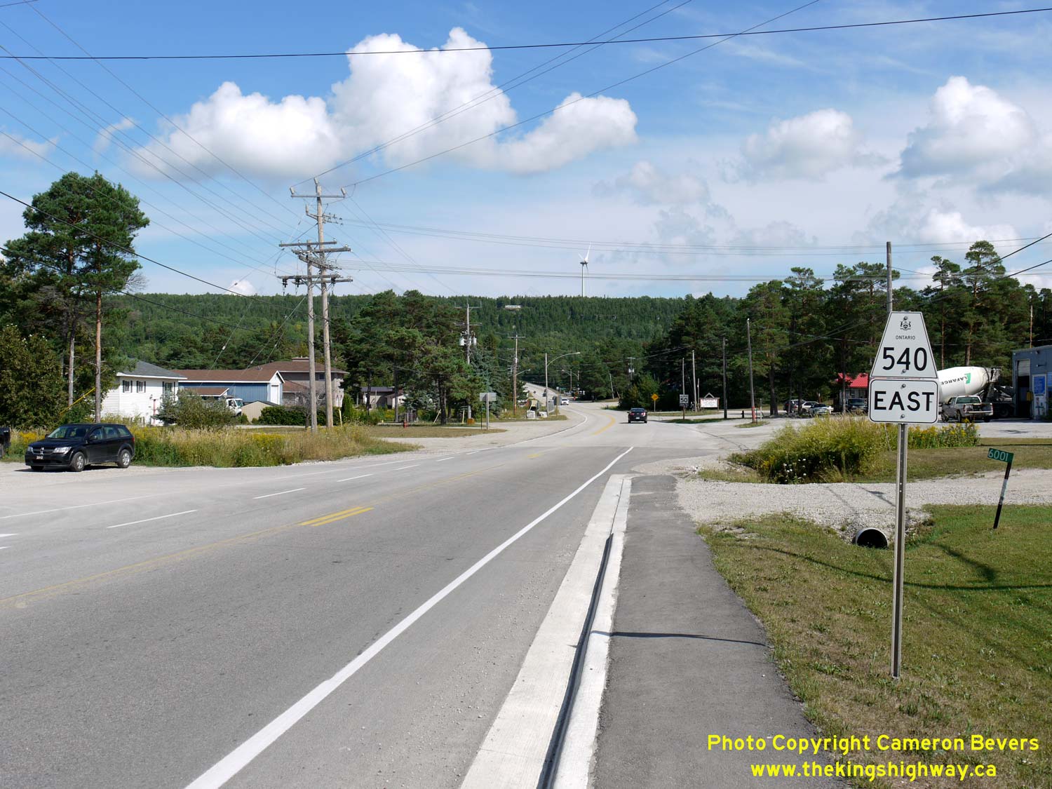
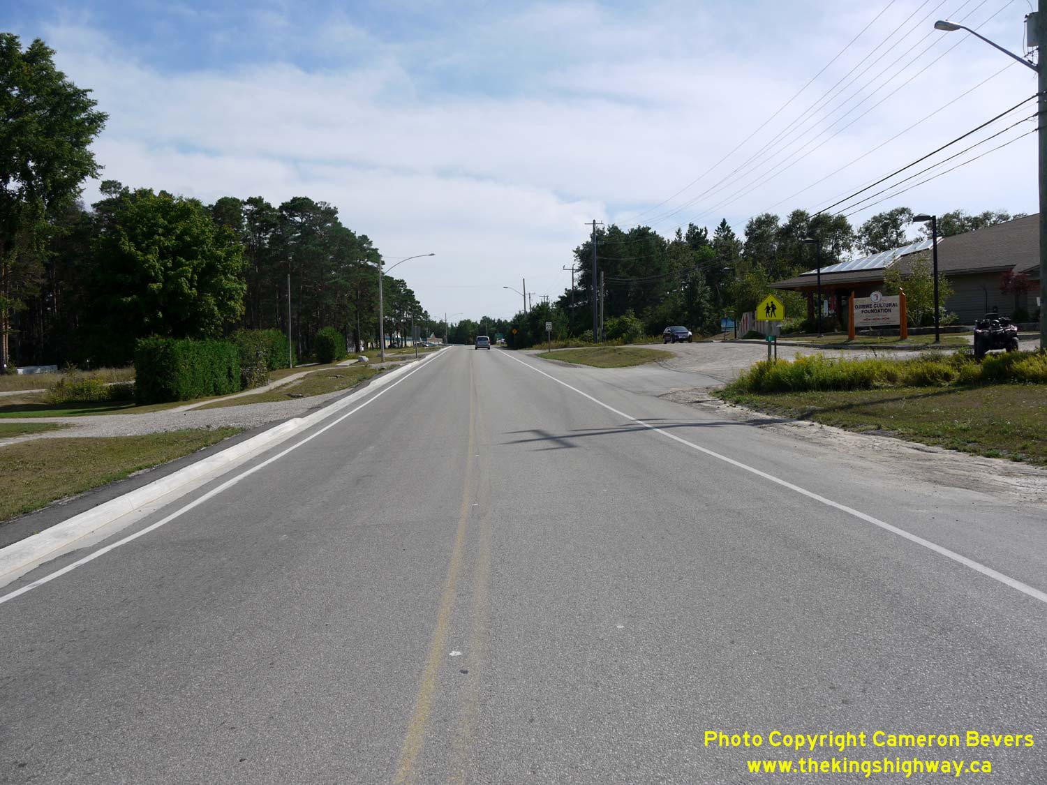
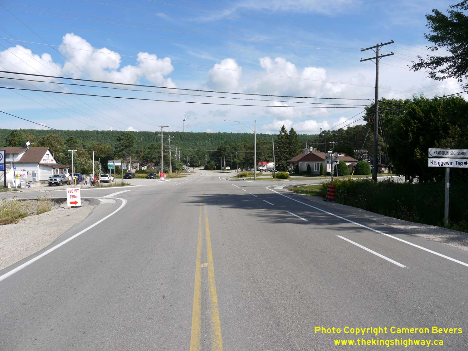
spring. See an Enlarged Photo here. (Photograph taken on August 15, 2016 - © Cameron Bevers) Right - Approaching M'Chigeeng on Hwy 540, facing west towards the Hwy 551 Junction. The turn-off to Hwy 551 to Mindemoya and Providence Bay lies just beyond the second curve in the background. See an Enlarged Photo here. (Photograph taken on August 15, 2016 - © Cameron Bevers) 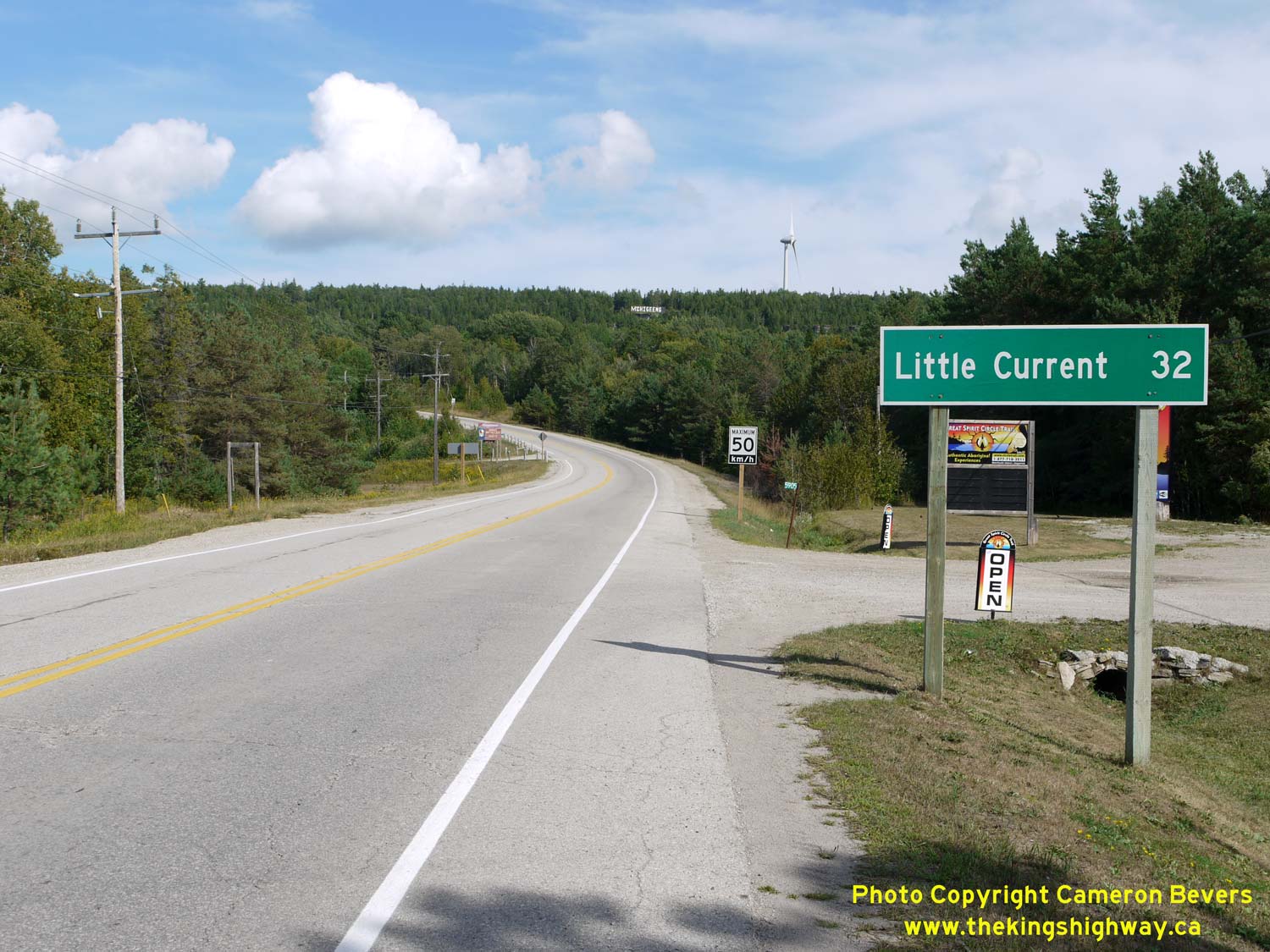
Left - Distance guide sign on eastbound Hwy 540 at M'Chigeeng. See an
Enlarged Photo here. (Photograph taken on August 15, 2016 - © Cameron Bevers) Right - Facing east along Hwy 540 from the Hwy 551 Junction in M'Chigeeng. See an Enlarged Photo here. (Photograph taken on August 15, 2016 - © Cameron Bevers) 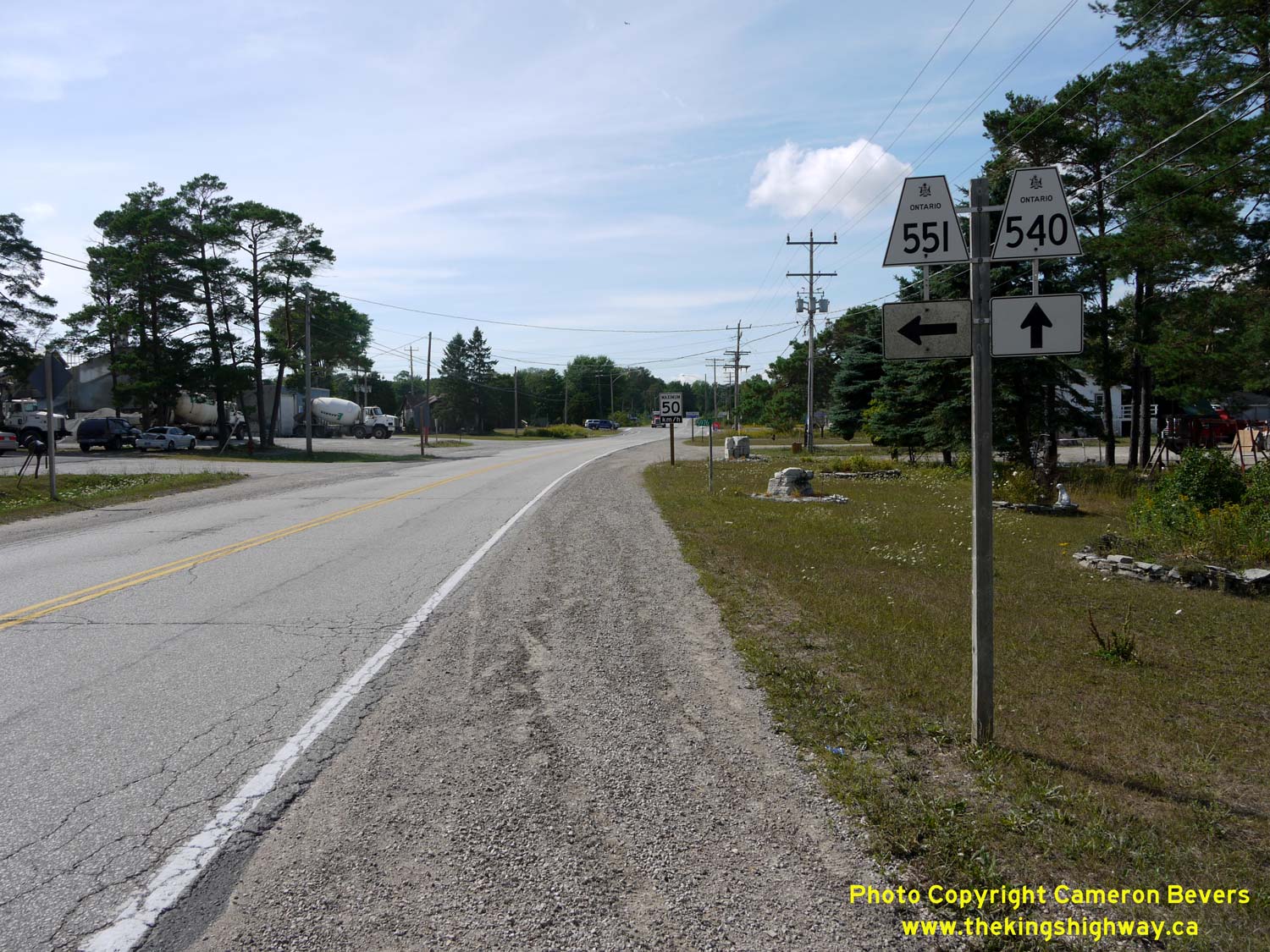
Left - Junction sign assembly on westbound Hwy 540 approaching the Hwy 551 Junction in M'Chigeeng. See an
Enlarged Photo here. (Photograph taken on August 15, 2016 - © Cameron Bevers) Right - Facing south along Hwy 551 towards Mindemoya from the Hwy 540 Junction in M'Chigeeng. See an Enlarged Photo here. (Photograph taken on August 15, 2016 - © Cameron Bevers) 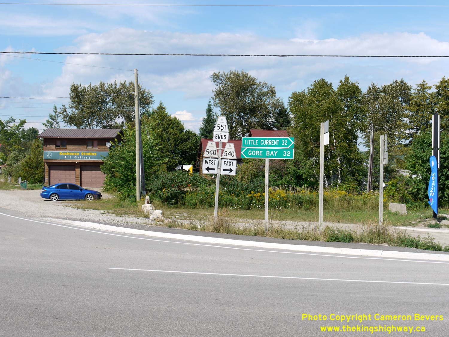
Left - Junction assembly at the northern terminus of Hwy 551 at Hwy 540 in M'Chigeeng. From here, traffic can either follow Hwy 540 West to Gore Bay or follow
Hwy 540 East to Little Current. Coincidentally, this highway junction lies at the exact midpoint between these two towns - both towns lie 32 km away from
M'Chigeeng. See an Enlarged Photo here. (Photograph taken on August 15, 2016 - © Cameron Bevers) Right - Approaching the northern terminus of Hwy 551 in M'Chigeeng. Apart from Hwy 6, Hwy 551 is the only other north-south highway across Manitoulin Island. See an Enlarged Photo here. (Photograph taken on August 15, 2016 - © Cameron Bevers) 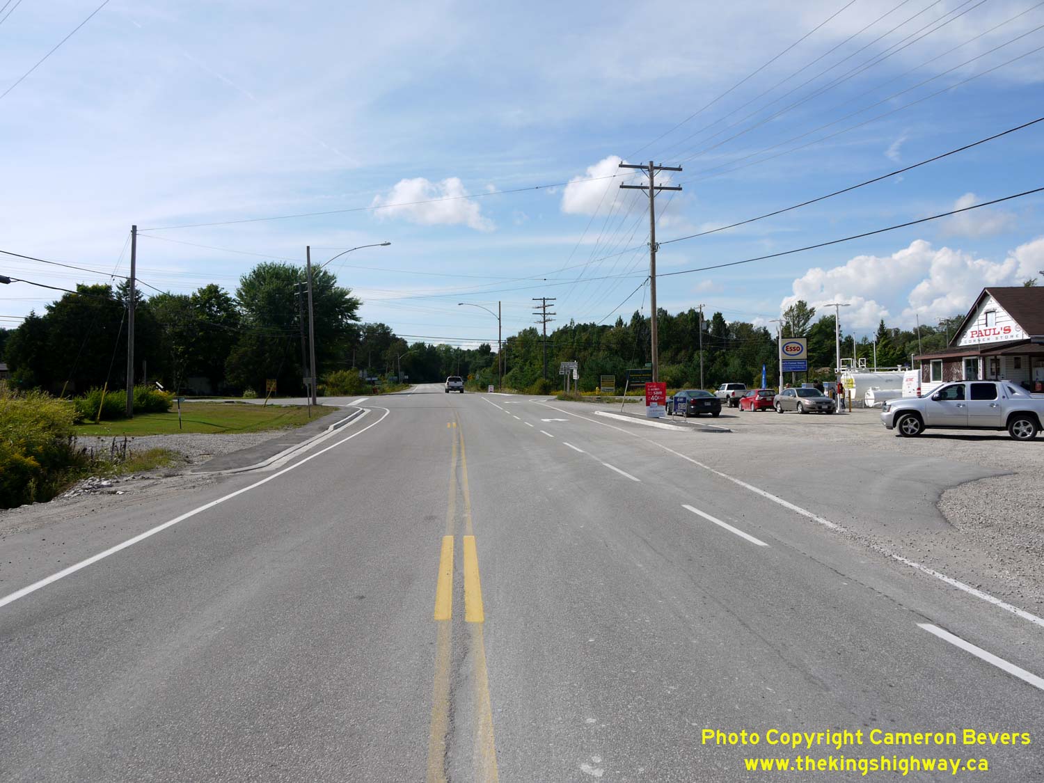
Left - Facing west along Hwy 540 towards Gore Bay at the Hwy 551 Junction in M'Chigeeng. See an
Enlarged Photo here. (Photograph taken on August 15, 2016 - © Cameron Bevers) Right - Facing east along Hwy 540 at the Hwy 551 Junction in M'Chigeeng. See an Enlarged Photo here. (Photograph taken on August 15, 2016 - © Cameron Bevers) 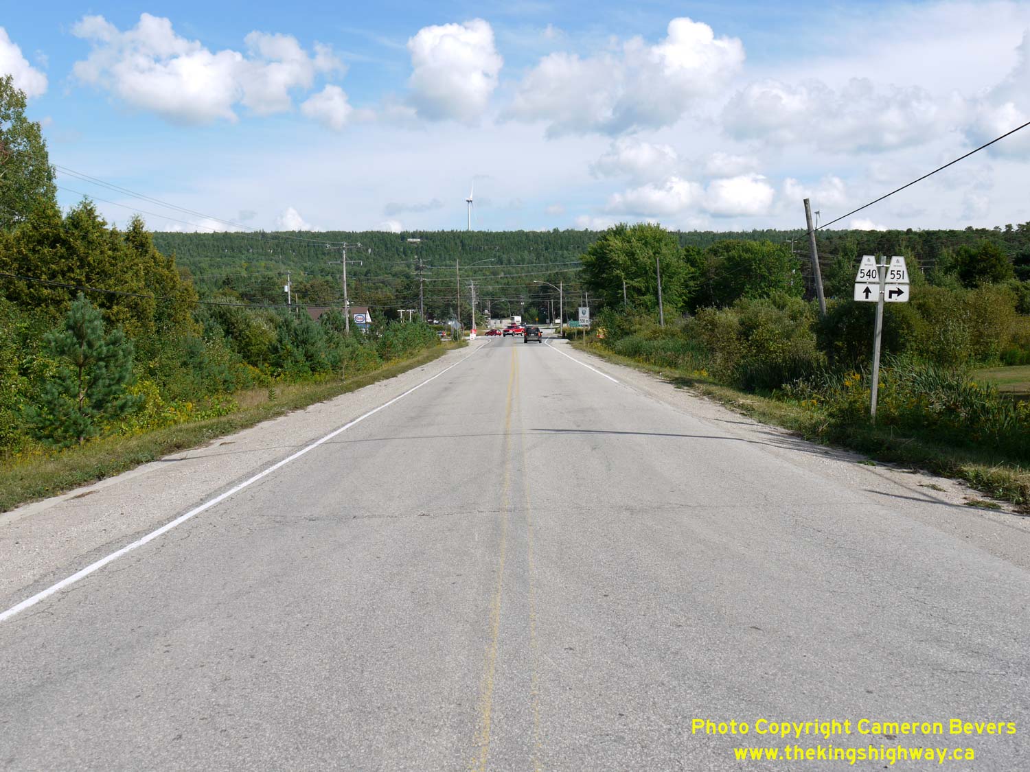
Left - Approaching the Hwy 551 Junction on Hwy 540 in M'Chigeeng, facing east. See an
Enlarged Photo here. (Photograph taken on August 15, 2016 - © Cameron Bevers) Right - Facing west along Hwy 540 towards Gore Bay from the Hwy 551 Junction in M'Chigeeng. See an Enlarged Photo here. (Photograph taken on August 15, 2016 - © Cameron Bevers) 

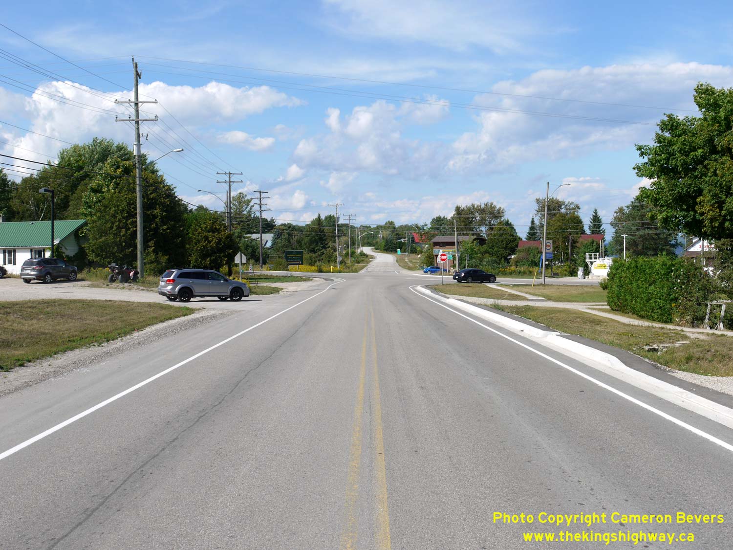
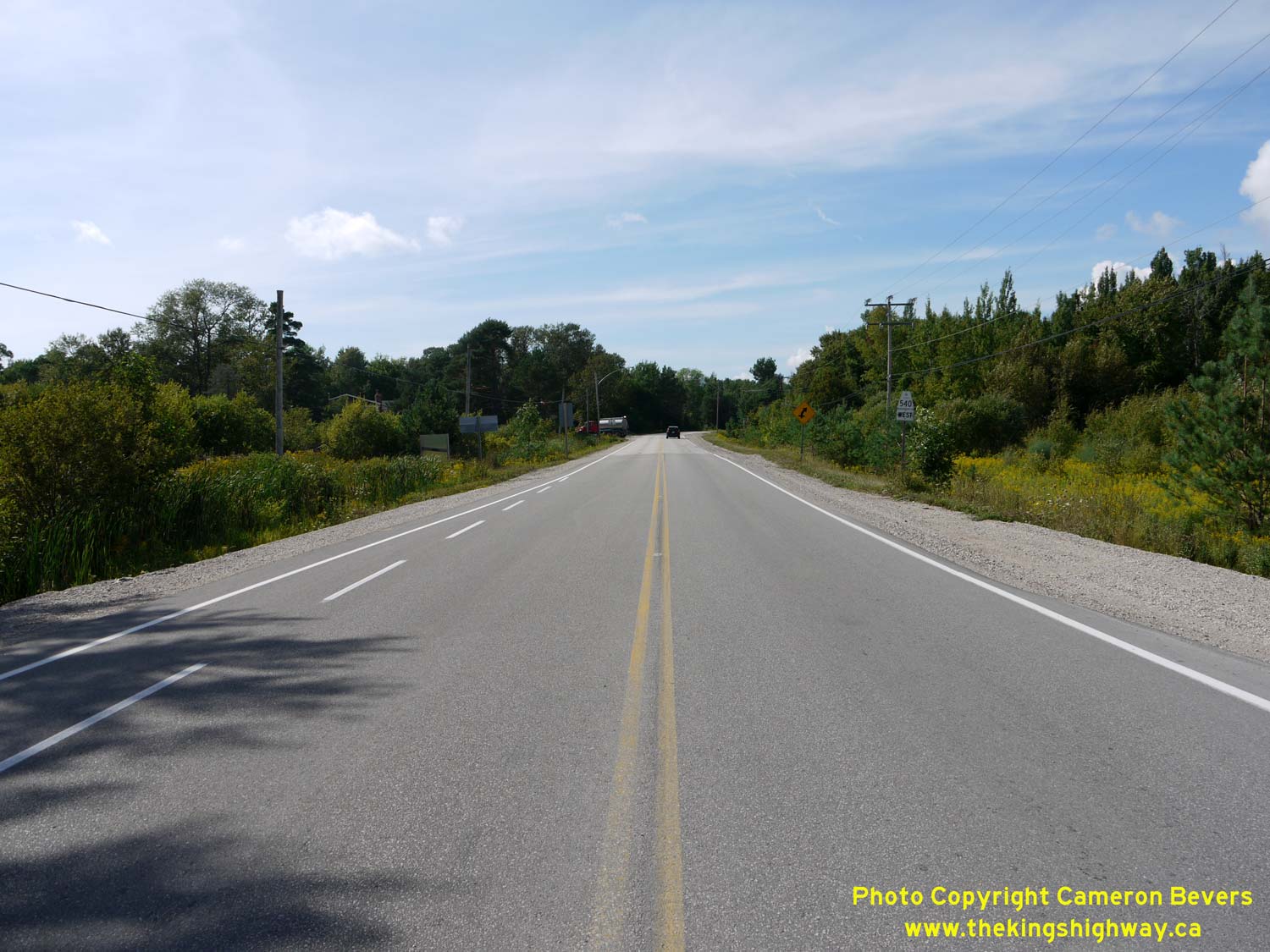
Left - Approaching M'Chigeeng on Hwy 540, facing east towards Little Current. See an
Enlarged Photo here. (Photograph taken on August 15, 2016 - © Cameron Bevers) Right - Distance guide sign on westbound Hwy 540 departing M'Chigeeng. See an Enlarged Photo here. (Photograph taken on August 15, 2016 - © Cameron Bevers) 

Left - Bridal Veil Falls on Hwy 540 in Kagawong, located 44 km west of Little Current. See an
Enlarged Photo here. (Photograph taken on July 2, 2005 - © Cameron Bevers) Right - Facing west towards Gore Bay across the Ice Lake Causeway on Hwy 540. This massive causeway was built in 1975-1976 in an effort to improve the highway alignment. The original highway route had several bad curves on it, including one curve with a severe deflection angle of about 120 degrees and a radius of approximately 30 metres. See an Enlarged Photo here. (Photograph taken on July 2, 2005 - © Cameron Bevers) 

Left - This abandoned section of Hwy 540 lies behind a fence near the Ice Lake Causeway. This old section of Hwy 540 was bypassed once the new causeway was
completed and opened to traffic in the mid-1970s. This former highway alignment was legally closed to traffic in 1978. See an
Enlarged Photo here. (Photograph taken on July 2, 2005 - © Cameron Bevers) Right - Facing east towards Little Current across the Ice Lake Causeway on Hwy 540. The causeway is about 400 metres in length. The long sweeping curve across the causeway is not only aesthetically pleasing, it also offers a much safer highway alignment than the old, crooked highway which once followed the lakeshore. See an Enlarged Photo here. (Photograph taken on July 2, 2005 - © Cameron Bevers) 

Left - Abandoned section of Hwy 540 west of Ice Lake. Prior to the mid-1970s, the highway followed the edge of the lake. The original highway had several sharp
curves in it, which were all removed when a new diversion and causeway were built across Ice Lake. See an
Enlarged Photo here. (Photograph taken on July 2, 2005 - © Cameron Bevers) Right - Another view of the abandoned section of Hwy 540 at Ice Lake. Traces of the old highway centreline can still be seen in this photo. See an Enlarged Photo here. (Photograph taken on July 2, 2005 - © Cameron Bevers) 

Left - Facing east along Hwy 540 from the Hwy 540B & Hwy 542 Junction in Gore Bay. See an
Enlarged Photo here. (Photograph taken on July 2, 2005 - © Cameron Bevers) Right - Junction assembly on southbound Hwy 540B approaching the Hwy 540 & Hwy 542 Junction in Gore Bay. Interestingly, Hwy 542 is not indicated on this sign assembly, even though Hwy 540B ends only a few hundred metres to the south. See an Enlarged Photo here. (Photograph taken on July 2, 2005 - © Cameron Bevers) 

Left - Facing west along Hwy 540 at the Hwy 540B & Hwy 542 Junction in Gore Bay. Hwy 542 begins at this intersection at left and heads southeast across
Manitoulin Island to Mindemoya. Ultimately, Hwy 542 connects to Hwy 6 near South Baymouth. Hwy 540 continues straight ahead towards Meldrum Bay, while the eastern leg
of Hwy 540B begins its loop through Gore Bay at right. Hwy 540B connects back to Hwy 540 about 1 km ahead, just west of Gore Bay. See an
Enlarged Photo here. (Photograph taken on July 2, 2005 - © Cameron Bevers) Right - Junction assembly at the Hwy 540, Hwy 540B & Hwy 542 Junction in Gore Bay. Hwy 542 reaches its western terminus at this intersection, but the road continues straight ahead into Gore Bay as Hwy 540B. Manitoulin Island's main east-west highway, Hwy 540, is the through highway at this intersection. Hwy 540 connects Little Current to Meldrum Bay. See an Enlarged Photo here. (Photograph taken on July 2, 2005 - © Cameron Bevers) 

Left - Facing north along Hwy 540B from the Hwy 540 & Hwy 542 Junction. Gore Bay's town centre lies about 2 km north of Hwy 540. See an
Enlarged Photo here. (Photograph taken on July 2, 2005 - © Cameron Bevers) Right - Junction assembly on westbound Hwy 542 approaching the Hwy 540 & Hwy 540B Junction in Gore Bay. See an Enlarged Photo here. (Photograph taken on July 2, 2005 - © Cameron Bevers) 

Left - Junction assembly at the Hwy 540, Hwy 540B & Hwy 542 Junction in Gore Bay, facing southbound traffic. See an
Enlarged Photo here. (Photograph taken on July 2, 2005 - © Cameron Bevers) Right - Approaching the Hwy 540, Hwy 540B & Hwy 542 Junction in Gore Bay, facing east towards Little Current. See an Enlarged Photo here. (Photograph taken on July 2, 2005 - © Cameron Bevers) 

Left - Facing west along Hwy 540 from the Hwy 540B Junction west of Gore Bay. See an
Enlarged Photo here. (Photograph taken on July 2, 2005 - © Cameron Bevers) Right - Junction assembly at the Hwy 540 & Hwy 540B Junction west of Gore Bay, facing southbound traffic. See an Enlarged Photo here. (Photograph taken on July 2, 2005 - © Cameron Bevers) 

Left - Facing east along Hwy 540 towards Little Current from the Hwy 540B Junction west of Gore Bay. See an
Enlarged Photo here. (Photograph taken on July 2, 2005 - © Cameron Bevers) Right - Facing north along Hwy 540B towards Gore Bay from the western Hwy 540 Junction. See an Enlarged Photo here. (Photograph taken on July 2, 2005 - © Cameron Bevers) 

Left - Eastern terminus of Hwy 540A at the Hwy 540 Junction west of Gore Bay. Hwy 540A is a short spur highway which leads to Barrie Island. See an
Enlarged Photo here. (Photograph taken on July 2, 2005 - © Cameron Bevers) Right - Approaching the Hwy 540A Junction on Hwy 540, facing east towards Gore Bay. At the intersection, Hwy 540A turns to the left, while Hwy 540 turns to the right. See an Enlarged Photo here. (Photograph taken on July 2, 2005 - © Cameron Bevers) 
Above - Great Spirit Circle Trail route marker on Hwy 540 at the Hwy 540A Junction west of Gore Bay. See an
Enlarged Photo here. (Photograph taken on July 2, 2005 - © Cameron Bevers) 

Left - Facing west along Hwy 540 towards Meldrum Bay from the Hwy 540A Junction west of Gore Bay. Note the oversized westbound Hwy 540 route marker, which was
placed there presumably to serve as additional guidance for motorists. Given the geometry of the intersection of Hwy 540 & Hwy 540A, it would be easy for
westbound motorists on Hwy 540 to mistakenly believe that Hwy 540A is actually the through highway. Hwy 540A reaches a dead-end on Barrie Island about 5 km away. See
an Enlarged Photo here. (Photograph taken on July 2, 2005 - © Cameron Bevers) Right - Facing east along Hwy 540 towards Gore Bay from the Indian Point Bridge. This bridge is situated on a causeway between the North Channel (Lake Huron) and Lake Wolsey, about 15 km west of Gore Bay. See an Enlarged Photo here. (Photograph taken on July 2, 2005 - © Cameron Bevers) 

Left - Side view of the Indian Point Bridge on Hwy 540. This single-span steel beam structure was completed in 1983. This structure replaced a one-lane Bailey
Bridge which had been installed on this causeway in 1960. See an Enlarged Photo here. (Photograph taken on July 2, 2005 - © Cameron Bevers) Right - Date stamp (1983) and structure identification number on the Indian Point Bridge on Hwy 540. See an Enlarged Photo here. (Photograph taken on July 2, 2005 - © Cameron Bevers) 

Left - Facing west along Hwy 540 towards Meldrum Bay from the Indian Point Bridge. See an
Enlarged Photo here. (Photograph taken on July 2, 2005 - © Cameron Bevers) Right - View of Hwy 540 looking east, about 24 km west of Gore Bay. See an Enlarged Photo here. (Photograph taken on July 2, 2005 - © Cameron Bevers) 

Left - Scenic view of Meldrum Bay, as Hwy 540 approaches its western terminus. See an
Enlarged Photo here. (Photograph taken on July 2, 2005 - © Cameron Bevers) Right - Facing west along Hwy 540 approaching Meldrum Bay. See an Enlarged Photo here. (Photograph taken on July 2, 2005 - © Cameron Bevers) 

Left - Facing east along Hwy 540 towards Gore Bay from the highway's western terminus at Meldrum Bay. See an
Enlarged Photo here. (Photograph taken on July 2, 2005 - © Cameron Bevers) Right - Western terminus of Hwy 540 at Meldrum Bay. Although the provincial highway ends, the road continues as a municipal road (Water Street). See an Enlarged Photo here. (Photograph taken on July 2, 2005 - © Cameron Bevers) 

Left - Sign marking the western terminus of Hwy 540 at Meldrum Bay. See an
Enlarged Photo here. (Photograph taken on July 2, 2005 - © Cameron Bevers) Right - A piece of historical oil company memorabilia still stands at the western terminus of Hwy 540 in Meldrum Bay. This Shell sign likely dates from the 1960s. See an Enlarged Photo here. (Photograph taken on July 2, 2005 - © Cameron Bevers)
More Secondary Highway 540 Photographs Coming Soon!
|
|---|
Links to Adjacent Highway Photograph Pages:
Back to Secondary Highway 535 Photos /
Secondary Highway 540 History /
On to Secondary Highway 541 Photos
Ontario Highway History - Main Menu / Back to List of Highways / Main Photograph Index Page Website contents, photos & text © 2002-2026, Cameron
Bevers (Webmaster) - All Rights Reserved / Contact Me
|
|---|