
| 
| |
|
|
This page contains historical photos of Ontario's King's Highway 55 (#2), which ran from Homer to Niagara-on-the-Lake. All
photographs displayed on this page were taken by the Ontario Ministry of Transportation, unless specifically noted otherwise. Historical photographs are arranged in
approximate chronological order. Click on any thumbnail to see a larger image!
Please note that all photographs displayed on this
website are protected by copyright. These photographs must not be reproduced, published,
electronically stored or copied, distributed, or posted onto other websites without
my written permission. If you want to use photos from this website, please
email me first for permission. Thank-you!
|
|---|
|
Historical King's Highway 55 (#2) Photographs


Left - Queen Elizabeth Way approaching Glendale Avenue and the Garden City Skyway Toll Plaza
near St. Catharines in 1964. The Glendale Avenue Interchange was essentially a double-interchange. It provided full access between adjacent Hwy 8 and the Queen
Elizabeth Way. When the Garden City Skyway first opened to traffic in 1963, it was a toll bridge. The Garden City Skyway Toll Plaza seen in the background was removed
after tolls were lifted from the skyway in 1973. Fluorescent tube highway luminaires were installed along this section of the Queen Elizabeth Way as part of the
Garden City Skyway and Hwy 405 construction. This was one of only two sections along the Queen Elizabeth Way where a fluorescent tube highway illumination system was
used. The other section where fluorescent tube highway lighting was used was on the approaches to the Burlington Bay Skyway. The fluorescent tube lighting system at
the Garden City Skyway was eventually switched over to a high-pressure sodium (HPS) illumination system in the mid-1980s. See an
Enlarged Photo here. Photo taken in May, 1964. (Photo courtesy of Ontario Ministry of Transportation - © King's Printer for Ontario, 2014) Right - Facing south across the Glendale Avenue Overpass on the Queen Elizabeth Way near St. Catharines in 1964. Note how rural the area around the Glendale Avenue Interchange was at that time, compared to what it looks like today. Substantial development has occurred around this interchange in recent years. Note the Hwy 8 and "To Hwy 8A" route markers mounted on the median island, facing traffic exiting from the Toronto-bound Queen Elizabeth Way. Until Hwy 405 was completed and opened to traffic in September, 1963, Hwy 8A formed the only provincial highway link to the Queenston International Bridge. See an Enlarged Photo here. Photo taken in May, 1964. (Photo courtesy of Ontario Ministry of Transportation - © King's Printer for Ontario, 2014) 

Left - Facing east along Hwy 8 at the Glendale Avenue and Queen Elizabeth Way Interchange near
St. Catharines in 1964. This rather strange interchange was completed in 1962 and remained in service until the 1990s. When York Road (Former Hwy 8) was relocated onto a new
alignment in the late 1990s, it essentially made this interchange redundant and was subsequently closed. See an
Enlarged Photo here. Photo taken in May, 1964. (Photo courtesy of Ontario Ministry of Transportation - © King's Printer for Ontario, 2014) Right - Facing south across the Hwy 8 Underpass at the Queen Elizabeth Way and Glendale Avenue Interchange near St. Catharines in 1964. Now demolished, this interchange used to exist immediately north of the Queen Elizabeth Way. It provided access to Hwy 8 from Glendale Avenue and adjacent Queen Elizabeth Way. The interchange became redundant in the 1990s when Glendale Avenue was extended north to meet a realigned York Road (Former Hwy 8). The ramps and abandoned underpass stood for several years, before they were demolished. See an Enlarged Photo here. Photo taken in May, 1964. (Photo courtesy of Ontario Ministry of Transportation - © King's Printer for Ontario, 2014) 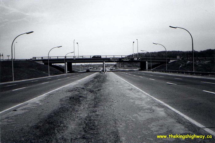
Above - Approaching the Glendale Avenue Interchange on the Queen Elizabeth Way near Niagara Falls in 1977. Note the fluorescent tube highway
luminaires that were installed on this section of the QEW when it was rebuilt in the early 1960s, in conjunction with the Garden City Skyway and Hwy 405
construction. The original fluorescent tube lighting system was replaced with high-pressure sodium (HPS) lenses in the mid-1980s. Photo taken on April 28,
1977. (Photo courtesy of Ontario Ministry of Transportation - © King's Printer for Ontario, 2011) 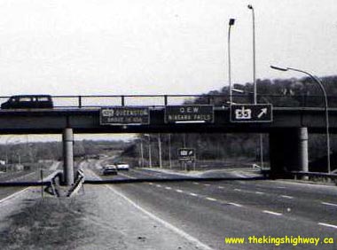
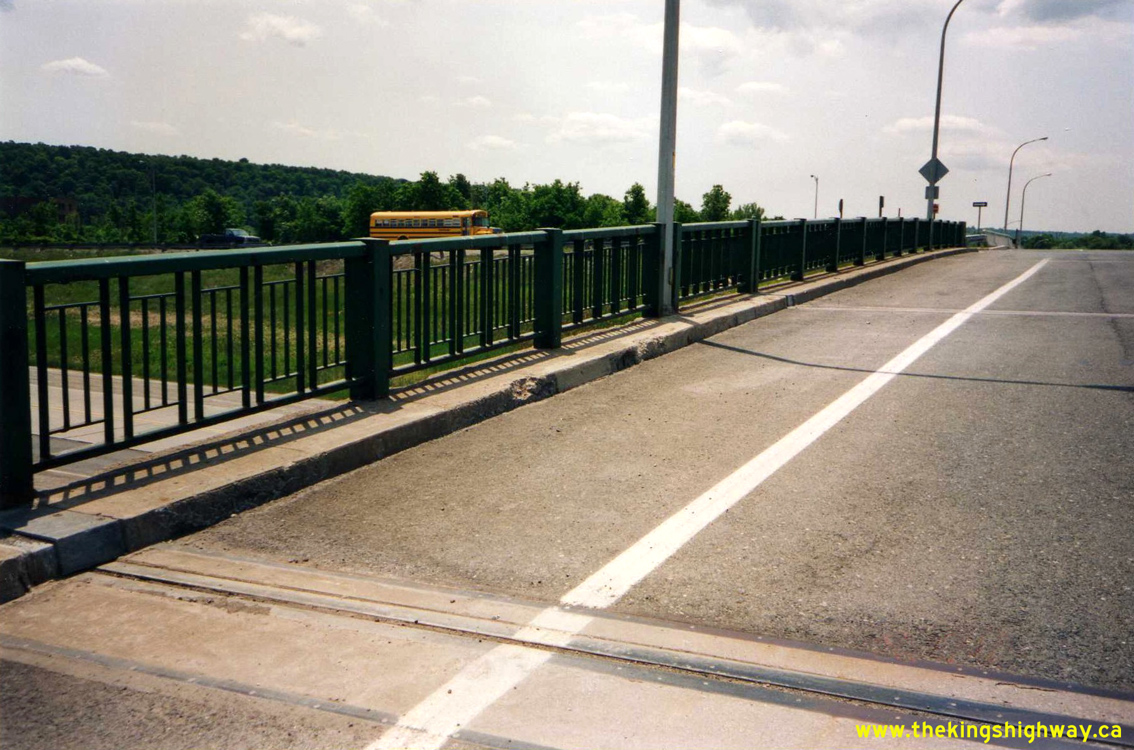
Left - Close-up view of the bridge-mounted guide signs on the Glendale Avenue Overpass on the Queen Elizabeth Way. This interchange provided access
between the QEW and Hwy 55, a route leading to nearby Niagara-on-the-Lake. The Glendale Avenue Interchange was signed as Hwy 55 until 1997, when the
highway was downloaded. However, the provincially-owned section of Hwy 55 actually began 2 km away in Homer, below the Garden City Skyway. Photo taken on
April 28, 1977. (Photo courtesy of Ontario Ministry of Transportation - © King's Printer for Ontario, 2011) Right - Facing north across the Glendale Avenue Overpass on the Queen Elizabeth Way near Niagara Falls (April 28, 1977) (Photo courtesy of Ontario Ministry of Transportation - © King's Printer for Ontario, 2011) 
Above - Glendale Avenue Interchange on Old Hwy 8 (Niagara Road 81) and the Queen Elizabeth Way, facing west towards St. Catharines (November 3, 1981) (Photo courtesy of Ontario Ministry of Transportation - © King's Printer for Ontario, 2012) 
Above - Facing north along Glendale Avenue from the Queen Elizabeth Way towards the Old Hwy 8 (Niagara Road 81) Interchange near St. Catharines (November 3, 1981) (Photo courtesy of Ontario Ministry of Transportation - © King's Printer for Ontario, 2012) 

Left - Facing south across the Glendale Avenue Overpass on the Queen Elizabeth Way near St. Catharines (October 14, 1982) (Photo courtesy of Ontario Ministry of Transportation - © King's Printer for Ontario, 2012) Right - Facing north across the Glendale Avenue Overpass on the Queen Elizabeth Way near St. Catharines (October 14, 1982) (Photo courtesy of Ontario Ministry of Transportation - © King's Printer for Ontario, 2012) 

Left - Facing north along Glendale Avenue from the Queen Elizabeth Way at the Old Hwy 8 (Niagara Road 81) Interchange near St. Catharines (October 18, 1983) (Photo courtesy of Ontario Ministry of Transportation - © King's Printer for Ontario, 2012) Right - Rehabilitation of the Old Hwy 8 Overpass on the Queen Elizabeth Way near St. Catharines (September 7, 1984) (Photo courtesy of Ontario Ministry of Transportation - © King's Printer for Ontario, 2012) 

Left - Glendale Avenue Overpass on the Queen Elizabeth Way near St. Catharines, facing south (September 17, 1984) (Photo courtesy of Ontario Ministry of Transportation - © King's Printer for Ontario, 2012) Right - Facing north across the Old Hwy 8 Overpass on the Queen Elizabeth Way in St. Catharines (June 2, 1987) (Photo courtesy of Ontario Ministry of Transportation - © King's Printer for Ontario, 2012) 

Left - Facing east along the Queen Elizabeth Way towards the Hwy 405 Interchange, from the Glendale Avenue Overpass (June 2, 1987) (Photo courtesy of Ontario Ministry of Transportation - © King's Printer for Ontario, 2012) Right - Facing north across the Glendale Avenue Overpass on the Queen Elizabeth Way. Note that the fluorescent tube lighting system has been replaced with a high-pressure sodium (HPS) lighting system. Photo taken on August 16, 1989. (Photo courtesy of Ontario Ministry of Transportation - © King's Printer for Ontario, 2012) 

Left - Glendale Avenue Interchange on Old Hwy 8 (Niagara Regional Road 81) and the Queen Elizabeth Way, facing west towards St. Catharines in 1990. Historically,
traffic bound for Niagara-on-the-Lake via Hwy 55 had to utilize this interchange from the adjacent Queen Elizabeth Way. Although Niagara Regional Road 81 was never
officially designated as a part of Hwy 55, there is an overhead pull-through sign guiding motorists to the beginning of Hwy 55 on the opposite side of the bridge. See
an Enlarged Photo Here. Photo taken on August 14, 1990. (Photo courtesy of Ontario Ministry of Transportation - © King's Printer for Ontario, 2012) Right - Facing south along Glendale Avenue from the Old Hwy 8 (Niagara Regional Road 81) Interchange near St. Catharines in 1990. This strange interchange was built under Contract #1961-171 in order to provide a connection between Glendale Avenue, Hwy 8 and the Queen Elizabeth Way. The new interchange was completed in 1962. While an interchange with the Queen Elizabeth Way still exists today, the old interchange ramps connecting Glendale Avenue to Old Hwy 8 were closed off years ago after Glendale Avenue was extended north. The structure seen here (Site #18-164) has since been demolished. See an Enlarged Photo Here. Photo taken on August 14, 1990. (Photo courtesy of Ontario Ministry of Transportation - © King's Printer for Ontario, 2012) 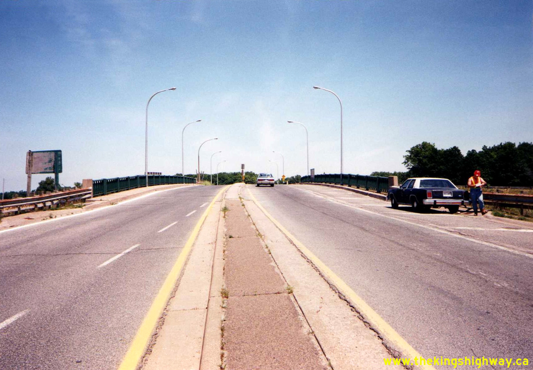

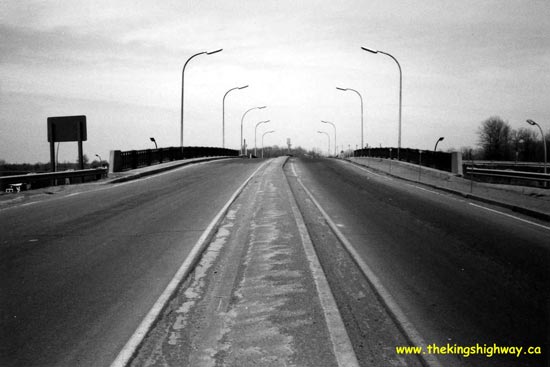
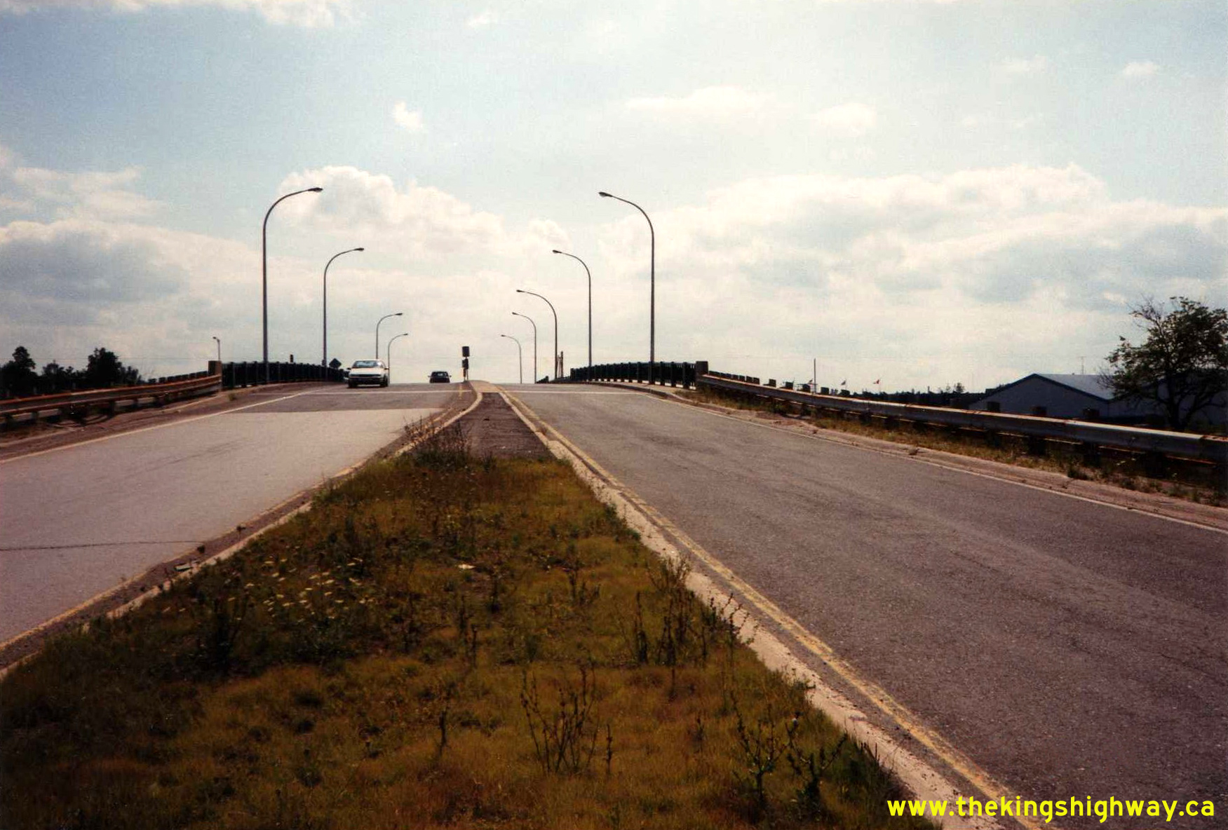
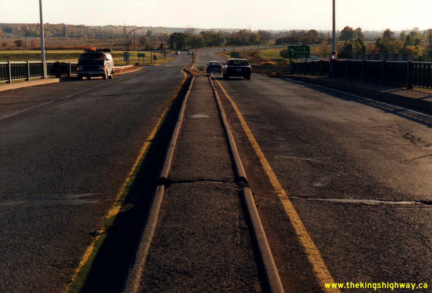
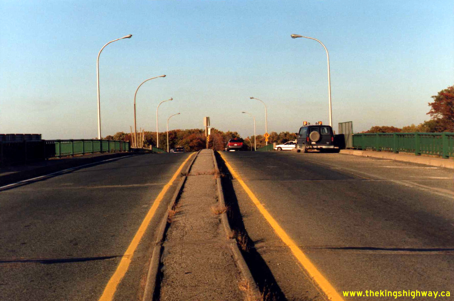
Left - Facing north across the Glendale Avenue Overpass (Site #18-161) on the Queen Elizabeth Way. See an
Enlarged Photo Here. Photo taken on June 20, 1991. (Photo courtesy of Ontario Ministry of Transportation - © King's Printer for Ontario, 2012) Right - Glendale Avenue Interchange at the Queen Elizabeth Way and Old Hwy 8 (Niagara Regional Road 81) near St. Catharines, facing north. The structure in the foreground (Site #18-161) carries Glendale Avenue over the Queen Elizabeth Way, while the structure in the background (Site #18-164) carries Glendale Avenue over Niagara Regional Road 81 (Old Hwy 8). See an Enlarged Photo Here. Photo taken on June 20, 1991. (Photo courtesy of Ontario Ministry of Transportation - © King's Printer for Ontario, 2012) 

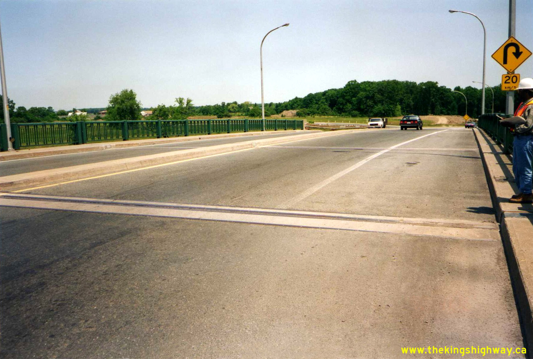
Left - Eastern side of the Glendale Avenue Interchange on the Queen Elizabeth Way, facing west towards St. Catharines. See an
Enlarged Photo Here. Photo taken on June 20, 1991. (Photo courtesy of Ontario Ministry of Transportation - © King's Printer for Ontario, 2012) Right - Bridge-mounted overhead guide signs for Hwy 405 and Hwy 55 on the Queen Elizabeth Way at the Glendale Avenue Interchange near St. Catharines in 1991. In addition to the turn-off exit guide sign for Hwy 55, an advance diagrammatic sign illustrates the lane configuration at the upcoming Hwy 405 Interchange. See an Enlarged Photo Here. Photo taken on October 18, 1991. (Photo courtesy of Ontario Ministry of Transportation - © King's Printer for Ontario, 2012) 

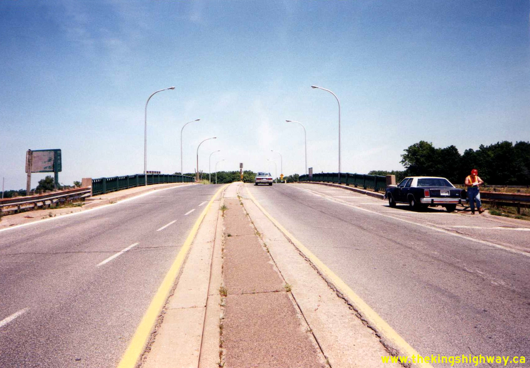
Left - Facing south along Glendale Avenue from the Queen Elizabeth Way Interchange near St. Catharines. See an
Enlarged Photo Here. Photo taken on October 18, 1991. (Photo courtesy of Ontario Ministry of Transportation - © King's Printer for Ontario, 2012) Right - Glendale Avenue Overpass on the Queen Elizabeth Way, facing north towards Niagara-on-the-Lake. See an Enlarged Photo Here. Photo taken on October 18, 1991. (Photo courtesy of Ontario Ministry of Transportation - © King's Printer for Ontario, 2012) 
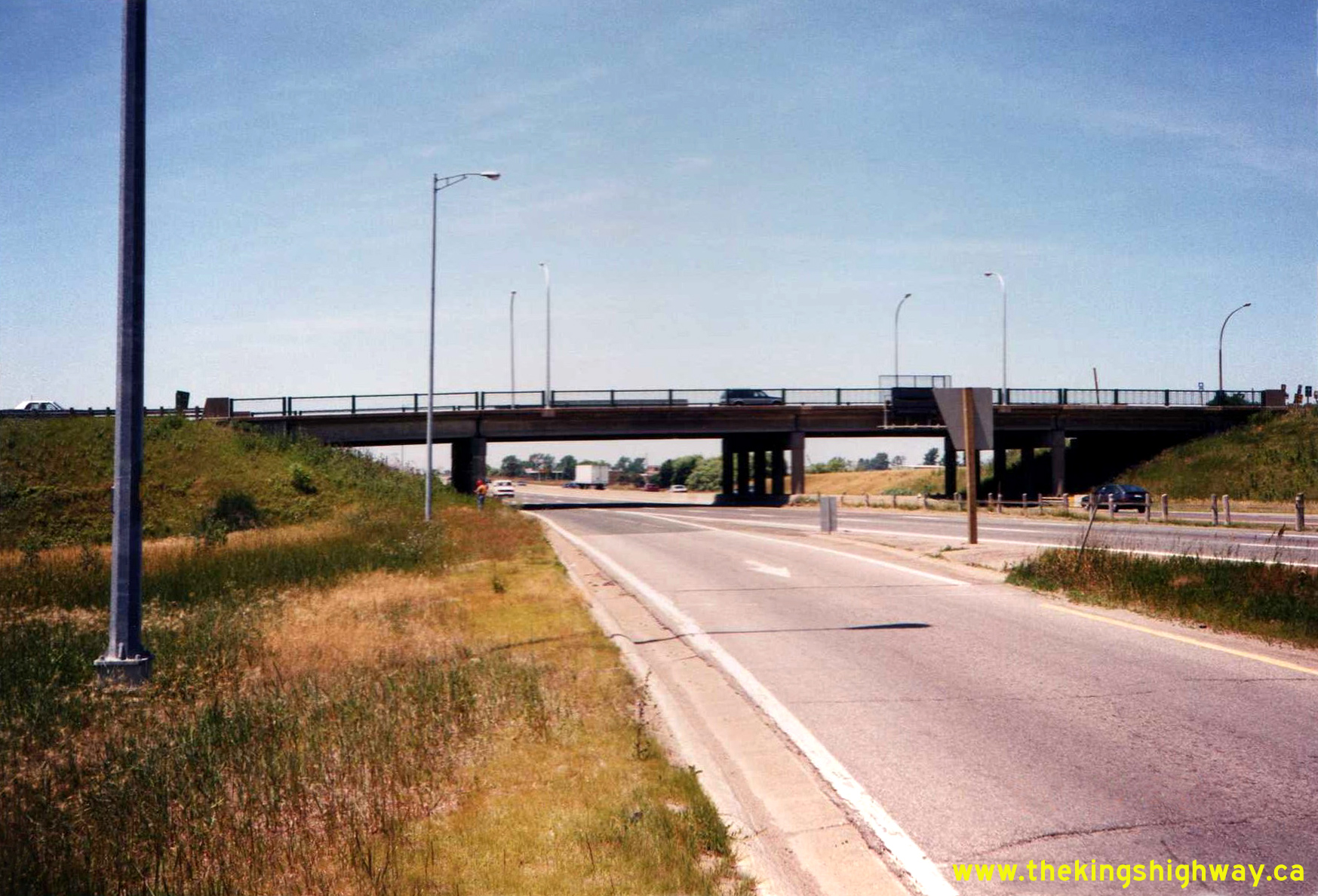
Left - Facing north along Glendale Avenue from the Queen Elizabeth Way towards the Old Hwy 8 (Niagara Regional Road 81) Interchange near St. Catharines in
1994. Traffic wishing to access Hwy 55 had to loop around to access Old Hwy 8 below this structure and then double-back towards Homer to continue north on Hwy 55
towards Niagara-on-the-Lake. In the late 1990s, the interchange seen here was closed off. Glendale Avenue was extended northwards towards the woodlot seen in the
background of this photo, where it met a relocated Niagara Regional Road 81. Although it was no longer in use, the closed interchange at Old Hwy 8 was left in place
until 2006-2007, when it was finally removed altogether. See an Enlarged Photo Here. Photo
taken on June 15, 1994. Right - Facing south along Glendale Avenue towards the Queen Elizabeth Way from the Old Hwy 8 (Niagara Regional Road 81) Overpass near St. Catharines in 1994. The Old Hwy 8 and Queen Elizabeth Way Interchanges on Glendale Avenue were situated immediately adjacent to each other. See an Enlarged Photo Here. Photo taken on June 15, 1994. (Photo courtesy of Ontario Ministry of Transportation - © King's Printer for Ontario, 2012) 

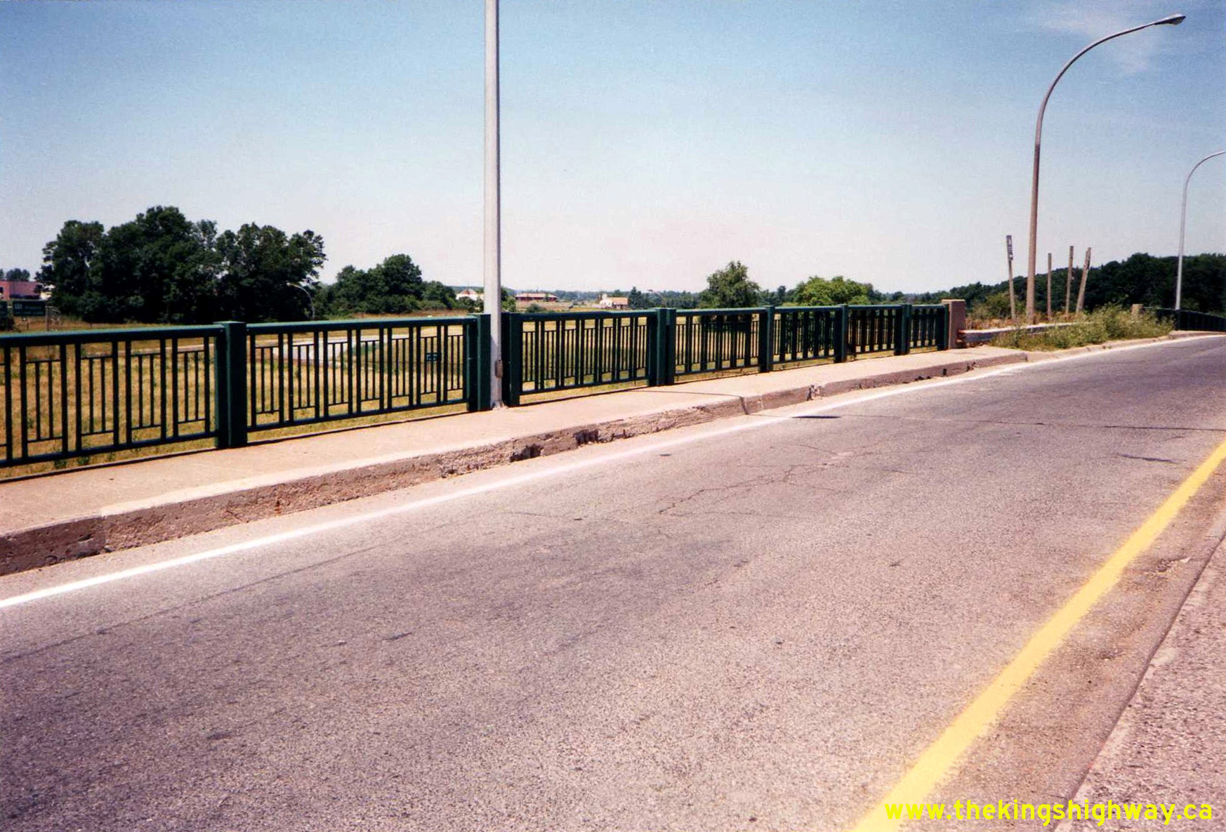
Left - Facing south across the Glendale Avenue Overpass on the Queen Elizabeth Way Interchange near St. Catharines (May 18, 1995) (Photo courtesy of Ontario Ministry of Transportation - © King's Printer for Ontario, 2012) Right - An early changeable message sign on the Queen Elizabeth Way at the Glendale Avenue Interchange near St. Catharines (May 21, 1997) (Photo courtesy of Ontario Ministry of Transportation - © King's Printer for Ontario, 2012) 
Above - Facing south along Glendale Avenue at the Queen Elizabeth Way Interchange near St. Catharines in 1999. Compare this photo to the
1991 Photo above, which illustrates the rather dramatic development
that has taken place south of the interchange during the 1990s. Photo taken on July 12, 1999. (Photo courtesy of Ontario Ministry of Transportation - © King's Printer for Ontario, 2012)
More King's Highway 55 (#2) Photographs Coming Soon!
|
|---|
Links to Adjacent King's Highway Photograph Pages:
Back to King's Highway 55 (#1) Photos /
King's Highway 55 (#2) History /
On to King's Highway 56 Photos
Ontario Highway History - Main Menu / Back to List of Highways Website contents, photos & text © 2002-2026, Cameron
Bevers (Webmaster) - All Rights Reserved / Contact Me
|
|---|