
| 
| |
|
|
This page contains historical and present day photos of Ontario's King's Highway 56. All photographs displayed on this page
were taken by the Webmaster (Cameron Bevers), unless specifically noted otherwise. Historical photographs are arranged in approximate chronological order, while
present day photographs (Year 2000 to date) are arranged by location from south to north. Click on any thumbnail to see a larger image!
Please note that all photographs displayed on this
website are protected by copyright. These photographs must not be reproduced, published,
electronically stored or copied, distributed, or posted onto other websites without
my written permission. If you want to use photos from this website, please
email me first for permission. Thank-you!
|
|---|
|
Historical King's Highway 56 Photographs


Left - Facing north along Hwy 56 towards Hamilton from the Hwy 3 Junction between Cayuga and Canfield. See an
Enlarged Photo Here. Photo taken on March 12, 1982. (Photo courtesy of Ontario Ministry of Transportation - © King's Printer for Ontario, 2023) Right - Facing west along Hwy 3 towards Cayuga from the Hwy 56 Junction near Canfield. See an Enlarged Photo Here. Photo taken on March 12, 1982. (Photo courtesy of Ontario Ministry of Transportation - © King's Printer for Ontario, 2023) 

Left - Junction of Hwy 3 & Hwy 56 near Canfield, facing north towards Hamilton. See an
Enlarged Photo Here. Photo taken on March 12, 1982. (Photo courtesy of Ontario Ministry of Transportation - © King's Printer for Ontario, 2023) Right - Facing east along Hwy 3 towards Canfield from the Hwy 56 Junction. See an Enlarged Photo Here. Photo taken on March 12, 1982. (Photo courtesy of Ontario Ministry of Transportation - © King's Printer for Ontario, 2023) |
|---|
|
Present Day King's Highway 56 Photographs
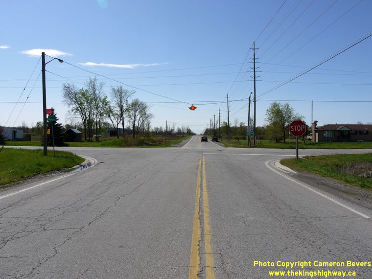
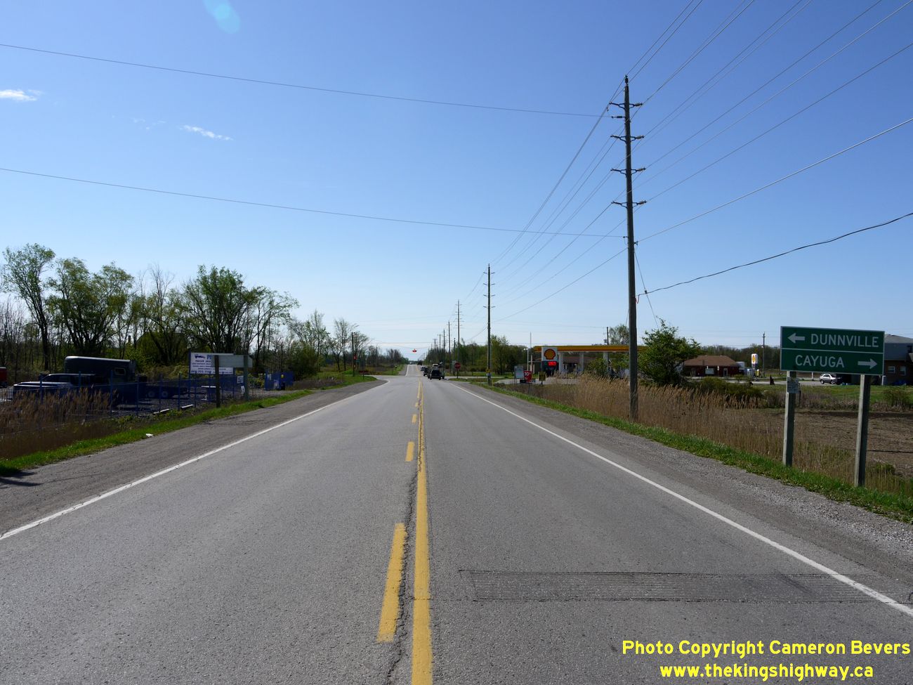
Left - Facing east along Hwy 3 towards Dunnville at the Hwy 56 Junction near Canfield. (Photograph taken on May 5, 2012 - © Cameron Bevers) Right - Facing west along Hwy 3 towards Cayuga from the Hwy 56 Junction near Canfield. (Photograph taken on May 5, 2012 - © Cameron Bevers) 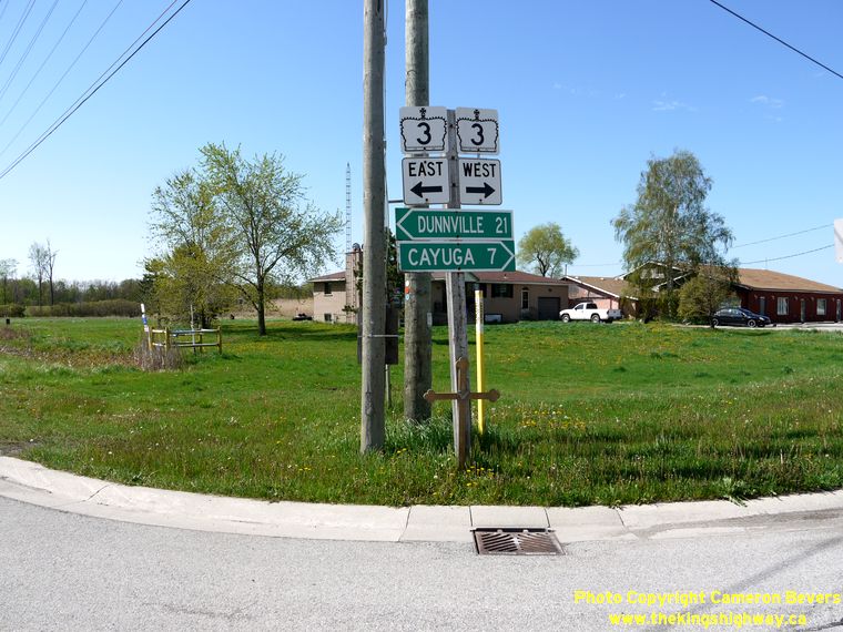
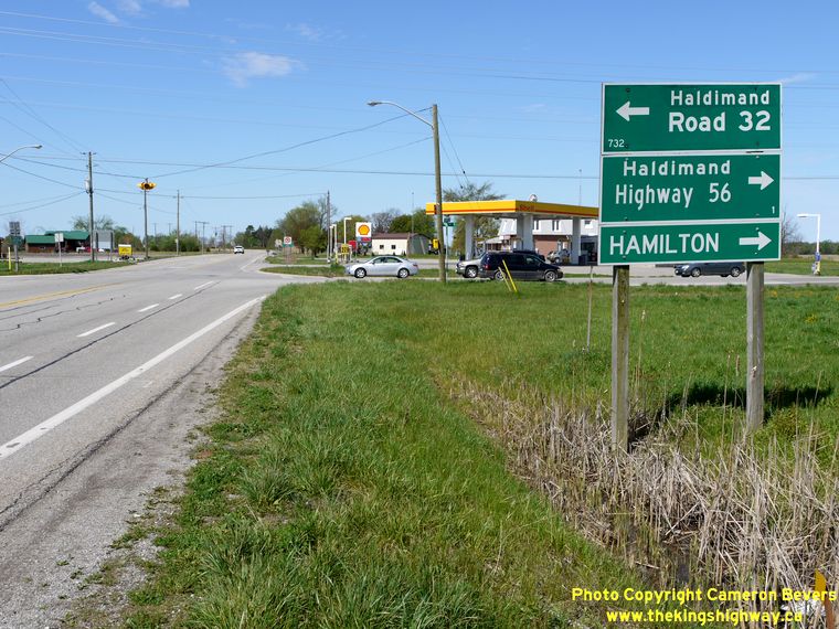
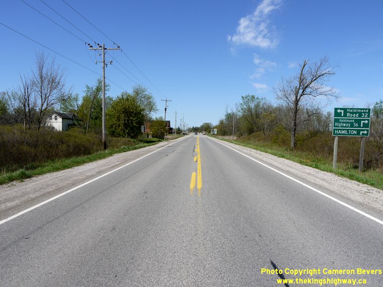
Left - Junction and destination signs at the Hwy 3 & Hwy 56 Junction west of Canfield. (Photograph taken on May 5, 2012 - © Cameron Bevers) Right - Southern terminus of Hwy 56 at the Hwy 3 Junction near Canfield. At this point, motorists can either follow Hwy 3 East to Dunnville or follow Hwy 3 West to Cayuga. Straight ahead, Haldimand Road 32 continues south for a few more kilometres before ending at the Grand River. (Photograph taken on May 5, 2012 - © Cameron Bevers) 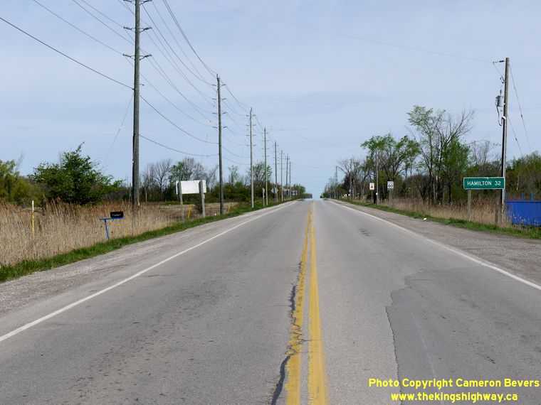

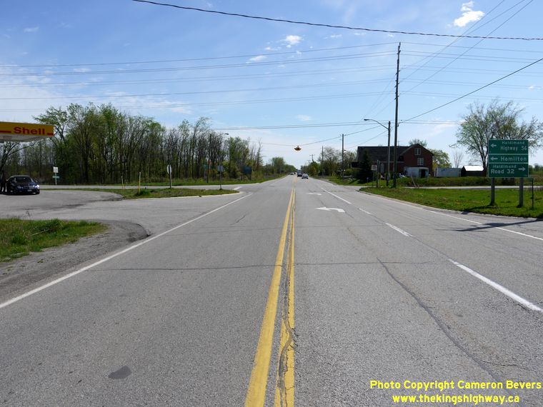
Left - Facing north along Hwy 56 towards Hamilton from the Hwy 3 Junction near Canfield. (Photograph taken on May 5, 2012 - © Cameron Bevers) Right - Guide signs approaching the Hwy 3 Junction on Southbound Hwy 56. See an Enlarged Photo Here. (Photograph taken on May 5, 2012 - © Cameron Bevers) 
Left - Facing west along Hwy 3 at the Hwy 56 Junction between Canfield and Cayuga. See an
Enlarged Photo Here. (Photograph taken on May 5, 2012 - © Cameron Bevers) Right - Guide signs marking the Hwy 56 Junction on Westbound Hwy 3. (Photograph taken on May 5, 2012 - © Cameron Bevers) 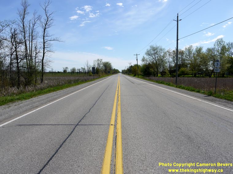
Left - Facing east along Hwy 3 towards Canfield from the Hwy 56 Junction. (Photograph taken on May 5, 2012 - © Cameron Bevers) Right - Approaching the Hwy 56 Junction on Hwy 3, facing west towards Cayuga. (Photograph taken on May 5, 2012 - © Cameron Bevers) 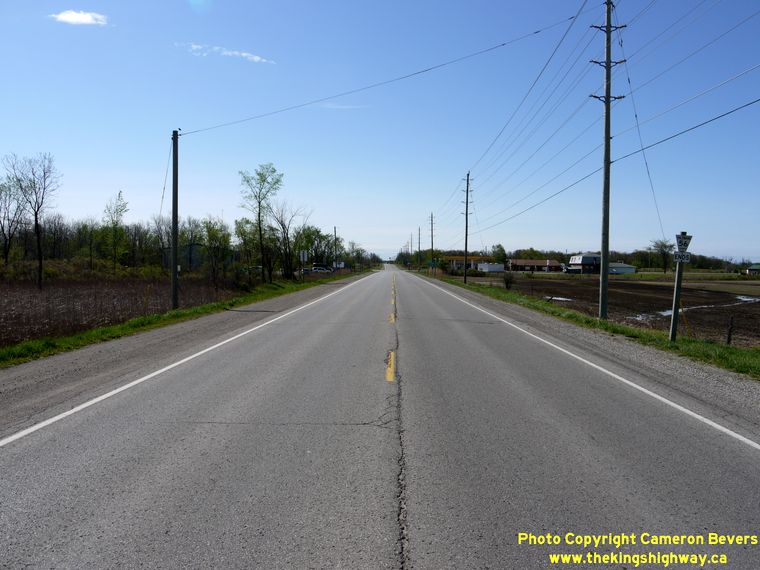

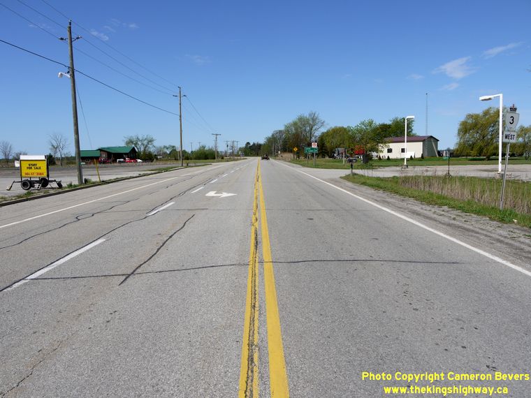
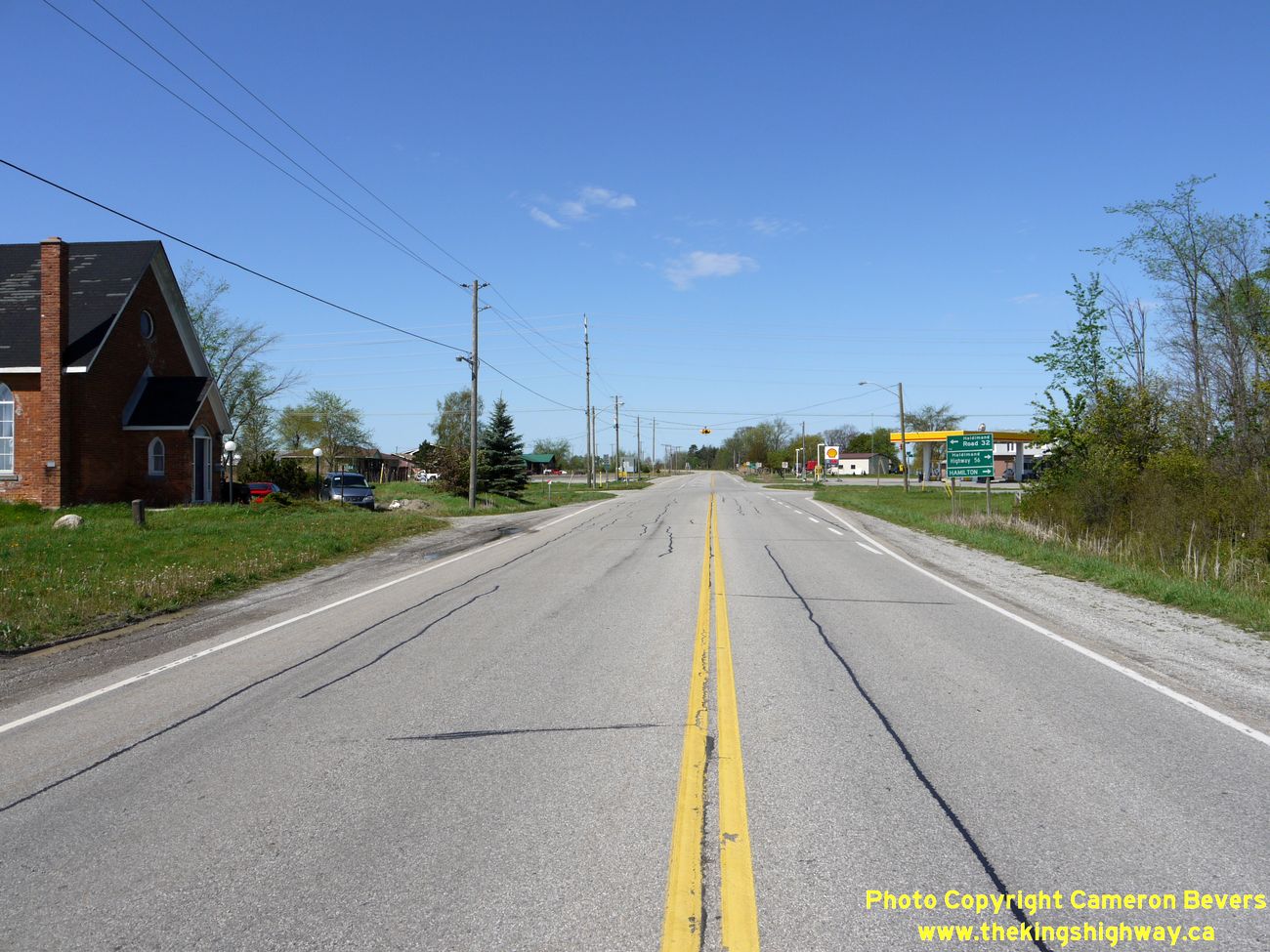
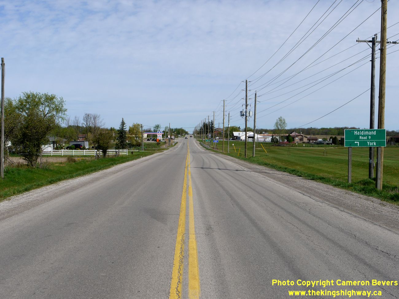
Left - Sign marking the end of Haldimand Highway 56 (Former Hwy 56) approaching the Hwy 3 Junction near Canfield. (Photograph taken on May 5, 2012 - © Cameron Bevers) Right - Facing north along Hwy 56 towards Hamilton at Empire Corners. See an Enlarged Photo Here. (Photograph taken on May 5, 2012 - © Cameron Bevers) 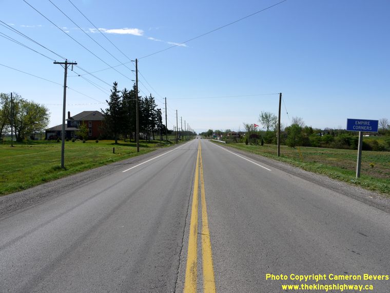
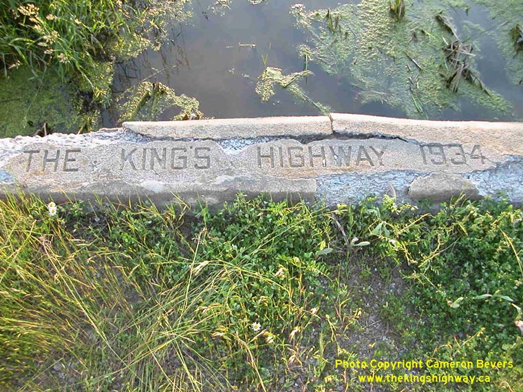
Left - Facing south along Hwy 56 approaching Empire Corners. (Photograph taken on May 5, 2012 - © Cameron Bevers) Right - Inscription on an old concrete culvert on an abandoned Hwy 56 alignment at Blackheath - "THE KING'S HIGHWAY 1934". (Photograph taken on June 22, 2003 - © Cameron Bevers) 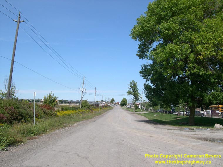
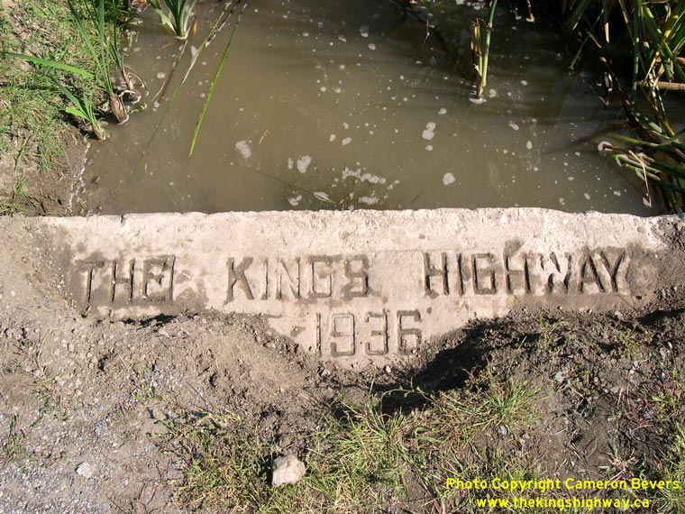
Left - Former Hwy 56 alignment at Elfrida, facing north towards Hwy 53. See an
Enlarged Photo Here. (Photograph taken on September 15, 2005 - © Cameron Bevers) Right - Inscription on an old concrete culvert on Swayze Road (Old Hwy 56) - "THE KING'S HIGHWAY 1936". (Photograph taken on September 15, 2005 - © Cameron Bevers) 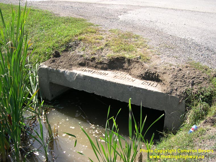
Above - Old concrete culvert on a former Hwy 56 alignment at Elfrida. (Photograph taken on September 15, 2005 - © Cameron Bevers)
More King's Highway 56 Photographs Coming Soon!
|
|---|
Links to Adjacent King's Highway Photograph Pages:
Back to King's Highway 55 Photos /
King's Highway 56 History /
On to King's Highway 57 Photos
Ontario Highway History - Main Menu / Back to List of Highways Website contents, photos & text © 2002-2026, Cameron
Bevers (Webmaster) - All Rights Reserved / Contact Me
|
|---|