
| 
| |
|
|
This page contains present day photos (Year 2010 to date) of Ontario's King's Highway 58, arranged by location from Allanburg
northerly to Thorold. All photographs displayed on this page were taken by the Webmaster (Cameron Bevers), unless specifically noted otherwise. Click on any
thumbnail to see a larger image!
Please note that all photographs displayed on this
website are protected by copyright. These photographs must not be reproduced, published,
electronically stored or copied, distributed, or posted onto other websites without
my written permission. If you want to use photos from this website, please
email me first for permission. Thank-you!
|
|---|
|
Page 4: Present Day King's Highway 58 Photographs (Allanburg to Thorold)
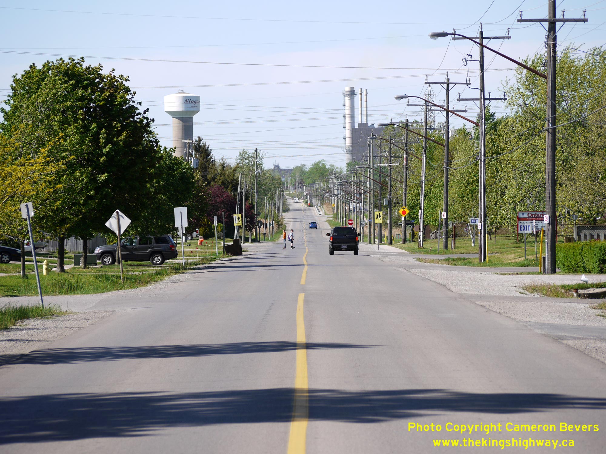
 Left - Facing north along Allanburg Road (Old Hwy 58) from Hodgkins Avenue. This former route of Hwy 58 through Thorold South was bypassed by a new highway on an improved alignment in the late 1960s as part of the construction of a new highway tunnel under the Welland Canal. Provincial jurisdiction over the Allanburg-Thorold Road began in 1930, when the province first assumed responsibility for the Allanburg Stone Road through Thorold South. See an Enlarged Photo Here. (Photograph taken on May 16, 2013 - © Cameron Bevers) Right - View of Old Hwy 58 (Allanburg Road) in Thorold South, facing north from Beaverdams Road. Prior to the completion of the Thorold Tunnel in 1968, Hwy 58 crossed the Welland Canal via an opening cantilever bridge. Motorists travelling between Allanburg and Thorold prior to 1968 would have continued straight ahead along this street to reach the Welland Canal Bridge and Thorold. Today, this is a dead-end street which carries only local traffic. See an Enlarged Photo Here. (Photograph taken on May 16, 2013 - © Cameron Bevers) 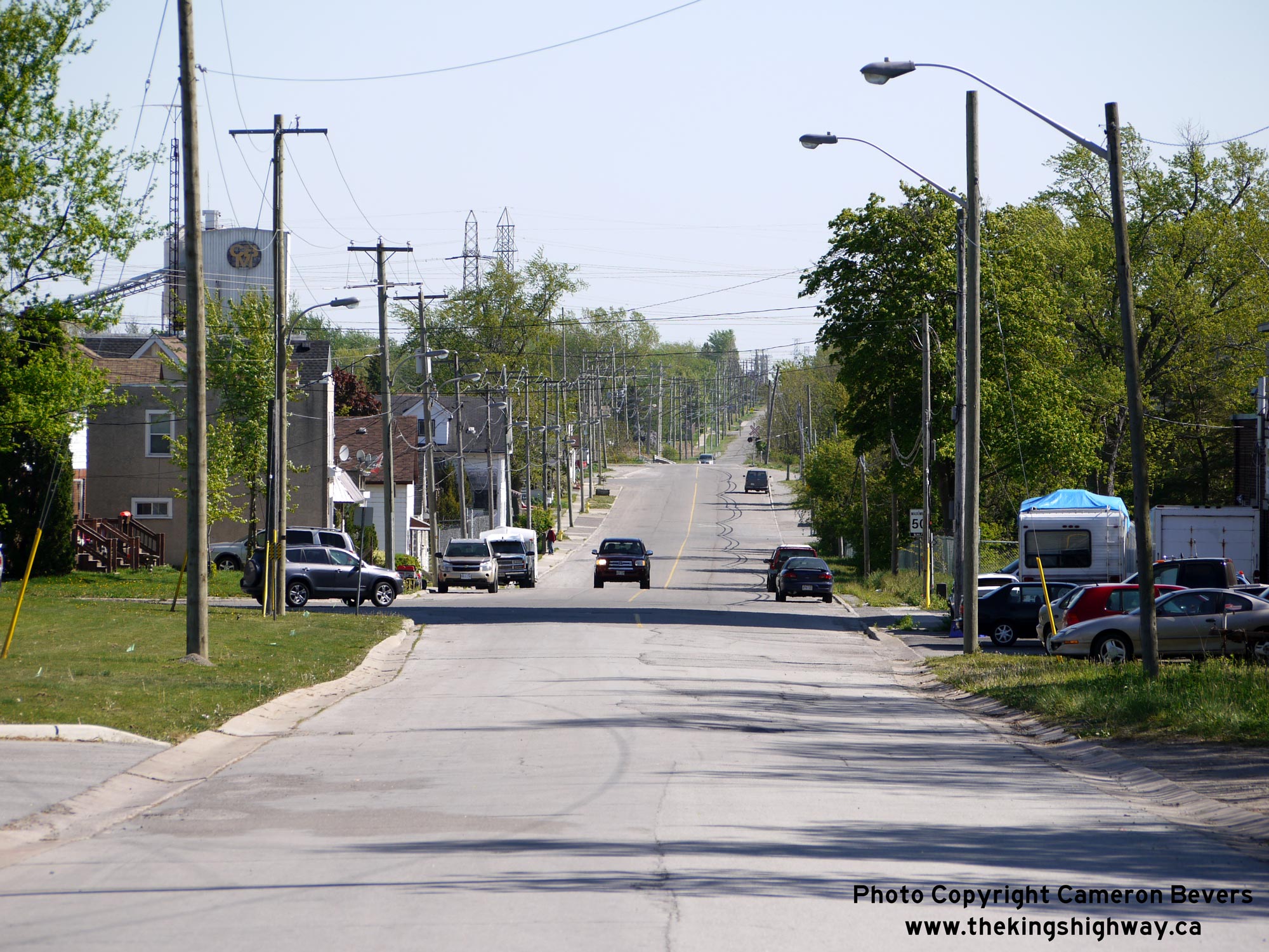
 Left - View of Old Hwy 58 (Allanburg Road) in Thorold South, facing south approaching Beaverdams Road. A 1 1/2 mile section of Hwy 58 was bypassed by a new highway alignment in the late 1960s. After the Welland Canal Bridge was removed following the completion of the Thorold Tunnel, the old alignment of Hwy 58 through Thorold South became a dead-end route with no outlet. Snce the highway no longer served a provincial purpose, jurisdiction was transferred from the Department of Highways of Ontario (DHO) to the newly-created Regional Municipality of Niagara in September 1970. See an Enlarged Photo Here. (Photograph taken on May 16, 2013 - © Cameron Bevers) Right - Facing south along Old Hwy 58 from the former site of the Welland Canal Bridge in Thorold South. Part of Hwy 58 crossed through federally-owned canal lands, so this section of the highway's route which followed the Welland Canal was actually not under provincial jurisdiction. Due to the proximity of the canal to the Ontario Paper Company's buildings at left, the highway had a total right-of-way width in places of only 28 feet, 5 inches - well short of the right-of-way needed to adequately accommodate two busy lanes of highway traffic, pedestrians, drainage infrastructure and utilities. By the late 1960s, almost 9,000 vehicles a day, many of them trucks, tried to squeeze down this narrow street on their journey between Welland and St. Catharines. Along the way to the bridge, traffic on Hwy 58 would also have to compete for precious space on the road with industrial traffic carrying lumber products between the Ontario Paper Company's plant and their shipping docks located on the banks of the Welland Canal. Today, the old route of Hwy 58 is virtually silent, as it now only carries occasional local traffic. See an Enlarged Photo Here. (Photograph taken on May 16, 2013 - © Cameron Bevers) 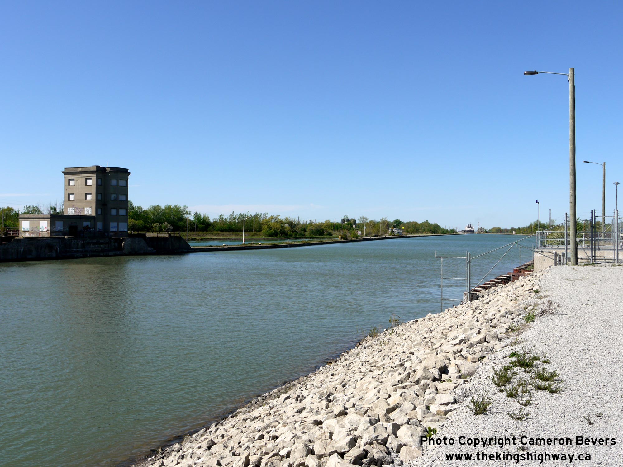
 Left - Former site of the old opening bridge on Hwy 58 across the Welland Canal. The old bridge had a total span length of 89 feet (about 27.1 metres) and spanned a narrow section of the canal. Following the completion of the Thorold Tunnel, the old bridge was dismantled and the canal width greatly expanded to accommodate larger ships through. See an Enlarged Photo Here. (Photograph taken on May 16, 2013 - © Cameron Bevers) Right - At the canal bridge, Hwy 58 curved sharply to the left and crossed over the Welland Canal. While the street may appear silent today, this was once the site of one of the Niagara Peninsula's worst traffic bottlenecks. What a relief the completion of the four-lane Thorold Tunnel must have been to motorists of the day! See an Enlarged Photo Here. (Photograph taken on May 16, 2013 - © Cameron Bevers) 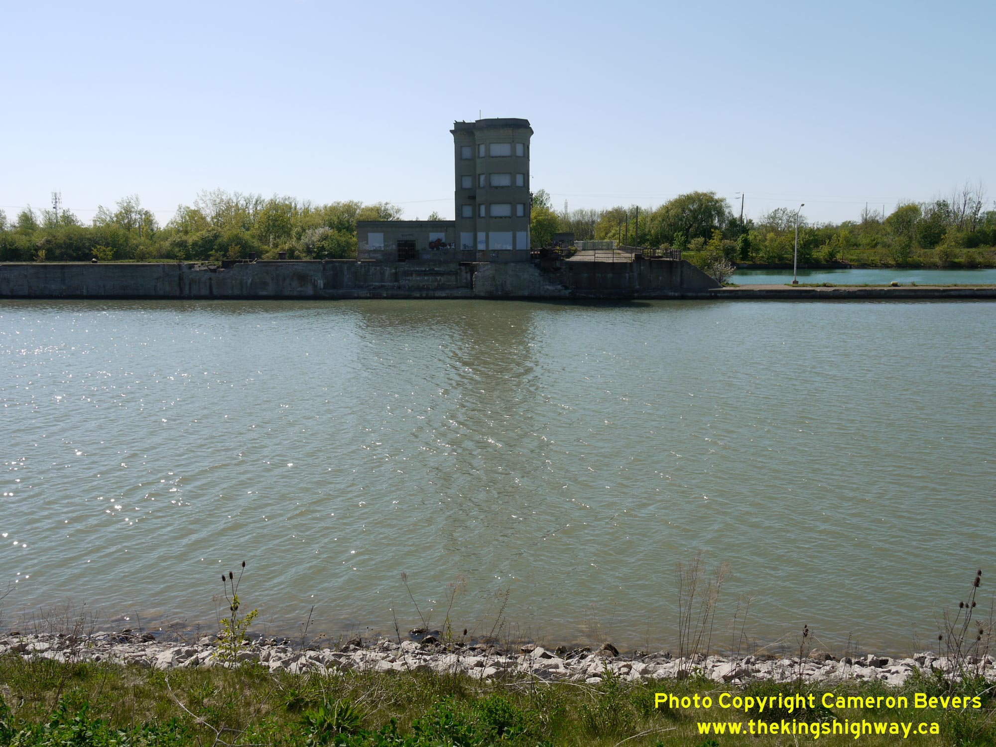
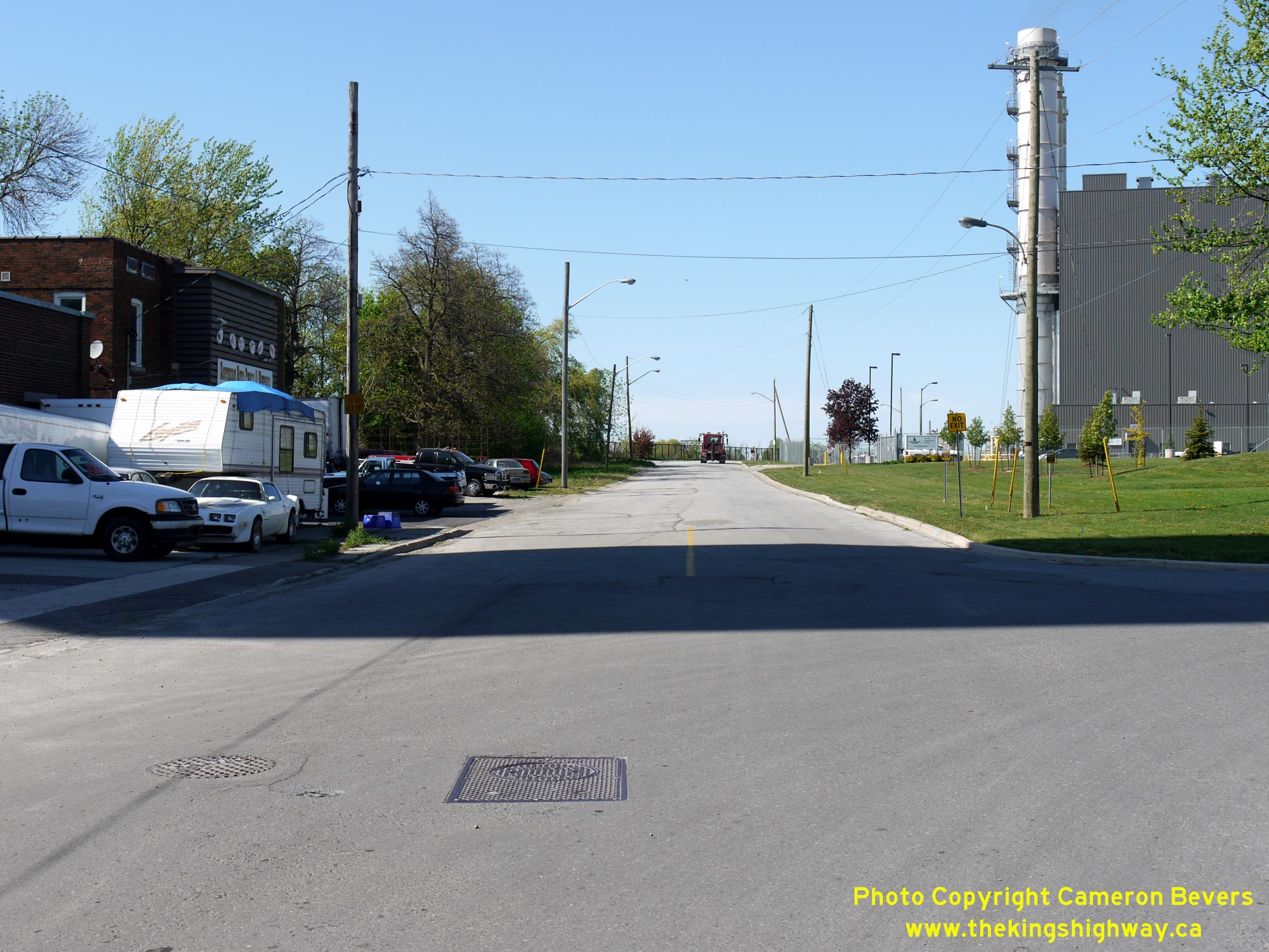
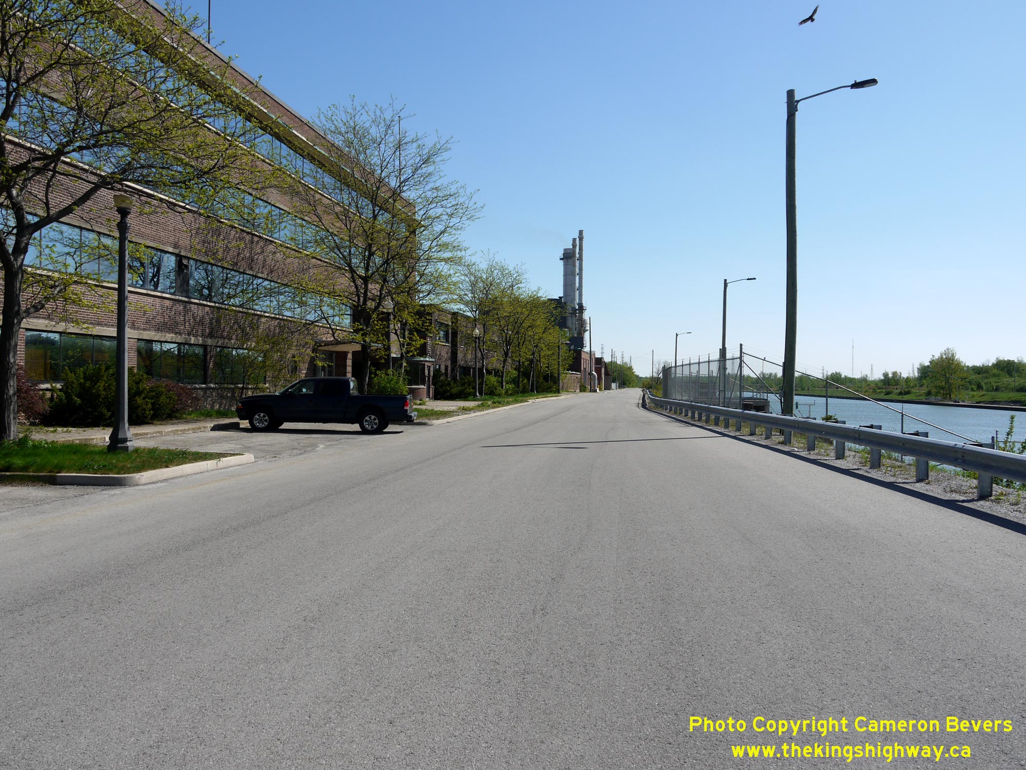
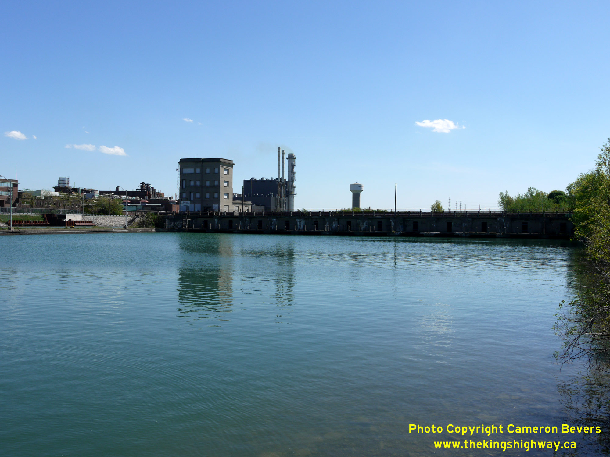 Left - Facing west across the Welland Canal at the location of the old opening bridge. Note the narrow width of the roadway across the control dam on the opposite side of the canal. The road across the cantilever bridge and control dam had a width of only 24 feet (about 7.3 metres) from curb face to curb face. In addition to the horizontal clearance issues of the roadway itself, the bridge also has a vertical clearance restriction of 15 feet (about 4.6 metres). See an Enlarged Photo Here. (Photograph taken on May 16, 2013 - © Cameron Bevers) Right - Northern side of the control dam beside the Welland Canal which once carried Hwy 58 traffic, as seen from the western canal bank in Thorold. See an Enlarged Photo Here. (Photograph taken on May 16, 2013 - © Cameron Bevers) 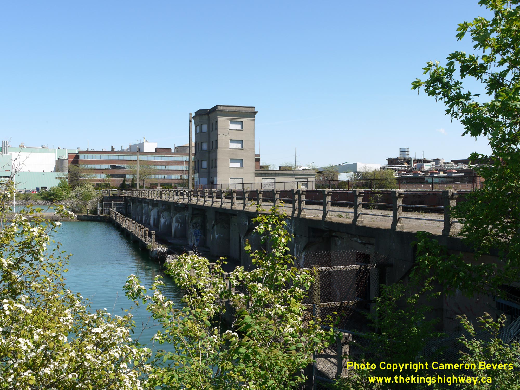
 Left - Close-up view of the abandoned route of Hwy 58 across the control dam at the Welland Canal, facing east. Until the late 1960s, almost 9,000 vehicles travelled across this narrow dam every day to reach the eastern side of the Welland Canal. Without the Thorold Tunnel and Hwy 406, travel through this part of the Niagara Peninsula by car in the 1960s would have been painfully slow. Not only was there an opening bridge at the canal, but also an at-grade railway crossing on Hwy 58 along the western approach to the canal crossing. The Post-War industrial boom in the Niagara Peninsula had a significant impact on the area's highway network, with traffic volumes on Hwy 58 surging 50% higher between 1955 and the time of the Thorold Tunnel's completion just 13 years later, in 1968. The new four-lane Thorold Tunnel was built to handle the increased traffic volumes on Hwy 58 and also remove a serious traffic bottleneck at the Welland Canal. See an Enlarged Photo Here. (Photograph taken on May 16, 2013 - © Cameron Bevers) Right - Abandoned section of pavement on Old Hwy 58 approaching the control dam at the Welland Canal. See an Enlarged Photo Here. (Photograph taken on May 16, 2013 - © Cameron Bevers) 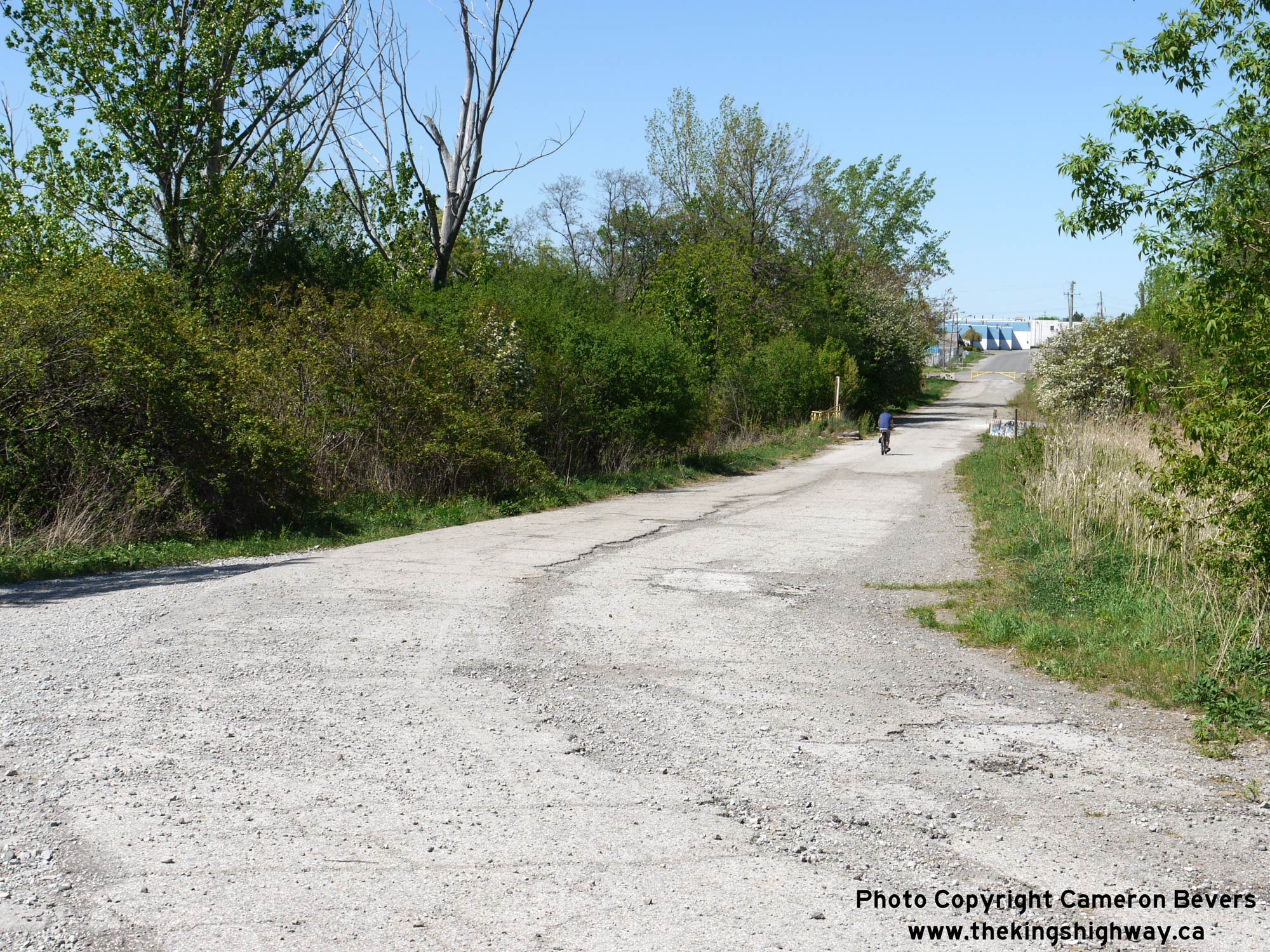
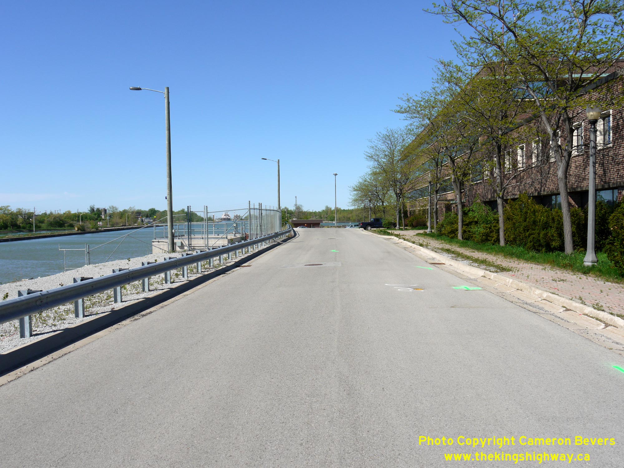
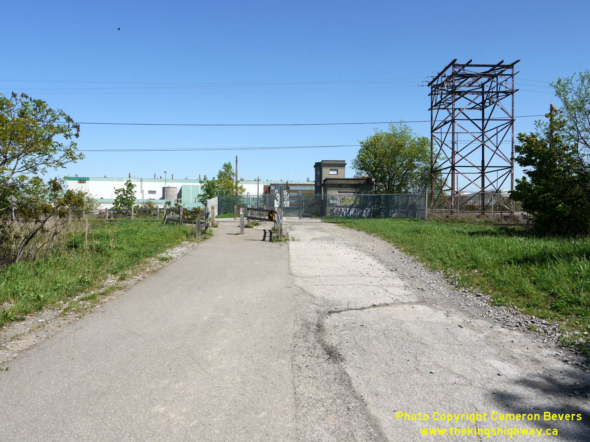
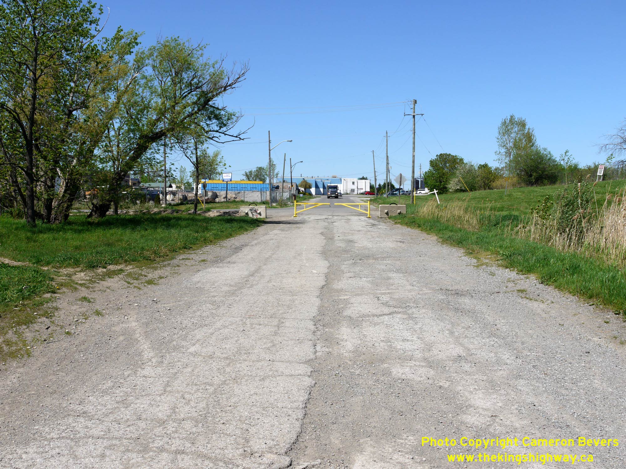 Left - Decades ago, Hwy 58 rounded this sharp curve on the western approach to the control dam and cantilever bridge at the Welland Canal in Thorold. The old highway pavement still serves as an industrial access road today. See an Enlarged Photo Here. (Photograph taken on May 16, 2013 - © Cameron Bevers) Right - Facing north along Old Hwy 58 approaching Beaverdams Road in Thorold. At the gate, this former route of Hwy 58 exited from the Welland Canal lands and continued north towards St. Catharines via Ormond Street as an assumed King's Highway. Interestingly, the DHO maintained jurisdiction over the entire route of Hwy 58 through the Town of Thorold's limits via Ormond Street right up until the early 1970s. See an Enlarged Photo Here. (Photograph taken on May 16, 2013 - © Cameron Bevers) 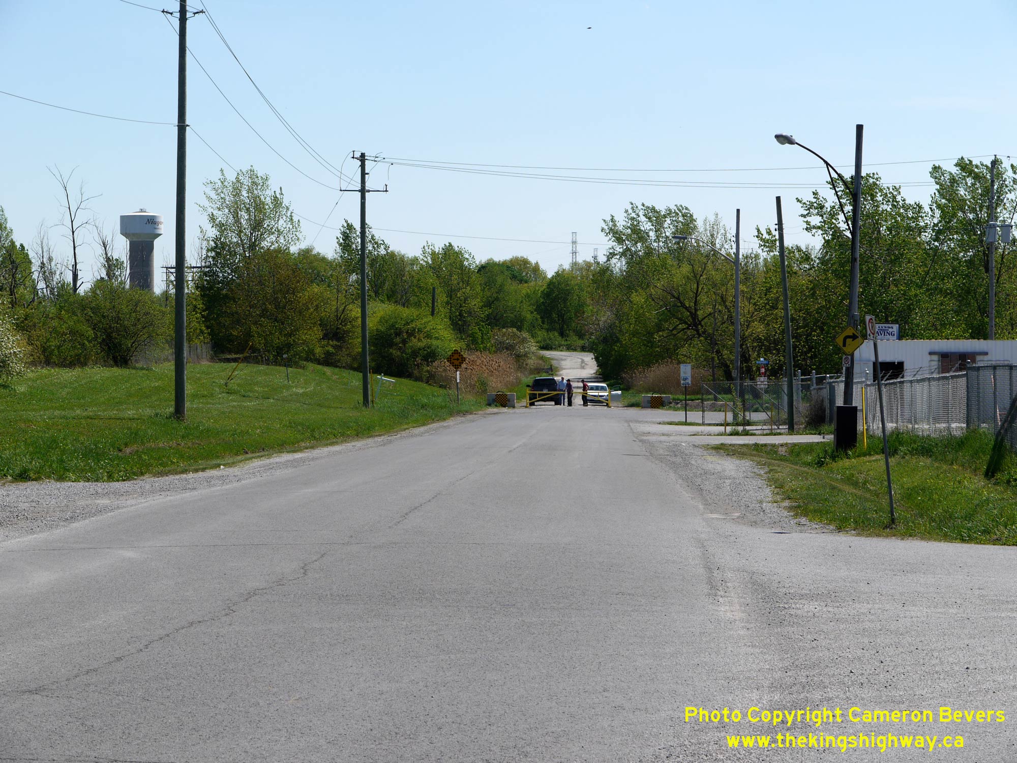
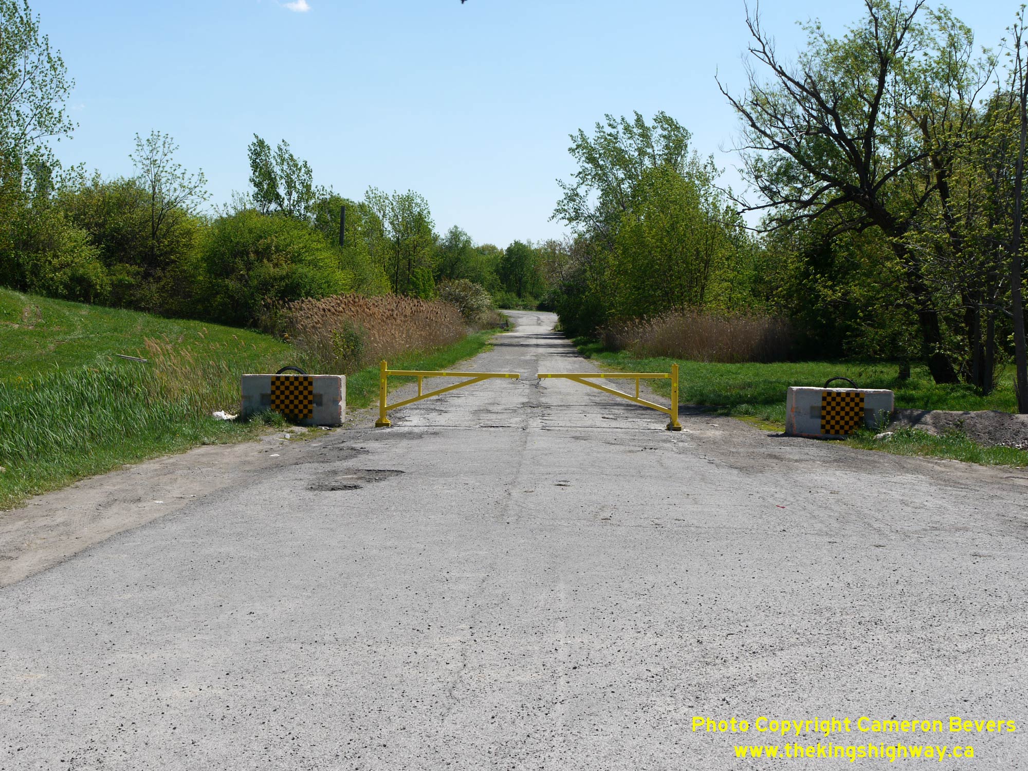 Left - Facing south along Ormond Street (Old Hwy 58) approaching Beaverdams Road in Thorold. With the old section of Hwy 58 typically gated off at the canal lands boundary, traffic on Ormond Street is now forced to turn right onto Beaverdams Road. Up until the late 1960s, through traffic on Hwy 58 would have simply continued straight ahead towards Thorold South and Allanburg. See an Enlarged Photo Here. (Photograph taken on May 16, 2013 - © Cameron Bevers) Right - Close-up view of the gate at the southern end of Ormond Street (Old Hwy 58) at Beaverdams Road in Thorold. The DHO's jurisdiction over the highway ended at this point as the highway passed through the federal canal lands. In an effort to improve provincial highway connections within the Niagara Peninsula, the DHO assumed jurisdition of the highway from this point northerly to St. Catharines in October 1937. Although this route from Allanburg to St. Catharines was originally considered to be a part of Hwy 3A, the route was absorbed into a northerly extension of Hwy 58 from Welland to St. Catharines in 1939. See an Enlarged Photo Here. (Photograph taken on May 16, 2013 - © Cameron Bevers) 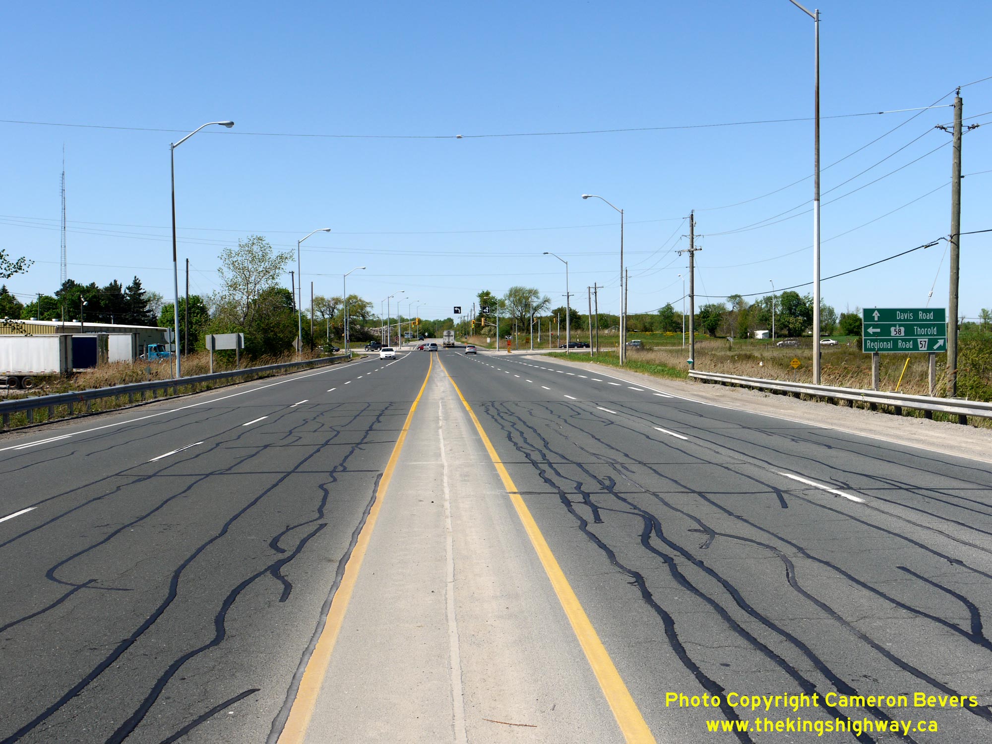
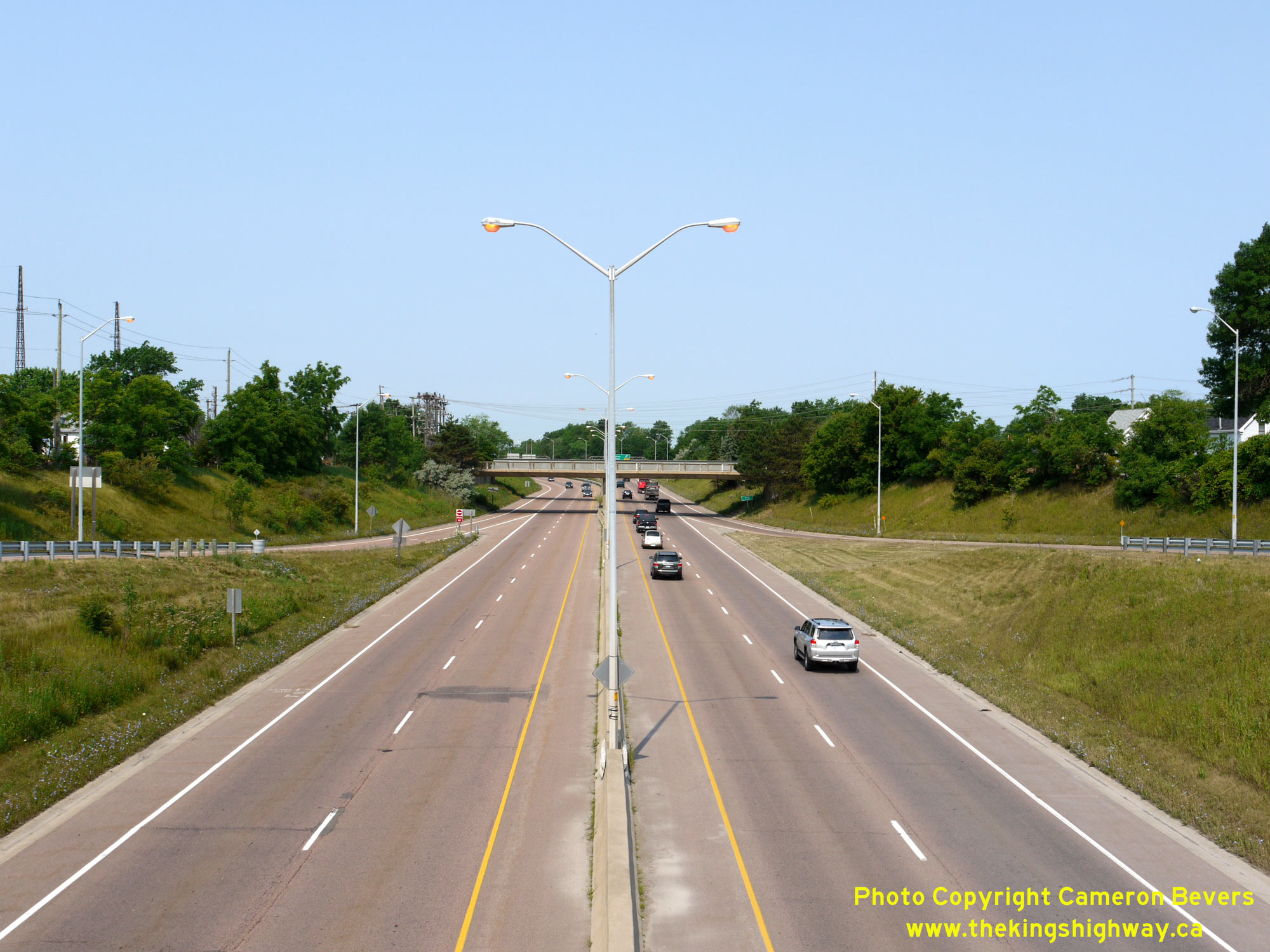
 Left - Facing north along the relocated route of Hwy 58 (the Thorold South Bypass) approaching the Thorold Tunnel Approach. See an Enlarged Photo Here. (Photograph taken on May 16, 2013 - © Cameron Bevers) Right - Green guide signs marking the Hwy 58 turn-off to the Thorold Tunnel. At this intersection, Hwy 58 turns left and heads west towards Hwy 406 via the Thorold Tunnel. At right, Thorold Stone Road heads east towards Niagara Falls. Although it is not signed as such, Thorold Stone Road is actually a non-posted provincial highway with a 7000-Series Highway designation (Hwy 7186). Provincial jurisdiction over Thorold Stone Road (Hwy 7186) ends about 800 metres to the east at Taylor Road, after which Thorold Stone Road becomes Niagara Regional Road 57. See an Enlarged Photo Here. (Photograph taken on May 16, 2013 - © Cameron Bevers) 
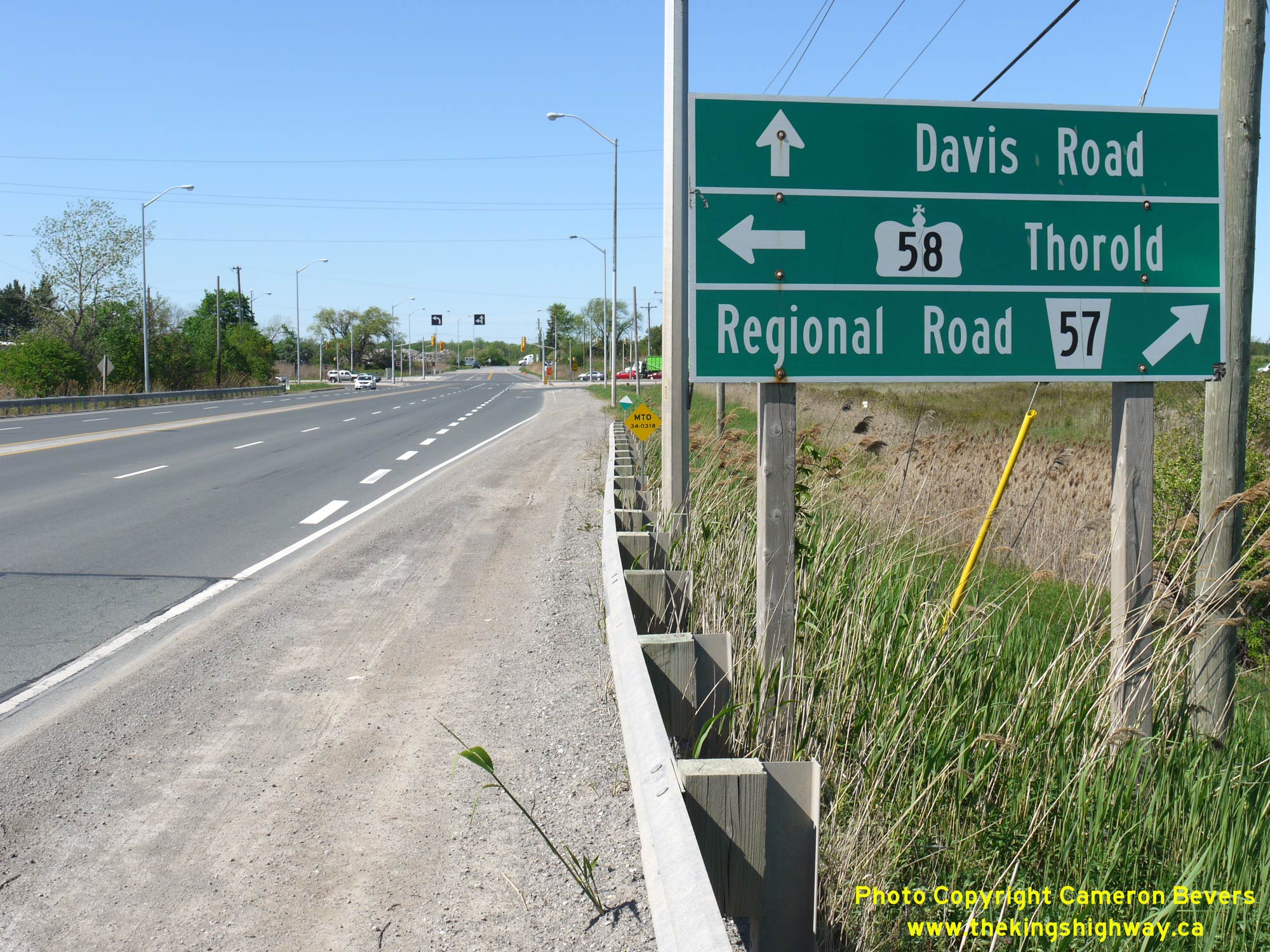
 Left - Facing south along the relocated route of Hwy 58 (the Thorold South Bypass) towards Allanburg from the Thorold Tunnel Approach. This diversion around Thorold South and the eastern extension of the Thorold Tunnel Approach (Thorold Stone Road) to Davis Road was constructed under Contract #1967-149. See an Enlarged Photo Here. (Photograph taken on May 16, 2013 - © Cameron Bevers) Right - Distance guide sign facing southbound traffic on Hwy 58 in Thorold. See an Enlarged Photo Here. (Photograph taken on May 16, 2013 - © Cameron Bevers) 
 Left - Overhead lane designation arrows facing northbound Hwy 58 traffic. At this intersection, two lanes of traffic are provided to accommodate the left turn movement from northbound Hwy 58 to the Thorold Tunnel. The right-most lane also accommodates through traffic to Davis Road. See an Enlarged Photo Here. (Photograph taken on May 16, 2013 - © Cameron Bevers) Right - Facing south along Davis Road towards the Hwy 58 Junction. As seen in this photo, this intersection is set up with separate northbound and southbound traffic signal phasing - meaning that each direction of traffic is released separately. This is due to the dual left turn lanes from northbound Hwy 58. While this traffic signal phasing ensures a safer intersection operation, it can also result in long delays for traffic waiting for their direction to be served. See an Enlarged Photo Here. (Photograph taken on May 16, 2013 - © Cameron Bevers) 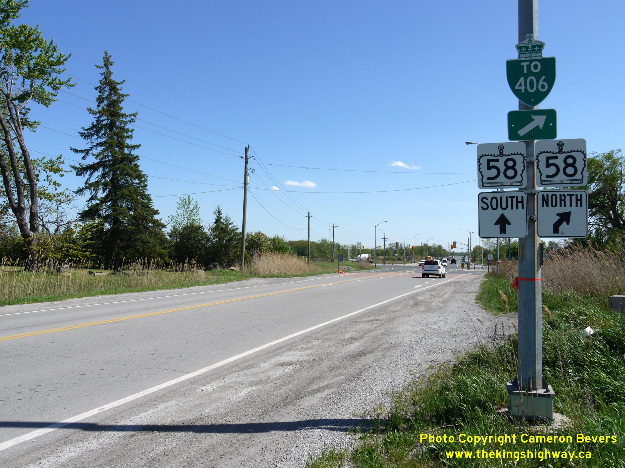
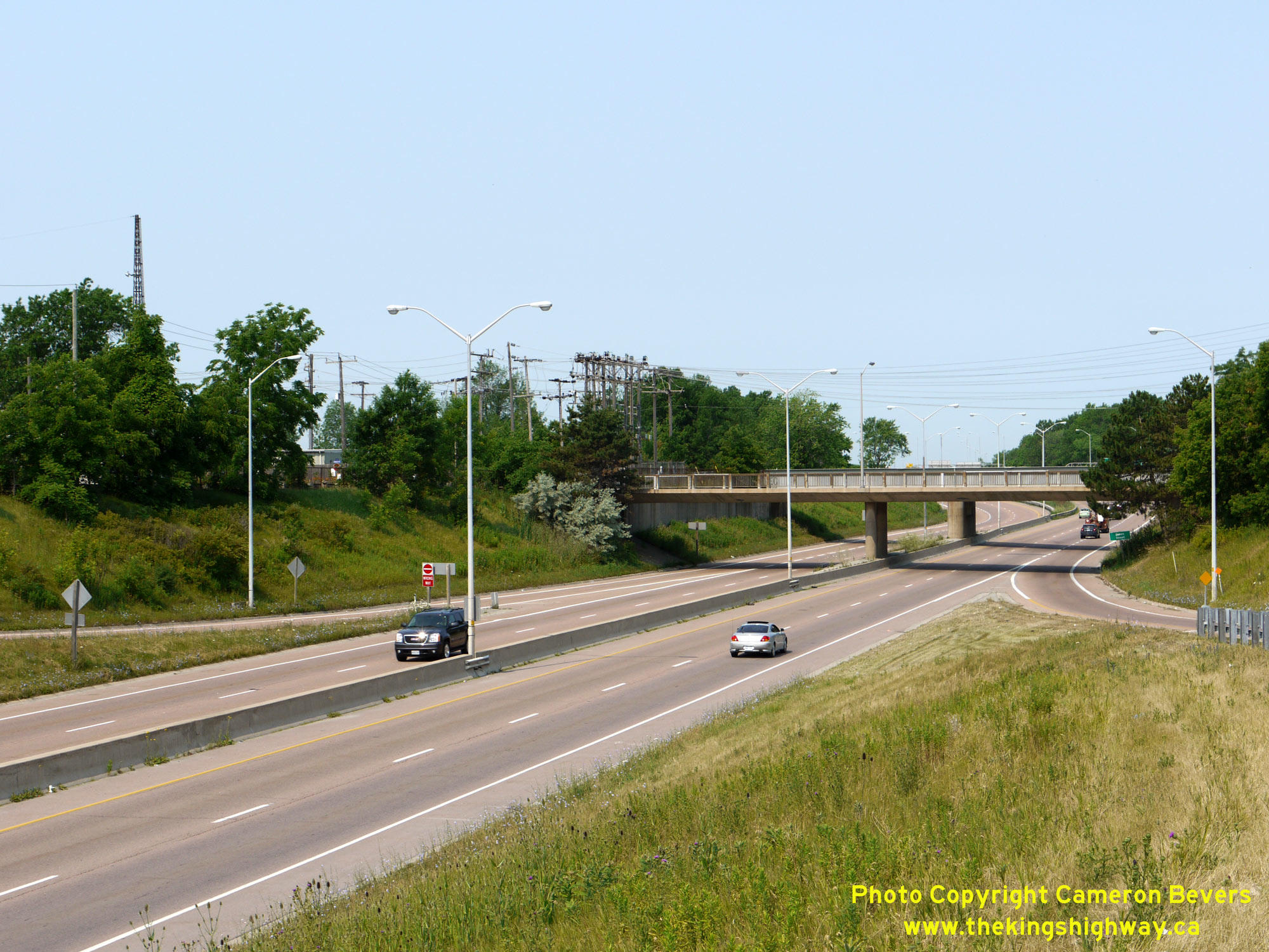
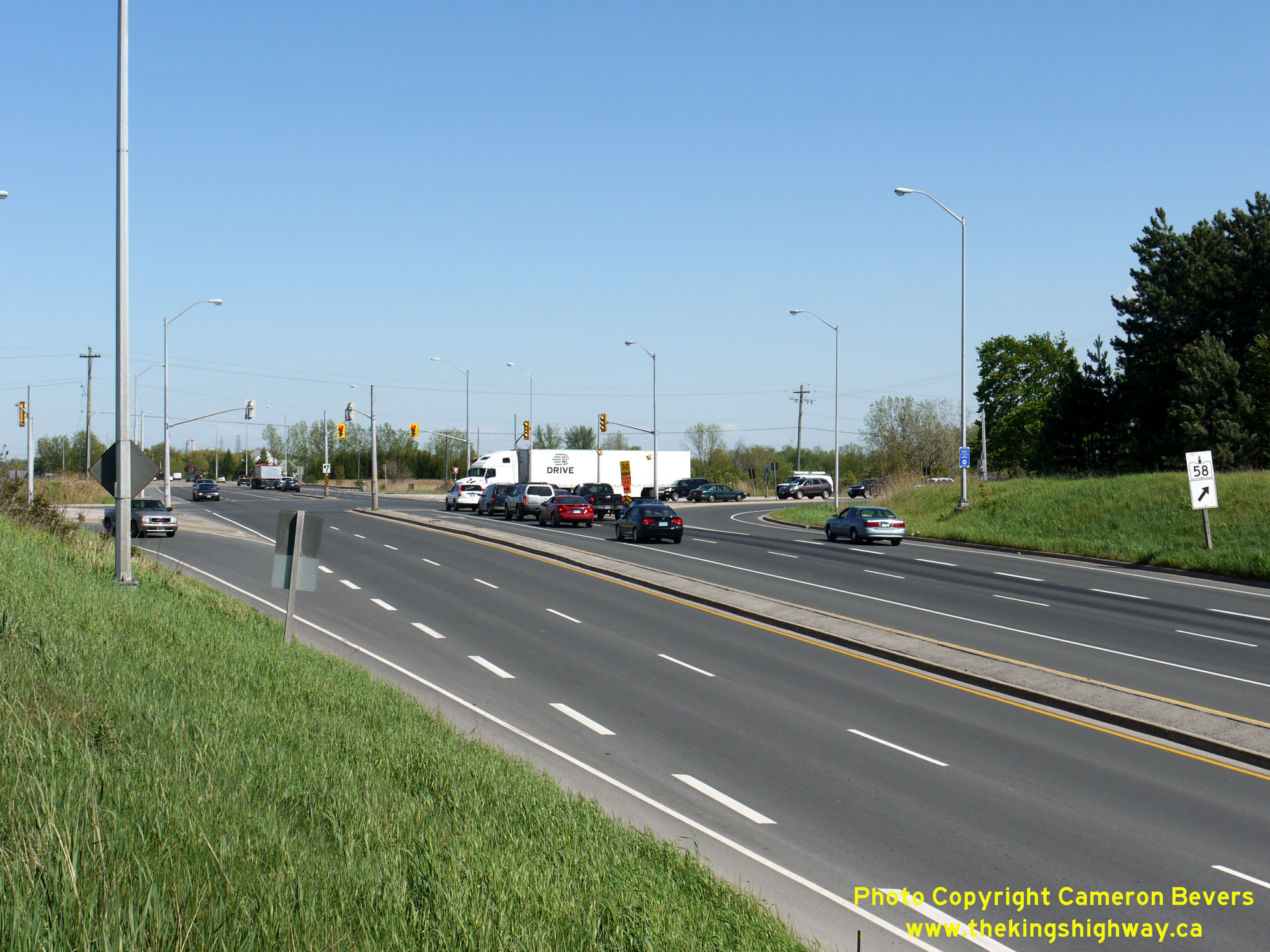 Left - Junction sign assembly facing southbound traffic approaching the Hwy 58 Junction in Thorold. See an Enlarged Photo Here. (Photograph taken on May 16, 2013 - © Cameron Bevers) Right - View of the Hwy 58 and Thorold Stone Road (Hwy 7186) Junction in Thorold, facing southeast. At the traffic signals, Hwy 58 turns right and heads south towards Allanburg, while Thorold Stone Road (Hwy 7186) continues straight ahead towards Niagara Falls. Early highway planning studies completed by the DHO in the 1960s identified a strong future travel demand pattern between St. Catharines and Niagara Falls via the Thorold Tunnel route. Although no provincially-owned highway connection was recommended as part of the DHO's groundbreaking 1964 Niagara Peninsula Planning Study, provisions were nevertheless made with the construction of the Thorold Tunnel to allow for an easterly continuation of the highway route if conditions warranted such expansion in the future. See an Enlarged Photo Here. (Photograph taken on May 16, 2013 - © Cameron Bevers) 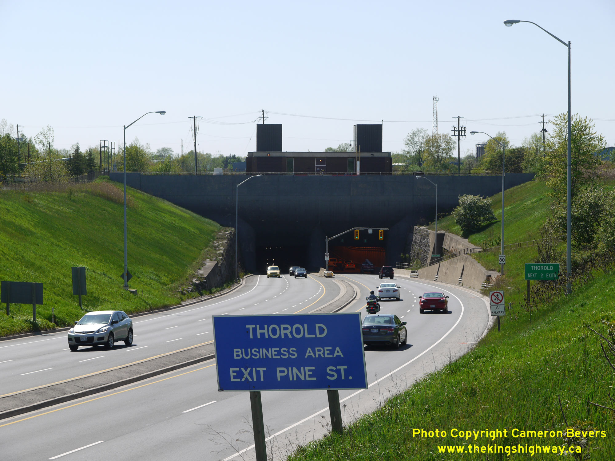
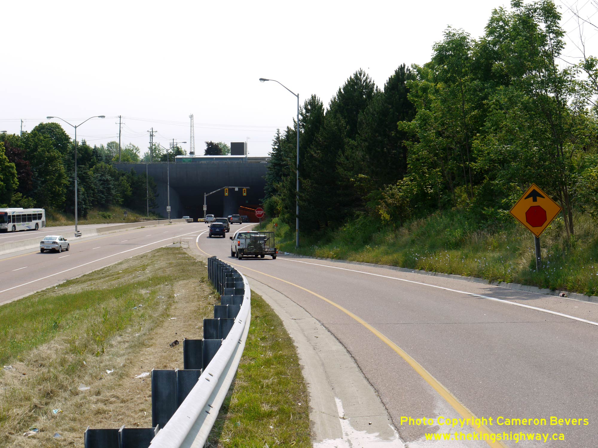
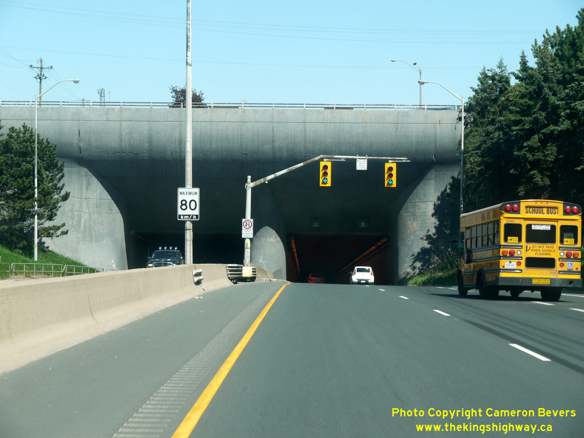 Left - Facing west along the approach to the Thorold Tunnel. The tunnel's eastern portal seen here is actually about 10 feet (3 metres) lower in elevation than the tunnel's western portal. From this point northwesterly to Hwy 406, Hwy 58 is a fully controlled-access freeway. See an Enlarged Photo Here. (Photograph taken on May 16, 2013 - © Cameron Bevers) Right - Western portal of the Thorold Tunnel on Hwy 58. This four-lane highway tunnel below the Welland Canal was constructed between 1965 and 1968 and was among the largest highway construction projects ever undertaken in the region. The new highway tunnel replaced a congested opening bridge across the canal located a short distance to the south along the original route of Hwy 58 between Thorold and Thorold South. The Thorold Tunnel was officially opened to traffic by Highways Minister George E. Gomme and Federal Transport Minister Paul T. Hellyer on September 18, 1968. The tunnel was built under a cost-sharing agreement between the DHO and the St. Lawrence Seaway Commission, with DHO paying two-thirds of the tunnel's $24 million construction cost in 1968 Dollars. Inflated to 2024 Dollars, the Thorold Tunnel cost about $206 million to construct. See an Enlarged Photo Here. (Photograph taken on May 16, 2013 - © Cameron Bevers) 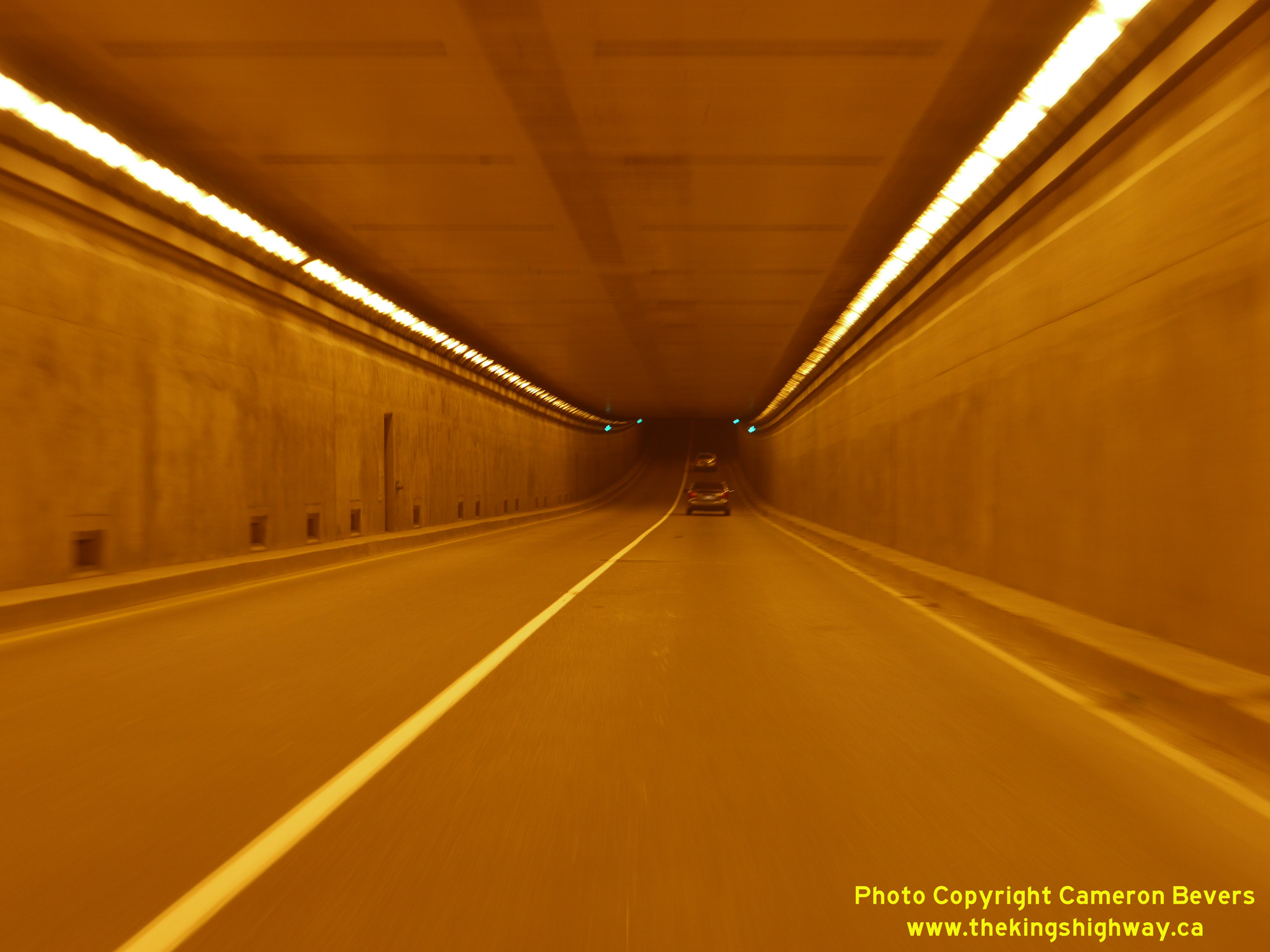
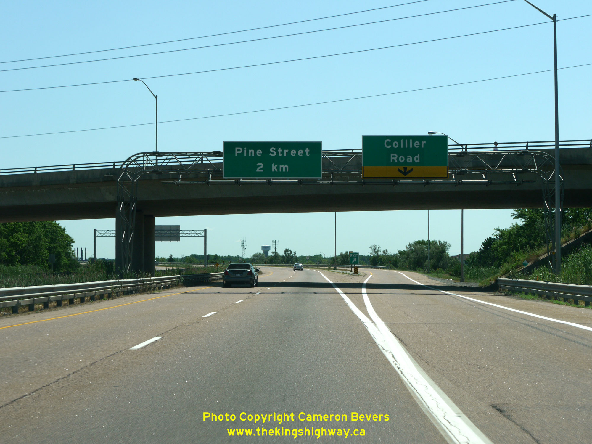
 Left - Passing through the Thorold Tunnel's South Tube on Hwy 58, facing east towards Niagara Falls. The Thorold Tunnel itself and the tunnel's eastern approach was constructed under Contract #1965-166 and took just over three years to construct. The western approach to the tunnel from east of Pine Street westerly was constructed under separate contracts. Geometrically, there are two vertical sag curves along Hwy 58 within the tunnel, with one curve lying beneath the Welland Canal and the second lying below the pondage canal near the tunnel's eastern portal. Both tunnel roadways are 26 feet in width (two lanes at 13 feet each, or about 4 metres), with a two-foot (0.6 metre) utility sidewalk on each side of the road through the south tube. The north tube has a two-foot utility sidewalk on the south side of the road only, and a dedicated 6 foot, 3 inch (1.9 metre) pedestrian sidewalk on the north side of the road. Motorists who pass through the tunnel may notice a series of utility doors on the left-hand side of the road. The north and south tubes of the tunnel are separated by a gap of 10 feet, 6 inches (3.2 metres). Within this gap is a service corridor, which is used by tunnel maintenance staff to access various parts of the tunnel. The minimum concrete thickness of the tunnel's exterior walls is 4 feet (about 1.2 metres), whicle the roof slab has a minimum thickness of 4 foot, 3 inches (about 1.3 metres). See an Enlarged Photo Here. (Photograph taken on July 30, 2011 - © Cameron Bevers) Right - View of Hwy 58 approaching the Pine Street Interchange in Thorold from the top of the western portal of the Thorold Tunnel. The relocated section of Hwy 58 through Thorold was built in the 1960s as a below-grade urban freeway. Two surface streets (Pine Street and Queen Street) cross over the freeway in close proxiity to the tunnel portal, while Ormond Street (Old Hwy 58) passes over the tunnel itself. See an Enlarged Photo Here. (Photograph taken on May 16, 2013 - © Cameron Bevers) 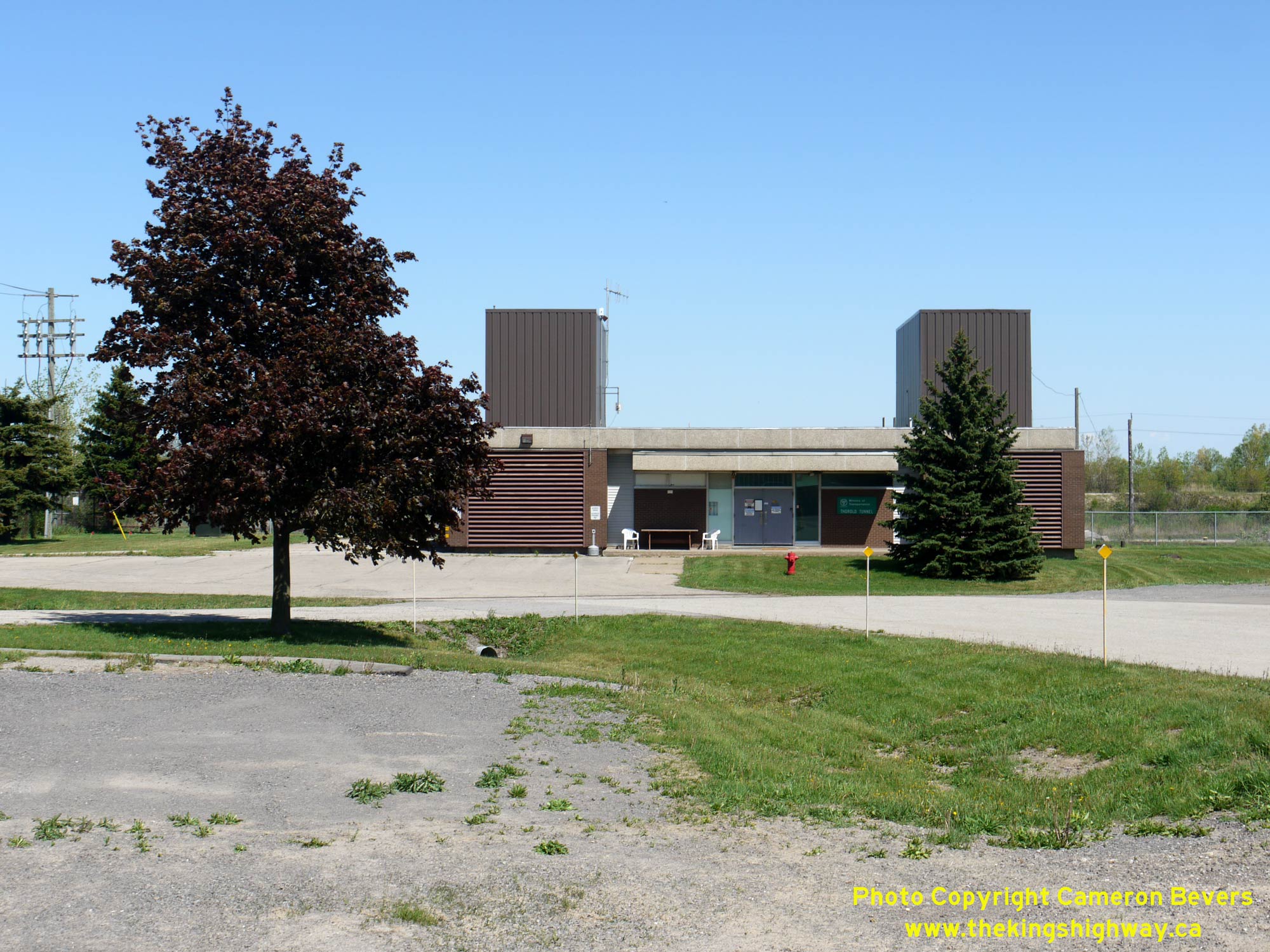
 Left - View of the Thorold Tunnel's administration and maintenance building. Interestingly, this building is situated on Ormond Street (Old Hwy 58) immediately above the relocated route of Hwy 58. Although Ormond Street crosses Hwy 58 above the tunnel's western portal, there is no direct access between the old and new routes of Hwy 58. Traffic must use the adjacent Pine Street Interchange in order to access the freeway below. See an Enlarged Photo Here. (Photograph taken on May 16, 2013 - © Cameron Bevers) Right - Facing east towards the Thorold Tunnel from the Pine Street Interchange in Thorold. Although it may not be obvious in this photo, the bottom of the Welland Canal actually sits 22 feet, 9 inches (about 6.9 metres) lower in elevation than the top of the Thorold Tunnel's western tube portals. If this tunnel seems deep as you drive through it, it isn't just your imagination - at its deepest point, the roadway of the Thorold Tunnel lies about 43 feet (about 13.1 metres) below the bottom of the Welland Canal. See an Enlarged Photo Here. (Photograph taken on June 28, 2012 - © Cameron Bevers) 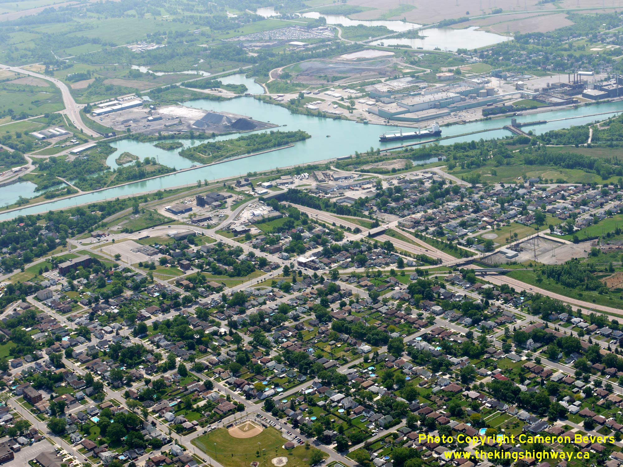
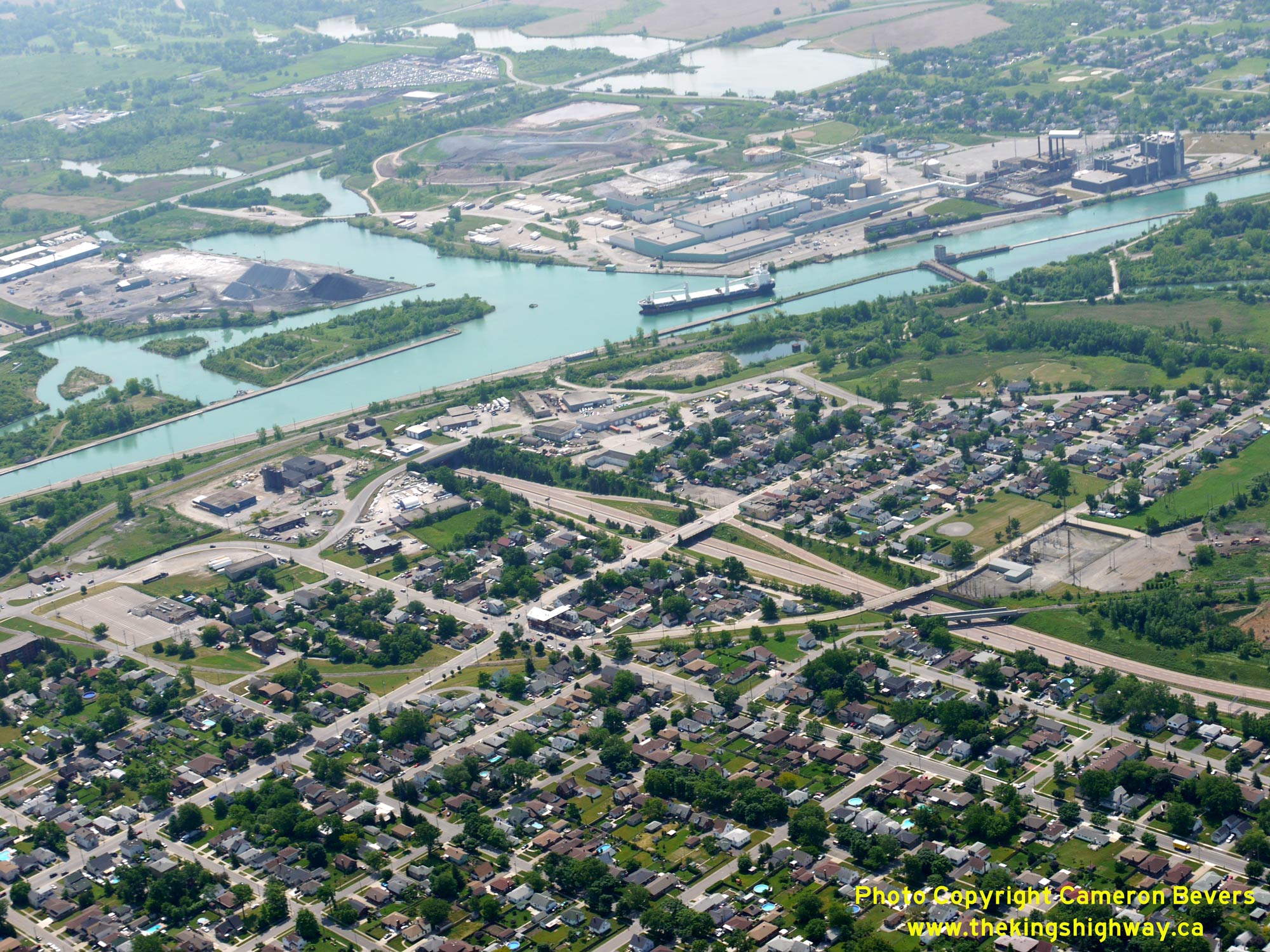 Left - Aerial view of the Thorold Tunnel below the Welland Canal on Hwy 58, facing southeast. See an Enlarged Photo Here. (Photograph taken on June 16, 2011 - © Cameron Bevers) Right - Close-up view of the Thorold Tunnel's western portal and adjacent Pine Street Interchange in Thorold. Just to the right of the ship on the Welland Canal, Old Hwy 58 can be seen approaching the site of the old cantilever opening bridge which once carried Hwy 58 traffic across the canal to Thorold South. See an Enlarged Photo Here. (Photograph taken on June 16, 2011 - © Cameron Bevers) 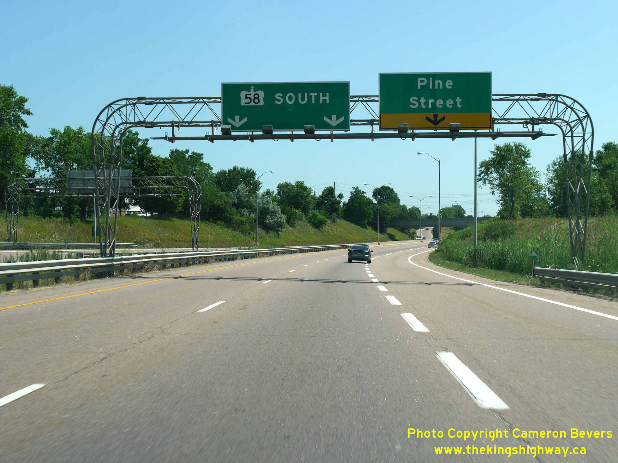
 Left - Overhead freeway guide signs facing southbound Hwy 58 traffic approaching the Pine Street Interchange in Thorold. It is interesting to note that this older "Type 1" Aluminum Tapered Leg (ATL) overhead sign structure is fitted with floodlights to externally illuminate the highway signs. Earlier highway signs were made from materials which had some retroreflective properties, but were nowhere near as effective or bright as the sign materials used today. Floodlights were often used on overhead sign structures during the 1950s and 1960s to enhance sign visibility. However, as the retroreflective properties of signmaking materials continued to improve, it was no longer necessary to use external illumination and many of these floodlight systems were turned off and removed. Somehow, this floodlight system remained in place right up until the 2010s. See an Enlarged Photo Here. (Photograph taken on July 30, 2011 - © Cameron Bevers) Right - View of the on-ramp to southbound Hwy 58 from Pine Street. Due to the close proximity of the Thorold Tunnel's western portal to the Pine Street Interchange, this on-ramp is a direct taper which is under Stop-control. See an Enlarged Photo Here. (Photograph taken on June 28, 2012 - © Cameron Bevers) 
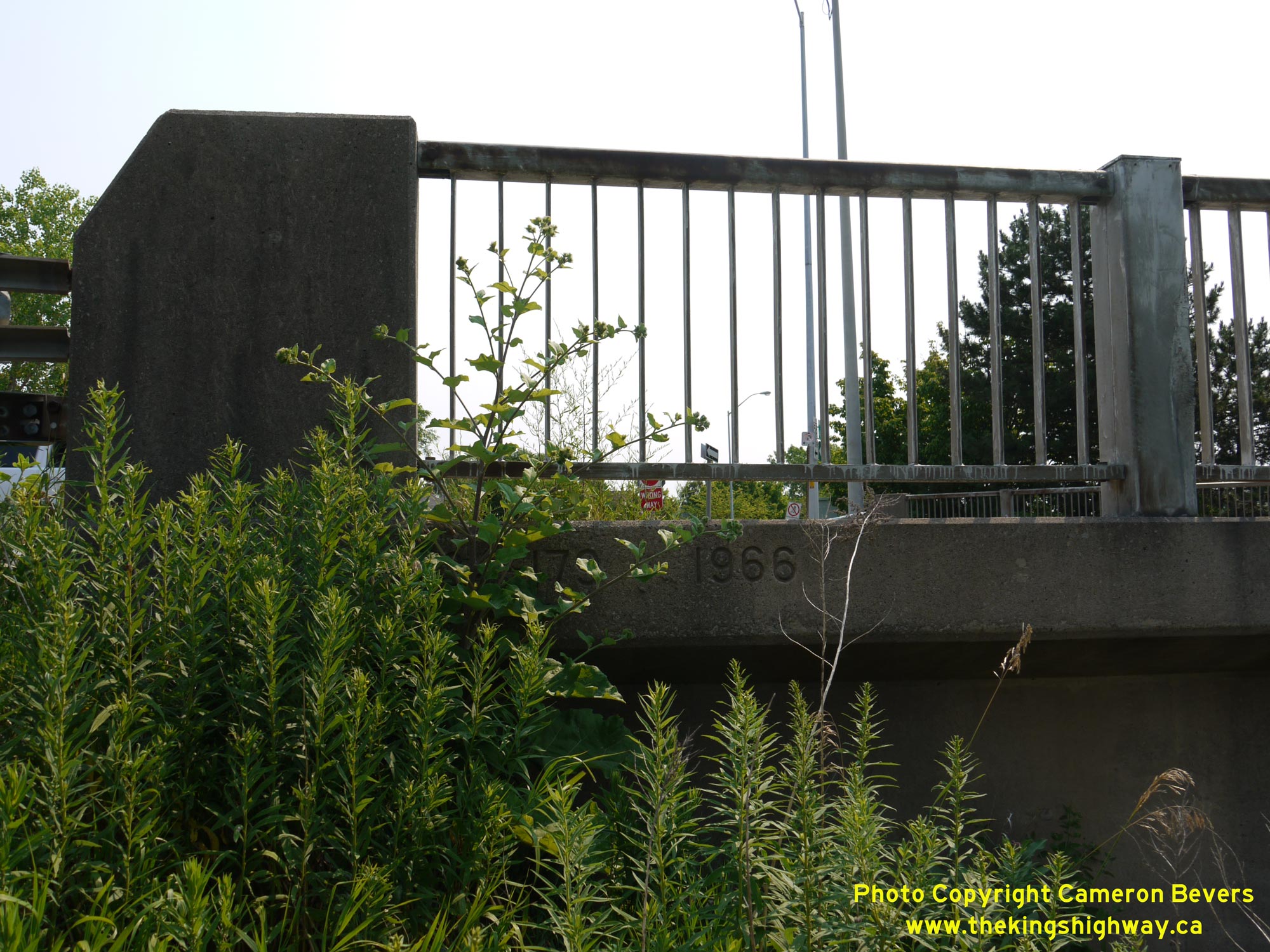 Left - Facing south across the Pine Street Overpass at Hwy 58 (Thorold Tunnel Approach). Although the urban freeway section of Hwy 58 through Thorold follows a predominantly east-west alignment, the highway is still signed with "North" and "South" cardinal directions through Thorold, in order to stay consistent with the rest of the highway. See an Enlarged Photo Here. (Photograph taken on June 28, 2012 - © Cameron Bevers) Right - Date stamp (1966) and structure identification number (Site #34-179) on the Pine Street Overpass on Hwy 58 in Thorold. See an Enlarged Photo Here. (Photograph taken on June 28, 2012 - © Cameron Bevers) 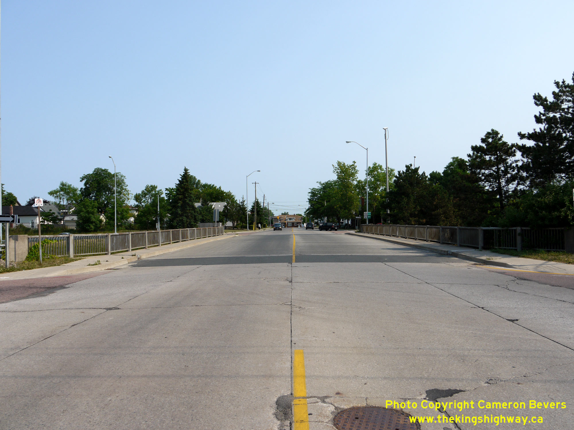
 Left - Facing north across the Pine Street Overpass on Hwy 58 in Thorold. See an Enlarged Photo Here. (Photograph taken on June 28, 2012 - © Cameron Bevers) Right - Western side of the Pine Street Overpass on Hwy 58 in Thorold. This two-span post-tensioned concrete structure was completed in 1966. See an Enlarged Photo Here. (Photograph taken on June 28, 2012 - © Cameron Bevers) 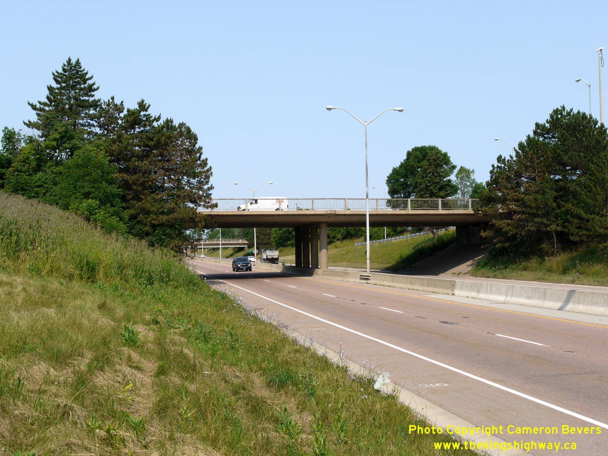
 Left - Eastern side of the Pine Street Overpass on Hwy 58 in Thorold. See an Enlarged Photo Here. (Photograph taken on June 28, 2012 - © Cameron Bevers) Right - Facing north along Hwy 58 towards St. Catharines from the Pine Street Interchange in Thorold. The highway has an urban curb-and-gutter drainage system through Thorold, so that designers could avoid the use of roadside ditches and therefore, a larger highway footprint. The relocated route of Hwy 58 through Thorold between the Pine Street Interchange and the Collier Road Interchange was constructed under Contract #1966-58. See an Enlarged Photo Here. (Photograph taken on June 28, 2012 - © Cameron Bevers) 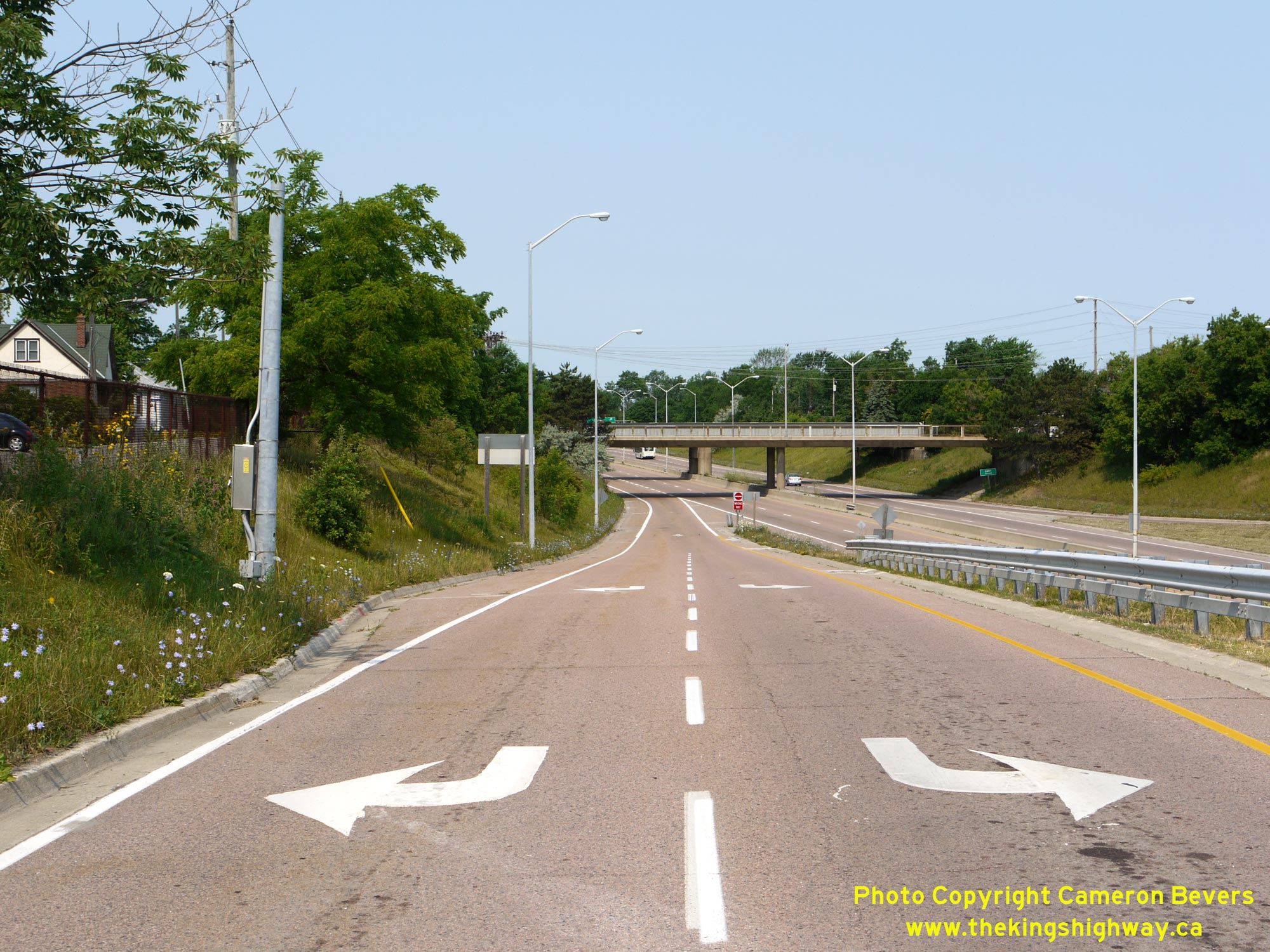
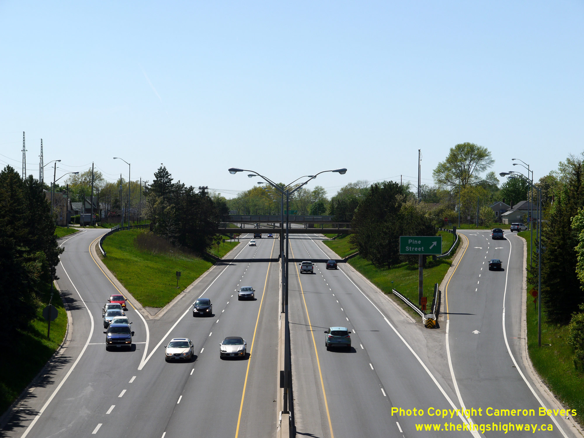
 Left - Exit ramp from southbound Hwy 58 to Pine Street. Although this ramp has an asphalt surface today, this interchange along with the entire Thorold Tunnel Approach was originally surfaced with concrete. This rigid pavement was overlaid with hot-mix asphalt during the ensuing years to create a composite pavement structure. See an Enlarged Photo Here. (Photograph taken on June 28, 2012 - © Cameron Bevers) Right - View of the depressed urban freeway section of Hwy 58 through Thorold, facing east from Pine Street. The highway was deliberately constructed below-grade through this area to allow for easier construction of the required grade separations at Thorold's surface streets with minimal property impacts. It is remarkable just how compact this design actually is. See an Enlarged Photo Here. (Photograph taken on June 28, 2012 - © Cameron Bevers) 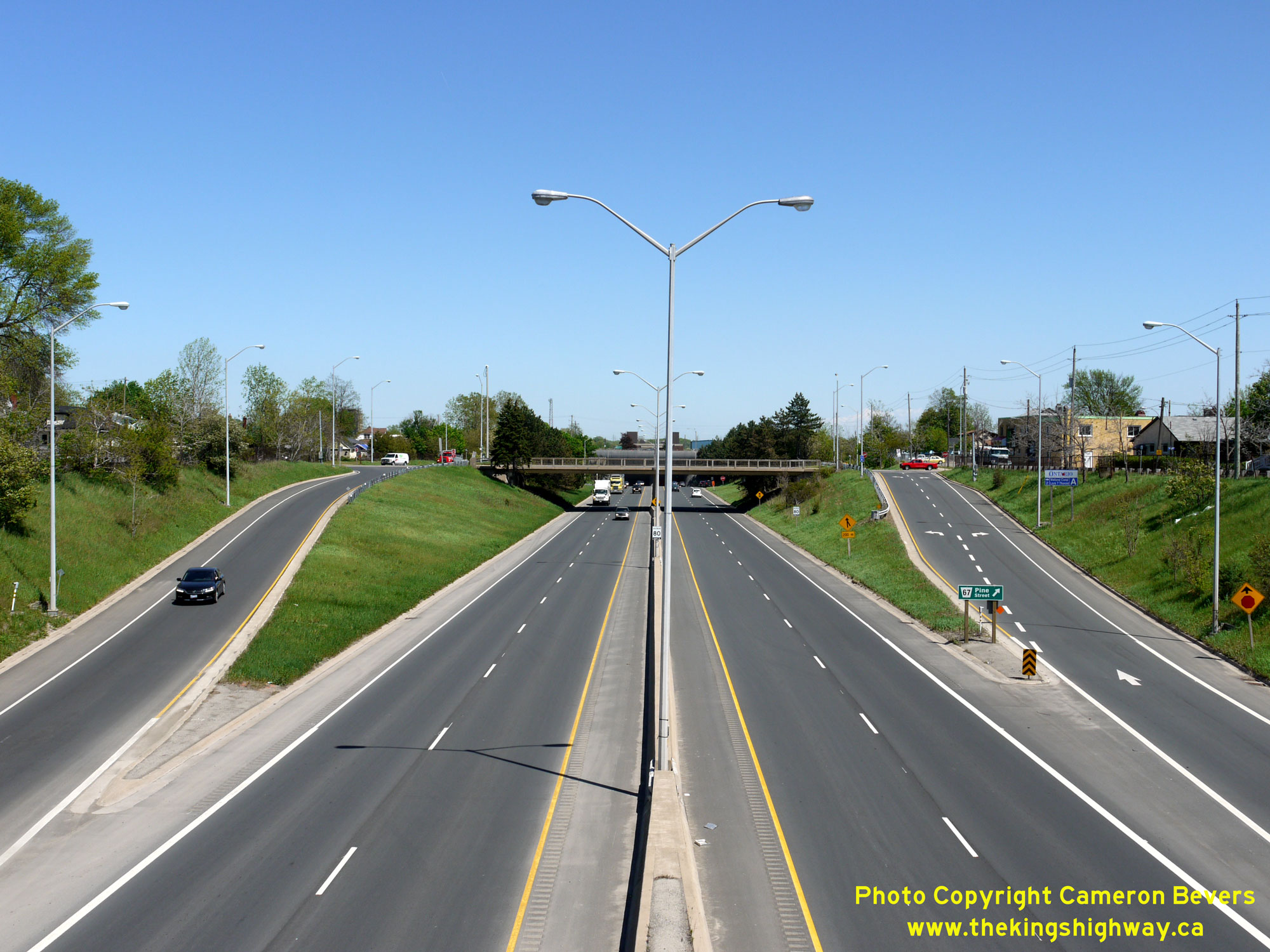
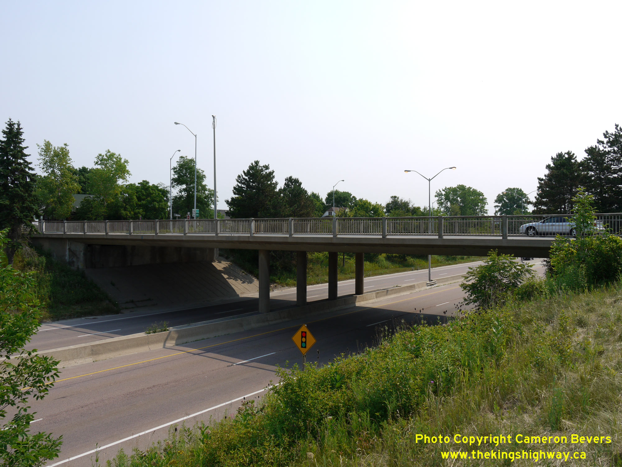
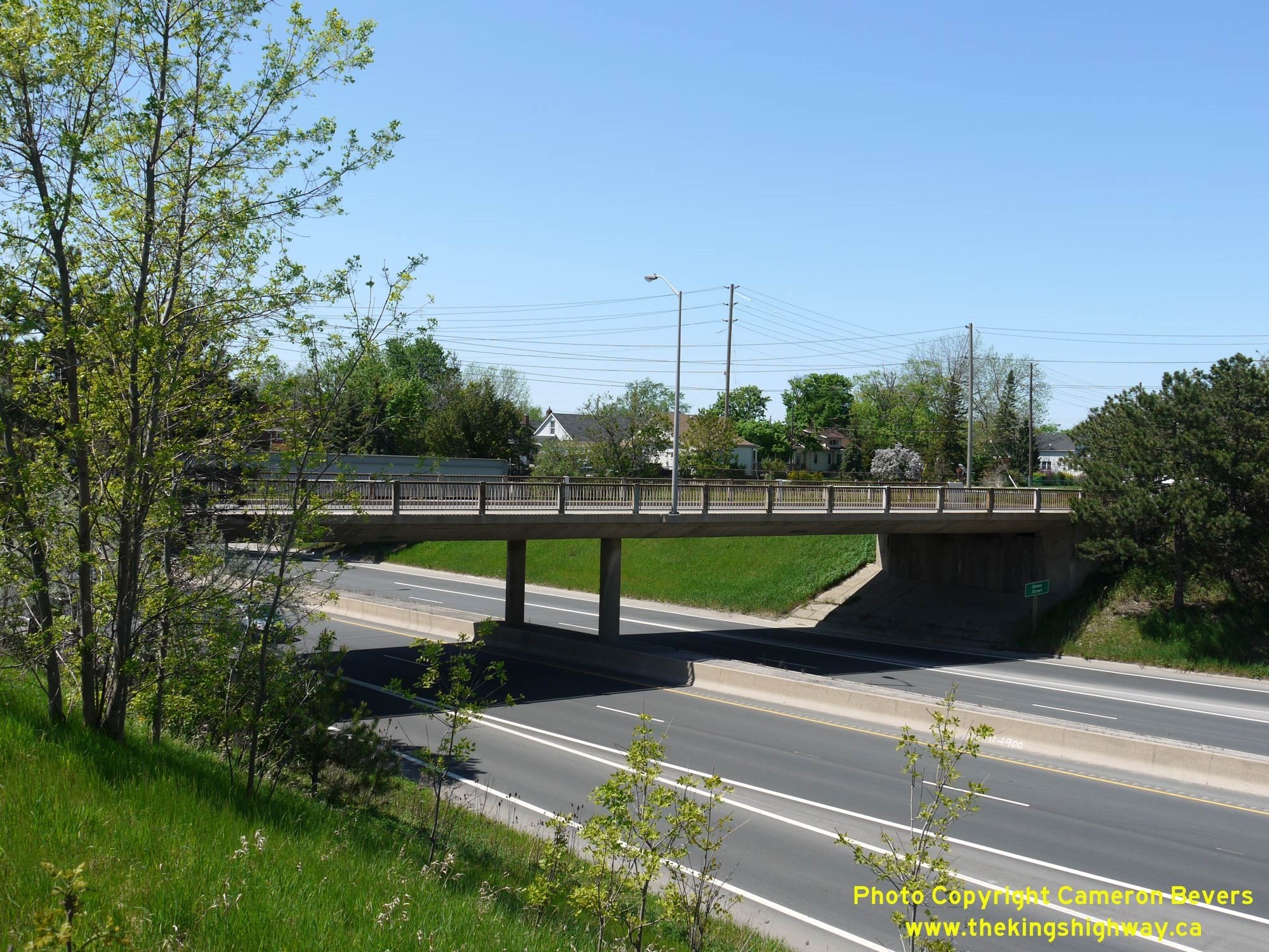 Left - Facing east along Hwy 58 towards the Thorold Tunnel and the Pine Street Interchange from the Queen Street Overpass in Thorold. See an Enlarged Photo Here. (Photograph taken on May 16, 2013 - © Cameron Bevers) Right - Eastern side of the Queen Street Overpass on Hwy 58 in Thorold. This two-span post-tensioned concrete structure was completed in 1966. See an Enlarged Photo Here. (Photograph taken on May 16, 2013 - © Cameron Bevers) 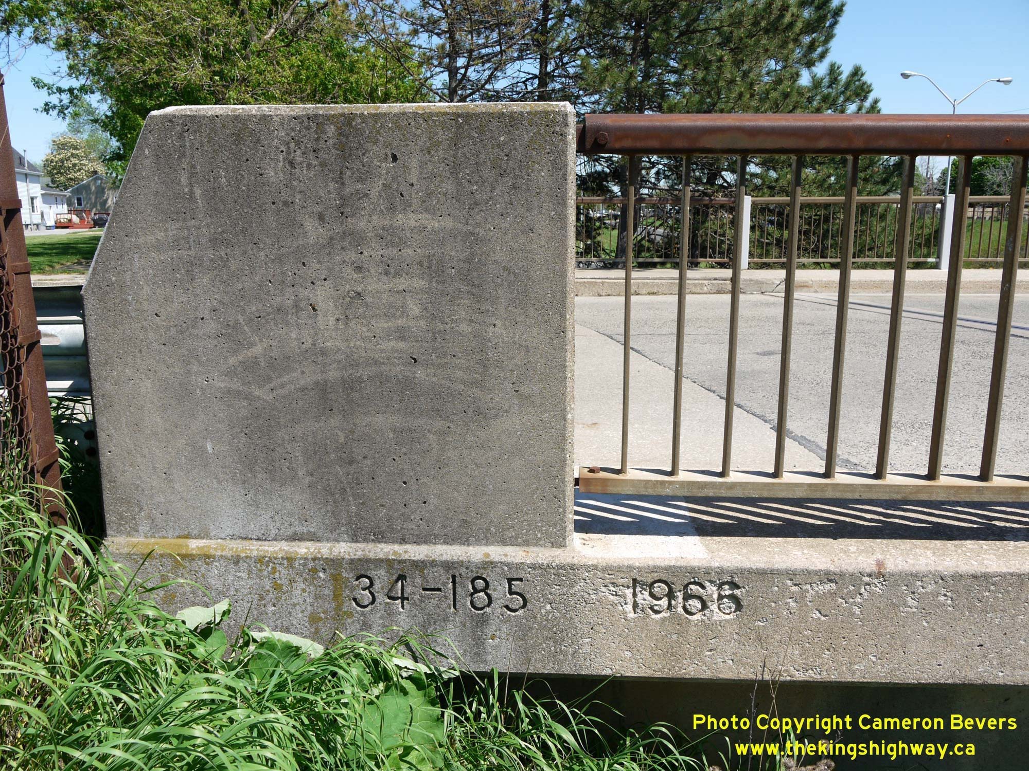
 Left - Date stamp (1966) and structure identification number (Site #34-185) on the Queen Street Overpass on Hwy 58 in Thorold. It is interesting to note that bridge site numbers within Niagara Region have two different prefixes. Bridges located in the northern areas of Niagara Region start with the prefix "18", while ones in the southern areas have the prefix "34". This is an interesting historical legacy left over from a time when the former counties of Lincoln and Welland were still in existence. Bridge site numbers located within Lincoln County start with prefix 18, while those in Welland County start with prefix 34. See an Enlarged Photo Here. (Photograph taken on May 16, 2013 - © Cameron Bevers) Right - An older 1960s-style DHO luminaire stands above Queen Street, as it crosses over Hwy 58 in Thorold. Like neighboring Pine Street, Queen Street also had a concrete pavement surface at the time this photo was taken in 2013. The Queen Street Overpass was closed to motor vehicle traffic a number of years ago and now serves as a pedestrian bridge only. See an Enlarged Photo Here. (Photograph taken on May 16, 2013 - © Cameron Bevers) 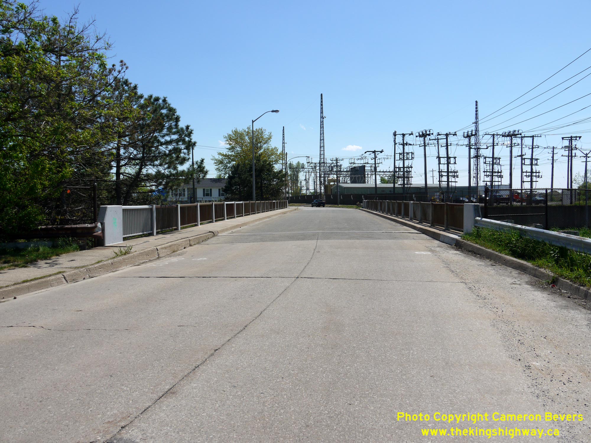
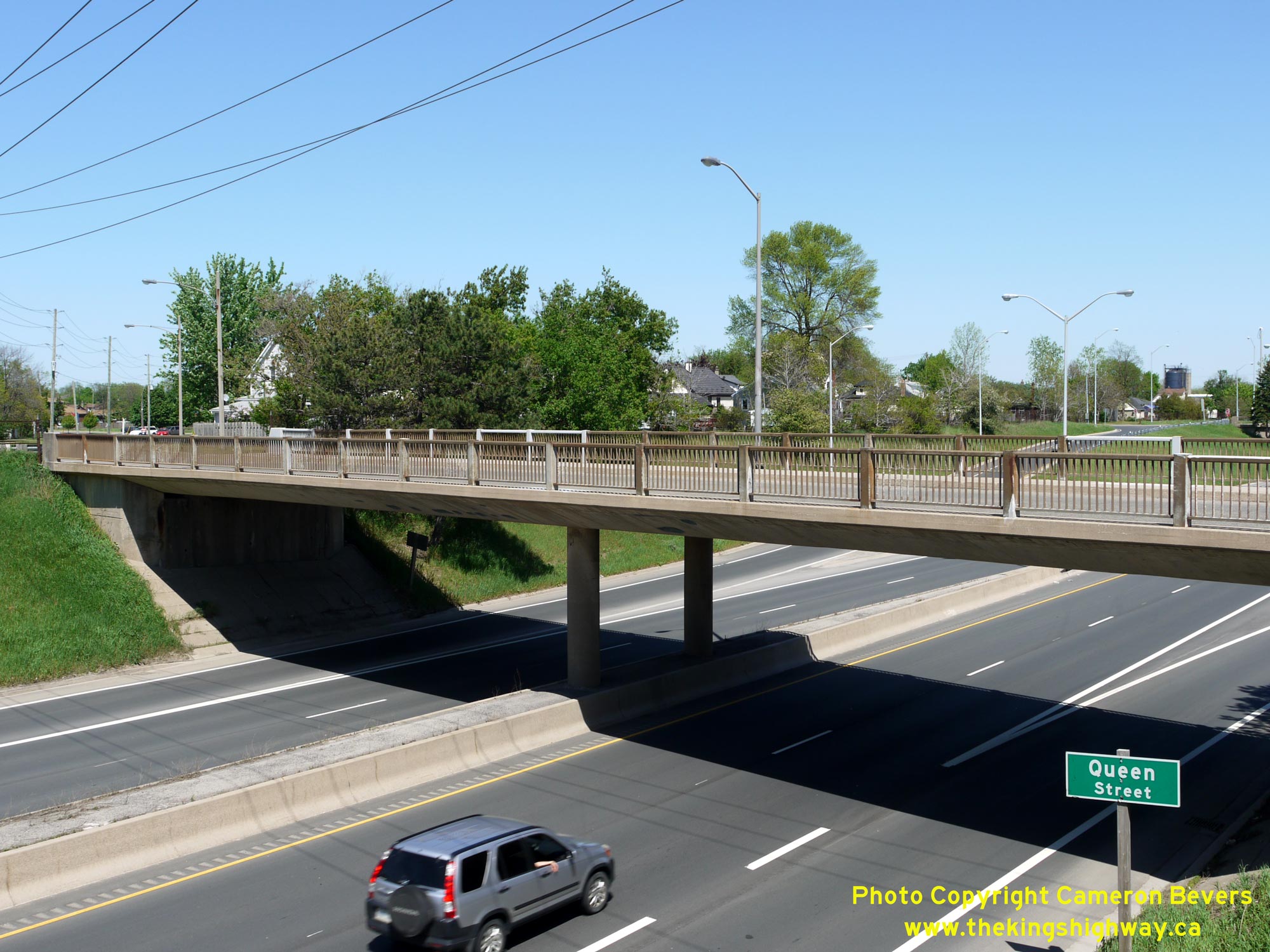 Left - Facing south across the Queen Street Overpass at Hwy 58 in Thorold. See an Enlarged Photo Here. (Photograph taken on May 16, 2013 - © Cameron Bevers) Right - Western side of the Queen Street Overpass on Hwy 58 in Thorold. This structure was built as part of the west tunnel approach under Contract #1966-58. See an Enlarged Photo Here. (Photograph taken on May 16, 2013 - © Cameron Bevers) 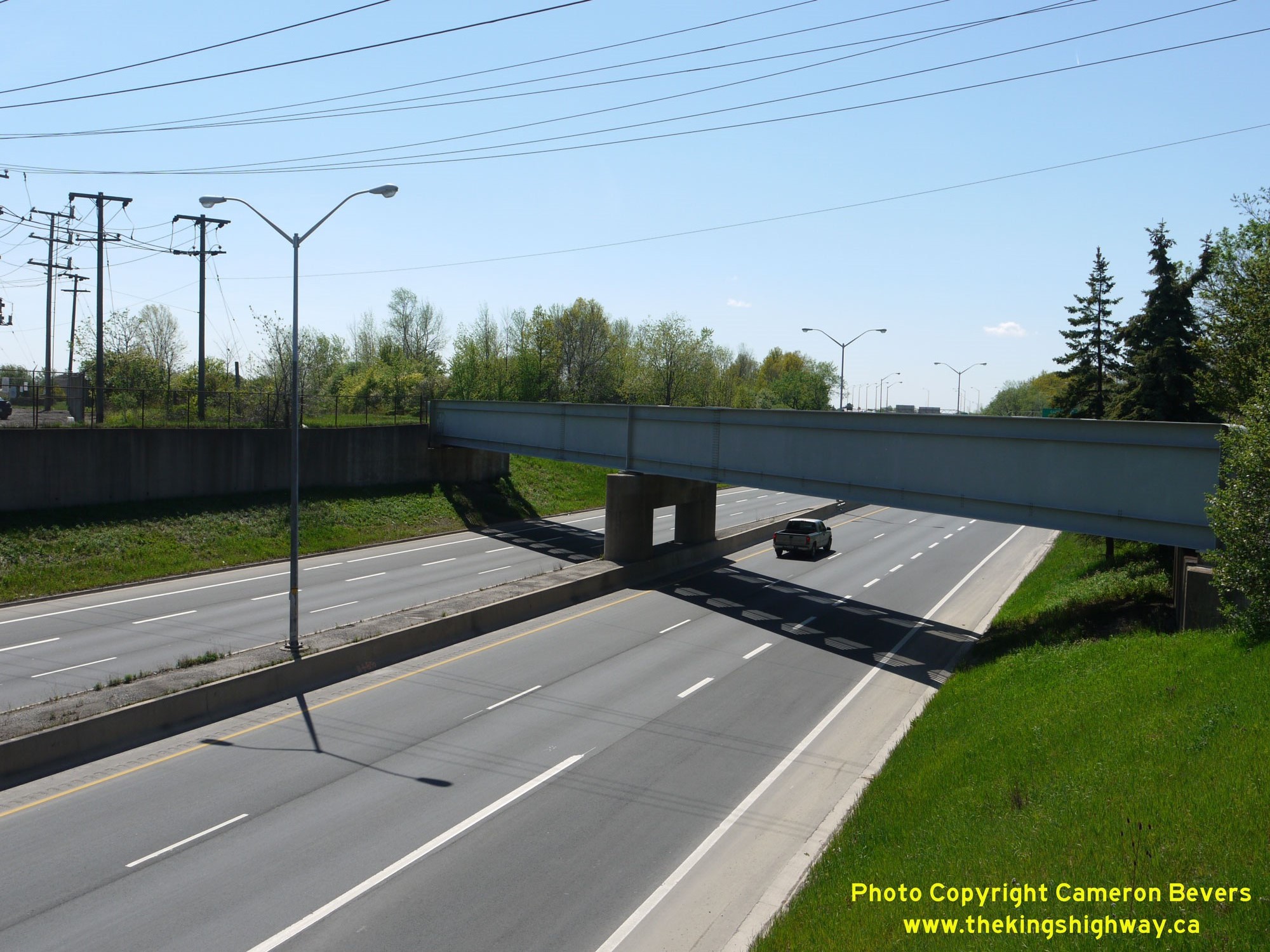
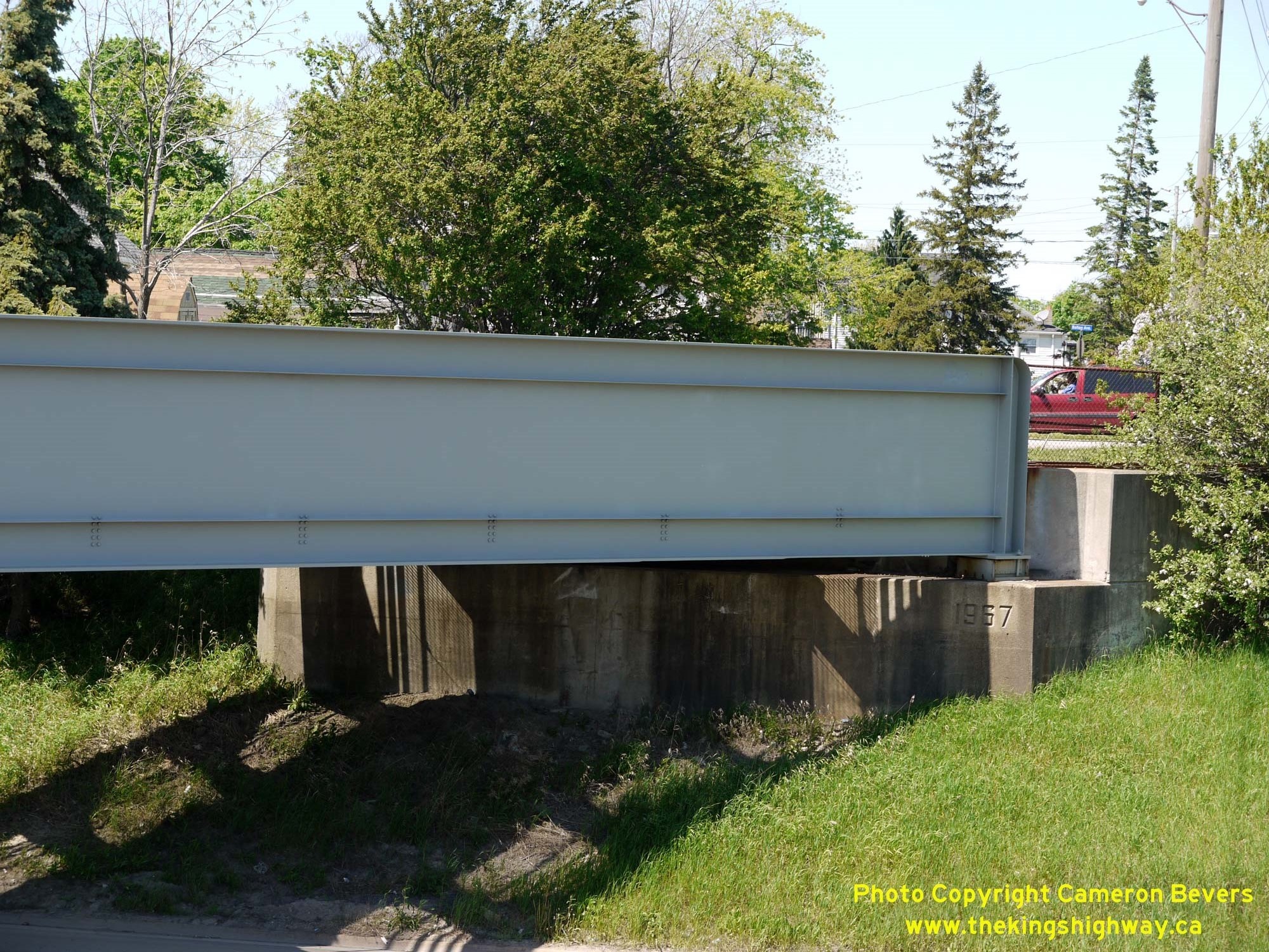 Left - Eastern side of the Thorold Canadian National Railway (CNR) Subway on Hwy 58. This railway grade separation carries an industrial railway spur across Hwy 58. See an Enlarged Photo Here. (Photograph taken on May 16, 2013 - © Cameron Bevers) Right - Close-up of the date stamp (1967) on the Thorold Canadian National Railway (CNR) Subway on Hwy 58. See an Enlarged Photo Here. (Photograph taken on May 16, 2013 - © Cameron Bevers) 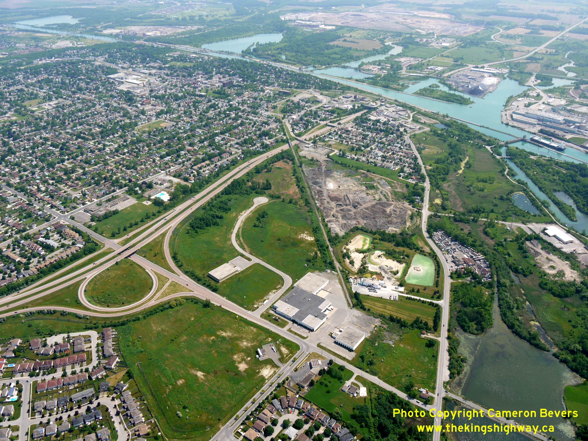
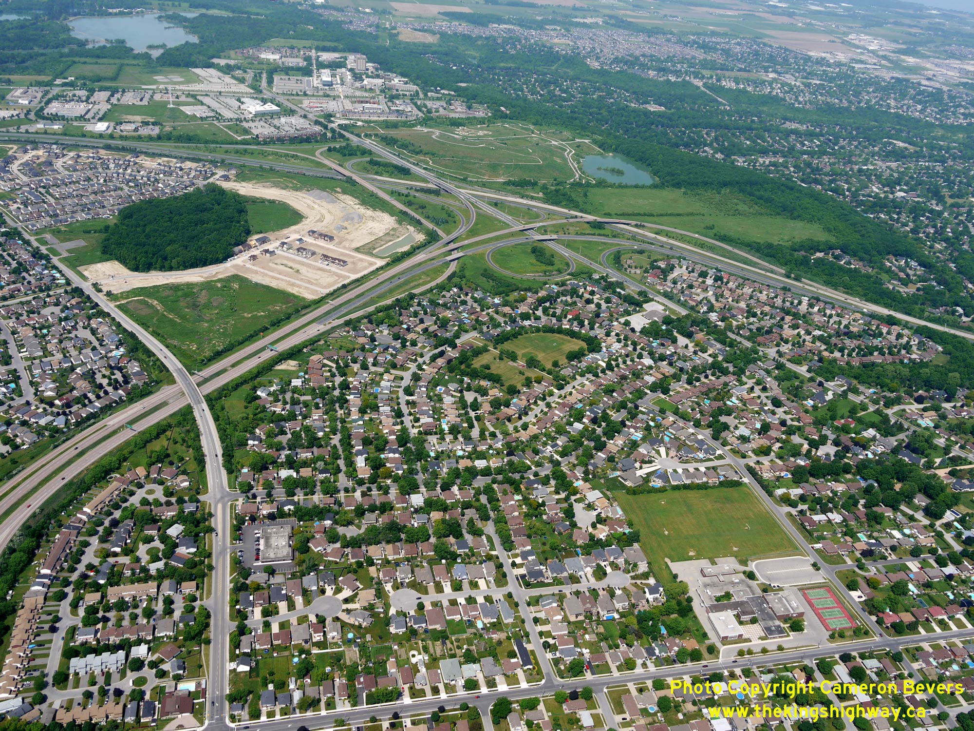
 Left - Aerial view of Hwy 58 through Thorold facing northeast from the Collier Road Interchange. When the Thorold Tunnel and its approaches first opened to traffic on September 18, 1968, the Hwy 58 Diversion temporarily ended at the Collier Road Interchange where all traffic was forced to exit from the freeway. Upon completion of the nearby Hwy 406 & Hwy 58 Interchange in the late 1960s, Hwy 58 was fully opened to traffic between Collier Road and Hwy 406 on November 21, 1969. See an Enlarged Photo Here. (Photograph taken on June 16, 2011 - © Cameron Bevers) Right - Aerial view of the Collier Road Interchange on Hwy 58 in Thorold, facing west towards Richmond Street. See an Enlarged Photo Here. (Photograph taken on June 16, 2011 - © Cameron Bevers) 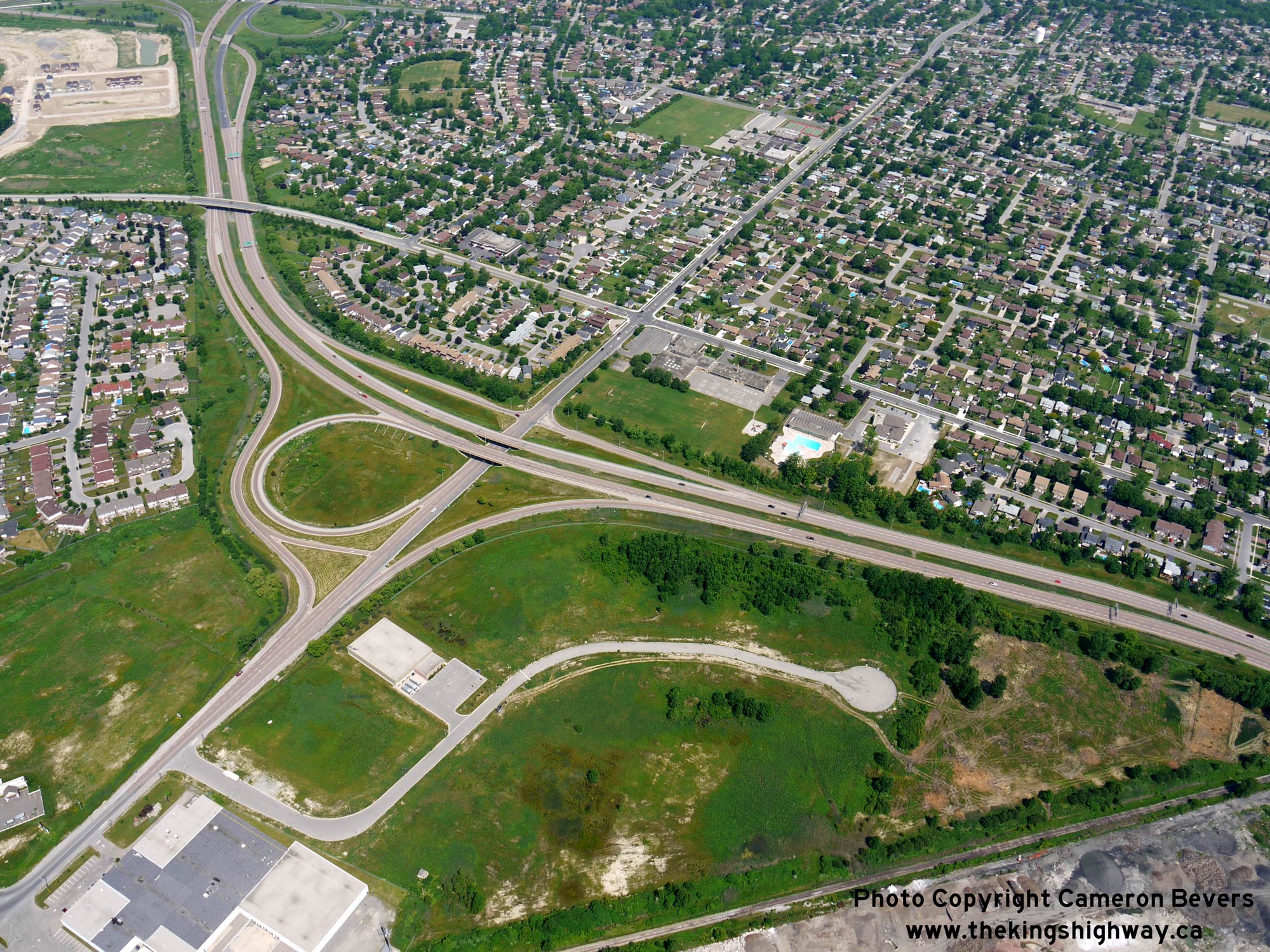
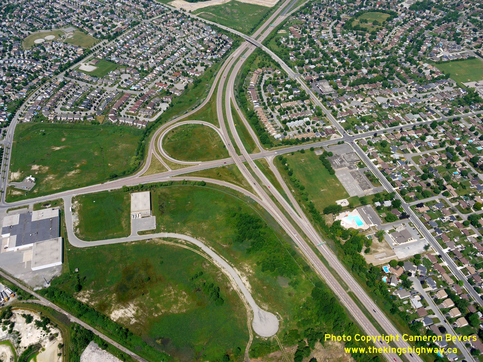
 Left - Aerial view of Hwy 58 between the Collier Road Interchange and Hwy 406 in Thorold, facing northeast. See an Enlarged Photo Here. (Photograph taken on June 16, 2011 - © Cameron Bevers) Right - Overhead freeway guide signs facing southbound Hwy 58 traffic approaching the Collier Road Interchange in Thorold. See an Enlarged Photo Here. (Photograph taken on June 28, 2012 - © Cameron Bevers) 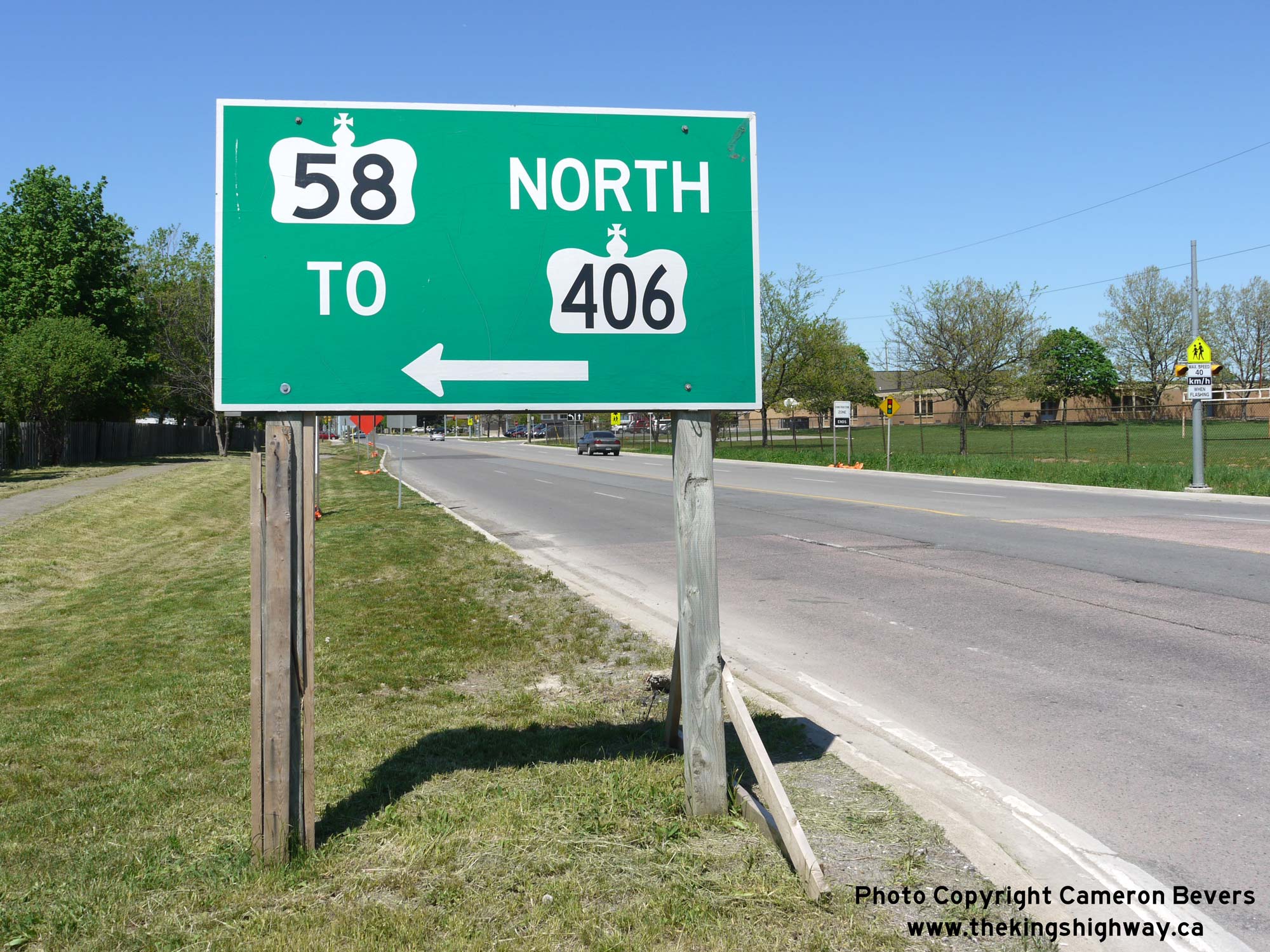
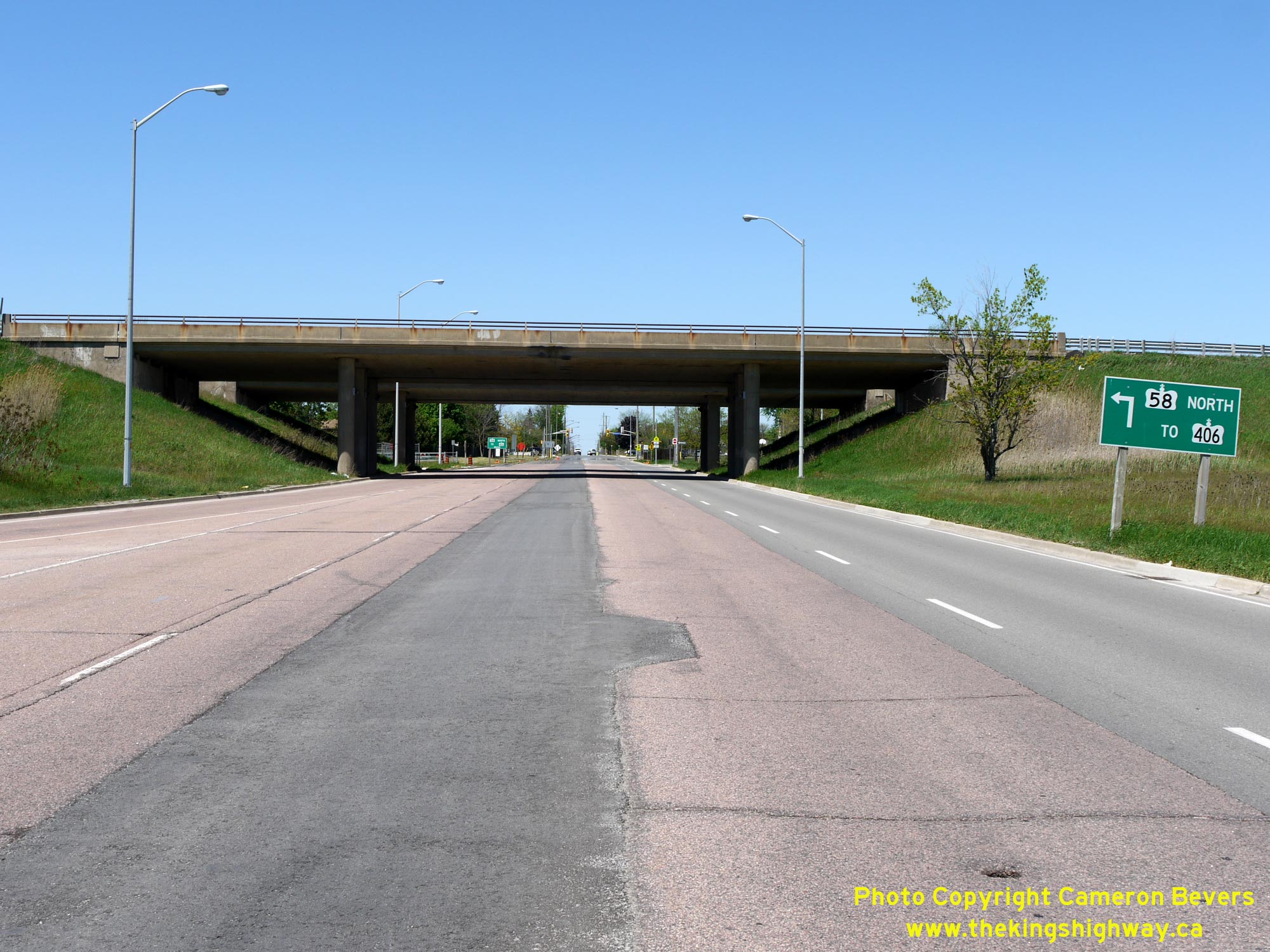 Left - Ground-mounted guide sign for the entrance ramp to Hwy 58 North at the Collier Road Interchange in Thorold. See an Enlarged Photo Here. (Photograph taken on May 16, 2013 - © Cameron Bevers) Right - Southern side of the Collier Road Underpass on Hwy 58 in Thorold. The Collier Road Interchange was built under Contract #1966-58, as part of the Thorold Tunnel's western approach (the Hwy 58 Diversion). The east-oriented ramps at this interchange opened to traffic in September 1968, but the west-oriented ramps did not open to traffic until November 1969. Hwy 58 ended at this interchange for just over a year, while the adjacent interchange at Hwy 406 & Hwy 58 was being constructed. See an Enlarged Photo Here. (Photograph taken on May 16, 2013 - © Cameron Bevers) 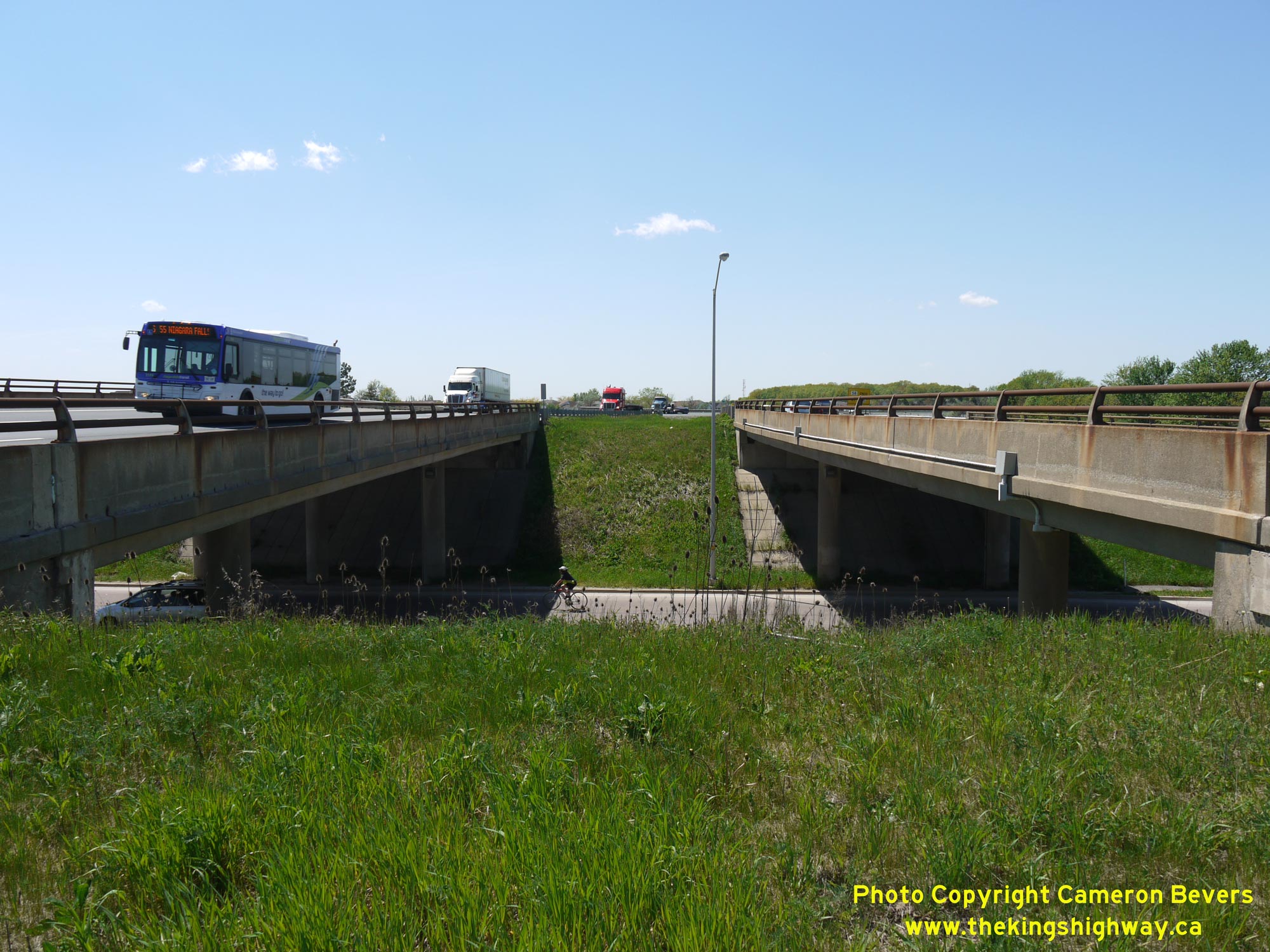
 Left - Dual underpass structures on Hwy 58 at Collier Road in Thorold. These dual three-span post-tensioned concrete structures were completed in 1966. See an Enlarged Photo Here. (Photograph taken on May 16, 2013 - © Cameron Bevers) Right - Facing east along Hwy 58 towards the Thorold Tunnel from the Collier Road Interchange. See an Enlarged Photo Here. (Photograph taken on May 16, 2013 - © Cameron Bevers) 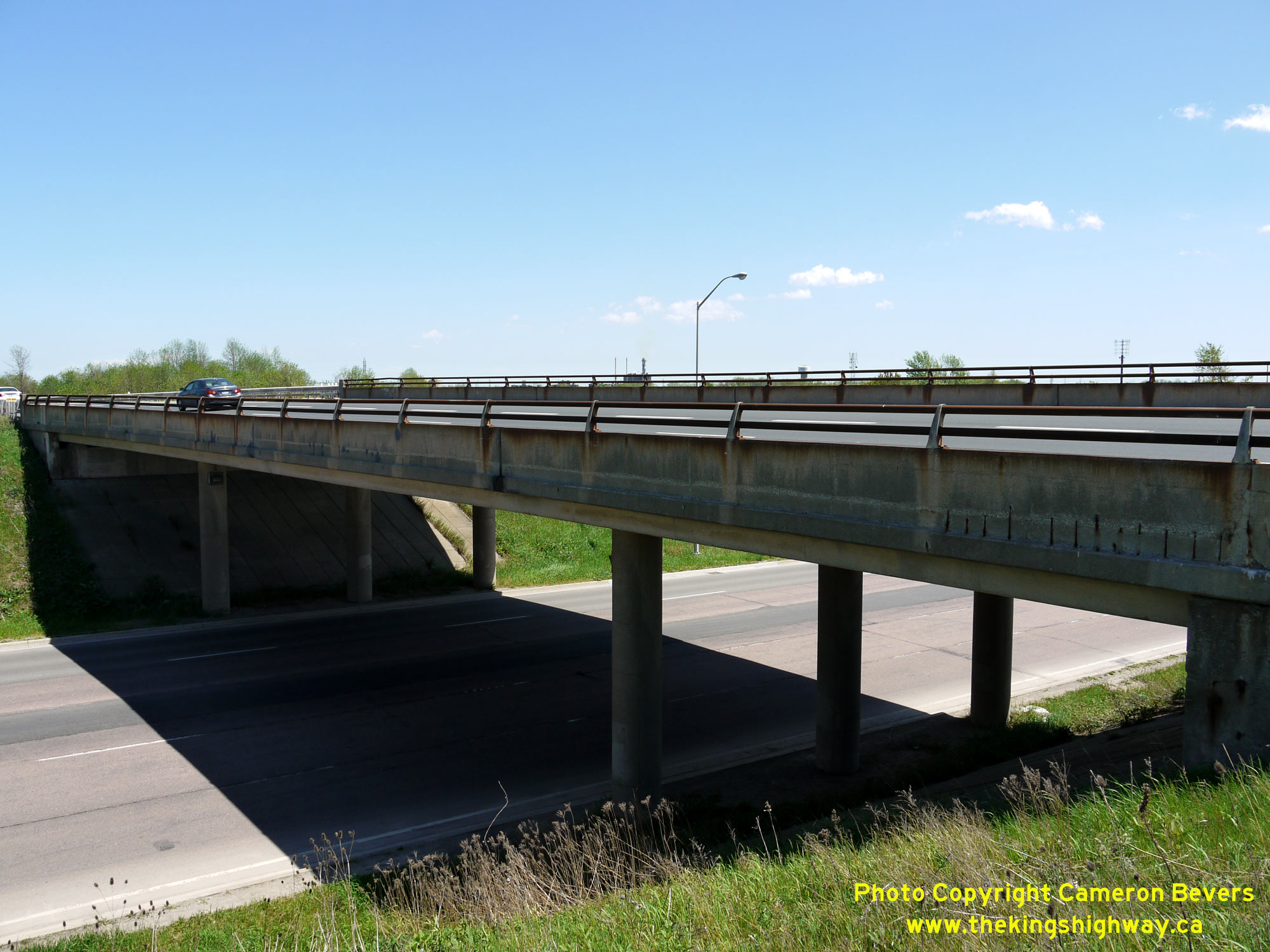
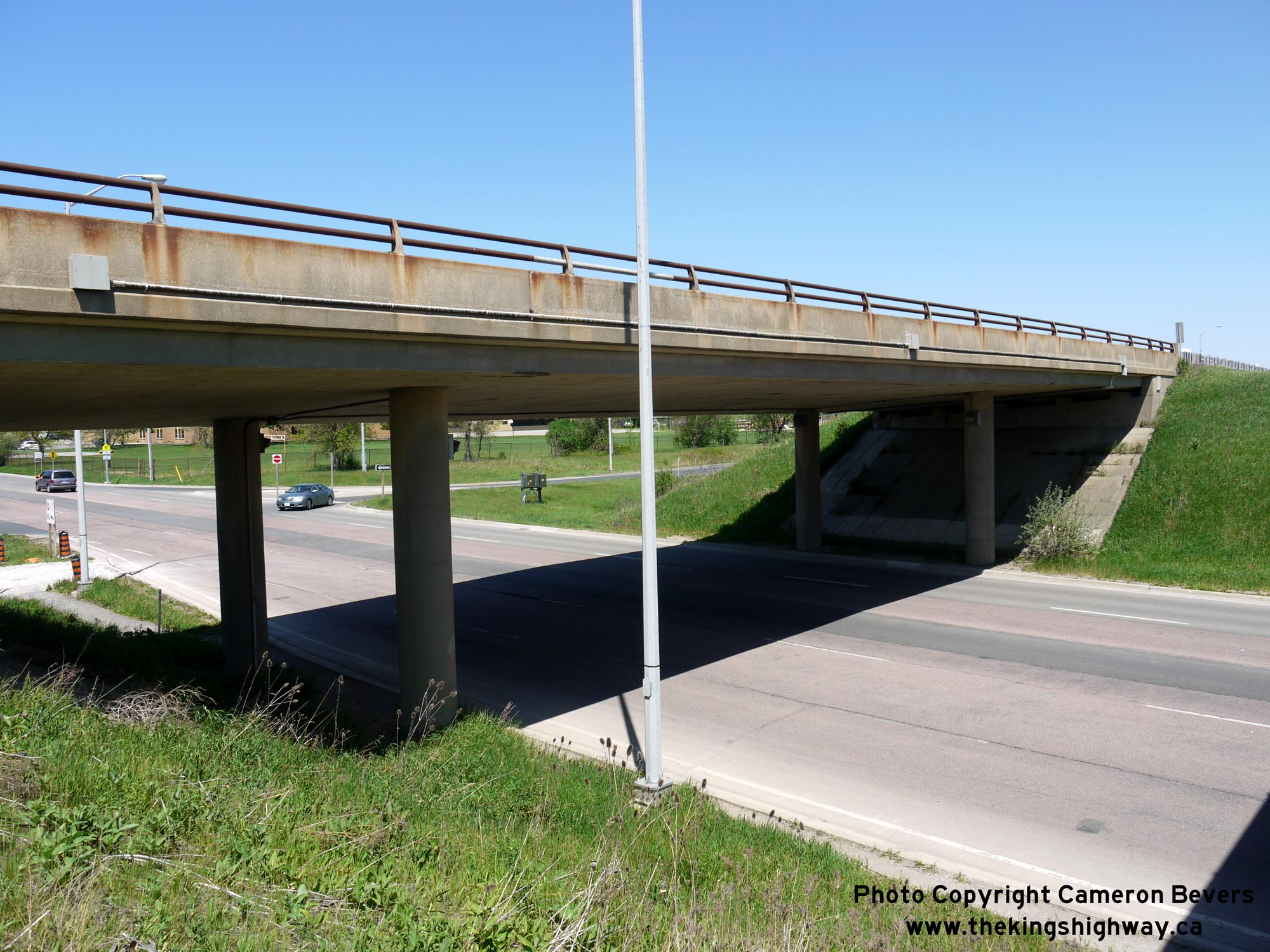
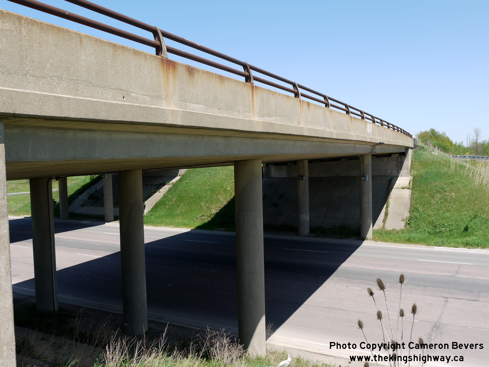 Left - This underpass structure carries the southbound lanes of Hwy 58 over Collier Road in Thorold. See an Enlarged Photo Here. (Photograph taken on May 16, 2013 - © Cameron Bevers) Right - Southern side of the Southbound Hwy 58 structure at the Collier Road Interchange. The southbound structure is wider that the opposing northbound structure, as this bridge also accommodates a ramp speed change lane in addition to the two southbound through lanes of Hwy 58. The 1960s saw a rapid expansion of Ontario's freeway network. In addition to new freeway corridors such as Hwy 58 and Hwy 406 through Thorold, substantial upgrades were made to existing sections of Hwy 401, Hwy 27 and the Queen Elizabeth Way across other regions of Ontario. See an Enlarged Photo Here. (Photograph taken on May 16, 2013 - © Cameron Bevers) 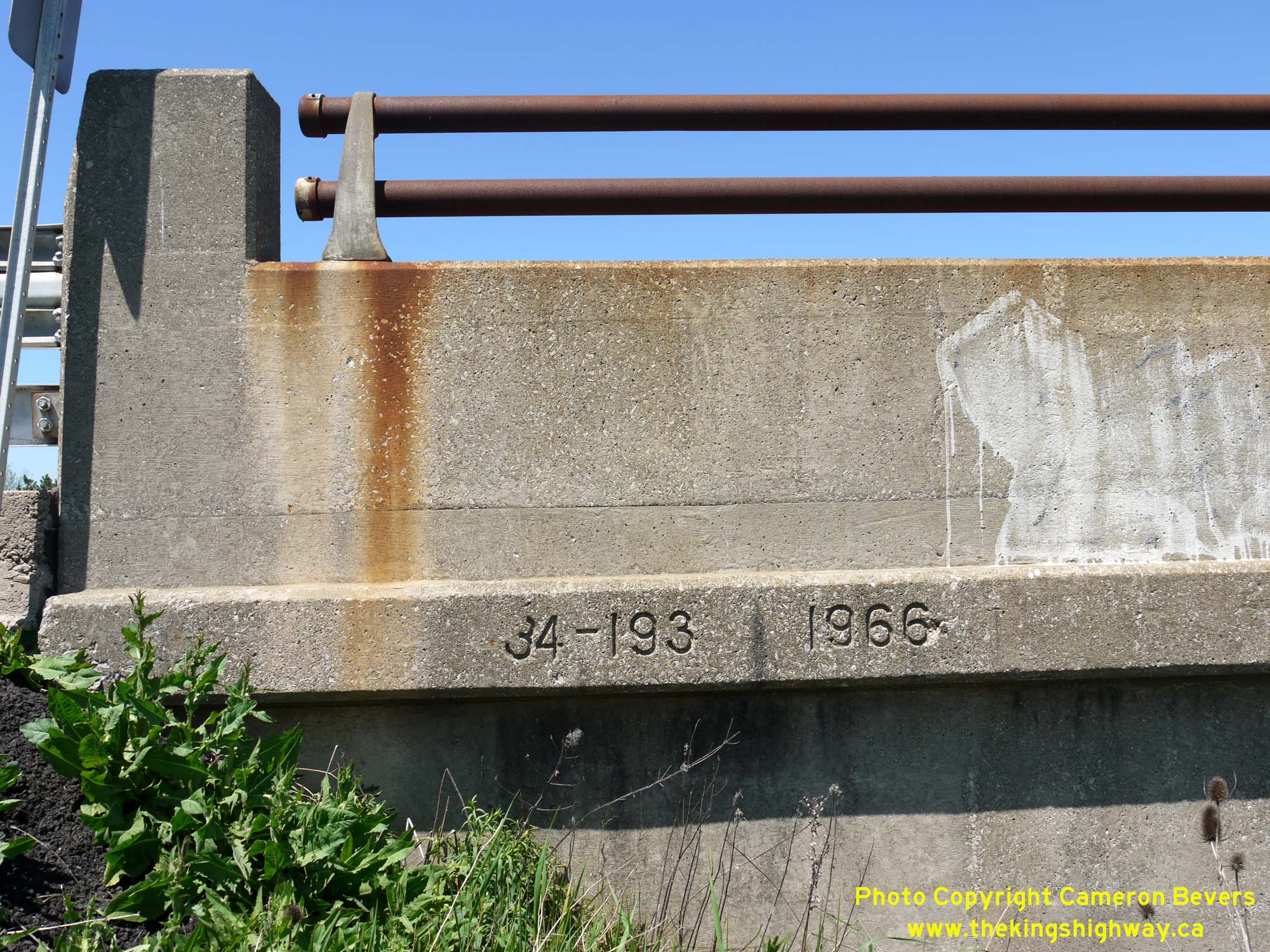
 Left - Date stamp (1966) and structure identification number (Site #34-193) on the Queen Street Overpass on Hwy 58 in Thorold. See an Enlarged Photo Here. (Photograph taken on May 16, 2013 - © Cameron Bevers) Right - Southern side of the Southbound Hwy 58 structure at the Collier Road Interchange in Thorold. See an Enlarged Photo Here. (Photograph taken on May 16, 2013 - © Cameron Bevers) 
 Left - Facing south towards the Hwy 58 and Collier Road Interchange in Thorold. See an Enlarged Photo Here. (Photograph taken on May 16, 2013 - © Cameron Bevers) Right - View of Hwy 58 facing northwest towards Richmond Street and the Hwy 406 Interchange. At right, a yellow guide sign advises motorists that Hwy 58 ends just ahead at Hwy 406. Historically, Hwy 58 ended just east of Downtown St. Catharines at the intersection of Queenston Street and Hartzel Road. The relocated route of Hwy 58 was completed through Thorold in the late 1960s to feed all through traffic onto the newly-built Hwy 406. See an Enlarged Photo Here. (Photograph taken on May 16, 2013 - © Cameron Bevers) 
 Left - Facing east towards the Collier Road Interchange from the Richmond Street Overpass in Thorold. See an Enlarged Photo Here. (Photograph taken on May 16, 2013 - © Cameron Bevers) Right - View of the Richmond Street Overpass on Hwy 58, facing east towards Downtown Thorold. See an Enlarged Photo Here. (Photograph taken on May 16, 2013 - © Cameron Bevers) 
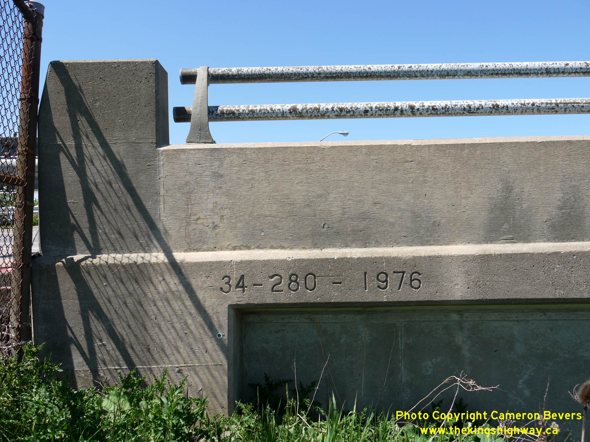 Left - Eastern side of the Richmond Street Overpass in Thorold. This two-span post-tensioned concrete structure was built under Contract #1976-14 and was completed in 1976. Interestingly, this structure was built several years after the Hwy 58 Diversion was completed and opened to traffic through Thorold in the late 1960s. See an Enlarged Photo Here. (Photograph taken on May 16, 2013 - © Cameron Bevers) Right - Date stamp (1976) and structure identification number (Site #34-280) on the Richmond Street Overpass on Hwy 58 in Thorold. See an Enlarged Photo Here. (Photograph taken on May 16, 2013 - © Cameron Bevers) 
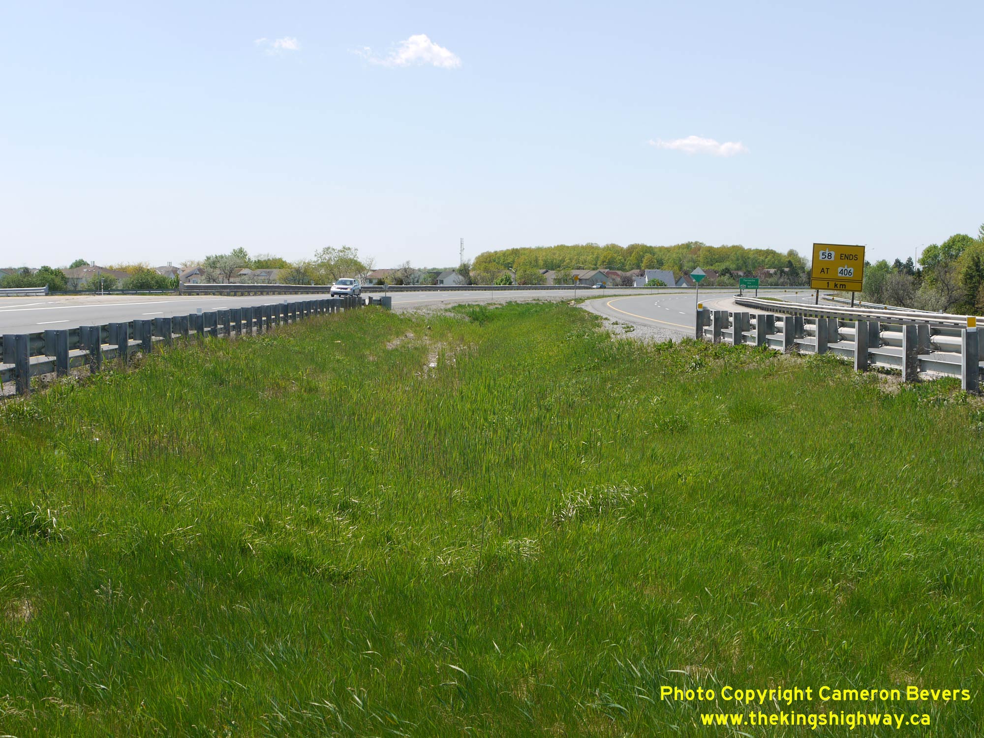
 Left - Facing west across the Richmond Street Overpass on Hwy 58 in Thorold. See an Enlarged Photo Here. (Photograph taken on May 16, 2013 - © Cameron Bevers) Right - View of Hwy 58 from the Richmond Street Overpass, facing northwest towads Hwy 58's northern terminus at the Hwy 406 Interchange. The connections to Hwy 406 and St. David's Road from Hwy 58 (Collier Road northwesterly) were all constructed under Contract #1968-03. The extension of Hwy 58 from the Collier Road Interchange northwesterly to Hwy 406 was completed and opened to traffic on November 21, 1969. See an Enlarged Photo Here. (Photograph taken on May 16, 2013 - © Cameron Bevers) 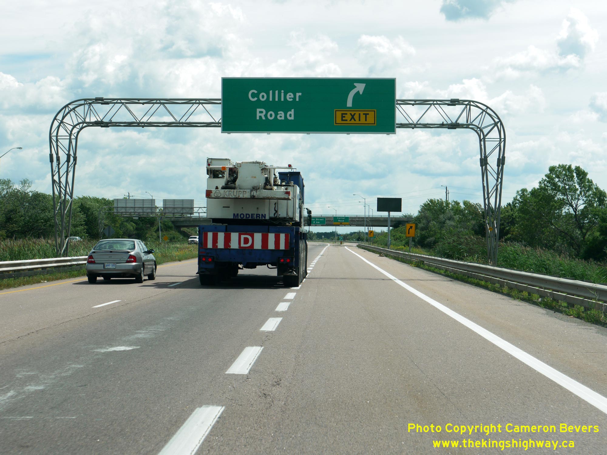
 Left - Advance overhead freeway guide sign for the upcoming Collier Road Interchange on southbound Hwy 58. See an Enlarged Photo Here. (Photograph taken on June 28, 2010 - © Cameron Bevers) Right - Aerial view of the Richmond Street Overpass on Hwy 58 and the southeastern approach to the Hwy 406 Interchange. Here, Hwy 58 reaches its northern terminus where it comes to an end at the Hwy 406 and St. David's Road Interchange. This large freeway-to-freeway interchange straddles the municipal boundary line between Thorold and St. Catharines. See an Enlarged Photo Here. (Photograph taken on June 16, 2011 - © Cameron Bevers)
More King's Highway 58 Photographs Coming Soon!
|
|---|
Links to Adjacent King's Highway Photograph Pages:
Back to King's Highway 57 Photos /
King's Highway 58 History /
On to King's Highway 59 Photos
Ontario Highway History - Main Menu / Back to List of Highways Website contents, photos & text © 2002-2026, Cameron
Bevers (Webmaster) - All Rights Reserved / Contact Me
|
|---|