
| 
|  |
|
|
All photographs displayed on this page were taken by the
Webmaster (Cameron Bevers), unless specifically noted otherwise. Historical photographs are
arranged in approximate chronological order, while present day photographs (Year 2005 to date)
are arranged by location from south to north. Click on any thumbnail to see a larger image!
Please note that all photographs displayed on this
website are protected by copyright. These photographs must not be reproduced, published,
electronically stored or copied, distributed, or posted onto other websites without
my written permission. If you want to use photos from this website, please
email me first for permission. Thank-you!
|
|---|
|
Historical Secondary Highway 632 Photographs
  Above - Circa 1940 postcard view of the Port Sandfield Swing Bridge on the Port Carling-Rosseau Secondary Road (later known as Hwy 632). Constructed in 1924,
this swing bridge remained in service until the late 1990s, when it was replaced by a new concrete and steel swing bridge. See an
Enlarged Photo Here. Photo taken circa 1940. Above - Circa 1940 postcard view of the Port Sandfield Swing Bridge on the Port Carling-Rosseau Secondary Road (later known as Hwy 632). Constructed in 1924,
this swing bridge remained in service until the late 1990s, when it was replaced by a new concrete and steel swing bridge. See an
Enlarged Photo Here. Photo taken circa 1940.(Photo courtesy of the Photogelatine Engraving Co. Ltd)   Above - New Joseph River Bridge on Hwy 632 between Port Sandfield and Rosseau in 1967, shortly after completion. This four-span concrete girder structure was
built under Contract #1966-47 and was completed in 1966. See an Enlarged Photo Here. Photo
taken in 1967. Above - New Joseph River Bridge on Hwy 632 between Port Sandfield and Rosseau in 1967, shortly after completion. This four-span concrete girder structure was
built under Contract #1966-47 and was completed in 1966. See an Enlarged Photo Here. Photo
taken in 1967.(Photo courtesy of Ontario Ministry of Transportation - © King's Printer for Ontario, 1967) 
Above - Construction of a revised alignment of Hwy 632 south of Rosseau, Contract #1989-224. See an
Enlarged Photo Here. Photo taken in 1990. (Photo courtesy of Ontario Ministry of Transportation - © King's Printer for Ontario, 1990) |
|---|
|
Present Day Secondary Highway 632 Photographs


Left - Facing south along Peninsula Road (Former Hwy 632) towards the Hwy 118 Junction in Port Carling. This highway junction marks the original southern
terminus of Hwy 632 as it existed prior to the 1970s. Since 1972, provincial jurisdiction over Hwy 632 has ended at the Muskoka-Parry Sound District Boundary between
Port Sandfield and Rosseau. See an Enlarged Photo Here. (Photograph taken on June 24, 2017 - © Cameron Bevers) Right - Facing north along Former Hwy 632 (Peninsula Road) towards Port Sandfield from the Hwy 118 Junction in Port Carling. The former route of Hwy 632 within the District Municipality of Muskoka is now known as Muskoka District Road 7. The route of Hwy 632 is signed with a green-and-white trailblazer route marker via Peninsula Road. See an Enlarged Photo Here. (Photograph taken on June 24, 2017 - © Cameron Bevers) 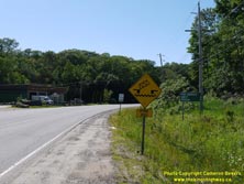

Left - Distance guide sign and opening bridge warning sign on Peninsula Road, facing north near the Hwy 118 Junction in Port Carling. Hwy 632 was first
designated as a provincial highway between Port Carling and Rosseau in 1961. It was one of many Secondary Highways established in Muskoka during the 1950s and
early 1960s to handle ever-increasing summer traffic volumes in this popular vacation area. See an
Enlarged Photo Here. (Photograph taken on June 24, 2017 - © Cameron Bevers) Right - Eastern side of the Port Sandfield Swing Bridge on Former Hwy 632 (Peninsula Road). See an Enlarged Photo Here. (Photograph taken on June 24, 2017 - © Cameron Bevers) 

Left - Facing south along Former Hwy 632 (Peninsula Road) towards Port Carling from the Port Sandfield Swing Bridge. See an
Enlarged Photo Here. (Photograph taken on June 24, 2017 - © Cameron Bevers) Right - View of the Port Sandfield Channel, facing west from the swing bridge on Peninsula Road. This artificial navigation channel was constructed in the 19th Century to link Lake Rosseau and Lake Joseph together. A bit further to the north, a natural channel (the Joseph River) also connects the two lakes together. Lake Joseph lies to the west of the swing bridge, while Lake Rosseau lies to the east of the swing bridge. Lake Joseph and Lake Rosseau are among the largest inland lakes in this part of Ontario, and offer extensive recreational boating opportunities. See an Enlarged Photo Here. (Photograph taken on June 24, 2017 - © Cameron Bevers) 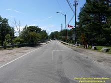

Left - Facing north towards Rosseau at the Port Sandfield Swing Bridge. The bridge only has a single traffic lane, so motorists may have to yield the
right-of-way to traffic coming in the opposing direction. There are no traffic control signals at this bridge, so motorists typically cross the bridge on a
first-come, first-serve basis. See an Enlarged Photo Here. (Photograph taken on June 24, 2017 - © Cameron Bevers) Right - Eastern side of the Port Sandfield Swing Bridge on Peninsula Road (Former Hwy 632). The current structure over the Port Sandfield Channel is actually the fourth bridge to have been built across this navigation channel. The current swing bridge was completed in 1998. It replaced a much older steel truss swing bridge which had been built in 1924. See an Enlarged Photo Here. (Photograph taken on June 24, 2017 - © Cameron Bevers) 

Left - Interpretive plaque on the Port Sandfield Swing Bridge, showing the historical bridges which have existed over the Port Sandfield Channel since the
1870s. The current swing bridge on Peninsula Road at Port Sandfield was completed in 1998. See an
Enlarged Photo Here. (Photograph taken on June 24, 2017 - © Cameron Bevers) Right - View from the Port Sandfield Swing Bridge, facing east. The channel opens up into Lake Rosseau a short distance east of the highway bridge. Lake Joseph and Lake Rosseau are among the most popular lakes in Ontario for both cottagers and recreational boaters. In the summer, there is no shortage of boat traffic at Port Sandfield! A small but scenic roadside park exists on the southeastern corner of the swing bridge (at right, in this photo), which allows motorists to stop and enjoy this classic Muskoka scene. See an Enlarged Photo Here. (Photograph taken on June 24, 2017 - © Cameron Bevers) 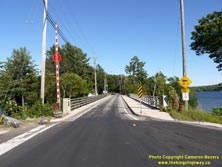

Left - Facing south along Former Hwy 632 (Peninsula Road) at the Port Sandfield Swing Bridge. See an
Enlarged Photo Here. (Photograph taken on June 24, 2017 - © Cameron Bevers) Right - Facing north along Peninsula Road towards Rosseau from the Port Sandfield Swing Bridge. See an Enlarged Photo Here. (Photograph taken on June 24, 2017 - © Cameron Bevers) 
  Left - View of the Port Sandfield Swing Bridge from the eastern (Lake Rosseau) end of the navigation channel. See an
Enlarged Photo Here. Left - View of the Port Sandfield Swing Bridge from the eastern (Lake Rosseau) end of the navigation channel. See an
Enlarged Photo Here.(Photograph taken on June 18, 2023 - © Cameron Bevers)  Right - Approaching the navigation channel below the Port Sandfield Swing Bridge from the western (Lake Joseph) side. See an
Enlarged Photo Here. Right - Approaching the navigation channel below the Port Sandfield Swing Bridge from the western (Lake Joseph) side. See an
Enlarged Photo Here.(Photograph taken on June 18, 2023 - © Cameron Bevers) 
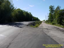
Left - Port Sandfield's small business district is concentrated at the northern end of the swing bridge. The highway right-of-way through Port Sandfield is
very narrow. See an Enlarged Photo Here. (Photograph taken on June 24, 2017 - © Cameron Bevers) Right - Former alignment of Hwy 632 (McLeod Road) just north of Port Sandfield. See an Enlarged Photo Here. (Photograph taken on June 24, 2017 - © Cameron Bevers) 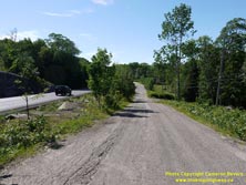
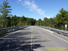
Left - The old alignment of Hwy 632 (McLeod Road) north of Port Sandfield was bypassed by a new highway alignment at left with improved vertical geometry. See
an Enlarged Photo Here. (Photograph taken on June 24, 2017 - © Cameron Bevers) Right - Facing north along Peninsula Road (Former Hwy 632) at the Joseph River Bridge, located about 5 km north of Port Sandfield. See an Enlarged Photo Here. (Photograph taken on June 24, 2017 - © Cameron Bevers) 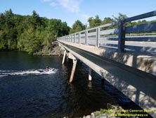
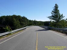
Left - Western side of the Joseph River Bridge on Peninsula Road. This four-span concrete girder structure was completed in 1966. About one mile of Hwy 632's
route was relocated in 1966-1967, as a result of this bridge replacement project. The new bridge replaced an older steel pony truss structure. See an
Enlarged Photo Here. (Photograph taken on June 24, 2017 - © Cameron Bevers) Right - Facing south along Peninsula Road (Former Hwy 632) towards Port Sandfield at the Joseph River Bridge. See an Enlarged Photo Here. (Photograph taken on June 24, 2017 - © Cameron Bevers) 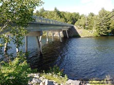
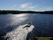
Left - Eastern side of the Joseph River Bridge on Peninsula Road between Port Sandfield and Rosseau. See an
Enlarged Photo Here. (Photograph taken on June 24, 2017 - © Cameron Bevers) Right - View of the Joseph River from the bridge on Peninsula Road. The Joseph River links Lake Rosseau to Lake Joseph, and thus sees considerable marine traffic. See an Enlarged Photo Here. (Photograph taken on June 24, 2017 - © Cameron Bevers) 
  Left - Facing east approaching the Joseph River Bridge from the western (Lake Joseph) side of the navigation channel. See an
Enlarged Photo Here. Left - Facing east approaching the Joseph River Bridge from the western (Lake Joseph) side of the navigation channel. See an
Enlarged Photo Here.(Photograph taken on June 8, 2025 - © Cameron Bevers)  Right - View of the Joseph River Bridge from the eastern (Lake Rosseau) side of the navigation channel. See an
Enlarged Photo Here. Right - View of the Joseph River Bridge from the eastern (Lake Rosseau) side of the navigation channel. See an
Enlarged Photo Here.(Photograph taken on June 8, 2025 - © Cameron Bevers) 

Left - Crossing the Muskoka-Parry Sound District Boundary on Hwy 632 near Mary Jane Lake, about 11 km south of Rosseau. Since 1972, provincial jurisdiction
over Hwy 632 has commenced at this boundary and continues north to the Village of Rosseau. See an
Enlarged Photo Here. (Photograph taken on June 24, 2017 - © Cameron Bevers) Right - Current southern terminus of Hwy 632 at the Muskoka-Parry Sound District Boundary. Historically, Hwy 632 continued south for approximately 16 km to Hwy 118 in Port Carling. Today, the District Municipality of Muskoka maintains jurisdiction over Peninsula Road from the Muskoka-Parry Sound District Boundary southerly to the Hwy 118 Junction. See an Enlarged Photo Here. (Photograph taken on June 24, 2017 - © Cameron Bevers) 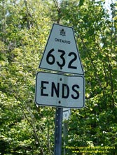
Above - Route marker indicating the end of the provincially-owned section of Hwy 632, about 11 km south of Rosseau. From this point southerly to the Hwy 118
Junction, Former Hwy 632 is officially known as Muskoka District Road 7. Provincial jurisdiction over Hwy 632 through the District of Muskoka was relinquished in
1972. See an Enlarged Photo Here. (Photograph taken on June 24, 2017 - © Cameron Bevers) 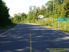
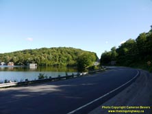
Left - Distance guide sign on northbound Hwy 632 at the Muskoka-Parry Sound District Boundary. See an
Enlarged Photo Here. (Photograph taken on June 24, 2017 - © Cameron Bevers) Right - Facing south along Hwy 632 towards Port Sandfield beside Lake Rosseau. See an Enlarged Photo Here. (Photograph taken on June 24, 2017 - © Cameron Bevers) 
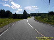
Left - View of one of Lake Rosseau's countless bays from Hwy 632, about 5 km south of Rosseau. See an
Enlarged Photo Here. (Photograph taken on June 24, 2017 - © Cameron Bevers) Right - Facing south along Hwy 632 towards Port Sandfield, about 1 km south of the Hwy 141 Junction in Rosseau. See an Enlarged Photo Here. (Photograph taken on June 24, 2017 - © Cameron Bevers) 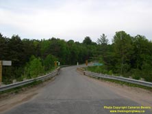

Left - Old Shadow River Bridge on Hwy 632, facing north towards Rosseau. This single-lane bridge once stood at the southern entrance to Rosseau. See an
Enlarged Photo Here. (Photograph taken on June 3, 2006 - © Cameron Bevers) Right - Eastern side of the old Shadow River Bridge on Hwy 632. This three-span concrete beam structure was completed in 1930. See an Enlarged Photo Here. (Photograph taken on June 3, 2006 - © Cameron Bevers) 
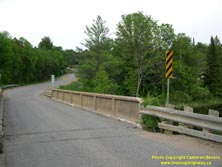
Left - Facing south across the old Shadow River Bridge on Hwy 632 in Rosseau. This aging structure was replaced with a brand-new two-lane bridge in 2010. See
an Enlarged Photo Here. (Photograph taken on June 3, 2006 - © Cameron Bevers) Right - Concrete handrail of the Shadow River Bridge on Hwy 632. See an Enlarged Photo Here. (Photograph taken on June 3, 2006 - © Cameron Bevers) 

Left - Western side of the old Shadow River Bridge on Hwy 632 in Rosseau. See an
Enlarged Photo Here. (Photograph taken on June 3, 2006 - © Cameron Bevers) Right - New replacement Shadow River Bridge on Hwy 632 in Rosseau. This single span concrete girder structure was completed in 2010. See an Enlarged Photo Here. (Photograph taken on June 24, 2017 - © Cameron Bevers) 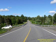
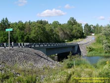
Left - Facing north across the Shadow River Bridge on Hwy 632. The crooked highway alignment on the approaches to the old bridge are now a thing of the past.
See an Enlarged Photo Here. (Photograph taken on June 24, 2017 - © Cameron Bevers) Right - Eastern side of the new Shadow River Bridge on Hwy 632. See an Enlarged Photo Here. (Photograph taken on June 24, 2017 - © Cameron Bevers) 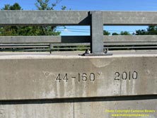

Left - Date stamp (2010) and structure identification number on the replacement Shadow River Bridge on Hwy 632. See an
Enlarged Photo Here. (Photograph taken on June 24, 2017 - © Cameron Bevers) Right - Facing south across the Shadow River Bridge on Hwy 632 in Rosseau. See an Enlarged Photo Here. (Photograph taken on June 24, 2017 - © Cameron Bevers) 

Left - Entering Rosseau on Hwy 632, facing north. Rosseau is the only settlement situated along the provincially-owned section of Hwy 632. See an
Enlarged Photo Here. (Photograph taken on June 24, 2017 - © Cameron Bevers) Right - Facing south along Hwy 632 towards Port Sandfield from the southern entrance to Rosseau. See an Enlarged Photo Here. (Photograph taken on June 24, 2017 - © Cameron Bevers) 
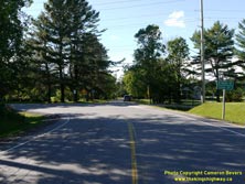
Left - Facing north along Hwy 632 in Rosseau. Hwy 632 briefly turns east for one block at Maple Street. See an
Enlarged Photo Here. (Photograph taken on June 24, 2017 - © Cameron Bevers) Right - Southbound Hwy 632 turns left onto Peninsula Road at Maple Street in Rosseau. See an Enlarged Photo Here. (Photograph taken on June 24, 2017 - © Cameron Bevers) 

Left - Hwy 632 skirts a small community park in Rosseau before turning north again via Pine Street towards the Hwy 141 Junction. See an
Enlarged Photo Here. (Photograph taken on June 24, 2017 - © Cameron Bevers) Right - A Hwy 141 "JCT" junction route marker on northbound Pine Street (Hwy 632) in Rosseau. See an Enlarged Photo Here. (Photograph taken on June 24, 2017 - © Cameron Bevers) 
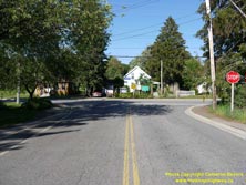
Left - Facing south along Hwy 632 (Pine Street) towards Port Sandfield from the Hwy 141 Junction. See an
Enlarged Photo Here. (Photograph taken on June 24, 2017 - © Cameron Bevers) Right - Northern terminus of Hwy 632 at the Hwy 141 Junction in Rosseau. See an Enlarged Photo Here. (Photograph taken on June 24, 2017 - © Cameron Bevers) 
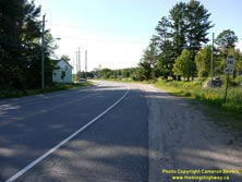
Left - Fingerboard guide signs and junction sign assembly at the Hwy 141 & Hwy 632 Junction. Motorists at this highway junction can either turn left and
head west along Hwy 141 towards Hwy 400 and Parry Sound, or turn right and head east along Hwy 141 towards Hwy 11, Bracebridge and Huntsville. See an
Enlarged Photo Here. (Photograph taken on June 24, 2017 - © Cameron Bevers) Right - Facing west along Hwy 141 towards Parry Sound from the Hwy 632 Junction in Rosseau. See an Enlarged Photo Here. (Photograph taken on June 24, 2017 - © Cameron Bevers) 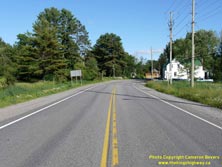
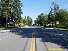
Left - Approaching the Hwy 632 Junction on Hwy 141 in Rosseau, facing east. These two highways connect near the western entrance to the village. See an
Enlarged Photo Here. (Photograph taken on June 24, 2017 - © Cameron Bevers) Right - Facing east along Hwy 141 towards Bracebridge and Huntsville at the Hwy 632 Junction in Rosseau. See an Enlarged Photo Here. (Photograph taken on June 24, 2017 - © Cameron Bevers) 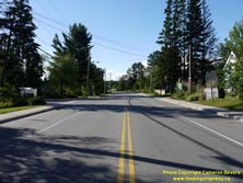

Left - Junction of Hwy 141 & Hwy 632 in Rosseau, facing west towards Parry Sound. This is the only provincial highway junction situated along Hwy 141
between the Hwy 11 Interchange and the Hwy 69 Junction south of Parry Sound at Hayes Corners. See an
Enlarged Photo Here. (Photograph taken on June 24, 2017 - © Cameron Bevers) Right - Junction sign assembly on westbound Hwy 141 at the Hwy 632 Junction in Rosseau. See an Enlarged Photo Here. (Photograph taken on June 24, 2017 - © Cameron Bevers) 

Left - Facing east along Hwy 141 towards Utterson from the Hwy 632 Junction in Rosseau. See an
Enlarged Photo Here. (Photograph taken on June 24, 2017 - © Cameron Bevers) Right - View of Hwy 141 through Rosseau, facing west. Just ahead, Hwy 141 connects with Hwy 632 at Pine Street. See an Enlarged Photo Here. (Photograph taken on June 24, 2017 - © Cameron Bevers) 
Above - An older junction sign assembly on westbound Hwy 141 approaching the Hwy 632 Junction in Rosseau. See an
Enlarged Photo Here. (Photograph taken on June 24, 2017 - © Cameron Bevers)
More Secondary Highway 632 Photographs Coming Soon!
|
|---|
Links to Adjacent Highway Photograph Pages:
Back to Secondary Highway 627 Photos /
Secondary Highway 632 History /
On to Secondary Highway 634 (#2) Photos
Ontario Highway History - Main Menu / Back to List of Highways / Main Photograph Index Page Website contents, photos & text © 2002-2026, Cameron
Bevers (Webmaster) - All Rights Reserved / Contact Me
|
|---|