
| 
|  |
|
|
This page contains historical and present day photos of Ontario's King's Highway 72. All photographs displayed on this page
were taken by the Webmaster (Cameron Bevers), unless specifically noted otherwise. Historical photographs are arranged in approximate chronological order, while
present day photographs (Year 2000 to date) are arranged by location from south to north. Click on any thumbnail to see a larger image!
Please note that all photographs displayed on this
website are protected by copyright. These photographs must not be reproduced, published,
electronically stored or copied, distributed, or posted onto other websites without
my written permission. If you want to use photos from this website, please
email me first for permission. Thank-you!
|
|---|
|
Historical King's Highway 72 Photographs
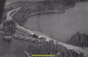
Above - Aerial view of the new steel truss Frog Rapids Bridge, shown shortly after its completion in 1938. This new steel bridge was built on Hwy 72 just south
of Sioux Lookout. It replaced a multiple-span timber truss bridge, which can be seen in this photo to the left of the new bridge. The timber structure was removed
shortly after this photo was taken. Note that in the 1953 photo postcard shown below, the steel truss Frog Rapids Bridge is on its own. The steel truss Frog Rapids
Bridge existed up until 2003, when it too was demolished and replaced by a new structure. (Photo courtesy of Ontario Ministry of Transportation - © King's Printer for Ontario, 1938) 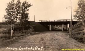
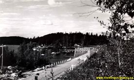
Left - Circa 1940 postcard view of the Canadian National Railway subway on Hwy 72 in Sioux Lookout. See an
Enlarged Photo here. (Photo from Cameron Bevers' historical photograph collection - Original photographer unknown) Right - Postcard view of Hwy 72 approaching the Frog Rapids Bridge south of Sioux Lookout in 1953. See an Enlarged Photo here. (Photo from Cameron Bevers' historical photograph collection - Original photographer unknown) 

Left - Grading operations on a diversion of Hwy 72, 2 1/2 miles north of Dinorwic (1964) (Photo courtesy of Ontario Ministry of Transportation - © King's Printer for Ontario, 1964) Right - Reconstruction of Hwy 72, 2 miles north of Dinorwic (1965) (Photo courtesy of Ontario Ministry of Transportation - © King's Printer for Ontario, 1965) 
Above - Completed grading on Hwy 72 near the Moose Creek Bridge south of the Hwy 116 Junction, just prior to paving (1968) (Photo courtesy of Ontario Ministry of Transportation - © King's Printer for Ontario, 1968) |
|---|
|
Present Day King's Highway 72 Photographs
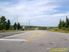
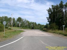
Left - Facing north along Hwy 72 towards Sioux Lookout from the turn-off in Dinorwic. From 1937 up until the early 1970s, Hwy 72 ended at this intersection
at Old Hwy 17. In 1973, construction began on a diversion for Hwy 17 around the southern side of Dinorwic. As a result of the new diversion, Hwy 72 was extended
slightly along the old route of Hwy 17 to meet the relocated Hwy 17. See an Enlarged Photo here. (Photograph taken on August 31, 2006 - © Cameron Bevers) Right - Facing east along a former alignment of Hwy 17 from the Hwy 72 turn-off in Dinorwic. A grade separation was constructed across a nearby railway during 1973, which resulted in Hwy 17 being relocated around the southern side of Dinorwic. A portion of the former Hwy 17 alignment was incorporated into the route of Hwy 72, while the rest of the old route of Hwy 17 was kept open as an access road to the community of Dinorwic. See an Enlarged Photo here. (Photograph taken on August 31, 2006 - © Cameron Bevers) 

Left - Approaching the Hwy 72 turn-off at Dinorwic. Until 1973, this section of Hwy 72 was actually part of Hwy 17. When the Dinorwic Bypass opened to
traffic, the old route of Hwy 17 was closed at the railway crossing in Dinorwic and thus ceased to operate as a through highway. Hwy 72 was rerouted along the western
portion of Old Hwy 17 so that it connected to the relocated Hwy 17. See an Enlarged Photo here. (Photograph taken on August 31, 2006 - © Cameron Bevers) Right - Facing south along Hwy 72 towards the Hwy 17 Junction on the Dinorwic Bypass. The two highways meet about 600 metres to the south. See an Enlarged Photo here. (Photograph taken on August 31, 2006 - © Cameron Bevers) 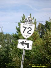
Above - King's Highway 72 route marker at the turnoff to Sioux Lookout in Dinorwic. See an
Enlarged Photo here. (Photograph taken on August 31, 2006 - © Cameron Bevers) 

Left - Facing north along Hwy 72 towards Sioux Lookout from Dinorwic. See an
Enlarged Photo here. (Photograph taken on August 31, 2006 - © Cameron Bevers) Right - An abandoned Hwy 72 alignment near Ojibway Provincial Park. In 1967, construction got underway on the Misfit Lake Diversion, which bypassed several miles of the original 1937 route of Hwy 72. This section of the old highway is now very overgrown. See an Enlarged Photo here. (Photograph taken on August 22, 2003 - © Cameron Bevers) 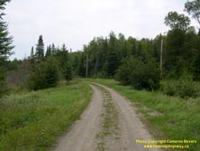

Left - Abandoned alignment of Hwy 72 near Ojibway Provincial Park. This old section of Hwy 72 was bypassed by the Misfit Lake Diversion in 1967. See an
Enlarged Photo here. (Photograph taken on August 22, 2003 - © Cameron Bevers) Right - Timber trestle bridge over Moose Creek on Hwy 72 south of Sioux Lookout. This small but interesting wartime structure was completed in 1943. See an Enlarged Photo here. (Photograph taken on August 22, 2003 - © Cameron Bevers) 
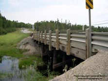
Left - Looking south along Hwy 72 towards Ojibway Provincial Park across the Moose Creek Bridge. See an
Enlarged Photo here. (Photograph taken on August 22, 2003 - © Cameron Bevers) Right - Western side of the Moose Creek Bridge on Hwy 72 south of Sioux Lookout. See an Enlarged Photo here. (Photograph taken on August 22, 2003 - © Cameron Bevers) 

Left - Erroneous advance warning sign on northbound Hwy 72 for the Secondary Highway 664 Junction at Patricia. The Hwy 664 indication displayed on this sign
should be in a trapezoid-shaped Secondary Highway route marker, not a King's Highway crown route marker. See an
Enlarged Photo here. (Photograph taken on August 22, 2003 - © Cameron Bevers) Right - Demolition and replacement of the Frog Rapids Bridge on Hwy 72, looking north towards Sioux Lookout. See an Enlarged Photo here. (Photograph taken on August 22, 2003 - © Cameron Bevers) 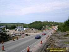
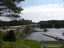
Left - Demolition of the old Frog Rapids Bridge on Hwy 72, looking north. See an
Enlarged Photo here. (Photograph taken on August 22, 2003 - © Cameron Bevers) Right - Demolition of the old Frog Rapids Bridge on Hwy 72, looking south. See an Enlarged Photo here. (Photograph taken on August 22, 2003 - © Cameron Bevers) 

Left - A very old Department of Highways sign at the Frog Rapids Roadside Park and Picnic Area. See an
Enlarged Photo here. (Photograph taken on August 22, 2003 - © Cameron Bevers) Right - Timber trestle bridge over the Pelican River in Sioux Lookout. Structure completed in 1967. See an Enlarged Photo here. (Photograph taken on August 22, 2003 - © Cameron Bevers) 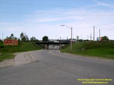
Above - Modern view of the CN railway subway at Sioux Lookout. The former northern terminus of Hwy 72 lies just beyond the underpass. In 2006, the Ministry of
Transportation designated the Ed Ariano Bypass as a provincial highway. This truck bypass was actually built in the mid-1990s. It looped around the southeastern side
of Sioux Lookout and joined directly to Hwy 516 and Hwy 642. Although the Ed Ariano Bypass has been designated as a part of Hwy 72 for several years now, it is merely
signed as "Truck Route". See an Enlarged Photo here. (Photograph taken on August 22, 2003 - © Cameron Bevers)
More King's Highway 72 Photographs Coming Soon!
|
|---|
Links to Adjacent King's Highway Photograph Pages:
Back to King's Highway 71 Photos /
King's Highway 72 History /
On to King's Highway 73 Photos
Ontario Highway History - Main Menu / Back to List of Highways Website contents, photos & text © 2002-2025, Cameron
Bevers (Webmaster) - All Rights Reserved / Contact Me |
|---|