
| 
| |
|
|
This page contains present day photos (Year 2000 to date) of Ontario's King's Highway 7, arranged by location from Lindsay
easterly to Peterborough. All photographs displayed on this page were taken by the Webmaster (Cameron Bevers), unless specifically noted otherwise. Click on any
thumbnail to see a larger image!
Please note that all photographs displayed on this
website are protected by copyright. These photographs must not be reproduced, published,
electronically stored or copied, distributed, or posted onto other websites without
my written permission. If you want to use photos from this website, please
email me first for permission. Thank-you!
|
|---|
|
Page 14: Present Day King's Highway 7 Photographs (Lindsay to Peterborough)
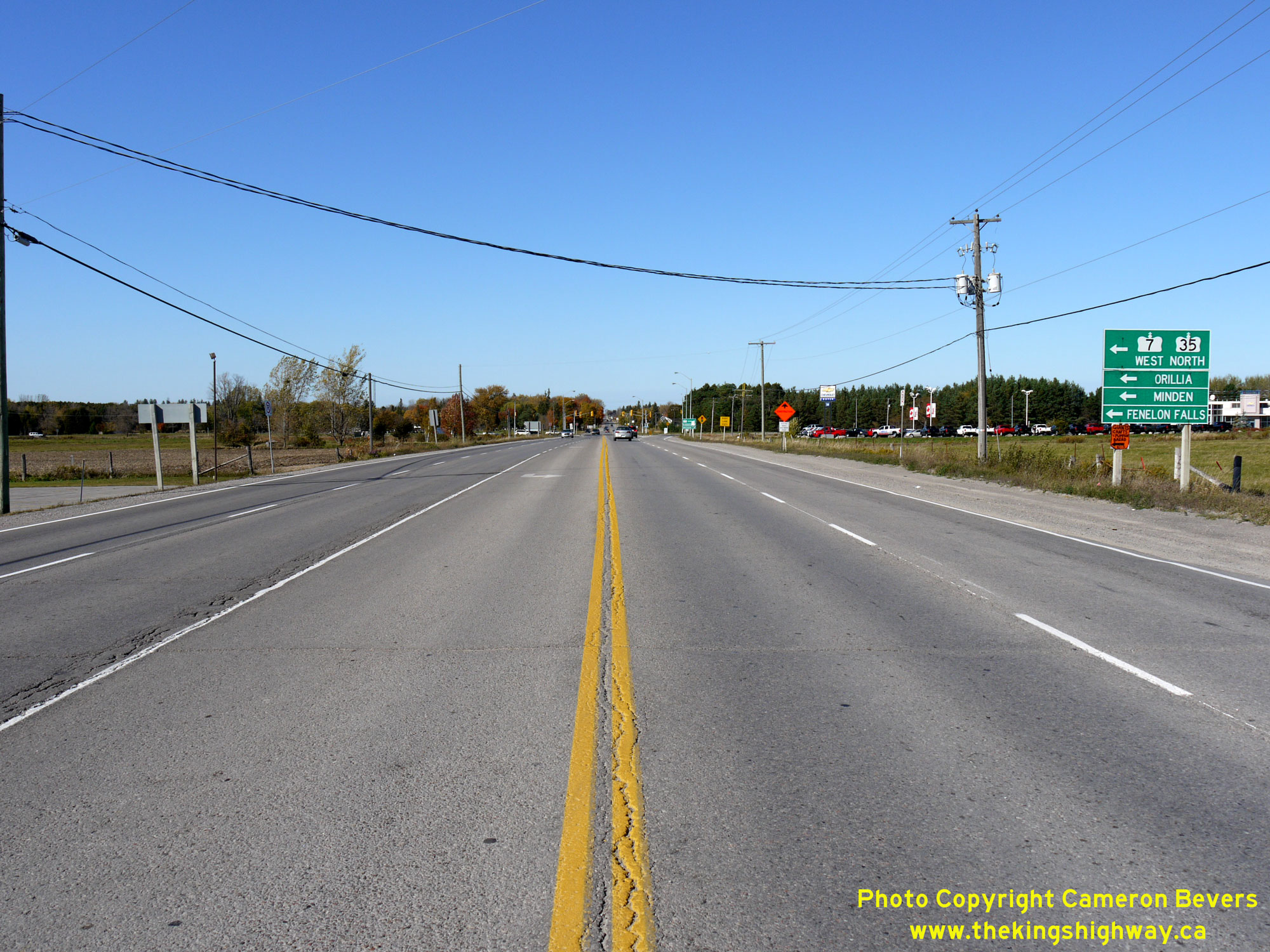

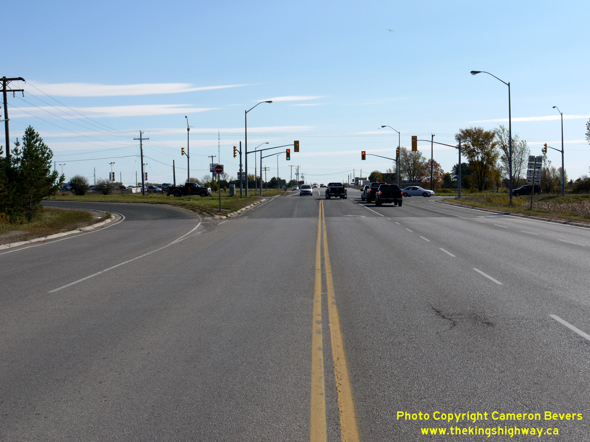
Left - Facing north along Hwy 35 approaching the Hwy 7 Junction at the Lindsay Bypass. This highway junction is a major decision point in the provincial
highway system, with motorists having the choice of following Hwy 7 East towards Peterborough, or Hwy 7 West & Hwy 35 North towards Sunderland and Minden,
respectively. Much of Central Ontario's long-distance through traffic passes through this intersection. Historically, this was also the southern terminus of Lindsay's
Business Route (Hwy 7B & Hwy 35B). See an Enlarged Photo Here. (Photograph taken on October 10, 2010 - © Cameron Bevers) Right - Green guide signs marking the overlapped route of Hwy 7 West & Hwy 35 North via the Lindsay Bypass, along with destination guide signs. Although the "control city" of Orillia is signed at this junction, the city is actually not located on either Hwy 7 or Hwy 35. Rather, traffic needs to turn north from Hwy 7 via Hwy 12 at Sunderland Corners in order to reach Orillia. For northbound Hwy 35 motorists, Orillia is actually a logical control city to sign to, as this is the most direct route to Orillia from many cities and towns located along Lake Ontario's shoreline. See an Enlarged Photo Here. (Photograph taken on October 10, 2010 - © Cameron Bevers) 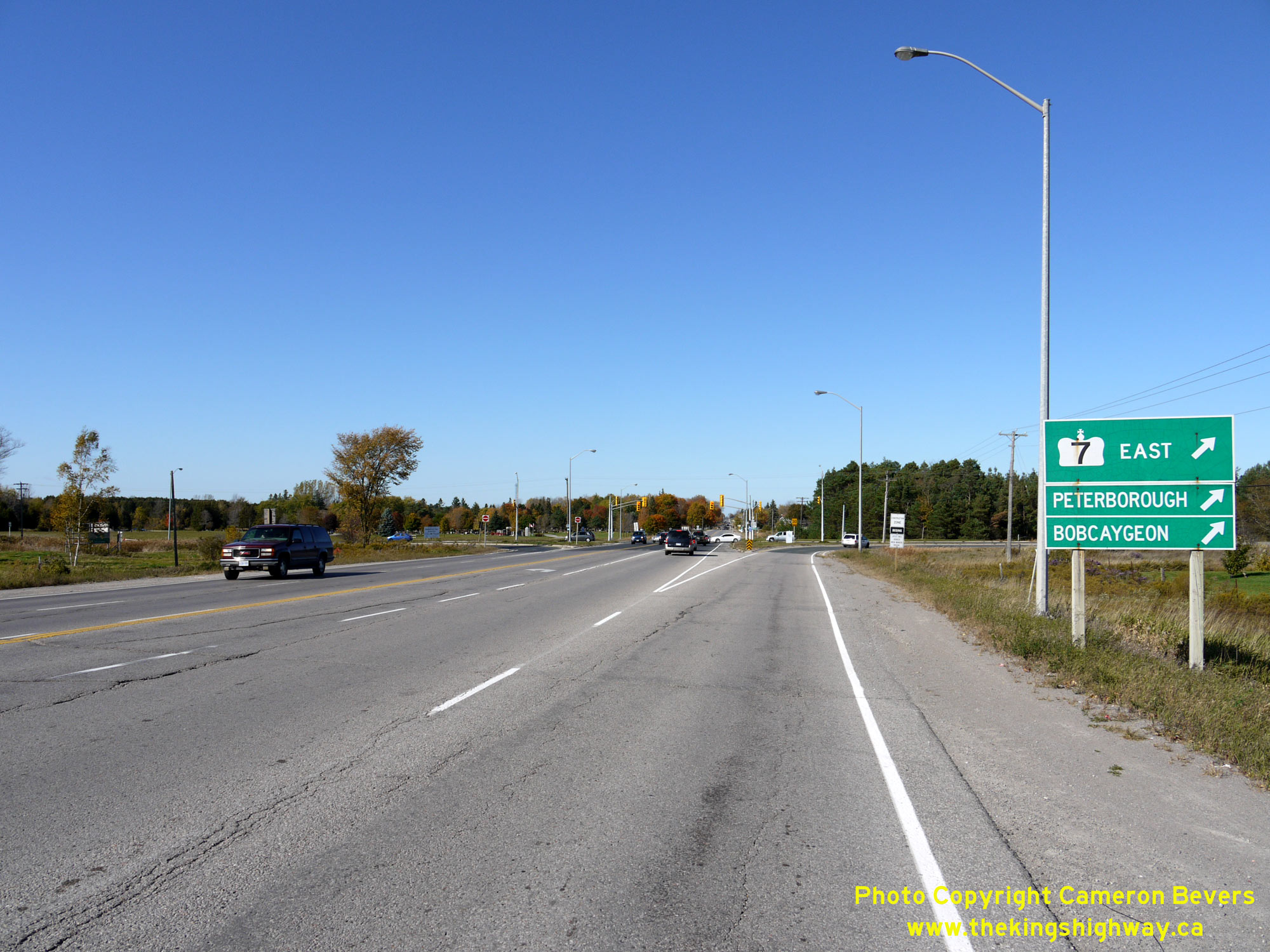
Left - Green guide signs marking Hwy 7 East on northbound Hwy 35 near Lindsay. Bobcaygeon is signed as a control city via Hwy 7 East even though traffic needs
to turn north from Hwy 7 via nearby Hwy 36 in order to reach Bobcaygeon. Logically, Peterborough is signed as the next eastbound control city via Hwy 7 East. See an
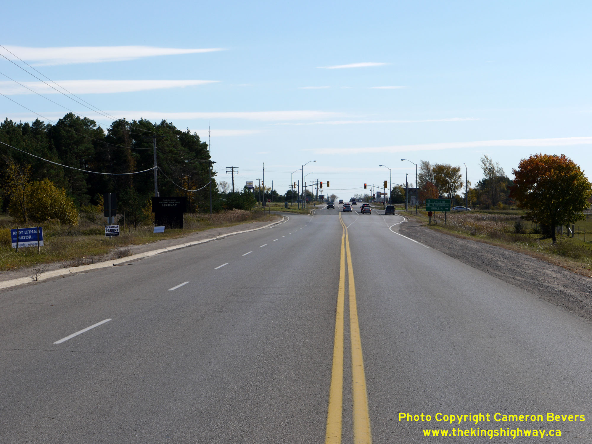
Enlarged Photo Here. (Photograph taken on October 10, 2010 - © Cameron Bevers) Right - Approaching the Hwy 7 Junction on Hwy 35, facing north towards Lindsay. Three of the quadrants at this highway junction are channelized - the ramp from northbound Hwy 35 to eastbound Hwy 7 and from the eastbound Lindsay Bypass (Hwy 7 & Hwy 35) to southbound Hwy 35. Additionally, westbound traffic on Hwy 7 turns into Lindsay via a channelized right-turn ramp. Straight ahead, Lindsay Street (Former Hwy 7B & Hwy 35B) continues north into Downtown Lindsay. See an Enlarged Photo Here. (Photograph taken on October 10, 2010 - © Cameron Bevers) 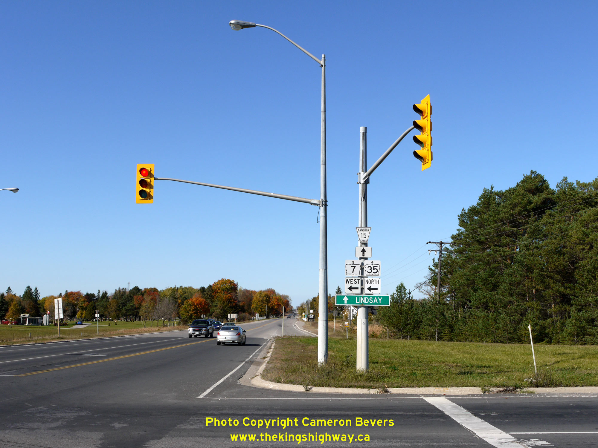
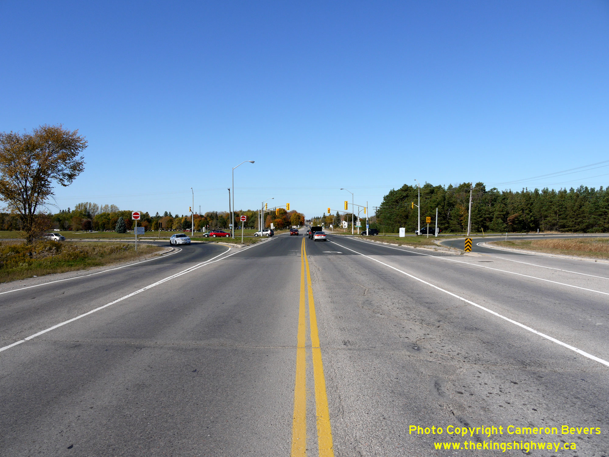
Left - Junction sign assembly at the Hwy 7 & Hwy 35 Junction, facing north. Following the decommissioning and transfer of Hwy 7B & Hwy 35B in the 1990s,
the signed route via Lindsay Street was discontinued at this junction. The former highway was renamed Victoria County Road 15 (now known as Kawartha Lakes Road 15).
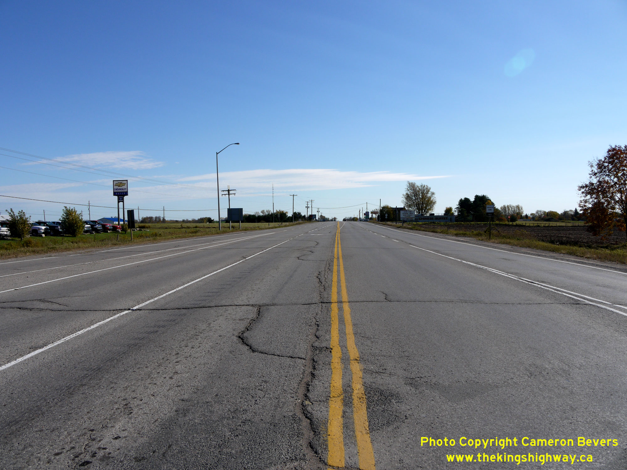
See an Enlarged Photo Here. (Photograph taken on October 10, 2010 - © Cameron Bevers) Right - Facing south along Hwy 35 towards Newcastle from the Hwy 7 Junction near Lindsay. While Hwy 35 between Newcastle and Lindsay is a modern arterial highway today, it wasn't always a good route. Early motorists using Hwy 35 south of Lindsay would recall a dusty, pot-holed gravel road, with numerous sharp turns and a poor alignment. In fact, many sections of the original highway were in such poor condition that they were abandoned altogether when Hwy 35 was rebuilt in the late 1950s. See an Enlarged Photo Here. (Photograph taken on October 10, 2010 - © Cameron Bevers) 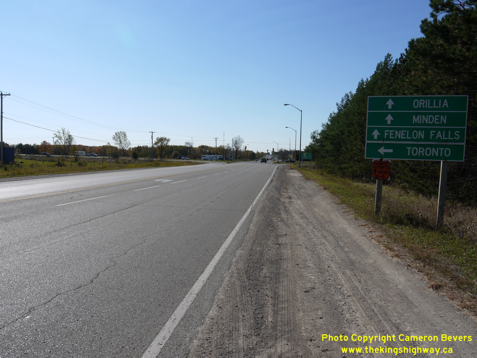
Left - Destination guide signs along westbound Hwy 7 approaching the Hwy 35 Junction. Through traffic on Hwy 7 and traffic bound for Hwy 35 North are signed
straight ahead, while traffic bound for Newcastle is signed via Hwy 35 South at left. Lindsay is signed to the north via Lindsay Street (Hwy 7B & Hwy 35B). See an
Enlarged Photo Here. (Photograph taken on October 10, 2010 - © Cameron Bevers) Right - Facing west along Hwy 7 towards the Hwy 35 South Junction near Lindsay. Historically, Hwy 7 curved to the right at this point and joined Hwy 35. Both highways continued north into Lindsay via an overlapped, concurrent route. As part of the Trans-Canada Highway's construction in the 1950s, a new bypass was constructed around the southern side of Lindsay. Rather than curve to the right, through traffic on the Trans-Canada Highway could continue straight ahead via the Lindsay Bypass to avoid the congested downtown area. The Lindsay Bypass was unofficially made available to public travel as a gravel highway in the early Summer of 1958. Final paving of the bypass was completed in September, with the new highway officially opened to traffic on October 10, 1958. Following the completion of the Lindsay Bypass, the original highway route through Lindsay was renumbered as Hwy 7B & Hwy 35B. See an Enlarged Photo Here. (Photograph taken on October 10, 2010 - © Cameron Bevers) 

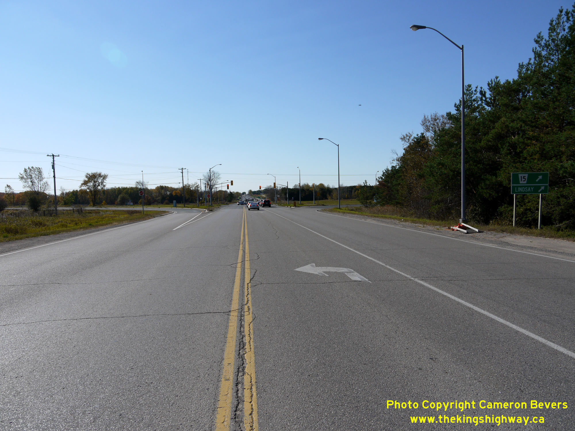
Left - Destination guide signs on the Lindsay Bypass facing east, approaching the Hwy 35 South Junction. At this intersection, Hwy 7 & Hwy 35 part ways
again, with Hwy 35 turning right and heading south towards Newcastle. Traffic continues straight ahead towards Peterborough via Hwy 7, while traffic bound for
Downtown Lindsay can turn left and follow Lindsay Street (Hwy 7B & Hwy 35B). See an
Enlarged Photo Here. (Photograph taken on October 10, 2010 - © Cameron Bevers) Right - Facing west along the Lindsay Bypass (Hwy 7 & Hwy 35) from the Hwy 35 South Junction near Lindsay. Built as part of the Trans-Canada Highway's Central Ontario Route, the 5-mile Lindsay Bypass formed a strategic bypass around the southern side of town. The first construction contract for the Lindsay Bypass was awarded in November 1956, with construction taking just under two years to complete. Grading for the new bypass was completed under Contract #1956-141, with final hot-mix asphalt paving completed along the bypass under Contract #1958-122. See an Enlarged Photo Here. (Photograph taken on October 10, 2010 - © Cameron Bevers) 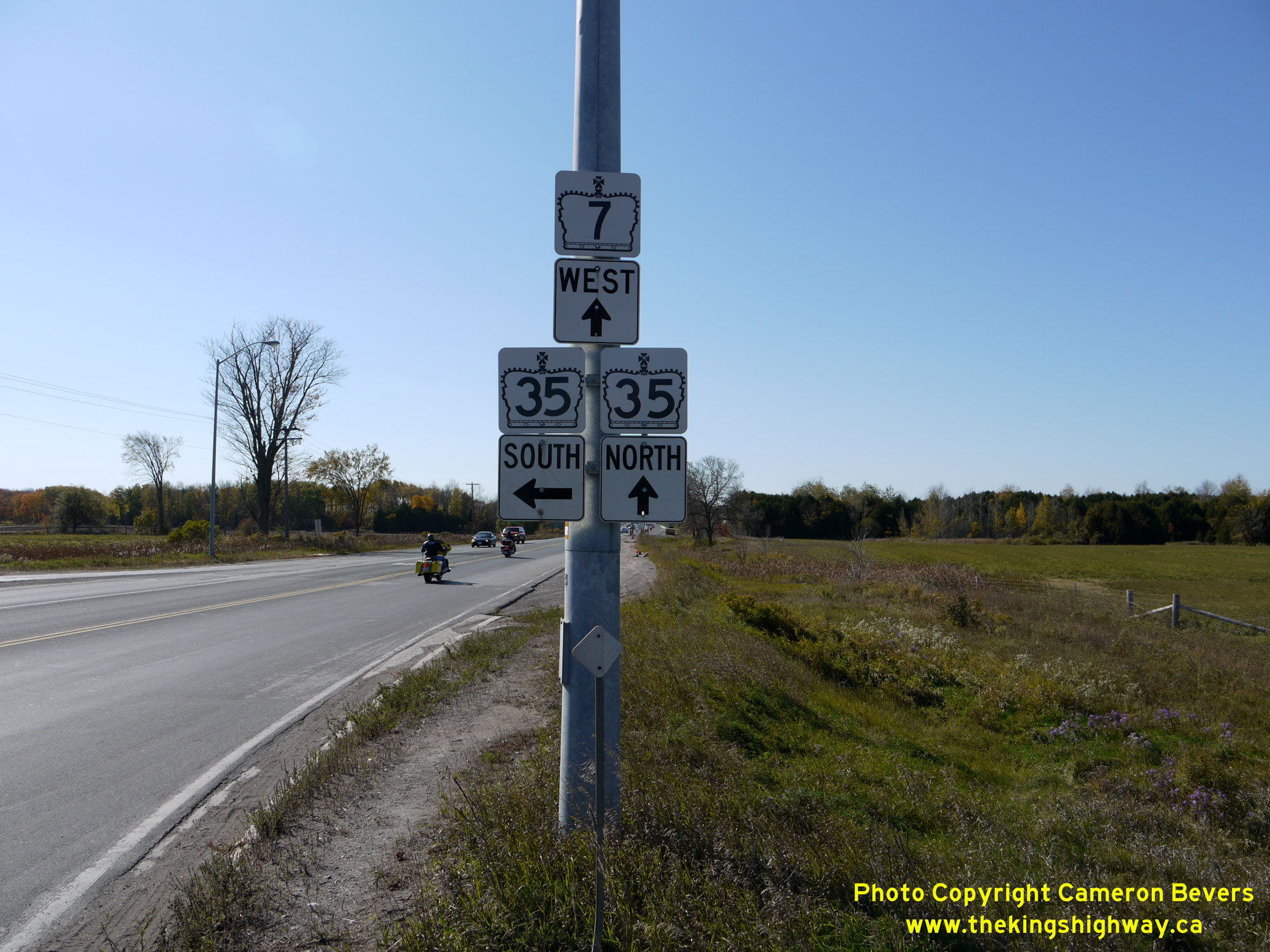

Left - Junction sign assembly at the eastern end of the Lindsay Bypass at the Hwy 7 & Hwy 35 Junction. Both Hwy 7 & Hwy 35 share an overlapped
concurrent route for a distance of about 5 km along the Lindsay Bypass. Although unsigned facing west at this highway junction, the Lindsay Bypass is part of the
Central Ontario Route of the Trans-Canada Highway. See an Enlarged Photo Here. (Photograph taken on October 10, 2010 - © Cameron Bevers) Right - Approaching the eastern terminus of the Lindsay Bypass at the Hwy 35 South Junction. At this junction, the Lindsay Bypass tied back into the original route of Hwy 7 coming out of Lindsay. From here, Hwy 7 continues east towards Peterborough more or less along its original 1920s alignment. See an Enlarged Photo Here. (Photograph taken on October 10, 2010 - © Cameron Bevers) 
Left - Turn-off junction sign assembly on southbound Lindsay Street (Hwy 7B & Hwy 35B) at the Lindsay Bypass. See an
Enlarged Photo Here. (Photograph taken on October 10, 2010 - © Cameron Bevers) Right - Facing south along Lindsay Street (Hwy 7B & Hwy 35B) towards the Lindsay Bypass. At this intersection, traffic can either proceed south towards Newcastle via Hwy 35, turn left towards Peterborough via Hwy 7 East or turn right towards Orillia via Hwy 7 West and Hwy 35 North. This intersection was also the historical southern terminus of the Lindsay Business Route (Hwy 7B & Hwy 35B). See an Enlarged Photo Here. (Photograph taken on October 10, 2010 - © Cameron Bevers) 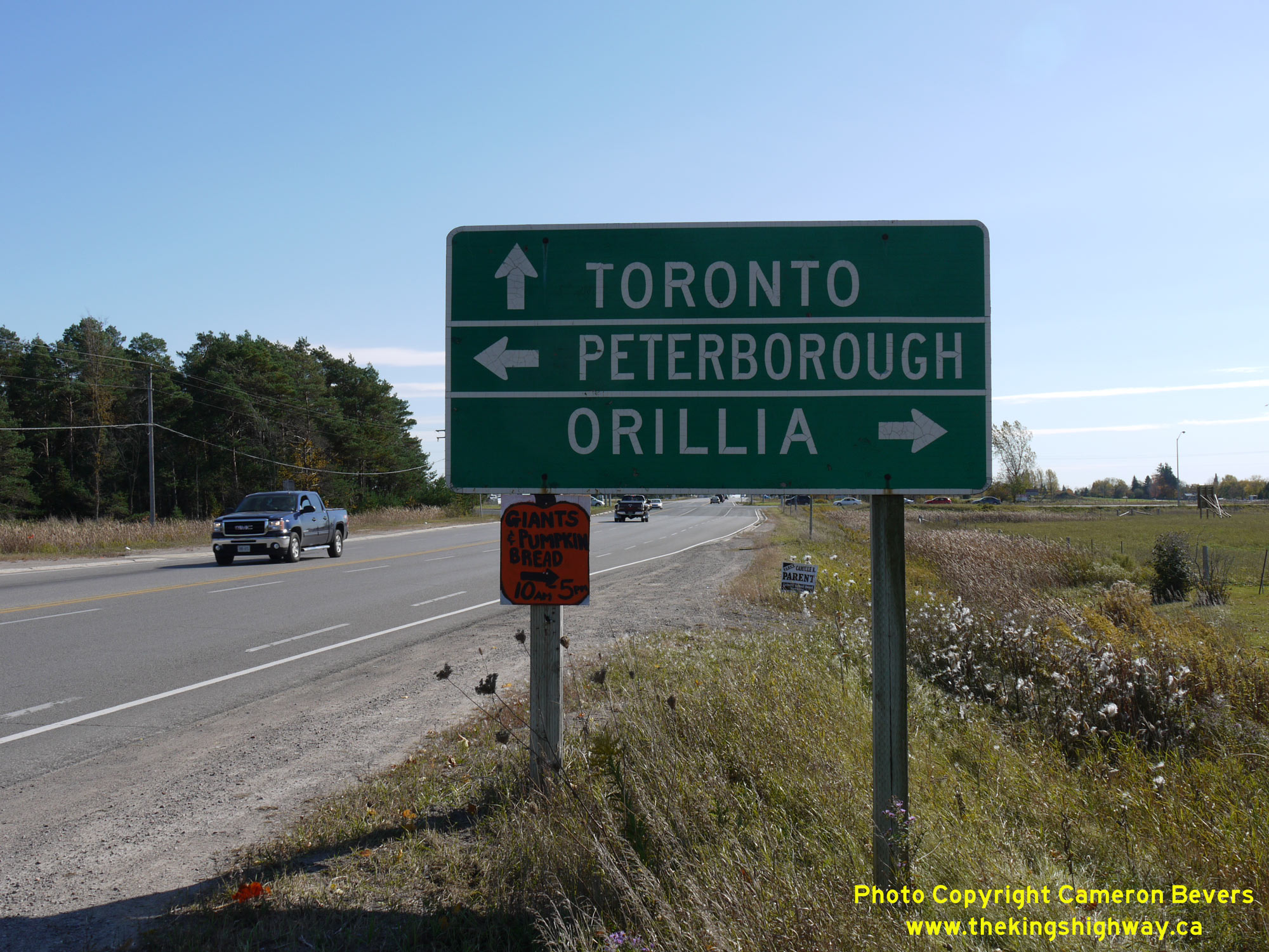
Left - An older destination guide sign on southbound Lindsay Street (Hwy 7B & Hwy 35B) approaching the Lindsay Bypass. See an
Enlarged Photo Here. (Photograph taken on October 10, 2010 - © Cameron Bevers) Right - Facing south along Lindsay Street (Hwy 7B & Hwy 35B) approaching the Hwy 7 & Hwy 35 Junction near Lindsay. At one time, Hwy 7 & Hwy 35 met at a Y-junction at this point, where Hwy 7 curved off to the left towards Peterborough, while Hwy 35 continued straight ahead towards Newcastle. It is believed that the curved diversion for Hwy 7 was built in 1934, soon after a railway line through this area was taken out of service. Previously, Hwy 7 crossed this railway line within the intersection. This 1930s highway curve was closed to traffic when the Lindsay Bypass was constructed in the late 1950s. Today, there is almost no evidence that there ever was a large highway curve located here. See an Enlarged Photo Here. (Photograph taken on October 10, 2010 - © Cameron Bevers) 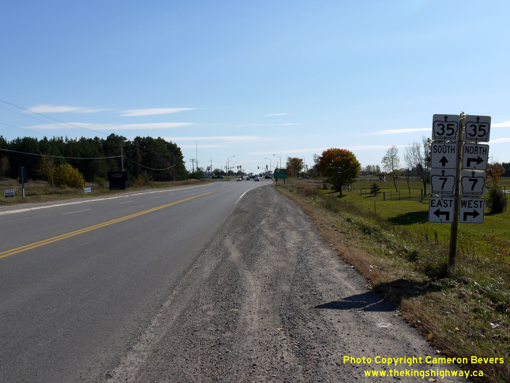

Left - Advance junction sign assembly on southbound Lindsay Street (Hwy 7B & Hwy 35B) approaching the Lindsay Bypass. See an
Enlarged Photo Here. (Photograph taken on October 10, 2010 - © Cameron Bevers) Right - Facing north along Lindsay Street (Hwy 7B & Hwy 35B) from the Lindsay Bypass (Hwy 7 & Hwy 35). See an Enlarged Photo Here. (Photograph taken on October 10, 2010 - © Cameron Bevers) 

Left - Bypassed section of Hwy 7 (Golden Mile Road) near Lindsay. A new railway overhead was constructed on Hwy 7 adjacent to the new Hwy 36 Junction in the
1950s. In an effort to reduce the impacts to existing homes, the highway was relocated onto a new alignment a short distance to the north of the original highway.
See an Enlarged Photo Here. (Photograph taken on October 10, 2010 - © Cameron Bevers) Right - Facing west along Old Hwy 7 (Golden Mile Road) east of Lindsay. The Ops Township Diversion is visible on top of the earth embankment off to the right. This diversion has carried Hwy 7 traffic across the railway overhead since 1957. See an Enlarged Photo Here. (Photograph taken on October 10, 2010 - © Cameron Bevers) 

Left - Facing east along Old Hwy 7 (Golden Mile Road) east of Lindsay from the site of the former Canadian Pacific Railway Crossing. This once busy at-grade
railway crossing was essentially eliminated in 1957, when Hwy 7 was rerouted across the new Ops Township Canadian Pacific Railway Overhead. As railway traffic declined, the line was eventually abandoned and the tracks were removed. (Photograph taken on October 10, 2010 - © Cameron Bevers) Right - Old Hwy 7 alignment east of Lindsay, facing west. Approximately one mile of Hwy 7 was bypassed by the Ops Township Diversion in the 1950s. Since 1957, this former Hwy 7 alignment has served only local traffic. See an Enlarged Photo Here. (Photograph taken on October 10, 2010 - © Cameron Bevers) 

Left - Ops Township Railway Overhead on Hwy 7 near Lindsay, as seen from Golden Mile Road (Old Hwy 7). Structure completed in 1957. (Photograph taken on October 10, 2010 - © Cameron Bevers) Right - Northern side of the Ops Township Railway Overhead on Hwy 7 near Lindsay. This short single-span concrete rigid frame structure once carried Hwy 7 across the Canadian Pacific Railway. After the railway line was abandoned, the tracks were removed and the right-of-way was converted to a multi-use trail. (Photograph taken on October 10, 2010 - © Cameron Bevers) 

Left - Facing west along Hwy 7 towards the western end of the Ops Township Diversion. The relocation of Hwy 7 was one of several major highway improvement
projects which took place in the Lindsay area during the late 1950s. Just beyond the reverse curve, Hwy 7 reaches its junction with Hwy 35 South to Newcastle and Hwy 401. See an
Enlarged Photo Here. (Photograph taken on October 10, 2010 - © Cameron Bevers) Right - Facing east across the Ops Township Canadian Pacific Railway Overhead on Hwy 7 east of Lindsay. The Hwy 36 Junction lies just beyond the bridge. (Photograph taken on October 10, 2010 - © Cameron Bevers) 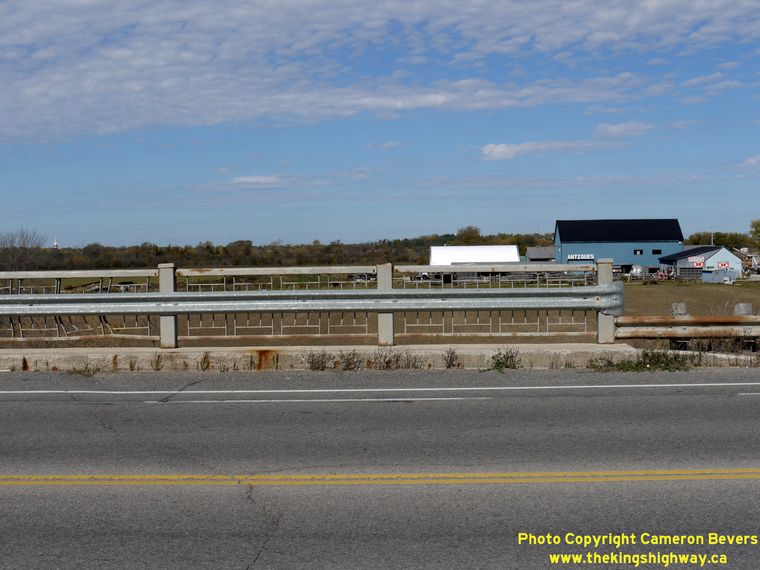

Left - Steel handrail on the Ops Township Canadian Pacific Railway Overhead on Hwy 7 east of Lindsay. (Photograph taken on October 10, 2010 - © Cameron Bevers) Right - Facing west along Hwy 7 towards Lindsay at the Ops Township Canadian Pacific Railway Overhead. (Photograph taken on October 10, 2010 - © Cameron Bevers) 

Left - Approaching the Hwy 36 Junction on Hwy 7, facing east towards Peterborough. The route of Hwy 36 begins at Hwy 7 just east of Lindsay and heads
northeasterly towards Bobcaygeon, before turning east towards Hwy 28 at Burleigh Falls. See an
Enlarged Photo Here. (Photograph taken on October 10, 2010 - © Cameron Bevers) Right - Facing west along Hwy 7 towards the Ops Township Canadian Pacific Railway Overhead from the Hwy 36 Junction. See an Enlarged Photo Here. (Photograph taken on October 10, 2010 - © Cameron Bevers) 

Left - Facing east along Hwy 7 at the Hwy 36 Junction east of Lindsay. Prior to the downloading of Hwy 36 in 1998, this was the only provincial highway
junction along Hwy 7 between Lindsay and Peterborough's Hwy 7B Junction at Fowlers Corners. (Photograph taken on October 10, 2010 - © Cameron Bevers) Right - A right-turn channelization was constructed at the Hwy 7 & Hwy 36 Junction to serve the predominant right-turn movement coming southbound on Hwy 36 from Bobcaygeon and the Kawartha Lakes Cottage Country. (Photograph taken on October 10, 2010 - © Cameron Bevers) 

Left - Facing west along Hwy 7 towards Lindsay approaching the Hwy 36 Junction. (Photograph taken on October 10, 2010 - © Cameron Bevers) Right - Facing north along Hwy 36 towards Bobcaygeon from the Hwy 7 Junction east of Lindsay. The entire 73 km route of Hwy 36 was transferred from the province to the Counties of Victoria and Peterborough in the late 1990s. Since 1998, Hwy 36 has been under municipal jurisdiction. After Victoria County was incorporated as the City of Kawartha Lakes in 2001, the section of Hwy 36 within Victoria County was renamed Kawartha Lakes Road 36. (Photograph taken on October 10, 2010 - © Cameron Bevers) 

Left - Southern terminus of Hwy 36 at the Hwy 7 Junction east of Lindsay. Most traffic on southbound Hwy 36 turns right at this junction, so a
right-turn channelization was constructed to serve this predominant movement. Up until the late 1950s, Hwy 36 ended in Downtown Lindsay at the corner of Kent Street
and Lindsay Street. The completion of the Lindsay Bypass in 1958 resulted in the relocation of Hwy 36 onto a new alignment east of town, and consequently, a relocated
southern terminus at Hwy 7. (Photograph taken on October 10, 2010 - © Cameron Bevers) Right - Turn-off green guide sign for the Hwy 7 Junction on southbound Hwy 36 east of Lindsay. The predominant south-to-west movement is shown on the sign with an angled right arrow to indicate that it is a channelized right-turn ramp. (Photograph taken on October 10, 2010 - © Cameron Bevers) 

Left - Flowerpot route marker indicating the end of Kawartha Lakes Road 36 (Former Hwy 36) at the Hwy 7 Junction east of Lindsay. In all likelihood, the
"Hwy 36 Ends" sign was placed above the two Hwy 7 crowns when this highway was still under provincial control, but was moved to its current location after the highway
was downloaded to the municipality in 1998. (Photograph taken on October 10, 2010 - © Cameron Bevers) Right - Distance sign on northbound Hwy 36 just north of the Hwy 7 Junction near Lindsay. Hwy 36 follows a generally northeasterly route towards Burleigh Falls, via Bobcaygeon. Distances to Bancroft are also provided along Hwy 36, since the highway offered a comparable route between Lindsay and Bancroft to the better-known Hwy 7 and Hwy 28 route. (Photograph taken on October 10, 2010 - © Cameron Bevers) 

Left - Green guide sign marking the upcoming Hwy 7 Junction on southbound Hwy 36 east of Lindsay. (Photograph taken on October 10, 2010 - © Cameron Bevers) Right - Distance sign on eastbound Hwy 7 at the Hwy 36 Junction. It is 37 km to Peterborough from this junction. See an Enlarged Photo Here. (Photograph taken on October 10, 2010 - © Cameron Bevers) 

Left - Facing east along Hwy 7 towards Peterborough from the Hwy 36 Junction east of Lindsay. (Photograph taken on October 10, 2010 - © Cameron Bevers) Right - Facing west along Old Hwy 7 (Golden Mile Road) from the start of the Ops Township Diversion east of Lindsay. Hwy 36 can be seen joining into the Hwy 7 Diversion at the traffic signals in the background. See an Enlarged Photo Here. (Photograph taken on October 10, 2010 - © Cameron Bevers) 

Left - Golden Mile Road (Old Hwy 7) reaches its eastern terminus where it joins existing Hwy 7, a short distance east of the Hwy 36 Junction. (Photograph taken on October 10, 2010 - © Cameron Bevers) Right - Pigeon River Bridge on Hwy 7 at Omemee. This handsome concrete arch bridge was completed in 1932. See an Enlarged Photo Here. (Photograph taken on June 19, 2004 - © Cameron Bevers) 

Left - Facing east along Hwy 7 towards Peterborough across the Omemee Bridge. (Photograph taken on June 19, 2004 - © Cameron Bevers) Right - Facing west along Hwy 7 towards Lindsay at the Pigeon River Bridge in Omemee. (Photograph taken on June 19, 2004 - © Cameron Bevers) 

Left - Northern side of the Omemee Bridge over the Pigeon River on Hwy 7. See an
Enlarged Photo Here. (Photograph taken on June 19, 2004 - © Cameron Bevers) Right - The Omemee Bridge was constructed on the original stone abutments of the previous bridge. (Photograph taken on June 19, 2004 - © Cameron Bevers) 

Left - Close-up of the old stone abutment and newer 1930s concrete arch superstructure. (Photograph taken on June 19, 2004 - © Cameron Bevers) Right - Some substantial grades can be found along Hwy 7 between Omemee and Fowlers Corners, such as this hill west of Orange Corners Road. See an Enlarged Photo Here. (Photograph taken on July 8, 2006 - © Cameron Bevers) 

Left - Approaching Fowlers Corners on Hwy 7, facing east. At Fowlers Corners, Hwy 7 turns right and briefly heads south to join with Hwy 115 in order to bypass
Peterborough. The highway ahead at the Fowlers Corners traffic signals is Former Hwy 7B (now Peterborough Road 1), which eventually leads into Downtown Peterborough.
A long westbound passing lane begins at Fowlers Corners and heads westerly towards Omemee for nearly 1.5 km. See an
Enlarged Photo Here. (Photograph taken on July 8, 2006 - © Cameron Bevers) Right - Facing west along Hwy 7 towards Omemee, between Orange Corners Road and Fowlers Corners. The westbound passing lane on Hwy 7 which begins at Fowlers Corners terminates in the foreground. See an Enlarged Photo Here. (Photograph taken on July 9, 2006 - © Cameron Bevers) 

Left - Facing north along Hwy 7 at the former CNR Overhead south of Fowlers Corners. See an
Enlarged Photo Here. (Photograph taken on July 9, 2006 - © Cameron Bevers) Right - Eastern side of the Fowlers Corners Overhead on Hwy 7. Structure completed in 1959. (Photograph taken on July 9, 2006 - © Cameron Bevers) 

Left - Western side of the Fowlers Corners Overhead on Hwy 7. (Photograph taken on July 9, 2006 - © Cameron Bevers) Right - Facing south along Hwy 7 towards Peterborough from the former CNR Overhead. (Photograph taken on July 9, 2006 - © Cameron Bevers) 

Left - Close-up of the steel handrail and parapet design on the Fowlers Corners Overhead. (Photograph taken on July 9, 2006 - © Cameron Bevers) Right - Jackson Creek Bridge on Hwy 7 between Fowlers Corners and Five Mile Corners west of Peterborough. Structure completed in 1958. (Photograph taken on July 9, 2006 - © Cameron Bevers) 

Left - Jackson Creek Bridge on Hwy 7, facing south towards Five Mile Corners near Peterborough. (Photograph taken on July 9, 2006 - © Cameron Bevers) Right - Facing north along Hwy 7 towards Fowlers Corners at the Jackson Creek Bridge. (Photograph taken on July 9, 2006 - © Cameron Bevers) 

Left - The Jackson Creek Bridge is a single-span concrete rigid frame structure. This was one of several bridges built in the Peterborough area during the late
1950s and early 1960s as part of the ambitious Peterborough Bypass project. The completion of the Peterborough Bypass in 1961 removed one of the greatest traffic
bottlenecks in Central Ontario. (Photograph taken on July 9, 2006 - © Cameron Bevers) Right - Five Mile Corners on Hwy 7 at Lansdowne Street (Old Hwy 28), facing east. This junction has a very complicated past. Originally, Hwy 28 simply curved to the right and merged with Lansdowne Street on its route between Port Hope and Peterborough. In the 1950s, a new highway was built along the western side of Peterborough, extending south from Hwy 7 at Fowlers Corners and joining Hwy 28 at this junction. Initially, this new highway was known as Hwy 133. As part of the Peterborough Bypass construction in 1959-1960, another leg was built onto this intersection, extending Hwy 133 south towards Springville. Once the highway was completed between Five Mile Corners and Scott's Corners in 1960, Hwy 133 was re-designated as Hwy 7. The route of Hwy 28 seen here was diverted onto the new alignment concurrently with Hwy 7 from this point southerly to Scott's Corners. However, the route of Hwy 28 heading east from Five Mile Corners continued to follow Lansdowne Street into Peterborough for many years. In 1984, Hwy 28 was rerouted onto Hwy 115 and The Parkway. See an Enlarged Photo Here. (Photograph taken on July 9, 2006 - © Cameron Bevers) 

Left - Facing south along Old Hwy 28 (Davis Road) from the Hwy 7 Junction at Five Mile Corners. Although it hasn't carried provincial highway traffic in over
50 years, this road still looks like an old King's Highway from a geometric perspective. Note the slight curve superelevation, designed so that high-speed traffic
could negotiate the change in the highway alignment. (Photograph taken on July 9, 2006 - © Cameron Bevers) Right - Hwy 7 descends this steep grade at Springville, just west of Peterborough. The Hwy 115 Interchange lies about 3 km ahead. See an Enlarged Photo Here. (Photograph taken on July 9, 2006 - © Cameron Bevers) 
Above - Hwy 7 & Formerly Hwy 7A route markers near Springville. These route markers have remained on the road ever since the recent renumbering of a
section of Hwy 7A as Hwy 7 through Springville in 2003. This section of highway west of Peterborough has been renumbered more times than any other route in Ontario's
provincial highway history. The highway route number(s) through Springville has changed no fewer than seven times since highway numbering was first introduced in Ontario
in 1925. Initially the highway was known as Hwy 12A (1925-1928), which later changed to Hwy 28 (1928-1938), which then became Hwy 28 & Hwy 7A (1938-1960), then
Hwy 28 (1960-1964), then Hwy 28 & Hwy 115 (1964-1970), then Hwy 28 (1970-1984), then Hwy 7A (1984-2003), and then finally Hwy 7 (2003-Present). Anyone lost yet? (Photograph taken on July 9, 2006 - © Cameron Bevers) 
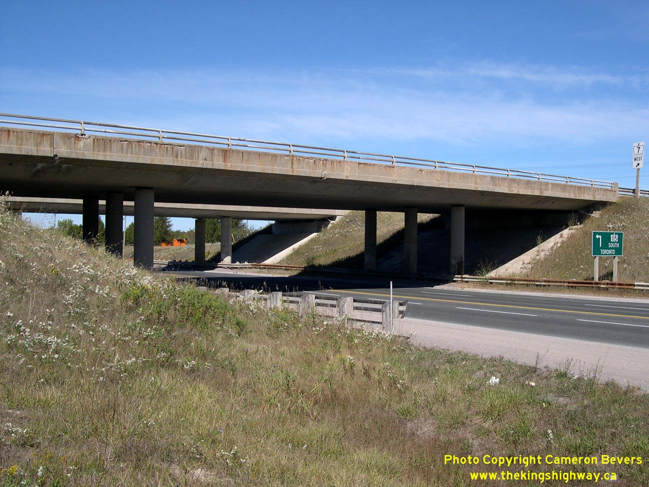
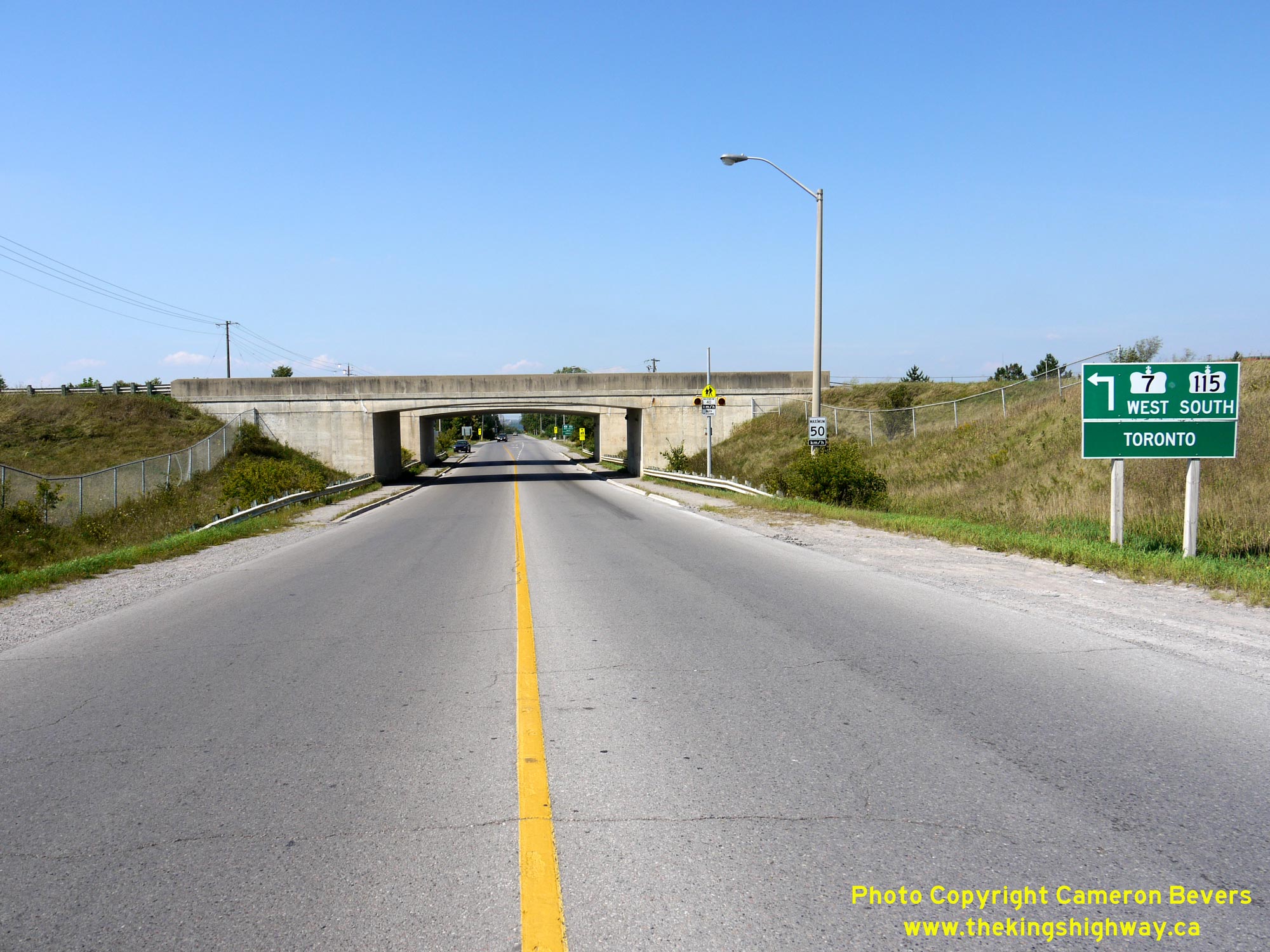
Left - Facing north towards Fowlers Corners at the Hwy 28 Interchange on Hwy 7 & Hwy 115 at Springville, southwest of Peterborough. Prior to the extension
of Hwy 115 from Springville to Peterborough in 1978, Hwy 115 used to end at this interchange. Until 1984, Hwy 28 used to continue straight through (north) towards
Five Mile Corners, located south of Fowlers Corners. Hwy 28 was rerouted southwest of Peterborough in the 1980s and was signed concurrently with Hwy 115 between 1984
and 2003. Originally, Hwy 7 did not pass through this interchange at all. However, the Hwy 7 designation was applied to the highway through Springville in 2003, in order
to close a gap left over when a section of Hwy 7 (North Monaghan Parkway and Sir Sandford Fleming Drive) was downloaded to the County of Peterborough in 1997. See an
Enlarged Photo Here. (Photograph taken on September 23, 2007 - © Cameron Bevers) Right - Dual underpass structures carry the freeway over Hwy 28. The northbound Hwy 115 structure is much older than the southbound Hwy 115 structure, due to the fact that Hwy 115 was constructed as a staged freeway through this interchange. Hwy 115 was initially built as an undivided two-lane highway, but was later expanded to a four-lane freeway in the mid-1980s. Click here to see a Historical 1972 Photo of the partially-completed Hwy 28 Interchange on Hwy 115, showing the former northern terminus of Hwy 115. See an Enlarged Photo Here. (Photograph taken on September 23, 2007 - © Cameron Bevers) 

Left - Northbound Hwy 115 underpass at the Hwy 28 Interchange near Peterborough. This three-span post-tensioned concrete structure was completed in 1966. See
an Enlarged Photo Here. (Photograph taken on September 23, 2007 - © Cameron Bevers) Right - Date stamp (1966) and structure identification number (Site #21-338) on the northbound Hwy 115 structure at the Hwy 28 Interchange. See an Enlarged Photo Here. (Photograph taken on September 23, 2007 - © Cameron Bevers) 

Left - Western side of the northbound Hwy 115 structure at the Hwy 28 Interchange at Springville. See an
Enlarged Photo Here. (Photograph taken on September 23, 2007 - © Cameron Bevers) Right - Southbound Hwy 115 structure at the Hwy 28 Interchange. This three-span post-tensioned concrete structure was completed in 1985. See an Enlarged Photo Here. (Photograph taken on September 23, 2007 - © Cameron Bevers) 

Left - Date stamp (1985) on the southbound Hwy 115 structure at the Hwy 28 Interchange. See an
Enlarged Photo Here. (Photograph taken on September 23, 2007 - © Cameron Bevers) Right - Facing north along Hwy 7 & Hwy 115 (Formerly Hwy 28 & Hwy 115) towards Peterborough from the Hwy 28 Interchange near Springville. See an Enlarged Photo Here. (Photograph taken on September 23, 2007 - © Cameron Bevers) 

Left - Green guide signs at the Airport Road Interchange near Peterborough, marking the entrance ramp to Hwy 7 East & Hwy 115 North. These two highways
share a concurrent overlapped route for about 13 km near Peterborough. Both Ottawa and Peterborough are signed as destination control cities at this interchange. See
an Enlarged Photo Here. (Photograph taken on September 25, 2021 - © Cameron Bevers) Right - Western side of the Airport Road Overpass on Hwy 7 & Hwy 115. This two-span post-tensioned concrete structure was completed in 1985. See an Enlarged Photo Here. (Photograph taken on September 25, 2021 - © Cameron Bevers) 

Left - Date stamp (1985) and structure identification number (Site #26-177) on the Airport Road Overpass on Hwy 7 & Hwy 115 southwest of Peterborough. See an
Enlarged Photo Here. (Photograph taken on September 25, 2021 - © Cameron Bevers) Right - Facing south across the Airport Road Overpass on Hwy 7 & Hwy 115. Airport Road is also known as Peterborough County Road 11. See an Enlarged Photo Here. (Photograph taken on September 25, 2021 - © Cameron Bevers) 

Left - Green guide signs at the Airport Road Interchange near Peterborough, marking the entrance ramp to Hwy 7 West and Hwy 115 South. Toronto is logically
shown as the destination control city on this sign, even though Hwy 7 does not enter (and historically has never entered) the City of Toronto. However, if one is
departing from Peterborough via this freeway, it is unlikely that your destination is anything other than the Greater Toronto Area (GTA). See an
Enlarged Photo Here. (Photograph taken on September 25, 2021 - © Cameron Bevers) Right - Dusk over Hwy 7 & Hwy 115, facing south from the Airport Road Interchange near Peterborough. See an Enlarged Photo Here. (Photograph taken on September 25, 2021 - © Cameron Bevers) 

Left - Facing north along Hwy 7 & Hwy 115 from the Airport Road Overpass near Peterborough. See an
Enlarged Photo Here. (Photograph taken on September 25, 2021 - © Cameron Bevers) Right - Airport Road Overpass on Hwy 7 & Hwy 115, facing north towards Peterborough. See an Enlarged Photo Here. (Photograph taken on September 25, 2021 - © Cameron Bevers) 

Left - Eastern side of the Airport Road Overpass on Hwy 7 & Hwy 115 near Peterborough. See an
Enlarged Photo Here. (Photograph taken on September 25, 2021 - © Cameron Bevers) Right - Facing west along the Peterborough Bypass (Hwy 7 & Hwy 115) from the Otonabee River Bridge. See an Enlarged Photo Here. (Photograph taken on August 25, 2012 - © Cameron Bevers) 

Left - View of the Otonabee River Bridge on the Peterborough Bypass (Hwy 7 & Hwy 115), facing south. See an
Enlarged Photo Here. (Photograph taken on August 25, 2012 - © Cameron Bevers) Right - Dual structures over the Otonabee River on the Peterborough Bypass (Hwy 7 & Hwy 115). As originally constructed, the Peterborough Bypass was an undivided two-lane highway. The bridge seen at right is the original Peterborough Bypass structure, which was completed in 1960. When the Peterborough Bypass was expanded from two to four lanes in the 1980s, a new structure was built at left to carry westbound traffic only. The original structure at right was then converted to carry eastbound traffic only. See an Enlarged Photo Here. (Photograph taken on August 25, 2012 - © Cameron Bevers) 

Left - Date stamp (1983) and structure identification number (Site #26-61) on the westbound Otonabee River structure on Hwy 7 & Hwy 115 in Peterborough.
See an Enlarged Photo Here. (Photograph taken on August 25, 2012 - © Cameron Bevers) Right - Eastbound Peterborough Bypass structure over the Otonabee River. This complicated structure was completed in 1960. It consists of a three-span haunched steel plate girder main structure over the Otonabee River and Trent-Severn Waterway along with eight steel beam approach spans. See an Enlarged Photo Here. (Photograph taken on August 25, 2012 - © Cameron Bevers) 
Left - Westbound Peterborough Bypass structure over the Otonabee River. This five-span trapezoidal steel box girder structure was completed in 1983. See an
Enlarged Photo Here. (Photograph taken on August 25, 2012 - © Cameron Bevers) Right - Approaching the dual underpasses at Bensfort Road and the Peterborough Bypass (Hwy 7 & Hwy 115), facing north. See an Enlarged Photo Here. (Photograph taken on August 25, 2012 - © Cameron Bevers) 

Left - Facing south along Bensfort Road approaching the dual underpasses at the Peterborough Bypass. See an
Enlarged Photo Here. (Photograph taken on August 25, 2012 - © Cameron Bevers) Right - Date stamp (1984) and structure identification number (Site #26-175) on the Bensfort Road Underpass on Hwy 7 & Hwy 115 in Peterborough. See an Enlarged Photo Here. (Photograph taken on August 25, 2012 - © Cameron Bevers) 

Left - Ground-mounted freeway guide sign for Hwy 7 East at the end of the Peterborough Bypass. Although Hwy 7 continues east from Peterborough towards
Norwood, Madoc and eventually Ottawa, Hwy 115 reaches its northern terminus at the traffic signals just ahead. See an
Enlarged Photo Here. (Photograph taken on September 23, 2007 - © Cameron Bevers) Right - Eastern end of the Peterborough Bypass (Hwy 7 & Hwy 115) approaching Lansdowne Street. At one time, Lansdowne Street west of this intersection was a signed business route (Hwy 7B) which passed through Peterborough. After a rather circuitous loop, Peterborough's Hwy 7B connected back to Hwy 7 west of the city at Fowlers Corners. See an Enlarged Photo Here. (Photograph taken on September 23, 2007 - © Cameron Bevers) 

Left - Green guide signs on westbound Hwy 7 approaching the Peterborough Bypass and Lansdowne Street (Former Hwy 7B). See an
Enlarged Photo Here. (Photograph taken on September 23, 2007 - © Cameron Bevers) Right - Ground-mounted guide sign marking the former route of Hwy 7B into Peterborough via Lansdowne Street. The route of Hwy 7B was decommissioned as a King's Highway in 1997, although the green patch placed over the old Hwy 7B crown is still quite obvious. This sign was replaced shortly after this photo was taken in 2007. See an Enlarged Photo Here. (Photograph taken on September 23, 2007 - © Cameron Bevers) 

Left - Facing west along Hwy 7 approaching the Peterborough Bypass Junction. At the traffic signals, Hwy 7 turns left and begins a concurrent overlapped route
with Hwy 115. Up until 1997, motorists could also follow the Hwy 7B Business Route through Peterborough. Although much longer that the route offered by Hwy 7,
Peterborough's Hwy 7B did form a complete loop. It eventually reconnected back to Hwy 7 at Fowlers Corners. The ramp seen joining in at left carries traffic from the
Peterborough Bypass to eastbound Hwy 7. See an Enlarged Photo Here. (Photograph taken on September 23, 2007 - © Cameron Bevers) Right - View of the eastern terminus of the Peterborough Bypass (Hwy 7 & Hwy 115), facing west from Lansdowne Street. See an Enlarged Photo Here. (Photograph taken on September 23, 2007 - © Cameron Bevers) 

Left - Green guide signs on eastbound Lansdowne Street (Formerly Hwy 7B) approaching the Peterborough Bypass. Although it isn't indicated on these signs,
traffic heading straight through at this intersection will join Hwy 7 East to Ottawa. See an
Enlarged Photo Here. (Photograph taken on September 23, 2007 - © Cameron Bevers) Right - Facing east along Hwy 7 towards Norwood from the Hwy 115 and Former Hwy 7B Junction in Peterborough. See an Enlarged Photo Here. (Photograph taken on September 23, 2007 - © Cameron Bevers)
Continue on to King's Highway 7 Photos: Peterborough to Havelock
|
|---|
Links to Adjacent King's Highway Photograph Pages:
Back to Hwy 7 - Sunderland Corners to Lindsay
Hwy 7 Photo Index
On to Hwy 7 - Peterborough to Havelock
Back to King's Highway 6 Photos /
King's Highway 7 History /
On to King's Highway 8 Photos
Ontario Highway History - Main Menu / Back to List of Highways Website contents, photos & text © 2002-2026, Cameron
Bevers (Webmaster) - All Rights Reserved / Contact Me
|
|---|