
| 
|  |
|
|
This page contains present day photos (Year 2000 to date) of Ontario's King's Highway 7, arranged by location from Perth
easterly to Carleton Place. All photographs displayed on this page were taken by the Webmaster (Cameron Bevers), unless specifically noted otherwise. Click on any
thumbnail to see a larger image!
Please note that all photographs displayed on this
website are protected by copyright. These photographs must not be reproduced, published,
electronically stored or copied, distributed, or posted onto other websites without
my written permission. If you want to use photos from this website, please
email me first for permission. Thank-you!
|
|---|
|
Page 19: Present Day King's Highway 7 Photographs (Perth to Carleton Place)

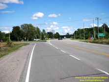
Left - Facing west along Hwy 7 towards Perth from the Hwy 7B Junction near Carleton Place. See an
Enlarged Photo Here. (Photograph taken on July 29, 2022 - © Cameron Bevers) Right - Hwy 7 & Hwy 7B Junction near Carleton Place, facing east. Prior to the completion of the Carleton Place Bypass in the late 1950s, the Trans-Canada Highway passed directly through Carleton Place. Following the completion of the bypass, a B-suffixed Business Route was established to direct traffic into downtown from the bypass. The Hwy 7B Business Route was decommissioned as a provincial highway in 1998 and was transferred to the County of Lanark. Today, Former Hwy 7B is merely signed as Townline Road West when approaching on Hwy 7. See an Enlarged Photo Here. (Photograph taken on July 29, 2022 - © Cameron Bevers) 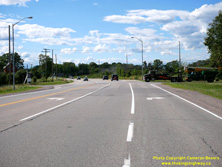
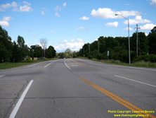
Left - Facing west along Hwy 7 approaching the Hwy 7B Junction near Carleton Place. See an
Enlarged Photo Here. (Photograph taken on July 29, 2022 - © Cameron Bevers) Right - View of the Carleton Place Bypass (Hwy 7), facing east from the Hwy 7B Junction. See an Enlarged Photo Here. (Photograph taken on July 29, 2022 - © Cameron Bevers) 

Left - Western terminus of Hwy 7B at the Carleton Place Bypass (Hwy 7) Junction. Due to a closure of a nearby bridge over the Mississippi River, an
extraordinarily high volume of traffic was using Townline Road during the Summer of 2022. This highway junction is normally not this busy. See an
Enlarged Photo Here. (Photograph taken on July 29, 2022 - © Cameron Bevers) Right - View of both the old and new highway routes approaching Carleton Place. Prior to 1959, Hwy 15 (known today as Hwy 7) entered Carleton Place from the west via High Street. Today, through traffic on Hwy 7 uses a bypass which passes around the western and southern side of Carleton Place. A part of High Street in the foreground was simply abandoned once the Carleton Place Bypass opened to traffic in December 1959. See an Enlarged Photo Here. (Photograph taken on July 29, 2022 - © Cameron Bevers) 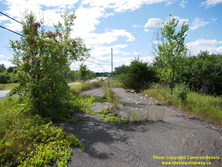
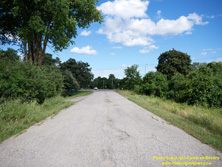
Left - The overgrown remains of Old Hwy 15 can be seen departing from the Hwy 7B Junction west of Carleton Place. Just ahead, the original highway tied back
into the Carleton Place Bypass, which can be seen curving off to the left in the foreground of this photo. Traffic hasn't used this old section of road since the
bypass at left was completed in 1959. See an Enlarged Photo Here. (Photograph taken on July 29, 2022 - © Cameron Bevers) Right - Approaching the Hwy 7B Junction on Old Hwy 15 (High Street), facing east towards Carleton Place. As traffic whizzes past on the Hwy 7 Bypass a short distance to the right, one can imagine an era of more leisurely travel on our King's Highways as this long gentle curve on Old Hwy 15 approaches Carleton Place from the west. See an Enlarged Photo Here. (Photograph taken on July 29, 2022 - © Cameron Bevers) 
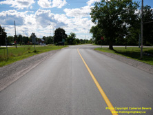
Left - Junction of Old Hwy 15 (High Street) and Hwy 7B (Townline Road) adjacent to the Carleton Place Bypass (Hwy 7). This once-important highway junction is
now a minor intersection of a quiet residential street. Townline Road at left was assumed by the Department of Highways of Ontario (DHO) as a new King's Highway in
1948. Known initially as the Hwy 15 Carleton Place Cut-Off, the route served as a convenient northern bypass of Carleton Place which offered improved access to
Hwy 29 to Arnprior. Over the years, the Townline Road route has also been known by several other different route numbers - Hwy 110, Hwy 15B and ultimately, Hwy 7B.
Provincial ownership of Townline Road ceased in 1998, when jurisdiction over Hwy 7B was transferred to the County of Lanark. See an
Enlarged Photo Here. (Photograph taken on July 29, 2022 - © Cameron Bevers) Right - Old Hwy 15 (High Street) intersects with Hwy 7B immediately east of the Carleton Place Bypass (Hwy 7) Junction. See an Enlarged Photo Here. (Photograph taken on July 29, 2022 - © Cameron Bevers) 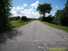
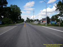
Left - A short section of Old Hwy 15 was kept open to local traffic near the Hwy 7 & Hwy 7B Junction to service adjacent properties on the old highway's
route. See an Enlarged Photo Here. (Photograph taken on July 29, 2022 - © Cameron Bevers) Right - Facing east along Hwy 7B (Townline Road) towards Carleton Place from the Hwy 7 Junction. The 2-mile (3.2 km) bypass route offered by Townline Road greatly improved traffic flow through this area once the road was assumed by the DHO as the Hwy 15 Carleton Place Cut-Off in 1948. The old King's Highway routes through Carleton Place were narrow, awkward routes with tight turns which were difficult for large vehicles to negotiate. Townline Road offered a wide, straight highway route across town. See an Enlarged Photo Here. (Photograph taken on July 29, 2022 - © Cameron Bevers) 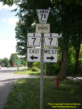

Left - Junction sign assembly at the Hwy 7 & Hwy 7B Junction west of Carleton Place. See an
Enlarged Photo Here. (Photograph taken on July 29, 2022 - © Cameron Bevers) Right - Following the jurisdictional transfer of Hwy 7B to Lanark County in 1998, the old King's Highway signs were removed and replaced with municipal "flowerpot" route markers. Letter-suffixed county road numbers were once extremely common in Ontario, but they have dwindled greatly in numbers in recent decades. Lanark's County Road 7B is one of the few surviving examples of a letter-suffixed county road route number. In this case, however, the county simply reused the old King's Highway number which previously existed here. See an Enlarged Photo Here. (Photograph taken on July 29, 2022 - © Cameron Bevers) 

Left - Facing west towards Perth along the Carleton Place Bypass (Hwy 7) near Napoleon Street. The Carleton Place Bypass was completed and opened to traffic
in December 1959. The new bypass was built to relieve recurring traffic congestion on Bridge Street through Downtown Carleton Place, which once carried the former
routes of Hwy 15 & Hwy 29. See an Enlarged Photo Here. (Photograph taken on July 1, 2012 - © Cameron Bevers) Right - Green guide sign on eastbound Hwy 7 indicating the upcoming Hwy 15 Junction in Carleton Place. As a result of the mass highway downloading spree of 1997-1998, the Hwy 7 & Hwy 15 Junction is the only non-freeway junction of two provincial highways in the Ottawa area. Up until the mid-1990s, Hwy 15 followed Franktown Road north from Hwy 7 through Downtown Carleton Place, where the route then continued north towards Arnprior. As a result of the highway downloading of 1997-1998, Hwy 15 no longer continues north from Carleton Place. See an Enlarged Photo Here. (Photograph taken on July 1, 2012 - © Cameron Bevers) 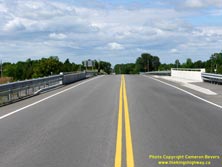
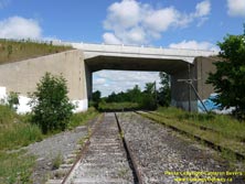
Left - Facing west along Hwy 7 towards Perth at the Carleton Place Railway Overhead. See
an Enlarged Photo Here. (Photograph taken on July 1, 2012 - © Cameron Bevers) Right - Northern side of the Carleton Place Railway Overhead. Structure completed in 1959. See an Enlarged Photo Here. (Photograph taken on July 1, 2012 - © Cameron Bevers) 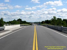

Left - Facing east along Hwy 7 towards the Hwy 15 Junction at the Carleton Place Railway Overhead. See
an Enlarged Photo Here. (Photograph taken on July 1, 2012 - © Cameron Bevers) Right - Southern side of the Carleton Place Railway Overhead on Hwy 7. This is one of two bridges along the Carleton Place Bypass. The other bridge crosses the Mississippi River a short distance to the west. See an Enlarged Photo Here. (Photograph taken on July 1, 2012 - © Cameron Bevers) 
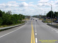
Left - Green guide sign for Franktown Road in Carleton Place. Up until the mid-1990s, Hwy 15 followed Franktown Road north from Hwy 7 through Downtown Carleton
Place, where the route then continued north towards Arnprior. As a result of the highway downloading of 1997-1998, Hwy 15 no longer continues north from Carleton
Place. A new truck bypass for Hwy 15 (McNeely Avenue) was constructed in the 1990s along the eastern side of Carleton Place, in order to divert through traffic away
from Bridge Street (Old Hwy 15). See an Enlarged Photo Here. (Photograph taken on July 1, 2012 - © Cameron Bevers) Right - Facing east along Hwy 7 towards the Hwy 15 Junction in Carleton Place. From here, motorists can either turn left and follow Franktown Road north into Downtown Carleton Place or turn right and head south along Hwy 15 towards Smiths Falls and Kingston. Ottawa lies 38 km straight ahead via Hwy 7. See an Enlarged Photo Here. (Photograph taken on July 1, 2012 - © Cameron Bevers) 

Left - Facing west along Hwy 7 towards the Hwy 15 Junction in Carleton Place. Prior to 1998, Hwy 15 was one of several highways leading south from Hwy 7 to
Hwy 401 between Ottawa and Peterborough. As a result of the mass highway downloading of 1997-1998, Hwy 15, along with Hwy 37 and Hwy 62, form the only north-south
provincial highway links between Hwy 7 and Hwy 401 between here and Peterborough. Prior to 1998, motorists could take their pick from five other King's Highways
(Hwy 38, Hwy 41, Hwy 30, Hwy 45 and Hwy 28) to reach Hwy 401 from Hwy 7. However, all five of these highways were transferred to municipalities and are therefore no
longer provincial highways today. See an Enlarged Photo Here. (Photograph taken on July 1, 2012 - © Cameron Bevers) Right - Guide sign marking the Hwy 15 Junction on westbound Hwy 7 in Carleton Place. The route of Hwy 15 extends south from Carleton Place to Smiths Falls and ultimately, Kingston. Prior to 1998, Hwy 15 shared a brief concurrent route with Hwy 7 between Franktown Road and McNeely Avenue (East Carleton Place Bypass). However, this concurrent routing was very short-lived and was discontinued when the section of Hwy 15 from Carleton Place to Arnprior was downloaded to Lanark County and the former Regional Municipality of Ottawa-Carleton. See an Enlarged Photo Here. (Photograph taken on July 1, 2012 - © Cameron Bevers) 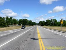
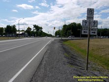
Left - Facing north along Franktown Road (Formerly Hwy 15) towards Downtown Carleton Place from the Hwy 7 Junction. Up until the 1990s, Hwy 15 extended north
from Carleton Place to Arnprior. The northern section of Hwy 15 from Carleton Place to Arnprior fell victim to the mass highway downloading spree of 1997-1998. As a
result, Hwy 15 now reaches its northern terminus at the Hwy 7 Junction in Carleton Place. See an
Enlarged Photo Here. (Photograph taken on July 1, 2012 - © Cameron Bevers) Right - Junction assembly on southbound Franktown Road, indicating the start of Hwy 15 at the Hwy 7 Junction in Carleton Place. See an Enlarged Photo Here. (Photograph taken on July 1, 2012 - © Cameron Bevers) 

Left - Facing south along Franktown Road (Hwy 15) towards the Hwy 7 Junction in Carleton Place. This intersection has been an important provincial highway
junction ever since the Franktown Road was assumed as a new provincial highway in 1936. See
an Enlarged Photo Here. (Photograph taken on July 1, 2012 - © Cameron Bevers) Right - Facing west along Hwy 7 towards Perth from the Hwy 15 Junction in Carleton Place. Up until the completion of the Carleton Place Bypass in 1959, there was no through road here. Traffic heading west to Perth had to turn right and follow Franktown Road and Bridge Street through Downtown Carleton Place in order to continue west to Perth. See an Enlarged Photo Here. (Photograph taken on July 1, 2012 - © Cameron Bevers) 

Left - Guide sign marking the Hwy 15 Junction on eastbound Hwy 7 in Carleton Place. Heading eastbound, Hwy 15 is the last provincial highway junction along
Hwy 7 before Hwy 417 in Ottawa. Following the completion of the East Carleton Place Bypass (McNeely Avenue) in the mid-1990s, Hwy 15 was briefly routed along Hwy 7
from this intersection easterly to McNeely Avenue. See an Enlarged Photo Here. (Photograph taken on July 1, 2012 - © Cameron Bevers) Right - Approaching the northern terminus of Hwy 15 at the Hwy 7 Junction in Carleton Place. See an Enlarged Photo Here. (Photograph taken on July 1, 2012 - © Cameron Bevers) 
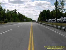
Left - Green guide sign marking the Hwy 7 Junction on northbound Hwy 15 in Carleton Place. Motorists arriving at this junction can either continue straight
ahead on Franktown Road into Downtown Carleton Place, turn left and head west towards Perth or turn right and head east towards Ottawa. See an
Enlarged Photo Here. (Photograph taken on July 1, 2012 - © Cameron Bevers) Right - Facing south along Hwy 15 towards Smiths Falls from the Hwy 7 Junction in Carleton Place. See an Enlarged Photo Here. (Photograph taken on July 1, 2012 - © Cameron Bevers) 
Above - Hwy 15 Ends sign at the Hwy 7 Junction in Carleton Place.
See an Enlarged Photo Here. (Photograph taken on July 1, 2012 - © Cameron Bevers) 

Left - Trans-Canada Highway route marker assembly on Hwy 7 at the Hwy 15 Junction in Carleton Place. The Central Ontario Route of the Trans-Canada Highway
follows Hwy 7 between Ottawa and Sunderland, northeast of Toronto. See an Enlarged Photo Here. (Photograph taken on July 1, 2012 - © Cameron Bevers) Right - Junction assembly at McNeely Avenue (Hwy 15 Bypass) and Hwy 7 in Carleton Place. Note the bilingual green "TO/VERS 15" trailblazer, which directs traffic to Hwy 15 South. For a couple of years in the mid-1990s, Hwy 7 & Hwy 15 shared a short concurrent route for about 600 metres between McNeely Avenue and Franktown Road. See an Enlarged Photo Here. (Photograph taken on July 1, 2012 - © Cameron Bevers)
Continue on to King's Highway 7 Photos: Carleton Place to Ottawa
|
|---|
Links to Adjacent King's Highway Photograph Pages:
Back to King's Highway 6 Photos /
King's Highway 7 History /
On to King's Highway 8 Photos
Ontario Highway History - Main Menu / Back to List of Highways Website contents, photos & text © 2002-2025, Cameron
Bevers (Webmaster) - All Rights Reserved / Contact Me |
|---|