
| 
| |
|
|
This page contains historical and present day photos of Ontario's King's Highway 81. All photographs displayed on this page
were taken by the Webmaster (Cameron Bevers), unless specifically noted otherwise. Historical photographs are arranged in approximate chronological order, while
present day photographs (Year 2000 to date) are arranged by location from south to north. Click on any thumbnail to see a larger image!
Please note that all photographs displayed on this
website are protected by copyright. These photographs must not be reproduced, published,
electronically stored or copied, distributed, or posted onto other websites without
my written permission. If you want to use photos from this website, please
email me first for permission. Thank-you!
|
|---|
|
Historical King's Highway 81 Photographs

Above - Postcard view of the Hwy 21 & Hwy 81 Junction in Grand Bend (1957). Note the steel truss bridge across the Ausable River on Hwy 21 immediately
south of the Hwy 81 Junction. This steel truss bridge existed up until 1964, when it was demolished and replaced with the current Hwy 21 structure. See an
Enlarged Photo Here. (Photo courtesy of Canadian Post Card Co.) 
Above - Construction of the Hwy 81 Overpass on Hwy 402 in Strathroy in 1977. See
an Enlarged Photo Here. (Photo courtesy of Ontario Ministry of Transportation - © King's Printer for Ontario, 1977) 
Above - Pouring concrete curb and gutter on Hwy 402 at the Hwy 81 Interchange in Strathroy (1979) (Photo courtesy of Ontario Ministry of Transportation - © King's Printer for Ontario, 1979) |
|---|
|
Present Day King's Highway 81 Photographs

Left - Facing east along Hwy 2 approaching the Hwy 81 Junction near Delaware. The route of Hwy 81 begins at Delaware and heads northwesterly to Grand Bend via
Mount Brydges and Strathroy. Prior to the completion of Hwy 402 in the early 1980s, Hwy 81 served as part of a connecting route between Hwy 7 and Hwy 22 west of
London and Hwy 401. At one time, this would have been a fairly busy highway junction. Following the completion of Hwy 402, traffic volumes through the Hwy 2 &
Hwy 81 Junction subsided considerably. See an Enlarged Photo Here. (Photograph taken on September 16, 2012 - © Cameron Bevers) Right - View of the Hwy 2 & Hwy 81 Junction, facing west towards Chatham. The right-turn lane from westbound Hwy 2 to northbound Hwy 81 is channelized, to better serve the predominant east-to-north traffic movement. Historically, this was a major decision point in the King's Highway system. Motorists wishing to head west towards Sarnia had to keep right to follow Hwy 81 up to Hwy 7 and Hwy 22, while through traffic heading towards Chatham and Windsor could continue straight ahead via Hwy 2. See an Enlarged Photo Here. (Photograph taken on September 16, 2012 - © Cameron Bevers) 

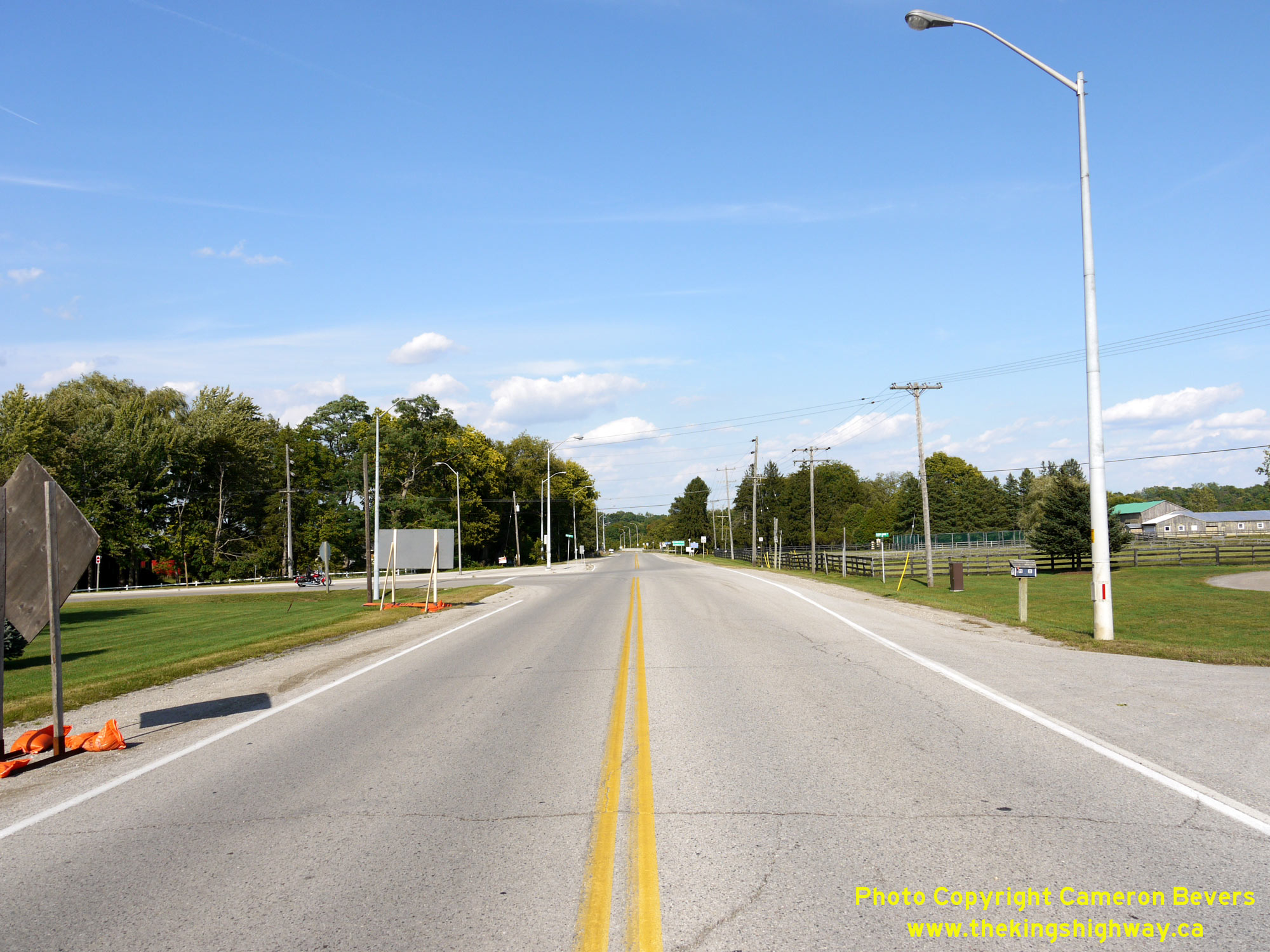
Left - Facing north along Hwy 81 towards Strathroy from the Hwy 2 Junction at Delaware. The route of Hwy 81 was first established in 1936 as a connecting
highway between Hwy 2 at Delaware and Hwy 22 in Strathroy. For years, Hwy 81 served as a convenient cut-off route for traffic bound for Sarnia. However, this highway
became largely redundant as a result of the completion of nearby Hwy 402 in 1982. Provincial jurisdiction over Hwy 81 ceased in 1997, when ownership of the highway
was transferred over to the County of Middlesex. See an Enlarged Photo Here. (Photograph taken on September 16, 2012 - © Cameron Bevers) Right - Approaching the southern terminus of Hwy 81 at the Hwy 2 Junction at Delaware. See an Enlarged Photo Here. (Photograph taken on September 16, 2012 - © Cameron Bevers) 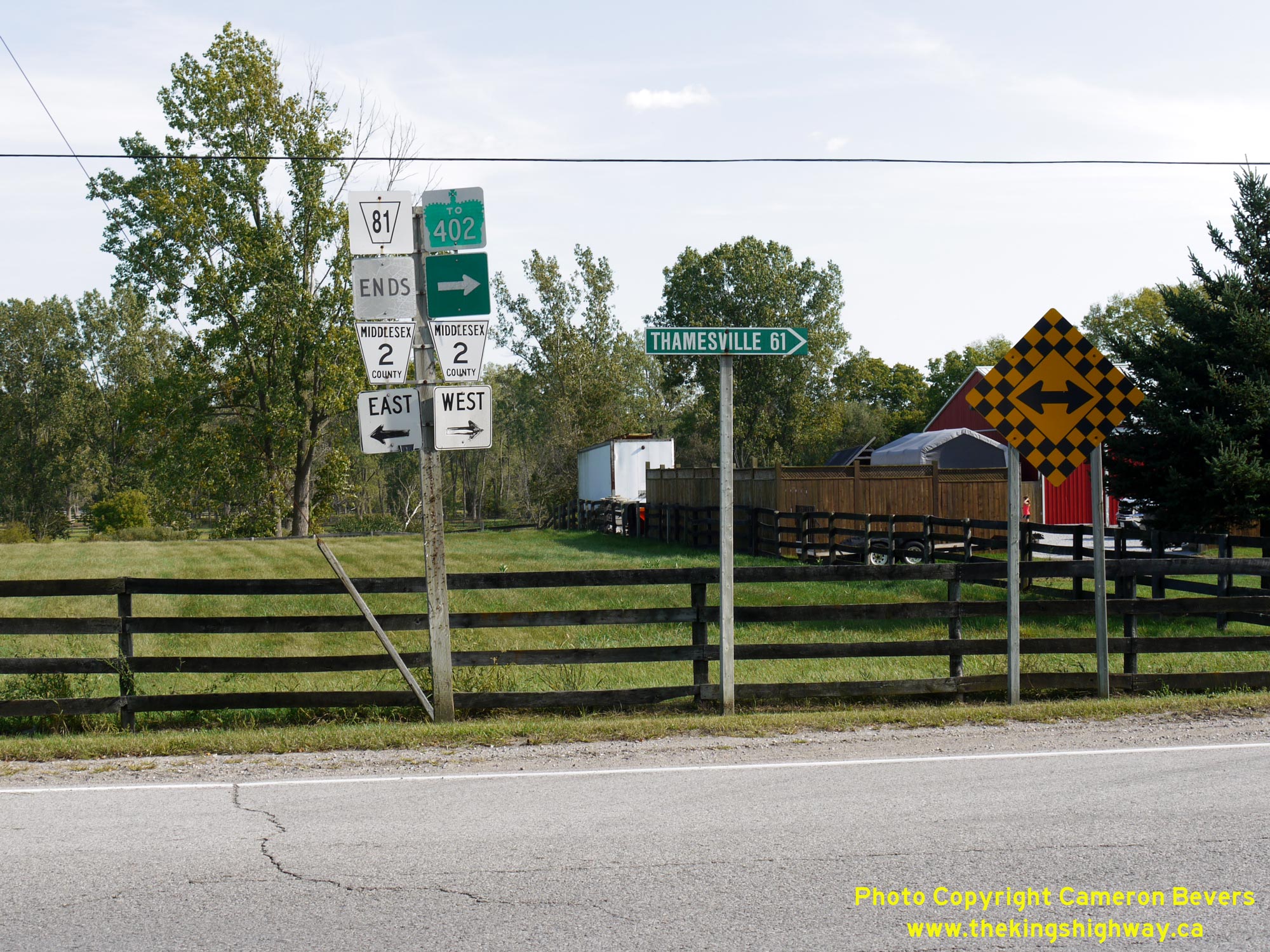

Left - Junction sign assembly at the southern terminus of Hwy 81 at the Hwy 2 Junction at Delaware. See an
Enlarged Photo Here. (Photograph taken on September 16, 2012 - © Cameron Bevers) Right - Approaching the Hwy 81 Junction on Hwy 2, facing west towards Chatham. Today, Hwy 81 is officially known as Middlesex County Road 81 and is also known as Adelaide Road. Motorists who wish to access Strathroy from Hwy 402 won't have to travel too far out of their way, as the Hwy 402 Interchange lies only 600 metres to the west of the Hwy 81 Junction. Although Hwy 81 crosses over Hwy 402 west of Delaware, there is no interchange between the two highways at that location. Access to Hwy 402 can only be obtained from Hwy 2 in the Delaware area. See an Enlarged Photo Here. (Photograph taken on September 16, 2012 - © Cameron Bevers) 
Above - View of Hwy 2 facing east towards London from the Hwy 81 Junction at Delaware. While Hwy 2 curves slightly to the left today, the highway originally
continued straight ahead. A new bridge was constructed over the Thames River on a diversion of Hwy 2 during the late 1950s. See an
Enlarged Photo Here. (Photograph taken on September 16, 2012 - © Cameron Bevers) 
Above - Old Hwy 81 alignment north of Mount Brydges. The railway overhead at left was completed in 1969. See an
Enlarged Photo Here. (Photograph taken in March 2003 - © Cameron Bevers) 

Left - Facing south along Hwy 81 at the Sydenham River Bridge in Strathroy. See an
Enlarged Photo Here. (Photograph taken on April 15, 2006 - © Cameron Bevers) Right - Western side of the Sydenham River Bridge at Strathroy. Structure completed in 1967. See an Enlarged Photo Here. (Photograph taken on April 15, 2006 - © Cameron Bevers) 
Left - Date stamp on the Sydenham River Bridge on Hwy 81 in Strathroy. See an
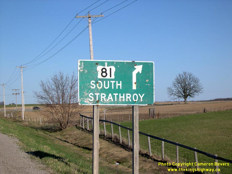
Enlarged Photo Here. (Photograph taken on April 15, 2006 - © Cameron Bevers) Right - Old advance guide sign for Hwy 81 South at the Hwy 22 Junction. See an Enlarged Photo Here. (Photograph taken on April 15, 2006 - © Cameron Bevers) 

Left - Old guide sign for Hwy 81 South at the Hwy 22 Junction north of Strathroy. See an
Enlarged Photo Here. (Photograph taken on April 15, 2006 - © Cameron Bevers) Right - Twin slab concrete pavement on Hwy 81 looking south towards Townsend Line. (Photograph taken on May 4, 2003 - © Cameron Bevers) 

Left - Twin slab concrete pavement on Hwy 81 just north of Townsend Line. (Photograph taken on May 4, 2003 - © Cameron Bevers) Right - Concrete pavement on Hwy 81 at the Ausable River Bridge. (Photograph taken on May 4, 2003 - © Cameron Bevers) 

Left - Concrete pavement on Hwy 81 at Bornish, facing south. (Photograph taken on May 4, 2003 - © Cameron Bevers) Right - Facing north along a concrete section of Hwy 81 at Bornish. (Photograph taken on May 4, 2003 - © Cameron Bevers) 

Left - Start of old concrete pavement on Hwy 81 south of Hwy 7. (Photograph taken on May 4, 2003 - © Cameron Bevers) Right - Concrete arch culvert under a former alignment of Hwy 81 in Grand Bend. Structure completed in 1948. See an Enlarged Photo Here. (Photograph taken on October 7, 2006 - © Cameron Bevers)
More King's Highway 81 Photographs Coming Soon!
|
|---|
Links to Adjacent King's Highway Photograph Pages:
Back to King's Highway 80 Photos /
King's Highway 81 History /
On to King's Highway 82 Photos
Ontario Highway History - Main Menu / Back to List of Highways Website contents, photos & text © 2002-2026, Cameron
Bevers (Webmaster) - All Rights Reserved / Contact Me
|
|---|