
| 
| |
|
|
This page contains historical and present day photos of Ontario's King's Highway 98. All photographs displayed on
this page were taken by the Webmaster (Cameron Bevers), unless specifically noted otherwise. Historical photographs are arranged in approximate chronological order,
while present day photographs (Year 2010 to date) are arranged by location from west to east. Click on any thumbnail to see a larger image!
Please note that all photographs displayed on this
website are protected by copyright. These photographs must not be reproduced, published,
electronically stored or copied, distributed, or posted onto other websites without
my written permission. If you want to use photos from this website, please
email me first for permission. Thank-you!
|
|---|
|
Historical King's Highway 98 Photographs

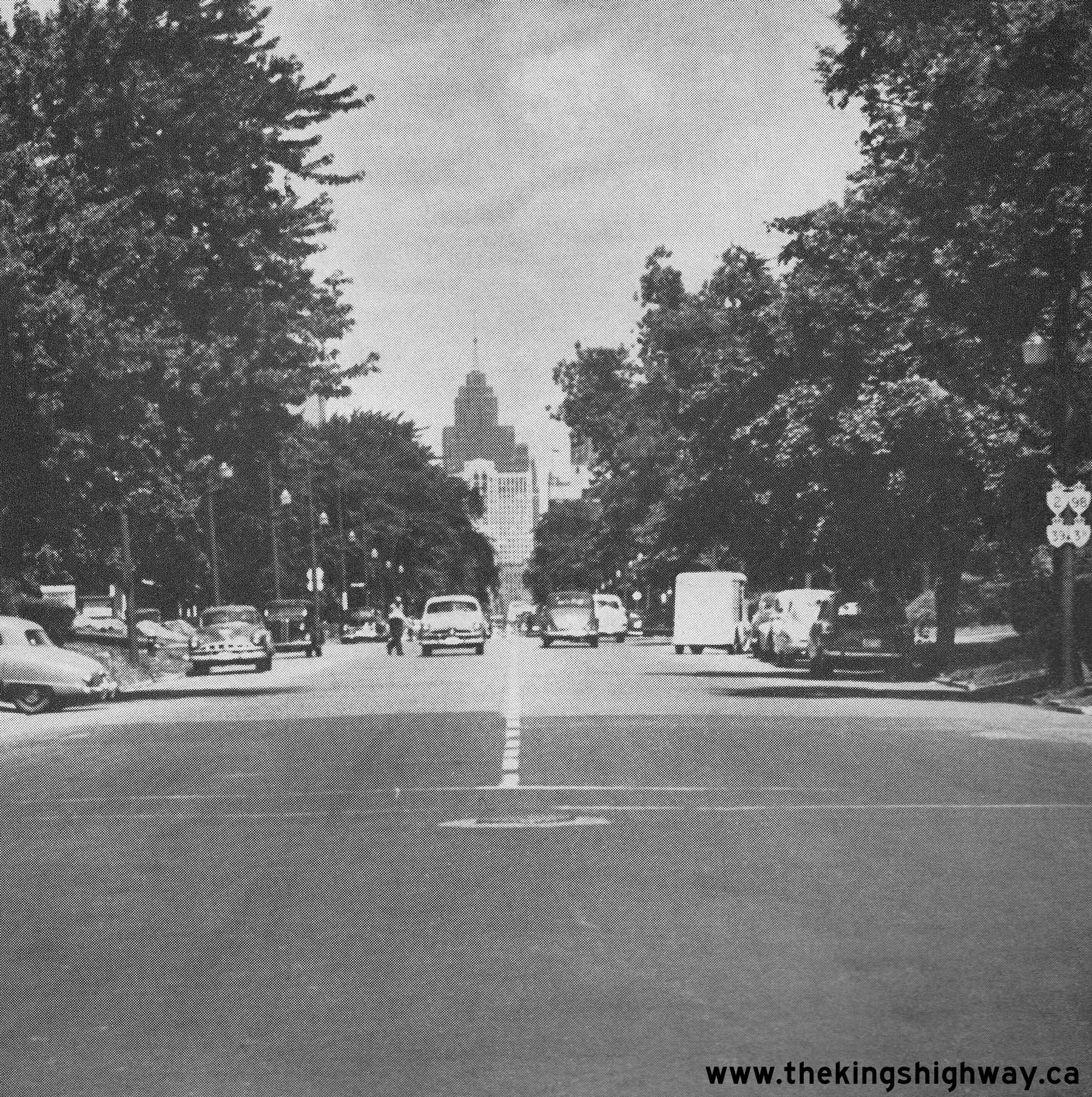
Above - Facing north along Ouellette Avenue towards Downtown Windsor in 1951. Note the signpost at right, which bears no fewer than four King's Highway shields.
Although the route numbers are difficult to discern in this photo, the four marked routes are Hwy 2, Hwy 3B, Hwy 39 and Hwy 98. For a number of years, all four of
these King's Highways were signed concurrently along Ouellette Avenue into Downtown Windsor. However, due to the construction of the E.C. Row Expressway and the
decommissioning of Hwy 39 and Hwy 98, three of these highway routes were eventually removed from Ouellette Avenue. Only the Hwy 3B route designation survived until
the 1990s. See an Enlarged Photo Here. Photo taken on July 10, 1951. (Photo courtesy of Ontario Ministry of Transportation - © King's Printer for Ontario, 1951) 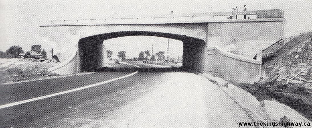
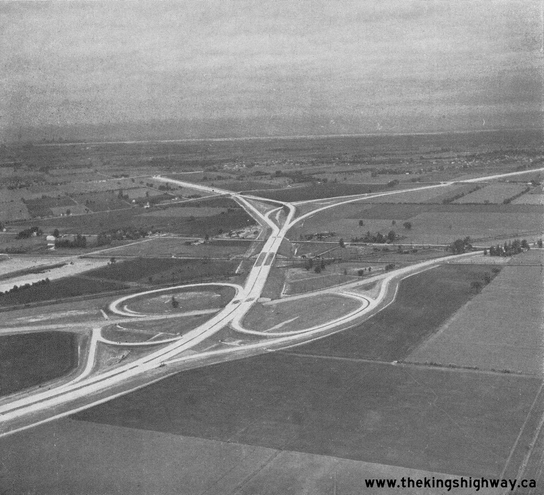
Above - Hwy 98 (Provincial Road) Interchange under construction on Hwy 401 south of Windsor, Contract #1955-59. See an
Enlarged Photo Here. Photo taken on July 26, 1956. (Photo courtesy of Ontario Ministry of Transportation - © King's Printer for Ontario, 1956) 
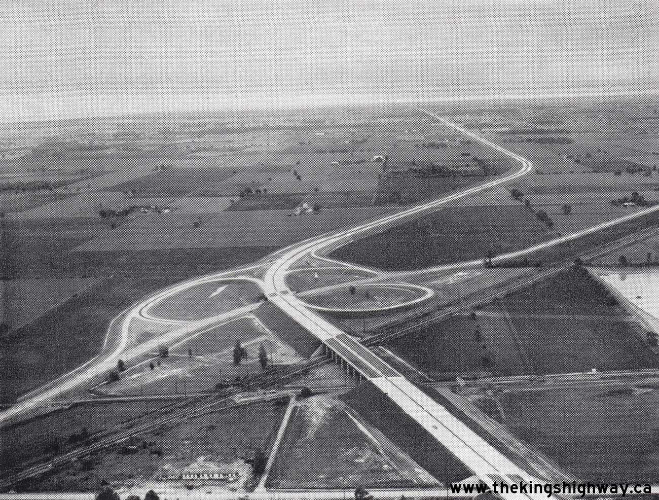
Above - Aerial view of Hwy 401 facing west from the Provincial Road (Hwy 98) Interchange in Windsor. See an
Enlarged Photo Here. Photo taken in 1958. (Photo courtesy of Ontario Ministry of Transportation - © King's Printer for Ontario, 1958) 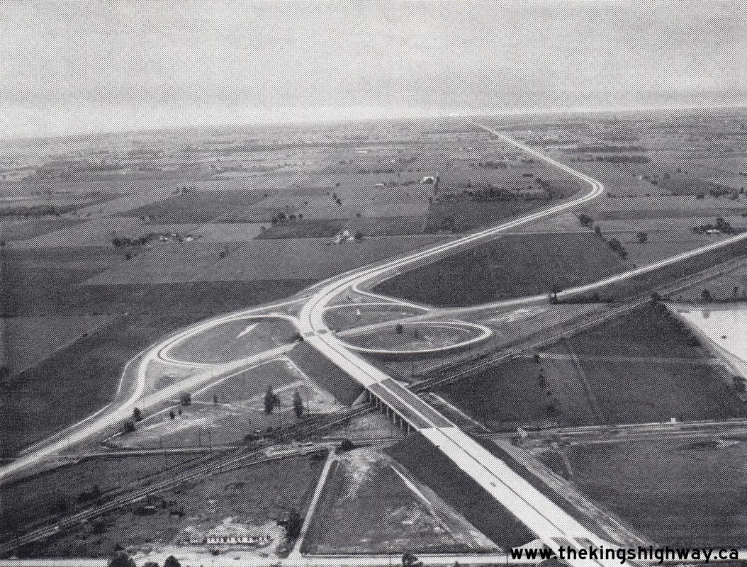
Above - Aerial view of the Hwy 98 (Provincial Road) Interchange on Hwy 401 in Windsor, facing east towards Tilbury. See an
Enlarged Photo Here. Photo taken in 1958. (Photo courtesy of Ontario Ministry of Transportation - © King's Printer for Ontario, 1958) 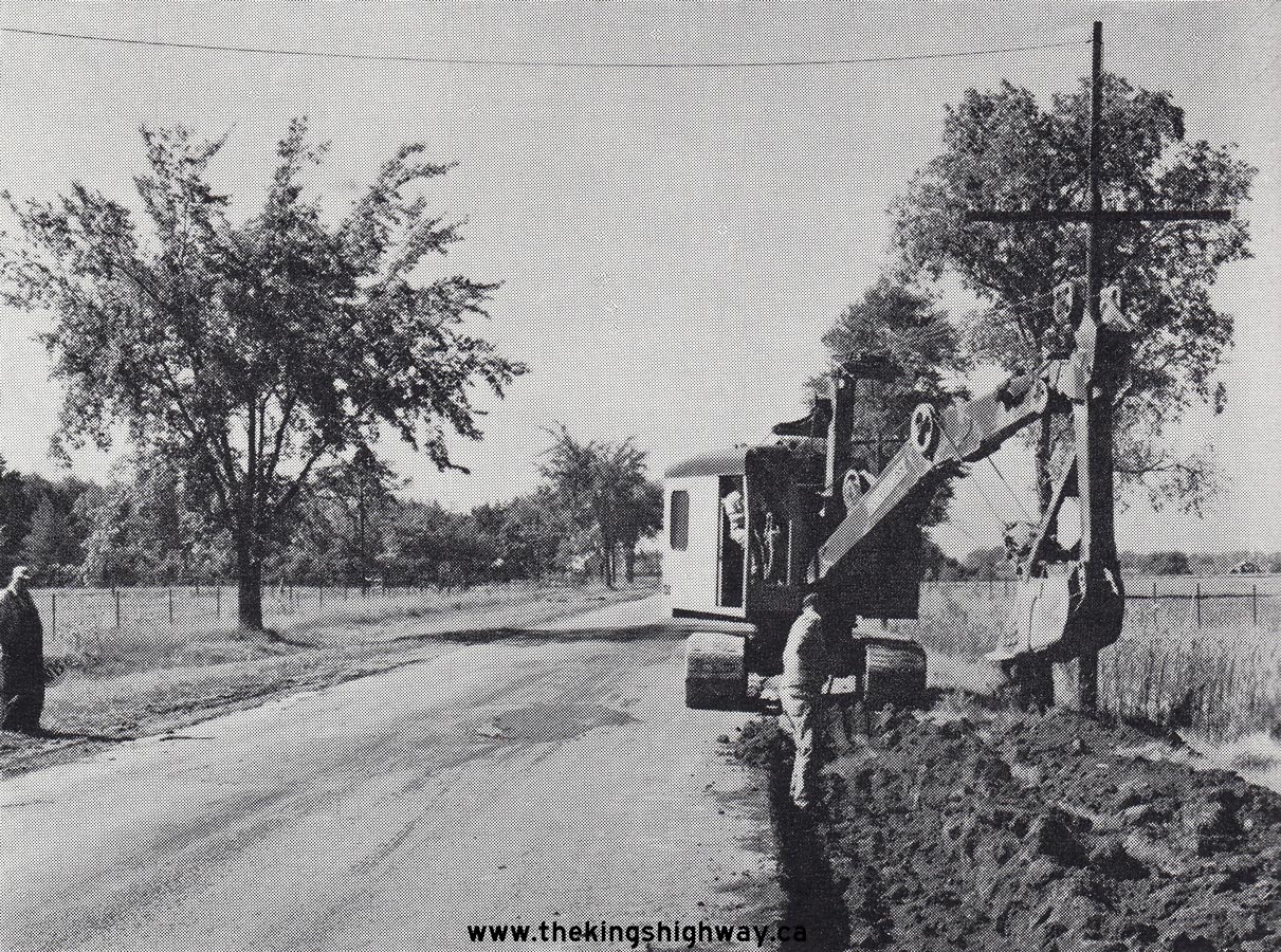
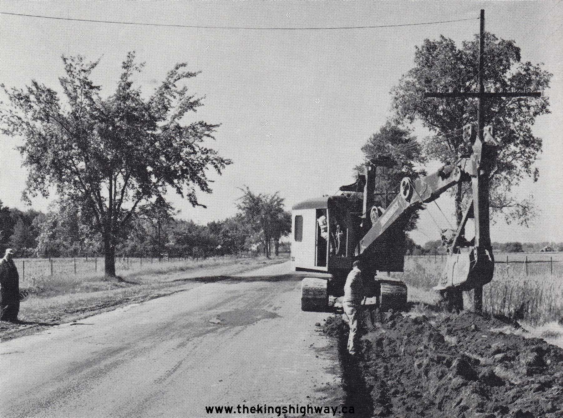
Above - Grading and culvert construction along Hwy 98 east of Merlin, under Contract #1958-126. See an
Enlarged Photo Here. Photo taken in 1958. (Photo courtesy of Ontario Ministry of Transportation - © King's Printer for Ontario, 1958) 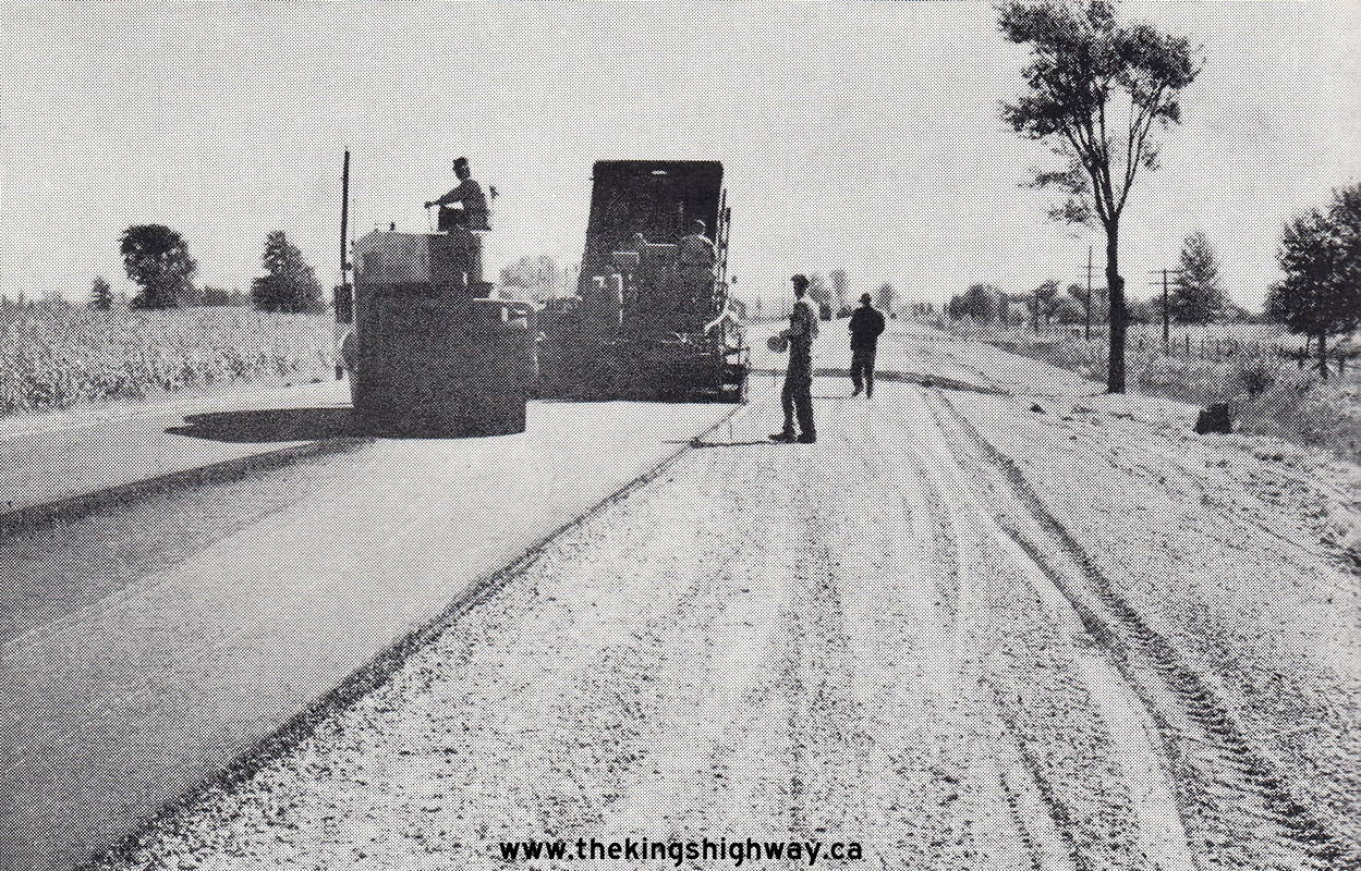
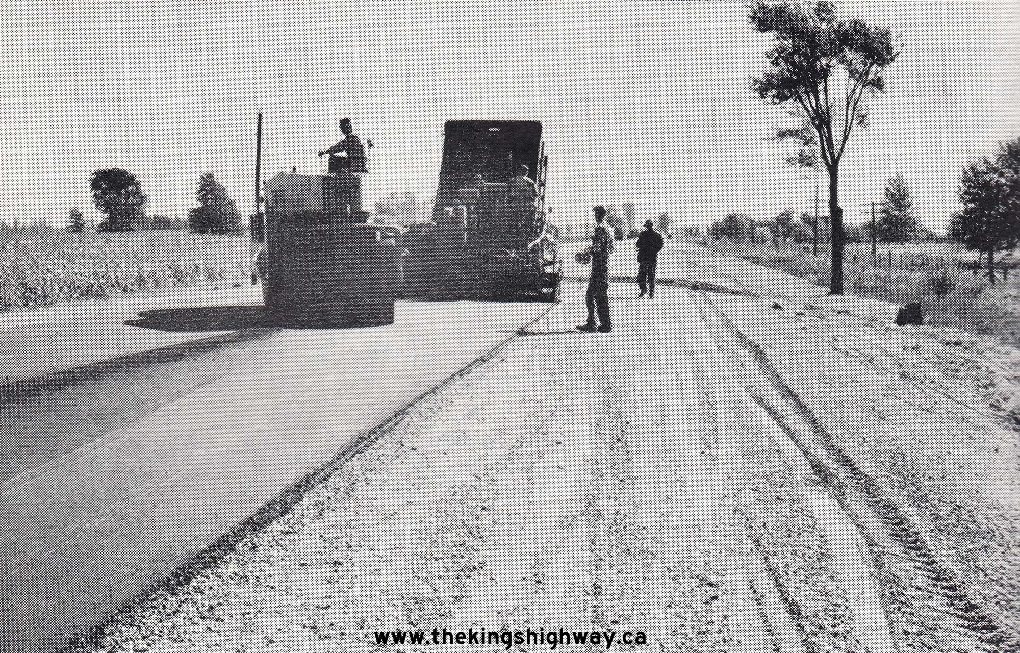
Above - Hot-mix asphalt paving operations underway along Hwy 98 east of Tilbury in 1958, under Contract #1957-605. See an
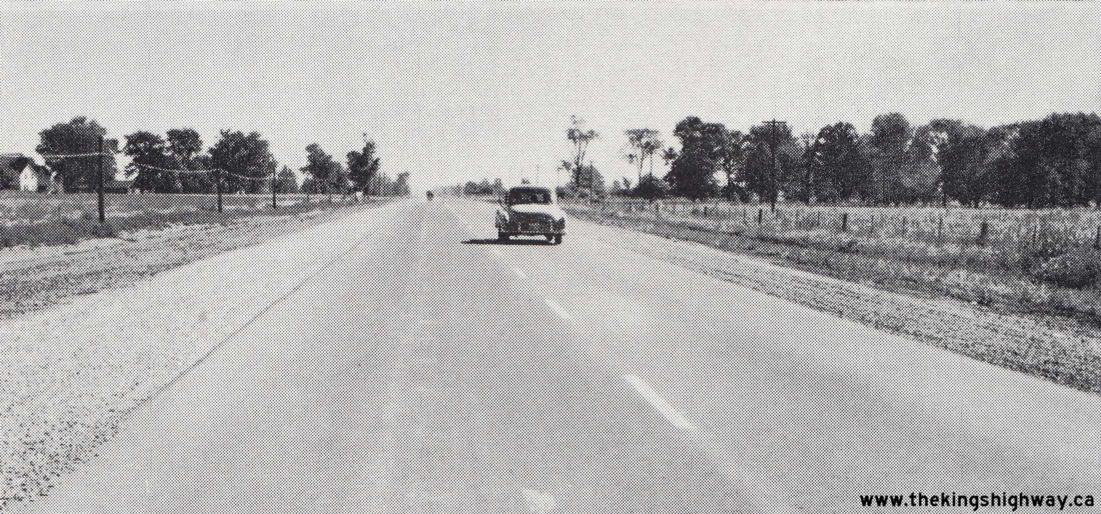
Enlarged Photo Here. Photo taken in 1958. (Photo courtesy of Ontario Ministry of Transportation - © King's Printer for Ontario, 1958) 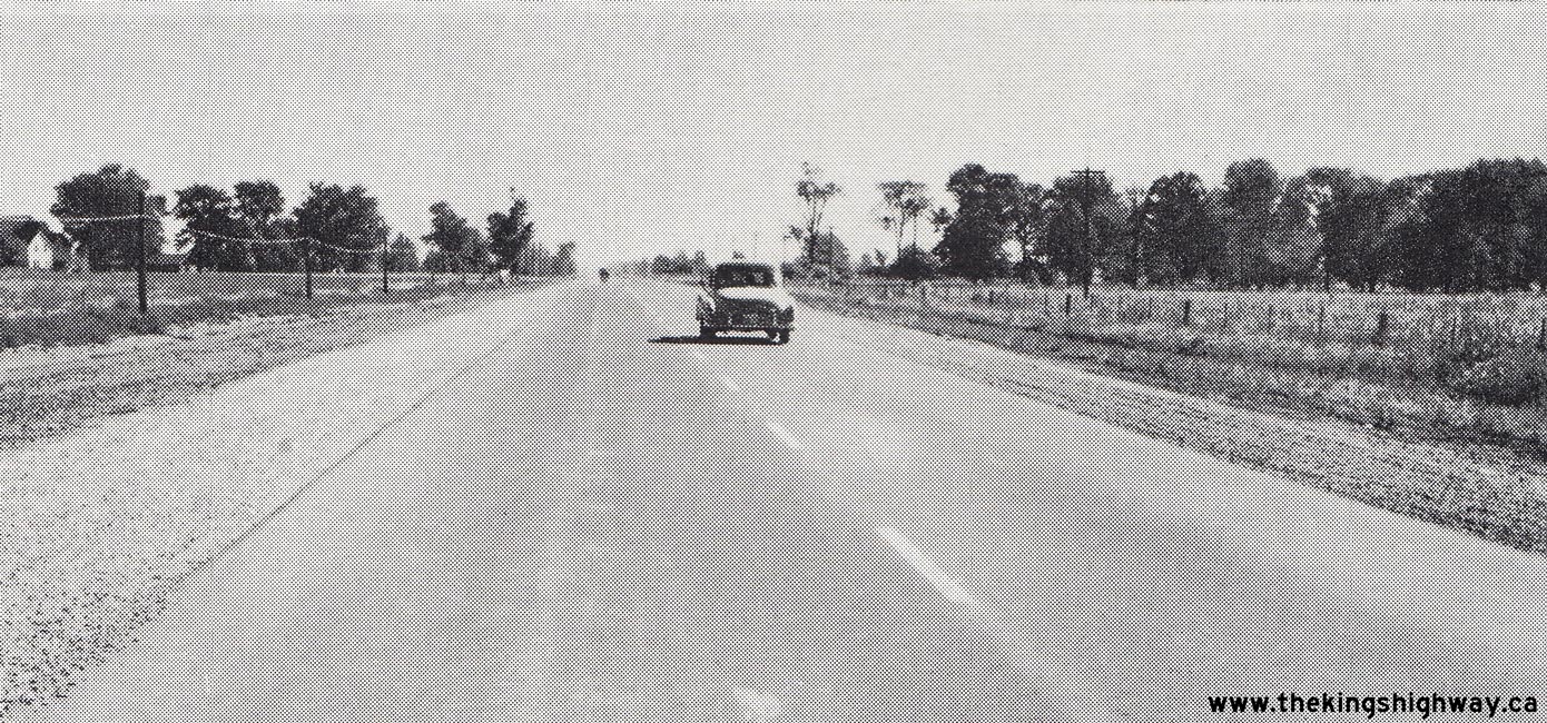  Above - Completed hot-mix asphalt pavement on Hwy 98, 1/2 mile east of Charing Cross, Contract #1957-296. See an
Enlarged Photo Here. Photo taken in 1958. Above - Completed hot-mix asphalt pavement on Hwy 98, 1/2 mile east of Charing Cross, Contract #1957-296. See an
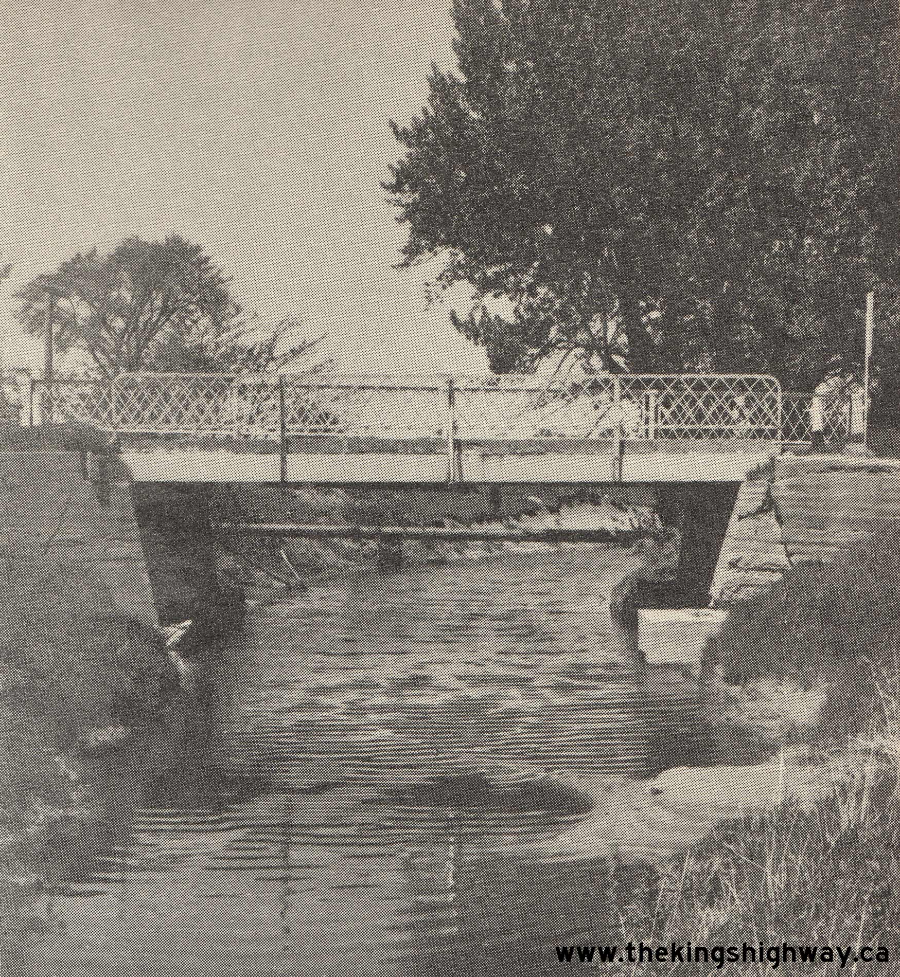
Enlarged Photo Here. Photo taken in 1958.(Photo courtesy of Ontario Ministry of Transportation - © King's Printer for Ontario, 1958) 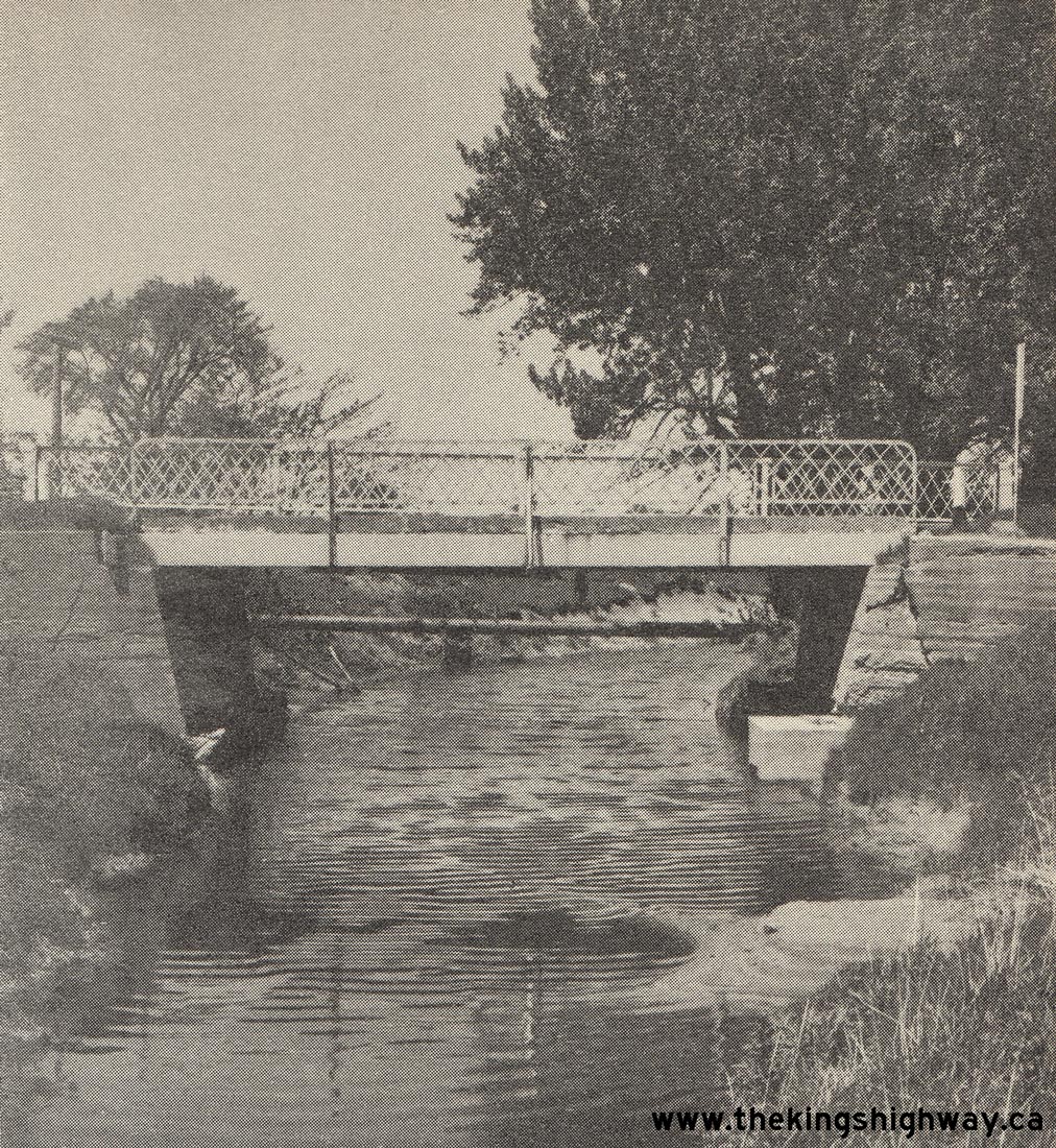 Above - Puce River Bridge on Hwy 98, located about 4 miles east of the Hwy 114 Junction. This single-span steel beam bridge was originally constructed along
the Windsor-Tilbury Highway in 1925. It was replaced with a new structure in 1963, under Contract #1963-95. This photo of the Puce River Bridge was taken in 1962,
just before the bridge replacement project began. See an Enlarged Photo Here. Photo taken in 1962. Above - Puce River Bridge on Hwy 98, located about 4 miles east of the Hwy 114 Junction. This single-span steel beam bridge was originally constructed along
the Windsor-Tilbury Highway in 1925. It was replaced with a new structure in 1963, under Contract #1963-95. This photo of the Puce River Bridge was taken in 1962,
just before the bridge replacement project began. See an Enlarged Photo Here. Photo taken in 1962.(Photo courtesy of Ontario Ministry of Transportation - © King's Printer for Ontario, 1962) 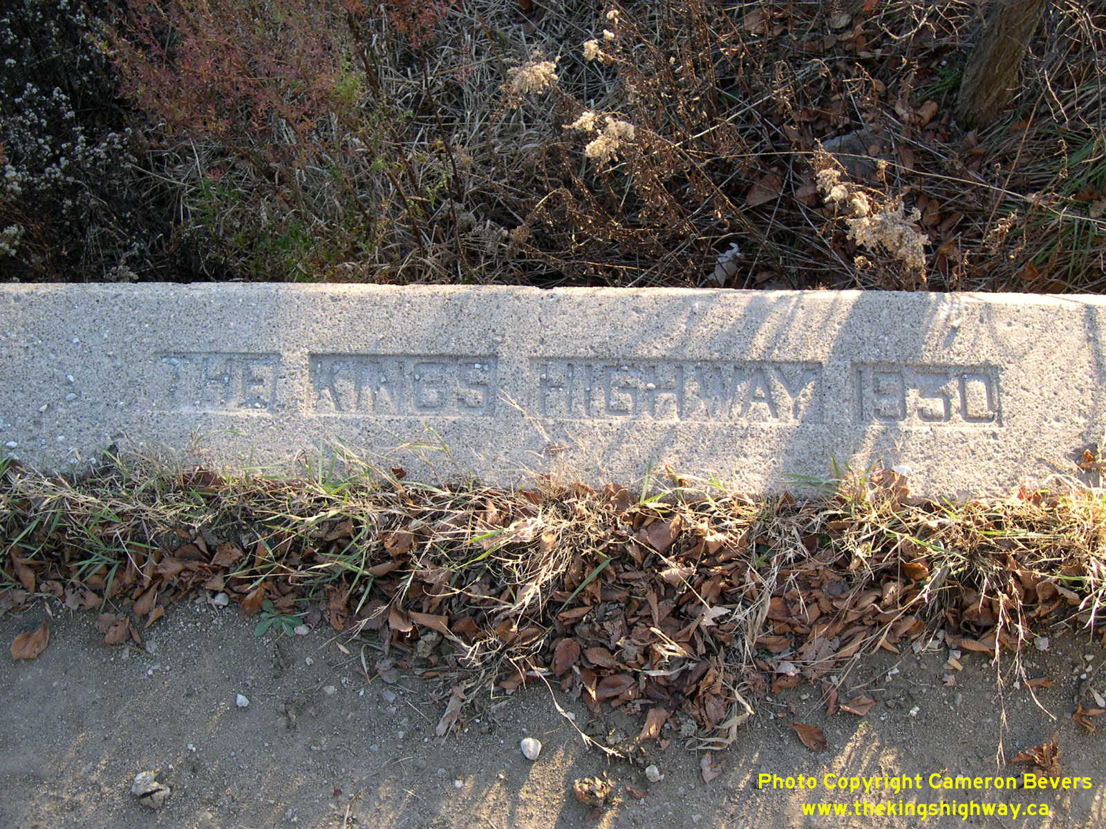
Left - Inscription on a concrete culvert on Old Hwy 98 (now Essex County Road 46) east of Windsor - "THE KING'S HIGHWAY 1930". See an
Enlarged Photo Here. (Photograph taken on November 8, 2003 - © Cameron Bevers) Right - Undated concrete culvert from the early 1940s on Old Hwy 98 at Hickey Road just west of Merlin. See an Enlarged Photo Here. (Photograph taken on September 12, 2004 - © Cameron Bevers) 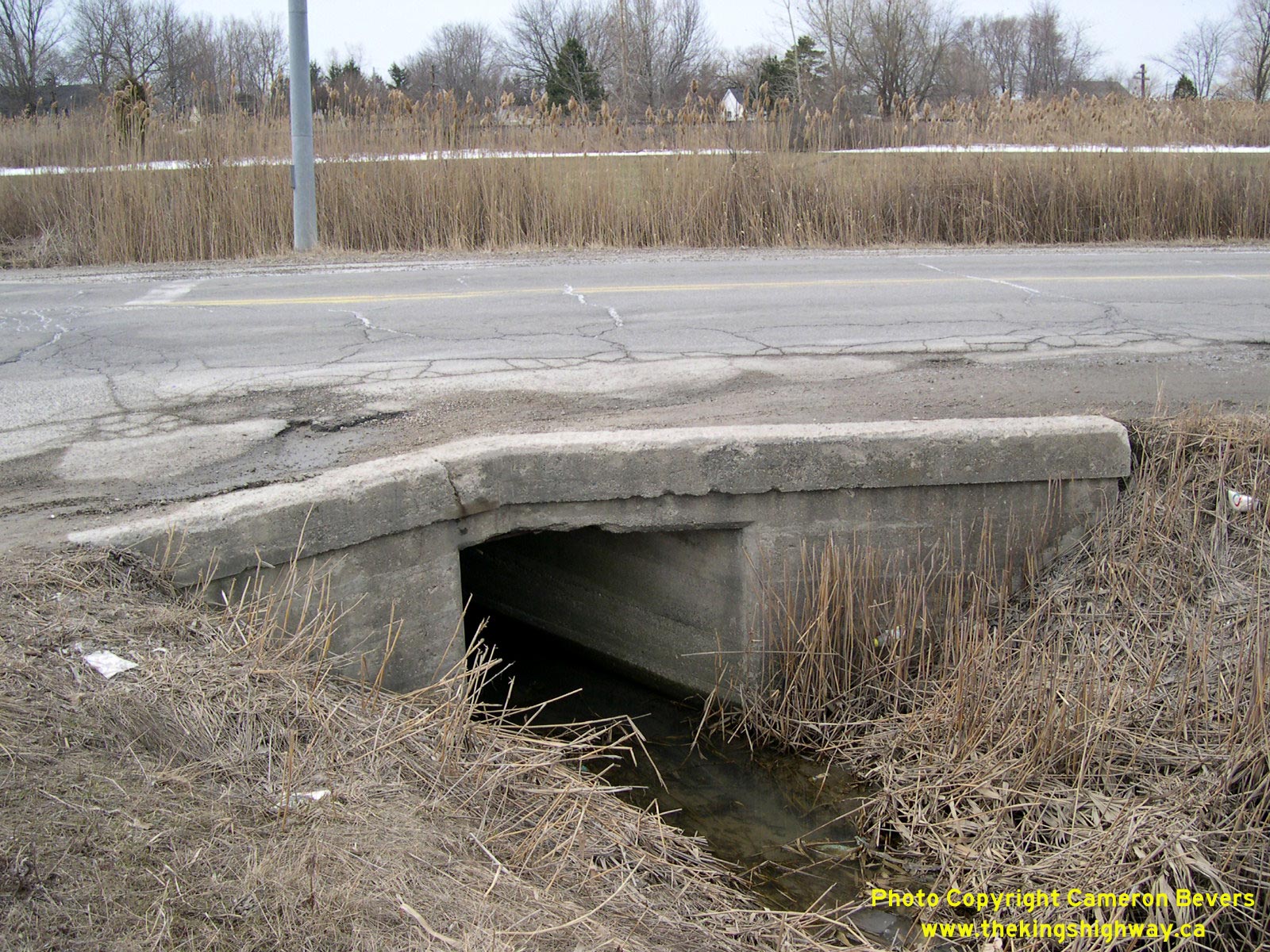
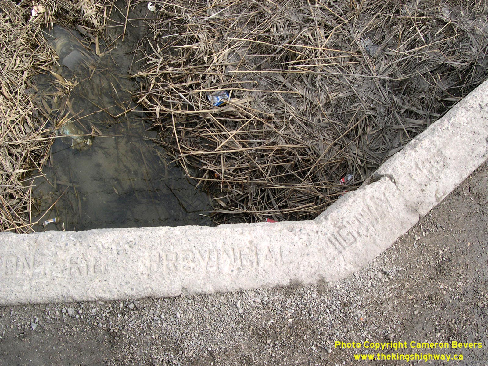 Left - Old concrete culvert on Old Hwy 98 (Essex County Road 46) at Concession Road 9 southeast of Windsor. See an
Enlarged Photo Here. Left - Old concrete culvert on Old Hwy 98 (Essex County Road 46) at Concession Road 9 southeast of Windsor. See an
Enlarged Photo Here.(Photograph taken on March 27, 2005 - © Cameron Bevers) Right - Inscription on a concrete culvert on Old Hwy 98 at Concession Road 9 near Windsor - "ONTARIO PROVINCIAL HIGHWAY 1929". See an
Enlarged Photo Here.(Photograph taken on March 27, 2005 - © Cameron Bevers) 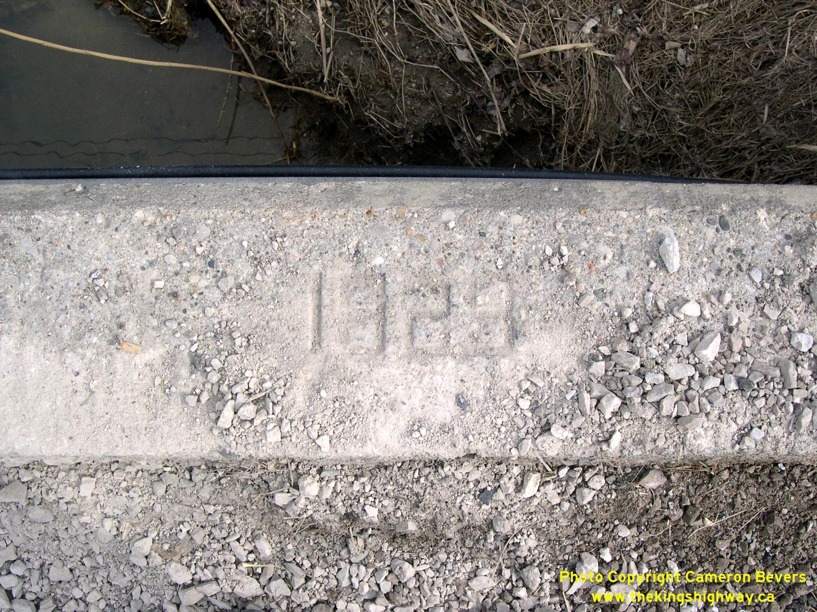
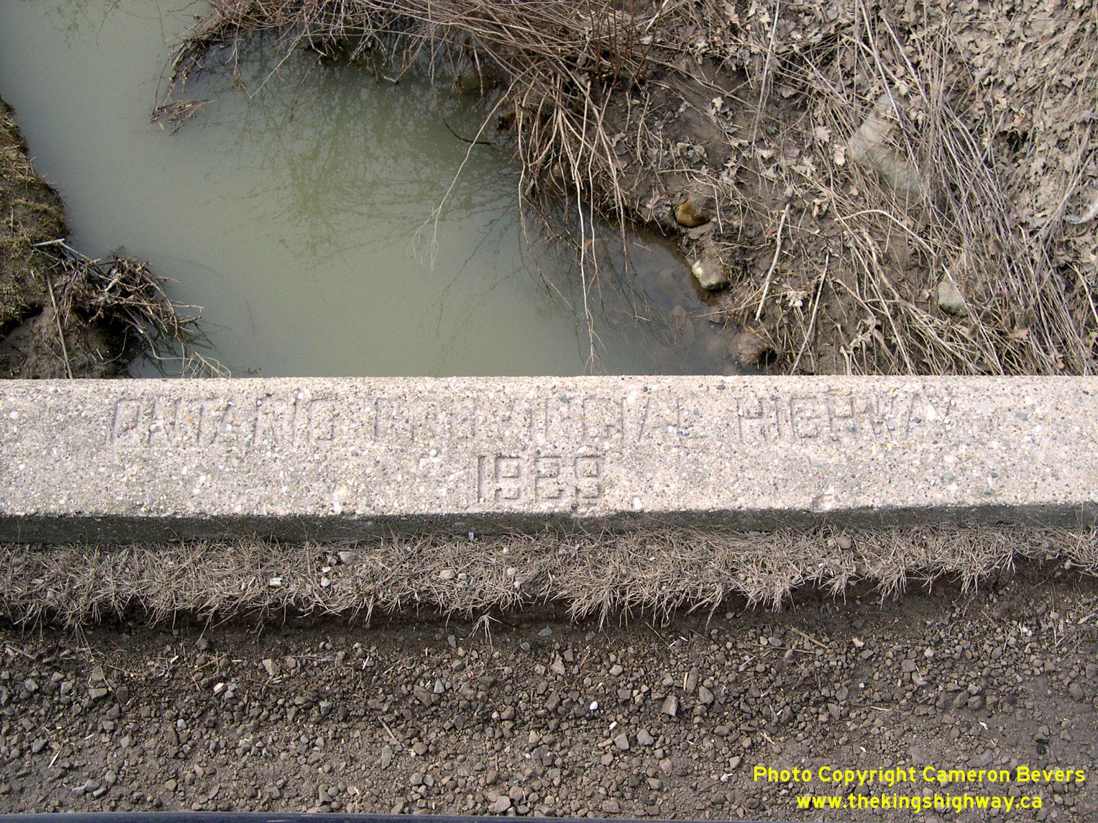
 Left - Date stamp (1929) on an old concrete culvert along Old Hwy 98 near Concession Road 10 east of Windsor. See an
Enlarged Photo Here. Left - Date stamp (1929) on an old concrete culvert along Old Hwy 98 near Concession Road 10 east of Windsor. See an
Enlarged Photo Here.(Photograph taken on March 27, 2005 - © Cameron Bevers) Right - Southern side of the Pike Creek Culvert on Old Hwy 98 (Essex County Road 46), located just east of the Essex County Road 43 Junction. See an
Enlarged Photo Here.(Photograph taken on March 27, 2005 - © Cameron Bevers) 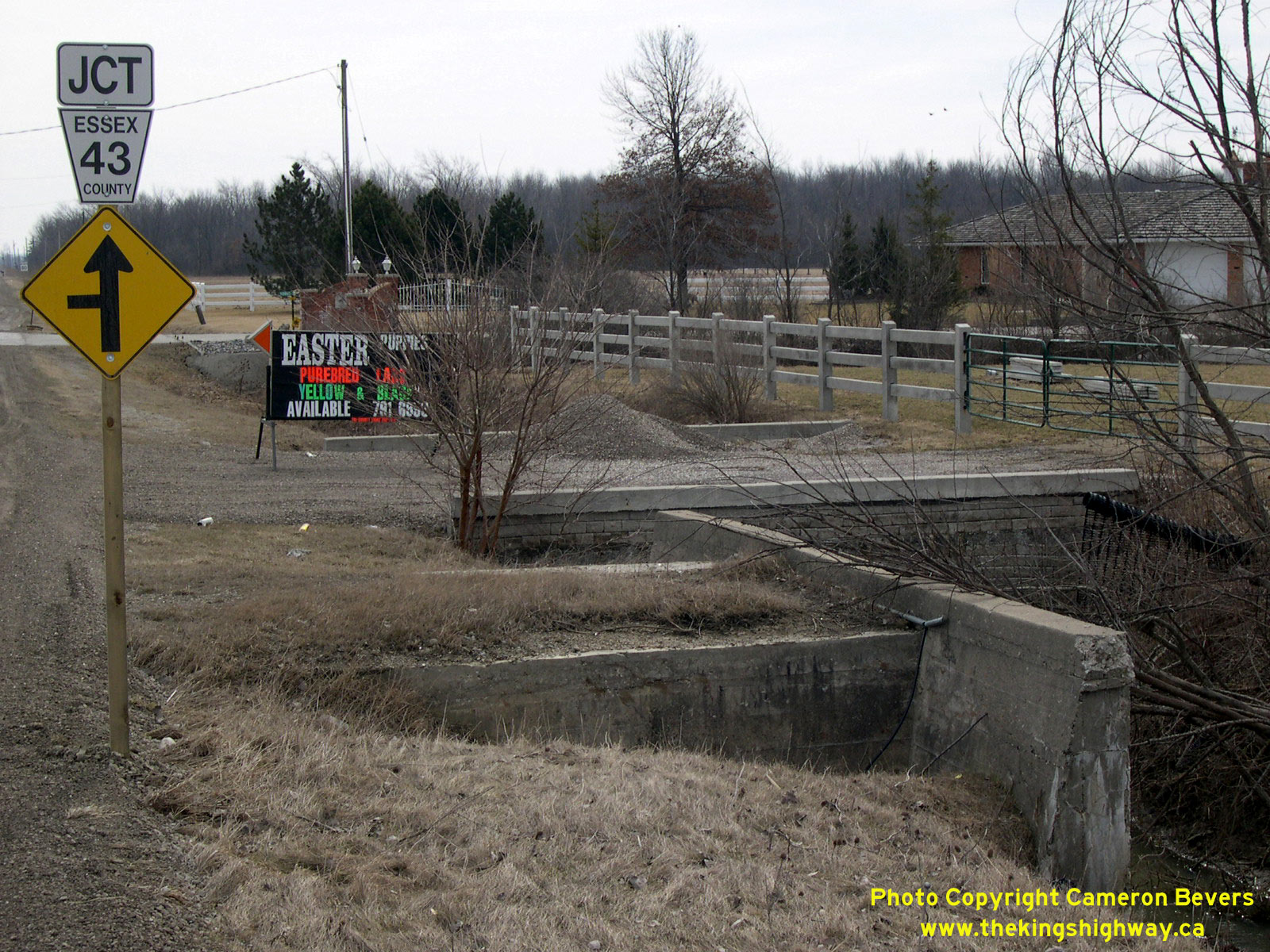
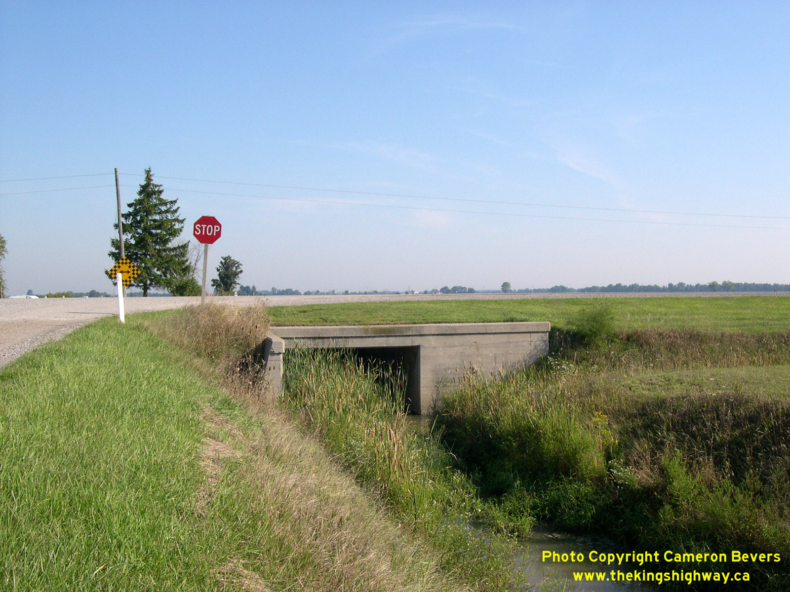
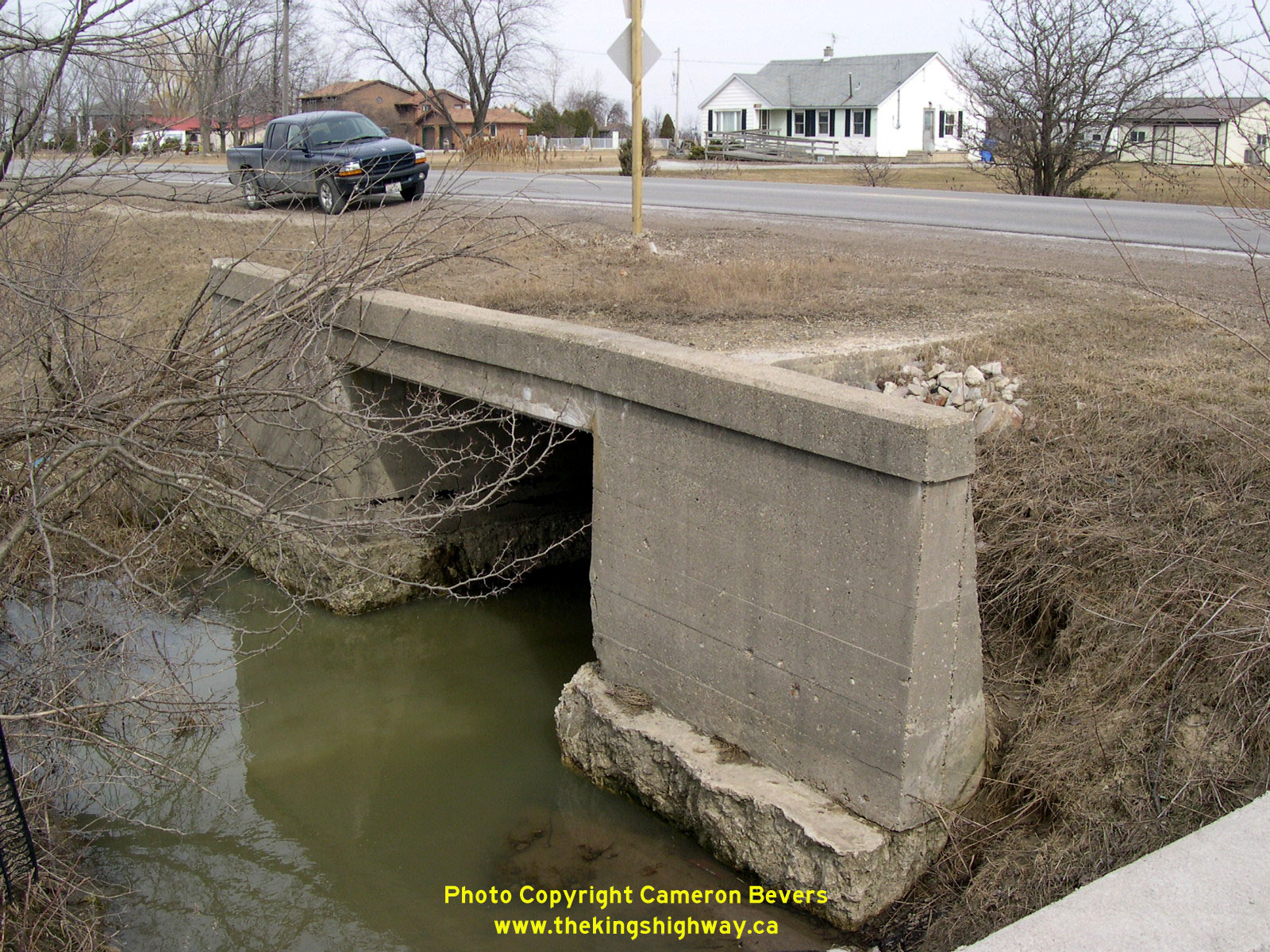
 Left - View of the Pike Creek Culvert on Old Hwy 98. This large concrete culvert was constructed in 1929 along the New Windsor Entrance Highway. This ambitious
highway construction project saw a new 8-mile highway route constructed into Windsor from the Maidstone area, under Contract #1929-67. Originally built as a westerly
extension of Hwy 2, the New Windsor Entrance Highway was renumbered as Hwy 2A in 1931, and then renumbered once again as Hwy 98 by the late 1930s. The culvert's
barrel and headwall projects well beyond the edge of the shoulder, which suggests that the culvert may have been designed with provisions for a future highway
widening in mind. See an Enlarged Photo Here. Left - View of the Pike Creek Culvert on Old Hwy 98. This large concrete culvert was constructed in 1929 along the New Windsor Entrance Highway. This ambitious
highway construction project saw a new 8-mile highway route constructed into Windsor from the Maidstone area, under Contract #1929-67. Originally built as a westerly
extension of Hwy 2, the New Windsor Entrance Highway was renumbered as Hwy 2A in 1931, and then renumbered once again as Hwy 98 by the late 1930s. The culvert's
barrel and headwall projects well beyond the edge of the shoulder, which suggests that the culvert may have been designed with provisions for a future highway
widening in mind. See an Enlarged Photo Here.(Photograph taken on March 27, 2005 - © Cameron Bevers) Right - Inscription on a concrete culvert on Old Hwy 98 over Pike Creek east of Windsor - "ONTARIO PROVINCIAL HIGHWAY 1929". See an
Enlarged Photo Here.(Photograph taken on March 27, 2005 - © Cameron Bevers) 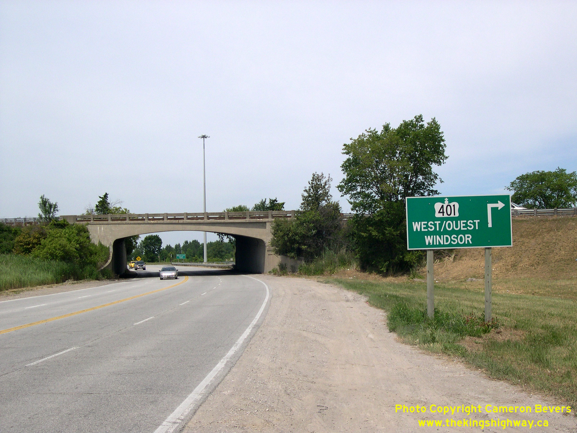
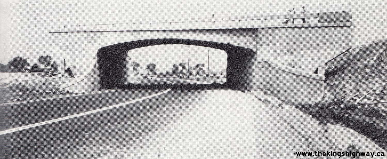
 Left - Southern side of the Provincial Road (Old Hwy 98) Underpass on Hwy 401 at the eastern entrance to Windsor. This single-span concrete rigid frame girder
structure was built under Contract #1955-59 and was completed in 1955. This bridge was replaced during a recent multi-year expansion project along Hwy 401 in the
Windsor area. See an Enlarged Photo Here. Left - Southern side of the Provincial Road (Old Hwy 98) Underpass on Hwy 401 at the eastern entrance to Windsor. This single-span concrete rigid frame girder
structure was built under Contract #1955-59 and was completed in 1955. This bridge was replaced during a recent multi-year expansion project along Hwy 401 in the
Windsor area. See an Enlarged Photo Here.(Photograph taken on August 4, 2007 - © Cameron Bevers) Right - Northern side of the Provincial Road Underpass (Site #6-74) on Hwy 401 in 2007, just prior to replacement. The route of Hwy 98 through Essex County was
made largely redundant due to the construction of Hwy 401 just a short distance to the north between Windsor and Tilbury. Provincial jurisdiction over Hwy 98 ended in
1971, when ownership of the highway from Windsor to Tilbury was transferred over to the County of Essex. Today, Old Hwy 98 is known as Essex County Road 46. See an
Enlarged Photo Here.(Photograph taken on August 4, 2007 - © Cameron Bevers) 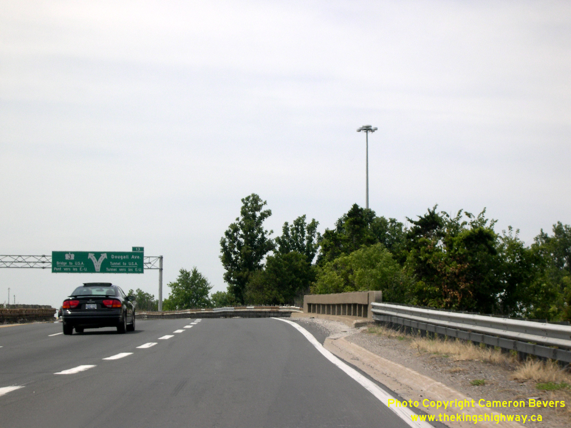 Above - Deck view of the Provincial Road (Old Hwy 98) Underpass on Hwy 401, facing west towards Windsor. See an
Enlarged Photo Here. Above - Deck view of the Provincial Road (Old Hwy 98) Underpass on Hwy 401, facing west towards Windsor. See an
Enlarged Photo Here.(Photograph taken on August 4, 2007 - © Cameron Bevers) |
|---|
|
Present Day King's Highway 98 Photographs

 Left - Facing west along Old Hwy 98 (Essex County Road 46) towards Windsor from the Former Hwy 114 Junction north of Maidstone. The intersection in the
background is Essex County Road 19 (Manning Road), which heads north towards Hwy 401 and Tecumseh. See an
Enlarged Photo Here. Left - Facing west along Old Hwy 98 (Essex County Road 46) towards Windsor from the Former Hwy 114 Junction north of Maidstone. The intersection in the
background is Essex County Road 19 (Manning Road), which heads north towards Hwy 401 and Tecumseh. See an
Enlarged Photo Here.(Photograph taken on August 1, 2019 - © Cameron Bevers) Right - View of the Former Hwy 114 Junction on Old Hwy 98 (Essex County Road 46) near Maidstone, facing east towards Tilbury. See an
Enlarged Photo Here.(Photograph taken on August 1, 2019 - © Cameron Bevers) 
 Left - Facing south along Old Hwy 114 towards Maidstone from Old Hwy 98 (Essex County Road 46). This short provincial highway once connected Hwy 98 to Hwy 3 at
Maidstone, although at one time, this was actually the route of the Trans-Provincial Highway (Hwy 2) leading into Windsor. A new cut-off highway to Windsor (which
ultimately became Hwy 98) was completed in 1929, which left this old section of the Trans-Provincial Highway behind. This highway connection to Maidstone has been
known by a series of different route numbers over the years, with the Hwy 114 designation being the most recent and final one assigned to this diminutive highway.
When jurisdiction over Hwy 98 was transferred from the province to the County of Essex in the early 1970s, Hwy 114 was no longer needed in the provincial highway
system either. Accordingly, Hwy 114 was also transferred over to municipal control in the early 1970s. Today, Old Hwy 114 is known as Malden Road. See an
Enlarged Photo Here. Left - Facing south along Old Hwy 114 towards Maidstone from Old Hwy 98 (Essex County Road 46). This short provincial highway once connected Hwy 98 to Hwy 3 at
Maidstone, although at one time, this was actually the route of the Trans-Provincial Highway (Hwy 2) leading into Windsor. A new cut-off highway to Windsor (which
ultimately became Hwy 98) was completed in 1929, which left this old section of the Trans-Provincial Highway behind. This highway connection to Maidstone has been
known by a series of different route numbers over the years, with the Hwy 114 designation being the most recent and final one assigned to this diminutive highway.
When jurisdiction over Hwy 98 was transferred from the province to the County of Essex in the early 1970s, Hwy 114 was no longer needed in the provincial highway
system either. Accordingly, Hwy 114 was also transferred over to municipal control in the early 1970s. Today, Old Hwy 114 is known as Malden Road. See an
Enlarged Photo Here.(Photograph taken on August 1, 2019 - © Cameron Bevers) Right - Approaching the former northern terminus of Hwy 114 at Old Hwy 98. Motorists reaching the end of Hwy 114 at this junction could either turn left and
head west along Hwy 98 towards Windsor, or turn right and head east along Hwy 98 towards Tilbury. See an
Enlarged Photo Here.(Photograph taken on August 1, 2019 - © Cameron Bevers) 
 Left - View of the Former Hwy 114 Junction on Old Hwy 98 north of Maidstone, facing west towards Windsor. Early motorists heading to Windsor along the
Trans-Provincial Highway (Hwy 2) would have curved to the left at this point up until the late 1920s. A new entrance highway into Windsor was constructed in 1929, in
order to provide improved highway connections to two proposed international links to the United States from Windsor - the Ambassador Bridge and the Detroit-Windsor
Tunnel, which were both under construction at that time. The New Windsor Entrance Highway began at this point and connected directly to Windsor's Howard Avenue about
8 miles ahead. Much of this route follows "Provincial Road" - an appropriate road name indeed, as this important new highway connection was built rapidly by the
Province of Ontario and opened to considerable fanfare in late 1929. See an Enlarged Photo Here. Left - View of the Former Hwy 114 Junction on Old Hwy 98 north of Maidstone, facing west towards Windsor. Early motorists heading to Windsor along the
Trans-Provincial Highway (Hwy 2) would have curved to the left at this point up until the late 1920s. A new entrance highway into Windsor was constructed in 1929, in
order to provide improved highway connections to two proposed international links to the United States from Windsor - the Ambassador Bridge and the Detroit-Windsor
Tunnel, which were both under construction at that time. The New Windsor Entrance Highway began at this point and connected directly to Windsor's Howard Avenue about
8 miles ahead. Much of this route follows "Provincial Road" - an appropriate road name indeed, as this important new highway connection was built rapidly by the
Province of Ontario and opened to considerable fanfare in late 1929. See an Enlarged Photo Here.(Photograph taken on August 1, 2019 - © Cameron Bevers) Right - Facing east along Old Hwy 98 towards Tilbury from the Former Hwy 114 Junction north of Maidstone. See an
Enlarged Photo Here.(Photograph taken on August 1, 2019 - © Cameron Bevers) 

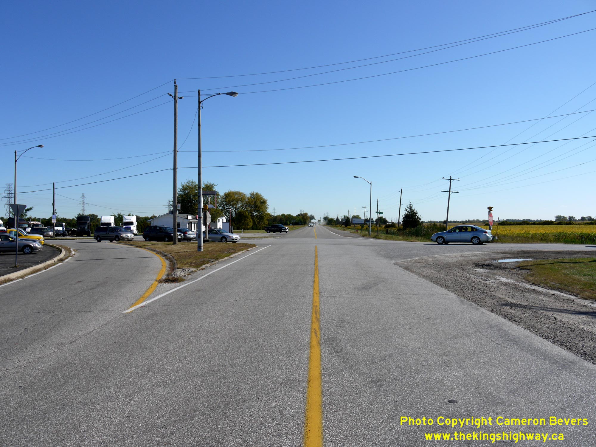
Left - Facing south along Hwy 77 towards Leamington from Old Hwy 98 (Essex County Road 46) in Comber. See an
Enlarged Photo Here. (Photograph taken on August 2, 2019 - © Cameron Bevers) Right - Approaching the Old Hwy 98 (Essex County Road 46) Junction on Hwy 77 in Comber, facing north. See an Enlarged Photo Here. (Photograph taken on August 2, 2019 - © Cameron Bevers) 

Left - Facing east along Old Hwy 98 towards Tilbury from the Hwy 77 Junction in Comber. Before the completion of Hwy 401 between Windsor and Tilbury in the
1950s, Hwy 98 served as an important east-west through route across Essex County. Traffic volumes on Hwy 98 declined once Hwy 401 opened to traffic, as most
long-distance through traffic began to use the freeway instead. Provincial jurisdiction over Hwy 98 ceased in 1971, when the highway was transferred from the
Department of Highways of Ontario (DHO) to Essex County. Old Hwy 98 is now known as Essex County Road 46. See an
Enlarged Photo Here. (Photograph taken on August 2, 2019 - © Cameron Bevers) Right - Approaching the Hwy 77 Junction on Old Hwy 98 (Essex County Road 46) in Comber, facing west. See an Enlarged Photo Here. (Photograph taken on August 2, 2019 - © Cameron Bevers) 

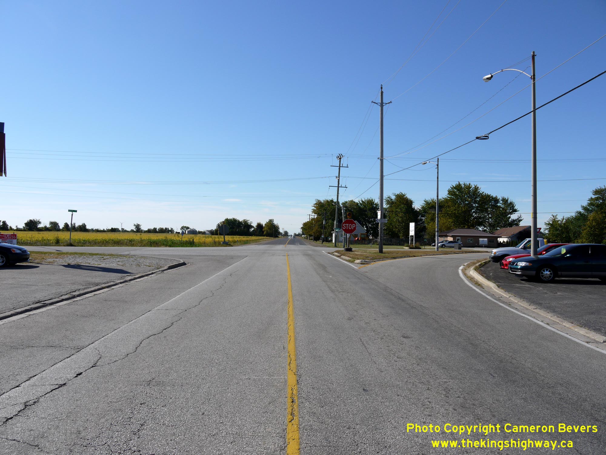
Left - Junction sign assembly on westbound Old Hwy 98 (Essex County Road 46) at the Hwy 77 Junction in Comber. See an
Enlarged Photo Here. (Photograph taken on August 2, 2019 - © Cameron Bevers) Right - Facing west along Old Hwy 98 (Essex County Road 46) towards Windsor from the Hwy 77 Junction in Comber. See an Enlarged Photo Here. (Photograph taken on August 2, 2019 - © Cameron Bevers) 

Left - Approaching the Hwy 77 Junction on Old Hwy 98 (Essex County Road 46) in Comber, facing east. This highway junction is quite unusual, in that the county
road is actually the "through highway", while traffic on Hwy 77 has to stop and yield the right-of-way before proceeding through the intersection. Under Ontario's
Highway Traffic Act (HTA), the King's Highway is always the "through highway" by default, with any exceptions to this general rule-of-the-road defined by a
case-specific regulation under the HTA. This intersection is one of the rare exceptions where traffic on a municipal road has right-of-way over traffic using the
King's Highway. See an Enlarged Photo Here. (Photograph taken on August 2, 2019 - © Cameron Bevers) Right - Stop-control and flashing warning beacon on southbound Hwy 77 at Old Hwy 98 (Essex County Road 46) in Comber. This intersection right-of-way configuration is rather unusual, in that the King's Highway has to stop and yield the right-of-way to a municipal road (Essex County Road 46). The reason for this configuration is based entirely on the history of this intersection. Essex County Road 46 was previously a King's Highway (Hwy 98) which was established decades before Hwy 77 was designated. Since Hwy 98 was the only King's Highway approaching this intersection in the early days of the provincial highway system, traffic on Hwy 98 had the right-of-way over the intersecting municipal road heading to Leamington (Essex County Road 12). Once Essex County Road 12 was assumed by the province in 1963 and also designated as a King's Highway, it was decided to leave the existing stop-control in place facing traffic on the newly-assumed route of Hwy 77. It has remained so ever since. See an Enlarged Photo Here. (Photograph taken on August 2, 2019 - © Cameron Bevers) 
Above - Junction sign assembly on eastbound Old Hwy 98 (Essex County Road 46) at the Hwy 77 Junction in Comber. See an
Enlarged Photo Here. (Photograph taken on August 2, 2019 - © Cameron Bevers) 

Left - Facing south along Hwy 77 towards the Old Hwy 98 (Essex County Road 46) Junction in Comber. See an
Enlarged Photo Here. (Photograph taken on August 2, 2019 - © Cameron Bevers) Right - Facing north along Hwy 77 from the Old Hwy 98 (Essex County Road 46) Junction. The route of Hwy 77 passes through Comber along the village's main street before arriving at the Hwy 401 Interchange about 1 km to the north. The province has retained ownership of Hwy 77 through the built-up area of Comber as this is an unincorporated village. See an Enlarged Photo Here. 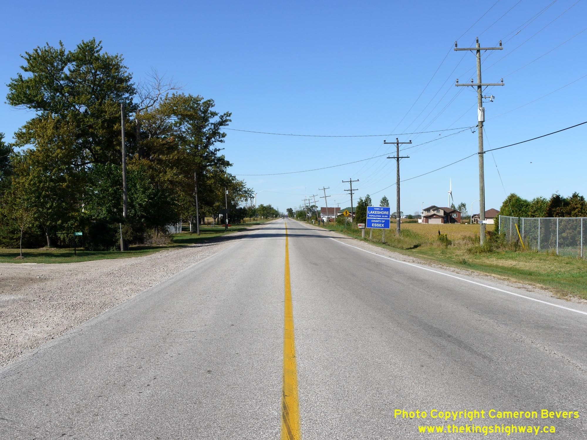
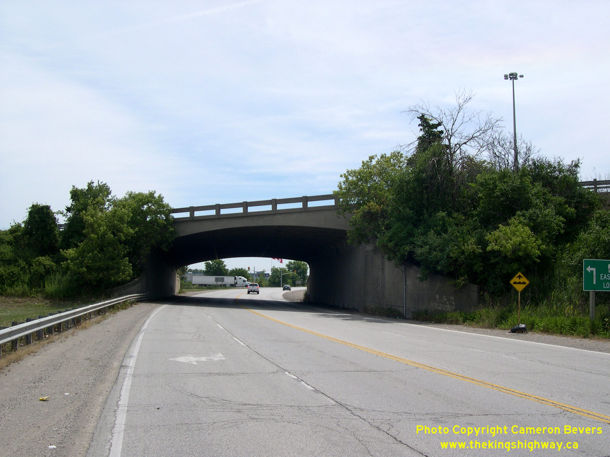
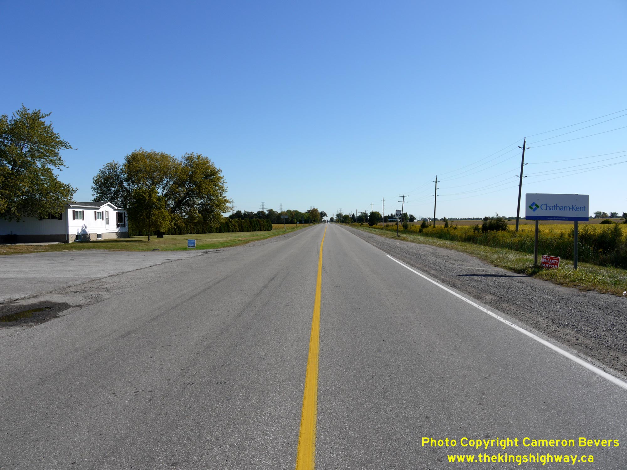
Left - Facing west along Middle Line (Old Hwy 98) towards Windsor from Queen Street (Old Hwy 98B) in Tilbury. Queen Street marks the boundary line between
the County of Essex and the neighbouring Municipality of Chatham-Kent. West of the intersection, Former Hwy 98 is known as Essex County Road 46. East of Tilbury,
Former Hwy 98 is known as Chatham-Kent Road 8. See an Enlarged Photo Here. (Photograph taken on September 14, 2010 - © Cameron Bevers) Right - Junction of Former Hwy 98 & Former Hwy 98B in Tilbury, facing east. Up until the early 1940s, the route of Hwy 98 curved to the left at this point into Tilbury's town centre. In 1941, Hwy 98 was extended easterly from Tilbury through Kent County to Blenheim, where Hwy 98 connected to Hwy 3. The 1941 extension added another 25 miles to the length of Hwy 98. See an Enlarged Photo Here. (Photograph taken on September 14, 2010 - © Cameron Bevers) 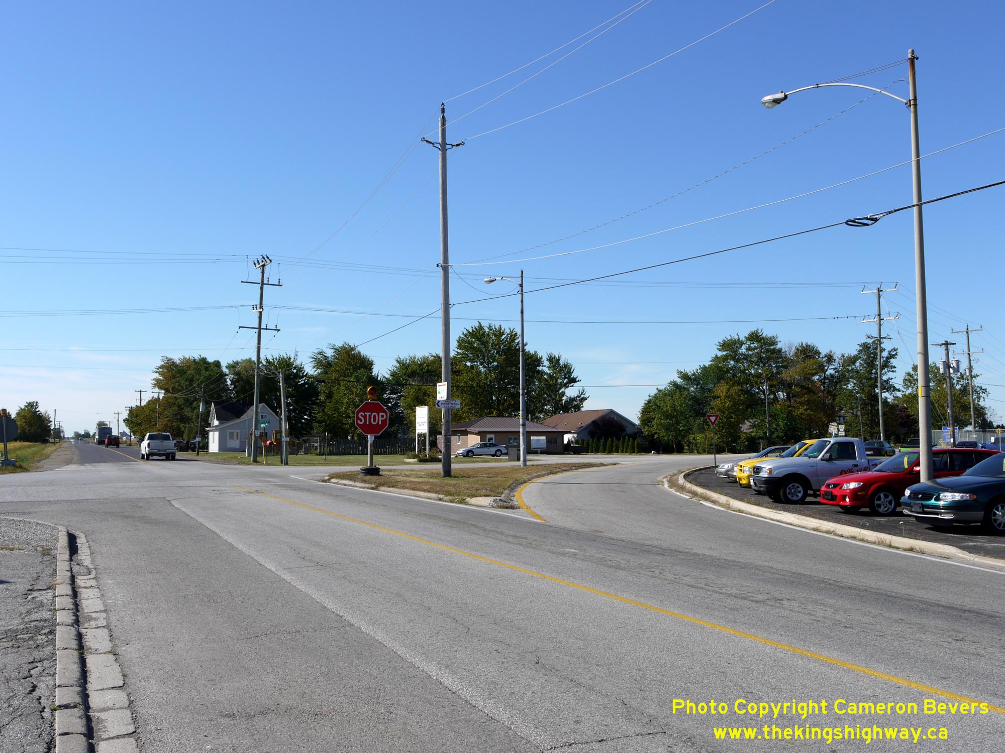
Left - Facing south along Queen Street (Old Hwy 98B) approaching Middle Line (Old Hwy 98). Up until 1941, Hwy 98 curved to the right at this intersection on
its route westerly towards Windsor. The extension of Hwy 98 from Tilbury easterly to Blenheim in 1941 bypassed about 1 mile of Hwy 98's original route. This bypassed
section of the highway via Tilbury's Queen Street ultimately became Hwy 98B. Even today, the original historical route of Hwy 98 heading south out of Tilbury features
a channelized right-turn ramp, giving some clues to observers that this was once the predominant traffic movement at this intersection. See an
Enlarged Photo Here. (Photograph taken on September 14, 2010 - © Cameron Bevers) Right - View of Middle Line (Old Hwy 98), facing east towards Blenheim from Queen Street (Old Hwy 98B) in Tilbury. The Department of Highways of Ontario (DHO) assumed jurisdiction over this easterly extension of Hwy 98 effective April 30, 1941, making this one of the few instances where a new King's Highway route was added to the provincial highway network during World War II. See an Enlarged Photo Here. (Photograph taken on September 14, 2010 - © Cameron Bevers) 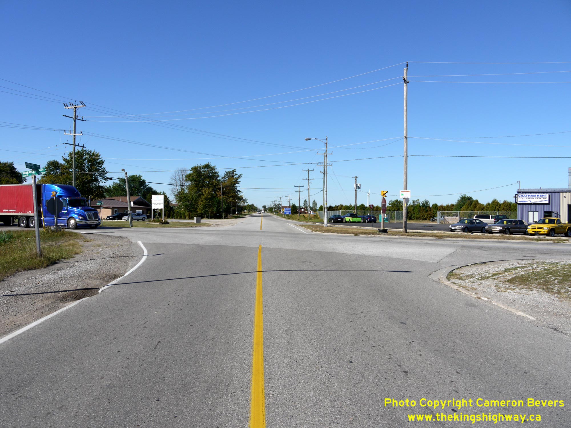
Left - Facing west along Middle Line (Old Hwy 98) towards Windsor at Queen Street (Old Hwy 98B) in Tilbury. See an
Enlarged Photo Here. (Photograph taken on September 14, 2010 - © Cameron Bevers) Right - Southern terminus of Old Hwy 98B at the Old Hwy 98 Junction in Tilbury. A series of old DHO luminaires from the 1950s still provide illumination over this intersection. It is believed that these luminaires were installed during a reconstruction project along Hwy 98 which took place in this area in 1958. See an Enlarged Photo Here. (Photograph taken on September 14, 2010 - © Cameron Bevers) 

Left - Facing north along Queen Street (Old Hwy 98B) from Middle Line (Old Hwy 98) in Tilbury. See an
Enlarged Photo Here. (Photograph taken on September 14, 2010 - © Cameron Bevers) Right - Facing east along Marlborough Street (Hwy 3) from Talbot Street in Blenheim. See an Enlarged Photo Here. (Photograph taken on September 13, 2010 - © Cameron Bevers) 

Left - Facing west along Talbot Street (Hwy 3) from the Former Hwy 98 Junction (now Chatham-Kent Road 8) at Marlborough Street in Blenheim. See an
Enlarged Photo Here. (Photograph taken on September 13, 2010 - © Cameron Bevers) Right - Facing east along Talbot Street (Hwy 3) at Marlborough Street (Former Hwy 98) approaching towards Downtown Blenheim. At the traffic signals, Hwy 3 turns right onto Marlborough Street on its route east towards St. Thomas. See an Enlarged Photo Here. (Photograph taken on September 14, 2010 - © Cameron Bevers) 

Left - Approaching Talbot Street on northbound Marlborough Street in Blenheim. Although the route of Hwy 3 historically went through Downtown Blenheim on
Talbot Street, through traffic in recent decades was encouraged to use the cut-off offered by Marlborough Street. The route of Hwy 3 was signed via Downtown along
Talbot Street for a brief period during the 1970s, before the highway's route was relocated permanently onto Marlborough Street in 1980. Hwy 3 turns left at the
traffic signals and continues west towards Wheatley. See an Enlarged Photo Here. (Photograph taken on September 14, 2010 - © Cameron Bevers) Right - Junction of Former Hwy 98 (now Chatham-Kent Road 8) and Hwy 3 at the intersection of Talbot Street and Marlborough Street in Blenheim. See an Enlarged Photo Here. (Photograph taken on September 14, 2010 - © Cameron Bevers) 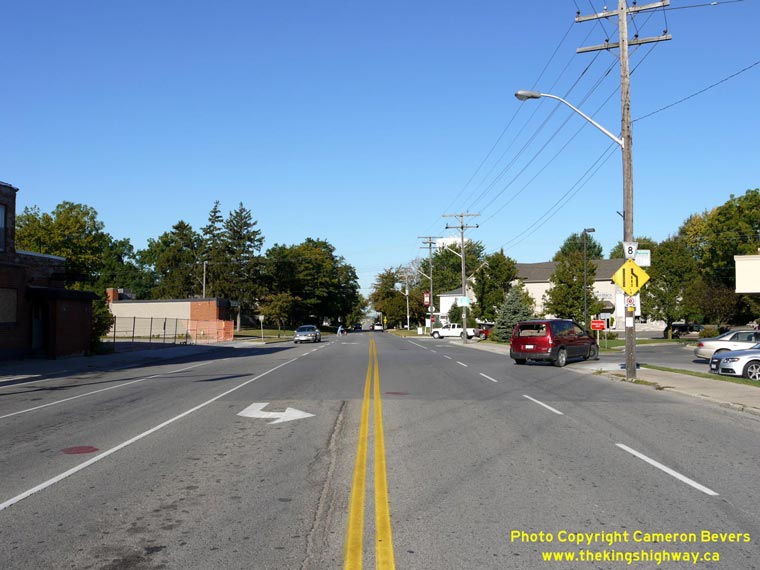

Left - Facing west along Marlborough Street (Former Hwy 98) towards Tilbury from Talbot Street (Hwy 3) in Blenheim. The once-important route of Hwy 98 between
Windsor and Blenheim essentially became redundant once Hwy 401 was completed. The entire route of Hwy 98 was transferred from the province to Kent and Essex Counties
back in 1970-1971. Up until the mass downloading of Ontario's highways in the late 1990s, Hwy 98 was the longest King's Highway to be eliminated entirely from the highway
network under a municipal transfer. See an Enlarged Photo Here. (Photograph taken on September 14, 2010 - © Cameron Bevers) Right - Former eastern terminus of Hwy 98 at the Hwy 3 Junction in Blenheim. The route of Hwy 98 ended at this intersection from the time the eastern leg of Hwy 98 was first established in 1941 up until 1970, when the eastern leg of Hwy 98 was decommissioned. With the route of Hwy 98 completed to Blenheim, through traffic heading east from Windsor was able to bypass the Leamington section of Hwy 3. The new Hwy 98 shortened the overall highway distance between Windsor and St. Thomas by approximately 17 km. See an Enlarged Photo Here. (Photograph taken on September 13, 2010 - © Cameron Bevers) 

Left - Marlborough Street at Talbot Street, facing south. The route of Former Hwy 98 ended here, while Hwy 3 continued eastbound beyond the intersection
towards St. Thomas. See an Enlarged Photo Here. (Photograph taken on September 13, 2010 - © Cameron Bevers) Right - Facing east along Talbot Street at the intersection of Marlborough Street in Blenheim. Heavy trucks are prohibited from using Blenheim's main street, except for local deliveries. Trucks are directed to bypass Downtown Blenheim, by following Hwy 3 (Marlborough Street) to Hwy 40 (Chatham Street). See an Enlarged Photo Here. (Photograph taken on September 13, 2010 - © Cameron Bevers)
More King's Highway 98 Photographs Coming Soon!
|
|---|
Links to Adjacent King's Highway Photograph Pages:
Back to King's Highway 97 Photos /
King's Highway 98 History /
On to King's Highway 98B Photos
Ontario Highway History - Main Menu / Back to List of Highways Website contents, photos & text © 2002-2026, Cameron
Bevers (Webmaster) - All Rights Reserved / Contact Me
|
|---|