
| 
| |
|
|
All photographs displayed on this page were taken by the
Webmaster (Cameron Bevers). Photographs are arranged by location from west to east. See a
Hwy 8 Route Map here. To view
photos of other Alaska Highways, please select a highway number listed on the
Alaska Photograph Index Page.
Click on any thumbnail to see a larger image!
Please note that all photographs displayed on this
website are protected by copyright. These photographs must not be reproduced, published,
electronically stored or copied, distributed, or posted onto other websites without
my written permission. If you want to use photos from this website, please
email me first for permission. Thank-you!
|
|---|
|
Alaska Highway 8 (Denali Highway) Photographs

Left - Start of the Denali Highway (Hwy 8) at Cantwell. The Denali Highway begins at the Alaska Railroad crossing in Cantwell and heads east towards Paxton,
located on the Richardson Highway (Hwy 4) between Glenallen and Delta Junction. Just east of Cantwell, the Denali Highway crosses the George Parks Highway (Hwy 3),
which provides a more direct access route to both Anchorage and Fairbanks. See an
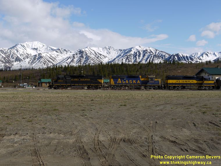
Enlarged Photo Here. (Photograph taken on May 29, 2012 - © Cameron Bevers) Right - Surrounded by mountainous beauty, an Alaska Railroad train passes through the small community of Cantwell. Located at the end of the Denali Highway (Hwy 8), Cantwell is a small railroad stop situated just west of the George Parks Highway (Hwy 3). See an Enlarged Photo Here. (Photograph taken on May 29, 2012 - © Cameron Bevers) 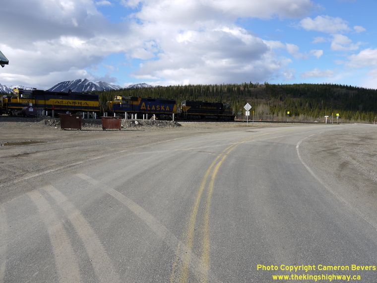

Left - Approaching the western terminus of the Denali Highway (Hwy 8) at Cantwell. The highway ends at the railroad crossing just beyond this curve. See an
Enlarged Photo Here. (Photograph taken on May 29, 2012 - © Cameron Bevers) Right - Facing west along the Denali Highway (Hwy 8) between the George Parks Highway (Hwy 3) Junction and Cantwell. The small community of Cantwell is situated at the foot of the Alaska Range. The mountains in the background which surround Cantwell are part of Denali National Park. See an Enlarged Photo Here. (Photograph taken on May 29, 2012 - © Cameron Bevers) 

Left - Snow-capped mountains abound as the Denali Highway (Hwy 8) crosses the Jack River Bridge east of Cantwell. See an
Enlarged Photo Here. (Photograph taken on May 29, 2012 - © Cameron Bevers) Right - Facing west along the Denali Highway (Hwy 8) from the George Parks Highway (Hwy 3) Junction. The Denali Highway ends at Cantwell, 2 miles ahead. (Photograph taken on May 29, 2012 - © Cameron Bevers) 

Left - Facing east along the Denali Highway (Hwy 8) at the George Parks Highway (Hwy 3) Junction, east of Cantwell. (Photograph taken on May 29, 2012 - © Cameron Bevers) Right - Distance guide sign on the Northbound George Parks Highway (Hwy 3), indicating the upcoming Denali Highway Junction east of Cantwell. See an Enlarged Photo Here. (Photograph taken on May 29, 2012 - © Cameron Bevers) 

Left - Distance sign on the Southbound George Parks Highway (Hwy 3) near the Denali Highway (Hwy 8) Junction. It is 214 miles to Anchorage from here. (Photograph taken on May 29, 2012 - © Cameron Bevers) Right - Facing south along the George Parks Highway (Hwy 3) towards the Jack River Bridge, from the Denali Highway (Hwy 8) Junction near Cantwell. See an Enlarged Photo Here. (Photograph taken on May 29, 2012 - © Cameron Bevers) 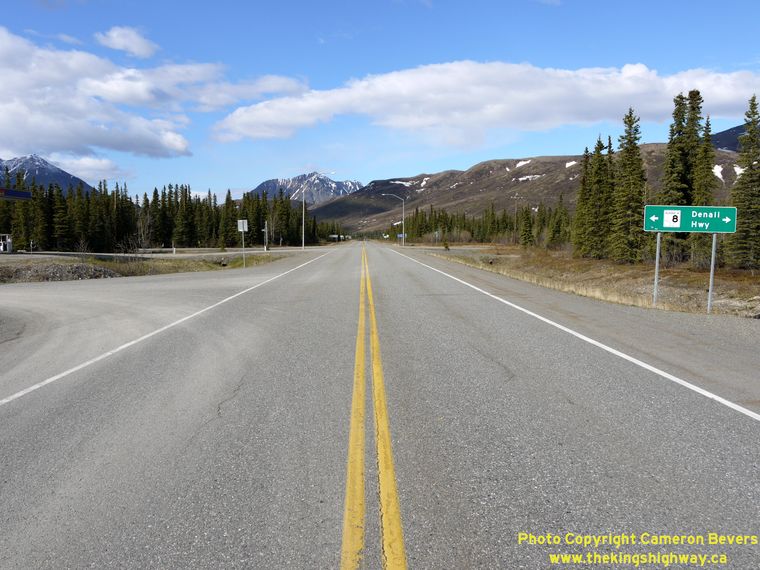

Left - Facing north along the George Parks Highway (Hwy 3) approaching the Denali Highway (Hwy 8) Junction near Cantwell. See an
Enlarged Photo Here. (Photograph taken on May 29, 2012 - © Cameron Bevers) Right - Junction sign on the Northbound George Parks Highway (Hwy 3) approaching the Denali Highway (Hwy 8). (Photograph taken on May 29, 2012 - © Cameron Bevers) 

Left - Facing north along the George Parks Highway (Hwy 3) towards Fairbanks from the Denali Highway (Hwy 8) Junction. See an
Enlarged Photo Here. (Photograph taken on May 29, 2012 - © Cameron Bevers) Right - Facing south along the George Parks Highway (Hwy 3) approaching the Denali Highway (Hwy 8) Junction, east of Cantwell. See an Enlarged Photo Here. (Photograph taken on May 29, 2012 - © Cameron Bevers) 

Left - Junction sign on the Southbound George Parks Highway (Hwy 3) approaching the Denali Highway (Hwy 8). (Photograph taken on May 29, 2012 - © Cameron Bevers) Right - Facing south along the George Parks Highway (Hwy 3), 1 mile north of the Denali Highway (Hwy 8) Junction. See an Enlarged Photo Here. (Photograph taken on May 29, 2012 - © Cameron Bevers) 

Left - Junction sign on the Westbound Denali Highway (Hwy 8) approaching the George Parks Highway (Hwy 3), east of Cantwell. (Photograph taken on May 29, 2012 - © Cameron Bevers) Right - Facing west along the Denali Highway (Hwy 8) at the George Parks Highway (Hwy 3) Junction, east of Cantwell. The Denali Highway continues west for another 2 miles beyond this highway junction, where it reaches its western terminus at Cantwell. See an Enlarged Photo Here. (Photograph taken on May 29, 2012 - © Cameron Bevers) 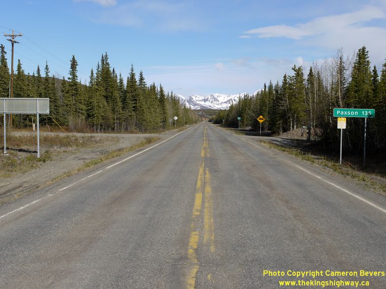
Above - Facing east along the Denali Highway (Hwy 8) from the George Parks Highway (Hwy 3) Junction near Cantwell. The Denali Highway continues east for 135
miles, climbing over Maclaren Summit to Paxton. The highway ahead is only paved for a few miles - the majority of Hwy 8 is still gravel-surfaced. The Denali Highway
is closed to traffic in winter, typically between October and May. At an elevation of 4,086 feet above sea level, the Denali Highway's Maclaren Summit is the
second-highest highway mountain pass in Alaska. The highest mountain pass in Alaska is Atigun Pass (Elevation 4,800 feet) through the Brooks Range on the James Dalton
Highway (Hwy 11). See an Enlarged Photo Here. (Photograph taken on May 29, 2012 - © Cameron Bevers) |
|---|
Links to Other Ontario Highway History Website Sections:
Back to Alaska Highway 7 Photos /
Alaska Highways Photo Index /
On to Alaska Highway 9 Photos
Vacation Highway Photos - Main Menu / Ontario Highway History - Main Menu Website contents, photos & text © 2002-2026, Cameron
Bevers (Webmaster) - All Rights Reserved / Contact Me
|
|---|