
| 
|  |
|
|
This page contains photographs of British Columbia's Highway 3 (Crowsnest Highway), arranged by location from the Fort Steele
Interchange east of Cranbrook westerly to Curzon Junction. All photographs displayed on this page were taken by the Webmaster (Cameron Bevers). To view photos of
other British Columbia Highways, please select a highway number listed on the
British Columbia Photograph Index Page. Click on any thumbnail to see a larger image!
Please note that all photographs displayed on this website are protected by copyright. These photographs must not be
reproduced, published, electronically stored or copied, distributed, or posted onto other websites without my written permission. If you want to use photos from this
website, please email me first for permission. Thank-you!
|
|---|
|
Page 2: BC Highway 3 (Crowsnest Highway) Photographs: Fort Steele Interchange to Curzon


Left - Advance green guide sign on the eastbound Crowsnest Highway (Hwy 3 & Hwy 95) approaching the Fort Steele Interchange east of Cranbrook. See an
Enlarged Photo Here. (Photograph taken on June 6, 2017 - © Cameron Bevers) Right - Advance green guide sign on westbound Hwy 3 & Hwy 95 approaching the Hwy 95A Junction (Cranbrook Interchange). See an Enlarged Photo Here. (Photograph taken on June 6, 2017 - © Cameron Bevers) 

Left - This spectacular view of the Rocky Mountains appears at the Crowsnest Highway departs from Cranbrook heading east. See an
Enlarged Photo Here. (Photograph taken on June 6, 2017 - © Cameron Bevers) Right - Distance guide sign on eastbound Hwy 3 & Hwy 95 just east of the Cranbrook Interchange. See an Enlarged Photo Here. (Photograph taken on June 6, 2017 - © Cameron Bevers) 

Left - Green guide sign marking the exit to Hwy 95A to Kimberley at the Cranbrook Interchange. See an
Enlarged Photo Here. (Photograph taken on June 6, 2017 - © Cameron Bevers) Right - Eastern approach to the Cranbrook Interchange, facing west towards Downtown Cranbrook. The exit ramp at right is for Hwy 95A, which heads north to Kimberley. See an Enlarged Photo Here. (Photograph taken on June 6, 2017 - © Cameron Bevers) 
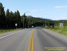
Left - Entering Cranbrook from the east on the Crowsnest Highway (Hwy 3 & Hwy 95). See an
Enlarged Photo Here. (Photograph taken on June 6, 2017 - © Cameron Bevers) Right - Facing east along Hwy 3 & Hwy 95 towards Fort Steele from the Cranbrook Interchange (Hwy 95A Junction). Hwy 3 & Hwy 95 part ways at the Fort Steele Interchange, which lies about 5 km to the east of Cranbrook. See an Enlarged Photo Here. (Photograph taken on June 6, 2017 - © Cameron Bevers) 
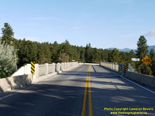
Left - Eastern side of the Hwy 95A Overpass at the Cranbrook Interchange. See an
Enlarged Photo Here. (Photograph taken on June 6, 2017 - © Cameron Bevers) Right - Facing south along Hwy 95A at the Cranbrook Overpass. This grade separation carries Hwy 95A across Hwy 3 & Hwy 95 at the eastern entrance to Cranbrook. After travelling about 55 km south from Hwy 93 & Hwy 95 via a loop through Kimberley, Hwy 95A reaches its southern terminus at the Cranbrook Interchange. See an Enlarged Photo Here. (Photograph taken on June 6, 2017 - © Cameron Bevers) 

Left - Date stamp (1956) on the grade separation at the Cranbrook Interchange on Hwy 95A at the Crowsnest Highway. See an
Enlarged Photo Here. (Photograph taken on June 6, 2017 - © Cameron Bevers) Right - Facing west along Hwy 3 & Hwy 95 from the Hwy 95A Overpass at the Cranbrook Interchange. Although the grade separation itself was built in 1956, the interchange ramps actually date from the 1980s. The ramps at this interchange are in a skewed "Trumpet-A" configuration. See an Enlarged Photo Here. (Photograph taken on June 6, 2017 - © Cameron Bevers) 
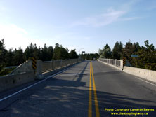
Left - Western side of the Hwy 95A Overpass at the Cranbrook Interchange. Interestingly, this structure wasn't always utilized as a highway grade separation.
When this structure was originally built in 1956, this was actually a railway overhead built to carry the Crowsnest Highway over a railway line. The railway overhead
was very cleverly repurposed as a highway grade separation during the 1980s after the railway line was abandoned. See an
Enlarged Photo Here. (Photograph taken on June 6, 2017 - © Cameron Bevers) Right - Facing north along Hwy 95A towards Kimberley at the Cranbrook Interchange. Before the Crowsnest Highway was realigned to pass underneath this former railway overhead, Hwy 3 turned right and headed east just a short distance north of the bridge. See an Enlarged Photo Here. (Photograph taken on June 6, 2017 - © Cameron Bevers) 

Left - Facing east along Hwy 3 & Hwy 95 from the Hwy 95A Overpass in Cranbrook. Careful observers may note the railway line's old alignment in the trees in
front on the white car on the highway. This reverse curve was built in the 1980s in order to allow the Crowsnest Highway to pass below the former railway grade
separation. See an Enlarged Photo Here. (Photograph taken on June 6, 2017 - © Cameron Bevers) Right - Approaching the Cranbrook Interchange on Hwy 95A. The ramp at right exits to Cranbrook, which the ramp ahead leads to the eastbound Crowsnest Highway. See an Enlarged Photo Here. (Photograph taken on June 6, 2017 - © Cameron Bevers) 

Left - Green guide sign on southbound Hwy 95A approaching the Cranbrook Interchange. See an
Enlarged Photo Here. (Photograph taken on June 6, 2017 - © Cameron Bevers) Right - Facing north along Hwy 95A towards Kimberley from the Cranbrook Interchange. See an Enlarged Photo Here. (Photograph taken on June 6, 2017 - © Cameron Bevers) 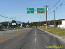

Left - Overhead guide signs on the western approach to the Cranbrook Interchange. The main street of Cranbrook is tangential to the Hwy 95A exit ramp, which
offers some subtle clues that the entire Crowsnest Highway once followed this route across the former railway overhead. Note that Hwy 93 is also trailblazed via the
eastbound Crowsnest Highway from the Cranbrook Interchange. There are no other intersections along Hwy 3 & Hwy 95 between the Cranbrook Interchange and the Fort
Steele Interchange, so eastbound motorists will automatically reach Hwy 93 if they continue through the interchange at Cranbrook. See an
Enlarged Photo Here. (Photograph taken on June 6, 2017 - © Cameron Bevers) Right - Green guide sign advising eastbound motorists departing Cranbrook to use Hwy 93 & Hwy 95 to access Fort Steele, Fairmont and Invermere. One could access all three towns by using Hwy 95A via Kimberley as well, but this would form a far longer route. See an Enlarged Photo Here. (Photograph taken on June 6, 2017 - © Cameron Bevers) 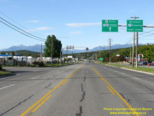

Left - The Rocky Mountains form an enticing backdrop as motorists head east out of Cranbrook on the Crowsnest Highway (Hwy 3 & Hwy 95). See an
Enlarged Photo Here. (Photograph taken on June 6, 2017 - © Cameron Bevers) Right - View of Cranbrook Street (Hwy 3 & Hwy 95), facing west from Ridgeview Road. Cranbrook is the largest city in southeastern British Columbia and has numerous highway commercial establishments along the eastern entrance to town. Cranbrook's main street is also populated by a style of truss luminaire that was also used extensively in my home province of Ontario. It is fairly evident that British Columbia's Department of Highways and the Department of Highways of Ontario (DHO) shared many design ideas and concepts with one another in the 1950s and 1960s, as the similarities between the two jurisdictions are simply too numerous for them to be a mere coincidence. See an Enlarged Photo Here. (Photograph taken on June 6, 2017 - © Cameron Bevers) 

Left - Facing east along Cranbrook Street (Hwy 3 & Hwy 95) from Victoria Avenue in Cranbrook. See an
Enlarged Photo Here. (Photograph taken on June 6, 2017 - © Cameron Bevers) Right - Distance guide sign on eastbound Hwy 3 & Hwy 95 in Cranbrook. See an Enlarged Photo Here. (Photograph taken on June 6, 2017 - © Cameron Bevers) 
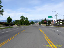
Left - View of Cranbrook Street (Hwy 3 & Hwy 95), facing east from 4th Street. Cranbrook's highway commercial strip offers many amenities for travellers on
the Crowsnest Highway before heading into the Rocky Mountains. There are also few amenities for motorists heading west from Cranbrook along the Crowsnest Highway
until Creston. See an Enlarged Photo Here. (Photograph taken on June 6, 2017 - © Cameron Bevers) Right - Facing east along Hwy 3 & Hwy 95 from 1st Avenue, near the western entrance to Cranbrook. See an Enlarged Photo Here. (Photograph taken on June 6, 2017 - © Cameron Bevers) 

Left - Dual Hwy 3 & Hwy 95 route markers on the westbound Crowsnest Highway departing from Cranbrook. See an
Enlarged Photo Here. (Photograph taken on June 10, 2017 - © Cameron Bevers) Right - Western entrance to Cranbrook on the Crowsnest Highway (Hwy 3 & Hwy 95), facing east. The highway widens to a four-lane cross section through the city, with most sections having a two-way centre left turn lane to safely accommodate turning traffic. See an Enlarged Photo Here. (Photograph taken on June 6, 2017 - © Cameron Bevers) 

Left - Distance guide sign on westbound Hwy 3 & Hwy 95 departing from Cranbrook. Creston is the next major town located along the Crowsnest Highway (Hwy 3)
west of Cranbrook. Kingsgate is located at the Canada-United States Border, where Hwy 95 continues south into Idaho as U.S. Route 95. Hwy 3 turns west from Hwy 95 at
Curzon Junction, located several kilometres north of the international border. See an
Enlarged Photo Here. (Photograph taken on June 6, 2017 - © Cameron Bevers) Right - Facing west along Hwy 3 & Hwy 95 about 2 km west of Cranbrook. More mountains appear on the horizon as the highway leaves the Cranbrook area. Although the Rocky Mountains are certainly the most well-known of British Columbia's Mountain Ranges, there are several substantial mountain ranges and summits located along the scenic Crowsnest Highway between Cranbrook and Hope. The highest mountain pass on the Crowsnest Highway is actually not located in the Rocky Mountains. The highest point is reached at Kootenay Summit west of Creston. See an Enlarged Photo Here. (Photograph taken on June 6, 2017 - © Cameron Bevers) 

Left - Facing east along Hwy 3 & Hwy 95 about 2 km west of Cranbrook. Although the front ranges are over 30 km away at this point, the Rocky Mountains
still make an imposing albeit beautiful landscape feature on the horizon. See an
Enlarged Photo Here. (Photograph taken on June 6, 2017 - © Cameron Bevers) Right - As Hwy 3 & Hwy 95 climb in elevation west of Cranbrook, the snow-capped rear ranges of the Rocky Mountains briefly come into view. See an Enlarged Photo Here. (Photograph taken on June 6, 2017 - © Cameron Bevers) 

Left - Distance guide sign on eastbound Hwy 3 & Hwy 95 near Moyie Lake. See an
Enlarged Photo Here. (Photograph taken on June 6, 2017 - © Cameron Bevers) Right - Southern side of the Swansea Bridge on Hwy 3 & Hwy 95 west of Cranbrook. See an Enlarged Photo Here. (Photograph taken on June 6, 2017 - © Cameron Bevers) 
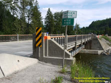
Left - Facing east across the Swansea Bridge over the Moyie River. Hwy 3 & Hwy 95 cross the Moyie River several times west of Cranbrook, so the bridges are
all named in order to differentiate them from one another. See an Enlarged Photo Here. (Photograph taken on June 6, 2017 - © Cameron Bevers) Right - Northern side of the Swansea Bridge on Hwy 3 & Hwy 95 west of Cranbrook. This single-span steel plate girder structure was completed in 1953. See an Enlarged Photo Here. (Photograph taken on June 6, 2017 - © Cameron Bevers) 

Left - Facing west across the Swansea Bridge over the Moyie River on Hwy 3 & Hwy 95. The Swansea Bridge was replaced in 2017-2018. Note the new highway
diversion under construction at right for the replacement bridge. The Swansea Bridge is located about 15 km west of Cranbrook. See an
Enlarged Photo Here. (Photograph taken on June 6, 2017 - © Cameron Bevers) Right - Facing west along Hwy 3 & Hwy 95 towards Creston at Moyie Lake. See an Enlarged Photo Here. (Photograph taken on June 6, 2017 - © Cameron Bevers) 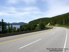

Left - View of the Crowsnest Highway (Hwy 3 & Hwy 95) facing east at Moyie Lake, about 27 km west of Cranbrook. See an
Enlarged Photo Here. (Photograph taken on June 6, 2017 - © Cameron Bevers) Right - This long westbound passing lane appears along the long grade leading to the highway summit at Irishman Creek, See an Enlarged Photo Here. (Photograph taken on June 6, 2017 - © Cameron Bevers) 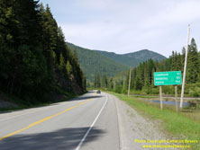

Left - Distance guide sign on eastbound Hwy 3 & Hwy 95 at the summit at Irishman Creek. See an
Enlarged Photo Here. (Photograph taken on June 6, 2017 - © Cameron Bevers) Right - Facing east along Hwy 3 & Hwy 95 towards Cranbrook from the summit at Irishman Creek. See an Enlarged Photo Here. (Photograph taken on June 6, 2017 - © Cameron Bevers) 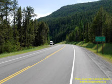

Left - Distance guide sign on westbound Hwy 3 & Hwy 95 at the summit at Irishman Creek. See an
Enlarged Photo Here. (Photograph taken on June 6, 2017 - © Cameron Bevers) Right - Sign about 47 km west of Cranbrook advising motorists of the time zone boundary change near Irishman Creek. East of this time zone boundary, the official time is one hour ahead of the Pacific Coast. Motorists travelling between Creston and Cranbrook need to keep this time zone change in mind if they are on a schedule. See an Enlarged Photo Here. (Photograph taken on June 6, 2017 - © Cameron Bevers) 

Left - The Crowsnest Highway briefly widens to a four-lane undivided cross section at Ryan, located just west of the summit at Irishman Creek. See an
Enlarged Photo Here. (Photograph taken on June 6, 2017 - © Cameron Bevers) Right - Facing east along Hwy 3 & Hwy 95 towards Cranbrook at the Ryan Bridge across the Moyie River. See an Enlarged Photo Here. (Photograph taken on June 6, 2017 - © Cameron Bevers) 

Left - Northern side of the Ryan Bridge east of Yahk. This three-span structure consists of a steel through truss (Pratt type), flanked by steel beam approach
spans on either side. This bridge is located about 54 km west of Cranbrook and 12 km east of Curzon Junction. See an
Enlarged Photo Here. (Photograph taken on June 6, 2017 - © Cameron Bevers) Right - Facing west across the Ryan Bridge on the Crowsnest Highway towards Curzon Junction. See an Enlarged Photo Here. (Photograph taken on June 6, 2017 - © Cameron Bevers) 

Left - Southern side of the Ryan Bridge over the Moyie River on Hwy 3 & Hwy 95 east of Yahk. See an
Enlarged Photo Here. (Photograph taken on June 6, 2017 - © Cameron Bevers) Right - Date stamp (1954) on the Ryan Bridge on Hwy 3 & Hwy 95 east of Yahk. See an Enlarged Photo Here. (Photograph taken on June 6, 2017 - © Cameron Bevers) 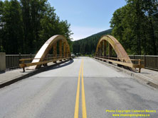

Left - Yahk Bridge on the Crowsnest Highway (Hwy 3 & Hwy 95), facing east towards Curzon Junction. See an
Enlarged Photo Here. (Photograph taken on June 6, 2017 - © Cameron Bevers) Right - Southern side of the Yahk Bridge over the Moyie River on Hwy 3 & Hwy 95. See an Enlarged Photo Here. (Photograph taken on June 6, 2017 - © Cameron Bevers) 
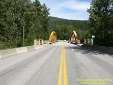
Left - The Moyie River Bridge at Yahk is an interesting steel bowstring arch structure, which was a relatively uncommon bridge design in British Columbia.
Although there was no date stamp on this structure, I suspect that it was constructed in the 1930s or 1940s. See an
Enlarged Photo Here. (Photograph taken on June 6, 2017 - © Cameron Bevers) Right - Facing east along Hwy 3 & Hwy 95 towards Cranbrook at the Yahk Bridge across the Moyie River. See an Enlarged Photo Here. (Photograph taken on June 6, 2017 - © Cameron Bevers) 

Left - Facing west along the Crowsnest Highway (Hwy 3 & Hwy 95) at the Curzon Bridge. See an
Enlarged Photo Here. (Photograph taken on June 6, 2017 - © Cameron Bevers) Right - Northern side of the Curzon Bridge over the Moyie River on Hwy 3 & Hwy 95. This three-span structure consists of a steel through truss (Warren type), flanked by steel beam approach spans on either side. It is one of two steel through truss structures approaching Curzon Junction. See an Enlarged Photo Here. (Photograph taken on June 6, 2017 - © Cameron Bevers) 

Left - Date stamp (1955) and southern side of the Curzon Bridge on Hwy 3 & Hwy 95 east of Curzon Junction. See an
Enlarged Photo Here. (Photograph taken on June 6, 2017 - © Cameron Bevers) Right - Facing east across the Curzon Bridge on Hwy 3 & Hwy 95 between Curzon Junction and Yahk. See an Enlarged Photo Here. (Photograph taken on June 6, 2017 - © Cameron Bevers)
Continue west along BC Highway 3 from Curzon Junction to Creston |
|---|
Links to Adjacent BC Highway Photograph Pages:
Back to BC Highway 1 Photos /
British Columbia Highways Photo Index /
On to BC Highway 3A Photos
Ontario Highway History - Home / Vacation Highway Photos - Home Website contents, photos & text © 2002-2024, Cameron
Bevers (Webmaster) - All Rights Reserved / Contact Me |
|---|