
| 
| |
|
|
This page contains photographs of British Columbia's Highway 3 (Crowsnest Highway), arranged by location from Castlegar
westerly to Grand Forks. All photographs displayed on this page were taken by the Webmaster (Cameron Bevers). To view photos of other British Columbia Highways,
please select a highway number listed on the British Columbia Photograph Index Page. Click on any
thumbnail to see a larger image!
Please note that all photographs displayed on this website are protected by copyright. These photographs must not be
reproduced, published, electronically stored or copied, distributed, or posted onto other websites without my written permission. If you want to use photos from this
website, please email me first for permission. Thank-you!
|
|---|
|
Page 6: BC Highway 3 (Crowsnest Highway) Photographs: Castlegar to Grand Forks


Left - Distance guide sign on the westbound Crowsnest Highway (Hwy 3) departing Castlegar. See an
Enlarged Photo Here. (Photograph taken on June 12, 2017 - © Cameron Bevers) Right - Warning sign on westbound Hwy 3 near Castlegar, advising motorists to be aware of changing weather conditions through the high Bonanza Pass which lies ahead. With a summit elevation of 1,535 metres (5,036 feet) above sea level, Bonanza Pass is one of the highest summits along the length of the Crowsnest Highway in British Columbia. Bonanza Pass is also known as Paulson Summit. See an Enlarged Photo Here. (Photograph taken on June 12, 2017 - © Cameron Bevers) 

Left - Sign on westbound Hwy 3 departing Castlegar advising motorists to check their fuel. See an
Enlarged Photo Here. (Photograph taken on June 12, 2017 - © Cameron Bevers) Right - Facing west along the Crowsnest Highway (Hwy 3) about 9 km west of Castlegar. The ascent towards Bonanza Pass from Castlegar is slow but steady! See an Enlarged Photo Here. (Photograph taken on June 12, 2017 - © Cameron Bevers) 

Left - Facing east along the Crowsnest Highway (Hwy 3) about 10 km west of Castlegar. See an
Enlarged Photo Here. (Photograph taken on June 12, 2017 - © Cameron Bevers) Right - Green guide sign on westbound Hwy 3 marking the upcoming Hwy 3B Junction. Hwy 3B forms an alternate route to Hwy 3 from a point west of Salmo to a point west of Castlegar, via Trail and Rossland. The route of Hwy 3B via Trail and Rossland is considerably longer than the route of Hwy 3 via Castlegar. See an Enlarged Photo Here. (Photograph taken on June 12, 2017 - © Cameron Bevers) 

Left - Overhead guide sign marking the Hwy 3B Junction on westbound Hwy 3. See an
Enlarged Photo Here. (Photograph taken on June 12, 2017 - © Cameron Bevers) Right - Distance guide sign on the eastbound Crowsnest Highway (Hwy 3) near the Hwy 3B Junction. See an Enlarged Photo Here. (Photograph taken on June 12, 2017 - © Cameron Bevers) 

Left - Facing east along Hwy 3 from the Hwy 3B Junction, located about 26 km west of Castlegar. See an
Enlarged Photo Here. (Photograph taken on June 12, 2017 - © Cameron Bevers) Right - Facing east along Hwy 3B towards Rossland from the highway's western terminus at the Crowsnest Highway (Hwy 3). See an Enlarged Photo Here. (Photograph taken on June 12, 2017 - © Cameron Bevers) 

Left - Facing east along Hwy 3 from the Hwy 3B Junction. This highway junction is rather unusual, in that the two highways connect in an isolated location deep
in the mountains. Most of British Columbia's highway junctions are located in (or near) a town centre down in the valleys. The Hwy 3 & Hwy 3B Junction is situated
approximately 1,275 metres (4,185 feet) above sea level. See an Enlarged Photo Here. (Photograph taken on June 12, 2017 - © Cameron Bevers) Right - Distance guide sign on eastbound Hwy 3B at the Hwy 3 Junction. See an Enlarged Photo Here. (Photograph taken on June 12, 2017 - © Cameron Bevers) 

Left - Overhead guide sign marking the Crowsnest Highway (Hwy 3) Junction on westbound Hwy 3B. From here, traffic can turn left and head west along Hwy 3
towards Christina Lake and Grand Forks, or turn right and head east along Hwy 3 towards Castlegar and Nelson. See an
Enlarged Photo Here. (Photograph taken on June 12, 2017 - © Cameron Bevers) Right - Crowsnest Highway (Hwy 3) junction assembly on westbound Hwy 3B, approaching the highway junction west of Castlegar. See an Enlarged Photo Here. (Photograph taken on June 12, 2017 - © Cameron Bevers) 

Left - Junction of Hwy 3 & Hwy 3B, facing east towards Castlegar. See an
Enlarged Photo Here. (Photograph taken on June 12, 2017 - © Cameron Bevers) Right - Facing west along Hwy 3 towards Christina Lake from the Hwy 3B Junction. See an Enlarged Photo Here. (Photograph taken on June 12, 2017 - © Cameron Bevers) 

Left - Overhead guide sign marking the Hwy 3B Junction on eastbound Hwy 3. See an
Enlarged Photo Here. (Photograph taken on June 12, 2017 - © Cameron Bevers) Right - Distance guide sign on the westbound Crowsnest Highway (Hwy 3) near the Hwy 3B Junction. See an Enlarged Photo Here. (Photograph taken on June 12, 2017 - © Cameron Bevers) 

Left - Junction assembly on the eastbound Crowsnest Highway (Hwy 3) approaching the Hwy 3B Junction between Christina Lake and Castlegar. See an
Enlarged Photo Here. (Photograph taken on June 12, 2017 - © Cameron Bevers) Right - Overhead guide sign on Hwy 3 directing eastbound commercial vehicles to use Hwy 3 rather than Hwy 3B. This sign struck me as being a bit odd, given the fact that taking Hwy 3B to Nelson from this junction adds an extra 50 km to the driving distance. Even if this sign was not present, virtually all commercial vehicles would elect to use Hwy 3 anyway. See an Enlarged Photo Here. (Photograph taken on June 12, 2017 - © Cameron Bevers) 

Left - Scenic view of Nancy Greene Lake from the Crowsnest Highway (Hwy 3) near the Hwy 3B Junction. See an
Enlarged Photo Here. (Photograph taken on June 12, 2017 - © Cameron Bevers) Right - Green guide sign on eastbound Hwy 3 marking the upcoming Hwy 3B Junction. See an Enlarged Photo Here. (Photograph taken on June 12, 2017 - © Cameron Bevers) 

Left - Facing east along Hwy 3 towards Castlegar from Paulson Summit. See an
Enlarged Photo Here. (Photograph taken on June 12, 2017 - © Cameron Bevers) Right - Crossing Paulson Summit on the Crowsnest Highway (Hwy 3) between Castlegar and Christina Lake. See an Enlarged Photo Here. (Photograph taken on June 12, 2017 - © Cameron Bevers) 

Left - Sign marking Paulson Summit (also known as Bonanza Pass) on the Crowsnest Highway (Hwy 3). This is the second-highest summit on the Crowsnest Highway,
second only to the Kootenay Summit located between Salmo and Creston. See an
Enlarged Photo Here. (Photograph taken on June 12, 2017 - © Cameron Bevers) Right - Distance guide sign on the eastbound Crowsnest Highway (Hwy 3) departing Christina Lake. See an Enlarged Photo Here. (Photograph taken on June 12, 2017 - © Cameron Bevers) 

Left - Sign on eastbound Hwy 3 departing Christina Lake advising motorists to check their fuel. See an
Enlarged Photo Here. (Photograph taken on June 12, 2017 - © Cameron Bevers) Right - A service frontage road was built along Hwy 3 through the northern part of Christina Lake, in order to minimize the number of commercial access points onto the highway. See an Enlarged Photo Here. (Photograph taken on June 12, 2017 - © Cameron Bevers) 

Left - Facing east along Hwy 3 towards Castlegar in Christina Lake. See an
Enlarged Photo Here. (Photograph taken on June 12, 2017 - © Cameron Bevers) Right - Facing east across the Christina Lake Bridge on Hwy 3. See an Enlarged Photo Here. (Photograph taken on June 12, 2017 - © Cameron Bevers) 

Left - Facing west across the Christina Lake Bridge on Hwy 3. See an
Enlarged Photo Here. (Photograph taken on June 12, 2017 - © Cameron Bevers) Right - Side view of the Christina Lake Bridge on Hwy 3. This steel plate girder structure is supported on unusual steel pole bents. See an Enlarged Photo Here. (Photograph taken on June 12, 2017 - © Cameron Bevers) 

Left - Date stamp (1962) on the Christina Lake Bridge. See an
Enlarged Photo Here. (Photograph taken on June 12, 2017 - © Cameron Bevers) Right - Distance guide sign on the westbound Crowsnest Highway (Hwy 3) departing Christina Lake. See an Enlarged Photo Here. (Photograph taken on June 12, 2017 - © Cameron Bevers) 

Left - Approaching Christina Lake on Hwy 3, about 1 km east of the Hwy 395 Junction. See an
Enlarged Photo Here. (Photograph taken on June 12, 2017 - © Cameron Bevers) Right - Facing east along the Crowsnest Highway (Hwy 3) towards Christina Lake from the Hwy 395 Junction. The town centre lies about 2 km east of the Hwy 395 Junction. See an Enlarged Photo Here. (Photograph taken on June 12, 2017 - © Cameron Bevers) 

Left - Approaching the Hwy 395 Junction on Hwy 3, facing west towards Grand Forks. See an
Enlarged Photo Here. (Photograph taken on June 12, 2017 - © Cameron Bevers) Right - Overhead guide sign at the Hwy 395 Junction marking the turn-off to Spokane, Washington. See an Enlarged Photo Here. (Photograph taken on June 12, 2017 - © Cameron Bevers) 

Left - Junction sign assembly approaching the Hwy 395 Junction on westbound Hwy 3. Hwy 395 is BC's highest-numbered signed provincial highway. The route
continues across the border as US Route 395, which extends south through Washington, Oregon, Nevada and California. See an
Enlarged Photo Here. (Photograph taken on June 12, 2017 - © Cameron Bevers) Right - Distance guide sign on southbound Hwy 395 showing the distance to Spokane, Washington. The Hwy 395 border crossing is located about 4 km south of the Hwy 3 Junction. See an Enlarged Photo Here. (Photograph taken on June 12, 2017 - © Cameron Bevers) 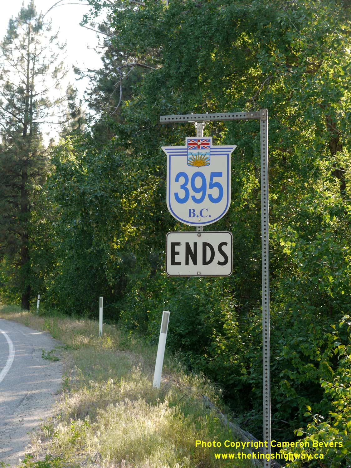

Left - Hwy 395 Ends route marker approaching the highway's northern terminus near Christina Lake, British Columbia. After travelling about 2,100 km (1,300
miles) north from the suburban fringes of Los Angeles, California, Hwy 395 comes to an end at the Crowsnest Highway (Hwy 3) just west of Christina Lake. See an
Enlarged Photo Here. (Photograph taken on June 12, 2017 - © Cameron Bevers) Right - A British Columbia Hwy 395 route marker near the Crowsnest Highway (Hwy 3) Junction. See an Enlarged Photo Here. (Photograph taken on June 12, 2017 - © Cameron Bevers) 

Left - Facing south along Hwy 395 from the Hwy 3 Junction near Christina Lake. See an
Enlarged Photo Here. (Photograph taken on June 12, 2017 - © Cameron Bevers) Right - Northern terminus of Hwy 395 at the Crowsnest Highway (Hwy 3) Junction west of Christina Lake. See an Enlarged Photo Here. (Photograph taken on June 12, 2017 - © Cameron Bevers) 

Left - Guide sign at the northern terminus of Hwy 395, showing the distances to destinations on the Crowsnest Highway (Hwy 3). See an
Enlarged Photo Here. (Photograph taken on June 12, 2017 - © Cameron Bevers) Right - Facing west along Hwy 3 towards Grand Forks from the Hwy 395 Junction. See an Enlarged Photo Here. (Photograph taken on June 12, 2017 - © Cameron Bevers) 

Left - Approaching the Hwy 395 Junction on the Crowsnest Highway (Hwy 3), facing east towards Christina Lake. See an
Enlarged Photo Here. (Photograph taken on June 12, 2017 - © Cameron Bevers) Right - Overhead guide sign on eastbound Hwy 3 approaching the Hwy 395 Junction near Christina Lake. See an Enlarged Photo Here. (Photograph taken on June 12, 2017 - © Cameron Bevers) 

Left - Hwy 3 & Hwy 395 route marker assembly on the eastbound Crowsnest Highway. See an
Enlarged Photo Here. (Photograph taken on June 12, 2017 - © Cameron Bevers) Right - Facing west along Hwy 3 about 5 km west of the Hwy 395 Junction. As the mountain forests slowly part, a wide open grassland valley begins to appear. The southern valleys of British Columbia have long stretches of grasslands, which extend from the Christina Lake area westerly to the Princeton area. See an Enlarged Photo Here. (Photograph taken on June 12, 2017 - © Cameron Bevers) 

Left - Facing east along Hwy 3 towards Christina Lake, about 6 km west of the Hwy 395 Junction. The contrast between the forested mountains in the background
and the grassland valley in the foreground is rather striking! See an
Enlarged Photo Here. (Photograph taken on June 13, 2017 - © Cameron Bevers) Right - Distance guide sign on the eastbound Crowsnest Highway (Hwy 3) located mid-way between Christina Lake and Grand Forks. See an Enlarged Photo Here. (Photograph taken on June 13, 2017 - © Cameron Bevers) 

Left - Scenic view of the grasslands and the fringes of the mountainous areas which surround them along Hwy 3, about 8 km west of the Hwy 395 Junction. See an
Enlarged Photo Here. (Photograph taken on June 13, 2017 - © Cameron Bevers) Right - Distance guide sign on the westbound Crowsnest Highway (Hwy 3), located about 11 km west of Christina Lake. See an Enlarged Photo Here. (Photograph taken on June 13, 2017 - © Cameron Bevers) 

Left - This scenic reverse curve is situated on Hwy 3 about 12 km west of Christina Lake. See an
Enlarged Photo Here. (Photograph taken on June 13, 2017 - © Cameron Bevers) Right - The Crowsnest Highway (Hwy 3) winds its way east towards Christina Lake through the Kettle River Valley, about 7 km east of Grand Forks. See an Enlarged Photo Here. (Photograph taken on June 13, 2017 - © Cameron Bevers) 

Left - Facing east along Hwy 3 towards Christina Lake, about 5 km east of Grand Forks. See an
Enlarged Photo Here. (Photograph taken on June 13, 2017 - © Cameron Bevers) Right - Facing west along Hwy 3, about 3 km east of Grand Forks. See an Enlarged Photo Here. (Photograph taken on June 13, 2017 - © Cameron Bevers) 

Left - View of the rugged, dry mountains along Hwy 3, about 3 km east of Grand Forks. See an
Enlarged Photo Here. (Photograph taken on June 13, 2017 - © Cameron Bevers) Right - Distance guide sign on the eastbound Crowsnest Highway (Hwy 3) departing Grand Forks. See an Enlarged Photo Here. (Photograph taken on June 13, 2017 - © Cameron Bevers) 

Left - Granby River Bridge on Hwy 3 in Grand Forks, facing west. See an
Enlarged Photo Here. (Photograph taken on June 13, 2017 - © Cameron Bevers) Right - The Granby River Bridge on Hwy 3 in Grand Forks is a Pratt-type steel through truss bridge. See an Enlarged Photo Here. (Photograph taken on June 13, 2017 - © Cameron Bevers) 

Left - Granby River Bridge on Hwy 3 in Grand Forks, facing east towards Christina Lake. See an
Enlarged Photo Here. (Photograph taken on June 13, 2017 - © Cameron Bevers) Right - Facing west along Hwy 3 from the Granby River Bridge in Grand Forks. See an Enlarged Photo Here. (Photograph taken on June 13, 2017 - © Cameron Bevers) 

Left - Facing east along Hwy 3 towards Downtown Grand Forks. See an
Enlarged Photo Here. (Photograph taken on June 13, 2017 - © Cameron Bevers) Right - Facing east along Hwy 3 towards Downtown Grand Forks from Spraggett Road. See an Enlarged Photo Here. (Photograph taken on June 13, 2017 - © Cameron Bevers) 
Above - A pair of service frontage roads line this section of the Crowsnest Highway (Hwy 3) between Grand Forks and the Hwy 41 Junction. See an
Enlarged Photo Here. (Photograph taken on June 13, 2017 - © Cameron Bevers)
Continue west along BC Highway 3 from Grand Forks to Rock Creek |
|---|
Links to Adjacent BC Highway Photograph Pages:
Back to BC Highway 1 Photos /
British Columbia Highways Photo Index /
On to BC Highway 3A Photos
Ontario Highway History - Main Menu / Vacation Highway Photos - Main Menu Website contents, photos & text © 2002-2026, Cameron
Bevers (Webmaster) - All Rights Reserved / Contact Me
|
|---|