| 
| |
|
|
History of Secondary Highway 520:
Secondary Highway 520 is a local highway in the District of Parry Sound that provides access from Highway 11 at Burk's Falls to Magnetawan, Dunchurch and Ardbeg.
Highway 520 was first depicted on a Preliminary Route Plan prepared by the Department of Highways of Ontario (DHO) in April 1956 and was designated as a Secondary
Highway by an Order-in-Council dated May 9, 1956. The route of Highway 520 extended northwesterly from Highway 11 at Burk's Falls along the Burk's Falls-Magnetawan
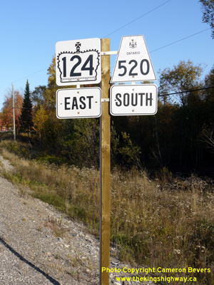
Road for approximately 17 miles (27.5 km) to the Highway 124 Junction at Whalley Lake north of Magnetawan. A second leg of Highway 520 extended north from Highway 124
at Dunchurch for 15.5 miles (25 km) to Ardbeg. The route of Highway 520 was signed concurrently with Highway 124 for approximately 10 miles (16 km) between Dunchurch
and Whalley Lake. The total length of Highway 520 was thus about 42.5 miles (68.5 km). Highway 520 was paved from Burk's Falls to Magnetawan prior to being designated as a Secondary Highway in 1956. The balance of Highway 520 was gravel-surfaced at the time of designation. The section of Highway 520 from Magnetawan to the Highway 124 Junction at Whalley Lake was paved in 1961, and the north leg of Highway 520 from Dunchurch to Ardbeg was paved in 1966. Over the years, several realignments of Highway 520 took place. The majority of these took place along the concurrent section of Highway 124 & Highway 520 near Ahmic Harbour in the mid-1960s. The only major change which took place along the highway was when the Burk's Falls Bypass was completed and opened to traffic in 1976. A portion of the old route of Highway 11 through Downtown Burk's Falls became an extension of Highway 520, while the remainder of Old Highway 11 became an unposted 7000-series highway (Highway 7162). The completion of the Burk's Falls Bypass resulted in an extension of Highway 520 by about 1 km. However, with all of the realignments which took place along Highway 520 over the years, the route's length remained more or less the same as it was when the highway was first designated in 1956. For many years after the completion of the Burk's Falls Bypass, the Ministry of Transportation of Ontario (MTO) maintained jurisdiction over Highway 520 through the Village of Burk's Falls. On March 31, 1997, jurisdiction over a 1 km section of Highway 520 from the south municipal limits near Hi-View Drive to the north end of the Magnetawan River Bridge was transferred from the province to the Village of Burk's Falls. This section of Highway 520 through Burk's Falls was subsequently designated as a Municipal Connecting Link by a Minister's Order, dated January 21, 1999. Unless posted otherwise, the speed limit on Highway 520 is 80 km/h (50 mph). Services are available in Burk's Falls, at the Highway 124 Junction north of Magnetawan at Whalley Lake, Dunchurch and Ardbeg. |
|---|
Links to Adjacent Secondary Highway Pages: Website contents, photos & text © 2002-2025, Cameron
Bevers (Webmaster) - All Rights Reserved / Contact Me |
|---|