
| 
|  |
|
|
All photographs displayed on this page were taken by the
Webmaster (Cameron Bevers), unless specifically noted otherwise. Historical photographs are
arranged in approximate chronological order, while present day photographs (Year 2000 to date)
are arranged by location from west to east. Click on any thumbnail to see a larger image!
Please note that all photographs displayed on this
website are protected by copyright. These photographs must not be reproduced, published,
electronically stored or copied, distributed, or posted onto other websites without
my written permission. If you want to use photos from this website, please
email me first for permission. Thank-you!
|
|---|
|
Historical Secondary Highway 520 Photographs
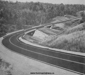
Above - Facing north along the newly-completed Burk's Falls Bypass (Hwy 11) approaching the Magnetawan River Bridge and Hwy 520 Underpass. See an
Enlarged Photo Here. Photo taken in 1976. (Photo courtesy of Ontario Ministry of Transportation - © King's Printer for Ontario, 1976) |
|---|
|
Present Day Secondary Highway 520 Photographs
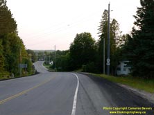

Left - Facing west along Hwy 124 from the Hwy 520 Junction near Dunchurch. See an
Enlarged Photo here. (Photograph taken on July 4, 2015 - © Cameron Bevers) Right - Sign marking the upcoming Hwy 124 Junction on southbound Hwy 520 near Dunchurch. See an Enlarged Photo here. (Photograph taken on July 4, 2015 - © Cameron Bevers) 
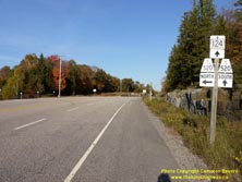
Left - Approaching the Hwy 520 Junction on Hwy 124 near Dunchurch, facing east. The route of Hwy 520 actually intersects Hwy 124 at two different points
between Dunchurch and Magnetawan. The route of Hwy 520 turns off towards Magnetawan and Burk's Falls about 15 km to the east along Hwy 124. See an
Enlarged Photo here. (Photograph taken on October 8, 2011 - © Cameron Bevers) Right - Junction assembly on eastbound Hwy 124 approaching the Hwy 520 Junction in Dunchurch. From this junction, the route of Hwy 520 North heads north towards Maple Island and Ardbeg. The route of Hwy 520 South follows a concurrent route with Hwy 124. The two highways part ways 15 km to the east near Whalley Lake north of Magnetawan. See an Enlarged Photo here. (Photograph taken on October 8, 2011 - © Cameron Bevers) 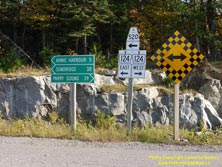

Left - Junction assembly at the Hwy 124 & Hwy 520 Junction near Dunchurch. As indicated on the junction assembly, Hwy 124 and Hwy 520 share a concurrent
route east of the highway junction at Dunchurch. This highway junction also marks the approximate midpoint between Parry Sound and Sundridge along Hwy 124. See an
Enlarged Photo here. (Photograph taken on October 8, 2011 - © Cameron Bevers) Right - Facing north along Hwy 520 from the Hwy 124 Junction near Dunchurch. See an Enlarged Photo here. (Photograph taken on October 8, 2011 - © Cameron Bevers) 

Left - Facing west along Hwy 124 at the Hwy 520 Junction near Dunchurch. See an
Enlarged Photo here. (Photograph taken on July 4, 2015 - © Cameron Bevers) Right - Destination guide sign on westbound Hwy 124 approaching the Hwy 520 Junction near Dunchurch. The route of Hwy 520 departs from Hwy 124 at this point, and heads north towards Maple Valley and Whitestone, before finally reaching its northern terminus at Ardbeg. See an Enlarged Photo here. (Photograph taken on July 4, 2015 - © Cameron Bevers) 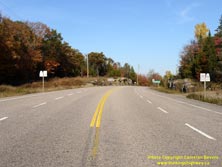
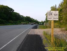
Left - Facing east along Hwy 124 from the Hwy 520 Junction near Dunchurch. See an
Enlarged Photo here. (Photograph taken on October 8, 2011 - © Cameron Bevers) Right - This newly-installed sign marks the concurrent route of Hwy 124 East and Hwy 520 South near Dunchurch. See an Enlarged Photo here. (Photograph taken on July 4, 2015 - © Cameron Bevers) 
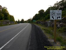
Left - Distance guide sign on eastbound Hwy 124 & Hwy 520 departing Dunchurch. See an
Enlarged Photo here. (Photograph taken on July 4, 2015 - © Cameron Bevers) Right - Approaching the Hwy 520 North Junction of westbound Hwy 124 near Dunchurch. See an Enlarged Photo here. (Photograph taken on July 4, 2015 - © Cameron Bevers) 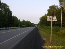

Left - Hwy 124 & Hwy 520 route markers between Dunchurch and Magnetawan. This is a rare instance where an Ontario Secondary Highway shares a concurrent
route with an Ontario King's Highway. The only other example where a signed overlapped route such as this occurs is along Hwy 11 & Hwy 71 west of Fort Frances,
where Hwy 611 shares the route for approximately 2 km. Another overlapped Secondary Highway route can be found in Hearst, where Hwy 583 briefly shares the route with
Hwy 11. However, the route of Hwy 583 is not actually signed along the main highway in that case, so the overlapped route with Hwy 583 is not apparent when traveling
along Hwy 11. See an Enlarged Photo here. (Photograph taken on July 4, 2015 - © Cameron Bevers) Right - Reverse curve on Hwy 124 & Hwy 520 near the Magnetawan-Whitestone municipal boundary, facing west towards Dunchurch. See an Enlarged Photo here. (Photograph taken on July 4, 2015 - © Cameron Bevers) 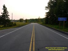

Left - Facing west along Hwy 124 & Hwy 520 at the Whitestone municipal boundary sign. See an
Enlarged Photo here. (Photograph taken on July 4, 2015 - © Cameron Bevers) Right - Magnetawan municipal boundary sign on eastbound Hwy 124 & Hwy 520. See an Enlarged Photo here. (Photograph taken on July 4, 2015 - © Cameron Bevers)
More Secondary Highway 520 Photographs Coming Soon!
|
|---|
Links to Adjacent Highway Photograph Pages:
Back to Secondary Highway 517 Photos /
Secondary Highway 520 History /
On to Secondary Highway 521 Photos
Ontario Highway History - Main Menu / Back to List of Highways / Main Photograph Index Page Website contents, photos & text © 2002-2026, Cameron
Bevers (Webmaster) - All Rights Reserved / Contact Me
|
|---|