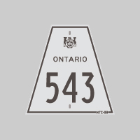
History of Secondary Highway 543:
Secondary Highway 543 was a local highway in the District of Sudbury that once connected Highway 69 to Long Lake, located south of the City of Sudbury. The road from
Highway 69 to Long Lake was first designated as Secondary Highway 543 by an Order-in-Council dated May 9, 1956. A Preliminary Route Plan was prepared by the
Department of Highways of Ontario (DHO) in April 1956, which showed the proposed assumption of the Long Lake Road. The new highway was originally 4.5 miles (7.2 km)
in length, although the highway's mileage increased slightly as a result of revisions to the highway's alignment during the 1960s and early 1970s. Highway 543 was
already paved at the time the route was designated in 1956. Highway 543 remained in the provincial highway system up until 1974. The entire route of Highway 543 from
Sudbury to Long Lake was transferred to the newly-formed Regional Municipality of Sudbury on May 1, 1974. The road is known today as Sudbury Road 80 (Long Lake Road).
|