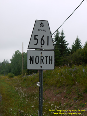
History of Secondary Highway 561:
Secondary Highway 561 was a local highway in the District of Algoma that provided access from Highway 17 in Bruce Mines to Highway 638 near Ophir, located east of
Echo Bay. Highway 561 was first designated by an Order-in-Council dated May 9, 1956. The route was first depicted on a Preliminary Route Plan prepared by the
Department of Highways of Ontario (DHO) in June 1956. As originally designated in 1956, Highway 561 extended from Bruce Mines to Dunns Valley, located northeast of
Bruce Mines. The highway from Bruce Mines to Dunns Valley was 18.7 miles (30 km) in length. Highway 561 was entirely gravel-surfaced at the time of designation in
1956, but a short section of the highway was paved from Bruce Mines northerly in 1978. During 1962, Highway 638 was established between Echo Bay and Ophir. A decision
was made to renumber the east-west section of Highway 561 between Ophir and Dunns Valley as an extension of Highway 638. As a result, Highway 561 was truncated at the
Highway 638 Junction near Ophir, effective March 1, 1962.
As originally assumed in 1956, the DHO owned Highway 561 in its entirety with the exception of the portions of the route passing through the Town of Bruce Mines. This
non-assumed section of the route from the Highway 17 Junction to the north limits of Bruce Mines remained under municipal jurisdiction. The non-assumed section of
Highway 561 was eventually assumed by the province. On January 5, 1966, a Preliminary Assumption Plan was prepared by the DHO which showed the proposed assumption of
Highway 561 within the limits of the Town of Bruce Mines. The plan was registered on January 20, 1966 and the extension was formally designated as Highway 561 by an
Order-in-Council, effective February 10, 1966.
Apart from some minor revisions to the route of Highway 561 in a few locations, the highway did not change significantly until 1989. That year, the entire length of
Highway 561 was renumbered as Highway 638. In turn, the route of Highway 638 from Ophir to Dunns Valley was renumbered as Highway 670. Today, Highway 638 forms a
scenic alternate route to Highway 17 between Bruce Mines and Echo Bay.
|