History of Secondary Highway 565:
Secondary Highway 565 is a local highway in the District of Algoma, located northwest of Sault Ste. Marie. Highway 565 was first designated by an Order-in-Council
dated May 9, 1956. The route was first depicted on a Preliminary Route Plan prepared by the Department of Highways of Ontario (DHO) in June 1956. The new highway was
originally 3.6 miles (5.8 km) in length. Initially, Highway 565 began at Pointe-aux-Pins Road near Sault Ste. Marie Airport and headed north to connect with
Highway 550 northwest of Sault Ste. Marie. The highway was already paved at the time of designation in 1956. Highway 565 was extended westerly from the
Pointe-aux-Pins Road to Nokomis Beach in the mid-1960s. In March 1965, a Preliminary Assumption Plan was prepared by the DHO which showed a proposed 2 1/2 mile (4 km)
extension of Highway 565 from Pointe-aux-Pins Road to Nokomis Beach Drive. The highway extension to Nokomis Beach was assumed by the DHO on May 25, 1965.
The expansion of Sault Ste. Marie's city limits during the 1960s resulted in some changes to the route of Highway 565. About 2.6 miles of Highway 565 from Base Line
Road (the revised city limits) to Pointe-aux-Pins Road was transferred from the DHO to the City of Sault Ste. Marie on June 4, 1966. The balance of Highway 565 within
the City of Sault Ste. Marie from Pointe-aux-Pins Road to Nokomis Beach was transferred from the DHO to Sault Ste. Marie on July 16, 1966. For many years, the route
of Highway 565 from Base Line Road to Pointe-aux-Pins Road was considered to be a non-assumed section of Highway 565, under municipal jurisdiction. Throughout the
early 1970s, DHO mileage logs continued to include this non-assumed section of Highway 565 as part of the route's total mileage, which remained more or less the same
as when the highway was first designated in 1956. A 2.8 km non-assumed section of Highway 565 from the Sault Ste. Marie Airport entrance to Base Line Road was
officially designated as a Municipal Connecting Link by an Order-in-Council, effective June 7, 1978. This designation reestablished the length of Highway 565 at
4.4 km, including both the assumed and Municipal Connecting Link sections of the route. The Municipal Connecting Link status of Highway 565 through Sault Ste. Marie
lasted almost 20 years, until it was formally repealed under a Minister's Order dated September 18, 1997.
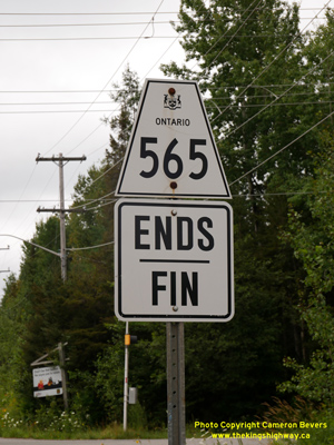
Since 1997, Highway 565 has officially ended at the north city limits of Sault Ste. Marie, at the intersection of Base Line Road. The length of the highway is now
1.6 km (1.0 miles). Unless posted otherwise, the speed limit on Highway 565 is 80 km/h (50 mph). There are no services available on this highway.
|