| 
| |
|
|
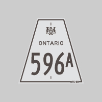
History of Secondary Highway 596A (#2):
Secondary Highway 596A was a local highway in the District of Kenora that was created out of a route renumbering in 1977. During the year, the route of Highway 596
was extended northerly from Pistol Lake Junction near Minaki up to the Wabaseemoong First Nation, via the Caribou Falls Road. In turn, the old route of Highway 596
leading into Minaki from Pistol Lake Junction was renumbered as Highway 596A. The route of Highway 596A first appeared on the 1978-1979 edition of the Ontario
Official Road Map. It was decided in the early 1980s that the Caribou Falls Road should be assigned its own unique route number. As a result of this decision, the
northerly extension of Highway 596 from Pistol Lake Junction to the Wabaseemoong First Nation was renumbered as
Highway 525, effective April 1, 1981. The Minaki Spur (Highway 596A) reverted back to its original
Highway 596 route number, effective June 26, 1981. This change in route numbers was first depicted on the 1982-1983 edition of the Ontario Official Road Map. A
different Highway 596A (#1) existed near Keewatin during the 1960s.
|
|---|
Links to Adjacent Secondary Highway Pages:
Back to Hwy 596A (#1) /
On to Hwy 597
Ontario Highway History - Main Menu / Back to List of Highways Website contents, photos & text © 2002-2025, Cameron
Bevers (Webmaster) - All Rights Reserved / Contact Me |
|---|