
| 
|  |
|
|
This page contains present day photos (Year 2000 to date) of Ontario's King's Highway 11, arranged by location from
Emsdale northerly to Burk's Falls. All photographs displayed on this page were taken by the Webmaster (Cameron Bevers), unless specifically noted otherwise. Click
on any thumbnail to see a larger image!
Please note that all photographs displayed on this
website are protected by copyright. These photographs must not be reproduced, published,
electronically stored or copied, distributed, or posted onto other websites without
my written permission. If you want to use photos from this website, please
email me first for permission. Thank-you!
|
|---|
|
Page 12: Present Day King's Highway 11 Photographs (Emsdale to Burk's Falls)

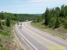
Left - View of the two-lane Hwy 11 between Emsdale and the Hwy 592 Junction near Katrine in 2003 before the highway widening, showing the proposed location of
the future northbound lanes. Hwy 11 was expanded from two lanes to four lanes during a multi-year construction contract which began shortly after this photo was taken
in 2003. See an Enlarged Photo Here. (Photograph taken on July 6, 2003 - © Cameron Bevers) Right - Southbound passing lane on Hwy 11 just south of the Hwy 592 Junction near Katrine in 2003. This was one of several passing lanes located along the old two-lane route of Hwy 11 between Huntsville and North Bay that were removed as result of the reconstruction and widening of Hwy 11 to a four-lane divided highway. See an Enlarged Photo Here. (Photograph taken on July 6, 2003 - © Cameron Bevers) 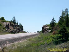
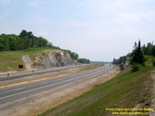
Left - This rock cut located just south of the Hwy 592 Junction near Katrine was widened in 2004-2005 to make way for the four-lane Hwy 11. See an
Enlarged Photo Here. (Photograph taken on July 6, 2003 - © Cameron Bevers) Right - Rock cut just south of the Hwy 592 Junction near Katrine after completion of the Hwy 11 widening project. See an Enlarged Photo Here. (Photograph taken on June 17, 2006 - © Cameron Bevers) 
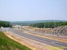
Left - Facing north along Hwy 11 towards the Hwy 592 Junction near Katrine in 2003, before reconstruction. See an
Enlarged Photo Here. (Photograph taken on July 6, 2003 - © Cameron Bevers) Right - View of Hwy 11 facing north towards the Hwy 592 junction near Katrine in 2006, after reconstruction. When the Emsdale Bypass section of Hwy 11 was completed in the Fall of 2005, a temporary median crossover existed at the end of the four-lane divided highway. The new northbound lanes of the divided highway tied back into the existing two-lane highway immediately south of the Hwy 592 Junction. Note the large rock stockpile excavated from the rock cut to the south lying beside the highway at right. This rock stockpile was crushed and utilized as fill material for the approaches to the Hwy 592 Overpass during a subsequent highway widening contract. See an Enlarged Photo Here. (Photograph taken on June 17, 2006 - © Cameron Bevers) 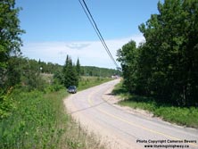

Left - Facing north along Hwy 592 approaching the Hwy 11 Junction near Katrine in 2003, before reconstruction. See an
Enlarged Photo Here. (Photograph taken on July 6, 2003 - © Cameron Bevers) Right - Hwy 11 & Hwy 592 Junction near Katrine during reconstruction in 2006, facing north. Note the advance clearing and grading at right for the relocation of Hwy 592 and the future construction of the new northbound lanes of Hwy 11. The elevation of Hwy 592 lay well below that of Hwy 11, so a large amount of fill material was needed at this location in order for Hwy 592 to span the new four-lane divided highway. See an Enlarged Photo Here. (Photograph taken on June 17, 2006 - © Cameron Bevers) 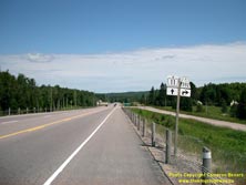
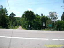
Left - Junction sign assembly on northbound Hwy 11 approaching the Hwy 592 Junction near Katrine in 2003, before reconstruction. See an
Enlarged Photo Here. (Photograph taken on July 6, 2003 - © Cameron Bevers) Right - Hwy 11 & Hwy 592 Junction near Katrine in 2003, before reconstruction. This at-grade intersection was closed off and grade-separated in 2008-2009 as a result of the reconstruction of Hwy 11 as a four-lane divided highway. See an Enlarged Photo Here. (Photograph taken on July 6, 2003 - © Cameron Bevers) 

Left - Former site of the Hwy 592 Junction near Katrine during reconstruction in 2008. As a result of construction staging, Hwy 592 had to be fully closed to
traffic during the Hwy 11 widening project while the new grade separation and approaches were being built. See an
Enlarged Photo Here. (Photograph taken on September 19, 2008 - © Cameron Bevers) Right - New Hwy 592 Overpass under construction on Hwy 11 in 2008. This new bridge replaced the old at-grade intersection between Hwy 11 and Hwy 592. See an Enlarged Photo Here. (Photograph taken on September 19, 2008 - © Cameron Bevers) 

Left - Newly-built Hwy 592 Overpass on Hwy 11 between Emsdale and Katrine in 2008, prior to the construction of the bridge's approach slabs, waterproofing
membrane installation and asphalt deck paving. Bridge decks are rarely left exposed in Ontario anymore, although exposed concrete decks were used on many highway
bridges built in the past. See an Enlarged Photo Here. (Photograph taken on September 19, 2008 - © Cameron Bevers) Right - Date stamp (2008) and structure identification number (Site #44-394) on the Hwy 592 Overpass on Hwy 11. See an Enlarged Photo Here. (Photograph taken on September 19, 2008 - © Cameron Bevers) 
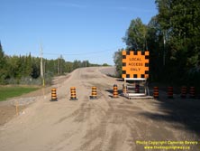
Left - Western approach to the new Hwy 592 Overpass on Hwy 11 between Emsdale and Katrine in 2008. See an
Enlarged Photo Here. (Photograph taken on September 19, 2008 - © Cameron Bevers) Right - Facing east towards the Hwy 592 Overpass from Katrine Road. Most of the four-lane route of Hwy 11 between Katrine and Burk's Falls was constructed on a brand new alignment. Katrine Road provides a service road connection between the north end of Hwy 592 and the bypassed section of Hwy 11 through Katrine. See an Enlarged Photo Here. (Photograph taken on September 19, 2008 - © Cameron Bevers) 
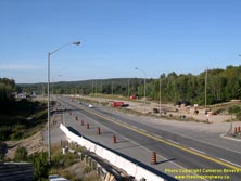
Left - Facing south along Hwy 11 from the Hwy 592 Overpass between Emsdale and Katrine in 2008. Note the temporary median crossover at the end of the four-lane
section of Hwy 11 (Emsdale Bypass) at right and the abandoned alignment of Hwy 592 near the yellow excavator in the centre of this photo. The relocation of Hwy 592
was necessary in order to make room for the new northbound lanes of Hwy 11. See an
Enlarged Photo Here. (Photograph taken on September 19, 2008 - © Cameron Bevers) Right - View of the closed at-grade intersection on Hwy 11 at Hwy 592 and Sunset Pass Road, facing north from the new Hwy 592 Overpass. See an Enlarged Photo Here. (Photograph taken on September 19, 2008 - © Cameron Bevers) 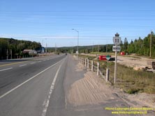
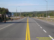
Left - Hwy 11 route marker at the now-closed Hwy 592 Junction between Emsdale and Katrine in 2008. See an
Enlarged Photo Here. (Photograph taken on September 19, 2008 - © Cameron Bevers) Right - Facing north along Hwy 11 towards Burk's Falls from the former site of the Hwy 11 & Hwy 592 Junction. See an Enlarged Photo Here. (Photograph taken on September 19, 2008 - © Cameron Bevers) 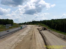
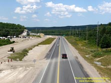
Left - Facing south along Hwy 11 from the Hwy 592 Overpass in 2010. The new northbound lanes of the highway had been completed at the time this photo was
taken, with all traffic using the newly-built carriageway. The existing highway (the future southbound lanes) had been closed to traffic for reconstruction. See
an Enlarged Photo Here. (Photograph taken on July 10, 2010 - © Cameron Bevers) Right - Facing north along Hwy 11 towards Burk's Falls from the Hwy 592 Overpass between Emsdale and Katrine. See an Enlarged Photo Here. (Photograph taken on July 10, 2010 - © Cameron Bevers) 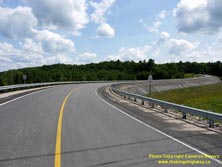

Left - Completed eastern approach to the Hwy 592 Overpass on Hwy 11 in 2010. The amount of fill needed to construct the eastern approach to this structure was
quite remarkable! From this point, Hwy 592 heads south through Emsdale to Novar. Up until the 1950s, Hwy 592 was the route of Hwy 11. See an
Enlarged Photo Here. (Photograph taken on July 10, 2010 - © Cameron Bevers) Right - Facing west across the new Hwy 592 Overpass on Hwy 11 between Emsdale and Katrine in 2010. See an Enlarged Photo Here. (Photograph taken on July 10, 2010 - © Cameron Bevers) 
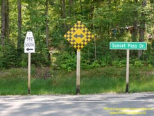
Left - Route marker noting the northern terminus of Hwy 592 at the Hwy 11 Overpass in 2010. Although Hwy 592 ends here, provincial jurisdiction over the road
actually continues north from this point to Burk's Falls via Sunset Pass Road and Katrine Road, which is a non-posted 7000-series highway (Hwy 7188). It is a little
bit puzzling why MTO didn't simply sign Katrine Road as a northerly continuation of Hwy 592. See an
Enlarged Photo Here. (Photograph taken on July 10, 2010 - © Cameron Bevers) Right - Signs at the end of Katrine Road directing traffic to Hwy 592. See an Enlarged Photo Here. (Photograph taken on July 10, 2010 - © Cameron Bevers) 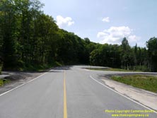

Left - Intersection of Sunset Pass Road and Katrine Road just west of Hwy 11. As a result of the reconstruction and widening of Hwy 11 to four lanes, an
extensive system of service roads had to be built in this area in order to provide local access to properties located adjacent to Hwy 11. Katrine Road begins here at
right and continues north to Burk's Falls. Most of Katrine Road follows the former route of Hwy 11 through Katrine. See an
Enlarged Photo Here. (Photograph taken on July 10, 2010 - © Cameron Bevers) Right - Fingerboard sign marking the start of Katrine Road at Sunset Pass Road. The route of Hwy 592 begins at the grade separation across Hwy 11 in the background. See an Enlarged Photo Here. (Photograph taken on July 10, 2010 - © Cameron Bevers) 
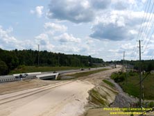
Left - Facing south along Hwy 11 towards the former site of the Hwy 11 & Hwy 592 Junction in 2008. The new grade separation can be seen in the background.
See an Enlarged Photo Here. (Photograph taken on September 19, 2008 - © Cameron Bevers) Right - View of the northern approach to the Hwy 592 Overpass on Hwy 11 in 2010, showing all traffic using the new northbound carriageway. See an Enlarged Photo Here. (Photograph taken on July 10, 2010 - © Cameron Bevers) 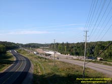
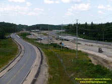
Left - View of Hwy 11 and Katrine Road (Hwy 7188), facing north towards the Magnetawan River Bridge during reconstruction in 2008. See an
Enlarged Photo Here. (Photograph taken on September 19, 2008 - © Cameron Bevers) Right - Facing north along Hwy 11 and Katrine Road (Hwy 7188) in 2010, showing construction progress at the Magnetawan River Bridge. In this photo, traffic had been shifted onto the newly-completed northbound carriageway. The original highway (the future southbound lanes of the divided highway) was closed to traffic for reconstruction. The Katrine Bypass was opened to traffic as a two-lane facility in 2009. See an Enlarged Photo Here. (Photograph taken on July 10, 2010 - © Cameron Bevers) 
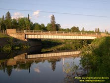
Left - Facing south along Hwy 11 towards Huntsville at the Magnetawan River Bridge south of Katrine in 2006, prior to reconstruction.
See an Enlarged Photo Here. (Photograph taken on June 4, 2006 - © Cameron Bevers) Right - Western side of the Magnetawan River Bridge on Hwy 11 south of Katrine. This single-span steel plate girder structure was completed in 1961. See an Enlarged Photo Here. (Photograph taken on June 4, 2006 - © Cameron Bevers) 
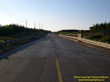
Left - Close-up of the concrete and steel handrail of the Magnetawan River Bridge on Hwy 11. See an
Enlarged Photo Here. (Photograph taken on June 4, 2006 - © Cameron Bevers) Right - Facing north along Hwy 11 towards Burk's Falls at the Magnetawan River Bridge south of Katrine. See an Enlarged Photo Here. (Photograph taken on June 4, 2006 - © Cameron Bevers) 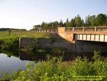
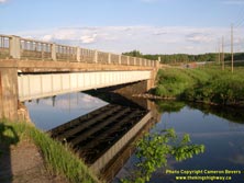
Left - Former abutment of the old Ferguson Highway Bridge at Magnetawan River. The old steel pony truss bridge at this location was closed and demolished after
the current Magnetawan River Bridge was completed in 1961. The revised alignment of Hwy 11 built along with the 1961 bridge also bypassed a sharp curve immediately
north of the old structure. See an Enlarged Photo Here. (Photograph taken on June 4, 2006 - © Cameron Bevers) Right - The tranquil Magnetawan River provides a mirror image of the steel plate girder superstructure. See an Enlarged Photo Here. (Photograph taken on June 4, 2006 - © Cameron Bevers) 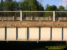

Left - Close-up view of the bolted steel plate girder superstructure on the Magnetawan River Bridge. This bridge was replaced by a new concrete girder
structure in 2009-2010 as part of the Hwy 11 expansion from two to four lanes. See an
Enlarged Photo Here. (Photograph taken on June 4, 2006 - © Cameron Bevers) Right - Eastern side of the Magnetawan River Bridge on Hwy 11 south of Katrine. See an Enlarged Photo Here. (Photograph taken on June 4, 2006 - © Cameron Bevers) 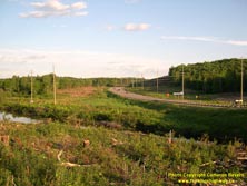
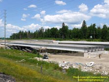
Left - Advance clearing underway in 2006 for the future four-lane Hwy 11 at the Magnetawan River Bridge south of Katrine. See an
Enlarged Photo Here. (Photograph taken on June 4, 2006 - © Cameron Bevers) Right - New Magnetawan River Bridge under construction on Hwy 11 in 2010. This new concrete girder bridge replaced the 1961 structure seen in the preceding photos. When the new bridge was opened to traffic, it carried the southbound lanes of Hwy 11 only. The previous bridge at this location carried both northbound and southbound Hwy 11 traffic. See an Enlarged Photo Here. (Photograph taken on July 10, 2010 - © Cameron Bevers) 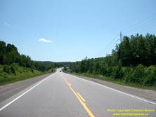
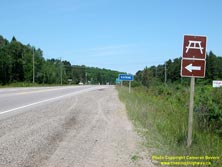
Left - Facing south along Hwy 11 towards the Magnetawan River Bridge from the Katrine Roadside Park entrance in 2003, before reconstruction. See an
Enlarged Photo Here. (Photograph taken on July 6, 2003 - © Cameron Bevers) Right - Facing north along Hwy 11 towards Katrine from the Katrine Roadside Park entrance in 2003, before reconstruction. See an Enlarged Photo Here. (Photograph taken on July 6, 2003 - © Cameron Bevers) 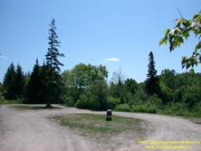

Left - This MTO Roadside Park on Hwy 11 at Katrine was closed in 2004 due to the Hwy 11 widening. See an
Enlarged Photo Here. (Photograph taken on July 6, 2003 - © Cameron Bevers) Right - View of Doe Lake Road at Katrine in 2003, facing east towards the future Hwy 11 Interchange. Doe Lake Road is actually an old alignment of the Ferguson Highway, a Northern Development Trunk Road which was the predecessor of today's Hwy 11. The Ferguson Highway was relocated onto an improved alignment for several miles between Katrine and Burk's Falls once a new steel truss bridge was completed over the Magnetawan River in 1930. See an Enlarged Photo Here. (Photograph taken on July 6, 2003 - © Cameron Bevers) 

Left - View of Three Mile Lake Road before reconstruction in 2003, facing west towards the proposed site of the Hwy 11 Interchange. See an
Enlarged Photo Here. (Photograph taken on July 6, 2003 - © Cameron Bevers) Right - Katrine Interchange under construction at Hwy 11 and Doe Lake Road in 2010. The eastern half of the interchange was already completed at the time this photo was taken, but the future southbound lanes of Hwy 11 were still under construction. See an Enlarged Photo Here. (Photograph taken on July 10, 2010 - © Cameron Bevers) 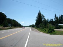
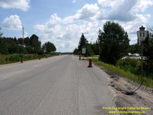
Left - Facing south along Hwy 11 from Doe Lake Road at Katrine in 2003, prior to reconstruction. See an
Enlarged Photo Here. (Photograph taken on July 6, 2003 - © Cameron Bevers) Right - A lone Hwy 11 route marker still stands on a bypassed section of the highway through Katrine in 2010. See an Enlarged Photo Here. (Photograph taken on July 10, 2010 - © Cameron Bevers) 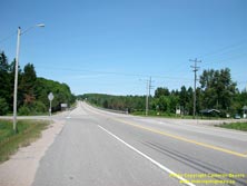
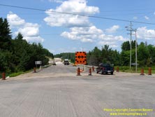
Left - View of Hwy 11 facing north from Doe Lake Road at Katrine in 2003. The Magnetawan River Bridge lies a short distance ahead. Completed in 1973, this
concrete structure replaced a large steel through truss structure which had been completed on a diversion of the Ferguson Highway (the predecessor of Hwy 11) in 1930.
Prior to the completion of the bridge, the Ferguson Highway turned left onto Doe Lake Road. See an
Enlarged Photo Here. (Photograph taken on July 6, 2003 - © Cameron Bevers) Right - View of Old Hwy 11 facing north from Doe Lake Road at Katrine in 2010. The Magnetawan River Bridge on Old Hwy 11 was temporarily closed for rehabilitation once the Katrine Bypass (the new route of Hwy 11) was opened to traffic. See an Enlarged Photo Here. (Photograph taken on July 10, 2010 - © Cameron Bevers) 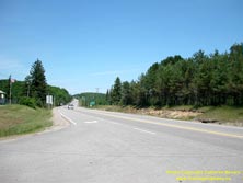
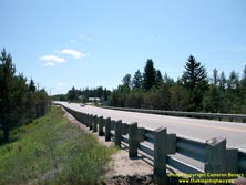
Left - Facing north along Hwy 11 towards Doe Lake Road from the southern entrance to Katrine in 2003, prior to the start of construction on the Katrine Bypass.
See an Enlarged Photo Here. (Photograph taken on July 6, 2003 - © Cameron Bevers) Right - Facing south along Hwy 11 towards Doe Lake Road from the Magnetawan River Bridge at Katrine in 2003. See an Enlarged Photo Here. (Photograph taken on July 6, 2003 - © Cameron Bevers) 

Left - Eastern side of the Magnetawan River Bridge on Hwy 11 at Katrine in 2003. This three-span continuous concrete girder structure was completed in 1973.
See an Enlarged Photo Here. (Photograph taken on July 6, 2003 - © Cameron Bevers) Right - View of Hwy 11 facing south towards Katrine, about 3 km south of the Hwy 520 Junction in 2003. See an Enlarged Photo Here. (Photograph taken on July 6, 2003 - © Cameron Bevers) 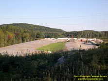
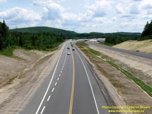
Left - Construction progress on the Katrine Bypass (New Hwy 11) at the Magnetawan River Bridges in 2008, facing south from existing Hwy 11. See an
Enlarged Photo Here. (Photograph taken on September 19, 2008 - © Cameron Bevers) Right - View of the partially-completed Katrine Bypass (New Hwy 11) from the Katrine Road Overpass in 2010, facing south towards the Magnetawan River Bridges. Due to construction sequencing, the Katrine Bypass was initially opened as a two-lane undivided highway. In this photo, all traffic is using the northbound carriageway, while the southbound carriageway is still under construction at right. See an Enlarged Photo Here. (Photograph taken on July 10, 2010 - © Cameron Bevers) 
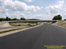
Left - Date stamp (2009) and structure identification number (Site #44-427) on the Katrine Road Overpass on Hwy 11. See an
Enlarged Photo Here. (Photograph taken on July 10, 2010 - © Cameron Bevers) Right - Completed hot-mix asphalt pavement on Hwy 11 approaching the Katrine Road Overpass, facing south along the future southbound lanes. See an Enlarged Photo Here. (Photograph taken on July 10, 2010 - © Cameron Bevers) 

Left - Facing north along the Katrine Bypass (Hwy 11) towards Burk's Falls from Katrine Road in 2010. In this photo. all traffic is using the northbound
carriageway while the future southbound lanes were being completed. See an
Enlarged Photo Here. (Photograph taken on July 10, 2010 - © Cameron Bevers) Right - View of the Katrine Bypass (Hwy 11) in 2010, facing south towards Huntsville. The Katrine Road Overpass carries the old alignment of Hwy 11 across the new freeway. Several kilometres of the old two-lane Hwy 11 were bypassed by the new freeway. The three structures in the background carry the Katrine Bypass and the on-ramp from Doe Lake Road across the Magnetawan River. See an Enlarged Photo Here. (Photograph taken on July 10, 2010 - © Cameron Bevers) 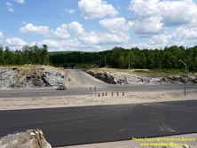
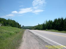
Left - Temporary connection between Old Hwy 11 (Katrine Road) and the new Katrine Bypass in 2010. Due to construction sequencing, Katrine Road had to be
temporarily cut off at both ends in order to construct the new freeway. Local traffic had to use this temporary connection during certain stages until Katrine Road
was opened in its entirety between Hwy 592 and Burk's Falls. This temporary connection was removed shortly after this photo was taken. See an
Enlarged Photo Here. (Photograph taken on July 10, 2010 - © Cameron Bevers) Right - Facing south towards Katrine along Hwy 11, 1 km south of Burk's Falls in 2003. See an Enlarged Photo Here. (Photograph taken on July 6, 2003 - © Cameron Bevers) 

Left - Facing north along Hwy 11 towards Burk's Falls, about 3 km south of Hwy 520 in 2003. See an
Enlarged Photo Here. (Photograph taken on July 6, 2003 - © Cameron Bevers) Right - Facing south along Hwy 11 towards Katrine about 2 km south of the Hwy 520 Junction in 2003. This part of Hwy 11 became a service road once the new four-lane highway was built. See an Enlarged Photo Here. (Photograph taken on July 6, 2003 - © Cameron Bevers) 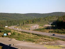

Left - Advance clearing for the Katrine Bypass (New Hwy 11) about 1 km south of Burk's Falls in 2008. The new four-lane route of Hwy 11 will diverge from the
existing two-lane route of Hwy 11 at this point. Most sections of Hwy 11 between Burk's Falls and Katrine were constructed on a brand new alignment. The old route of
Hwy 11 became a service road known as Katrine Road. See an Enlarged Photo Here. (Photograph taken on September 19, 2008 - © Cameron Bevers) Right - Twinning progress along Hwy 11 just south of Burk's Falls in 2008, showing the temporary connection to Hwy 520. See an Enlarged Photo Here. (Photograph taken on September 19, 2008 - © Cameron Bevers) 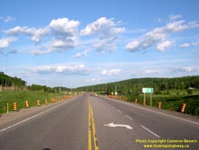

Left - Facing south along Hwy 11 towards the Hwy 520 Junction at Burk's Falls in 2006. This at-grade intersection was removed and replaced with a grade
separation and interchange. See an Enlarged Photo Here. (Photograph taken on June 4, 2006 - © Cameron Bevers). Right - Facing south along Hwy 11 towards the new Hwy 520 Interchange at Burk's Falls in 2008. See an Enlarged Photo Here. (Photograph taken on September 19, 2008 - © Cameron Bevers) 

Left - Green guide sign marking the Hwy 520 Junction on Hwy 11 at Burk's Falls in 2006. See an
Enlarged Photo Here. (Photograph taken on June 4, 2006 - © Cameron Bevers) Right - Facing south along Hwy 11 from the Hwy 520 Overpass at Burk's Falls in 2008. See an Enlarged Photo Here. (Photograph taken on September 19, 2008 - © Cameron Bevers) 
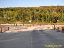
Left - Facing north along the future southbound lanes of Hwy 11 towards the Hwy 520 Overpass in Burk's Falls in 2008. See an
Enlarged Photo Here. (Photograph taken on September 19, 2008 - © Cameron Bevers) Right - Temporary ramp connections between Hwy 11 and Hwy 520 in Burk's Falls in 2008. See an Enlarged Photo Here. (Photograph taken on September 19, 2008 - © Cameron Bevers) 

Left - New Hwy 520 Overpass on Hwy 11 in Burk's Falls in 2008, facing north towards the town centre. Up until the mid-1970s, Hwy 11 used to pass through
Downtown Burk's Falls. A new two-lane bypass was completed for Hwy 11 around the western side of Burk's Falls in 1976. See an
Enlarged Photo Here. (Photograph taken on September 19, 2008 - © Cameron Bevers) Right - Facing south across the Hwy 520 Overpass on Hwy 11 in Burk's Falls in 2008. Although Hwy 520 ends at this point, the road straight ahead is Ferguson Road. As the name may suggest, this was an early route of the Ferguson Highway which was left behind when an improved highway was built on a new alignment between Burk's Falls and Katrine in the early 1930s. See an Enlarged Photo Here. (Photograph taken on September 19, 2008 - © Cameron Bevers) 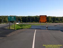
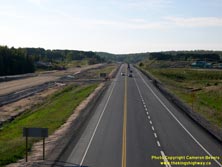
Left - Future on-ramp to southbound Hwy 11 at the Hwy 520 Interchange in 2008. Due to construction sequencing, traffic wishing to access (or exit from)
southbound Hwy 11 at Hwy 520 had to use a temporary ramp connection. Note the green sign directing traffic to the temporary ramp connection to Hwy 11 South at left.
See an Enlarged Photo Here. (Photograph taken on September 19, 2008 - © Cameron Bevers) Right - Facing north along the Burk's Falls Bypass (Hwy 11) from the Hwy 520 Interchange in 2008. At the time this photo was taken, all traffic was using the northbound carriageway while the southbound carriageway was being built. See an Enlarged Photo Here. (Photograph taken on September 19, 2008 - © Cameron Bevers) 

Left - Future southbound carriageway of Hwy 11 under construction on the Burk's Falls Bypass in 2008. The grading for the future ramp connections at the Hwy 11
& Hwy 520 Interchange can be seen under construction at left. See an Enlarged Photo Here. (Photograph taken on September 19, 2008 - © Cameron Bevers) Right - Facing north along the Burk's Falls Bypass (Hwy 11) in 2008, showing the temporary median crossover at the end of the proposed four-lane highway. Several of these temporary median crossovers had to be constructed as part of the various phases of the Hwy 11 expansion between Huntsville and North Bay. See an Enlarged Photo Here. (Photograph taken on September 19, 2008 - © Cameron Bevers)
Continue on to King's Highway 11 Photos: Burk's Falls to Sundridge
|
|---|
Links to Adjacent King's Highway Photograph Pages:
Back to King's Highway 10 Photos /
King's Highway 11 History /
On to King's Highway 12 Photos
Ontario Highway History - Main Menu / Back to List of Highways Website contents, photos & text © 2002-2025, Cameron
Bevers (Webmaster) - All Rights Reserved / Contact Me |
|---|