
| 
|  |
|
|
This page contains present day photos (Year 2000 to date) of Ontario's King's Highway 11, arranged by location from Otasawian
River westerly to Longlac. All photographs displayed on this page were taken by the Webmaster (Cameron Bevers), unless specifically noted otherwise. Click
on any thumbnail to see a larger image!
Please note that all photographs displayed on this
website are protected by copyright. These photographs must not be reproduced, published,
electronically stored or copied, distributed, or posted onto other websites without
my written permission. If you want to use photos from this website, please
email me first for permission. Thank-you!
|
|---|
|
Page 28: Present Day King's Highway 11 Photographs (Otasawian River to Longlac)
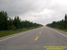
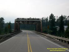
Left - Facing west along Hwy 11 towards Longlac near the Otasawian River Bridge. See an
Enlarged Photo Here. (Photograph taken on August 20, 2003 - © Cameron Bevers) Right - Facing west along Hwy 11 at the Pagwachuan River Bridge between Longlac and Hearst. See an Enlarged Photo Here. (Photograph taken on August 20, 2003 - © Cameron Bevers) 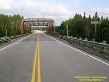
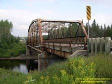
Left - Pagwachuan River Bridge on Hwy 11, facing east towards Hearst. See an
Enlarged Photo Here. (Photograph taken on August 20, 2003 - © Cameron Bevers) Right - Northern side of the Pagwachuan River Bridge on Hwy 11. Structure completed in 1942. See an Enlarged Photo Here. (Photograph taken on August 20, 2003 - © Cameron Bevers) 

Left - Southern side of the Pagwachuan River Bridge on Hwy 11, facing west towards Longlac. See an
Enlarged Photo Here. (Photograph taken on August 20, 2003 - © Cameron Bevers) Right - Looking west along an empty Hwy 11 near the Cochrane-Thunder Bay District Boundary. See an Enlarged Photo Here. (Photograph taken on August 20, 2003 - © Cameron Bevers) 

Left - North Pagwachuan River Bridge on Hwy 11 east of Longlac. Structure completed in 1991. See an
Enlarged Photo Here. (Photograph taken on August 20, 2003 - © Cameron Bevers) Right - The North Pagwachuan River Bridge was the first prestressed timber deck and steel beam composite bridge ever built in Ontario. This structure was the first in a series of several bridges built by the Ontario Ministry of Transportation (MTO) on remote highways in the 1990s, in places where a local supply of concrete was not readily available. This marked a return to timber deck bridge construction by MTO, a practice which was practically stopped in the 1960s, when concrete became the preferred construction material. See an Enlarged Photo Here. (Photograph taken on August 20, 2003 - © Cameron Bevers) 
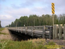
Left - Close-up of the handrail and deck design of the North Pagwachuan River Bridge on Hwy 11. See an
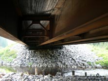
Enlarged Photo Here. (Photograph taken on August 20, 2003 - © Cameron Bevers) Right - View underneath the North Pagwachuan River Bridge on Hwy 11, showing steel beam and laminated timber deck. Note the remains of the original timber pilings for the original 1940s bridge in the foreground. See an Enlarged Photo Here. (Photograph taken on August 20, 2003 - © Cameron Bevers) 
Left - Facing east along Hwy 11 at the Hoiles Creek Bridge, west of Klotz Lake. See an
Enlarged Photo Here. (Photograph taken on August 20, 2003 - © Cameron Bevers) Right - North side of the Hoiles Creek Bridge on Hwy 11. This structure is of identical design to the prestressed timber deck and steel beam composite bridge at the nearby North Pagwachuan River, and was completed in 1994. See an Enlarged Photo Here. (Photograph taken on August 20, 2003 - © Cameron Bevers)
Continue on to King's Highway 11 Photos: Longlac to Geraldton
|
|---|
Links to Adjacent King's Highway Photograph Pages:
Back to King's Highway 10 Photos /
King's Highway 11 History /
On to King's Highway 12 Photos
Ontario Highway History - Main Menu / Back to List of Highways Website contents, photos & text © 2002-2025, Cameron
Bevers (Webmaster) - All Rights Reserved / Contact Me |
|---|