
| 
|  |
|
|
This page contains present day photos (Year 2000 to date) of Ontario's King's Highway 11, arranged by location from Toronto
northerly to Orillia. All photographs displayed on this page were taken by the Webmaster (Cameron Bevers), unless specifically noted otherwise. Click on any
thumbnail to see a larger image!
Please note that all photographs displayed on this
website are protected by copyright. These photographs must not be reproduced, published,
electronically stored or copied, distributed, or posted onto other websites without
my written permission. If you want to use photos from this website, please
email me first for permission. Thank-you!
|
|---|
|
Page 8: Present Day King's Highway 11 Photographs (Toronto to Orillia)


Left - Aerial view of the Yonge Street (Hwy 11) Interchange on Hwy 401, facing south towards Downtown Toronto. Note the Hogg's Hollow Bridge on Hwy 401 to
the right of the Yonge Street Interchange. See an Enlarged Photo Here. (Photograph taken on May 30, 2004 - © Cameron Bevers) Right - Aerial view of the Hwy 407 and Hwy 7 Interchanges at Yonge Street (Hwy 11) in Richmond Hill, facing north. See an Enlarged Photo Here. (Photograph taken on May 30, 2004 - © Cameron Bevers) 
Left - Close-up of the Hwy 407 and Hwy 7 Interchanges at Yonge Street (Hwy 11) in Richmond Hill, facing north. See an
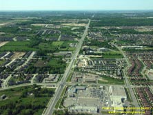
Enlarged Photo Here. (Photograph taken on May 30, 2004 - © Mark Mirrlees) Right - Aerial view of Yonge Street (Hwy 11) in Richmond Hill, facing north from Elgin Mills Road. See an Enlarged Photo Here. (Photograph taken on May 30, 2004 - © Cameron Bevers) 

Left - Facing north along Yonge Street (Hwy 11) towards the Canadian National Railway (CNR) Subway in Aurora. Structure completed in 1940. See an
Enlarged Photo Here. (Photograph taken on April 11, 2009 - © Cameron Bevers) Right - View underneath the Aurora CNR Subway on Yonge Street (Hwy 11). This bridge is a steel plate girder structure, with a single span measuring 120 feet in length. See an Enlarged Photo Here. (Photograph taken on April 11, 2009 - © Cameron Bevers) 

Left - Date stamp (1940) on the east abutment of the Aurora CNR Subway on Yonge Street (Hwy 11). See an
Enlarged Photo Here. (Photograph taken on April 11, 2009 - © Cameron Bevers) Right - Facing south along Yonge Street (Hwy 11) towards the Aurora CNR Subway. This bridge replaced a narrower subway that was constructed at this location in 1923. See an Enlarged Photo Here. (Photograph taken on April 11, 2009 - © Cameron Bevers) 
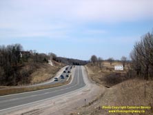
Left - The original 1923 subway at Aurora was only 42 feet wide, which was only just wide enough to allow two lanes of traffic on Hwy 11, one sidewalk, and a
radial railway line to pass through. The 1940 structure, which replaced the narrow 1923 subway, was designed to ultimately accommodate a four-lane divided highway.
The completion of the new Aurora Subway in 1940 was an instrumental stage in the redevelopment of Hwy 11 as a multi-lane highway during the 1930s and 1940s. See an
Enlarged Photo Here. (Photograph taken on April 11, 2009 - © Cameron Bevers) Right - Facing north towards Bradford along the Holland Landing Bypass (Hwy 11), about 3 km north of Newmarket. See an Enlarged Photo Here. (Photograph taken on April 10, 2005 - © Cameron Bevers) 
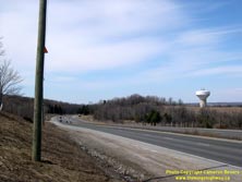
Left - The Holland Landing Bypass portion of Hwy 11 is a limited access four-lane divided highway that was constructed in the late 1950s. The narrow curbed
median seen on the Holland Landing Bypass was also used on other major Toronto-area highways in the 1950s, including sections of Hwy 27, Hwy 401 and the Queen
Elizabeth Way. See an Enlarged Photo Here. (Photograph taken on April 10, 2005 - © Cameron Bevers) Right - Facing north along Hwy 11 towards Bradford on the Holland Landing Bypass, about 4 km north of Newmarket. See an Enlarged Photo Here. (Photograph taken on April 10, 2005 - © Cameron Bevers) 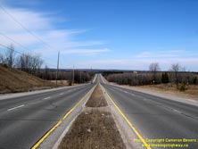

Left - The Holland Landing Bypass was completed and opened to traffic in 1958. This new four-lane divided highway diverted Hwy 11 through traffic off of the
narrow, old two-lane highway that was built up the Holland Landing Hill in the early 1920s. The completion of the Holland Landing Bypass greatly improved traffic flow
between Newmarket and Bradford. See an Enlarged Photo Here. (Photograph taken on April 10, 2005 - © Cameron Bevers) Right - Northern entrance to Bradford on Hwy 11, facing south towards 8th Line. See an Enlarged Photo Here. (Photograph taken on August 8, 2020 - © Cameron Bevers) 

Left - Facing north along Hwy 11 towards Barrie from the northern entrance to Bradford. Jurisdiction over Hwy 11 between Bradford and Barrie ended in 1997,
when ownership of the highway was transferred from the province to the County of Simcoe. The former route of Hwy 11 between Bradford and Barrie is officially known
today as Simcoe County Road 4. See an Enlarged Photo Here. (Photograph taken on August 8, 2020 - © Cameron Bevers) Right - Facing south along Hwy 11 approaching Bradford. The route of Hwy 11 through Simcoe County was among the earliest established portions of this highway. The province assumed jurisdiction over the Bradford-Barrie Road in August 1920 - 100 years before this photo was taken. For many years, Hwy 11 was the only provincial highway leading from Toronto to Barrie. As traffic volumes between the two cities grew, new parallel highways were established. The parallel routes of Hwy 27 and Hwy 400 were completed in 1938 and 1952, respectively. See an Enlarged Photo Here. (Photograph taken on August 8, 2020 - © Cameron Bevers) 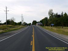

Left - Approaching Fennell on Hwy 11, facing north towards Barrie. There seems to be several variations of the spelling of Fennell's Corner(s), depending on
the source. However, this crossroads hamlet is simply identified as "Fennell" on the Official Ontario Road Map and "Fennell's Corner" on Simcoe County's online
interactive maps. See an Enlarged Photo Here. (Photograph taken on August 8, 2020 - © Cameron Bevers) Right - Facing south along Hwy 11 towards Bradford from Fennell. See an Enlarged Photo Here. (Photograph taken on August 8, 2020 - © Cameron Bevers) 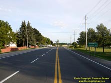

Left - Facing south along Hwy 11 from the Hwy 89 Junction at Fennell. See an
Enlarged Photo Here. (Photograph taken on August 8, 2020 - © Cameron Bevers) Right - Distance guide sign on southbound Hwy 11 near the Hwy 89 Junction at Fennell. See an Enlarged Photo Here. (Photograph taken on August 8, 2020 - © Cameron Bevers) 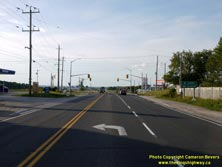
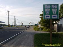
Left - Facing north along Hwy 11 at Fennell approaching the Hwy 89 Junction. See an
Enlarged Photo Here. (Photograph taken on August 8, 2020 - © Cameron Bevers) Right - Green guide sign on Hwy 11 at Fennell, marking the Former Hwy 89 (now Simcoe County Road 89) Junction. It may be of interest to note that Simcoe County Road 3, which currently extends from Fennell easterly to Gilford, also continued west from Fennell to Cookstown at one time. Beginning in 1963, the province started to assume jurisdiction over sections of Simcoe County Road 3 east of Cookstown, as this county road provided a very strategic link to both Hwy 400 and Hwy 11. As these various sections of the county road were assumed by the province in the 1960s and 1970s, they were designated as part of King's Highway 89. See an Enlarged Photo Here. (Photograph taken on August 8, 2020 - © Cameron Bevers) 

Left - An older green MTO destination guide sign still stands at the Hwy 11 & Hwy 89 Junction at Fennell. See an
Enlarged Photo Here. (Photograph taken on August 8, 2020 - © Cameron Bevers) Right - Approaching the former eastern terminus of Hwy 89 at the Hwy 11 Junction at Fennell. Back in the 1970s, there was a proposal to extend Hwy 89 even further to the east, but it was never carried forward and the concept was eventually abandoned. Had this highway extension been carried out, Hwy 89 would have turned to the right and briefly headed south concurrently with Hwy 11 to the Coulsons Hill area north of Bradford. At that point, Hwy 89 would have turned left and continued east to connect with Hwy 7 & Hwy 12 in the Sunderland area. See an Enlarged Photo Here. (Photograph taken on August 8, 2020 - © Cameron Bevers) 
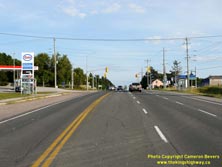
Left - Facing west along Hwy 89 towards Cookstown from Fennell. As a result of the mass highway downloading of 1997-1998, jurisdiction over a 5 km section of
Hwy 89 immediately west of Fennell was transferred from the province to the County of Simcoe. This section of Former Hwy 89 is officially known as Simcoe County Road
89 today. Provincial jurisdiction over Hwy 89 now begins at the Hwy 400 Interchange near Cookstown. See an
Enlarged Photo Here. (Photograph taken on August 8, 2020 - © Cameron Bevers) Right - Facing south along Hwy 11 towards the Hwy 89 Junction at Fennell. See an Enlarged Photo Here. (Photograph taken on August 8, 2020 - © Cameron Bevers) 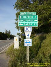
Above - Green guide signs at the Hwy 11 (Simcoe County Road 4) and Hwy 89 Junction at Fennell. See an
Enlarged Photo Here. (Photograph taken on August 8, 2020 - © Cameron Bevers) 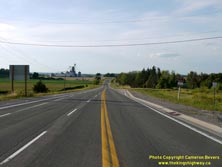

Left - Facing north along Hwy 11 towards Barrie from the Hwy 89 Junction at Fennell. The highway seen here is actually a 1930s-era diversion of the original
route of Hwy 11. The Fennell Diversion was completed and opened to traffic in 1937. The new highway bypassed an old section of Hwy 11, which had several hazardous
curves on it. See an Enlarged Photo Here. (Photograph taken on August 8, 2020 - © Cameron Bevers) Right - View of the old route of Hwy 11 at Fennell, facing north towards Barrie. Since 1937, traffic has used the new route for Hwy 11, which can be seen at left. See an Enlarged Photo Here. (Photograph taken on August 8, 2020 - © Cameron Bevers) 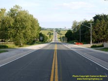

Left - View of Hwy 11 at Churchill, facing south towards Bradford. See an
Enlarged Photo Here. (Photograph taken on August 8, 2020 - © Cameron Bevers) Right - This spectacular vista appears as Hwy 11 departs from Churchill, heading south towards Fennell. The rolling topography of Simcoe County results in many fine vistas along the route of Hwy 11 between Barrie and Bradford. The highway offers a pleasant, albeit slower-paced, alternative to Hwy 400 between Bradford and Barrie. See an Enlarged Photo Here. (Photograph taken on August 8, 2020 - © Cameron Bevers) 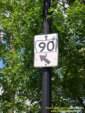
Above - Junction crown sign for Hwy 90 at the Hwy 11 & Hwy 27 Junction at Bradford Street and Dunlop Street in Downtown Barrie. See an
Enlarged Photo Here. (Photograph taken on June 30, 2007 - © Cameron Bevers) 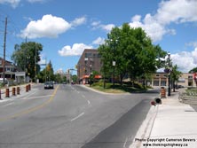

Left - Facing north along Bradford Street (Hwy 11 & Hwy 27) approaching the Hwy 90 Junction at Dunlop Street in Downtown Barrie. At this intersection,
Hwy 90 turns left and proceeds west towards Angus via Dunlop Street, while Hwy 11 & Hwy 27 turn right and follow Dunlop Street. See an
Enlarged Photo Here. (Photograph taken on June 30, 2007 - © Cameron Bevers) Right - Overhead diagrammatic guide sign on northbound Hwy 400 approaching the Crown Hill Overpass north of Barrie. At this junction, Hwy 400 actually exits from the apparent through highway, and charts a new course northwesterly towards Parry Sound where it joins Hwy 69 to Sudbury. The through route leads to Hwy 11, which continues northeasterly towards Orillia and North Bay. This is a challenging exit to sign, since the interchange appears at the end of a long curve. See an Enlarged Photo Here. (Photograph taken on August 2, 2007 - © Cameron Bevers) 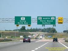
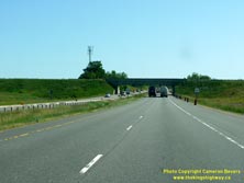
Left - Overhead turn-off guide signs on northbound Hwy 400 at Crown Hill. The route of Hwy 69, which extends from the Parry Sound area to Sudbury, is
"trailblazed" via Hwy 400 on both the advance and turn-off overhead guide signs. See an
Enlarged Photo Here. (Photograph taken on August 2, 2007 - © Cameron Bevers) Right - Approaching the Crown Hill Overpass north of Barrie. At this point, northbound Hwy 400 traffic has already exited from the highway, so traffic continuing north below this bridge is already committed to taking Hwy 11. Although signed as Hwy 11 heading northbound, the short section of the highway between the Crown Hill Overpass and the neighbouring Crown Hill Interchange (Hwy 11 & Hwy 93 Junction) has an unposted designation (Hwy 400A). That route number was logically omitted from all highway signs at both junctions, due to the potential for confusion amongst motorists. See an Enlarged Photo Here. (Photograph taken on June 19, 2013 - © Cameron Bevers) 

Left - Southern side of the Crown Hill Overpass on Hwy 400. This single span concrete rigid frame girder structure was completed in 1959, as part of the
Hwy 400 Extension from Crown Hill to Coldwater. See an Enlarged Photo Here. (Photograph taken on June 19, 2013 - © Cameron Bevers) Right - Northern side of the Crown Hill Overpass on Hwy 400. The bridge deck had a significant superelevation, to compensate for the relatively small ramp footprint. As a result, the structure's north fascia appears to be much larger than the south fascia. See an Enlarged Photo Here. (Photograph taken on June 19, 2013 - © Cameron Bevers) 
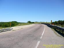
Left - Northbound Hwy 400 ramp approaching the Crown Hill Overpass, facing south towards Barrie. The designers used a very economical design to unite the
original route of Hwy 400 and the Hwy 400 Extension to Coldwater. A project began in May 2013 to replace the Crown Hill Overpass and realign the approach ramp.
Preliminary grading for the new ramp can be seen in the background. The old 1959 structure was demolished on December 12, 2015, a few weeks after the replacement
bridge opened to traffic. See an Enlarged Photo Here. (Photograph taken on June 19, 2013 - © Cameron Bevers) Right - Deck view of the Crown Hill Overpass on Hwy 400, facing north. This point marked the beginning of the so-called "Hwy 400 Extension" to Coldwater. This two-lane undivided highway was completed in 1959. The new route provided a direct connection to the Trans-Canada Highway at Coldwater, and shortened the distance between Toronto and Sudbury by approximately 13 km. The term "Extension" is a bit of a misnomer today. Ever since the completion of the MacTier-Horseshoe Lake Diversion in 2003, the Hwy 400 Extension is now actually longer than the original Toronto-Barrie route of Hwy 400. See an Enlarged Photo Here. (Photograph taken on June 19, 2013 - © Cameron Bevers) 

Left - Facing south towards Barrie from the Crown Hill Overpass. See an
Enlarged Photo Here. (Photograph taken on June 19, 2013 - © Cameron Bevers) Right - Facing north from the Crown Hill Overpass on Hwy 400 towards Crown Hill. The adjacent Hwy 11 & Hwy 93 Interchange at Crown Hill can be seen in the background. See an Enlarged Photo Here. (Photograph taken on June 19, 2013 - © Cameron Bevers) 
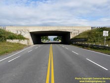
Left - Facing south along Hwy 400A towards the Crown Hill Overpass near Barrie. See an
Enlarged Photo Here. (Photograph taken on June 19, 2013 - © Cameron Bevers) Right - Crown Hill Underpass at the Hwy 11 & Hwy 93 Interchange near Barrie, facing north. This single span concrete rigid frame structure was completed in 1951. See an Enlarged Photo Here. (Photograph taken on August 25, 2011 - © Cameron Bevers) 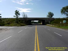
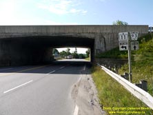
Left - Northern side of the Crown Hill Underpass at the Hwy 11 & Hwy 93 Interchange. This interchange marked the northern terminus of the Toronto-Barrie
Highway (Hwy 400) for several years, before the Coldwater Extension was completed in 1959. Today, the Crown Hill Interchange ensures a seamless transition between
Hwy 400 and the expressway portion of Hwy 11. See an Enlarged Photo Here. (Photograph taken on August 25, 2011 - © Cameron Bevers) Right - Historically, the highway numbering at the Crown Hill Interchange was rather confusing. Up until 1997, the route of Hwy 11 exited from the expressway and passed through the Crown Hill Underpass. From there, Hwy 11 followed Penetanguishene Road south into Downtown Barrie. However, traffic on the expressway above the structure continued south towards Toronto by accessing Hwy 400. Although it was never a posted route number, the short section of highway connecting the Crown Hill Interchange to the Hwy 400 Extension Interchange is known as Hwy 400A. The route of Hwy 400A is signed as Hwy 11 heading northbound and Hwy 400 heading southbound. Between 1938 and 1997, Hwy 93 also terminated at this junction. See an Enlarged Photo Here. (Photograph taken on August 25, 2011 - © Cameron Bevers) 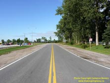

Left - Bi-directional freeway ramp at the Hwy 11 & Hwy 93 Interchange at Crown Hill near Barrie. This ramp also provides access to the Crown Hill MTO
Carpool Lot. See an Enlarged Photo Here. (Photograph taken on August 25, 2011 - © Cameron Bevers) Right - The Crown Hill Interchange ramps on the southbound side of Hwy 11 are in a "Parclo B-4" configuration, with the loop ramp situated on the far side of the grade separation. As a result, there are two exit ramps from Southbound Hwy 11 at this interchange. The directional ramp before the grade separation carries traffic to northbound Hwy 93 only, while the loop ramp on the south side of the grade separation carries traffic bound for Barrie via Penetanguishene Road (Former Hwy 11 South). See an Enlarged Photo Here. (Photograph taken on August 25, 2011 - © Cameron Bevers) 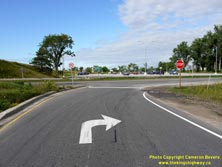
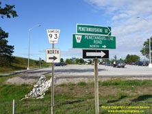
Left - Extra pavement markings and signs have been put in place to discourage drivers from turning left towards Barrie from the first southbound Hwy 11 exit
ramp at Crown Hill. To reach Barrie, drivers are supposed to take the second southbound exit ramp on the south side of the Crown Hill Underpass. These two exits were
a bit more distinctive prior to 1997, when the first exit was signed as Hwy 93 and the second exit was signed as Hwy 11. See an
Enlarged Photo Here. (Photograph taken on August 25, 2011 - © Cameron Bevers) Right - Guide signs marking Simcoe County Road 93 North (Former Hwy 93) at the Crown Hill Interchange on Hwy 11 near Barrie. Simcoe County has maintained Hwy 93 between Crown Hill and the Hwy 400 Interchange near Craighurst since the province transferred its jurisdiction over the highway in 1997. See an Enlarged Photo Here. (Photograph taken on August 25, 2011 - © Cameron Bevers) 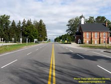
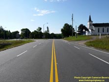
Left - Facing north along Hwy 93 towards Midland from the Crown Hill Interchange on Hwy 11. See an
Enlarged Photo Here. (Photograph taken on August 25, 2011 - © Cameron Bevers) Right - Southern terminus of Hwy 93 at the Crown Hill Interchange on Hwy 11, facing south towards Barrie. See an Enlarged Photo Here. (Photograph taken on August 25, 2011 - © Cameron Bevers) 
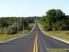
Left - County Road 93 route marker at Crown Hill. Prior to 1997, this route marker indicated Hwy 11 South. After Hwy 11 was downloaded to Simcoe County between
Barrie and Crown Hill, Simcoe County decided to renumber Former Hwy 11 as County Road 93. See an
Enlarged Photo Here. (Photograph taken on August 25, 2011 - © Cameron Bevers) Right - Facing south along Penetanguishene Road (Former Hwy 11) between Barrie and Crown Hill. The highway descends into a steep-sided valley approaching Willow Creek. See an Enlarged Photo Here. (Photograph taken on August 25, 2011 - © Cameron Bevers) 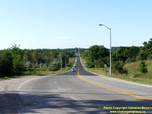

Left - Facing south along Penetanguishene Road (Former Hwy 11) from Crown Hill towards Downtown Barrie. See an
Enlarged Photo Here. (Photograph taken on August 25, 2011 - © Cameron Bevers) Right - Facing north along Penetanguishene Road (Former Hwy 11) approaching the Crown Hill Interchange. Up until 1997, Hwy 11 turned right at this ramp to join the expressway portion of Hwy 11 leading north to Orillia. Penetanguishene Road continues north towards Midland and Penetanguishene as Hwy 93 beyond this interchange. As a result of the 1997-1998 highway downloading, the Crown Hill Interchange now marks the southern terminus of Hwy 11. At one time, Hwy 11 extended south to Toronto. See an Enlarged Photo Here. (Photograph taken on August 25, 2011 - © Cameron Bevers) 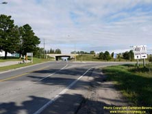
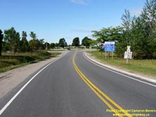
Left - Northbound guide signs on Penetanguishene Road (Former Hwy 11) approaching the Crown Hill Interchange, marking the on-ramps to Hwy 11 North and Hwy 400
South. See an Enlarged Photo Here. (Photograph taken on August 25, 2011 - © Cameron Bevers) Right - Bi-directional freeway ramp at the Hwy 11 & Hwy 93 Interchange at Crown Hill near Barrie. Bi-directional ramps such as this were actually quite common when Hwy 400 was first built, but they are slowly disappearing as interchanges are reconstructed. The Crown Hill Interchange marked the original northern terminus of Hwy 400 before the Coldwater Extension was completed in 1959. See an Enlarged Photo Here. (Photograph taken on August 25, 2011 - © Cameron Bevers) 
Above - Signs marking the former Hwy 11 & Hwy 93 Junction at the Crown Hill Interchange. This is a rare instance where highway downloading actually
improved the route numbering logic. After the province relinquished ownership of Hwy 11 between Barrie and Crown Hill, Simcoe County chose to rename the downloaded
section of Hwy 11 as County Road 93. See an Enlarged Photo Here. (Photograph taken on August 25, 2011 - © Cameron Bevers) 
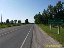
Left - The Crown Hill Interchange ramps on the northbound side of Hwy 11 are in a "Parclo B-2" configuration, with the loop ramp situated on the far side of
the grade separation. The interchange was designed this way in order to avoid disturbing a church in the southeast quadrant of the interchange. See an
Enlarged Photo Here. (Photograph taken on August 25, 2011 - © Cameron Bevers) Right - Distance guide sign on northbound Hwy 93 just north of Hwy 11 at the Crown Hill Interchange. See an Enlarged Photo Here. (Photograph taken on July 17, 2014 - © Cameron Bevers) 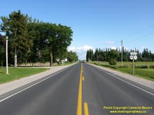

Left - Facing south along Hwy 93 towards the Crown Hill Interchange. Note the junction sign at right, indicating the upcoming highway interchange.
See an Enlarged Photo Here. (Photograph taken on July 17, 2014 - © Cameron Bevers) Right - Junction sign assembly on southbound Hwy 93 approaching the Hwy 11 Interchange at Crown Hill. This recently-installed sign assembly makes use of a full "Junction" sign tab, which has been a relatively uncommon signing practice on provincial highways in recent years. See an Enlarged Photo Here. (Photograph taken on July 17, 2014 - © Cameron Bevers) 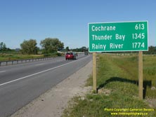
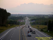
Left - Newly-installed distance guide sign on northbound Hwy 11 near the Crown Hill Interchange, marking the distance to the end of Hwy 11 in Rainy River
along with distances to Cochrane and Thunder Bay. Although it is fairly common to see "end-of-highway" destinations listed on Ontario distance guide signs, this sign
is particularly noteworthy due to the high distances shown on the sign. Hwy 11 is Ontario's second-longest provincial highway, second only to Hwy 17, so the high
distances shown on the sign are entirely attributable to the extreme length of this highway. To the best of my knowledge, this is the highest-mileage distance sign in
Canada, with the furthest destination being almost 1,775 km away. It easily beats out
this sign in Northern British Columbia, showing the distance to Fairbanks, Alaska
(a mere distance of 1,005 km) on the northbound Haines Highway. Personally, I really appreciate this new distance sign on Hwy 11 near Barrie. It serves as a reminder
to Ontario residents of the vast size of this province, and draws some attention to the seldom-explored northern regions of the province. Hopefully, this sign will
prove to be more than just a local curiosity, and encourage passer-bys to consider exploring Ontario's vast north in their future travels. See an
Enlarged Photo Here. (Photograph taken on July 17, 2014 - © Cameron Bevers) Right - An evening view of "Gasoline Alley" on Hwy 11 north of Barrie, facing south from the Oro-Medonte 3rd Line Overpass. This short but busy highway commercial strip lies immediately north of the end of the expressway portion of Hwy 11 at Crown Hill, just before the merge with Hwy 400. See an Enlarged Photo Here. (Photograph taken on August 15, 2015 - © Cameron Bevers) 
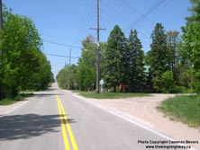
Left - A mid-summer sunset over Hwy 11 at Oro-Medonte 3rd Line, north of Barrie. See an
Enlarged Photo Here. (Photograph taken on August 15, 2015 - © Cameron Bevers) Right - This small corner diversion on a former Hwy 11 alignment south of Orillia was built in the early 1920s. It connected 15th Line to Memorial Avenue. In 1931, a larger curve diversion was built on Memorial Avenue in order to accommodate faster through traffic on Hwy 11. See an Enlarged Photo Here. (Photograph taken on June 3, 2005 - © Cameron Bevers) 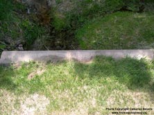
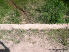
Left - An old culvert on a former Hwy 11 alignment near Orillia - "ONTARIO PROVINCIAL HIGHWAY 1921". See an
Enlarged Photo Here. (Photograph taken on June 3, 2005 - © Cameron Bevers) Right - Culvert inscription on a former alignment of Hwy 11 (Memorial Avenue Diversion) - "THE KING'S HIGHWAY 1931". See an Enlarged Photo Here. (Photograph taken on June 3, 2005 - © Cameron Bevers) 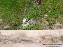
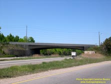
Left - Old 1921-dated culvert on a former Hwy 11 alignment south of Orillia on Memorial Avenue. See an
Enlarged Photo Here. (Photograph taken on June 3, 2005 - © Cameron Bevers) Right - Memorial Avenue Overpass on Hwy 11 south of Orillia. This single-span concrete rigid frame girder structure was completed in 1956. See an Enlarged Photo Here. (Photograph taken on June 3, 2005 - © Cameron Bevers) 
Above - An older King's Highway 11 sign on the Memorial Avenue on-ramp south of Orillia. See an
Enlarged Photo Here. (Photograph taken on June 3, 2005 - © Cameron Bevers) 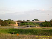
Above - Hwy 12 West Overpass on the Orillia Bypass (Hwy 11). This single-span concrete rigid frame girder structure was completed in 1956. See an
Enlarged Photo Here. (Photograph taken on June 4, 2005 - © Cameron Bevers)
Continue on to King's Highway 11 Photos: Orillia to Gravenhurst
|
|---|
Links to Adjacent King's Highway Photograph Pages:
Back to Hwy 11 - Historical Photos (1990 to 1999)
Hwy 11 Photo Index
On to Hwy 11 - Orillia to Gravenhurst
Back to King's Highway 10 Photos /
King's Highway 11 History /
On to King's Highway 12 Photos
Ontario Highway History - Main Menu / Back to List of Highways Website contents, photos & text © 2002-2025, Cameron
Bevers (Webmaster) - All Rights Reserved / Contact Me |
|---|