
| 
| |
|
|
This page contains present day photos (Year 2000 to date) of Ontario's King's Highway 12, arranged by location from Whitby
northerly to Brooklin. All photographs displayed on this page were taken by the Webmaster (Cameron Bevers), unless specifically noted otherwise. Click on any
thumbnail to see a larger image!
Please note that all photographs displayed on this
website are protected by copyright. These photographs must not be reproduced, published,
electronically stored or copied, distributed, or posted onto other websites without
my written permission. If you want to use photos from this website, please
email me first for permission. Thank-you!
|
|---|
|
Page 4: Present Day King's Highway 12 Photographs (Whitby to Brooklin)


Left - Facing west along Hwy 401 towards Henry Street from the Hwy 12 (Brock Street) Overpass in Whitby in 2005. See an
Enlarged Photo Here. (Photograph taken on May 20, 2005 - © Cameron Bevers) Right - Western side of the Hwy 12 (Brock Street) Overpass on Hwy 401 in Whitby in 2005. See an Enlarged Photo Here. (Photograph taken on May 20, 2005 - © Cameron Bevers) 

Left - Close-up of the Hwy 12 (Brock Street) Overpass on Hwy 401 in Whitby in 2005. This two-span concrete rigid frame structure was originally built during
World War II under Contract #1940-148 as part of the proposed Toronto-Oshawa Dual Highway. The bridge itself was completed in 1941, while the balance of the
interchange was put into full service with paved ramps in 1947. Although it was not officially open yet, the Toronto-Oshawa Highway had been in use by the public on a
gravel surface since 1942, when the completion of the twin bridges across the Rouge River east of Toronto allowed continuous travel between Toronto and Oshawa along
the new highway. See an Enlarged Photo Here. (Photograph taken on May 20, 2005 - © Cameron Bevers) Right - Eastern side of the Hwy 12 (Brock Street) Overpass on Hwy 401 in Whitby in 2005. The old bridge has since been demolished and replaced with a new structure. See an Enlarged Photo Here. (Photograph taken on May 20, 2005 - © Cameron Bevers) 

Left - Facing east along Hwy 401 towards Thickson Road from the Hwy 12 (Brock Street) Overpass in 2005. The section of Hwy 401 between Kingston Road in
Scarborough and Ritson Road in Oshawa is the oldest section of Hwy 401. Known initially as Hwy 2A, this section of Hwy 401 was officially opened to traffic on
December 3, 1947, after 10 years of construction. See an Enlarged Photo Here. (Photograph taken on May 20, 2005 - © Cameron Bevers) Right - Facing south across the Hwy 12 (Brock Street) Overpass on Hwy 401 in Whitby in 2005. See an Enlarged Photo Here. (Photograph taken on May 20, 2005 - © Cameron Bevers) 

Left - Facing north across the Hwy 12 (Brock Street) Overpass on Hwy 401 in 2005. Whitby's Town Centre lies about 1 km to the north of Hwy 401. See an
Enlarged Photo Here. (Photograph taken on May 20, 2005 - © Cameron Bevers) Right - Western side of the Hwy 12 (Brock Street) Overpass on Hwy 401 in Whitby in 2005, as seen from neighbouring Henry Street Overpass. See an Enlarged Photo Here. (Photograph taken on May 20, 2005 - © Cameron Bevers) 

Left - Aerial view of Henry Street and the Hwy 12 (Brock Street) Interchange on Hwy 401 in Whitby in 2004, facing southeast. See an
Enlarged Photo Here. (Photograph taken on May 30, 2004 - © Cameron Bevers) Right - Aerial view of the Hwy 12 (Brock Street) Interchange on Hwy 401 in Whitby in 2004, facing south. See an Enlarged Photo Here. (Photograph taken on May 30, 2004 - © Cameron Bevers) 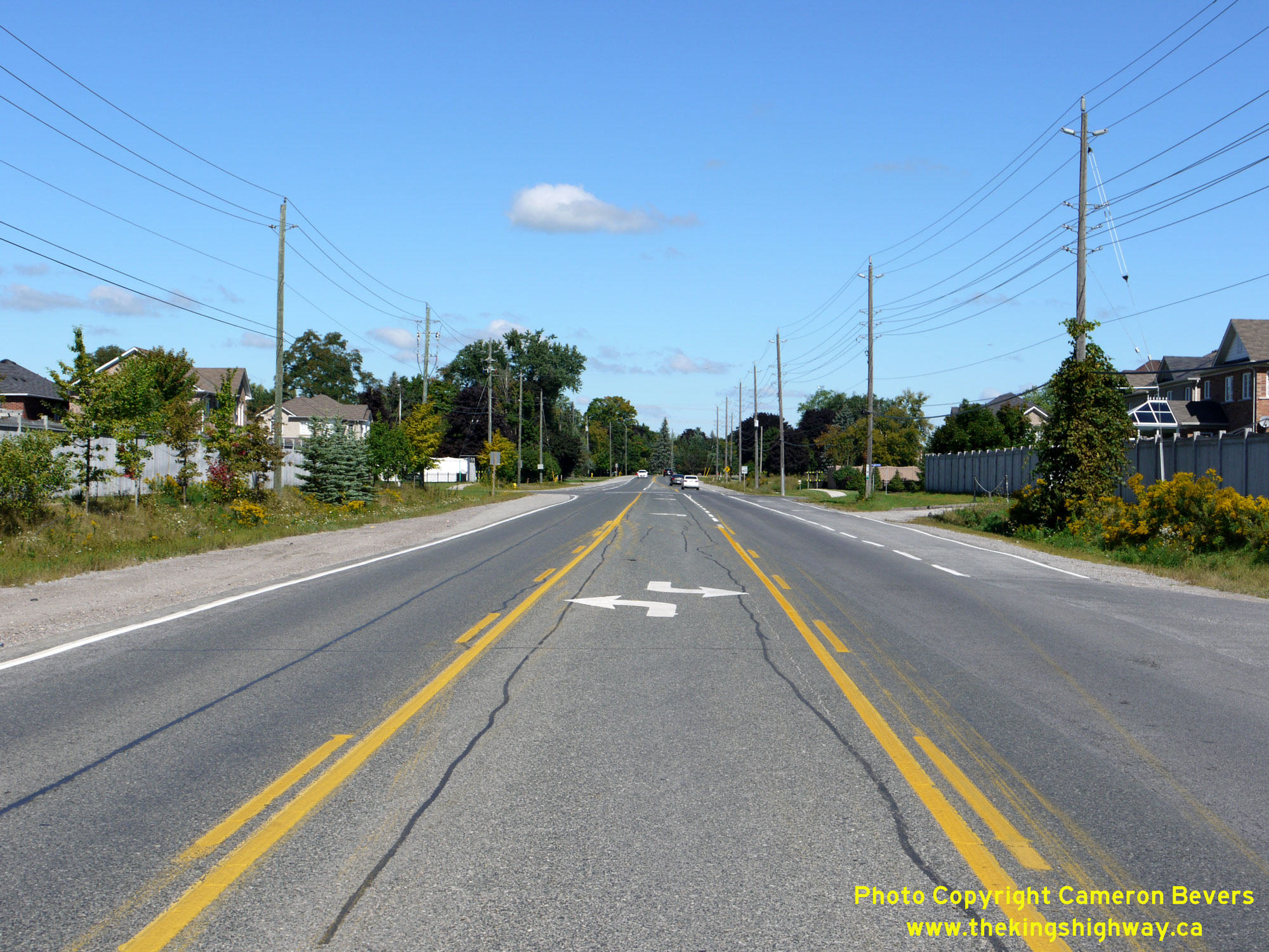
  Left - Facing north along Baldwin Street (Hwy 12) approaching the intersection of Sonley Drive & Sleepy Hollow Place in Whitby. At the time this photo was
taken in 2014, this point marked the northern urban boundary of Whitby. See an Enlarged Photo Here. Left - Facing north along Baldwin Street (Hwy 12) approaching the intersection of Sonley Drive & Sleepy Hollow Place in Whitby. At the time this photo was
taken in 2014, this point marked the northern urban boundary of Whitby. See an Enlarged Photo Here.(Photograph taken on September 7, 2014 - © Cameron Bevers) Right - View of Baldwin Street (Hwy 12), facing south towards the intersection of Sonley Drive & Sleepy Hollow Place in Whitby. Although it is now a
municipal street, the province owned Hwy 12 southerly to the intersection of Rossland Road as recently as the 1990s. With increased urbanization of the Hwy 12
corridor in recent decades, this section of the highway functioned more like a city street and progressively less like an arterial King's Highway. Jurisdiction over
the southern section of Hwy 12 approaching Whitby was ultimately transferred from the province over to the Regional Municipality of Durham in 1997. See an
Enlarged Photo Here.(Photograph taken on September 7, 2014 - © Cameron Bevers) 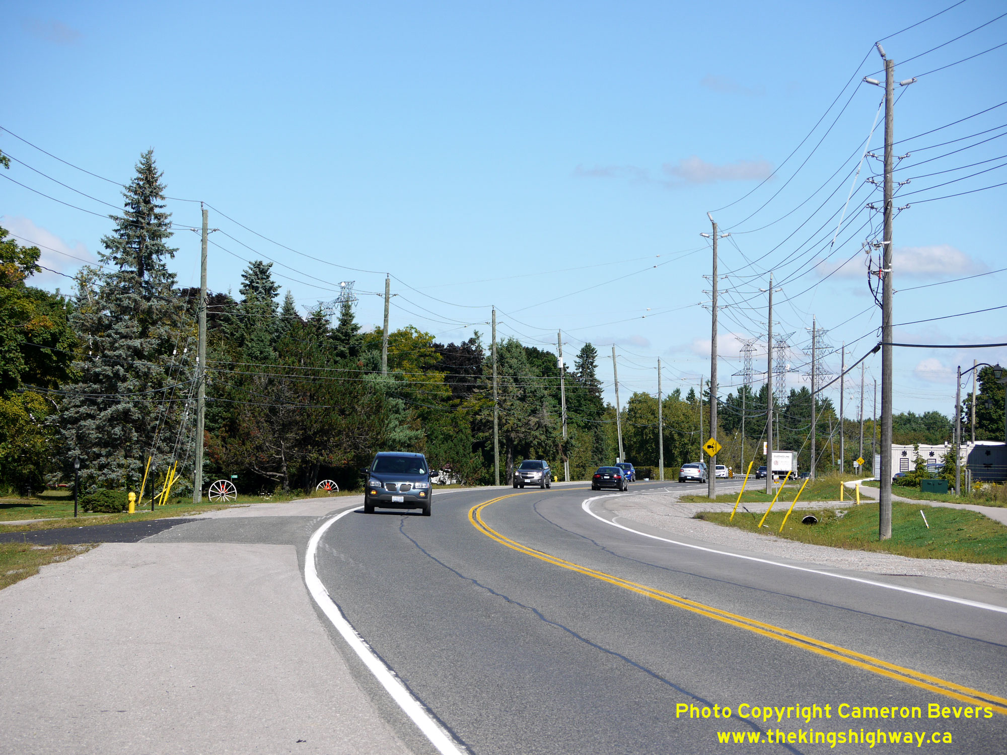
 Left - Departing from Whitby's urban area on Baldwin Street (Hwy 12), facing north towards Brooklin. The road between Whitby and Brooklin was added to
Ontario's growing system of Provincial Highways in the early 1920s. The province assumed jurisdiction and control over the Whitby-Brooklin Road on January 14, 1922.
The highway was assigned the Hwy 12 designation when route numbers were first introduced along Ontario's Provincial Highways in 1925. See an
Enlarged Photo Here. Left - Departing from Whitby's urban area on Baldwin Street (Hwy 12), facing north towards Brooklin. The road between Whitby and Brooklin was added to
Ontario's growing system of Provincial Highways in the early 1920s. The province assumed jurisdiction and control over the Whitby-Brooklin Road on January 14, 1922.
The highway was assigned the Hwy 12 designation when route numbers were first introduced along Ontario's Provincial Highways in 1925. See an
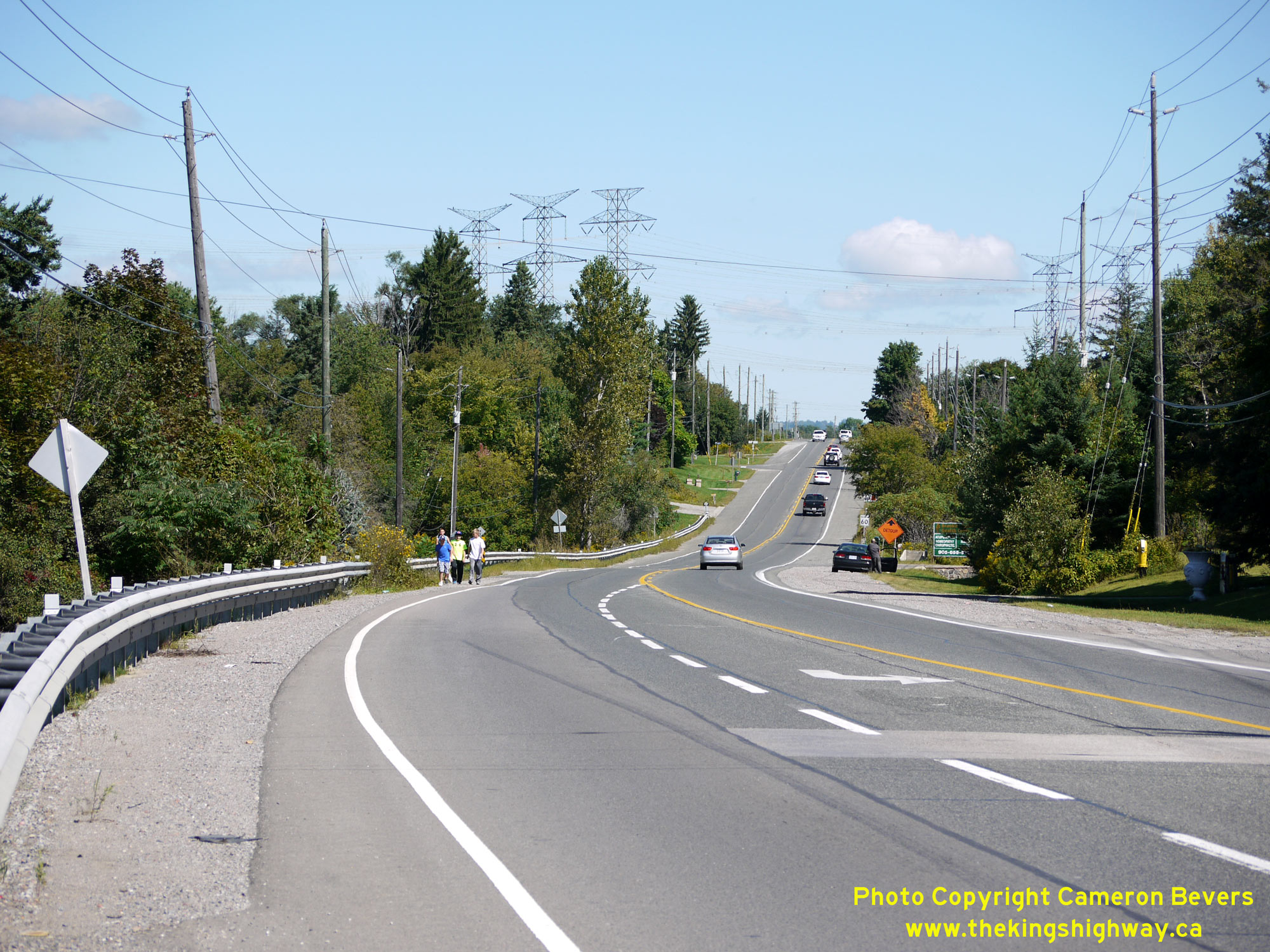
Enlarged Photo Here.(Photograph taken on September 7, 2014 - © Cameron Bevers) Right - Facing north along Baldwin Street (Hwy 12) towards Lynde Creek. At one time, there was a bridge which carried Hwy 12 over Lynde Creek. This bridge was
originally constructed in 1929, under Contract #1929-37. This bridge was subsequently widened in 1958 during a highway improvement project carried out under Contract
#1957-267. The bridge was demolished and replaced with a large concrete box culvert in the early 1990s under Contract #1992-22. This location was also the site
of a historical at-grade railway crossing, where Hwy 12 crossed over a Canadian National Railway line which ran just to the south of Lynde Creek. The railway line was
abandoned and removed many years ago. See an Enlarged Photo Here.(Photograph taken on September 7, 2014 - © Cameron Bevers) 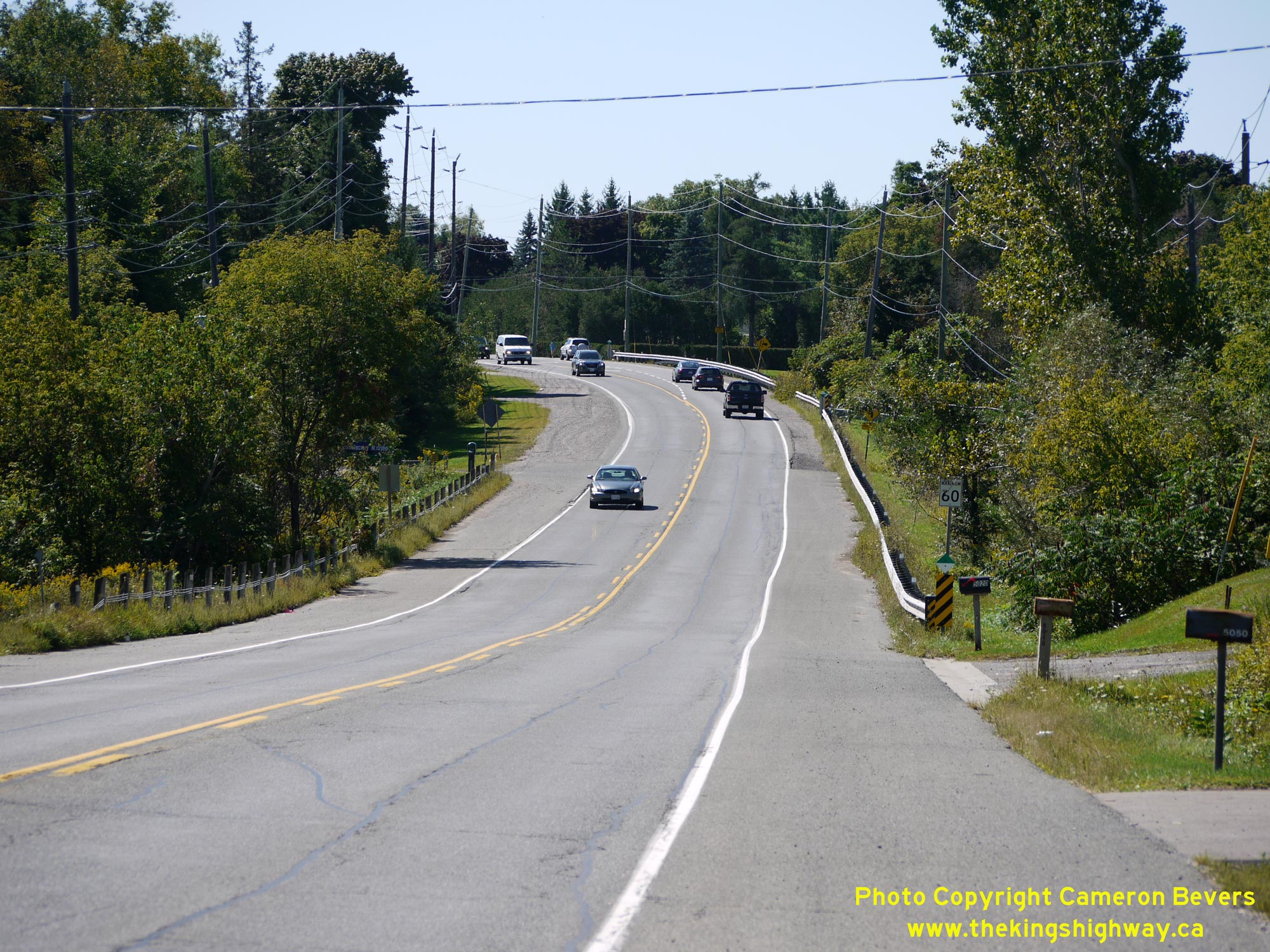
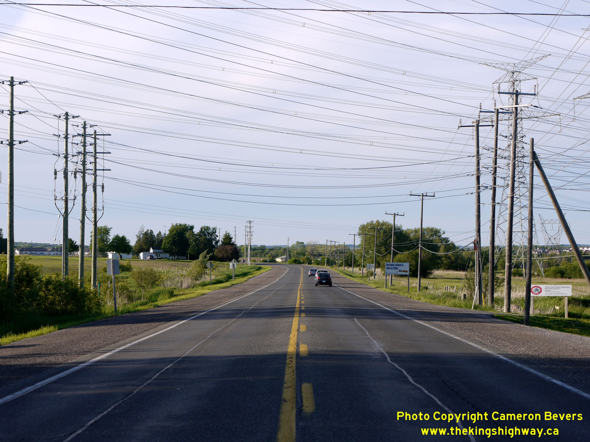
 Left - Facing south along Baldwin Street (Hwy 12) towards Lynde Creek. Whitby's Town Centre lies about 6 km ahead. See an
Enlarged Photo Here. Left - Facing south along Baldwin Street (Hwy 12) towards Lynde Creek. Whitby's Town Centre lies about 6 km ahead. See an
Enlarged Photo Here.(Photograph taken on September 7, 2014 - © Cameron Bevers) Right - Approaching the current southern terminus of Hwy 12 in Whitby, facing south from the hydro transmission corridor. See an
Enlarged Photo Here.(Photograph taken on June 4, 2013 - © Cameron Bevers) 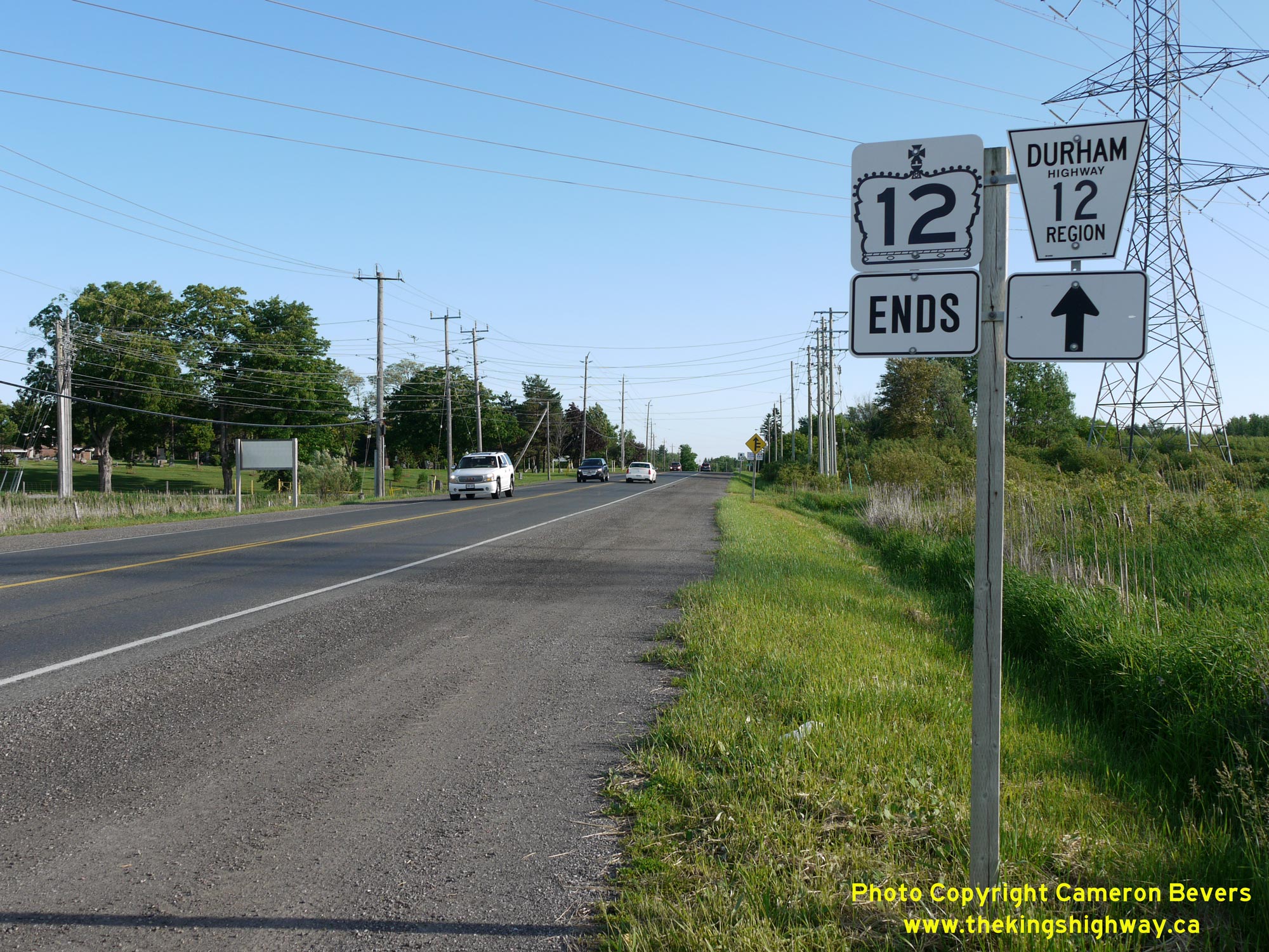
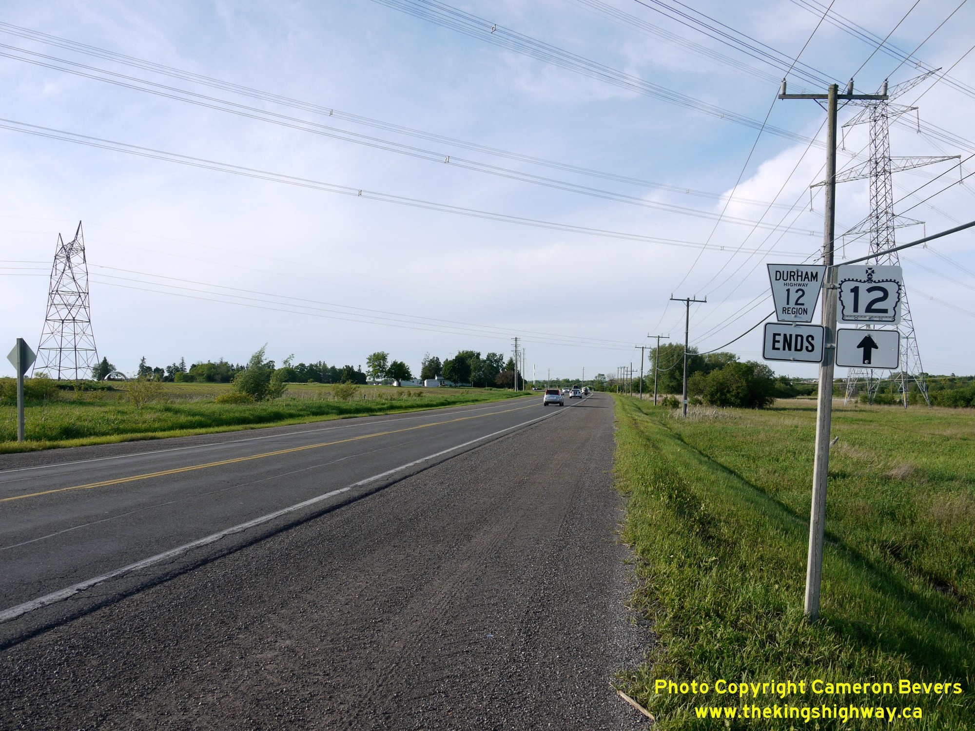
 Left - Route marker assembly indicating the end of Hwy 12 in Whitby. From this point southerly, Hwy 12 is a municipal road (Durham Regional Highway 12).
Roughly 5 km of Hwy 12's route between this point and the intersection of Rossland Road was transferred or "downloaded" to the Regional Municipality of Durham,
effective March 31, 1997. See an Enlarged Photo Here. Left - Route marker assembly indicating the end of Hwy 12 in Whitby. From this point southerly, Hwy 12 is a municipal road (Durham Regional Highway 12).
Roughly 5 km of Hwy 12's route between this point and the intersection of Rossland Road was transferred or "downloaded" to the Regional Municipality of Durham,
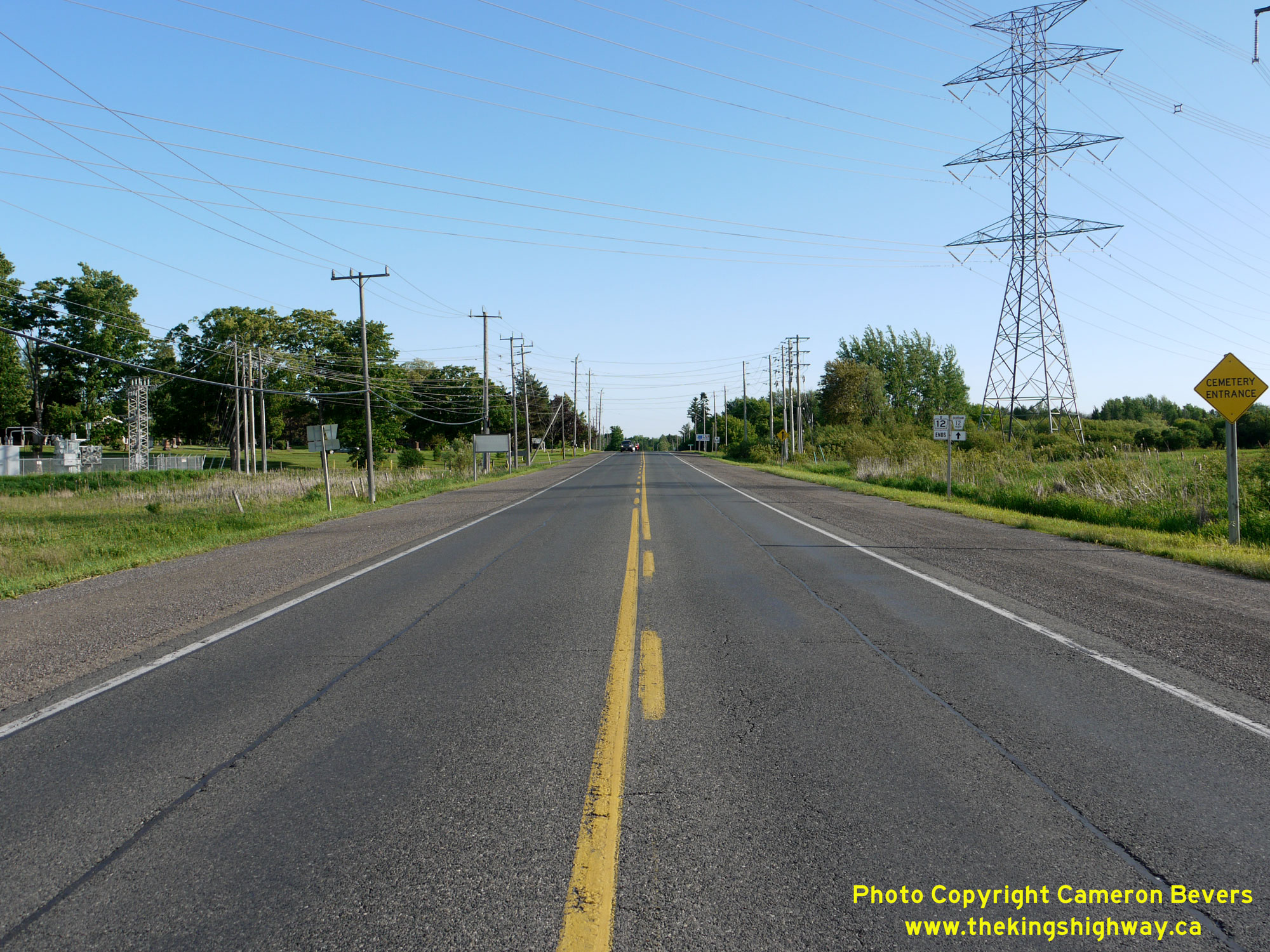
effective March 31, 1997. See an Enlarged Photo Here.(Photograph taken on June 4, 2013 - © Cameron Bevers) Right - Facing north along Hwy 12 at the hydro transmission corridor, located about 2 km south of Brooklin. When Hwy 12 was first established as a Provincial
Highway in 1922, it was initially an unpaved highway. A concrete pavement was constructed under contract for the Department of Public Highways of Ontario (DPHO)
during the Summer of 1925 from Whitby northerly for 2 1/2 miles under DPHO Contract #1203. The following year, concrete was laid along Hwy 12 for an additional 3
miles from the southern entrance to Brooklin southerly towards Whitby under DPHO Contract #1276. Upon completion of this second paving contract in 1926, motorists
could travel on a continuously paved highway route between Whitby and Brooklin. See an
Enlarged Photo Here.(Photograph taken on June 4, 2013 - © Cameron Bevers) 
 Left - Facing north along Hwy 12 at the highway's current southern terminus south of Brooklin. This point was chosen for the start of provincial ownership over
Hwy 12, as it was anticipated in the 1990s that this would be the approximate tie-in point for a future east-west freeway corridor (Hwy 407). As it happens, Hwy 407
was ultimately built a short distance north of this point. See an Enlarged Photo Here. Left - Facing north along Hwy 12 at the highway's current southern terminus south of Brooklin. This point was chosen for the start of provincial ownership over
Hwy 12, as it was anticipated in the 1990s that this would be the approximate tie-in point for a future east-west freeway corridor (Hwy 407). As it happens, Hwy 407
was ultimately built a short distance north of this point. See an Enlarged Photo Here.(Photograph taken on June 4, 2013 - © Cameron Bevers) Right - Route marker assembly indicating the end of Durham Regional Highway 12 and the start of King's Highway 12 south of Brooklin. See an
Enlarged Photo Here.(Photograph taken on June 4, 2013 - © Cameron Bevers) 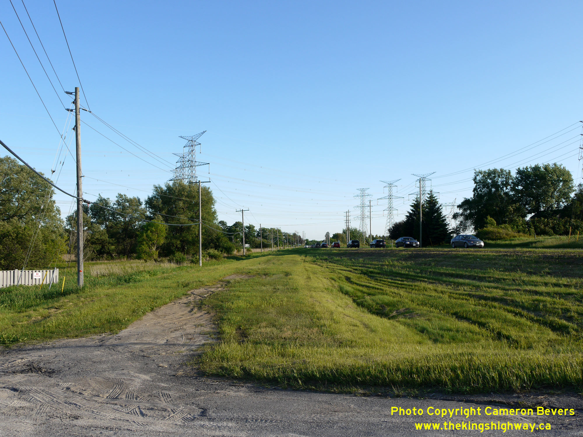
 Left - An abandoned highway curve lies just to the east of Hwy 12 about 1 km south of Brooklin. The original highway was constructed in 1922. This old curve
was abandoned during the 1950s, when it was bypassed by an improved highway alignment with a more gradual horizontal curve. See an
Enlarged Photo Here. Left - An abandoned highway curve lies just to the east of Hwy 12 about 1 km south of Brooklin. The original highway was constructed in 1922. This old curve
was abandoned during the 1950s, when it was bypassed by an improved highway alignment with a more gradual horizontal curve. See an
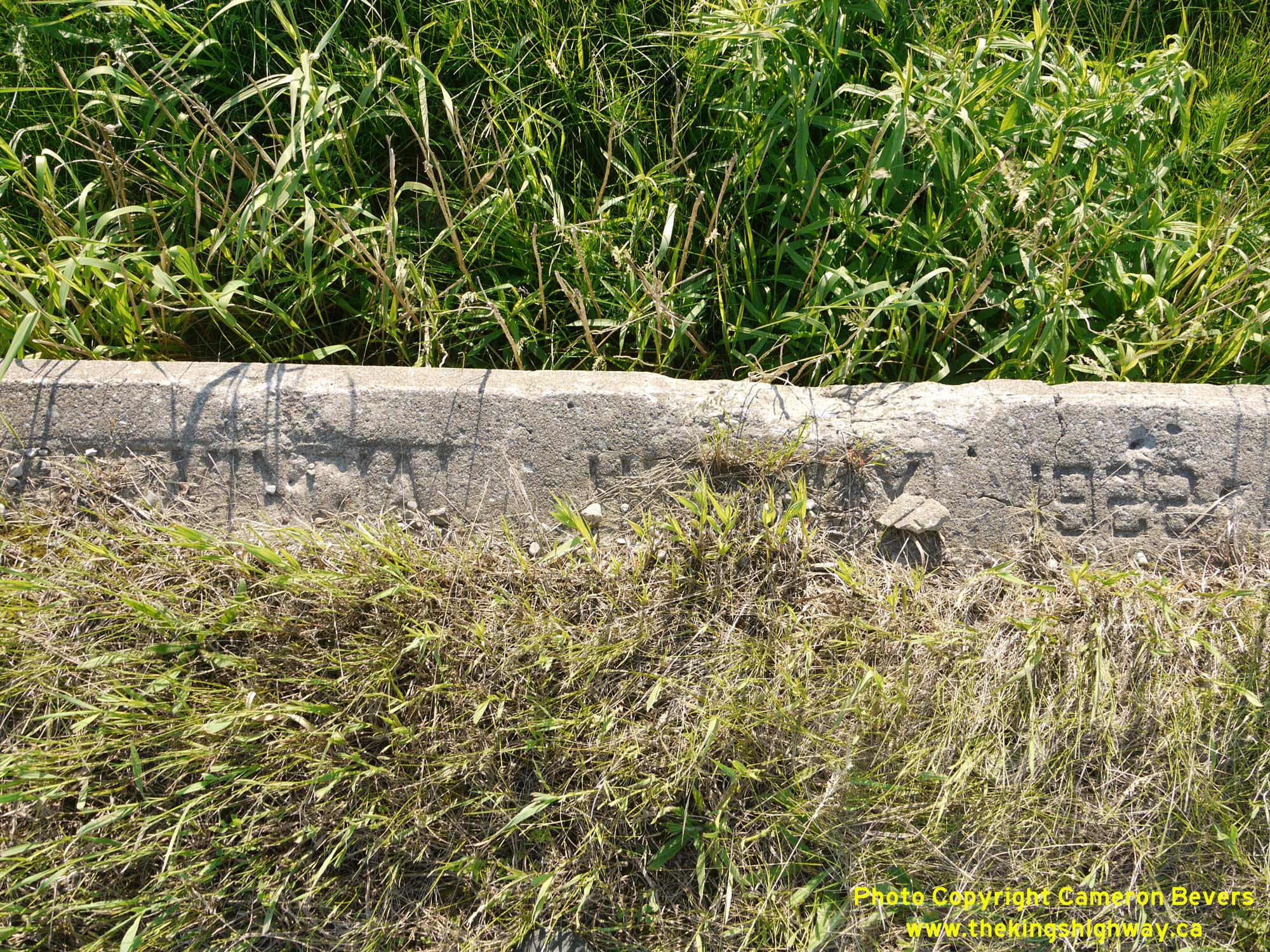
Enlarged Photo Here.(Photograph taken on June 4, 2013 - © Cameron Bevers) Right - Inscription on an old concrete culvert on an abandoned alignment of Hwy 12 south of Brooklin - "ONTARIO PROVINCIAL HIGHWAY - 1922". See an
Enlarged Photo Here.(Photograph taken on June 4, 2013 - © Cameron Bevers) 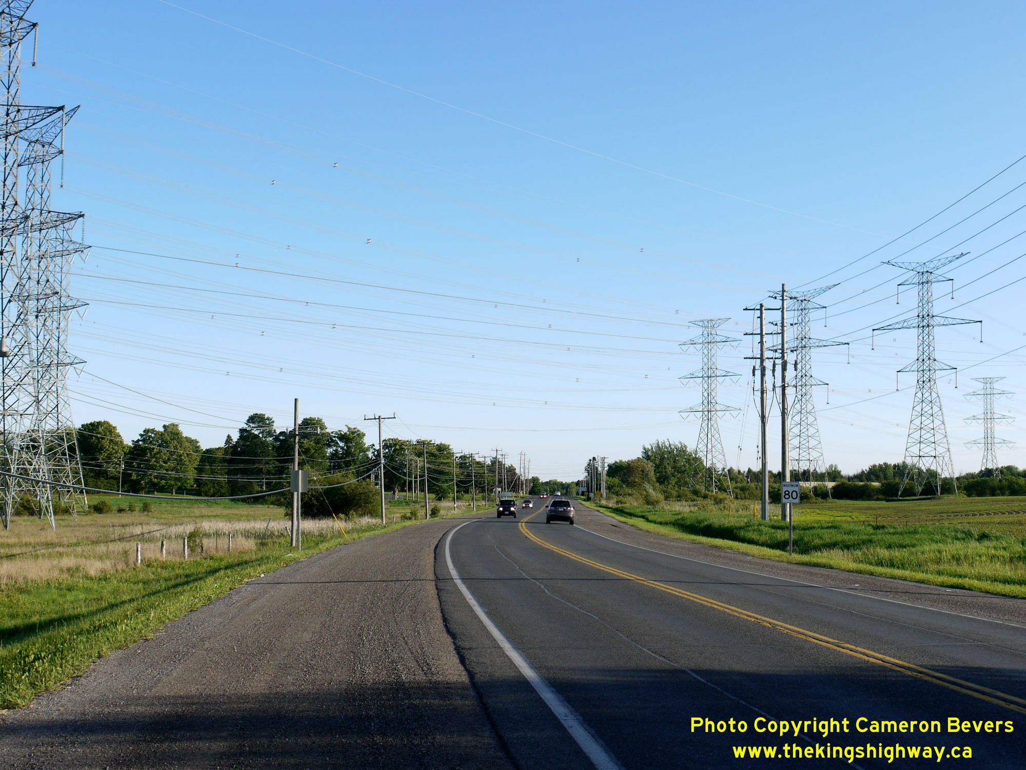
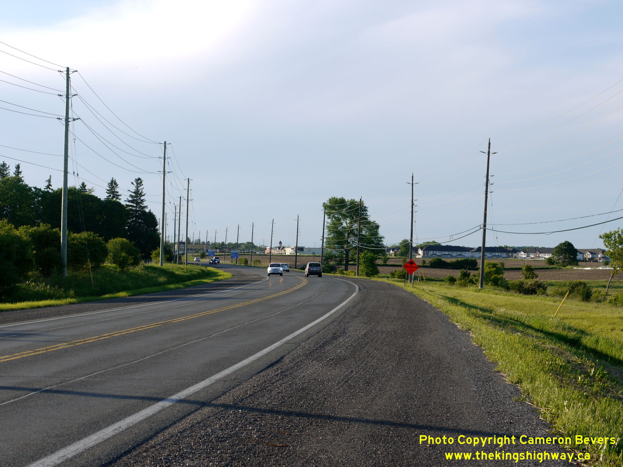 Left - This revised highway curve on Hwy 12 south of Brooklin was constructed in the 1950s, in order to bypass a sharp curve on the original highway's route. See an
Enlarged Photo Here. Left - This revised highway curve on Hwy 12 south of Brooklin was constructed in the 1950s, in order to bypass a sharp curve on the original highway's route. See an
Enlarged Photo Here.(Photograph taken on June 4, 2013 - © Cameron Bevers) Right - Facing north along Hwy 12 at the curve revision, located about 1 km south of Brooklin. This 2013 photo shows the southern approach to Brooklin prior
to the construction of Hwy 407 through this area. The Hwy 12 and Hwy 407 Interchange was completed in 2016. See an
Enlarged Photo Here.(Photograph taken on June 4, 2013 - © Cameron Bevers) 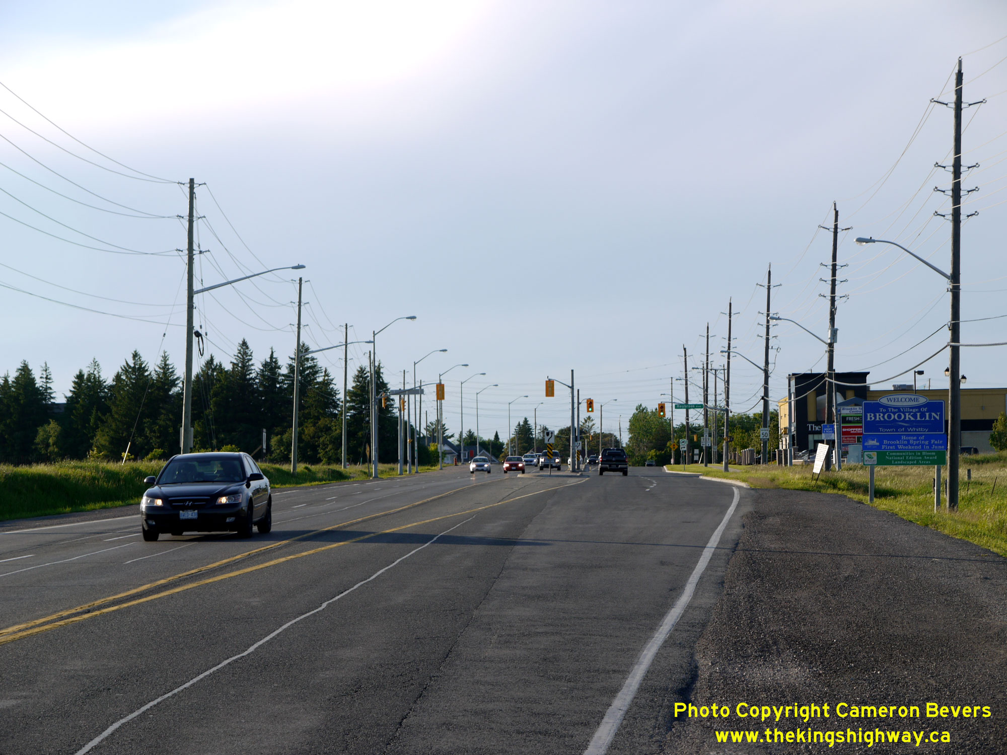
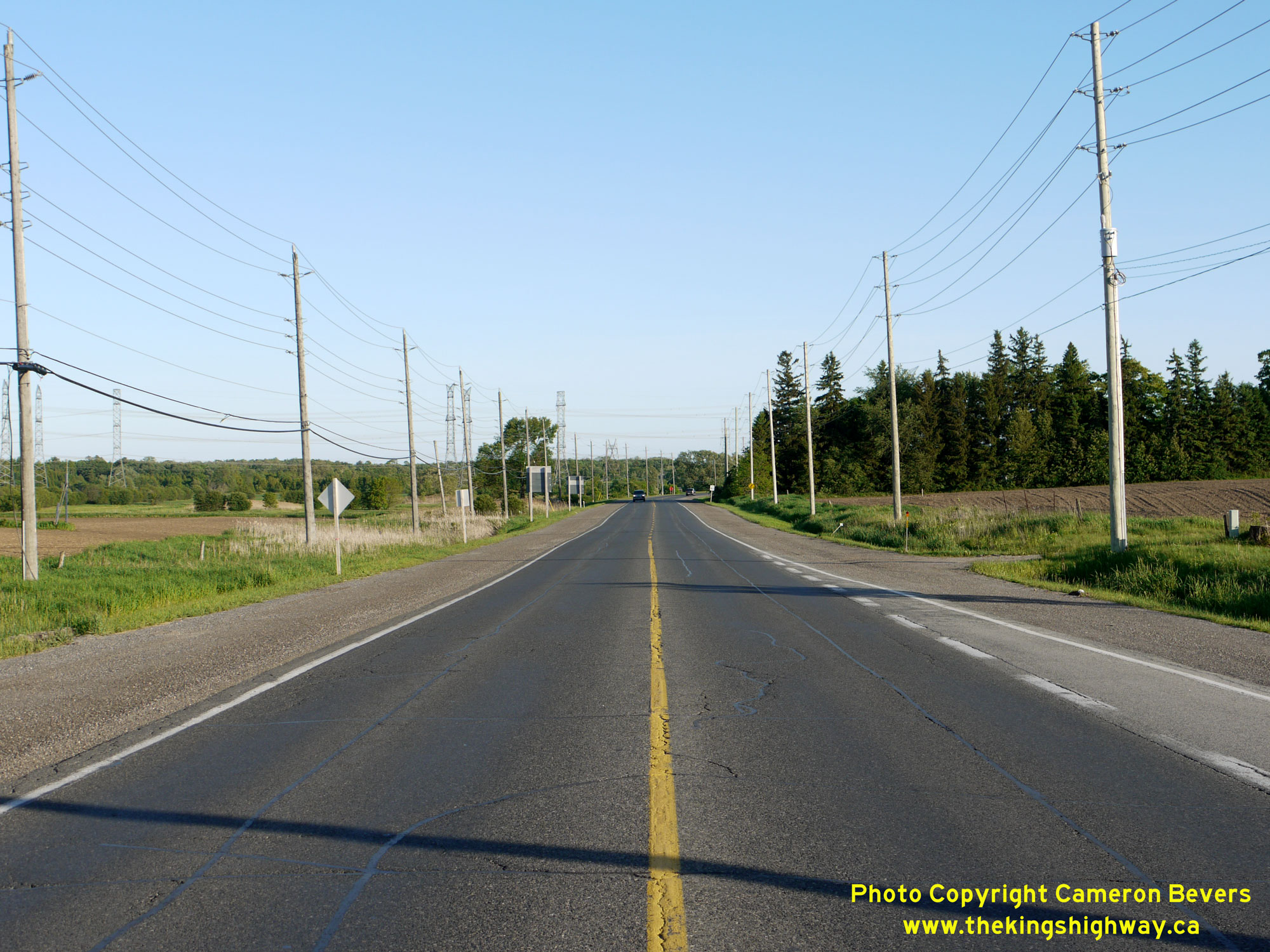 Left - Approaching Brooklin on Hwy 12 in 2013, facing north towards the Hwy 7 Junction. Brooklin is an unincorporated village which is now part of the Town of
Whitby. At Brooklin, Hwy 7 joins in from Markham and an overlapped, concurrent route of Hwy 7 & Hwy 12 begins. See an
Enlarged Photo Here. Left - Approaching Brooklin on Hwy 12 in 2013, facing north towards the Hwy 7 Junction. Brooklin is an unincorporated village which is now part of the Town of
Whitby. At Brooklin, Hwy 7 joins in from Markham and an overlapped, concurrent route of Hwy 7 & Hwy 12 begins. See an
Enlarged Photo Here.(Photograph taken on June 4, 2013 - © Cameron Bevers) Right - Facing south along Hwy 12 from the southern entrance to Brooklin in 2013, prior to the construction of the Hwy 407 Interchange. See an
Enlarged Photo Here.(Photograph taken on June 4, 2013 - © Cameron Bevers) 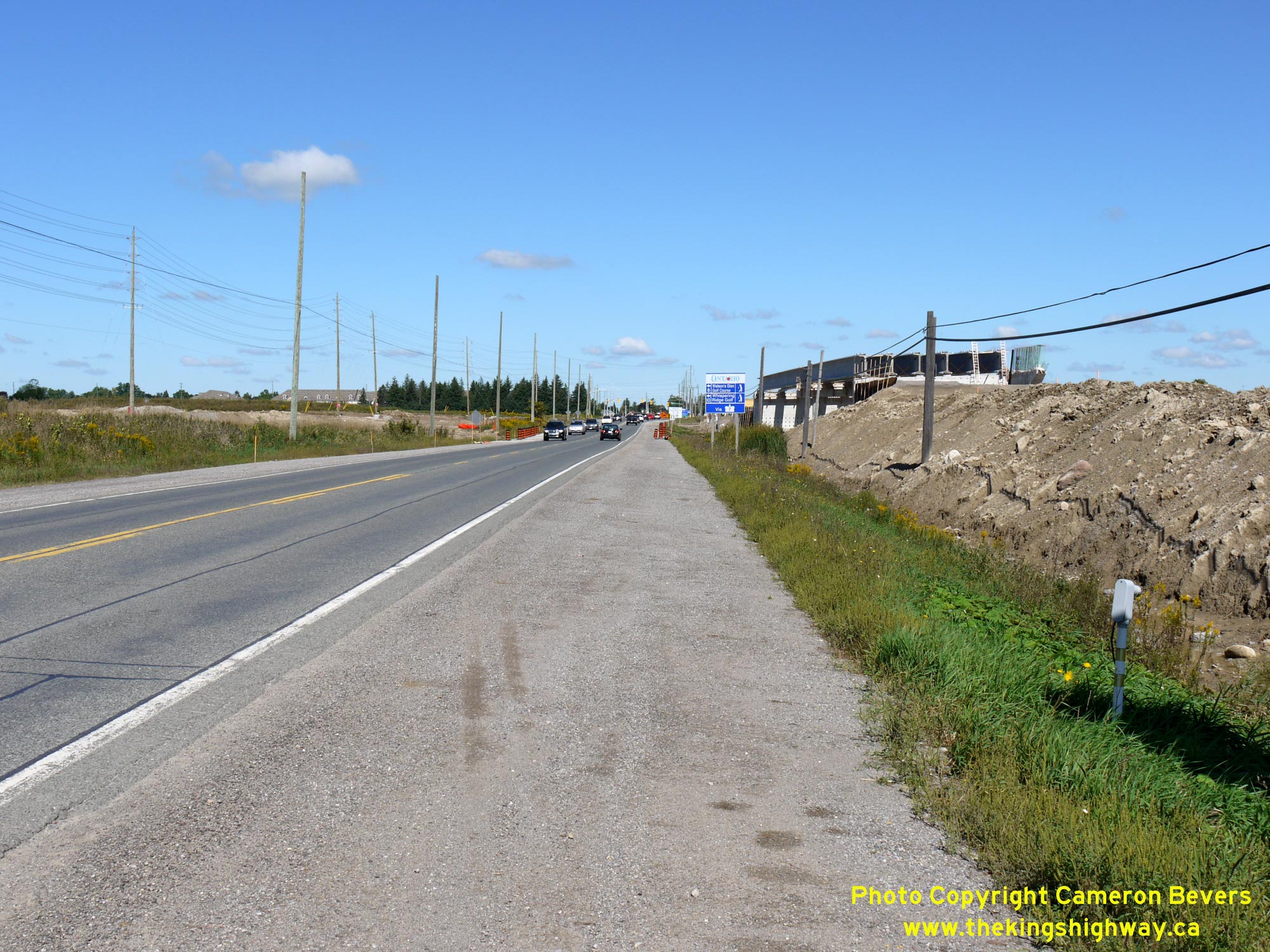
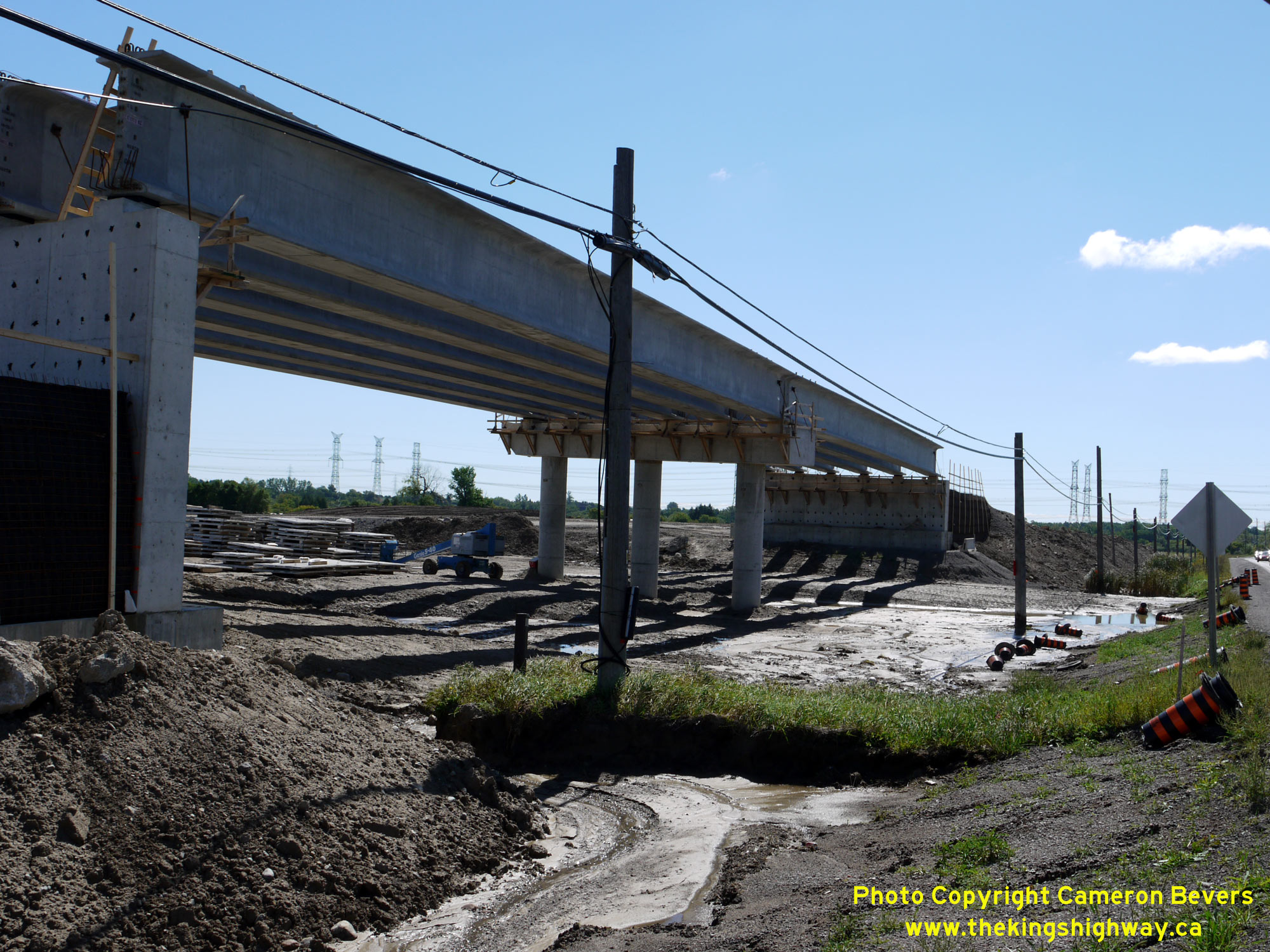 Left - Facing north along Hwy 12 towards Brooklin during the construction of Hwy 407 in 2014, showing the new overpass under construction at right. In order to
stage traffic during the interchange's construction, the eastern half of the Hwy 12 Overpass was built first, just off the existing highway's centreline. That way,
all Hwy 12 traffic could continue to use the existing highway for a good portion of the construction project. Upon completion of the eastern half of the structure,
Hwy 12 traffic was shifted onto the new bridge. The existing highway was then removed to allow the construction of the western half of the bridge. See an
Enlarged Photo Here. Left - Facing north along Hwy 12 towards Brooklin during the construction of Hwy 407 in 2014, showing the new overpass under construction at right. In order to
stage traffic during the interchange's construction, the eastern half of the Hwy 12 Overpass was built first, just off the existing highway's centreline. That way,
all Hwy 12 traffic could continue to use the existing highway for a good portion of the construction project. Upon completion of the eastern half of the structure,
Hwy 12 traffic was shifted onto the new bridge. The existing highway was then removed to allow the construction of the western half of the bridge. See an
Enlarged Photo Here.(Photograph taken on September 7, 2014 - © Cameron Bevers) Right - Western side of the new Hwy 12 Overpass on Hwy 407 near Brooklin in 2014. See an
Enlarged Photo Here.(Photograph taken on September 7, 2014 - © Cameron Bevers) 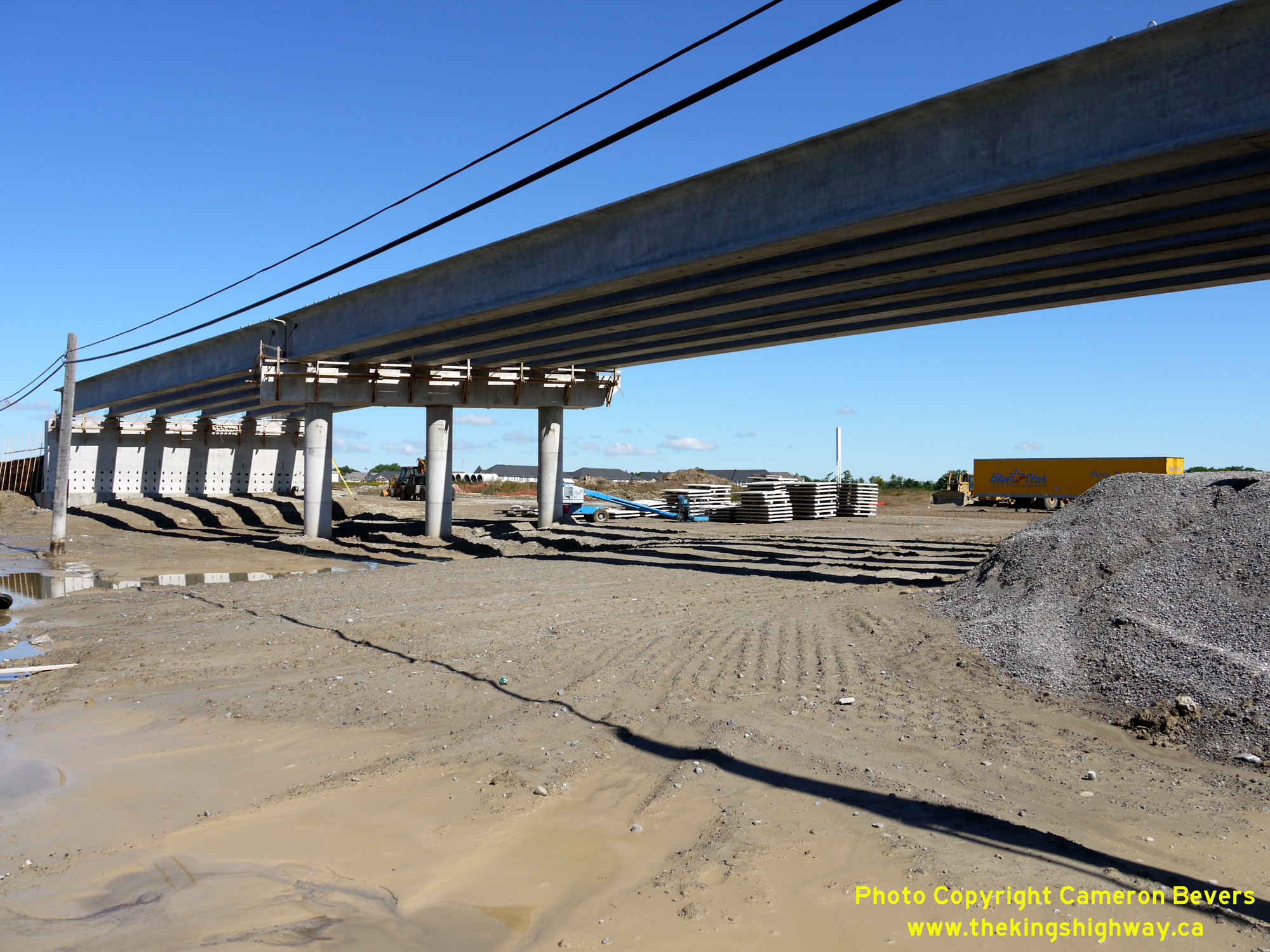
 Left - New Hwy 12 Overpass under construction on Hwy 407 south of Brooklin in 2014. See an
Enlarged Photo Here. Left - New Hwy 12 Overpass under construction on Hwy 407 south of Brooklin in 2014. See an
Enlarged Photo Here.(Photograph taken on September 7, 2014 - © Cameron Bevers) Right - Grading equipment positioned at the Hwy 12 Interchange, during construction of Hwy 407 in 2014. The dual bridges over Lynde Creek can be seen under
construction on Hwy 407 in the distance, along with the proposed overpass for Anderson Street which lies just beyond Lynde Creek. See an
Enlarged Photo Here.(Photograph taken on September 7, 2014 - © Cameron Bevers) 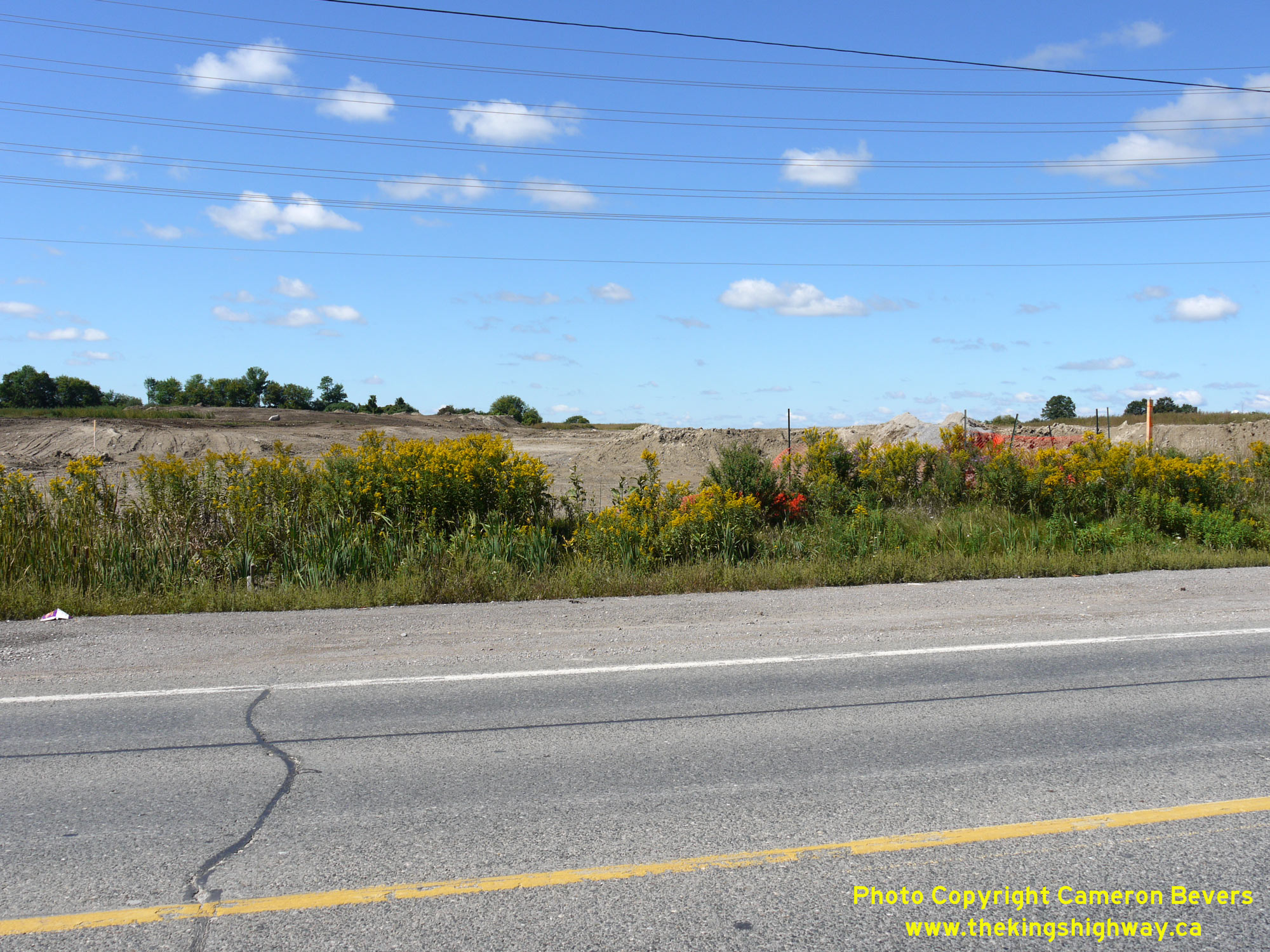
 Left - Facing west towards Markham along the proposed route of Hwy 407 at the Hwy 12 Interchange near Brooklin in 2014. See an
Enlarged Photo Here. Left - Facing west towards Markham along the proposed route of Hwy 407 at the Hwy 12 Interchange near Brooklin in 2014. See an
Enlarged Photo Here.(Photograph taken on September 7, 2014 - © Cameron Bevers) Right - View of the partially-completed Hwy 12 Overpass on Hwy 407 near Brooklin, facing north. At the time this photo was taken in 2015, traffic was using the
eastern half of the new overpass. The western half of the structure was still being built. Upon completion of the western half of the bridge, all southbound Hwy 12
traffic was shifted onto the western structure, while the eastern structure was converted to carry northbound Hwy 12 traffic only. See an
Enlarged Photo Here.(Photograph taken on July 7, 2015 - © Cameron Bevers) 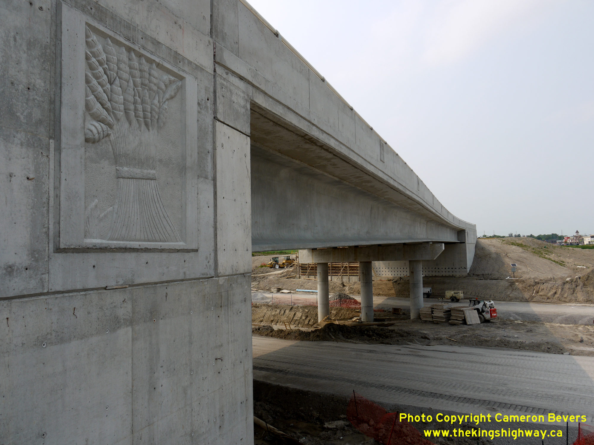
 Left - Close-up of the decorative emblem on the Hwy 12 Overpass on Hwy 407. Several provincial highway bridges built in recent decades have decorative emblems
on them, often highlighting environmental or wildlife themes - or in this case, agricultural produce. See an
Enlarged Photo Here. Left - Close-up of the decorative emblem on the Hwy 12 Overpass on Hwy 407. Several provincial highway bridges built in recent decades have decorative emblems
on them, often highlighting environmental or wildlife themes - or in this case, agricultural produce. See an
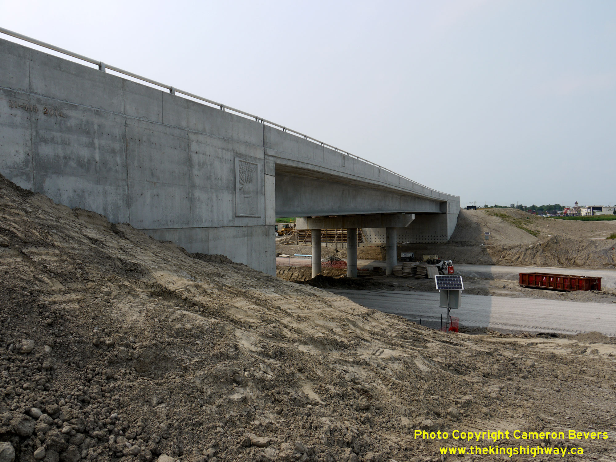
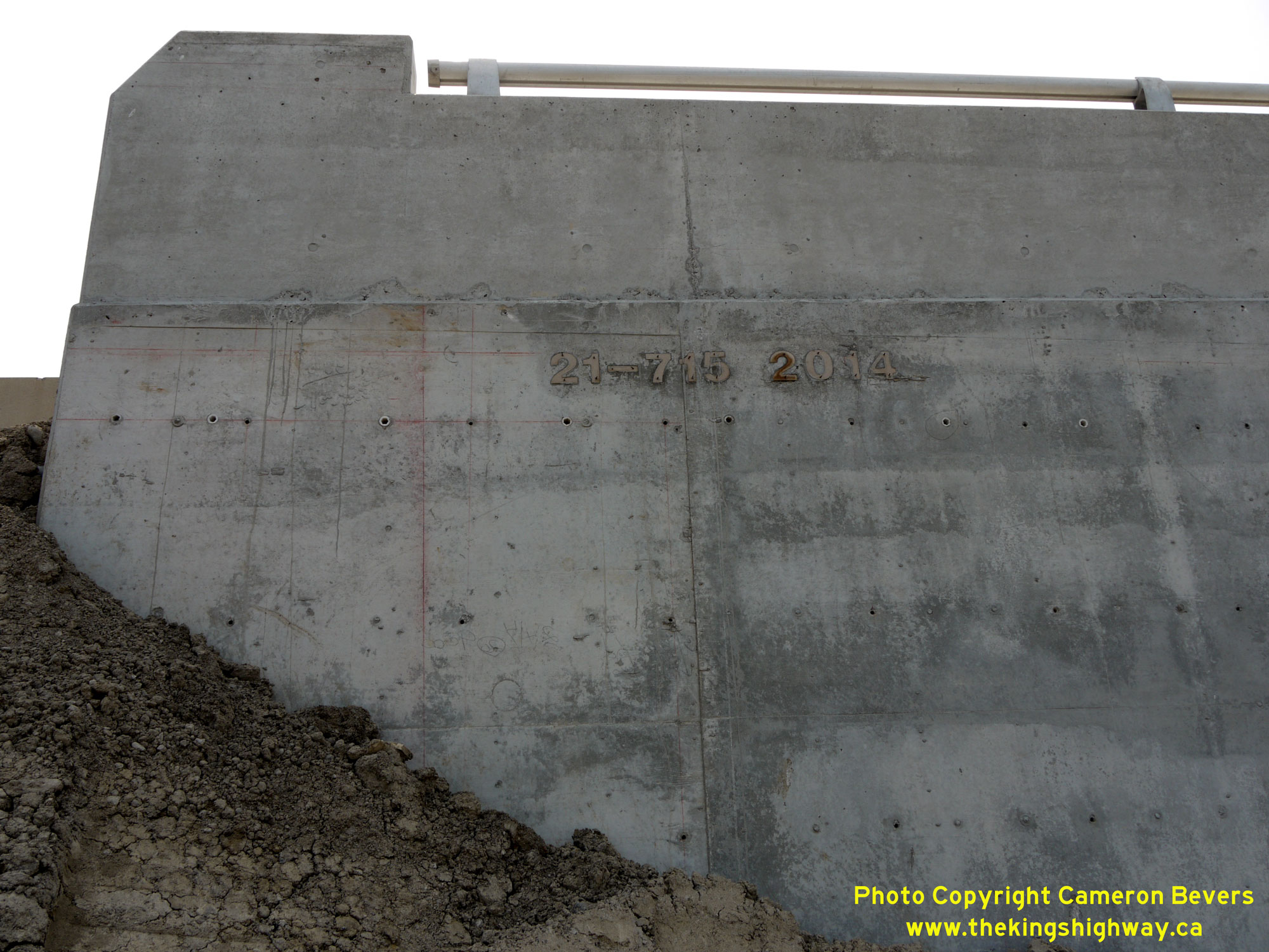
Enlarged Photo Here.(Photograph taken on July 7, 2015 - © Cameron Bevers) Right - Date stamp (2014) and structure identification number (Site #21-715) on the Hwy 12 Overpass on Hwy 407 near Brooklin. See an
Enlarged Photo Here.(Photograph taken on July 7, 2015 - © Cameron Bevers) 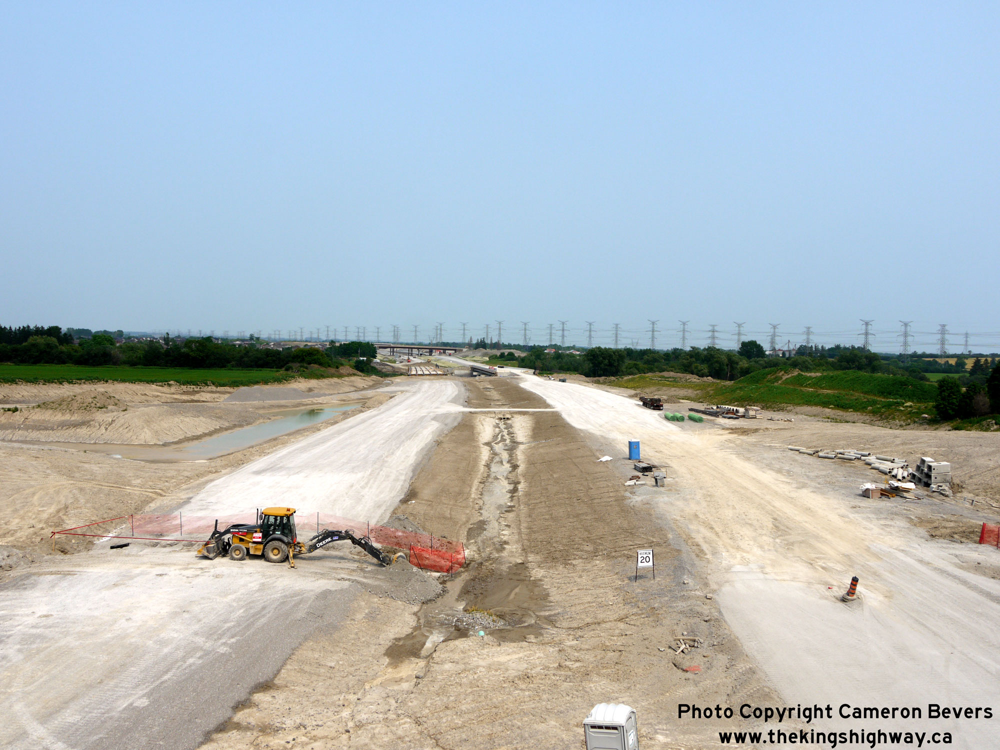
 Left - Facing east along Hwy 407 from the Hwy 12 Overpass in 2015, showing the completed grading works and placement of granular base. See an
Enlarged Photo Here. Left - Facing east along Hwy 407 from the Hwy 12 Overpass in 2015, showing the completed grading works and placement of granular base. See an
Enlarged Photo Here.(Photograph taken on July 7, 2015 - © Cameron Bevers) Right - View of Hwy 407 facing east from the Hwy 12 Overpass in 2016, one day prior to the highway's official opening. See an
Enlarged Photo Here.(Photograph taken on June 19, 2016 - © Cameron Bevers) 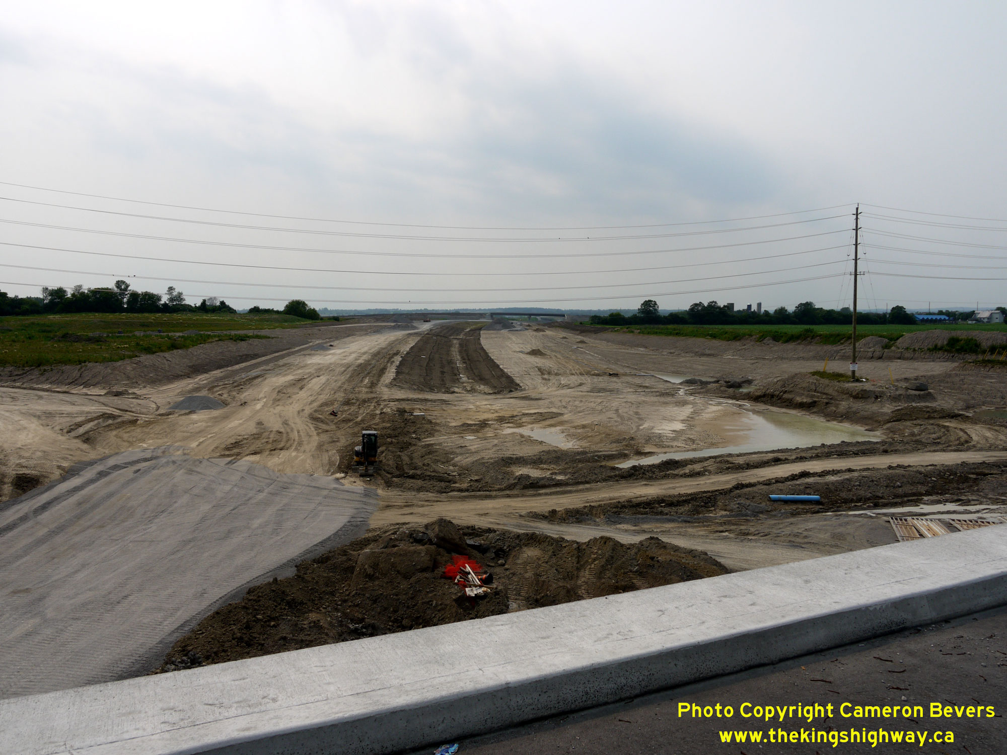
 Left - Facing west along Hwy 407 towards Markham from the Hwy 12 Overpass in 2015, showing the mainline freeway grading works nearing completion. Granular base
had been placed on the eastbound carriageway to a point just west of the Hwy 12 Overpass at the time this photo was taken. See an
Enlarged Photo Here. Left - Facing west along Hwy 407 towards Markham from the Hwy 12 Overpass in 2015, showing the mainline freeway grading works nearing completion. Granular base
had been placed on the eastbound carriageway to a point just west of the Hwy 12 Overpass at the time this photo was taken. See an
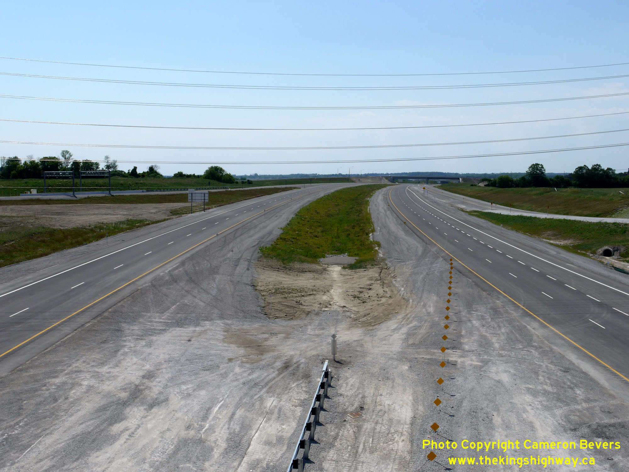
Enlarged Photo Here.(Photograph taken on July 7, 2015 - © Cameron Bevers) Right - View of Hwy 407 facing west towards Markham from the Hwy 12 Overpass in 2016, one day prior to the highway's official opening. See an
Enlarged Photo Here.(Photograph taken on June 19, 2016 - © Cameron Bevers) 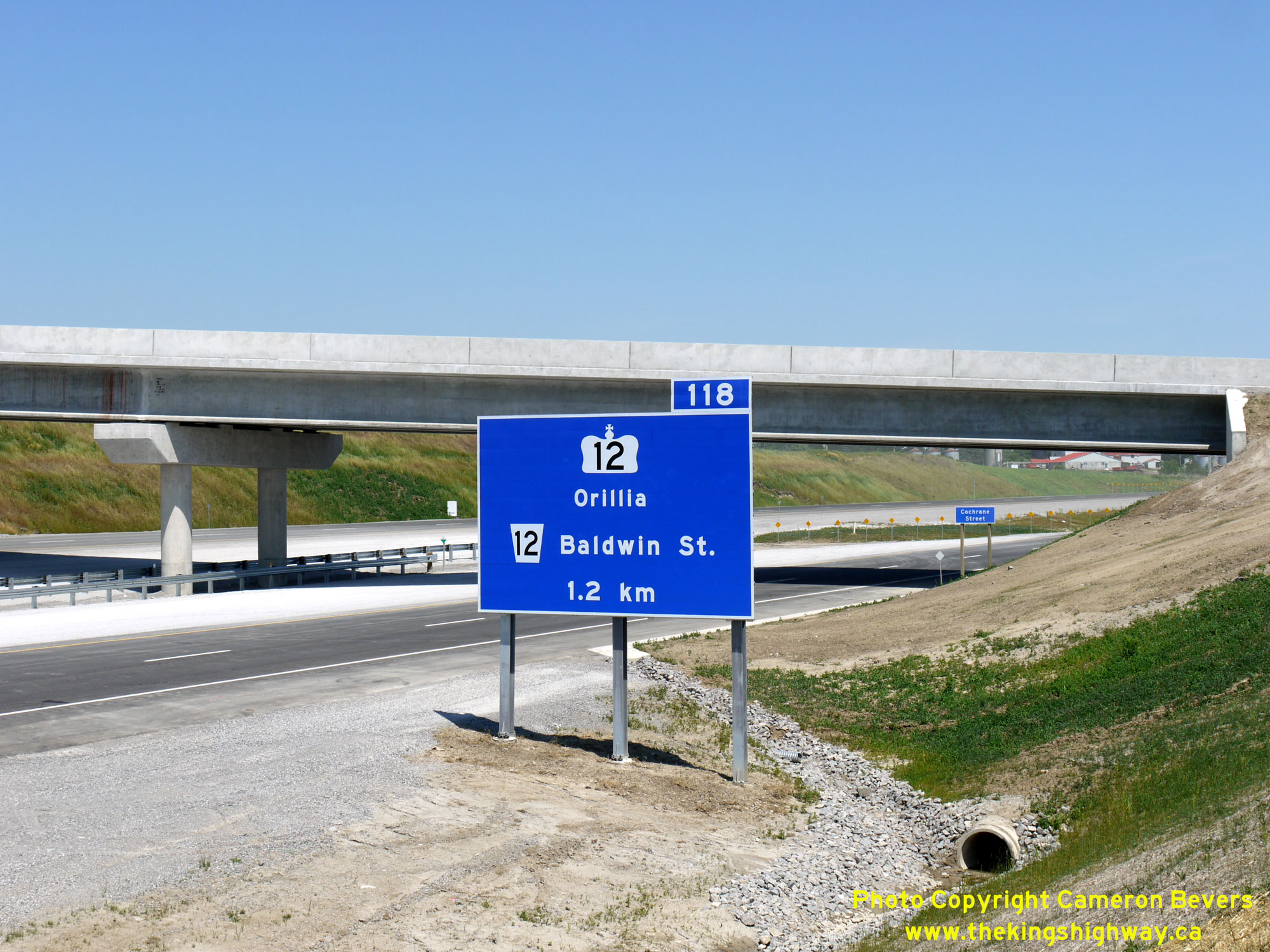
 Left - Advance freeway exit guide sign on eastbound Hwy 407 approaching the Hwy 12 Interchange. See an
Enlarged Photo Here. Left - Advance freeway exit guide sign on eastbound Hwy 407 approaching the Hwy 12 Interchange. See an
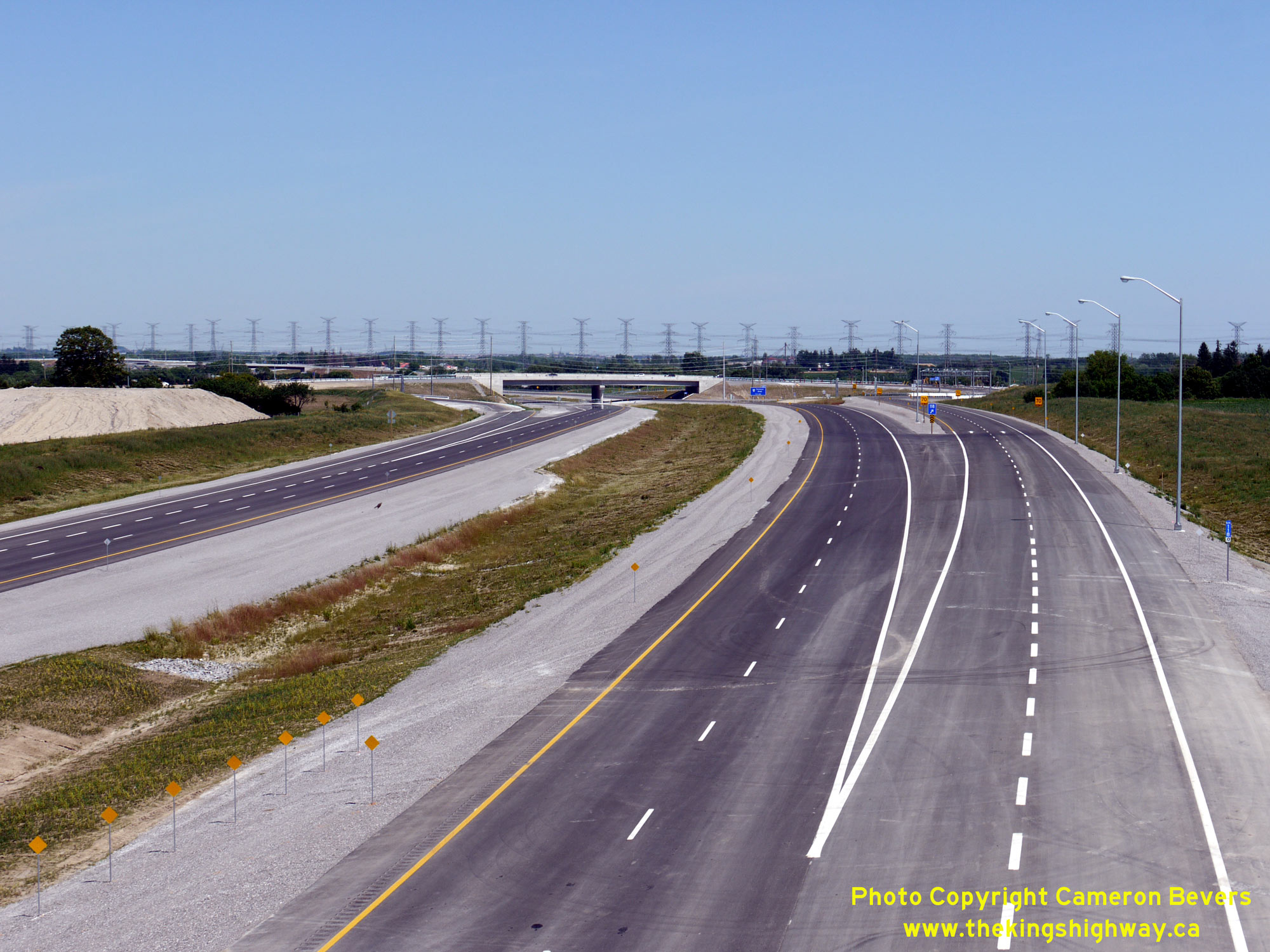
Enlarged Photo Here.(Photograph taken on June 19, 2016 - © Cameron Bevers) Right - View of the completed Hwy 12 Interchange on Hwy 407, facing east from the Ashburn Road Overpass near Brooklin. See an
Enlarged Photo Here.(Photograph taken on June 19, 2016 - © Cameron Bevers) 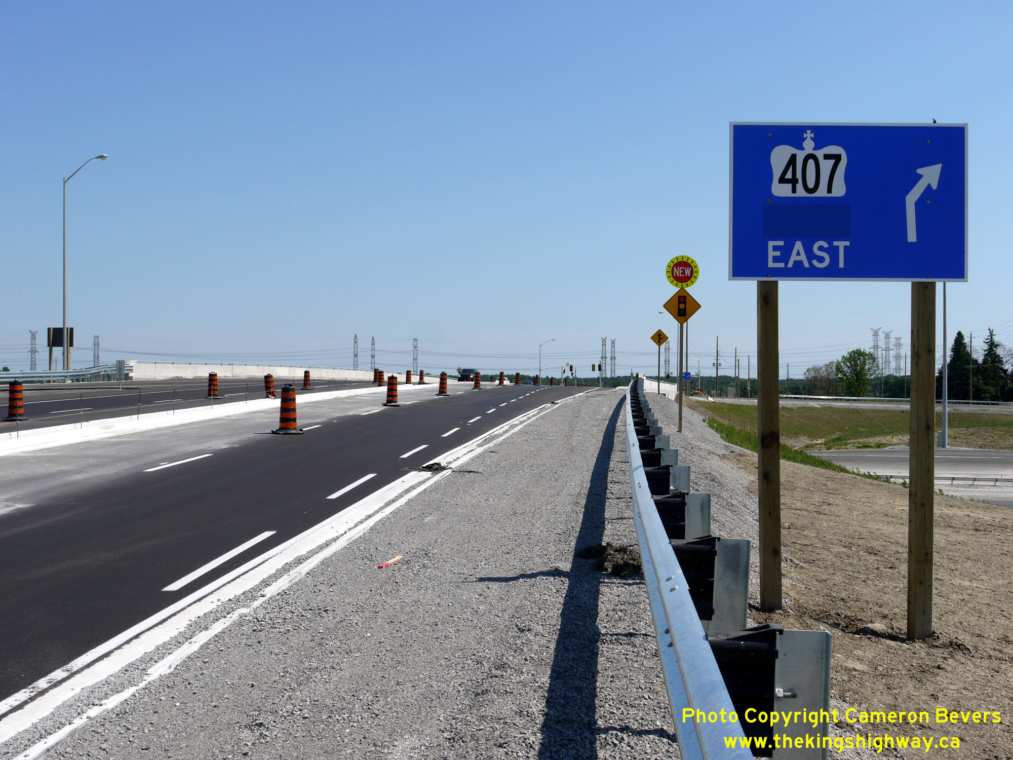
 Left - Guide sign on southbound Hwy 12 marking the on-ramp to eastbound Hwy 407. A temporary sticker covers up the word "Toll" on this sign. Tolls were not
collected along Hwy 407 for several months after the highway's official opening between Brock Road and Harmony Road on June 20, 2016. See an
Enlarged Photo Here. Left - Guide sign on southbound Hwy 12 marking the on-ramp to eastbound Hwy 407. A temporary sticker covers up the word "Toll" on this sign. Tolls were not
collected along Hwy 407 for several months after the highway's official opening between Brock Road and Harmony Road on June 20, 2016. See an
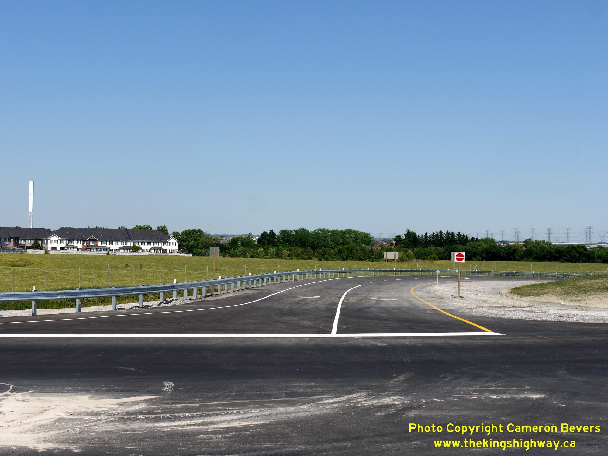
Enlarged Photo Here.(Photograph taken on June 19, 2016 - © Cameron Bevers) Right - Stop-controlled exit ramp from westbound Hwy 407 to Hwy 12. Due to prevailing traffic patterns, it was not necessary to signalize many of the westbound
ramp terminals at interchanges along Hwy 407 at the time of the highway's opening. See an
Enlarged Photo Here.(Photograph taken on June 19, 2016 - © Cameron Bevers) 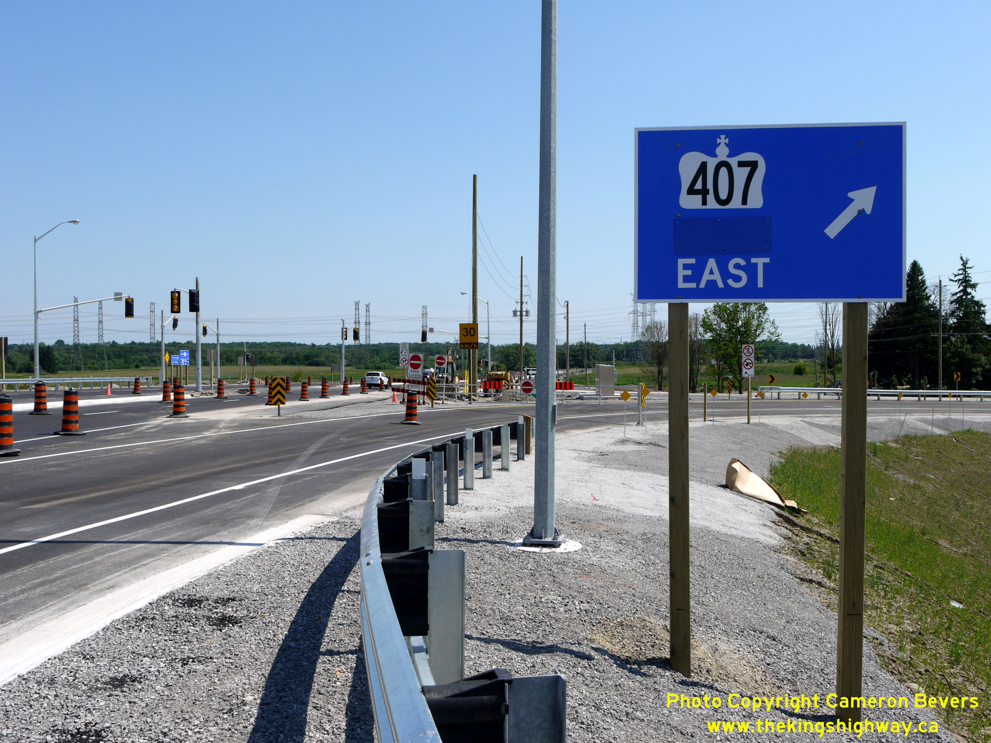
 Left - Facing south along Hwy 12 at the entrance ramp to eastbound Hwy 407. The eastbound Hwy 407 exit ramp to Hwy 12 intersects just ahead at the new traffic
signals. See an Enlarged Photo Here. Left - Facing south along Hwy 12 at the entrance ramp to eastbound Hwy 407. The eastbound Hwy 407 exit ramp to Hwy 12 intersects just ahead at the new traffic
signals. See an Enlarged Photo Here.(Photograph taken on June 19, 2016 - © Cameron Bevers) Right - Traffic signals awaiting activation at the south ramp terminal at the Hwy 407 & Hwy 12 Interchange, one day prior to Hwy 407's official opening.
See an Enlarged Photo Here.(Photograph taken on June 19, 2016 - © Cameron Bevers) 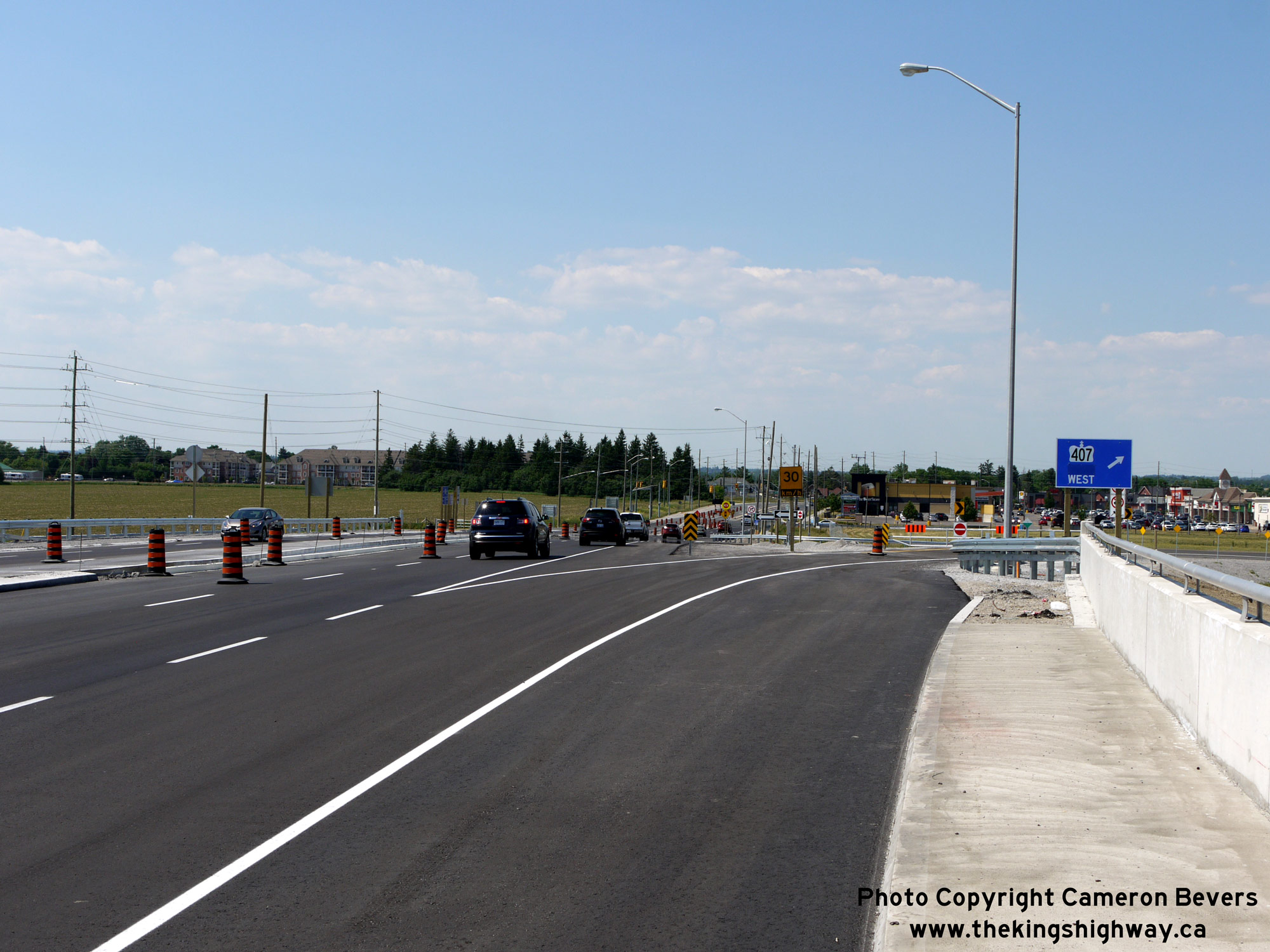
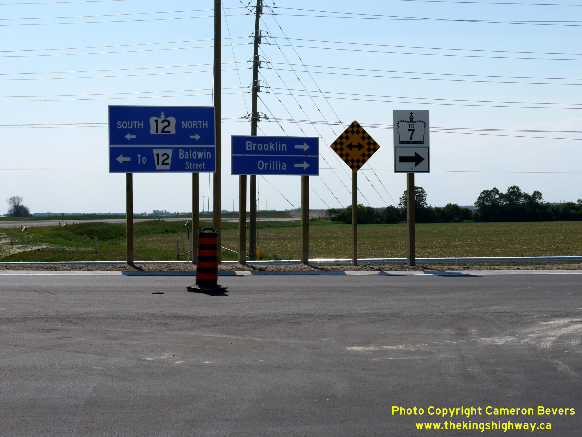 Left - Facing north along Hwy 12 towards Brooklin approaching the entrance ramp to westbound Hwy 407. See an
Enlarged Photo Here. Left - Facing north along Hwy 12 towards Brooklin approaching the entrance ramp to westbound Hwy 407. See an
Enlarged Photo Here.(Photograph taken on June 19, 2016 - © Cameron Bevers) Right - Guide signs at the eastbound Hwy 407 exit ramp to Hwy 12. See an
Enlarged Photo Here.(Photograph taken on June 19, 2016 - © Cameron Bevers) 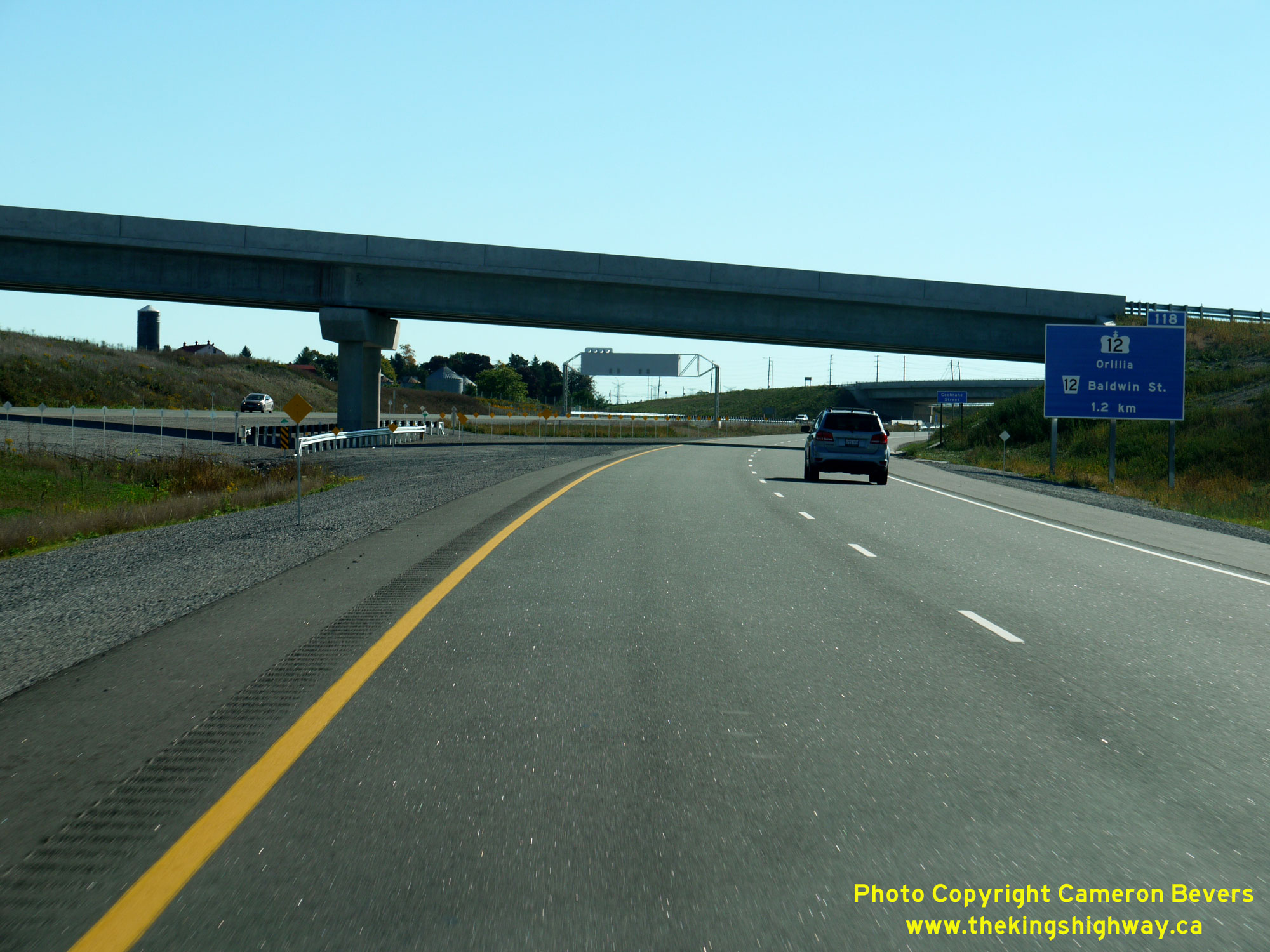
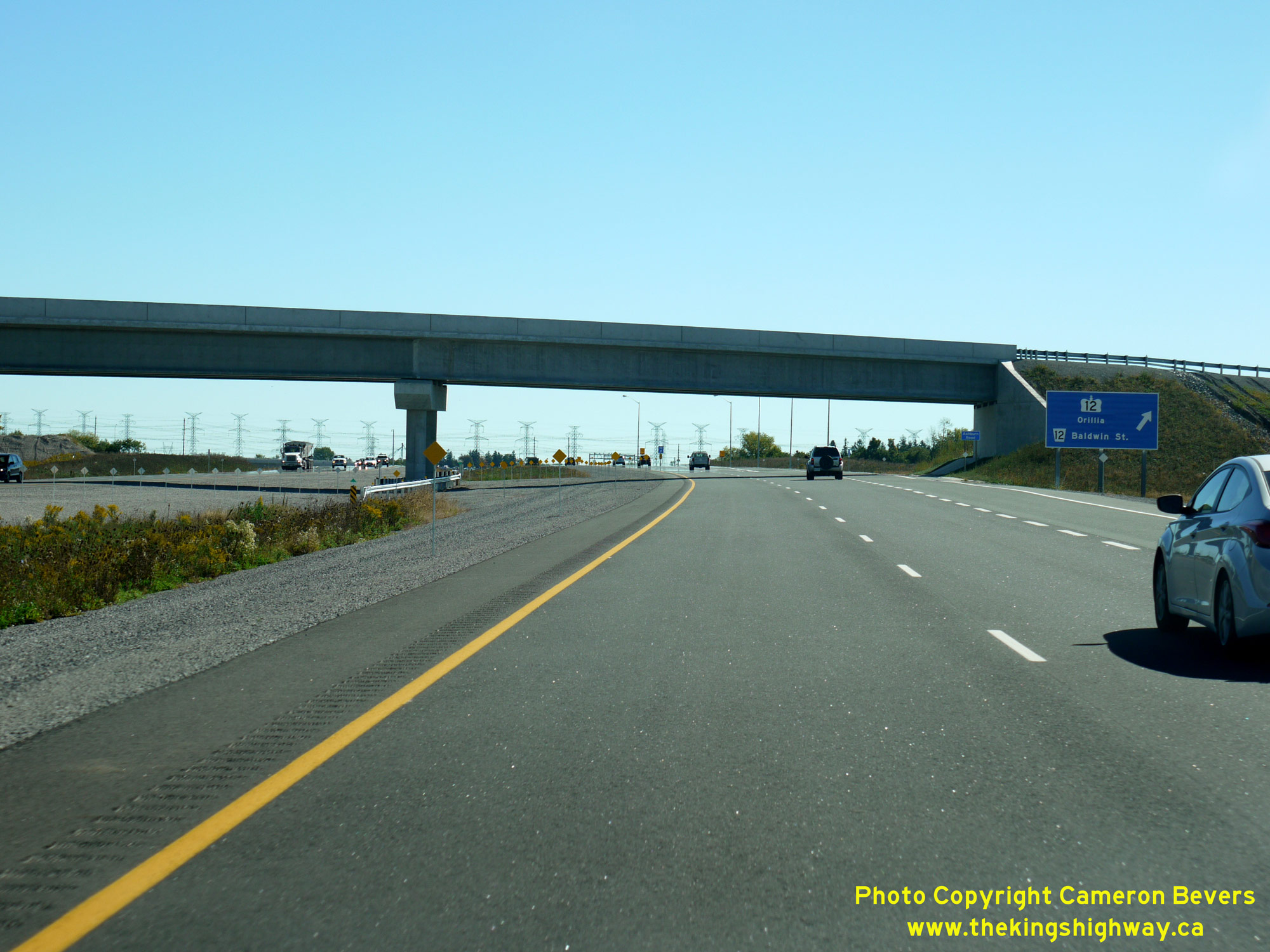 Left - Advance freeway exit guide sign for the upcoming Hwy 12 Interchange on eastbound Hwy 407 near Brooklin. See an
Enlarged Photo Here. Left - Advance freeway exit guide sign for the upcoming Hwy 12 Interchange on eastbound Hwy 407 near Brooklin. See an
Enlarged Photo Here.(Photograph taken on September 24, 2016 - © Cameron Bevers) Right - Facing east along Hwy 407 after the freeway's opening in 2016, approaching the Hwy 12 Interchange near Brooklin. See an
Enlarged Photo Here.(Photograph taken on September 24, 2016 - © Cameron Bevers) 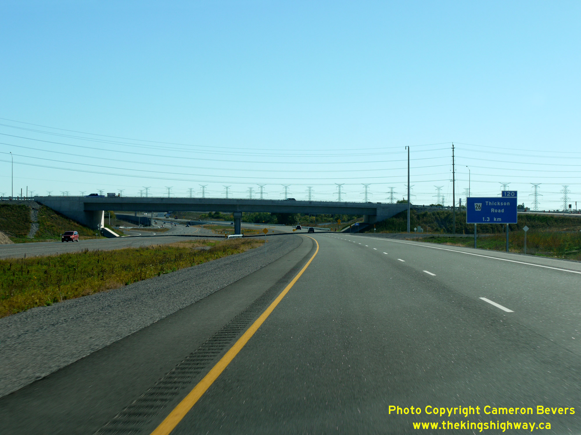
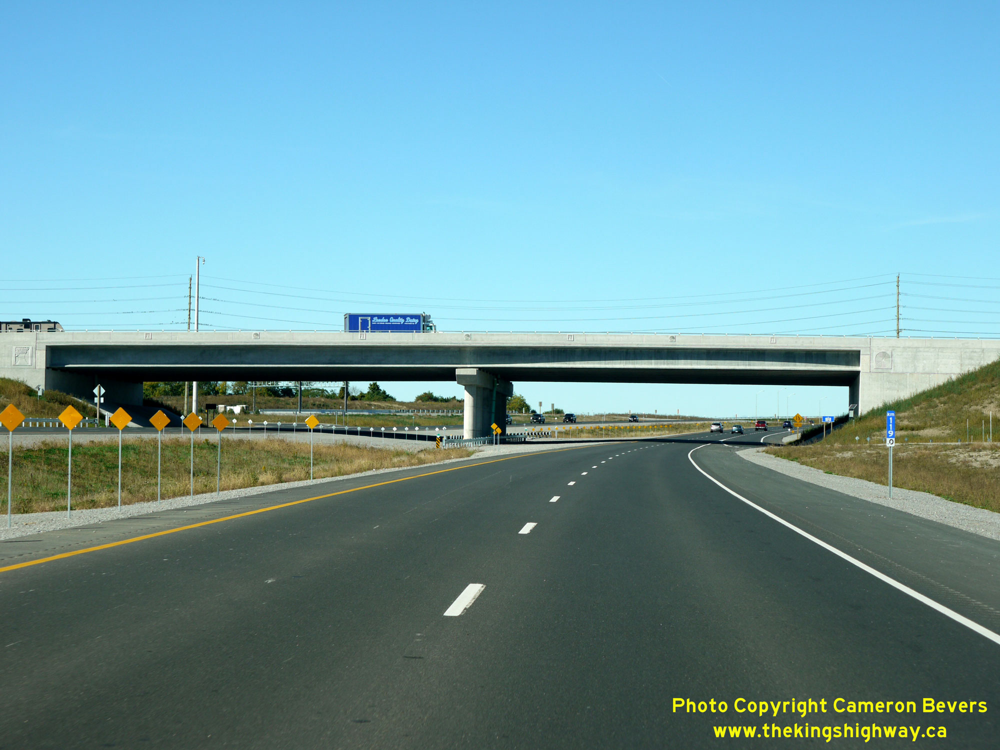
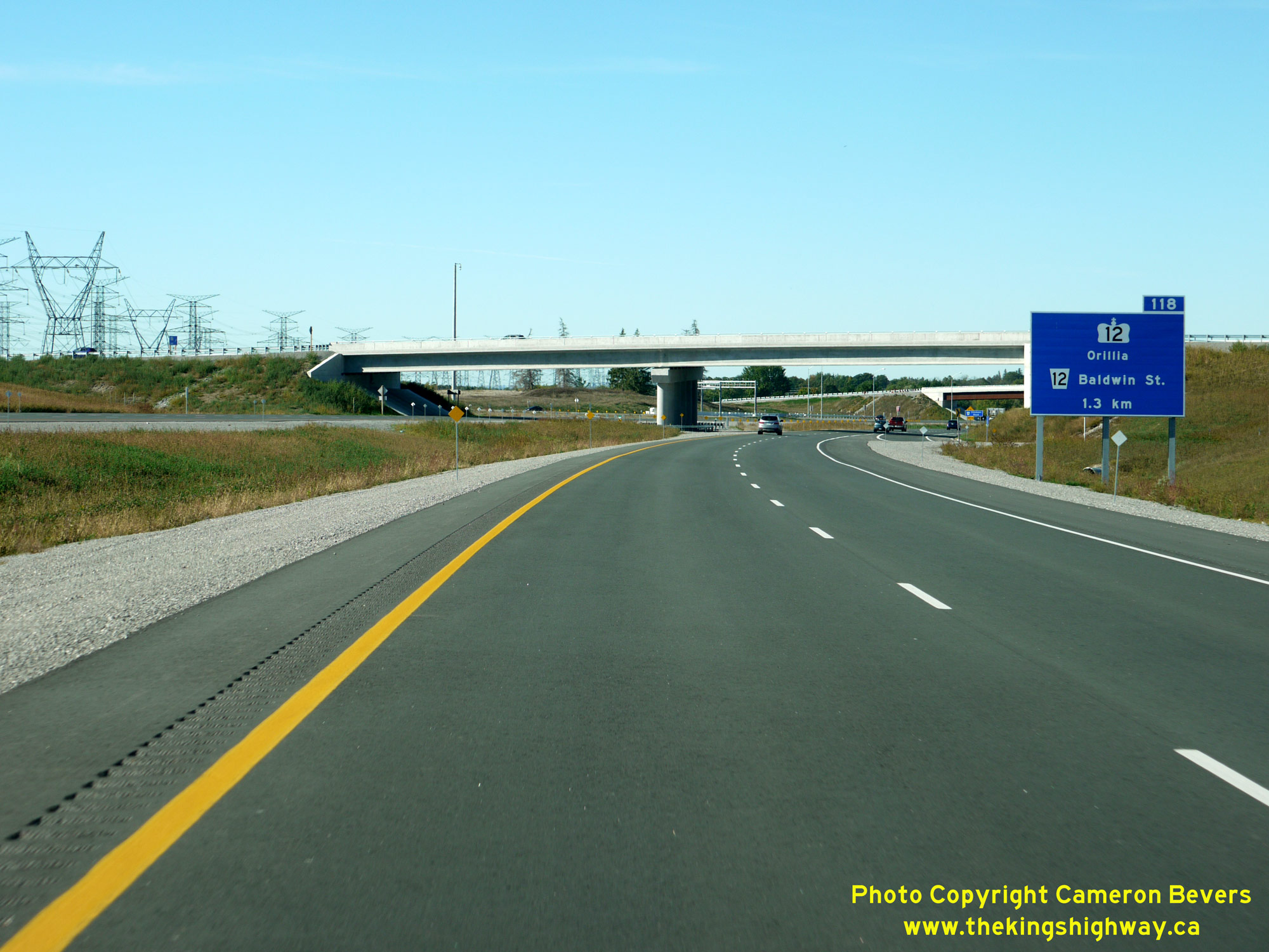 Left - Western side of the Hwy 12 Overpass on Hwy 407 near Brooklin, as seen from the completed freeway after it was opened to traffic in 2016. See an
Enlarged Photo Here. Left - Western side of the Hwy 12 Overpass on Hwy 407 near Brooklin, as seen from the completed freeway after it was opened to traffic in 2016. See an
Enlarged Photo Here.(Photograph taken on September 24, 2016 - © Cameron Bevers) Right - Advance freeway exit guide sign for the upcoming Hwy 12 Interchange on westbound Hwy 407 near Brooklin. See an
Enlarged Photo Here.(Photograph taken on September 24, 2016 - © Cameron Bevers) 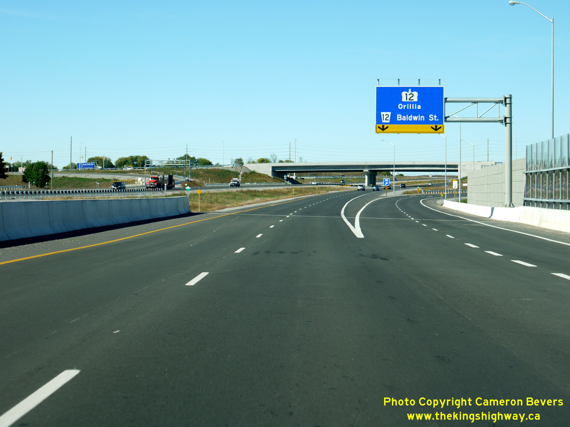
 Left - Overhead freeway exit guide sign for the Hwy 12 Interchange on westbound Hwy 407 near Brooklin. This sign was installed on a cantilevered overhead sign
structure, as there was insufficient space beside the freeway to install a standard ground-mounted freeway exit guide sign. See an
Enlarged Photo Here. Left - Overhead freeway exit guide sign for the Hwy 12 Interchange on westbound Hwy 407 near Brooklin. This sign was installed on a cantilevered overhead sign
structure, as there was insufficient space beside the freeway to install a standard ground-mounted freeway exit guide sign. See an
Enlarged Photo Here.(Photograph taken on September 24, 2016 - © Cameron Bevers) Right - Eastern side of the Hwy 12 Overpass on Hwy 407 near Brooklin, as seen from the completed freeway after it was opened to traffic in 2016. See an
Enlarged Photo Here.(Photograph taken on September 24, 2016 - © Cameron Bevers)
Continue on to King's Highway 12 Present Day Photos: Brooklin to Beaverton
|
|---|
Links to Adjacent King's Highway Photograph Pages:
Back to Hwy 12 - Historical Photos (1990 to 1999)
Hwy 12 Photo Index
On to Hwy 12 - Brooklin to Beaverton
Back to King's Highway 11 Photos /
King's Highway 12 History /
On to King's Highway 14 Photos
Ontario Highway History - Main Menu / Back to List of Highways Website contents, photos & text © 2002-2026, Cameron
Bevers (Webmaster) - All Rights Reserved / Contact Me
|
|---|