
| 
| |
|
|
This page contains historical and present day photos of Ontario's King's Highway 141. All photographs displayed on this page
were taken by the Webmaster (Cameron Bevers), unless specifically noted otherwise. Historical photographs are arranged in approximate chronological order, while
present day photographs (Year 2000 to date) are arranged by location from west to east. Click on any thumbnail to see a larger image!
Please note that all photographs displayed on this
website are protected by copyright. These photographs must not be reproduced, published,
electronically stored or copied, distributed, or posted onto other websites without
my written permission. If you want to use photos from this website, please
email me first for permission. Thank-you!
|
|---|
|
Historical King's Highway 141 Photographs
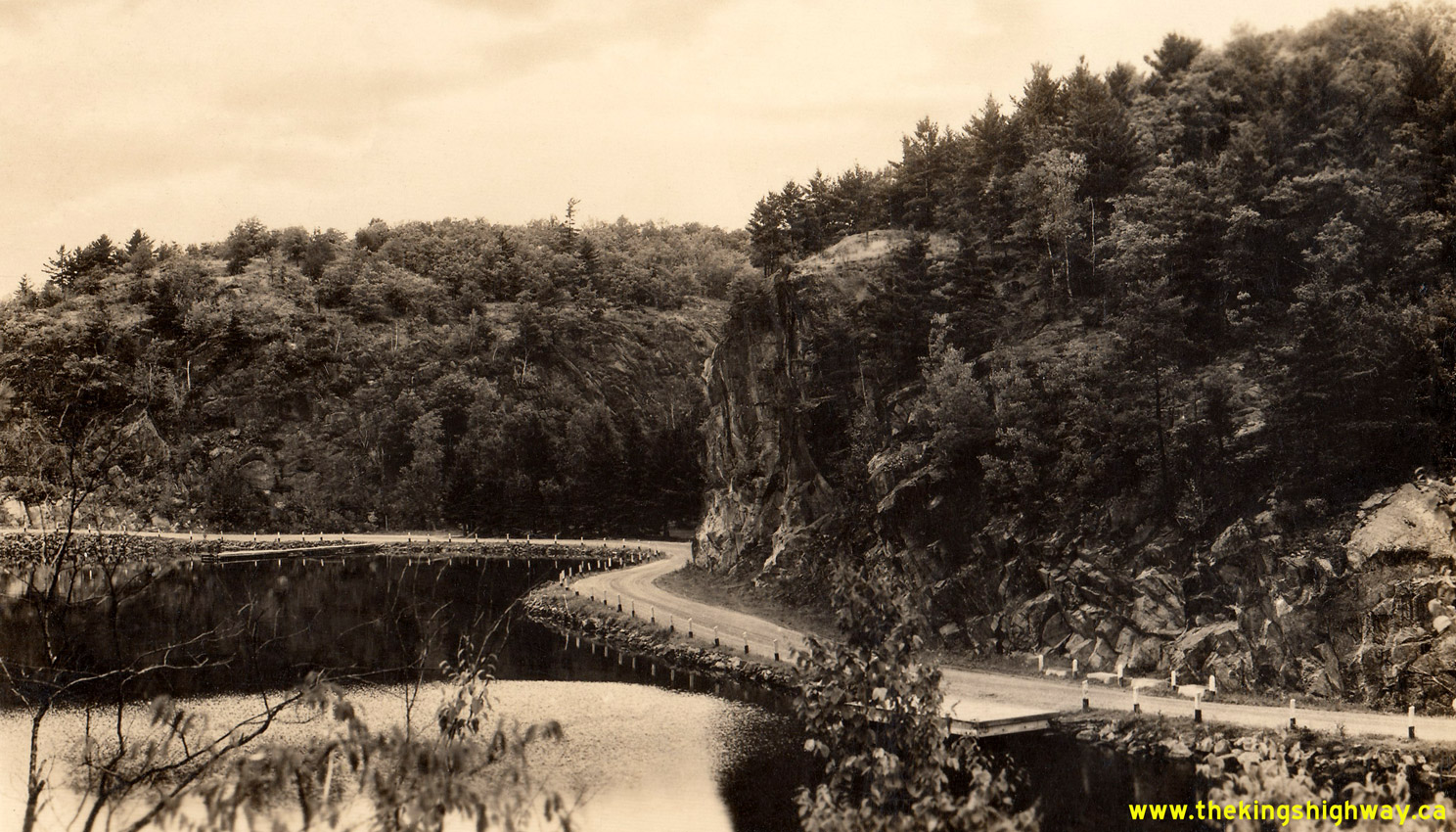
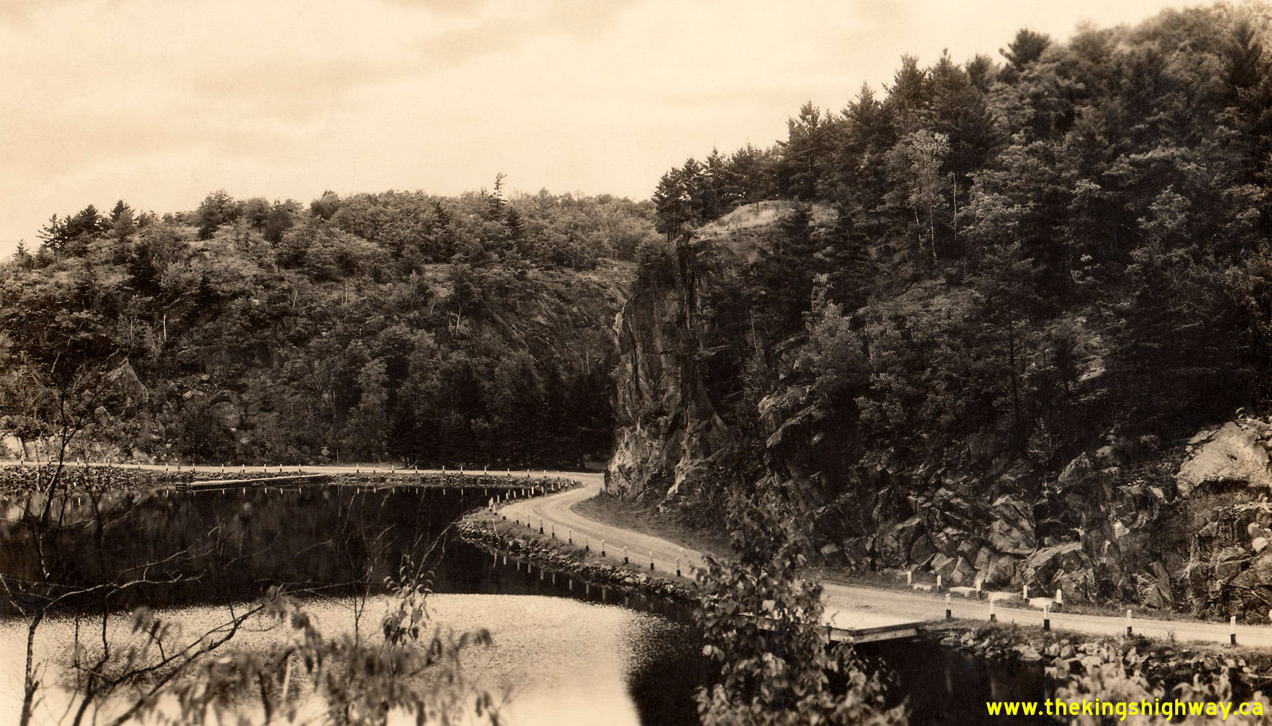
Above - Circa 1945 postcard view of the Bracebridge-Rosseau Secondary Road (Hwy 532, which later became Hwy 141) at Skeleton Bay, Lake Rosseau. Apart from
improvements to the roadway width, pavement and installation of newer roadside barriers since the 1940s, the present day route of Hwy 141 around Skeleton Bay still
looks quite similar today. See an Enlarged Photo Here. Photo taken circa 1945. (Photo courtesy of Canadian Airmaps Limited) 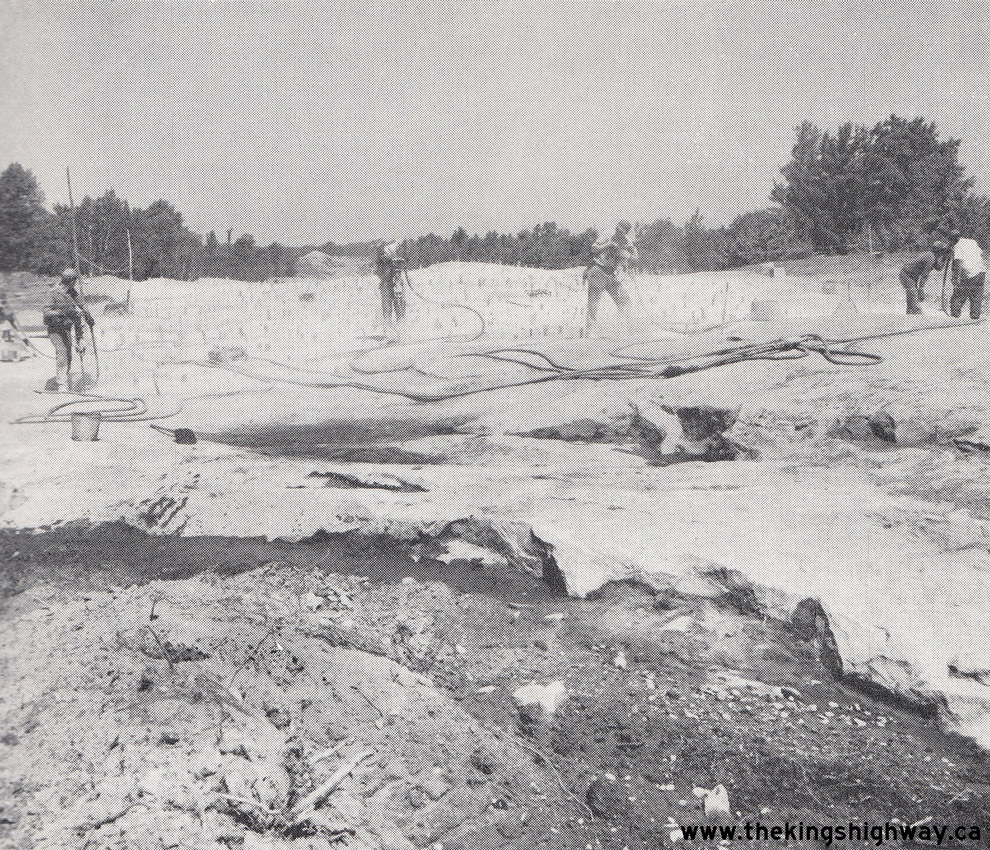
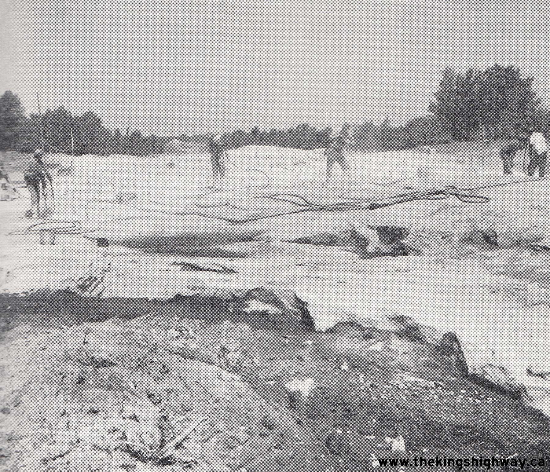
Above - Rock drilling and excavation on a diversion of Hwy 532 (later known as Hwy 141) west of Rosseau by Day Labour. See an
Enlarged Photo Here. Photo taken in 1959. (Photo courtesy of Ontario Ministry of Transportation - © King's Printer for Ontario, 1959) 
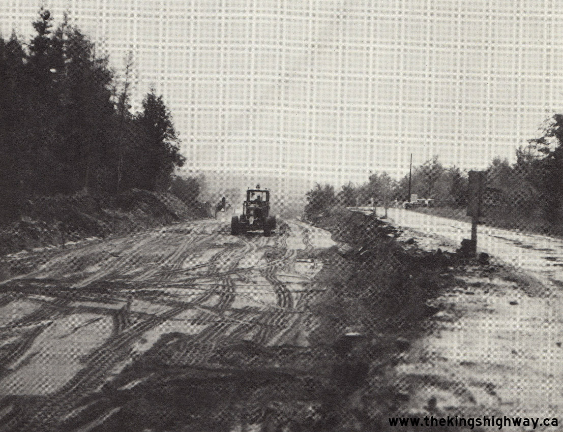
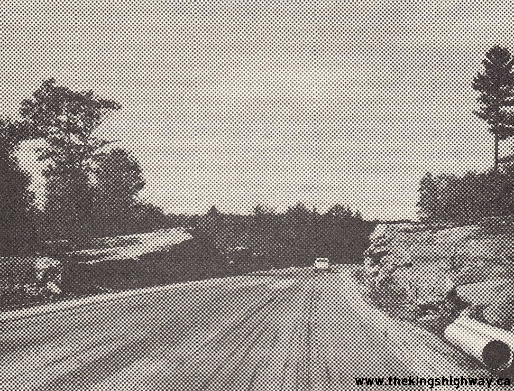
Left - Day Labour grading project on Hwy 532 (later known as Hwy 141), 1 mile east of Rosseau Road. See an
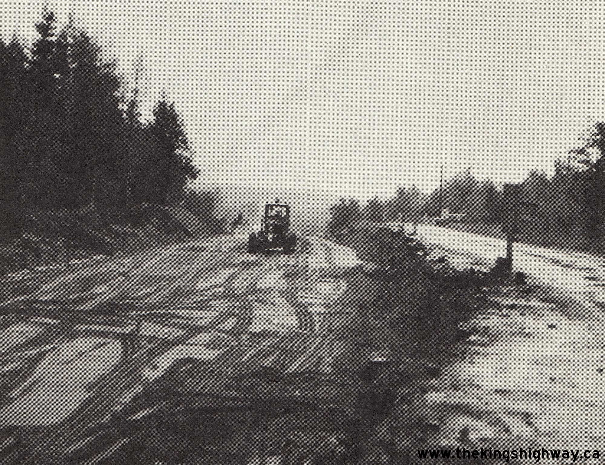
Enlarged Photo Here. Photo taken in 1964. (Photo courtesy of Ontario Ministry of Transportation - © King's Printer for Ontario, 1964) Right - Reconstruction and vertical profile correction on Hwy 532 near the Hwy 516 Junction near Patterson's Corners southeast of Raymond, Contract #1968-123. This contract included the reconstruction of both the north and south Hwy 516 & Hwy 532 Junctions north of Bracebridge, along with the reconstruction of Hwy 516 (later known as Hwy 141) from Patterson's Corners to the Hwy 11 Junction at Port Sydney. See an Enlarged Photo Here. Photo taken in 1969. (Photo courtesy of Ontario Ministry of Transportation - © King's Printer for Ontario, 1969) |
|---|
|
Present Day King's Highway 141 Photographs


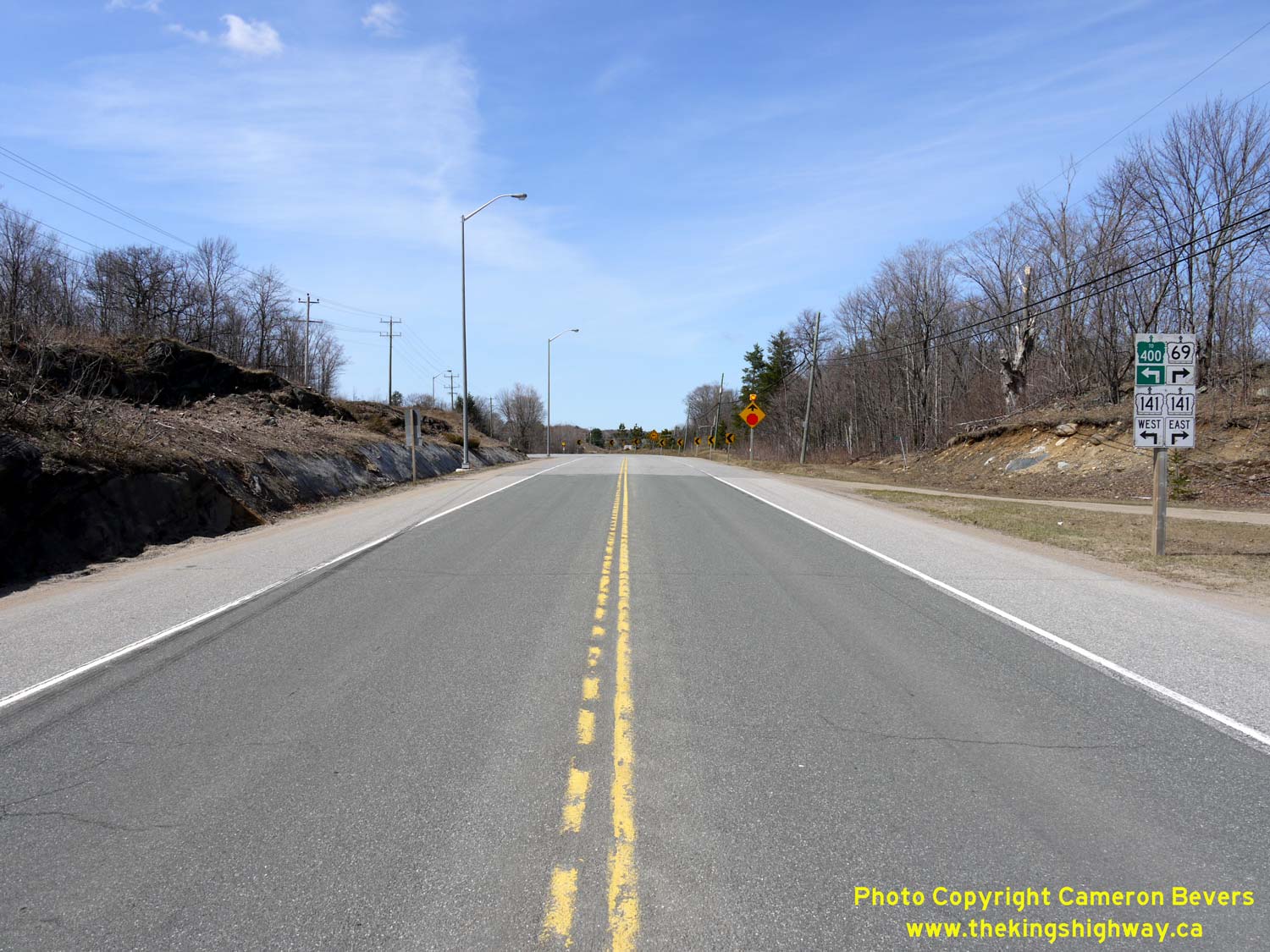
Left - Unopened Hwy 400 Extension facing south towards MacTier from the Hwy 141 Overpass near Horseshoe Lake. See an
Enlarged Photo Here. (Photograph taken on August 31, 2003 - © Cameron Bevers) Right - Facing east along the Hwy 141 Extension from the new Hwy 400 Interchange south of Horseshoe Lake. As a result of the construction of the new Hwy 400 Extension, Hwy 141 was also extended west from Hwy 69 to connect with Hwy 400 in 2003. See an Enlarged Photo Here. (Photograph taken on August 31, 2003 - © Cameron Bevers) 

Left - Unopened Hwy 400 Extension facing north from the Hwy 141 Overpass near Horseshoe Lake. See an
Enlarged Photo Here. (Photograph taken on August 31, 2003 - © Cameron Bevers) Right - Approaching the Hwy 141 Interchange on the unopened Hwy 400 Extension in 2003, facing north. See an Enlarged Photo Here. (Photograph taken on August 31, 2003 - © Cameron Bevers) 
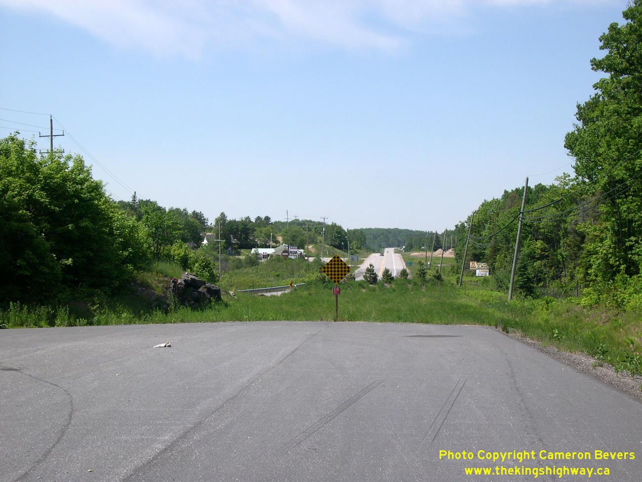
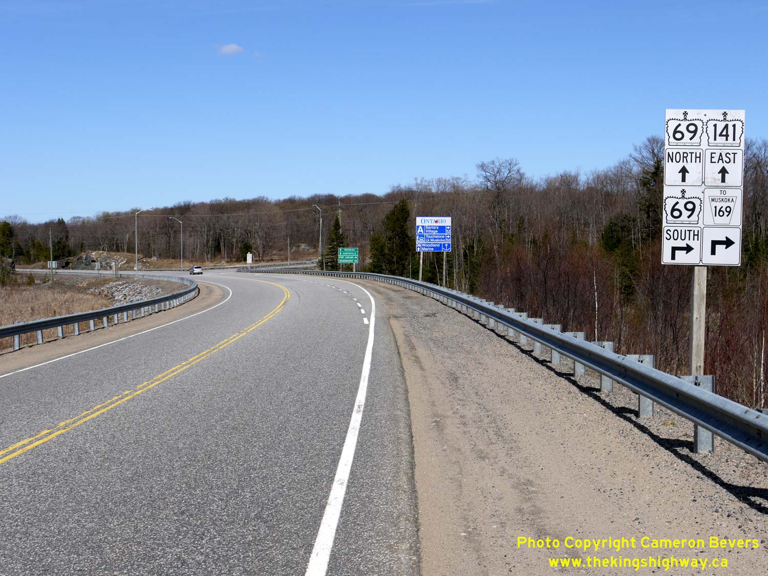
Left - Facing south towards the Hwy 141 Interchange along an unopened section of the Hwy 400 Extension in 2003. See an
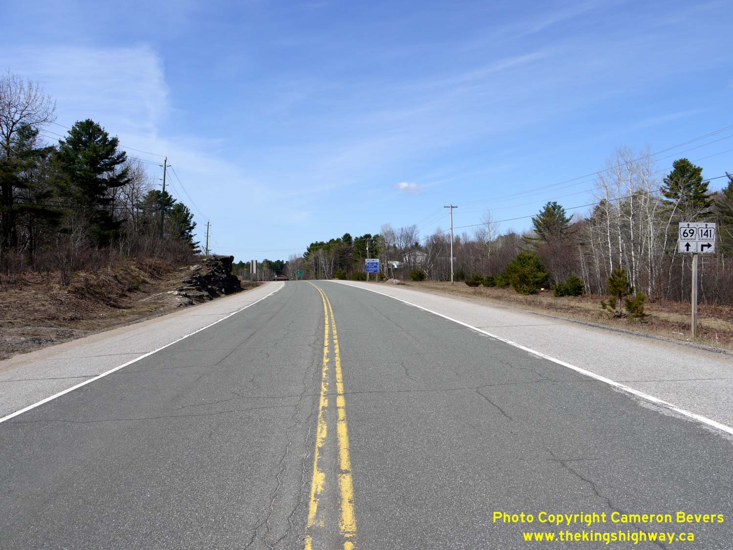
Enlarged Photo Here. (Photograph taken on August 31, 2003 - © Cameron Bevers) Right - Facing north along Hwy 69 approaching the Hwy 141 West Junction between Gordon Bay and Hayes Corners. This was a new highway junction completed in 2003, as part of the adjacent Hwy 400 Extension. Hwy 141 was extended west from Hwy 69 at Hayes Corners to join with the new route of Hwy 400. See an Enlarged Photo Here. (Photograph taken on April 12, 2012 - © Cameron Bevers) 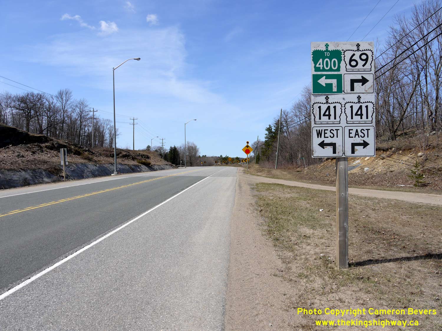
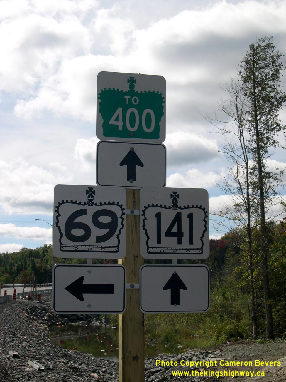
Left - Junction assembly on northbound Hwy 69 approaching the Hwy 141 West Junction between Gordon Bay and Hayes Corners. The route of Hwy 400 is trailblazed
using green "To 400" route markers via westbound Hwy 141. The Hwy 141 Interchange is the first access point along Hwy 400 since the Hwy 69 Interchange south of
MacTier. See an Enlarged Photo Here. (Photograph taken on April 12, 2012 - © Cameron Bevers) Right - Cul-de-sac on the former Hwy 69 alignment at the Hwy 141 West Junction between Gordon Bay and Hayes Corners. In 2003, Hwy 69 was realigned so that it intersected with the relocated route of Hwy 141. The realignment left behind a short bypassed section of Hwy 69, which terminated at this point. In the background, the concurrent route of Hwy 69 & Hwy 141 can be seen continuing north towards Parry Sound. See an Enlarged Photo Here. (Photograph taken on June 10, 2007 - © Cameron Bevers) 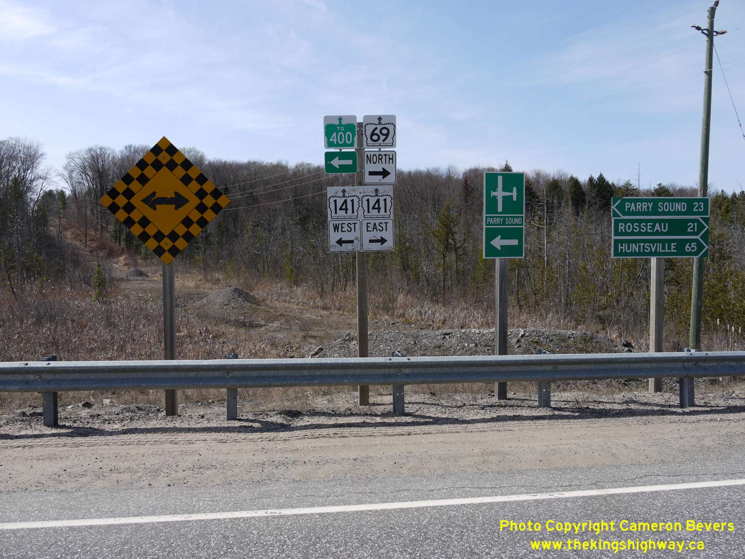
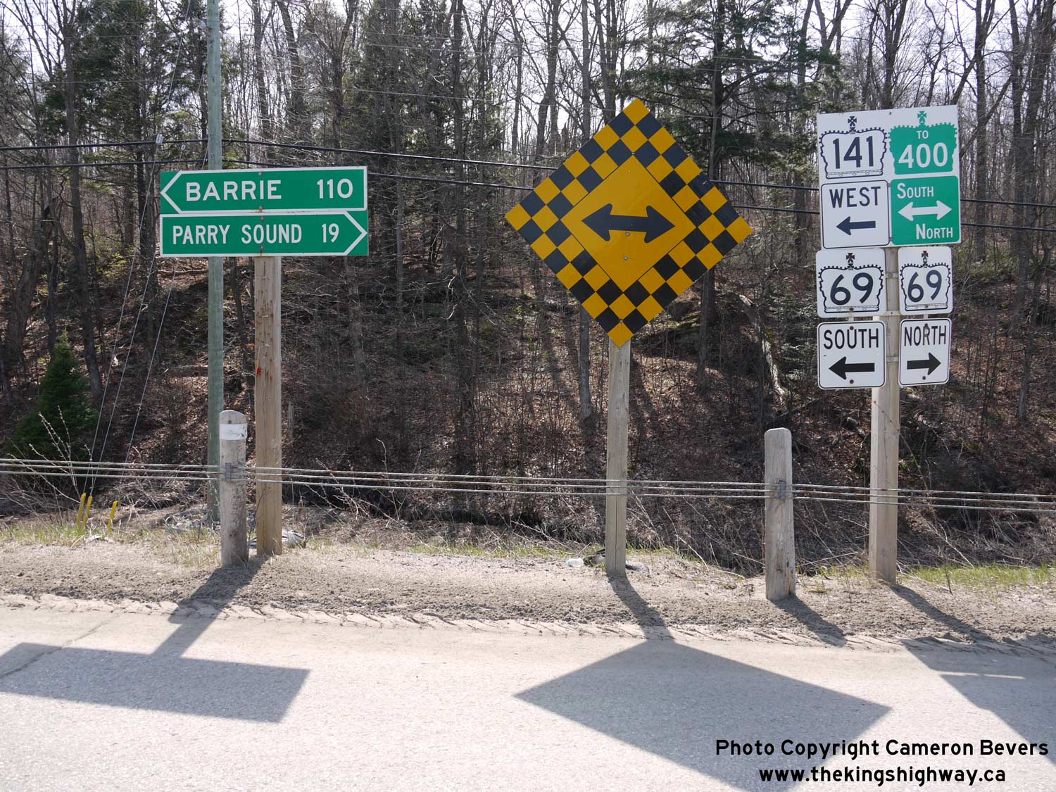
Left - Junction assembly and fingerboard destination signs at the Hwy 69 & Hwy 141 West Junction between Gordon Bay and Hayes Corners. Interestingly,
traffic bound for Parry Sound is directed to follow Hwy 141 West to Hwy 400. Although it may seem somewhat counter-intuitive to turn west at this junction, motorists
will find that travel times between using Hwy 400 and Hwy 69 to reach Parry Sound from this highway junction are more or less comparable. See an
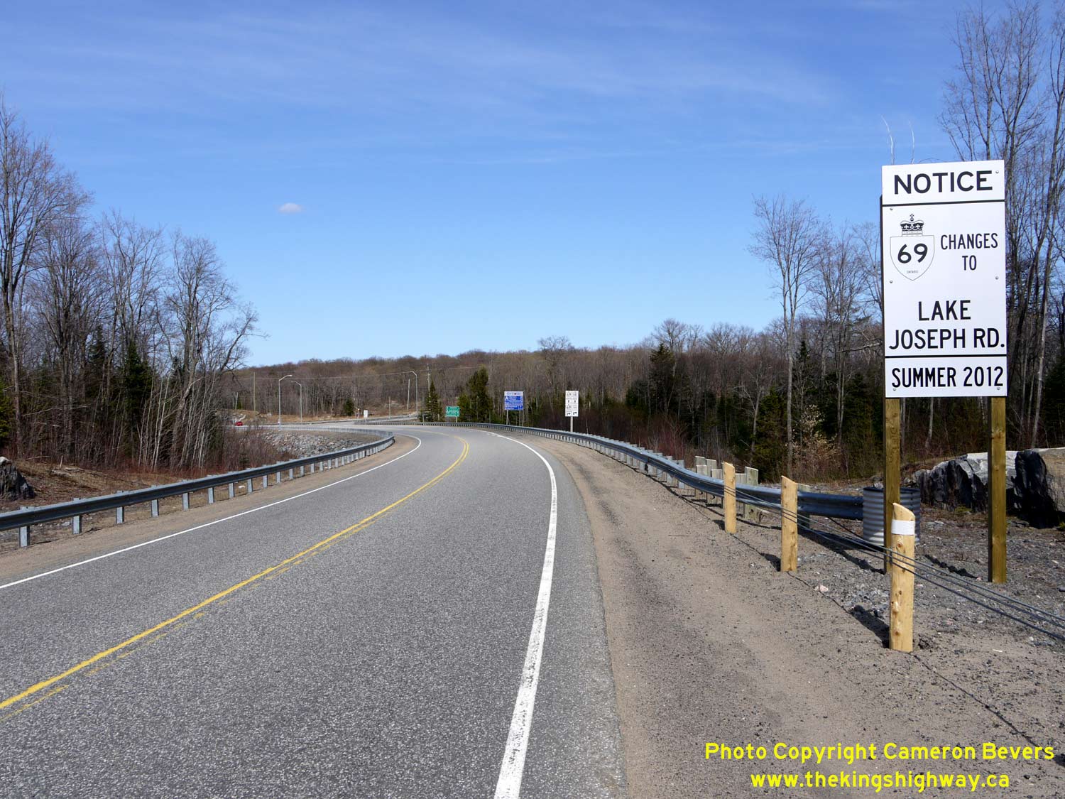
Enlarged Photo Here. (Photograph taken on April 12, 2012 - © Cameron Bevers) Right - Advisory sign on Hwy 141 indicating the pending removal of the Hwy 69 designation. In September 2012, Hwy 69 route markers were removed along the highway between MacTier and the Nobel area. As the sign indicates, the former route of Hwy 69 between MacTier and Horseshoe Lake is now known as Lake Joseph Road. The old highway was assigned unposted 7000-series highway numbers. From MacTier to Hwy 141, Old Hwy 69 is referred to internally by MTO as Hwy 7289 and from Hwy 141 to Horseshoe Lake, Old Hwy 69 is known as Hwy 7290. See an Enlarged Photo Here. (Photograph taken on April 12, 2012 - © Cameron Bevers) 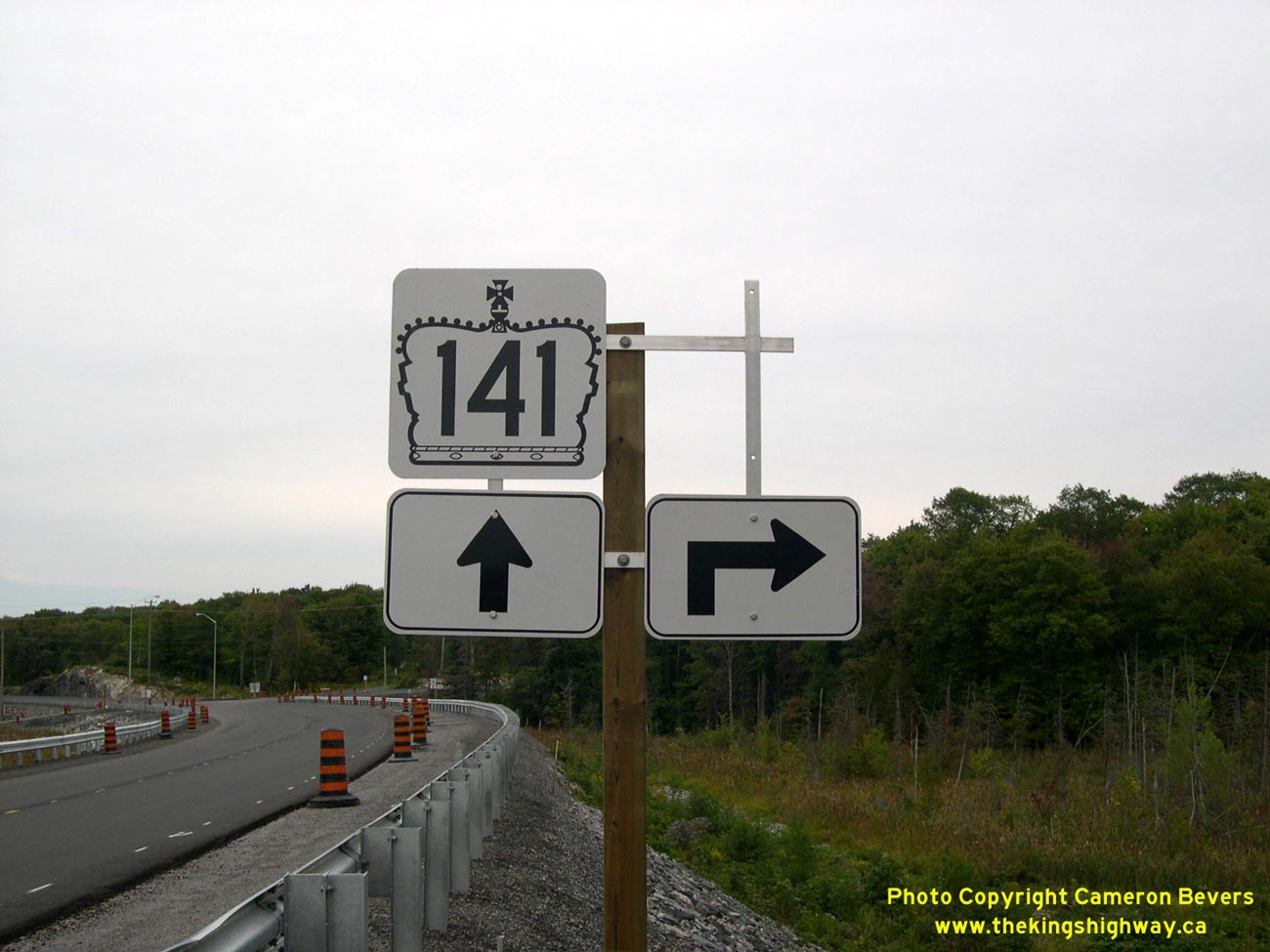
Left - Partially-installed junction assembly at the realigned Hwy 141 & Hwy 69 Junction between Gordon Bay and Hayes Corners just prior to opening in 2003,
facing east. Post-construction, the junction sign assembly was modified to include a trailblazer marker for Muskoka Road 169. See an
Enlarged Photo Here. (Photograph taken on August 31, 2003 - © Cameron Bevers) Right - Revised route marker assembly on eastbound Hwy 141 approaching the Hwy 69 South Junction between Gordon Bay and Hayes Corners. See an Enlarged Photo Here. (Photograph taken on April 12, 2012 - © Cameron Bevers) 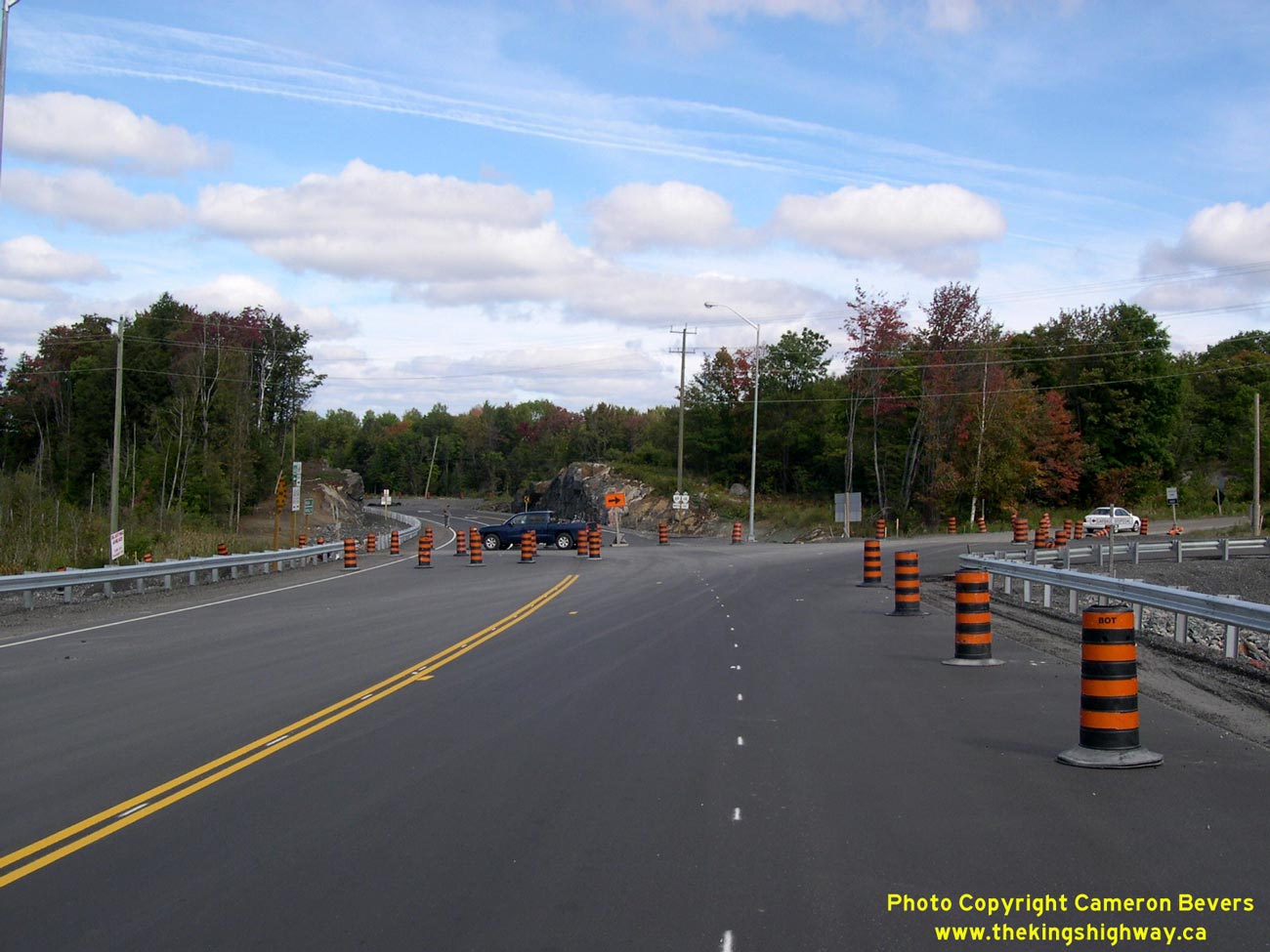

Left - Realigned junction of Hwy 69 and Hwy 141, just prior to opening in 2003. Due to construction staging, part of the new route of Hwy 141 was already open
to local traffic heading to and from the Parry Sound Area Municipal Airport and the nearby cottage community of Roberts Lake. See an
Enlarged Photo Here. (Photograph taken on September 20, 2003 - © Cameron Bevers) Right - Facing north at the Hwy 69 & Hwy 141 West Junction between Gordon Bay and Hayes Corners. This photo shows the completed diversion of Hwy 141 and new junction with Hwy 69 South, which is seen partially-constructed in the 2003 photo at left. See an Enlarged Photo Here. (Photograph taken on April 12, 2012 - © Cameron Bevers) 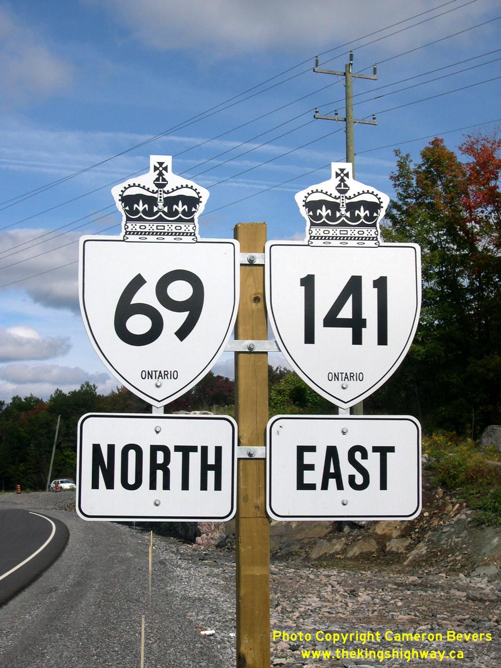
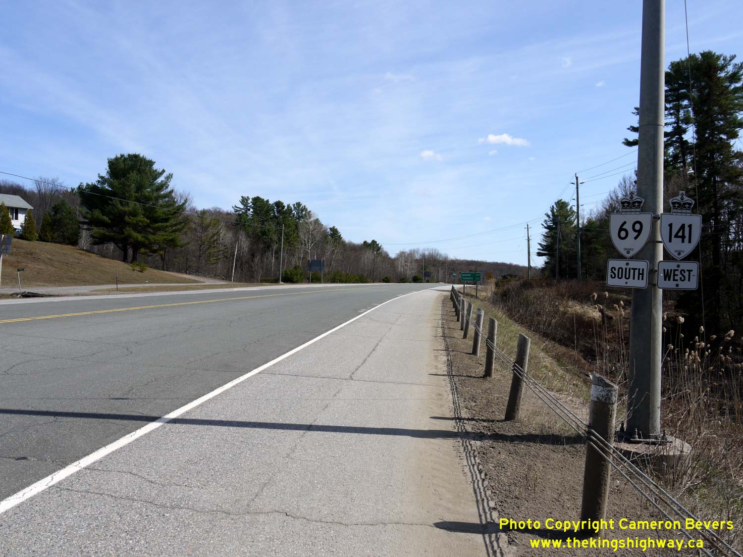
Left - Dual Hwy 69 & Hwy 141 route markers south of Hayes Corners. See an
Enlarged Photo Here. (Photograph taken on September 20, 2003 - © Cameron Bevers) Right - Junction assembly at the realigned Hwy 69 and Hwy 141 West Junction. See an Enlarged Photo Here. (Photograph taken on September 20, 2003 - © Cameron Bevers) 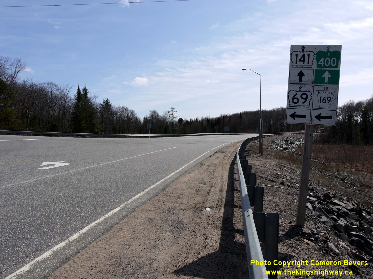
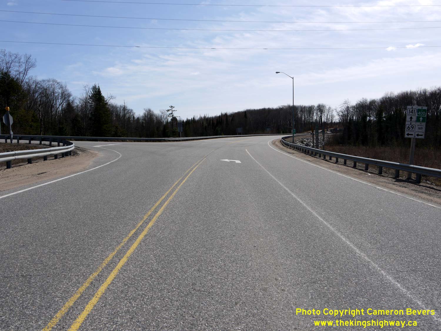
Left - Revised route marker assembly on westbound Hwy 141 approaching the Hwy 69 South Junction between Gordon Bay and Hayes Corners. Like the eastbound
Hwy 141 junction assembly, the westbound assembly was modified post-construction to include a trailblazer marker for Muskoka Road 169. See an
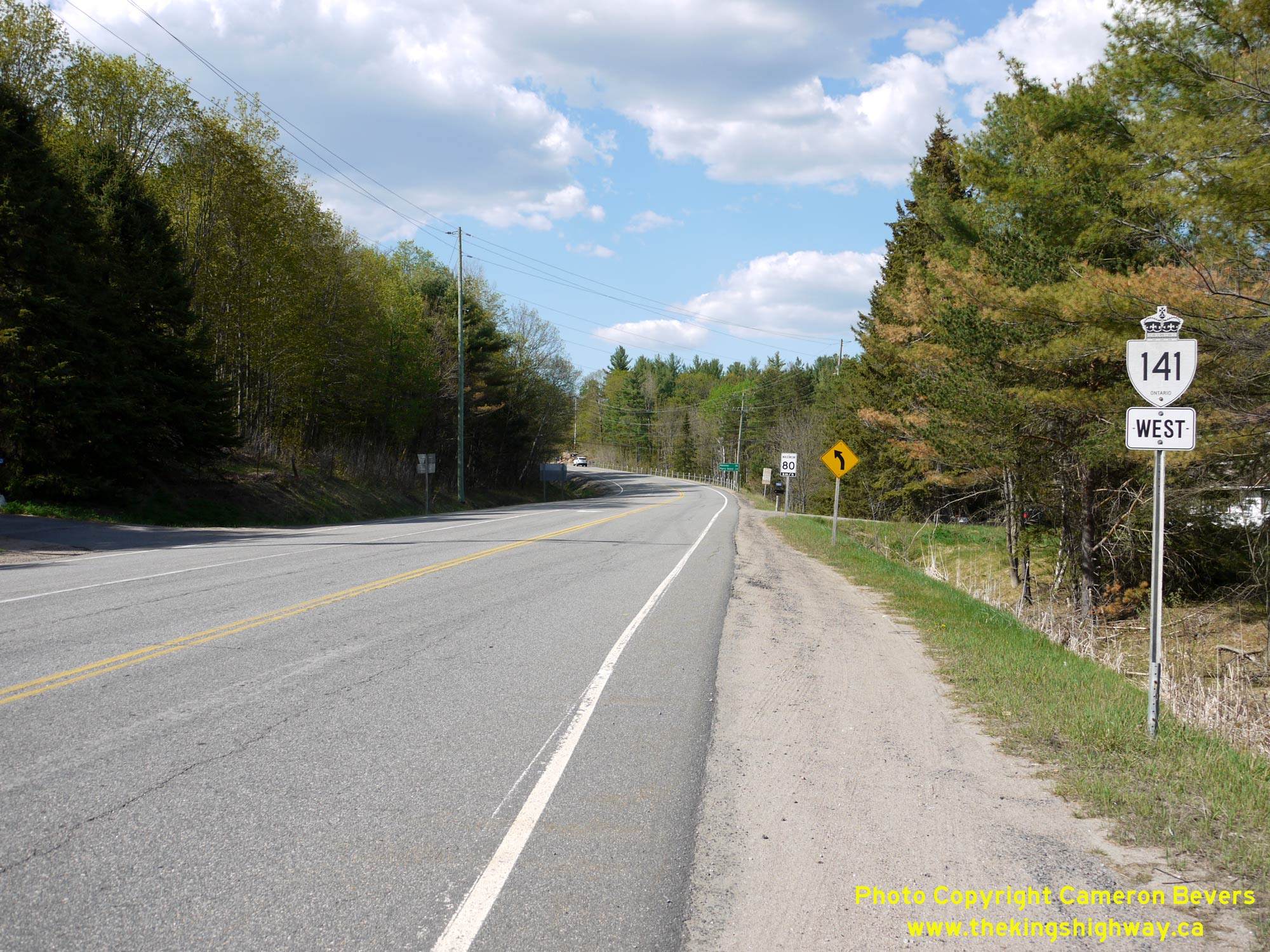
Enlarged Photo Here. (Photograph taken on April 12, 2012 - © Cameron Bevers) Right - Facing west along Hwy 141 at the Hwy 69 South Junction between Gordon Bay and Hayes Corners. The route of Hwy 141 continues west beyond Hwy 69 for about 1 km, where it terminates at the Hwy 400 Interchange. See an Enlarged Photo Here. (Photograph taken on April 12, 2012 - © Cameron Bevers) 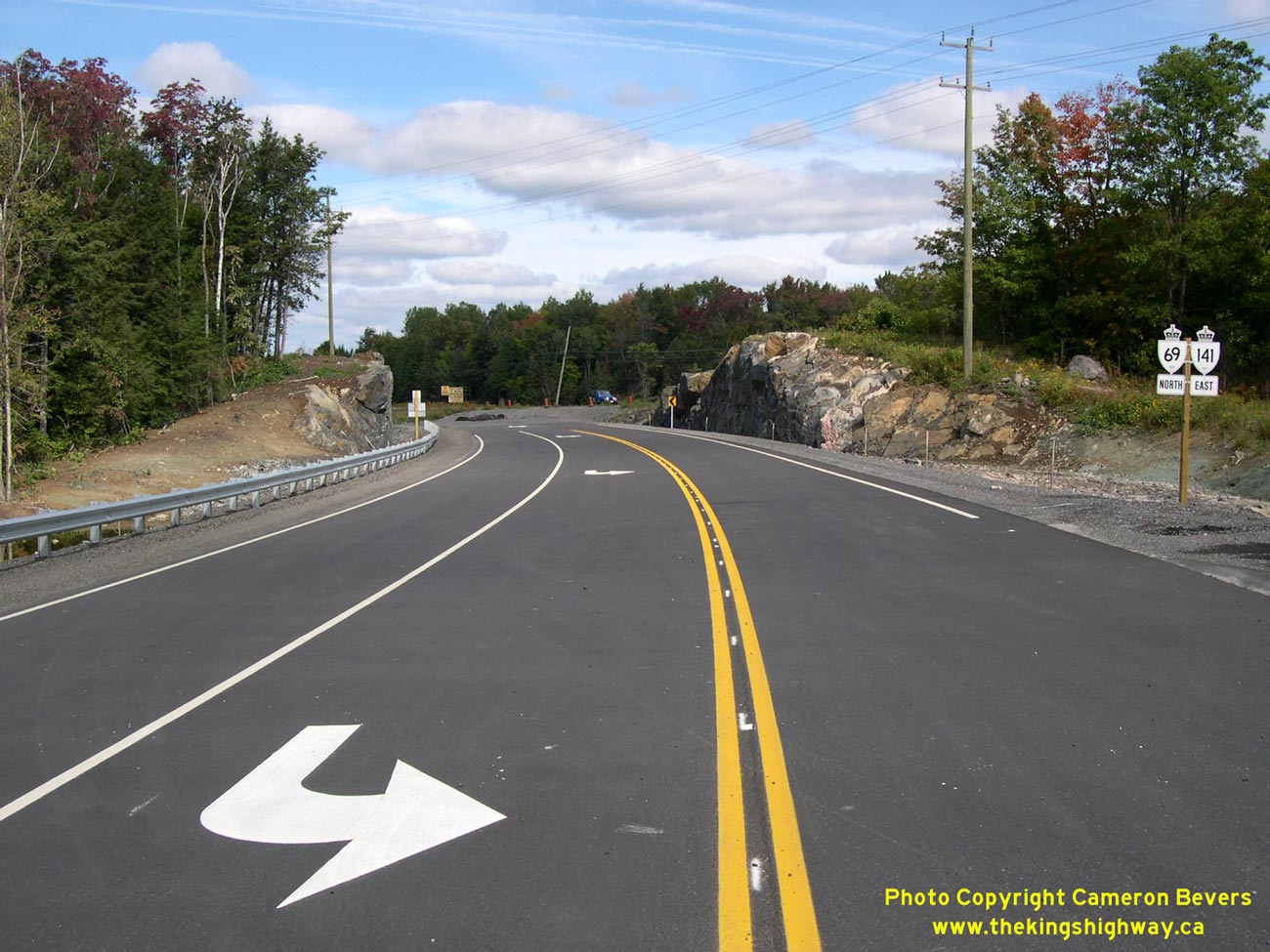
Left - Facing north along Hwy 69 & Hwy 141 towards Parry Sound from the new Hwy 141 West Junction, just prior to the highway's opening in 2003. See an
Enlarged Photo Here. (Photograph taken on September 20, 2003 - © Cameron Bevers) Right - Facing north along Hwy 69 & Hwy 141 approaching Hayes Corners. See an Enlarged Photo Here. (Photograph taken on April 12, 2012 - © Cameron Bevers) 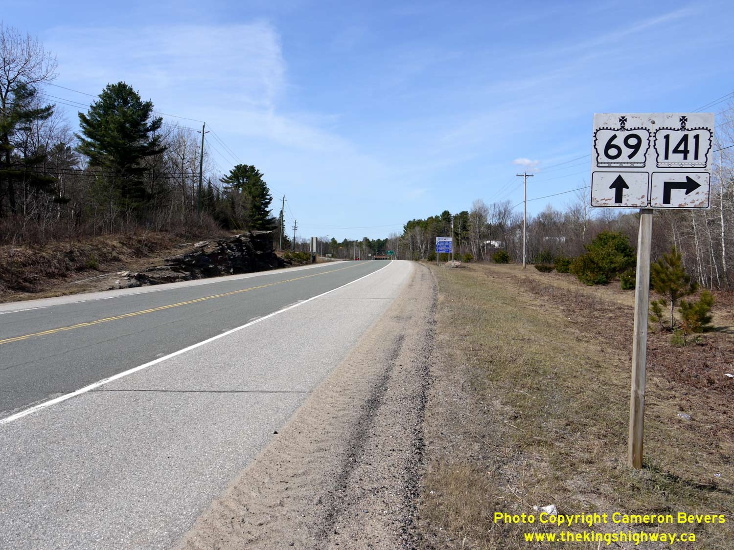
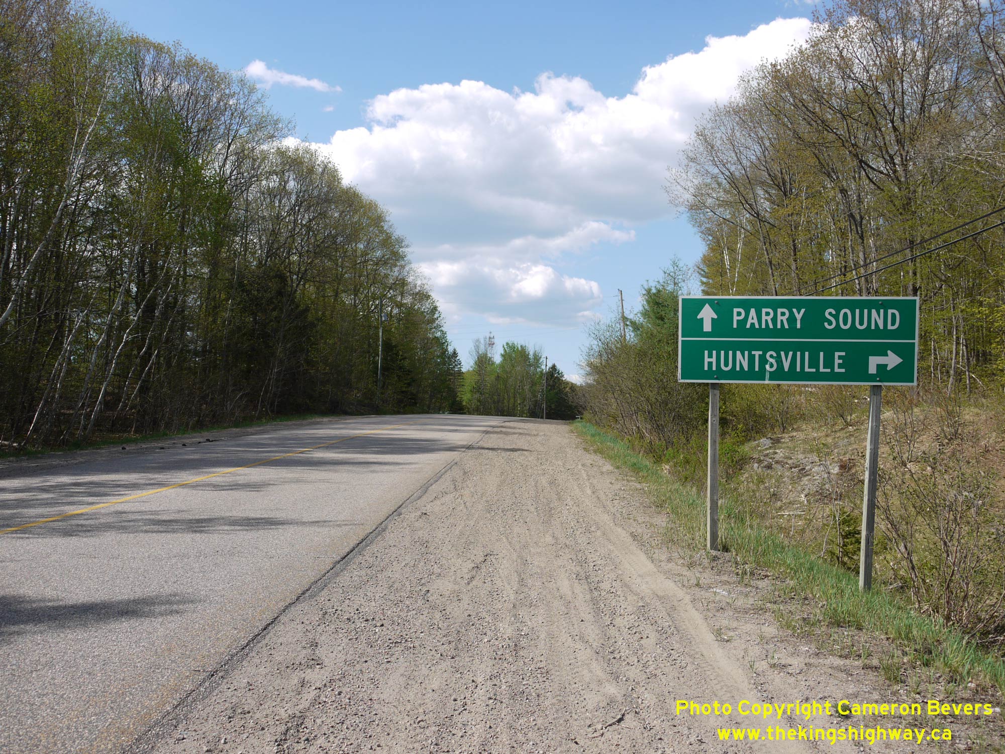
Left - Junction sign assembly on northbound Hwy 69 approaching the Hwy 141 East Junction at Hayes Corners. From Hayes Corners, Hwy 141 continues east via
Humphrey, Rosseau and Utterson, where it connects with Hwy 11 south of Huntsville. Historically, Hwy 141 was an Ontario Secondary Highway known as Hwy 532. See an
Enlarged Photo Here. (Photograph taken on April 12, 2012 - © Cameron Bevers) Right - Approaching Hayes Corners on westbound Hwy 141. Up until 2003, Hwy 141 reached its western terminus at the Hwy 69 Junction at Hayes Corners. See an Enlarged Photo Here. (Photograph taken on April 12, 2012 - © Cameron Bevers) 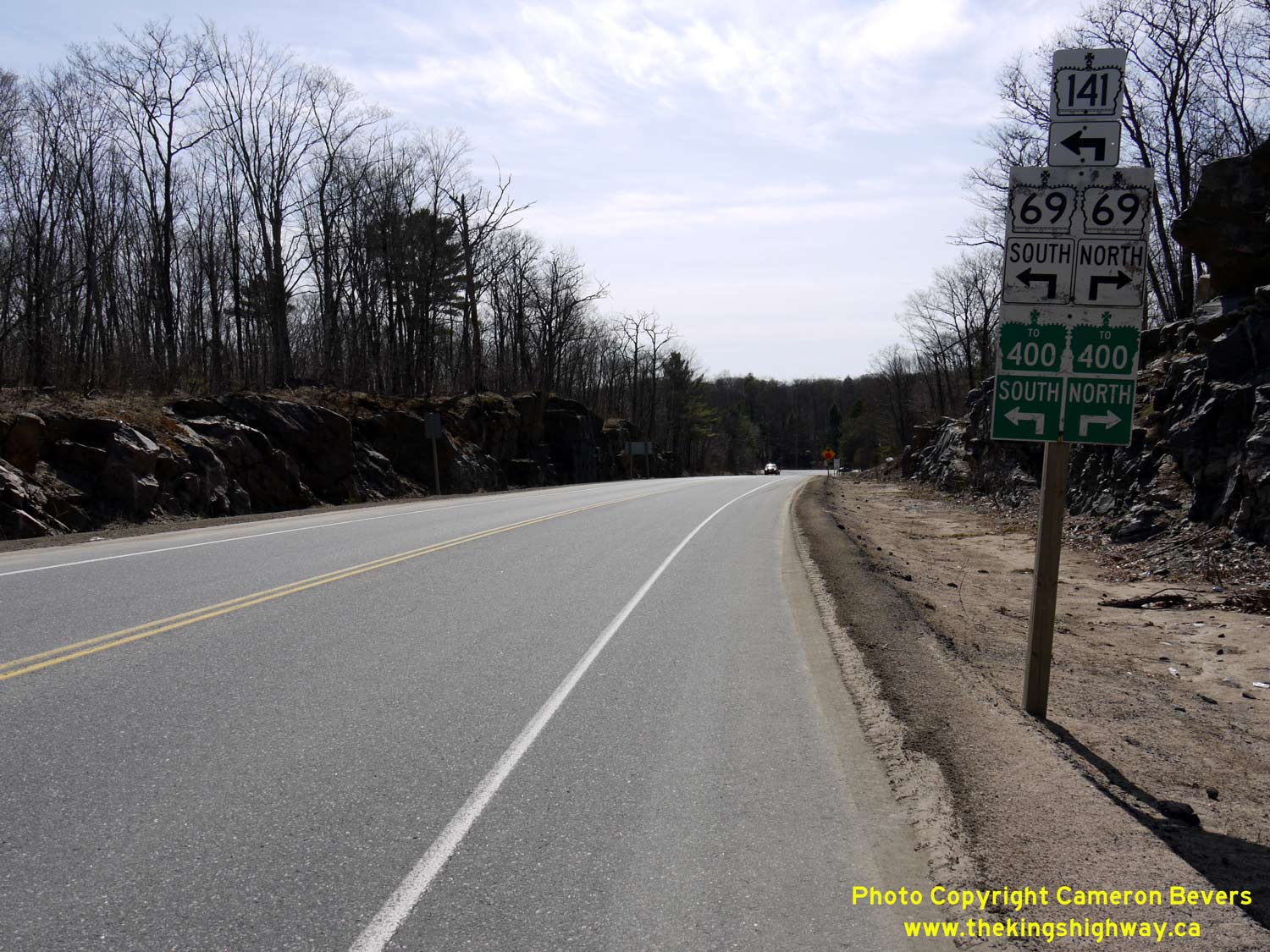
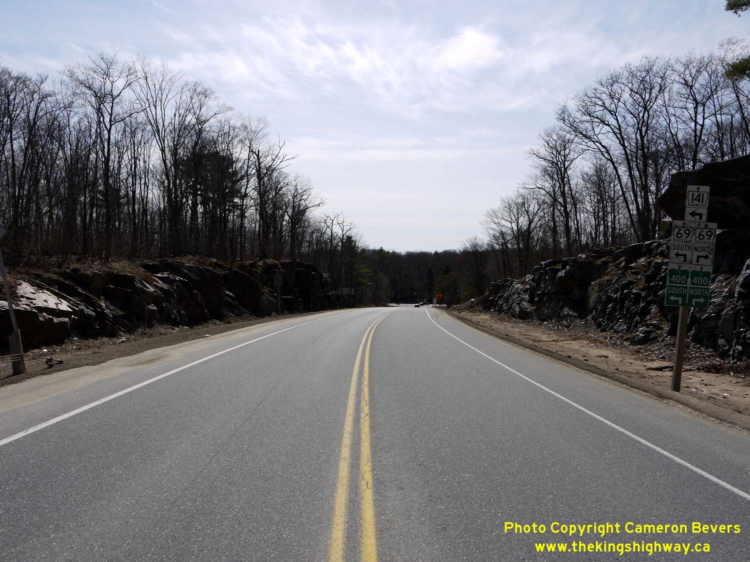
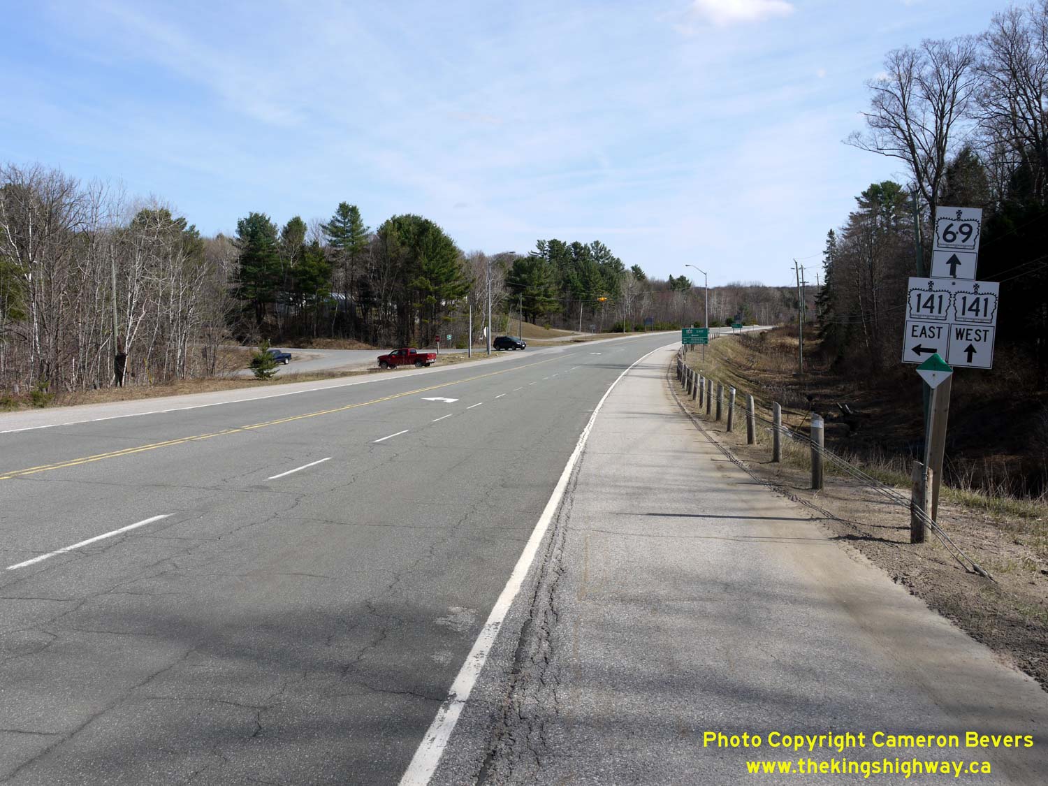
Left - Junction sign assembly on westbound Hwy 141 approaching the Hwy 69 North Junction at Hayes Corners. See an
Enlarged Photo Here. (Photograph taken on April 12, 2012 - © Cameron Bevers) Right - Junction sign assembly and fingerboard destination signs at the Hwy 69 & Hwy 141 East Junction at Hayes Corners. From Hayes Corners, Hwy 141 now continues south concurrently with Hwy 69, where it connects with Hwy 400 near the Parry Sound Area Municipal Airport. The 4 km extension of Hwy 141 came into effect in October, 2003, in conjunction with the Hwy 400 Extension to Horseshoe Lake. See an Enlarged Photo Here. (Photograph taken on April 12, 2012 - © Cameron Bevers) 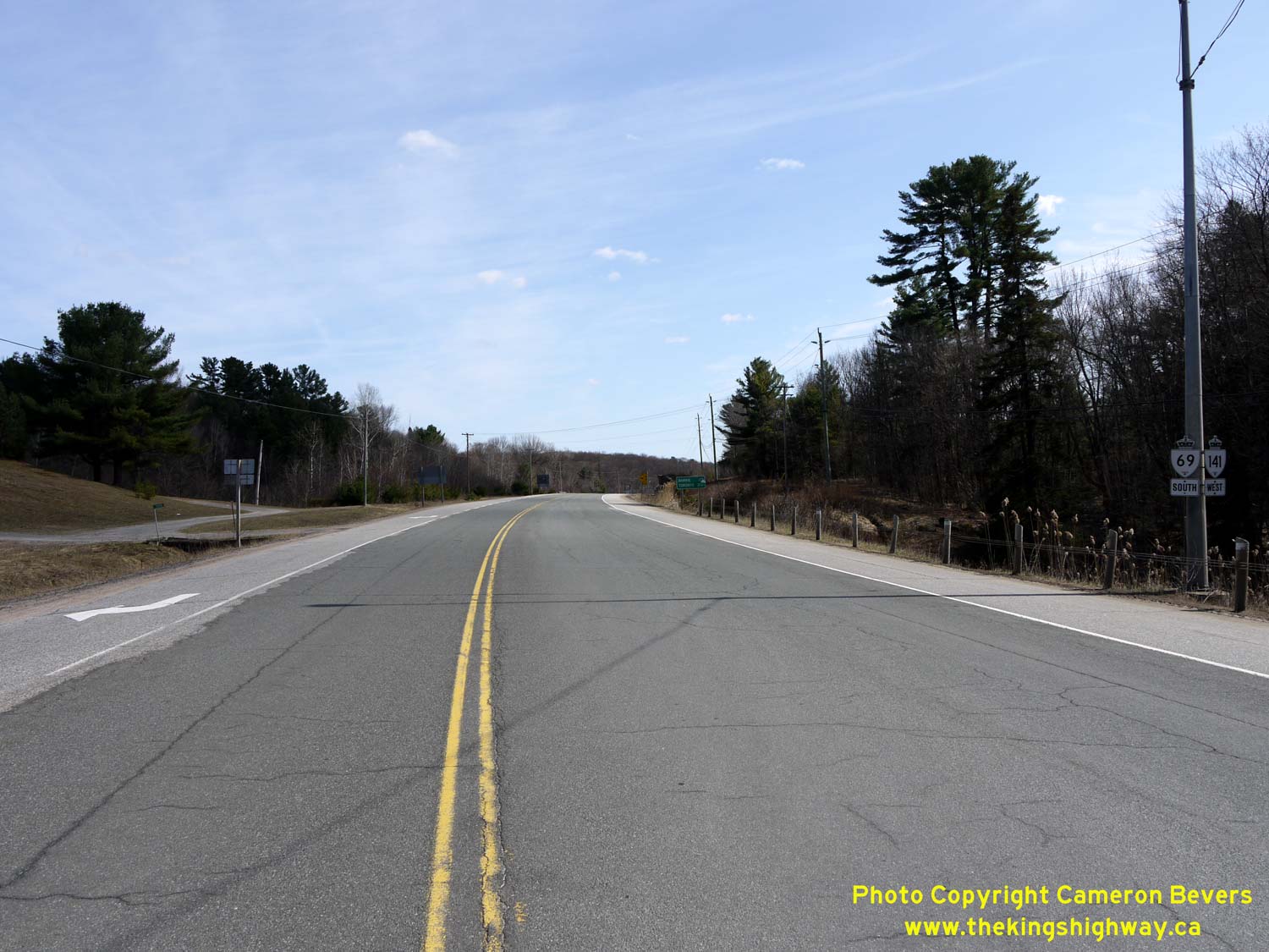
Left - Facing south along Hwy 69 & Hwy 141 towards MacTier from Hayes Corners. See an
Enlarged Photo Here. (Photograph taken on April 12, 2012 - © Cameron Bevers) Right - Dual King's Highway route markers on southbound Hwy 69 & Hwy 141 at Hayes Corners. See an Enlarged Photo Here. (Photograph taken on April 12, 2012 - © Cameron Bevers) 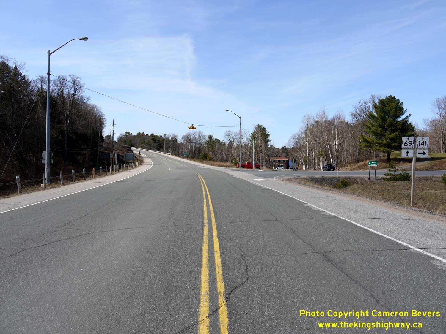
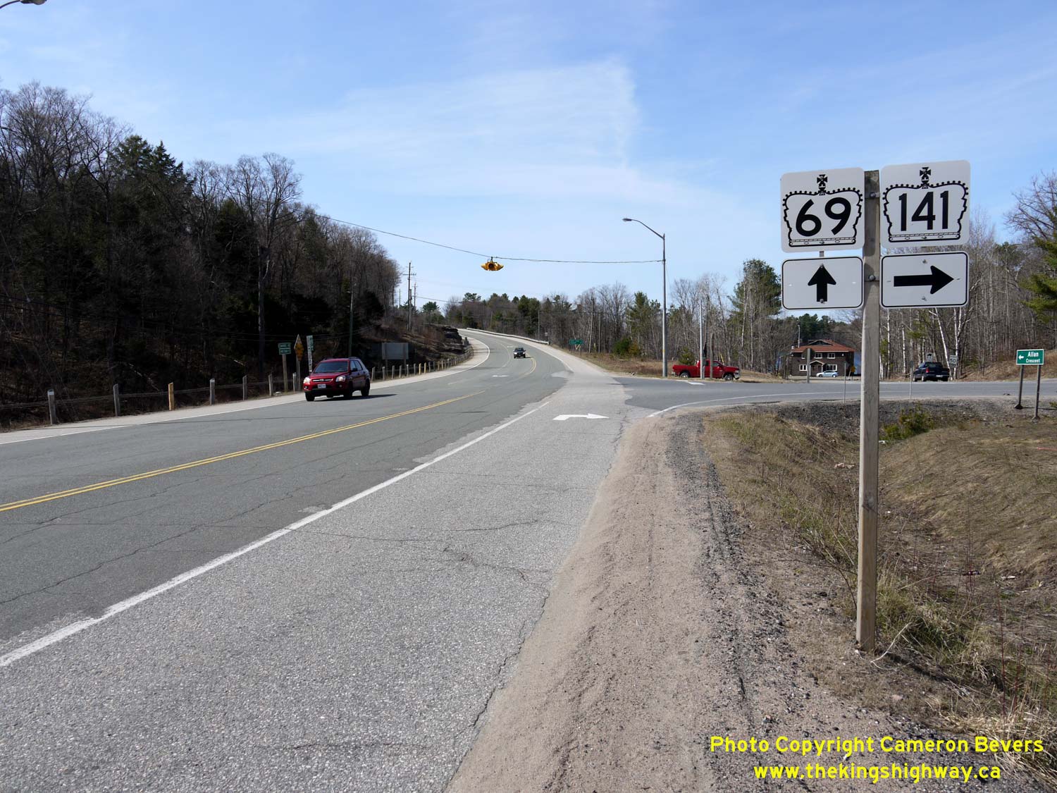
Left - Facing north along Hwy 69 towards Parry Sound at the Hwy 141 East Junction at Hayes Corners. The intersection at Hayes Corners is located on a long
horizontal curve. A flashing overhead intersection warning beacon exists at this highway junction. See an
Enlarged Photo Here. (Photograph taken on April 12, 2012 - © Cameron Bevers) Right - Hwy 69 & Hwy 141 route markers at Hayes Corners, facing north. These two highways have intersected at Hayes Corners ever since Hwy 141 was first established as a King's Highway in 1974. It wasn't until 2003 that Hwy 69 & Hwy 141 shared a brief concurrent route south of Hayes Corners. As a result of the Hwy 400 Extension's completion to Horseshoe Lake in 2003, Hwy 141 was extended west from Hayes Corners by about 4 km to reach the new freeway. See an Enlarged Photo Here. (Photograph taken on April 12, 2012 - © Cameron Bevers) 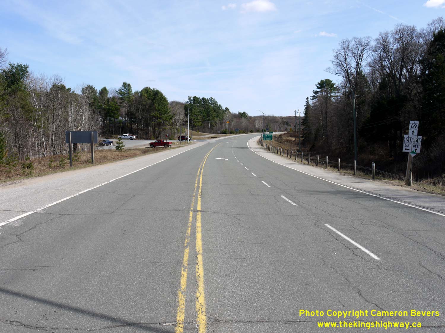
Left - Facing south along Hwy 69 towards MacTier at the Hwy 141 East Junction at Hayes Corners. See an
Enlarged Photo Here. (Photograph taken on April 12, 2012 - © Cameron Bevers) Right - Junction sign assembly on southbound Hwy 69 approaching the Hwy 141 East Junction at Hayes Corners. See an Enlarged Photo Here. (Photograph taken on April 12, 2012 - © Cameron Bevers) 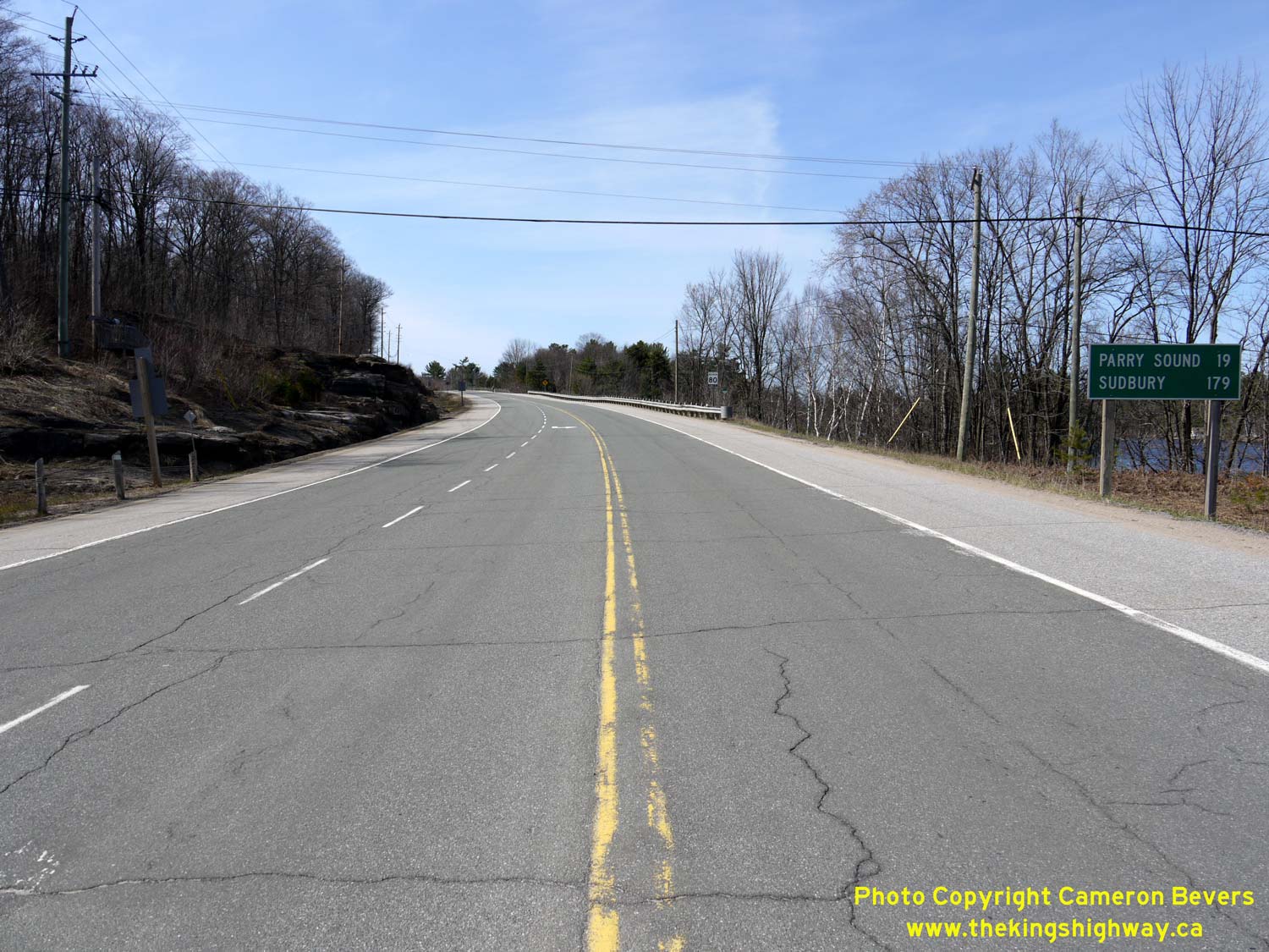
Above - Distance guide sign on northbound Hwy 69 near the Hwy 141 East Junction at Hayes Corners. See an
Enlarged Photo Here. (Photograph taken on April 12, 2012 - © Cameron Bevers) 

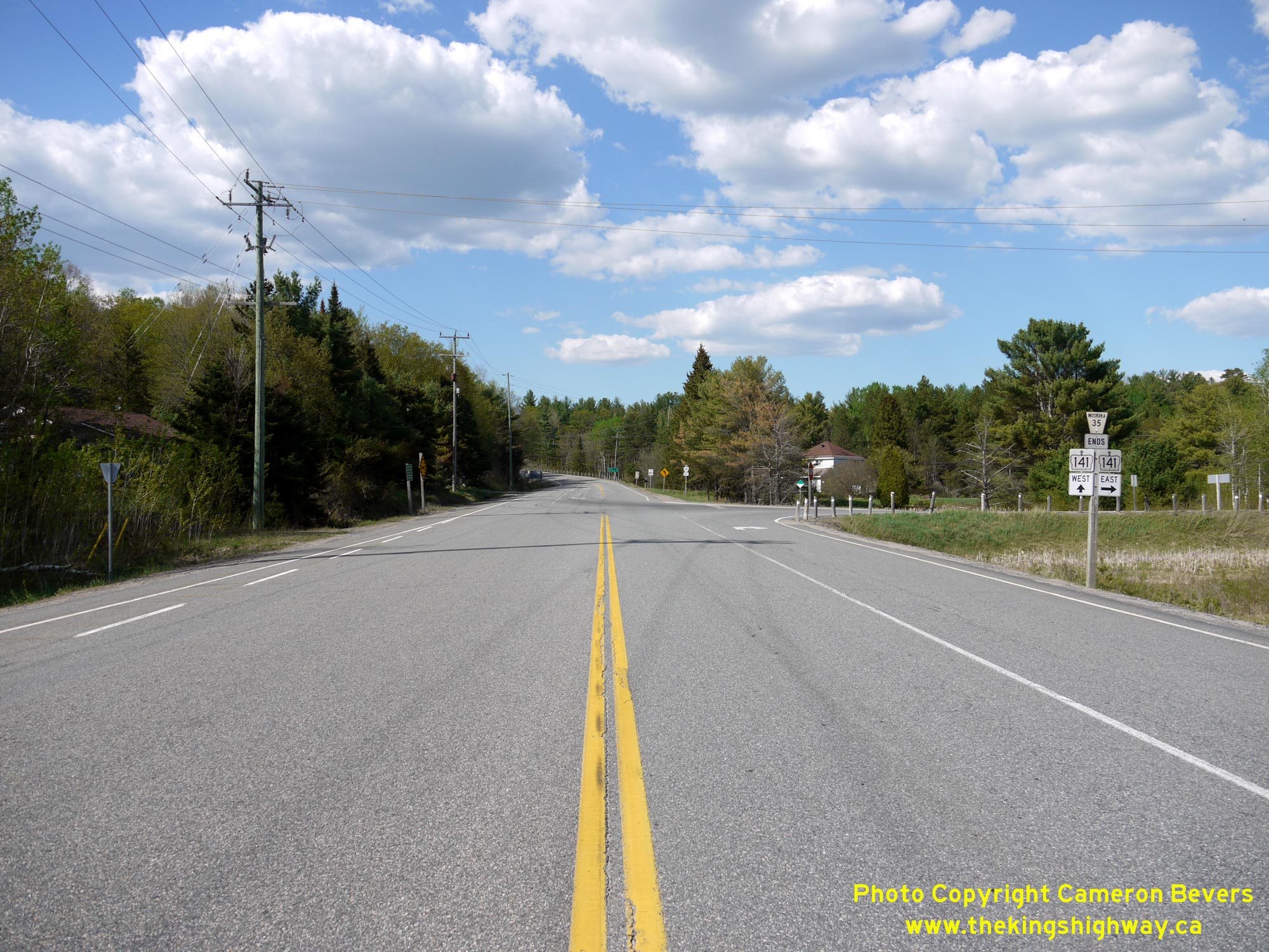
Left - Facing south along Hwy 632 (Pine Street) towards Port Sandfield from the Hwy 141 Junction. See an
Enlarged Photo Here. (Photograph taken on June 24, 2017 - © Cameron Bevers) Right - Northern terminus of Hwy 632 at the Hwy 141 Junction in Rosseau. See an Enlarged Photo Here. (Photograph taken on June 24, 2017 - © Cameron Bevers) 

Left - Fingerboard guide signs and junction sign assembly at the Hwy 141 & Hwy 632 Junction. Motorists at this highway junction can either turn left and
head west along Hwy 141 towards Hwy 400 and Parry Sound, or turn right and head east along Hwy 141 towards Hwy 11, Bracebridge and Huntsville. See an
Enlarged Photo Here. (Photograph taken on June 24, 2017 - © Cameron Bevers) Right - Facing west along Hwy 141 towards Parry Sound from the Hwy 632 Junction in Rosseau. See an Enlarged Photo Here. (Photograph taken on June 24, 2017 - © Cameron Bevers) 

Left - Approaching the Hwy 632 Junction on Hwy 141 in Rosseau, facing east. These two highways connect near the western entrance to the village. See an
Enlarged Photo Here. (Photograph taken on June 24, 2017 - © Cameron Bevers) Right - Facing east along Hwy 141 towards Bracebridge and Huntsville at the Hwy 632 Junction in Rosseau. See an Enlarged Photo Here. (Photograph taken on June 24, 2017 - © Cameron Bevers) 

Left - Junction of Hwy 141 & Hwy 632 in Rosseau, facing west towards Parry Sound. This is the only provincial highway junction situated along Hwy 141
between the Hwy 11 Interchange and the Hwy 69 Junction south of Parry Sound at Hayes Corners. See an
Enlarged Photo Here. (Photograph taken on June 24, 2017 - © Cameron Bevers) Right - Junction sign assembly on westbound Hwy 141 at the Hwy 632 Junction in Rosseau. See an Enlarged Photo Here. (Photograph taken on June 24, 2017 - © Cameron Bevers) 

Left - Facing east along Hwy 141 towards Utterson from the Hwy 632 Junction in Rosseau. See an
Enlarged Photo Here. (Photograph taken on June 24, 2017 - © Cameron Bevers) Right - View of Hwy 141 through Rosseau, facing west. Just ahead, Hwy 141 connects with Hwy 632 at Pine Street. See an Enlarged Photo Here. (Photograph taken on June 24, 2017 - © Cameron Bevers) 
Left - An older junction sign assembly on westbound Hwy 141 approaching the Hwy 632 Junction in Rosseau. See an
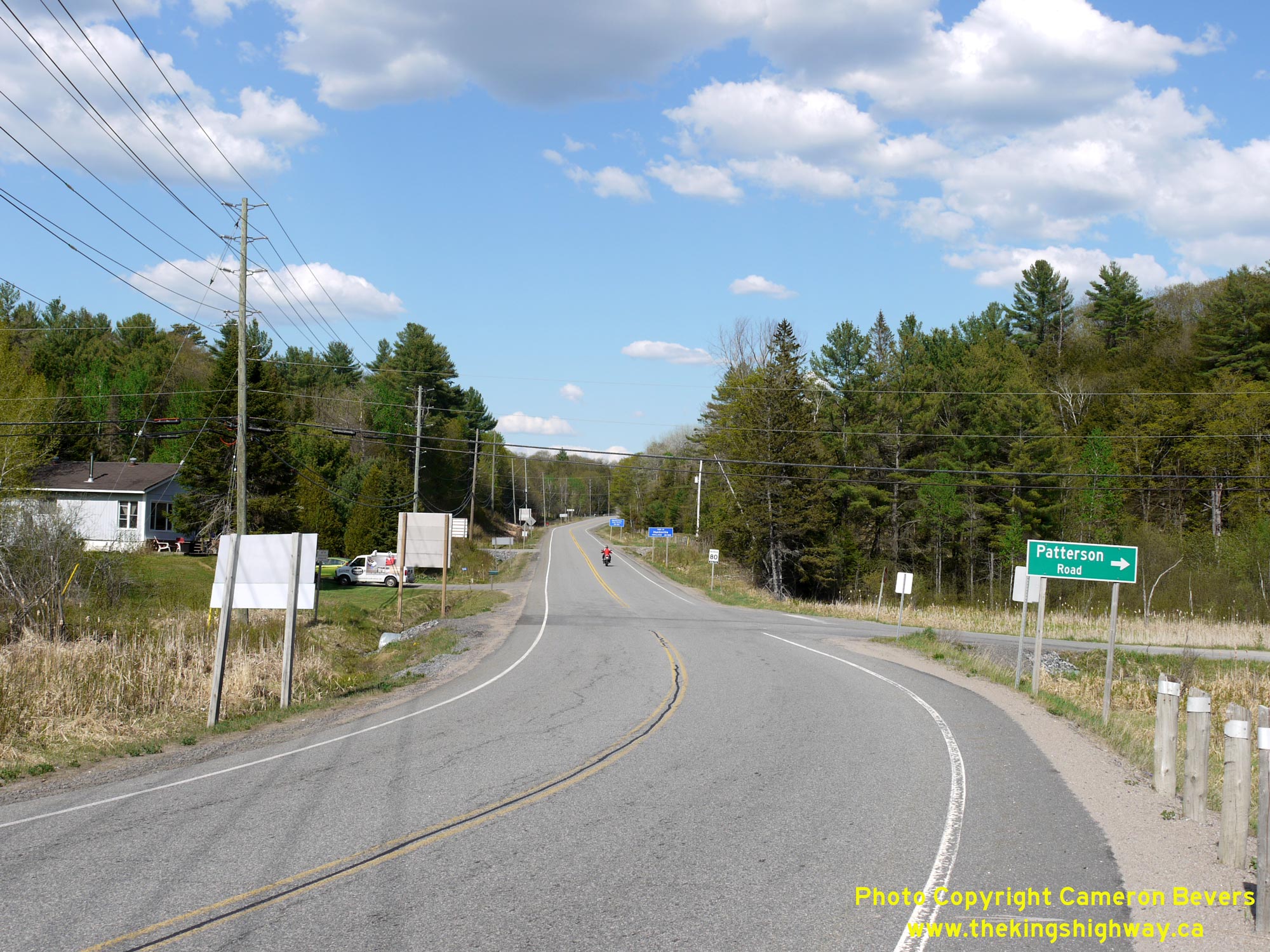
Enlarged Photo Here. (Photograph taken on June 24, 2017 - © Cameron Bevers) Right - Destination guide signs on northbound Raymond Road (Former Hwy 516 & Hwy 532) approaching the Hwy 141 Junction at Patterson's Corners. See an Enlarged Photo Here. (Photograph taken on May 23, 2020 - © Cameron Bevers) 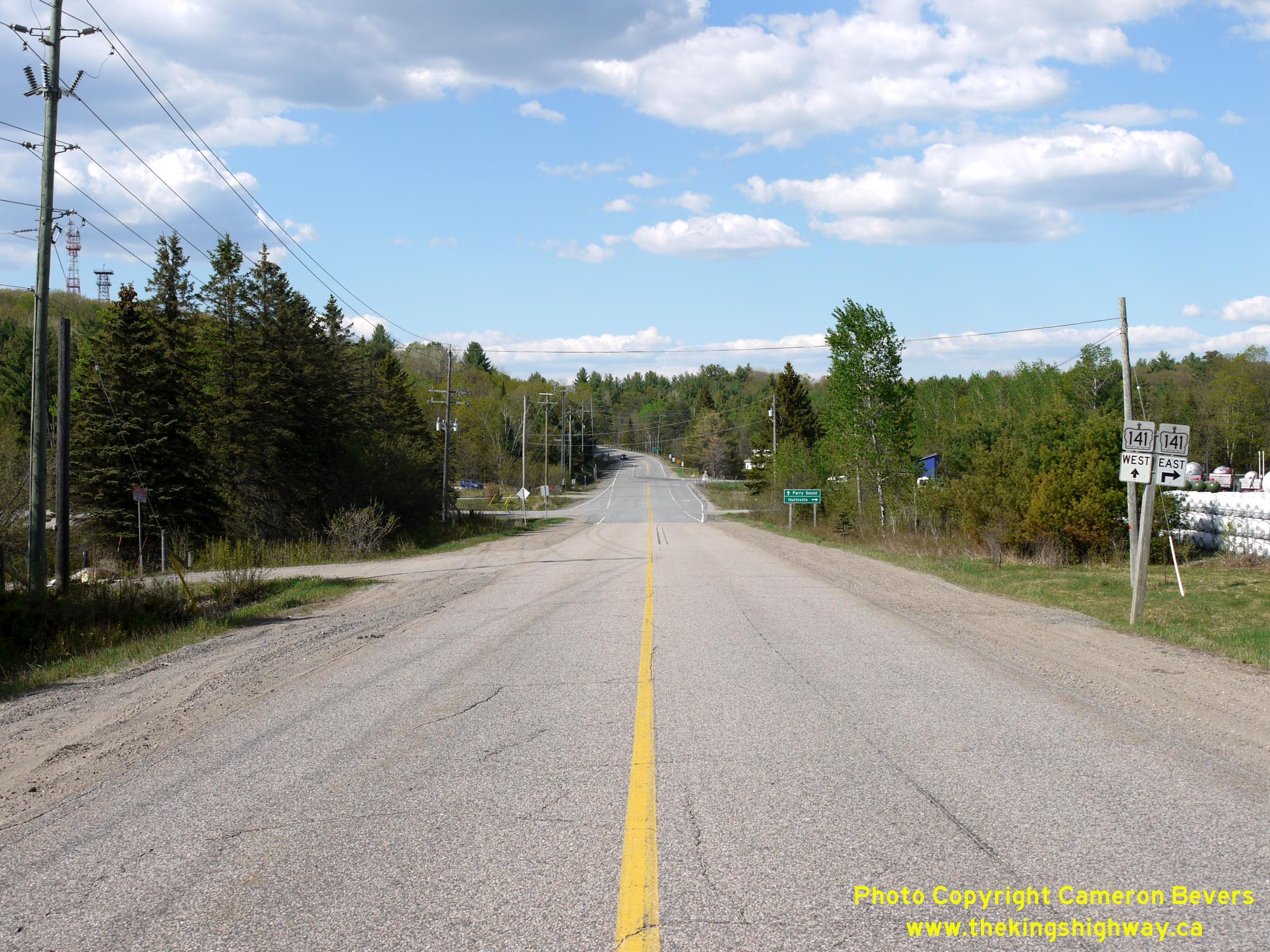
Left - Facing north along Raymond Road (Former Hwy 516 & Hwy 532) approaching the Hwy 141 Junction at Patterson's Corners. This view of the highway shows
the relocated highway junction constructed in the late 1960s. At the time of the highway junction's construction in 1968-1969, Hwy 532 was considered the "through
highway" at the junction. Today, Hwy 141 approaches Patterson's Corners along the former route of Hwy 516 East (at right) and the former route of Hwy 532 West
(straight ahead). Although these two highways also shared an overlapped route via Raymond Road south of this highway junction, jurisdiction over these two routes was
transferred from the province to the District Municipality of Muskoka in April 1972. See an
Enlarged Photo Here. (Photograph taken on May 23, 2020 - © Cameron Bevers) Right - View of Patterson's Corners, facing north along Raymond Road. Prior to 1972, Former Hwy 516 turned right and headed east towards Port Sydney, while Former Hwy 532 continued straight ahead towards Rosseau. The road from Port Sydney to Hayes Corners was designated as a King's Highway (Hwy 141) in December 1974. See an Enlarged Photo Here. (Photograph taken on May 23, 2020 - © Cameron Bevers) 
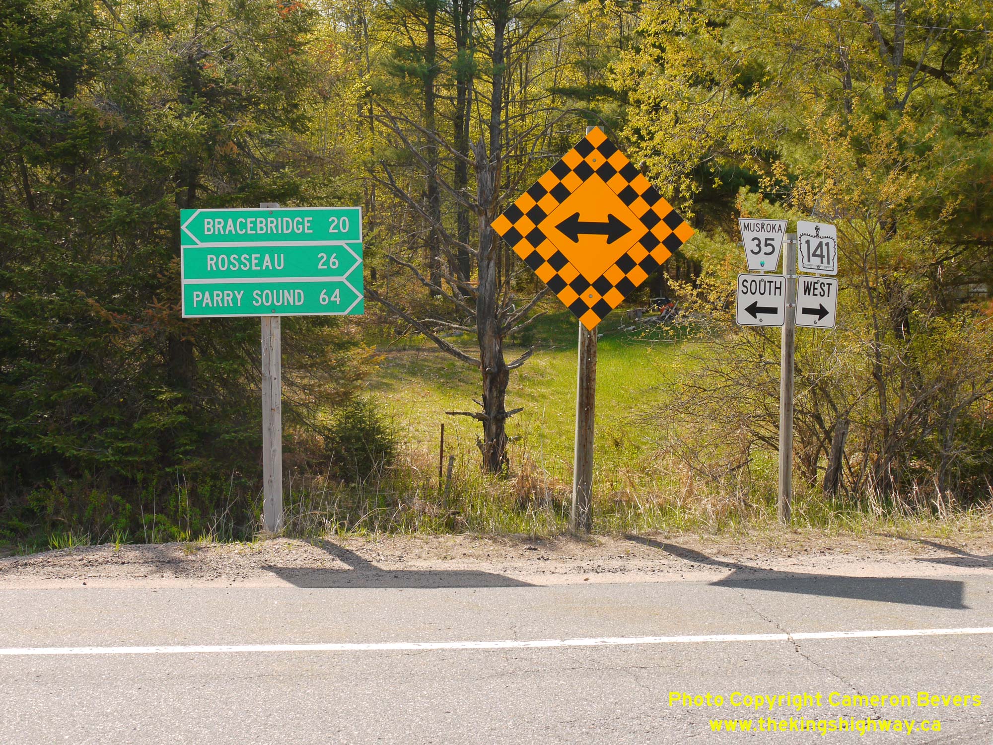
Left - Facing south along Raymond Road (Former Hwy 516 & Hwy 532) towards Bracebridge from the Hwy 141 Junction at Patterson's Corners. See an
Enlarged Photo Here. (Photograph taken on May 23, 2020 - © Cameron Bevers) Right - Junction sign assembly and fingerboard guide signs at Patterson's Corners. Today, Hwy 141 turns right heading westbound and heads northwesterly towards Rosseau. Motorists can also reach Bracebridge via Raymond Road (Muskoka Road 35) by turning left at this highway junction. See an Enlarged Photo Here. (Photograph taken on May 23, 2020 - © Cameron Bevers) 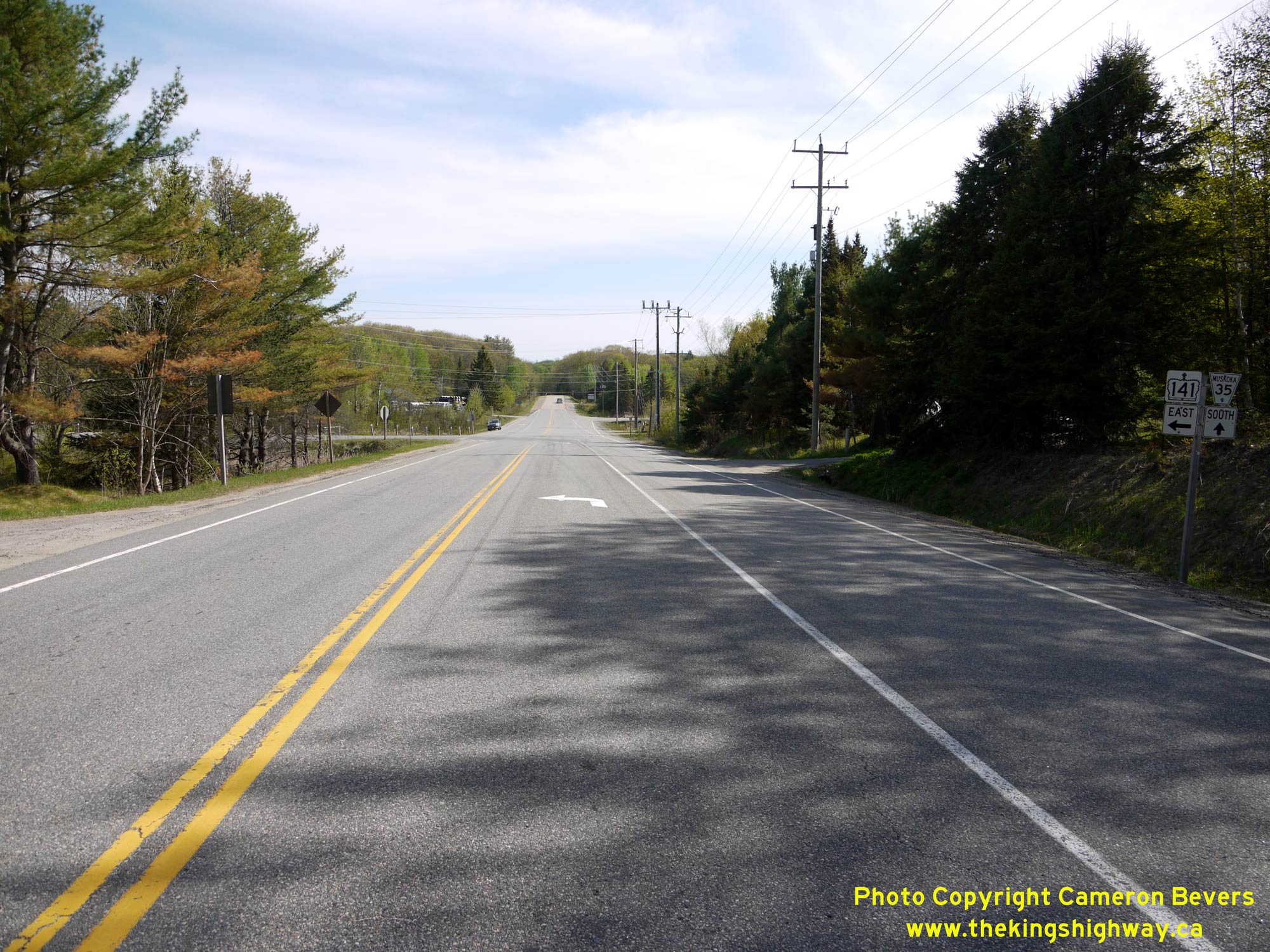
Left - Approaching Patterson's Corners on Hwy 141, facing east. The relocated highway junction at Patterson's Corners offered significantly improved geometry
and better sight lines for motorists approaching the intersection. The old highway junction at Patterson's Corners was inconspicuous on most of the approaches. One of
the curiosities of this highway junction though is that the current highway's route (Hwy 141) is not actually the through highway at the intersection. Motorists have
to turn left to continue east along Hwy 141. Historically, Hwy 532 continued straight through at this highway junction, which meant that the junction's layout was in
keeping with the route numbers in place at the time of the highway junction's construction in the late 1960s. See an
Enlarged Photo Here. (Photograph taken on May 23, 2020 - © Cameron Bevers) Right - Facing west towards Rosseau on Hwy 141 (Former Hwy 532) from Patterson's Corners. See an Enlarged Photo Here. (Photograph taken on May 23, 2020 - © Cameron Bevers) 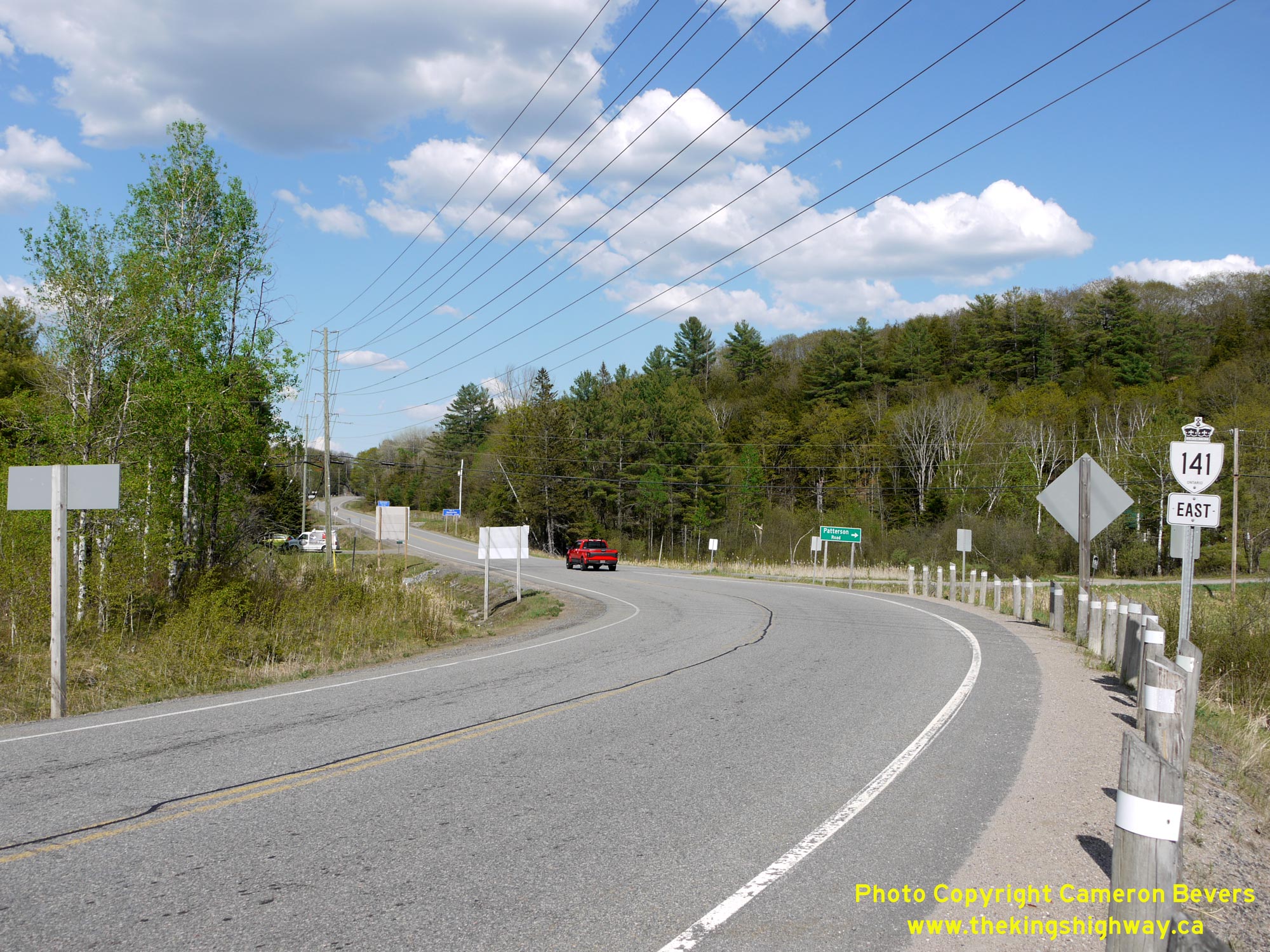
Left - View of Hwy 141 facing east towards Port Sydney from the relocated highway junction's location at Patterson's Corners. Prior to 1969, the highway
junction was located at the point where the red pickup truck is situated in this photo. See an
Enlarged Photo Here. (Photograph taken on May 23, 2020 - © Cameron Bevers) Right - Facing east along Hwy 141 towards the former location of the Hwy 516 & Hwy 532 Junction at Patterson Road. The highway junction was relocated about 100 metres west of its old location during the late 1960s, in order to improve the intersection's geometry and thereby offer better sight lines for motorists using the junction. See an Enlarged Photo Here. (Photograph taken on May 23, 2020 - © Cameron Bevers) 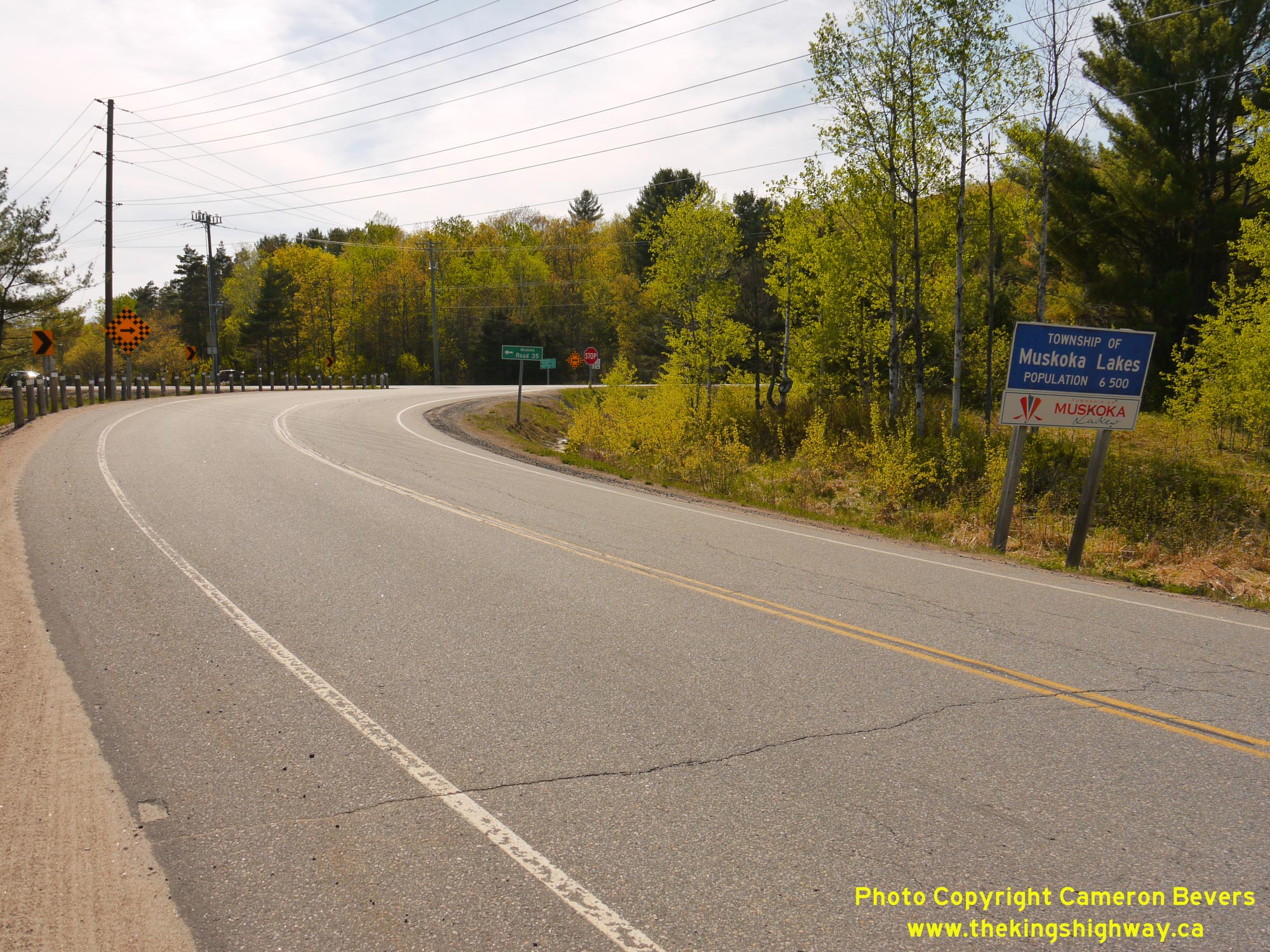
Left - Facing west along Hwy 141 approaching the highway junction at Patterson's Corners. Today, Hwy 141 turns right at this junction and continues west
towards Rosseau. Prior to 1972, Hwy 516 turned left and followed Raymond Road (Hwy 532) south to the Windermere Road. The northwestern leg of Hwy 532 from this
junction to Hayes Corners via Rosseau was renumbered as Hwy 141 in 1974. The former leg of Hwy 516 & Hwy 532 via Raymond Road was transferred to the District
Municipality of Muskoka in 1972. The old overlapped route Hwy 516 & Hwy 532 via Raymond Road is known today as Muskoka Road 35. See an
Enlarged Photo Here. (Photograph taken on May 23, 2020 - © Cameron Bevers) Right - View of the bypassed route of Hwy 516 & Hwy 532 (Patterson Road), as seen from the current route of Hwy 141. The revised highway junction completed at Patterson's Corners in 1969 bypassed a very sharp curve in the old highway's route approaching the junction from the south and a significant grade on the old highway's approach to the junction from the north. See an Enlarged Photo Here. (Photograph taken on May 23, 2020 - © Cameron Bevers) 
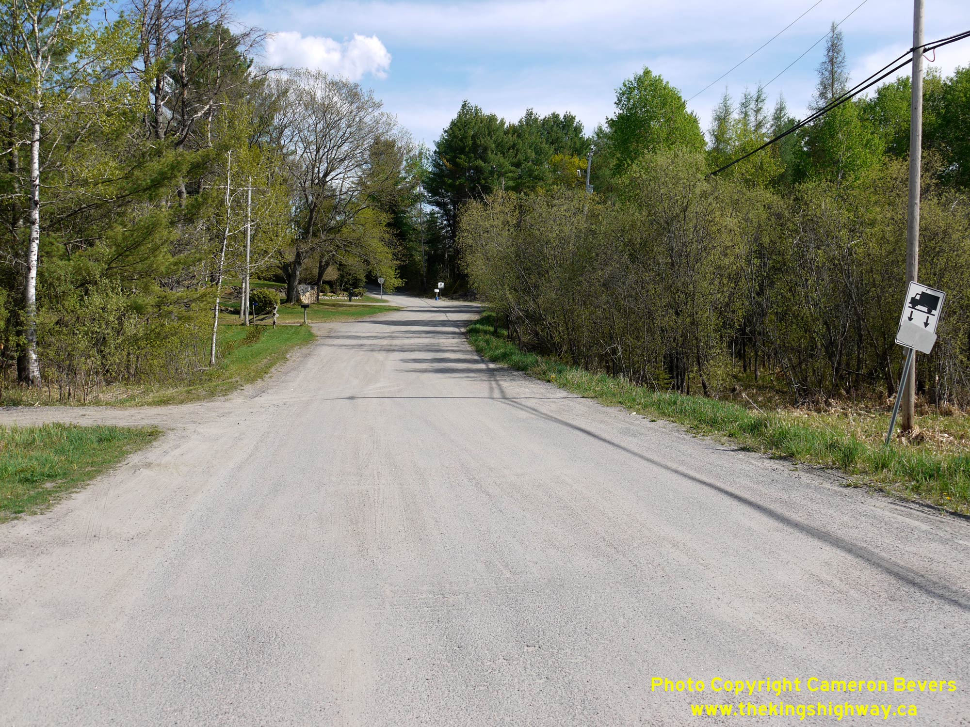
Above - View of the bypassed route of Hwy 516 & Hwy 532 (Patterson Road) where it intersects with the current route of Hwy 141. Although the road has now
been closed for many decades, Hwy 532 used to continue straight ahead across the road from this intersection towards Rosseau. Today, there is little trace of the
original route of Hwy 532 along the northern side of Hwy 141. Although it is not easy to detect anymore due to the vegetation and undergrowth, there was a significant
grade along the old north leg of this highway junction. See an Enlarged Photo Here. (Photograph taken on May 23, 2020 - © Cameron Bevers)
More King's Highway 141 Photographs Coming Soon!
|
|---|
Links to Adjacent King's Highway Photograph Pages:
Back to King's Highway 140 Photos /
King's Highway 141 History /
On to King's Highway 144 Photos
Ontario Highway History - Main Menu / Back to List of Highways Website contents, photos & text © 2002-2026, Cameron
Bevers (Webmaster) - All Rights Reserved / Contact Me
|
|---|