
| 
| |
|
|
This page contains present day photos of the former route of Ontario's King's Highway 15 through Ottawa, arranged by location
from the Highway 7 & Highway 15 Junction in Carleton Place easterly to the Highway 417 Interchange in Ottawa. All photographs displayed on this page were taken by
the Webmaster (Cameron Bevers), unless specifically noted otherwise. Click on any thumbnail to see a larger image!
Please note that all photographs displayed on this
website are protected by copyright. These photographs must not be reproduced, published,
electronically stored or copied, distributed, or posted onto other websites without
my written permission. If you want to use photos from this website, please
email me first for permission. Thank-you!
|
|---|
|
Present Day King's Highway 15 Photographs (Old Route Via Ottawa)


Left - Facing east along Old Hwy 7 & Hwy 15 (Robertson Road) towards the Bell's Corners Subway near Ottawa. See an
Enlarged Photo Here. (Photograph taken on August 12, 2007 - © Cameron Bevers) Right - The narrow Bell's Corners Subway shown in the historical 1958 photo above was demolished in 1966 and replaced with this modern railway subway. The new Bell's Corners Subway accommodates a four-lane divided highway. See an Enlarged Photo Here. (Photograph taken on August 12, 2007 - © Cameron Bevers) 

Left - Below-deck view of the Bell's Corners Subway on Old Hwy 7 & Hwy 15 west of Ottawa. See an
Enlarged Photo Here. (Photograph taken on August 12, 2007 - © Cameron Bevers) Right - Facing west along Old Hwy 7 & Hwy 15 towards the Bell's Corners Subway near Ottawa. See an Enlarged Photo Here. (Photograph taken on August 12, 2007 - © Cameron Bevers) 

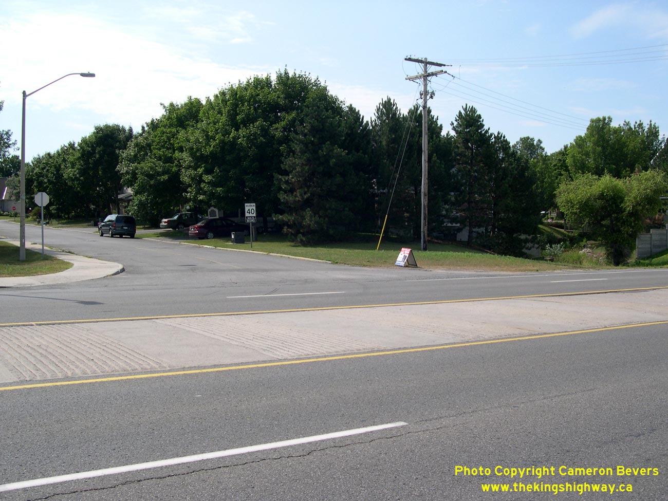
Left - The centre median of Old Hwy 7 & Hwy 15 approaching the Bell's Corners Subway is comprised of a wide concrete rumble strip known as a "singing
median". Many four-lane highways built in Ontario during the 1960s and 1970s had singing medians. However, this style of centreline treatment is no longer popular
with the Ontario Ministry of Transportation. The singing median is slowly disappearing from the Ontario landscape as older highways are reconstructed. See an
Enlarged Photo Here. (Photograph taken on August 12, 2007 - © Cameron Bevers) Right - Close-up of the singing median on Old Hwy 7 & Hwy 15 at Bell's Corners. The concrete centre strip has a series of intermittent alternating recessed grooves and raised humps, which provides drivers with an audible warning that their vehicle's tires have encroached over the centreline of the highway. See an Enlarged Photo Here. (Photograph taken on August 12, 2007 - © Cameron Bevers) 

Left - Structure identification number and date stamp (1966) on the Bell's Corners Subway on Old Hwy 7 & Hwy 15. See an
Enlarged Photo Here. (Photograph taken on August 12, 2007 - © Cameron Bevers) Right - Deck view of the Bell's Corners Subway on Old Hwy 7 & Hwy 15. This former railway line has been converted to a walking trail. See an Enlarged Photo Here. (Photograph taken on August 12, 2007 - © Cameron Bevers) 

Left - Facing east along Old Hwy 7 & Hwy 15 towards Bell's Corners from the former railway subway. This section of Old Hwy 7 & Hwy 15 now has a
distinctly suburban aura. See an Enlarged Photo Here. (Photograph taken on August 12, 2007 - © Cameron Bevers) Right - Conversely, the view of Old Hwy 7 & Hwy 15 facing west from the Bell's Corners Subway still resembles a rural four-lane King's Highway. See an Enlarged Photo Here. (Photograph taken on August 12, 2007 - © Cameron Bevers) |
|---|
Links to Adjacent King's Highway Photograph Pages:
Back to King's Highway 15 Photos /
King's Highway 15 History /
On to King's Highway 16 Photos
Ontario Highway History - Main Menu / Back to List of Highways Website contents, photos & text © 2002-2026, Cameron
Bevers (Webmaster) - All Rights Reserved / Contact Me
|
|---|