
| 
| |
|
|
This page contains present day photos (Year 2000 to date) of Ontario's King's Highway 17, arranged by location from the Quebec
Boundary westerly to Ottawa. All photographs displayed on this page were taken by the Webmaster (Cameron Bevers), unless specifically noted otherwise. Click on any
thumbnail to see a larger image!
Please note that all photographs displayed on this
website are protected by copyright. These photographs must not be reproduced, published,
electronically stored or copied, distributed, or posted onto other websites without
my written permission. If you want to use photos from this website, please
email me first for permission. Thank-you!
|
|---|
|
Page 10: Present Day King's Highway 17 Photographs (Quebec Boundary to Ottawa)
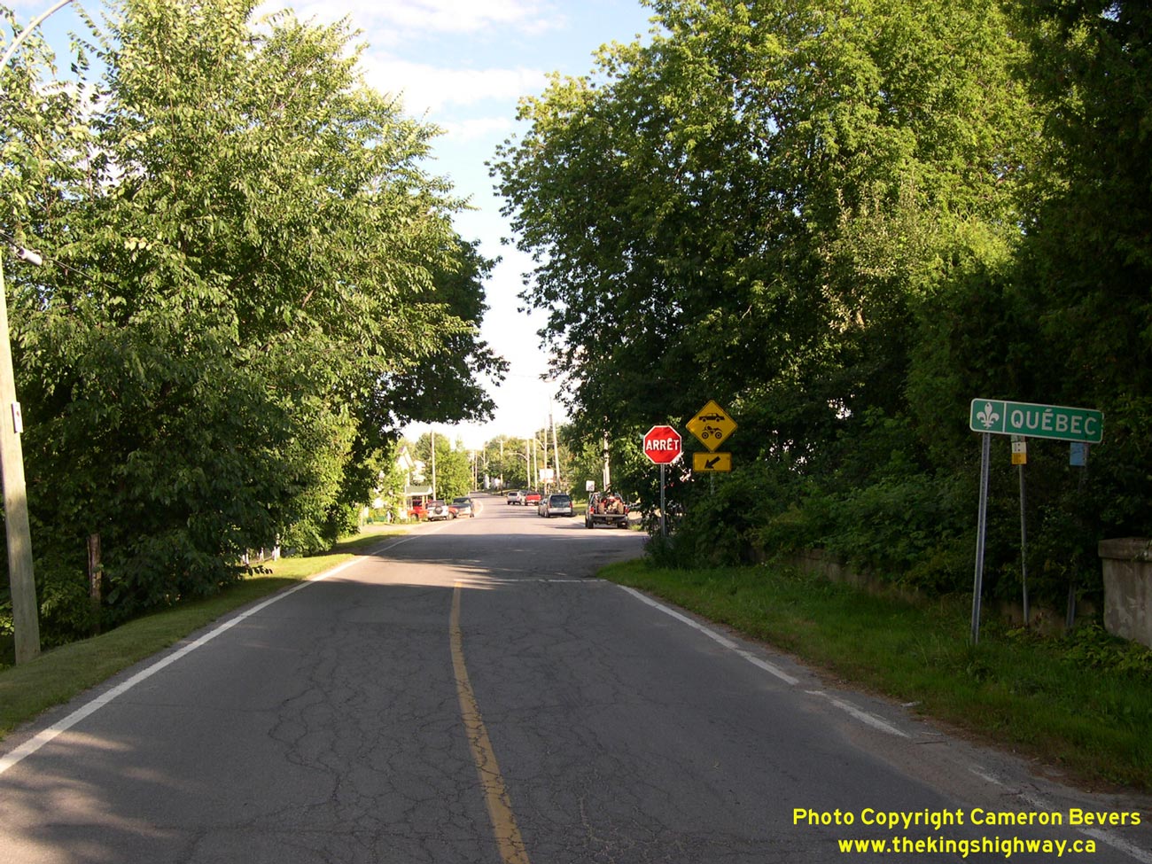
Left - Historical eastern terminus of Hwy 17 at Pointe Fortune, located on the Ontario-Quebec Boundary east of Hawkesbury. This section of Hwy 17 was bypassed
in the late 1950s. The new highway passes by Pointe Fortune about 2 km to the south. The relocated route of Hwy 17 immediately west of the Quebec Boundary is now part
of Hwy 417. See an Enlarged Photo Here. (Photograph taken on July 30, 2005 - © Cameron Bevers) Right - Facing east towards Hawkesbury along the former route of Hwy 17 at Pointe Fortune. Until Pointe Fortune was bypassed in the 1950s, Hwy 17 began at this intersection and proceeded all the way across Ontario to the Manitoba Boundary. Only a small portion of the original highway can be seen at Pointe Fortune. A 4 km section of the original route of Hwy 17 west of this point was flooded beneath the Ottawa River as a result of the Carillon Hydro-electric Dam project. See an Enlarged Photo Here. (Photograph taken on July 30, 2005 - © Cameron Bevers) 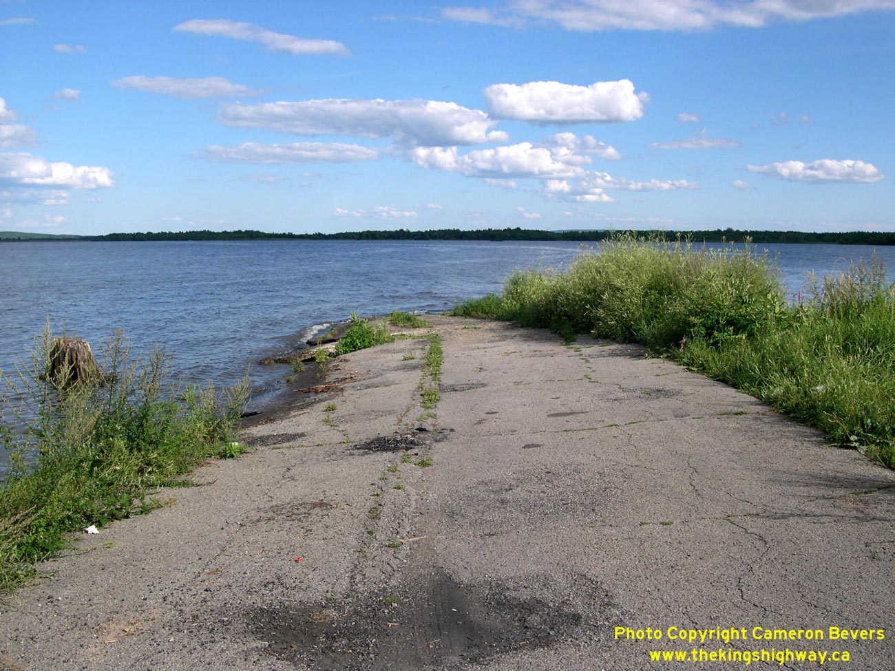
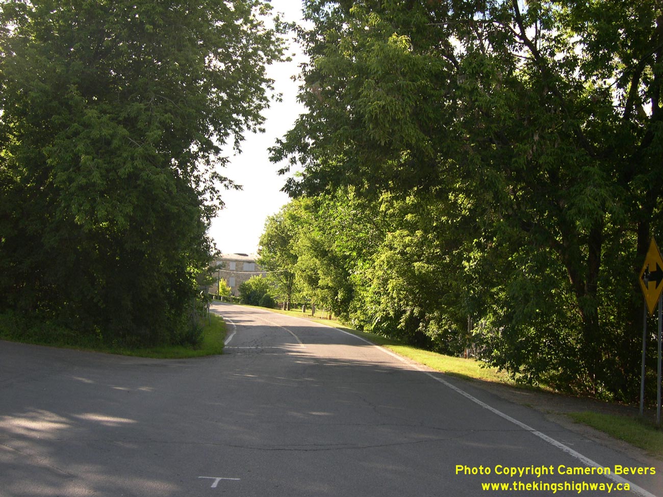
Left - In the late 1950s, Hwy 17 was relocated to bypass Pointe Fortune and the proposed Carillon Hydro-electric Dam project. In the early 1960s, the old
Hwy 17 alignment between Chute a Blondeau and Pointe Fortune was inundated by floodwaters as a result of this massive Hydro-electric Dam project. Here, an abandoned
section of Hwy 17 vanishes below Lac Dollard des Ormeaux, a flooded section of the Ottawa River. See an
Enlarged Photo Here. (Photograph taken on July 30, 2005 - © Cameron Bevers) Right - Once Hwy 17 emerges from the water near Chute a Blondeau, the highway proceeds continuously above the floodline through to Hawkesbury. See an Enlarged Photo Here. (Photograph taken on July 30, 2005 - © Cameron Bevers) 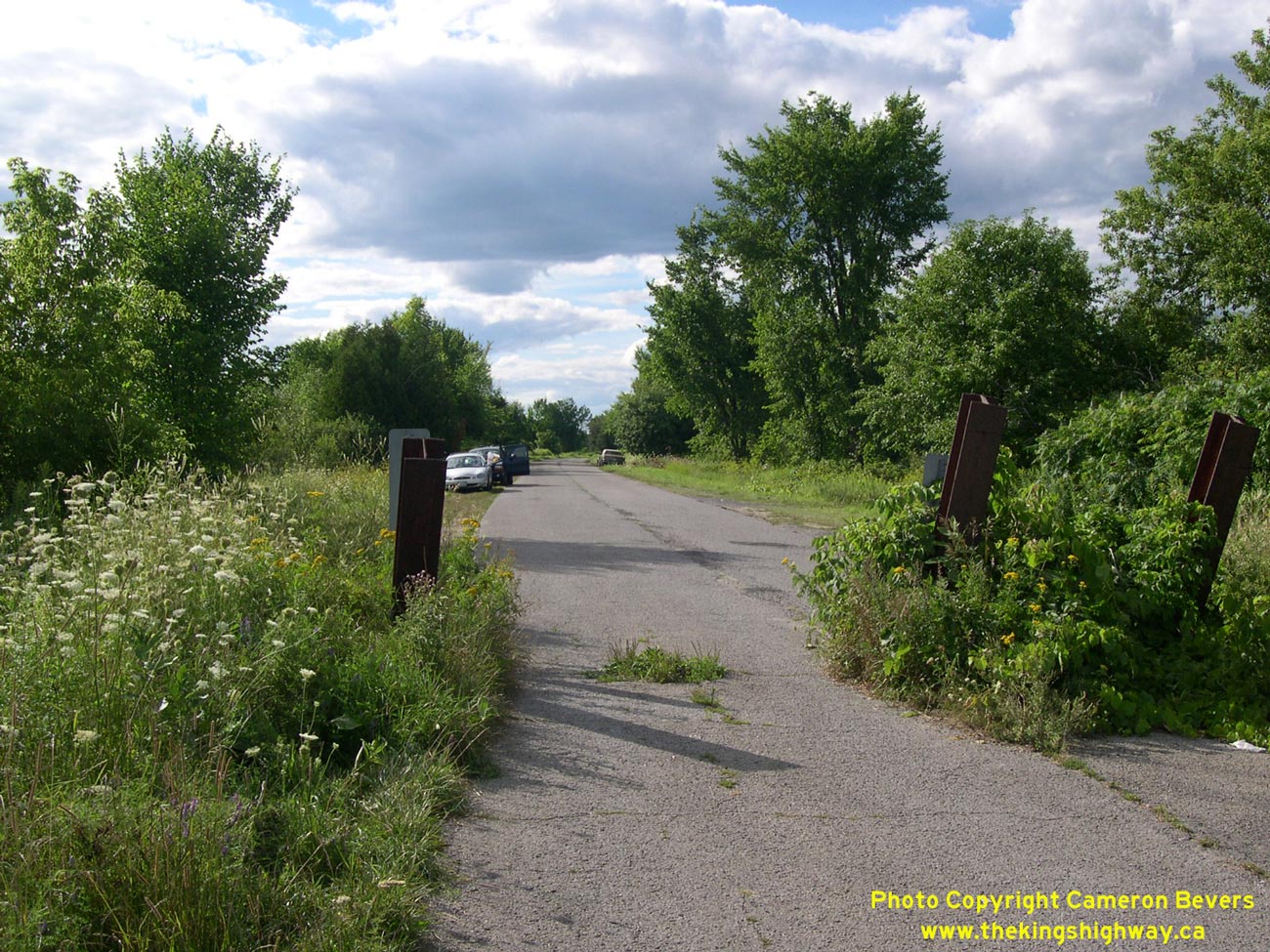
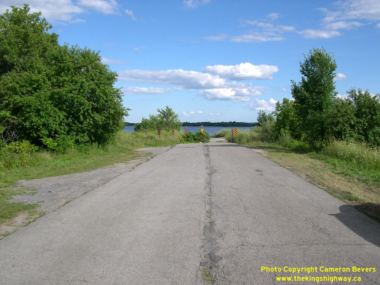
Left - The abrupt end of the former Hwy 17 alignment at Lac Dollard des Ormeaux is guarded by a series of steel H-beam piles driven through the pavement. See an
Enlarged Photo Here. (Photograph taken on July 30, 2005 - © Cameron Bevers) Right - Former alignment of Hwy 17 facing east towards the flooded section at Lac Dollard des Ormeaux. See an Enlarged Photo Here. (Photograph taken on July 30, 2005 - © Cameron Bevers) 
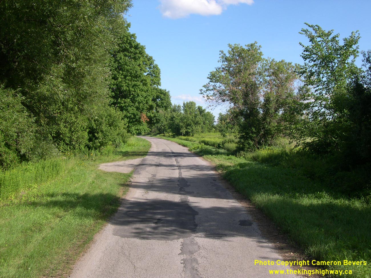
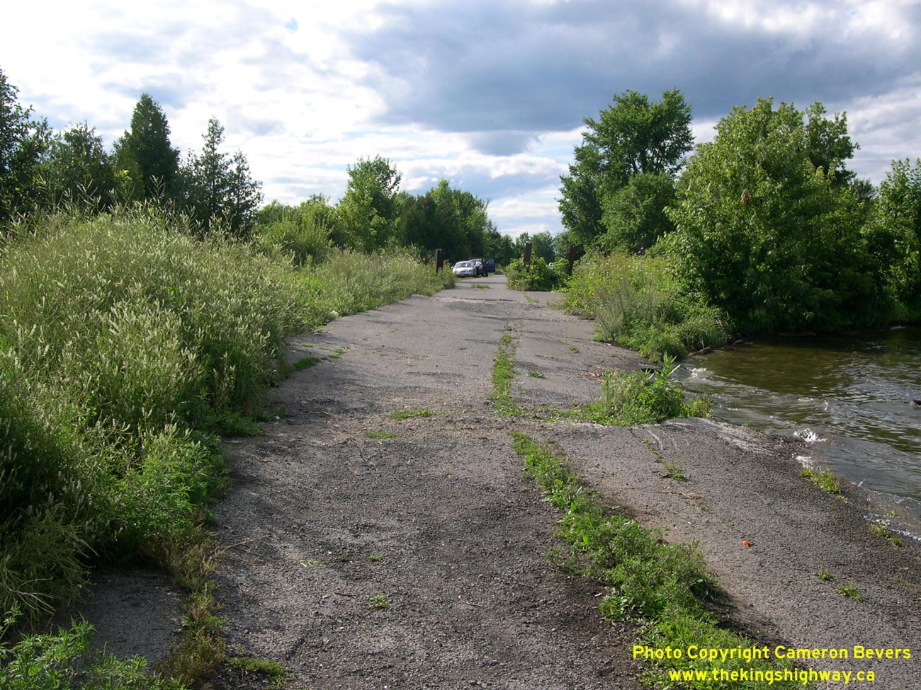
Left - Facing west towards Hawkesbury along the former Hwy 17 alignment east of Chute a Blondeau. See an
Enlarged Photo Here. (Photograph taken on July 30, 2005 - © Cameron Bevers) Right - Another view of the former Hwy 17 alignment near Chute a Blondeau, facing east. See an Enlarged Photo Here. (Photograph taken on July 30, 2005 - © Cameron Bevers) 
Left - Facing west towards Hawkesbury along the former Hwy 17 alignment at Chute a Blondeau. See an
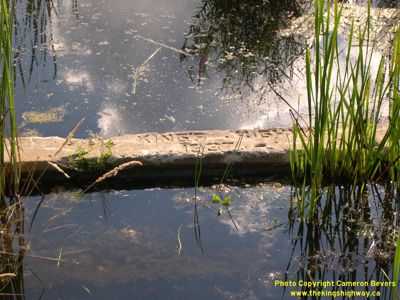
Enlarged Photo Here. (Photograph taken on July 30, 2005 - © Cameron Bevers) Right - A 1937-dated culvert on Hwy 17 is just barely visible above the floodwaters of the Ottawa River near Chute a Blondeau. See an Enlarged Photo Here. (Photograph taken on July 30, 2005 - © Cameron Bevers) 

Left - Approaching the partial two-ramp interchange at Hwy 17 & Hwy 417 east of Hawkesbury. At this interchange, eastbound Hwy 17 traffic can only continue
eastbound on Hwy 417. There are no ramps from eastbound Hwy 17 to westbound Hwy 417 or from eastbound Hwy 417 to westbound Hwy 17. For many years, this point marked
the eastern terminus of Hwy 17. Since the highway downloading spree in the late 1990s, the section of Hwy 17 east of Ottawa has been maintained by municipal road
authorities. The provincially-maintained section of Hwy 17 now begins west of Arnprior. See an
Enlarged Photo Here. (Photograph taken on August 3, 2008 - © Cameron Bevers) Right - Facing east along Hwy 417 towards Montreal from the Hwy 17 Overpass east of Hawkesbury. The freeway was under construction at the time this photo was taken, with only one roadway open for two-way traffic. Many sections of Hwy 417 have been reconstructed with concrete surfaces over the past few years, which necessitated a full closure of one of the carriageways temporarily during construction. See an Enlarged Photo Here. (Photograph taken on July 30, 2005 - © Cameron Bevers) 

Left - Facing west along Hwy 17 towards Hawkesbury from the Hwy 417 Overpass. Traffic coming east from Hawkesbury cannot access westbound Hwy 417 at this
interchange. All traffic entering the freeway must head east towards Montreal. See an
Enlarged Photo Here. (Photograph taken on July 30, 2005 - © Cameron Bevers) Right - Facing east across the Hwy 17 Overpass at Hwy 417 east of Hawkesbury. See an Enlarged Photo Here. (Photograph taken on July 30, 2005 - © Cameron Bevers) 

Left - Western side of the Hwy 17 Overpass across Hwy 417 near Hawkesbury. This two-span post-tensioned structure was completed in 1971. See an
Enlarged Photo Here. (Photograph taken on July 30, 2005 - © Cameron Bevers) Right - Little Rideau Creek Bridge on Hwy 17 east of Hawkesbury. This single span concrete rigid frame structure was completed in 1955. See an Enlarged Photo Here. (Photograph taken on July 30, 2005 - © Cameron Bevers) 
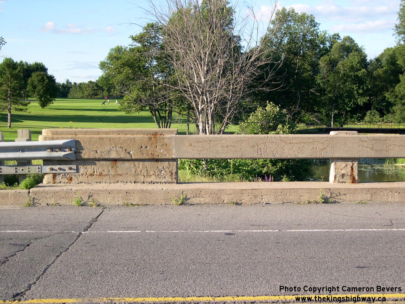
Left - Facing east towards Montreal along Hwy 17 at the Little Rideau Creek Bridge east of Hawkesbury. See an
Enlarged Photo Here. (Photograph taken on July 30, 2005 - © Cameron Bevers) Right - The concrete bar-and-post handrail design of the Little Rideau Creek Bridge is typical of many Ontario bridges built between the early 1940s and the mid-1960s. See an Enlarged Photo Here. (Photograph taken on July 30, 2005 - © Cameron Bevers) 

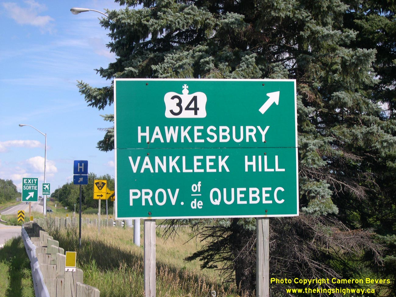
Left - Facing east along Hwy 17 towards Montreal at the Hawkesbury Interchange. See an
Enlarged Photo Here. (Photograph taken on July 30, 2005 - © Cameron Bevers) Right - Approaching the Hawkesbury Interchange at Hwy 17 & Hwy 34, facing south towards Vankleek Hill. See an Enlarged Photo Here. (Photograph taken on July 30, 2005 - © Cameron Bevers) 

Left - Facing north along Hwy 34 approaching the Hwy 17 Overpass. This single span concrete rigid frame structure was completed in 1956. See an
Enlarged Photo Here. (Photograph taken on July 30, 2005 - © Cameron Bevers) Right - View of Hwy 34 facing south towards Vankleek Hill from the Hwy 17 Overpass. See an Enlarged Photo Here. (Photograph taken on July 30, 2005 - © Cameron Bevers) 

Left - View of Hwy 34 facing north towards Hawkesbury from the Hwy 17 Overpass. See an
Enlarged Photo Here. (Photograph taken on July 30, 2005 - © Cameron Bevers) Right - Ramp to and from westbound Hwy 17 at Hwy 34 in Hawkesbury. See an Enlarged Photo Here. (Photograph taken on July 30, 2005 - © Cameron Bevers) 

Left - Green guide sign marking the entrance ramp to Hwy 17 West at the Hawkesbury Interchange. See an
Enlarged Photo Here. (Photograph taken on July 30, 2005 - © Cameron Bevers) Right - Ramps to and from eastbound Hwy 17 at Hwy 34 in Hawkesbury. See an Enlarged Photo Here. (Photograph taken on July 30, 2005 - © Cameron Bevers) 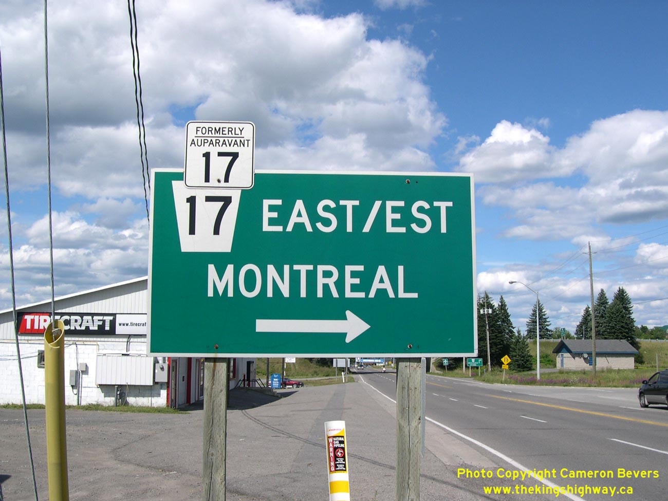
Left - Guide sign marking the entrance ramp to Hwy 17 East on northbound Hwy 34 at the Hawkesbury Interchange. See an
Enlarged Photo Here. (Photograph taken on July 30, 2005 - © Cameron Bevers) Right - Exit sign for Hwy 34 on eastbound Hwy 17 at the Hawkesbury Interchange. See an Enlarged Photo Here. (Photograph taken on July 30, 2005 - © Cameron Bevers) 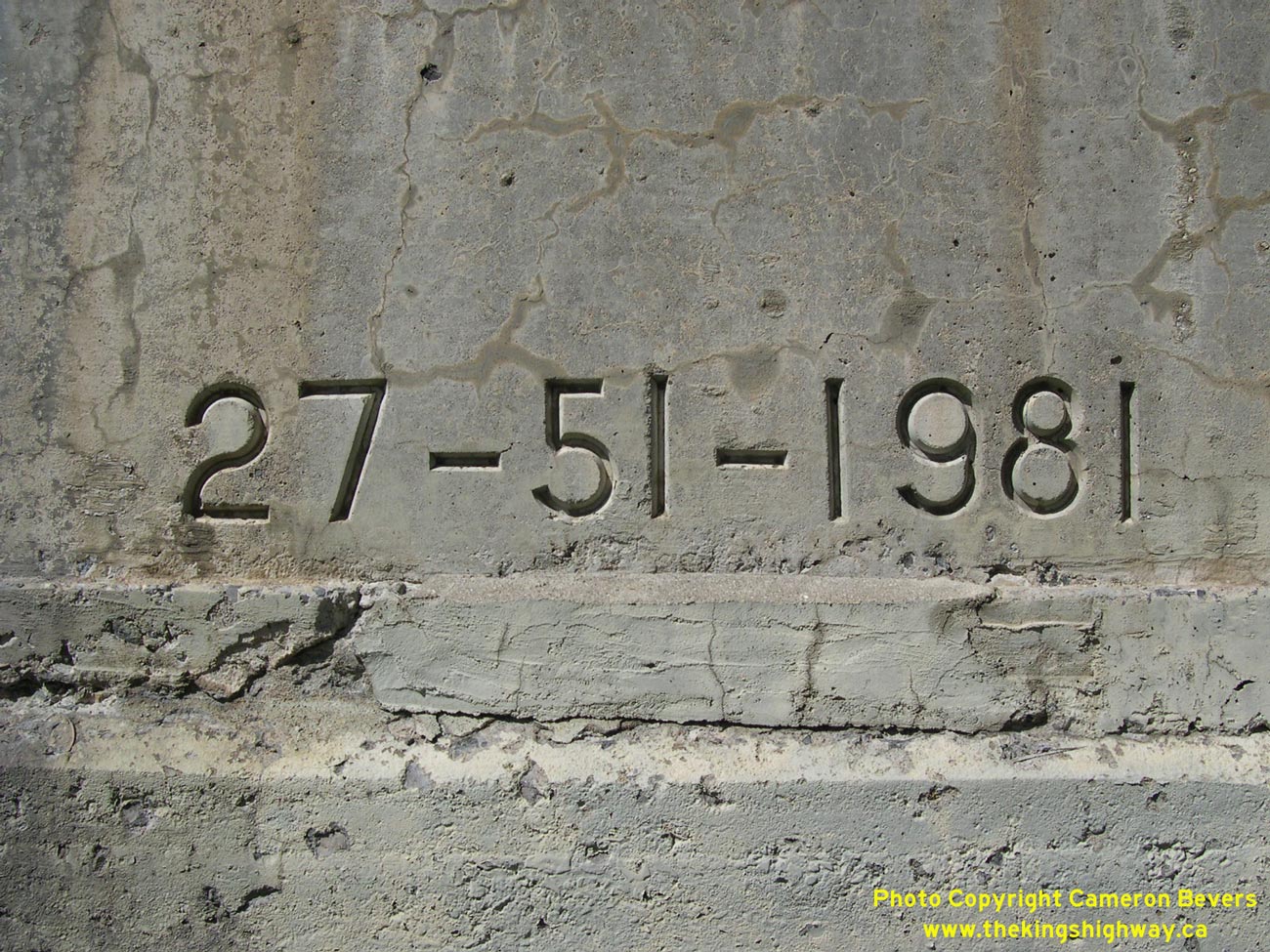
Left - Structure identification number and date stamp (1981) on the Hwy 17 Overpass at Hawkesbury. This date refers to the last major reconstruction date, not
the initial construction date of the bridge. See an Enlarged Photo Here. (Photograph taken on July 30, 2005 - © Cameron Bevers) Right - Close-up of the ramps at the Hawkesbury Interchange on Hwy 17, facing east towards Montreal. This section of the Hawkesbury Bypass is essentially an undivided freeway. See an Enlarged Photo Here. (Photograph taken on July 30, 2005 - © Cameron Bevers) 

Left - Railway overhead on the Hwy 17 Bypass in Hawkesbury located immediately west of the Hwy 34 Interchange. See an
Enlarged Photo Here. (Photograph taken on July 30, 2005 - © Cameron Bevers) Right - Close-up of date stamp (1955) on Hawkesbury Railway Overhead on Hwy 17. See an Enlarged Photo Here. (Photograph taken on July 30, 2005 - © Cameron Bevers) 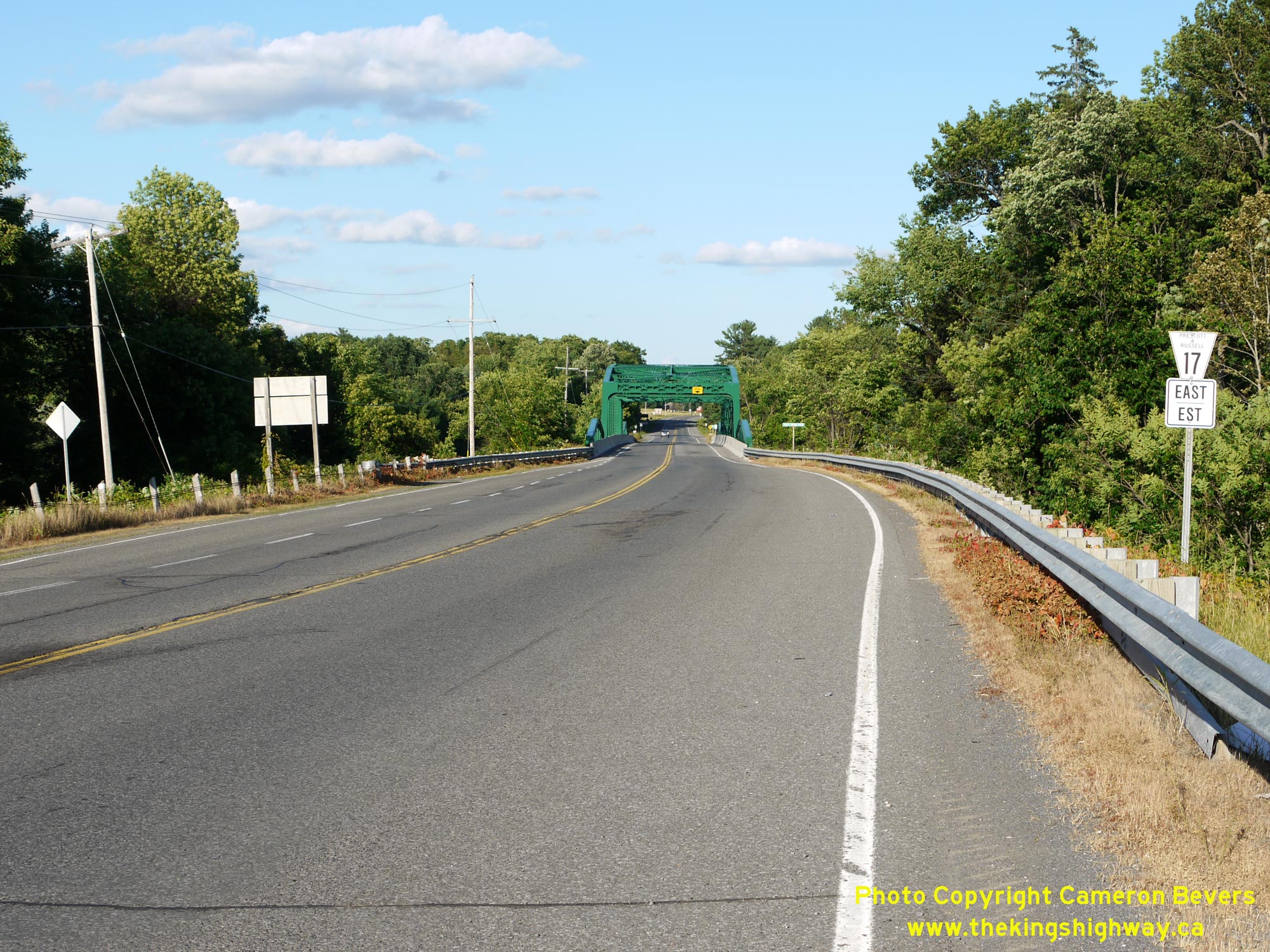
  Left - Facing east along the Plantagenet Bypass (Hwy 17) approaching the South Nation River Bridge. As part of the construction of the Trans-Canada Highway
between the Ontario-Quebec Boundary and Ottawa, sections of Hwy 17 were reconstructed on entirely new alignments. Construction of a 6 km bypass around Plantagenet
was commenced in 1951 under Contract #1950-215. By 1953, the proposed bypass was complete, except for the structure over the South Nation River and final paving. As
the sign at right indicates, this is now a municipal highway. This section of Hwy 17 has officially been known as Prescott & Russell County Road 17 since the late
1990s, when the province transferred jurisdiction of Hwy 17 over to the municipal tier. See an
Enlarged Photo Here. Left - Facing east along the Plantagenet Bypass (Hwy 17) approaching the South Nation River Bridge. As part of the construction of the Trans-Canada Highway
between the Ontario-Quebec Boundary and Ottawa, sections of Hwy 17 were reconstructed on entirely new alignments. Construction of a 6 km bypass around Plantagenet
was commenced in 1951 under Contract #1950-215. By 1953, the proposed bypass was complete, except for the structure over the South Nation River and final paving. As
the sign at right indicates, this is now a municipal highway. This section of Hwy 17 has officially been known as Prescott & Russell County Road 17 since the late
1990s, when the province transferred jurisdiction of Hwy 17 over to the municipal tier. See an
Enlarged Photo Here.(Photograph taken on July 1, 2012 - © Cameron Bevers) Right - View of the South Nation River Bridge on the Plantagenet Bypass (Hwy 17), facing east towards Hawkesbury. See an
Enlarged Photo Here.(Photograph taken on July 1, 2012 - © Cameron Bevers) 
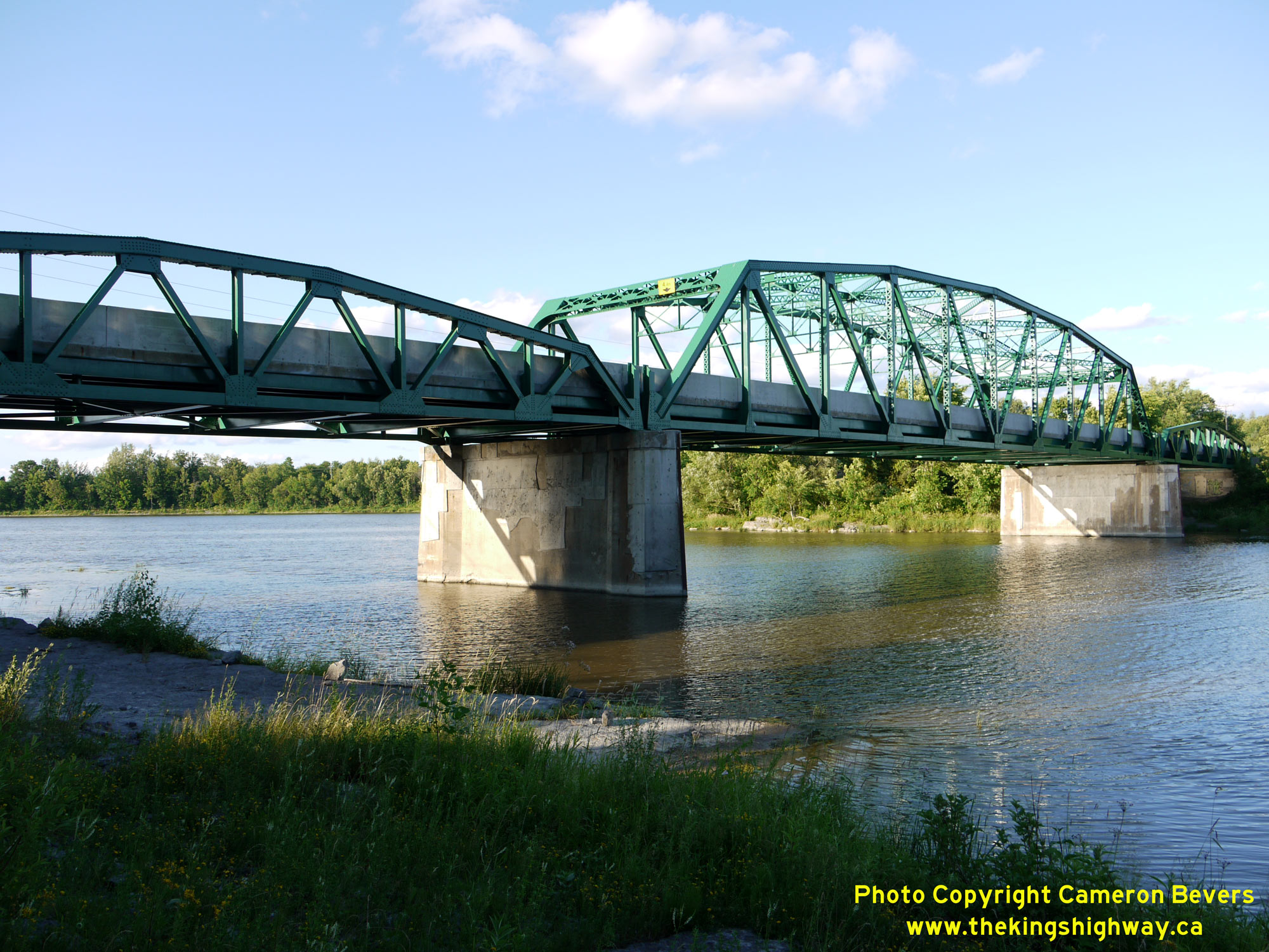
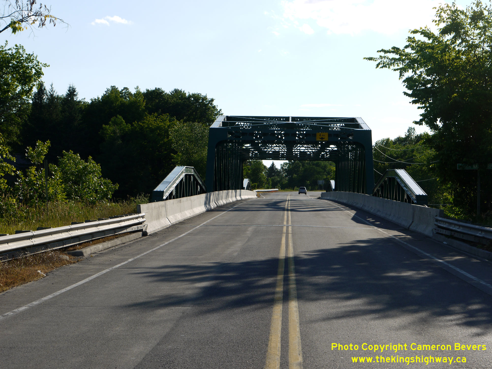 Left - Northern side of the South Nation River Bridge (Site #27-8) on Hwy 17 between Wendover and Plantagenet. This interesting structure was completed in
1954, and consists of a main Pratt-type steel through truss span with a length of 200 feet (61 metres), flanked on both sides by Warren-type steel pony truss approach
spans of 100 feet (30.5 metres) each. See an Enlarged Photo Here. Left - Northern side of the South Nation River Bridge (Site #27-8) on Hwy 17 between Wendover and Plantagenet. This interesting structure was completed in
1954, and consists of a main Pratt-type steel through truss span with a length of 200 feet (61 metres), flanked on both sides by Warren-type steel pony truss approach
spans of 100 feet (30.5 metres) each. See an Enlarged Photo Here.(Photograph taken on July 1, 2012 - © Cameron Bevers) Right - Facing west across the South Nation River Bridge on Hwy 17 towards Ottawa. This bridge is also locally known as the Jessup's Falls Bridge. See an
Enlarged Photo Here.(Photograph taken on July 1, 2012 - © Cameron Bevers) 
 Left - Plaque commemorating the rehabilitation of the Jessup's Falls Bridge on Hwy 17 over the South Nation River, which was completed in September 2008. See an
Enlarged Photo Here. Left - Plaque commemorating the rehabilitation of the Jessup's Falls Bridge on Hwy 17 over the South Nation River, which was completed in September 2008. See an
Enlarged Photo Here.(Photograph taken on July 1, 2012 - © Cameron Bevers) Right - Southern side of the South Nation River Bridge on Hwy 17 west of Plantagenet. Built by Lacking Brothers Construction Ltd. of Waterloo under Contract
#1953-24, this bridge was the final piece of the new Trans-Canada Highway to be completed between Plantagenet and Greens Creek east of Ottawa. Historical records
suggest that the Department of Highways of Ontario (DHO) had considerable difficulty in finding a contractor to supply the structural steel needed for this bridge.
After initially tendering the South Nation River Bridge construction contract in the Spring of 1953, the DHO had to delay the contract tender opening to allow more
time for prospective contractors to submit their bids. The tendering and construction of new highway bridges in Ontario was often delayed in the years following World
War II, due to chronic shortages of structural steel. See an Enlarged Photo Here.(Photograph taken on July 1, 2012 - © Cameron Bevers) 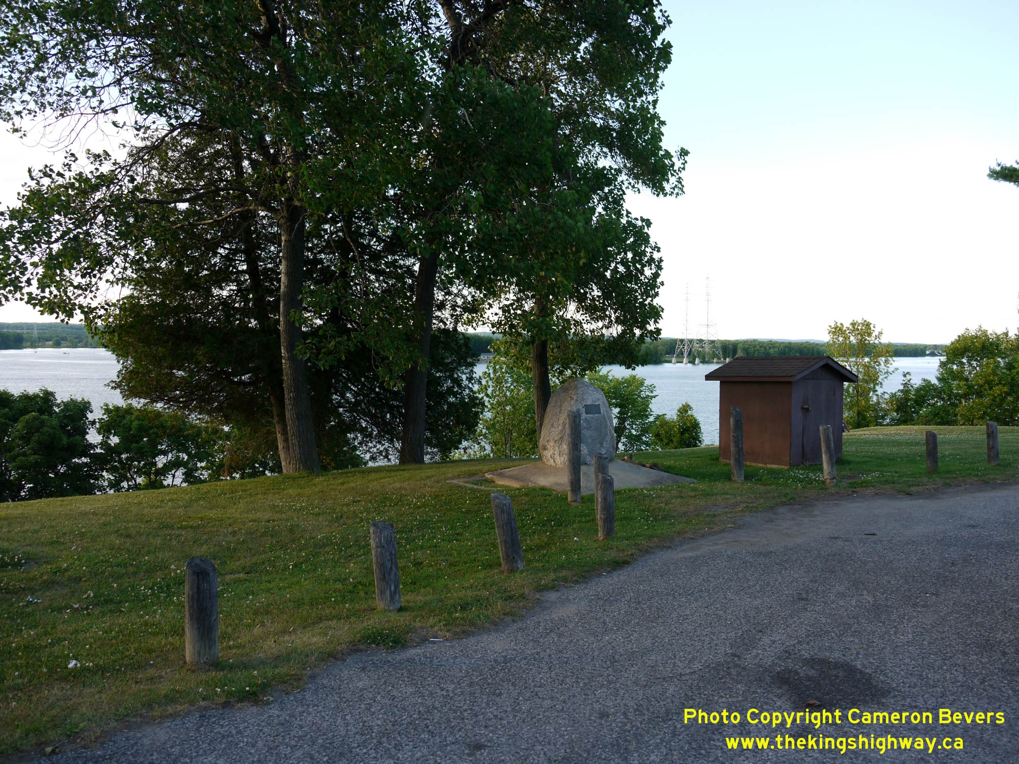
 Left - View of the Barnett Roadside Park along Hwy 17 between Orleans and Cumberland. This small roadside park was established in 1957, soon after the
construction of the new Trans-Canada Highway along the Ottawa River. See an
Enlarged Photo Here. Left - View of the Barnett Roadside Park along Hwy 17 between Orleans and Cumberland. This small roadside park was established in 1957, soon after the
construction of the new Trans-Canada Highway along the Ottawa River. See an
Enlarged Photo Here.(Photograph taken on July 1, 2012 - © Cameron Bevers) Right - A boulder in the park pays tribute to Lawrence "Barney" Barnett, who worked for the DHO from 1928 up until 1970. See an
Enlarged Photo Here.(Photograph taken on July 1, 2012 - © Cameron Bevers) 
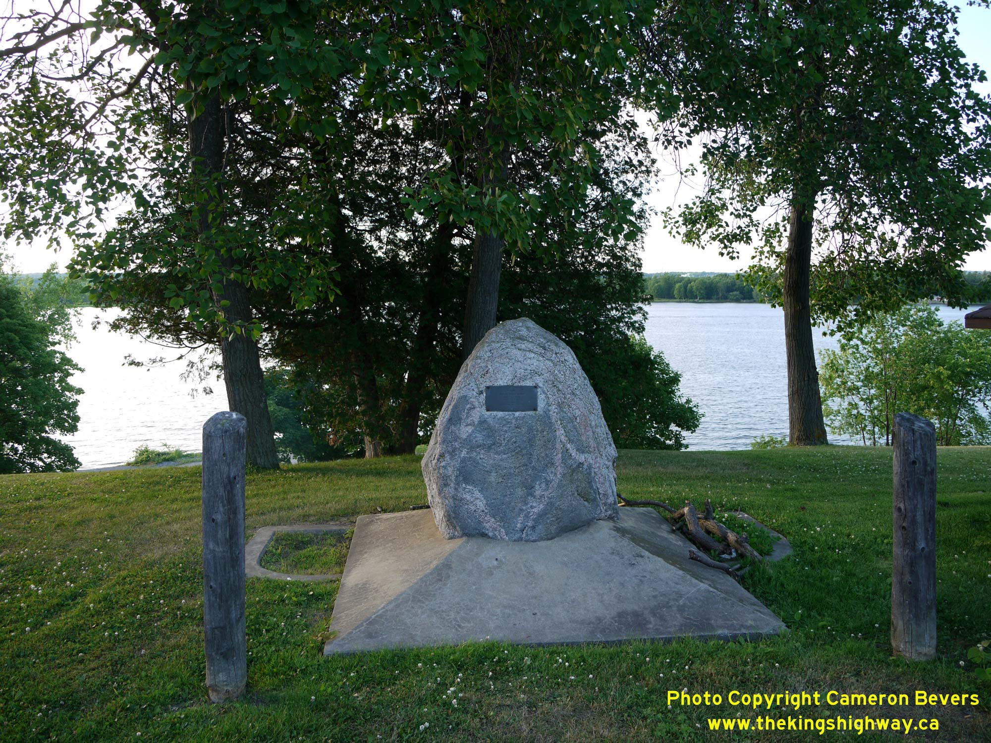
 Left - Close-up on the plaque at the Barnett Roadside Park along Hwy 17 east of Orleans, honouring Lawrence "Barney" Barnett's contributions to developing
this roadside park. The park along the Ottawa River was later named after him. See an
Enlarged Photo Here. Left - Close-up on the plaque at the Barnett Roadside Park along Hwy 17 east of Orleans, honouring Lawrence "Barney" Barnett's contributions to developing
this roadside park. The park along the Ottawa River was later named after him. See an
Enlarged Photo Here.(Photograph taken on July 1, 2012 - © Cameron Bevers) Right - Facing west along the Ottawa Queensway (Formerly Hwy 17 East) between Montreal Road and Blair Road. See an
Enlarged Photo Here.(Photograph taken on July 1, 2012 - © Cameron Bevers) 

Left - Overhead signs marking the Hwy 417 Interchange on the westbound Ottawa Queensway (Hwy 17 East). At this interchange, drivers can either continue
straight through on the Ottawa Queensway towards Downtown Ottawa via Hwy 417 West or exit from the Ottawa Queensway and follow Hwy 417 East towards Montreal. This is
an older Aluminum Tapered Leg (ATL) overhead sign support structure, commonly referred to by MTO as a "Type 1" overhead sign structure. These stylish arched truss
sign support structures were used on Ontario's freeways from the mid 1960s until the late 1980s, but are quickly being phased out and replaced by new overhead sign
support structures of different designs. See an Enlarged Photo Here. (Photograph taken on July 1, 2012 - © Cameron Bevers) Right - Advance guide sign marking the upcoming Ottawa Queensway Interchange. Up until the late 1990s, Hwy 17 continued east from this interchange towards Rockland and Hawkesbury. Following the downloading of Hwy 17 East by the province in 1997-1998, the former Regional Municipality of Ottawa-Carleton decided to renumber Hwy 17 East as Ottawa-Carleton Road 174. This was apparently done because the most logical choice for a route number, Ottawa-Carleton Road 17, was already assigned to a different route in the regional road system. In retrospect, however, it may have been better for the former Regional Municipality of Ottawa-Carleton to have renumbered the existing Ottawa-Carleton Road 17 (Maitland Avenue, Clyde Avenue and Merivale Road) to some other route number rather than introduce an entirely new route number on a high-speed freeway facility such as the Ottawa Queensway. This rather odd choice of a route number led to significant confusion at the time, as motorists on Hwy 417 who were seeking Hwy 17 East suddenly found themselves lost looking for a "17" route number that no longer existed. See an Enlarged Photo Here. (Photograph taken on July 1, 2012 - © Cameron Bevers) 
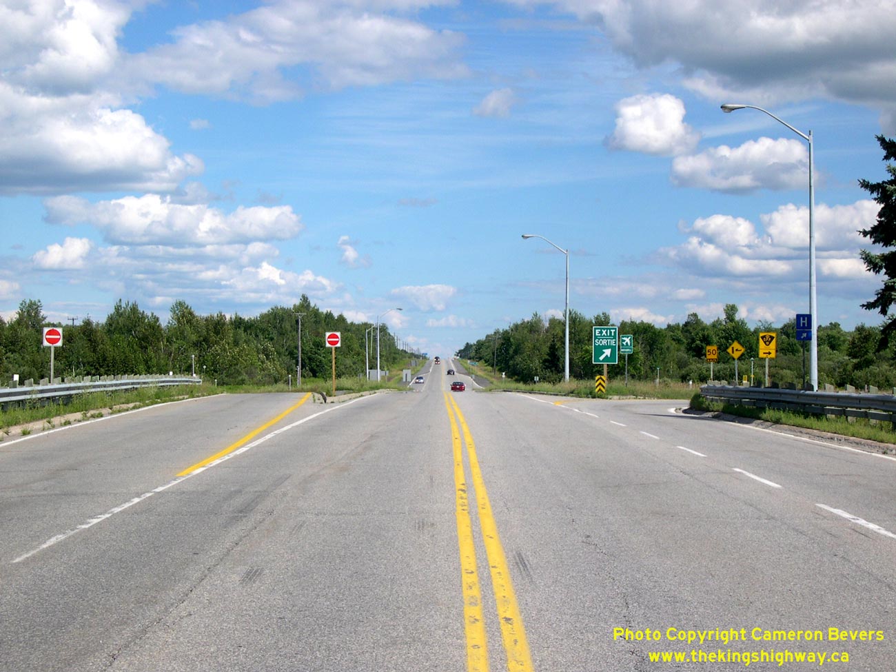
Above - Facing west along Hwy 417 at the Ottawa Queensway & Aviation Parkway Interchange. Here, Hwy 417 curves to the left and joins the westbound Ottawa
Queensway. Ottawa Route 174 (Formerly Hwy 17 East) follows the Ottawa Queensway East, while Aviation Parkway continues north towards Rockcliffe Park as a National
Capitol Commission scenic parkway. See an Enlarged Photo Here. (Photograph taken on July 1, 2012 - © Cameron Bevers)
Continue on to King's Highway 17 Photos: Ottawa to Renfrew |
|---|
Links to Adjacent King's Highway Photograph Pages:
Back to King's Highway 16 Photos /
King's Highway 17 History /
On to King's Highway 18 Photos
Ontario Highway History - Main Menu / Back to List of Highways Website contents, photos & text © 2002-2026, Cameron
Bevers (Webmaster) - All Rights Reserved / Contact Me
|
|---|